Big Bend
Big Bend National Park · Texas, USA
In the desert, the river is not the water you see — it is the canyon it left behind.
Also seen through Night Sky, Desert & Deep Time · all at Big Bend National Park →.
Why here
This country looks bone-dry, and water carved every line of it. Big Bend takes its name from a single hard turn in the Rio Grande, where the river swings from running east to running north between two mountain ranges. But that bend is only the loudest of water’s arguments here. The rock underfoot is mostly limestone and shale — the hardened floor of a shallow sea that once covered all of West Texas. The sea drained; the land rose; and ever since, water has been taking it back apart. It cuts canyons through the old sea floor in the slow years and moves whole hillsides in flash-flood minutes, spreading the broken rock in long fans at the foot of every mountain. This is the largest stretch of Chihuahuan Desert the country protects — a place that looks like the absence of water and is, in truth, a record of its patience. Every peak and mesa in this note is something the water has not yet finished carrying away.
The story
Start with a sea. The pale rock that makes up so much of this country is limestone and shale, the hardened floor of a shallow ocean that once lay over West Texas. When the sea was gone and the land lifted, water began the long work of undoing — cutting down through the old sea floor, carving the canyons the Rio Grande now runs, and hauling the debris downhill into broad fans of gravel and sand. That carrying-away is still going on.
Onto this bared rock came plants built for a place that keeps no water. Ocotillo throws up bare wands that leaf out within days of a rain and drop them again when it dries. Lechuguilla and century plants hoard years of moisture in tight rosettes of stiff blades. Creosote bush spaces itself across the flats, its roots claiming more ground than its small frame suggests. In spring the cactus answer the light — strawberry hedgehog and Texas rainbow cactus opening their flowers on the rock.
The record reaching this note is quiet on the people who lived here before the ranches and the park; what it holds is mostly the shape of the land itself. That, at least, is honest. Here the long story belongs to water and rock.
The sites
The floor of a vanished sea
Sierra de Cal
29.3099, −103.6816
The name is Spanish for the lime range, and lime — limestone — is the rock that shapes most of this country. Limestone is not ordinary stone. It is built almost entirely from the shells and skeletons of things that lived and died in a shallow sea, packed down and hardened into rock over an enormous stretch of time. When the sea was gone and the land rose, that old sea floor became the high ground you are standing on. Limestone matters to a water story because it is the one common rock that rainwater slowly dissolves as well as wears — which is why, across this desert, water carves limestone into steep-walled canyons rather than merely rounding it down. A range named for lime is a range being taken apart, grain by grain and flood by flood. Come here to stand on the floor of a vanished ocean and see what water has made of it since.
Put a flat hand on the pale rock of the ridge. Look closely for the ghosts of shells and coiled shapes pressed into it — this stone is made of sea life, laid down when a warm, shallow ocean covered all of West Texas. Then look for narrow grooves and shallow pockets where rainwater has eaten into the surface; that slow dissolving is water writing the first line of every canyon.
- AccessExpedition
- ExertionStrenuous
- TimeA full day
Fossil Knobs
29.3294, −103.6324
These low rises take their name from what weathers out of them: fossils, the hard remains of animals that lived in the same ancient sea that laid down the limestone across this country. A fossil in the desert is a small argument about deep time. The creature lived in warm salt water; the water is long gone; the land has risen and is now being carried back down toward the river a grain at a time. The knobs are a good place to feel how patient that process is. Every fossil now sitting in dry rock was once on a sea bottom, and everything that used to bury it — all the rock above — has already been removed by wind and water. What you walk on is the leftover, the part water has not reached yet. The park protects what is here, so this is a place to look and leave things where they lie.
Search the loose pale rock at the base of the knobs for shapes that don’t belong to plain stone — the fan of a shell, the ring of something coiled, a fragment with a too-regular texture. Each is an animal from a sea that stood here before the land rose. Photograph what you find and set it back exactly; these are the park’s, and the record thins every time one leaves.
- AccessHalf-day hike
- ExertionModerate
- TimeHalf a day
Islands the water left standing
Nine Point Mesa
29.6505, −103.4666
A mesa is a lesson in what water leaves behind. Picture a single flat sheet of hard rock that once stretched for miles across this country. Water — in rivers, in arroyos, in the sudden violence of flash floods — has spent an immense span of time cutting that sheet apart and hauling the pieces downhill, until only islands of it remain, each capped by the tough layer that held out longest. Nine Point Mesa is one of those islands. Its flat top marks the old level of the land; the empty air all around it is the measure of how much has been carried away. Everything that used to fill that space is now gravel and sand, spread in long fans at the feet of the mountains and moved, slowly, toward the Rio Grande. A mesa looks permanent and is really a countdown. Come to read the flat skyline as the ghost of a vanished plain.
Stand back far enough to see the whole mesa at once and trace its flat top with your eye. That level line is the surviving remnant of a rock layer that once continued straight out through the empty air on every side. Now picture that missing rock filled back in, and you are seeing the old surface of the land — and the sheer volume of stone that water has already taken away.
- AccessExpedition
- ExertionStrenuous
- TimeA full day
Bandera Mesa
29.6249, −103.7738
Bandera Mesa stands in the high western corner of this country, and its steep sides do something the flat top cannot: they show you the stack. A mesa is built of layer upon layer of rock, laid down one atop the next over a long reach of time, and where water has cut the edge away it leaves those layers exposed in the cliff face like lines on a page. Read from the bottom up and you are reading forward through time — the oldest rock at the base, the youngest at the rim. Much of it here is the pale limestone and darker shale of an old sea floor, the same ocean bottom that surfaces all across the Big Bend. The water that exposed these layers is also the water still removing them; the cliff is not a finished wall but a working edge. Come to see time stood on its side, with water doing the reading for you.
Find a place where you can see the mesa’s cliff side lit low by morning or evening sun, when the horizontal bands stand out most sharply. Count the layers if you can. Each is a separate chapter of sea floor or streambed, stacked oldest at the bottom; the cliff exists only because water has cut away everything that once stood in front of it.
- AccessExpedition
- ExertionStrenuous
- TimeA full day
Down toward the river
Black Mesa
29.2116, −103.4896
Out in the low desert toward the Rio Grande, Black Mesa holds its table above the flats while the ground all around it wears steadily down. The pattern is the one water repeats across the whole Big Bend: a resistant cap protects the softer rock beneath it, so the capped block stands as the country between the mesas is stripped away and carried off. That stripped material does not vanish. Flash floods gather it into the arroyos and spread it in broad aprons of gravel and sand at the mountains’ feet, and the Rio Grande, at the low edge of everything, hauls the finest of it away for good. Black Mesa is worth a stop precisely because it is plain in form and total in its meaning: a measuring stick left standing in a landscape being lowered around it. Come to see the height that used to be everywhere, and the emptiness that shows how much has already gone to the river.
From the flats, look at Black Mesa’s steep sides and flat crown, then sweep your eye across the open ground between it and the next high point. All that low, level desert was once filled to the height of the mesa top. Picture it filled back in, then picture the flash floods carrying it grain by grain toward the river — that is the work you are standing inside of.
- AccessHalf-day hike
- ExertionModerate
- TimeHalf a day
Tule Mountain
29.2644, −103.4768
Tule is the name for a tall marsh reed, a plant of standing water, and finding it attached to a mountain in one of the driest corners of Texas is worth a pause. Names like this, in desert country, tend to mark the scarce places where water gathers and lingers instead of running straight off. Whether or not the reeds still grow here, the mountain sits in a land shaped entirely by how water moves — the dry washes that thread its base run only after rain, and then briefly, but those brief flows do nearly all the carving and carrying this desert ever sees. Between floods the washes look dead. They are not. Water often keeps running beneath the sand long after the surface dries, and the plants know exactly where it is. Come to Tule Mountain to trade the idea of a river for the desert’s version of one: mostly invisible, occasionally overwhelming, always the thing in charge.
Walk to the edge of one of the dry, sandy washes at the foot of the mountain and look at what grows along its banks. Notice how the biggest, greenest plants crowd the channel and thin out fast on the bone-dry ground beside it. Their roots are reaching water that still runs beneath the sand between floods — a hidden river you can read by its plants.
- AccessHalf-day hike
- ExertionModerate
- TimeHalf a day
Bee Mountain
29.1877, −103.4857
Bee Mountain sits in the southern reach of the park, down where the land tilts toward its lowest line: the Rio Grande, the river that gave the Big Bend its name where it swings from running east to running north between two mountain ranges. Everything in this note drains, sooner or later, to that river. The peaks shed their broken rock into the arroyos; the arroyos deliver it to the river in flood; the river carries the finest of it away and, in the slow work of ages, has cut deep canyons straight through the limestone to do so. Standing in this southern country you are near the end of the argument — the place where all that carried rock is finally leaving. The river looks modest, often shallow and brown, and that modesty is the lesson: it is not the water you see on any given day that carves a canyon, but the same water returning, in flood and in patience, for a length of time the mind can barely hold. Come to stand at the low edge and watch where the desert is going.
Find a rise where you can pick out the green line of the Rio Grande in the distance, and notice that it lies lower than everything around it. Every wash, every slope, every fan of gravel you can see tilts toward that line. You are looking at the drain of the whole country — the single argument every rock here is slowly losing.
- AccessHalf-day hike
- ExertionModerate
- TimeHalf a day
When it's best
Spring is the easy season — mild days, cool nights, and little rain. It is also when the desert flowers: strawberry hedgehog and Texas rainbow cactus usually open their blooms by early spring, and ocotillo leafs out fast after any rain. Summer brings the heat and the sudden storms that do the real carving — the flash floods that fill the arroyos for an hour and then vanish. The canyons and the cooler high country hold birds through much of the year; listen along the rock walls for the canyon wren. Come in spring for comfort and color; come in summer to watch water work.
Go deeper
The names behind what you saw
- The pale rock that dominates the Big Bend is Cretaceous marine limestone and shale — an old sea floor. In the payload it appears as the region’s Mesozoic sedimentary rocks (limestone and shale) and Late Cretaceous units.
- The gravel-and-sand aprons at the mountains’ feet are Quaternary alluvial fan deposits — the debris water has already carried down.
- The signature desert plants, by name: ocotillo (Fouquieria splendens), lechuguilla (Agave lechuguilla), Havard’s century plant (Agave havardiana), creosote bush (Larrea tridentata), and the spring-flowering strawberry hedgehog cactus (Echinocereus stramineus) and Texas rainbow cactus (Echinocereus dasyacanthus). The bird that sings along the canyon walls is the canyon wren (Catherpes mexicanus).
To read next
- A Road Guide to the Geology of Big Bend National Park (Nelson, 1995) — organized road by road, the closest match to reading this landscape from where you can actually stand.
- Geology of Big Bend National Park, Brewster County, Texas (Maxwell, 1967) — the classic full-length account of how these rocks were laid down, raised, and cut.
- Geologic map of Big Bend National Park (USGS, 2011) — the modern map that shows which rock is which, unit by unit, if you want to name the ground beneath any site.
- Geological, geochemical, and geophysical studies by the USGS in Big Bend (2008) — a modern synthesis for the reader who wants the current science, not just the classic story.
- Persimmon Gap: Ouachita facies and Cretaceous cover deformed in a Laramide overthrust (1989) — a focused look at how the old sea floor was lifted and bent, the uplift that gave water something to cut.
The names behind what you saw
What lives here, and what it's called. Photographs from open collections — an aid to identification, not decoration.
-
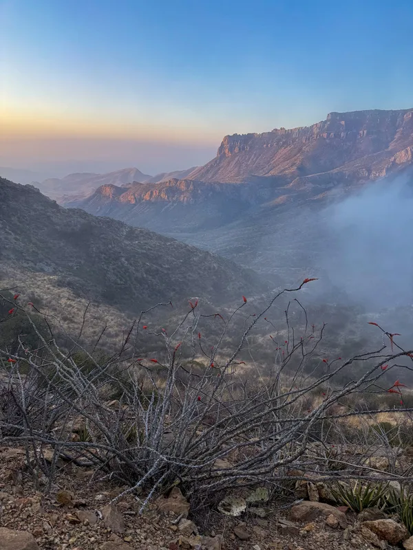
ocotillo Fouquieria splendens -
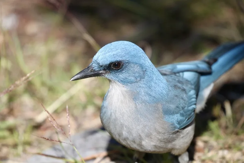
Mexican Jay Aphelocoma wollweberi -
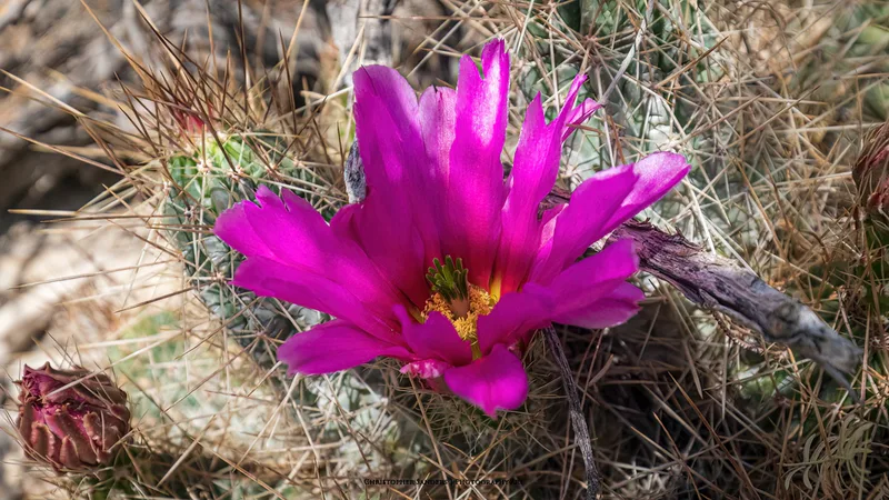
strawberry hedgehog cactus Echinocereus stramineus -
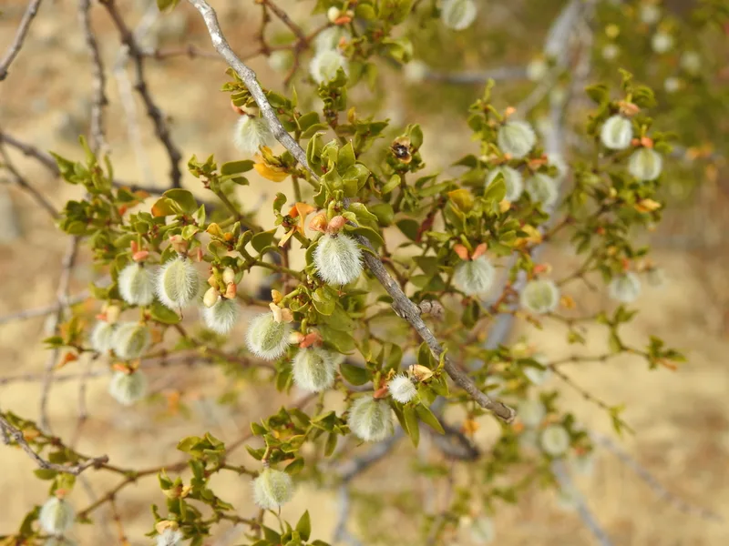
Creosote Bush Larrea tridentata -
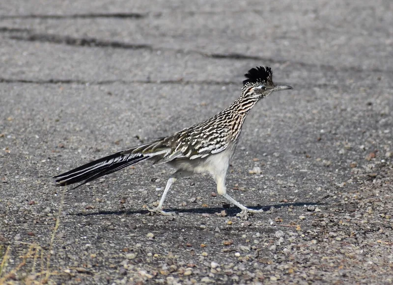
Greater Roadrunner Geococcyx californianus -
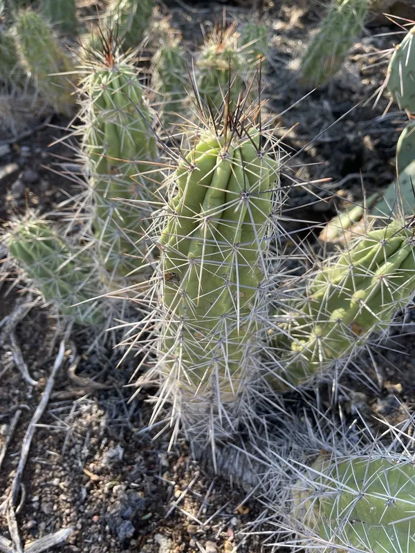
Strawberry Cactus Echinocereus enneacanthus -
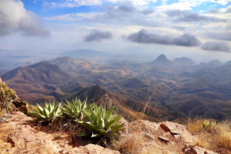
Havard's Century Plant Agave havardiana -
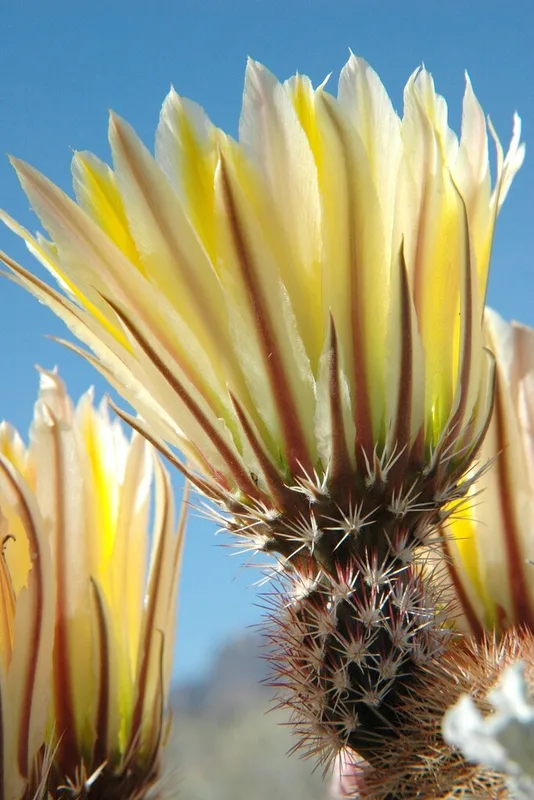
Texas rainbow cactus Echinocereus dasyacanthus -
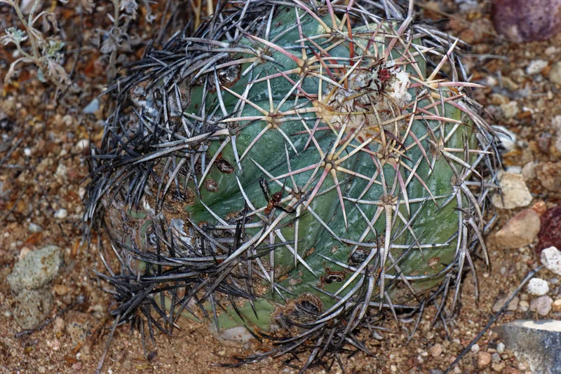
Devilshead Echinocactus horizonthalonius -
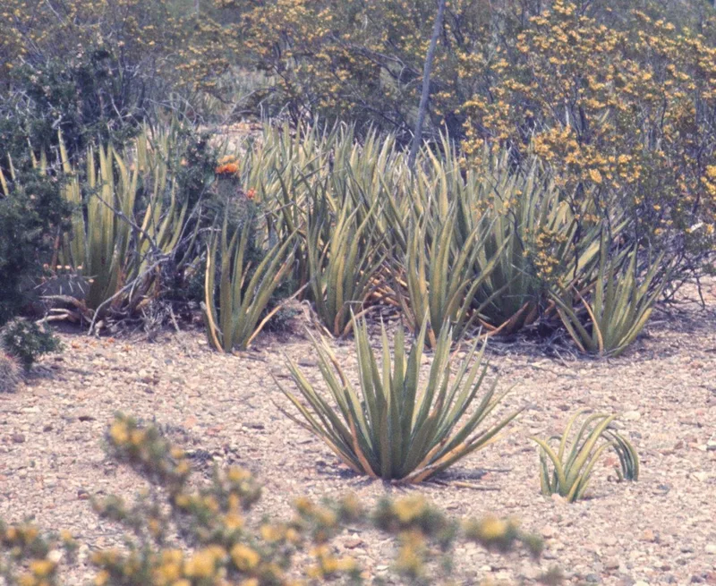
lechuguilla Agave lechuguilla -
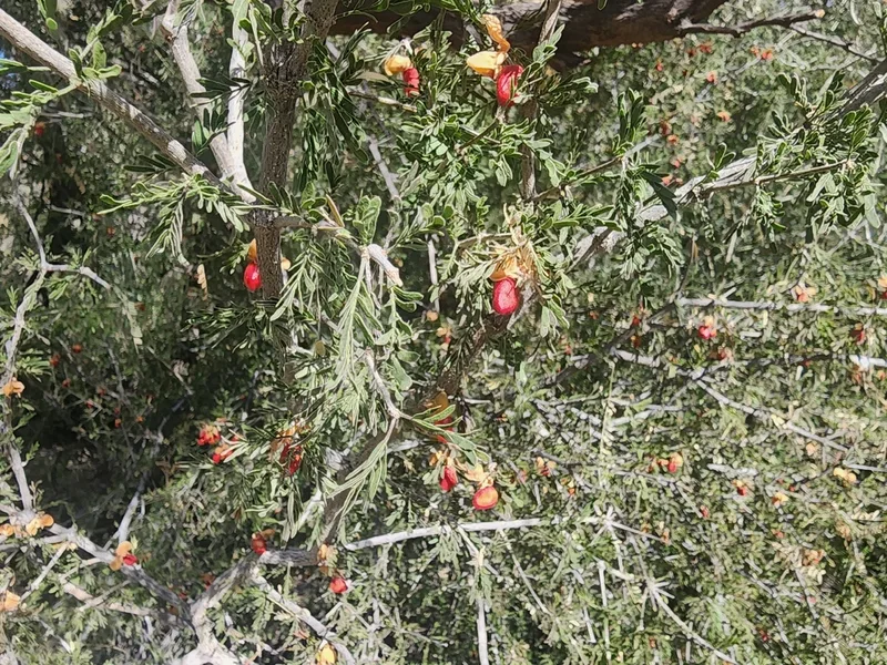
Texas lignum-vitae Guaiacum angustifolium -
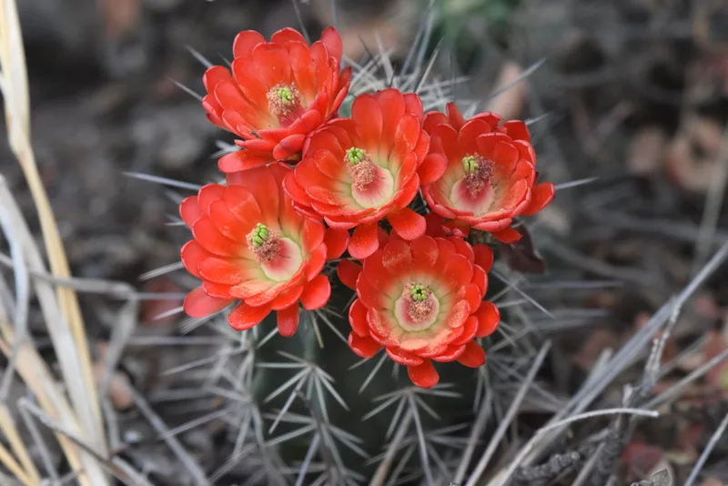
scarlet hedgehog cactus Echinocereus coccineus
Field Notes · Rivers & Canyons lens · Big Bend National Park · 29.3332, −103.1943