Big Bend
Big Bend National Park · Texas, USA
The desert keeps its history in layers because almost nothing grows fast enough to hide them.
Also seen through Rivers & Canyons, Night Sky · all at Big Bend National Park →.
Why here
Big Bend is a desert where the layers stay open. Sedimentary rock, alluvial ground, mesas, and mountains meet in a country dry enough for small changes in color and texture to remain visible. Water still shapes the place, but it arrives as an event rather than a constant presence. A wash cuts, a slope sheds, and a rare wet pocket gathers life. Walk among the mountains with that rhythm in mind. The deep past is not sealed below the plants. It is exposed in the walls, while ocotillo, cactus, and birds use the brief present between storms.
The sites
Layers in the open
Adobe Walls Mountain
29.4882, −103.5032
Adobe Walls Mountain gives the desert its vertical reading. Sedimentary rock rises above alluvial ground, and the contrast between wall and wash shows how long weathering operates on different surfaces. Look for ledges, fans, and the lower routes where loose material collects. The mountain is not a single block. It is a stack exposed by erosion, with each slope carrying a different balance of rock, soil, and water.
Trace a rocky slope down to the flatter ground below. The change from solid layer to loose fan shows where erosion has moved material away from the mountain.
- AccessShort walk
- ExertionEasy
- TimeAn hour
Amarilla Mountain
29.3127, −103.7432
Amarilla Mountain opens another view of Big Bend’s layered country. The desert’s dryness keeps the broad forms visible, but water still supplies the detail. Look for gullies and washes cutting into the slopes, then imagine how a storm can carry sediment through them. The process is intermittent, yet its marks remain. A desert is not a place without erosion. It is a place where erosion arrives in concentrated moments.
Find the deepest wash on the nearest slope. Its channel is a record of water that may be absent now but powerful when storms arrive.
- AccessHalf-day hike
- ExertionModerate
- TimeHalf a day
Water in brief appearances
Banta Shut-In
29.3294, −103.0804
Banta Shut-In brings the desert’s water story into a narrow place. Rock constrains the flow, so a wash that would spread across open ground becomes a channel with sharper edges. These places matter to life. Water can linger in shade, sediment can collect, and birds may use the corridor between storms. Look for the transition from open slope to confined channel. The desert’s history is written in that change of width.
Compare the open ground above the shut-in with the narrow channel below. A confined wash concentrates water and sediment, making a temporary refuge in dry country.
- AccessShort walk
- ExertionModerate
- TimeHalf a day
Life between storms
Bandera Mesa
29.6249, −103.7738
Bandera Mesa gives the desert plant community a wide stage. Ocotillo and cactus use different strategies for the same dry country: one reaches for light and brief moisture, the other stores water in a compact form. The mesa’s open surface makes those shapes easy to compare. Look for the places where plants gather, not only the isolated specimens. Small changes in soil, slope, and runoff can make a patch of life denser than the ground beside it.
Find an ocotillo and a cactus in the same view. Compare their shapes and positions; each is a different answer to dry ground and brief rain.
- AccessShort walk
- ExertionEasy
- TimeAn hour
Angela Peak
29.4802, −103.1913
Angela Peak brings birds and high ground into the desert story. Mexican jays use the mountain country where trees and shrubs offer more cover than the open flats. From the peak, look across the gradient from higher slopes to lower desert. The same sedimentary layers support different living communities as temperature, water, and shelter change. Big Bend’s deep time remains visible in the rock, but life keeps making a present-tense map over it.
Listen for a jay along the transition between open slope and wooded cover. Birds often reveal the boundary between two desert habitats before the vegetation does.
- AccessHalf-day hike
- ExertionStrenuous
- TimeA full day
When it's best
The cooler seasons are easiest for exploring open desert, while spring can bring flowers and active birds after useful rain. Summer heat makes early and late hours more comfortable, but storms can alter washes quickly. The desert remains readable year-round; your route should follow temperature, shade, and water rather than a fixed schedule.
Go deeper
The names behind what you saw. The payload includes Late Cretaceous sedimentary rock and intermediate alluvial deposits. Life includes ocotillo, Fouquieria splendens, Mexican jay, Aphelocoma wollweberi, and strawberry hedgehog cactus, Echinocereus stramineus.
To read next. - Big Bend’s geological map — for the sedimentary layers, mountains, and alluvial fans. - The park’s desert ecology material — for how plants and birds use brief water and shade.
The names behind what you saw
What lives here, and what it's called. Photographs from open collections — an aid to identification, not decoration.
-
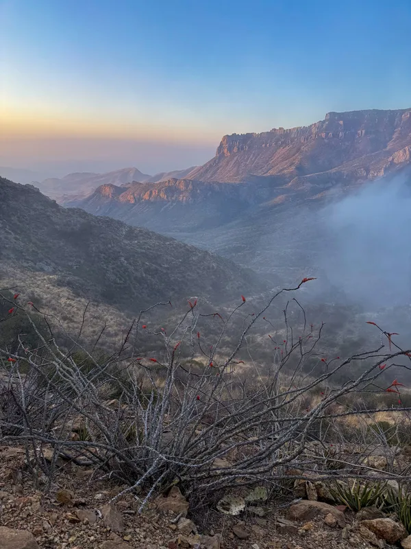
ocotillo Fouquieria splendens -
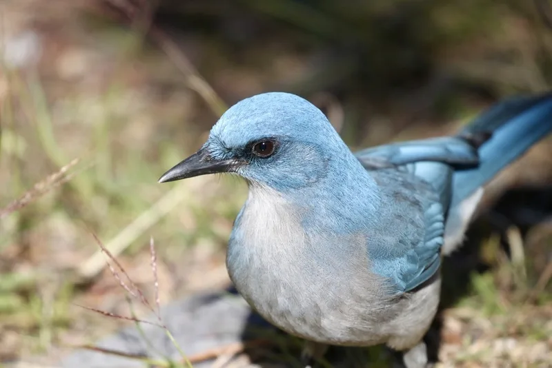
Mexican Jay Aphelocoma wollweberi -
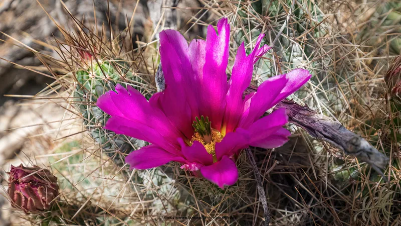
strawberry hedgehog cactus Echinocereus stramineus -
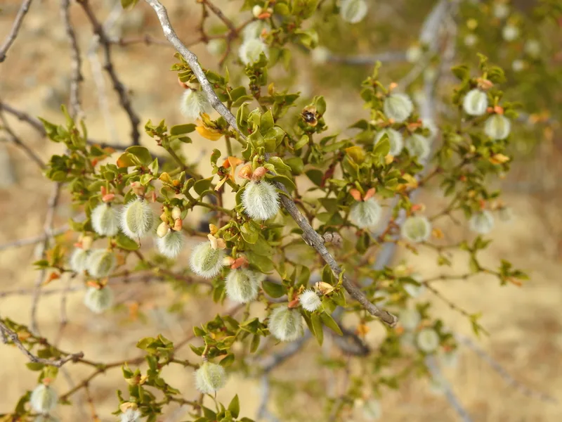
Creosote Bush Larrea tridentata -
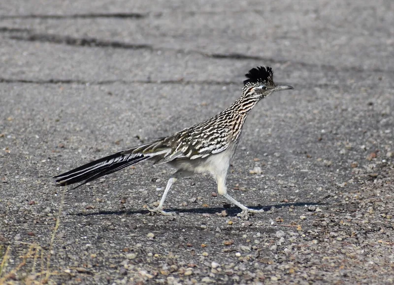
Greater Roadrunner Geococcyx californianus -
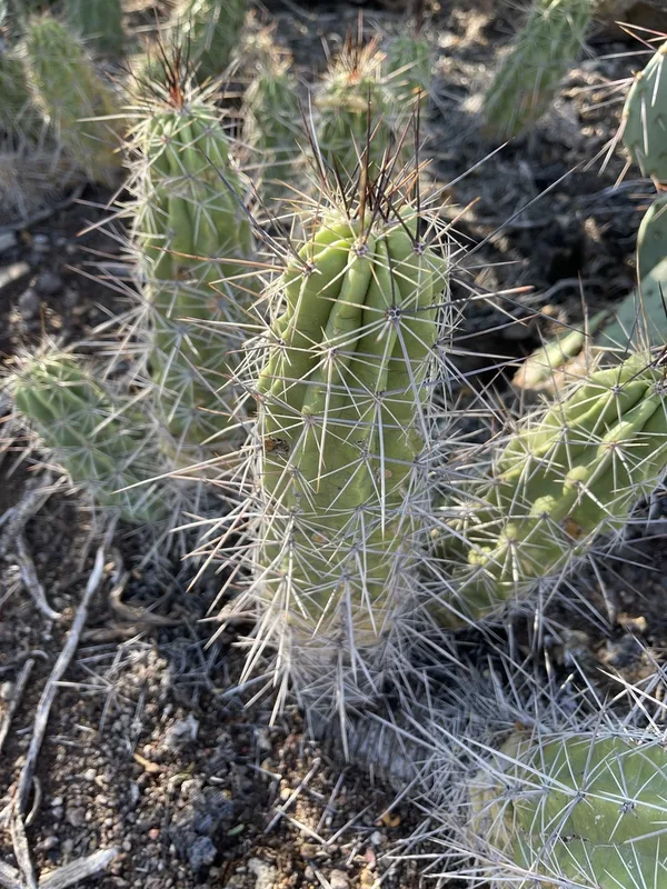
Strawberry Cactus Echinocereus enneacanthus -
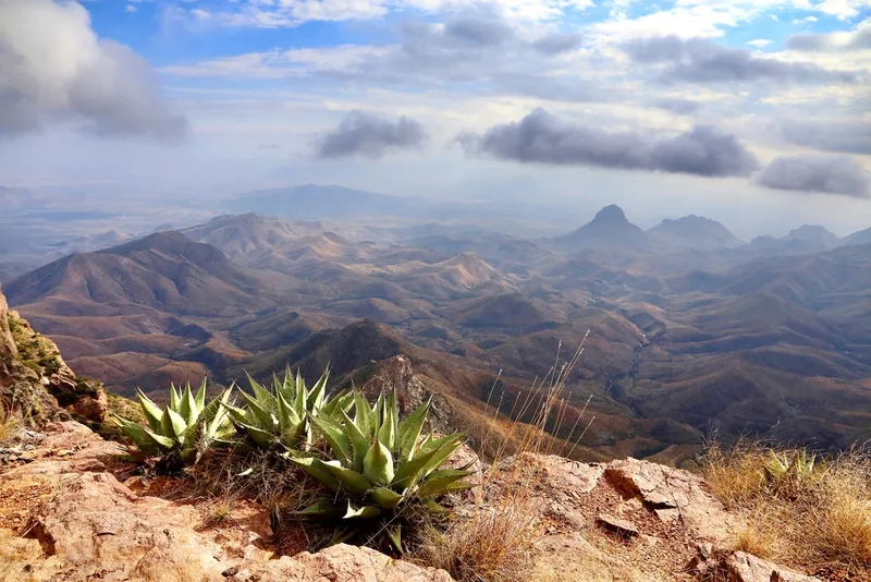
Havard's Century Plant Agave havardiana -
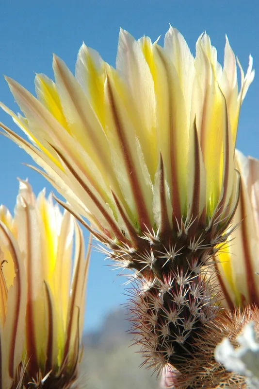
Texas rainbow cactus Echinocereus dasyacanthus -
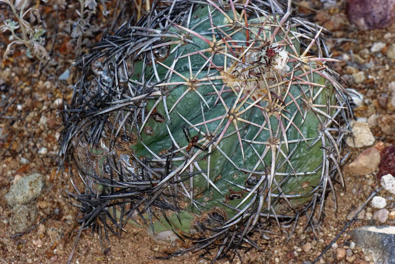
Devilshead Echinocactus horizonthalonius -
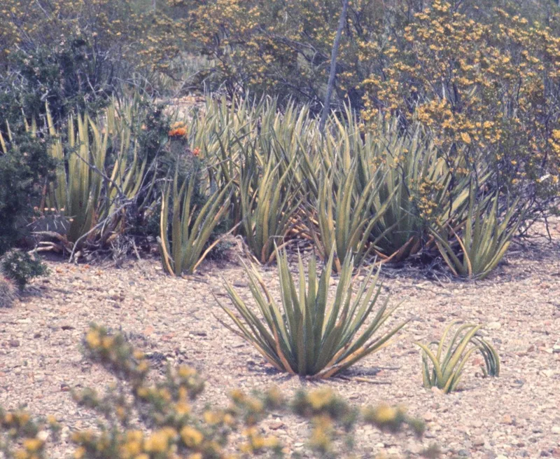
lechuguilla Agave lechuguilla -
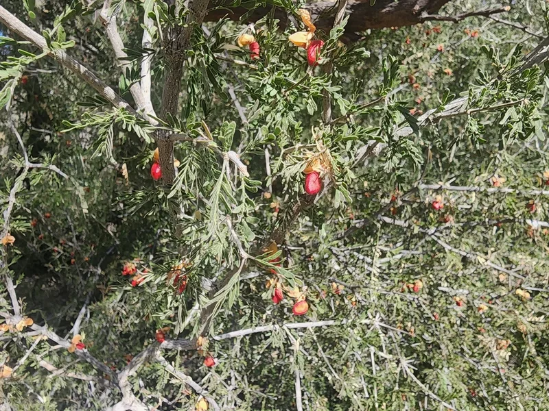
Texas lignum-vitae Guaiacum angustifolium -
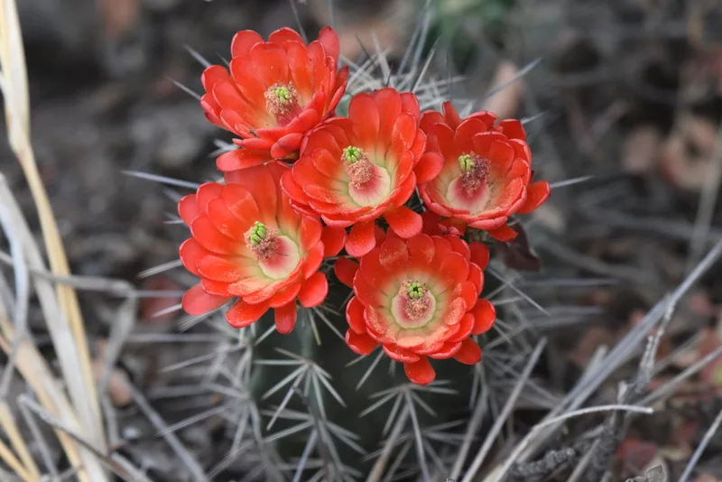
scarlet hedgehog cactus Echinocereus coccineus
Field Notes · Desert & Deep Time lens · Big Bend National Park · 29.3332, −103.1943