Big Bend
Big Bend National Park · Texas, USA
In the desert after dark, the ground gives back the day's heat and the sky gives up its distance.
Also seen through Rivers & Canyons, Desert & Deep Time · all at Big Bend National Park →.
Why here
Look up from the desert floor here on a clear, moonless night and you are looking at old light. The nearest stars send light that has traveled for years to reach your eye; the faint smudges between them left their sources long before anyone stood here to look up. This is the oldest view there is — and Big Bend is one of the few places left dark enough to take it in. It holds the largest protected piece of Chihuahuan Desert in the country, far from any city’s glow, with a single small community at its heart. The same emptiness that makes the days feel enormous makes the nights deep. Away from town lights the sky doesn’t just gain more stars; it gains the pale band of our own galaxy laid clear across the middle, the thing most city dwellers never see. What follows is a set of high places and open desert floors to stand in after the sun is down — a reminder that here, the show doesn’t end when the daylight does. It only changes shifts.
The story
The rock came first. Much of Big Bend is pale limestone, laid down as lime mud on the floor of a shallow sea back when this was a warm coast. Later the ground caught fire from below: molten rock pushed up and hardened into the darker, harder peaks that stand highest today, and volcanic ash settled over everything. Wind and flash floods have been taking it all apart ever since, spreading the debris in long aprons of gravel out toward the river.
Onto that hard ground came a hard-living desert. Ocotillo throws up bare, thorny wands that leaf out and flare red after rain; lechuguilla and century plants hoard water in tight rosettes; hedgehog and rainbow cacti open outsized flowers in spring. Much of the animal life simply waits out the sun. Come dusk the desert changes shift — a small owl no bigger than a fist hunts the flats, and a ground-loving nightjar calls its own name into the dark.
People never came in numbers. This is remote country, with a single small community inside the park and near-empty counties around it — one of them long since dissolved. That scarcity of people is exactly why the dark survived. The stars here are protected less by law than by distance.
The sites
High platforms in the mountains
Casa Grande Peak
29.2681, −103.2881
Casa Grande is the great blunt tower that stands over the mountain basin at the heart of the park. Its bulk is the harder, darker rock left behind when molten material cooled and the softer ground around it slowly wore away. For a sky-watcher, the basin beneath it is close to ideal. You are high enough to sit above the low desert haze, ringed by rock that walls off what little glow the distant towns throw, and open straight overhead. There is cool air here even when the desert below is still warm, and the dark comes early into the bowl as the surrounding peaks cut off the western sky. Come at dusk, watch the tower go from gold to grey to black, and stay put as the first stars find the gaps between the peaks.
Pick out the lowest notch in the ring of peaks around you and keep your eyes on it. Stars seem to switch on the instant they clear the rock, because there is no town light behind the ridge to blur the edge — count slowly and see how long one bright point takes to climb a hand’s-width above the stone.
- AccessDrive-up
- ExertionEasy
- TimeHalf a day
Lost Mine Peak
29.2758, −103.2582
The high shoulder of the range near Lost Mine Peak is one of the easiest ways to climb up out of the hot desert into cooler, darker air without a punishing hike. The peak itself is a rugged high point of the same old volcanic rock that forms the crest of the range. The trail onto its flank winds up through oak and juniper, where mountain birds like the soft blue-grey Mexican Jay work the slopes by day. By night the height pays off twice over: you sit above much of the haze that softens the low-desert sky, and the tall ridgeline screens the faint glow of the nearest settlements. Reach an open spot on the high ground before dusk, give your eyes time to settle into the dark, and the band of the galaxy seems to stand straight up out of the rock. Bring a jacket; the same height that clears the air also takes the day’s warmth away fast.
From an open place on the high ground, find the pale, hazy band that arches across the whole sky — the massed light of our own galaxy’s stars, too far and faint for the eye to pull apart. Follow it down to where it meets a black peak; the thickest, brightest stretch of it marks the crowded center of the galaxy.
- AccessHalf-day hike
- ExertionModerate
- TimeHalf a day
Nugent Mountain
29.2630, −103.1788
Nugent Mountain rises on its own near the road on the desert side of the range — a compact peak you can park close to and use as a marker in the dark. It suits anyone who wants the whole sky without walking far from the car. The flats around it are classic Chihuahuan desert: spindly ocotillo, low creosote bushes, and the stiff blades of lechuguilla, all of them short enough to leave the horizon clean and unbroken. With the peak as both a windbreak and a dark backdrop, it is an unfussy place to spread out, lie back, and let the sky slowly fill itself in. There is nothing to do here but wait for the dark to deepen, which is the entire point.
Lie on your back with Nugent’s dark mass off to one side and let a full half hour pass without looking at any white light. Watch the number of stars you can see roughly double as your eyes finish adjusting to the dark — the faint ones were there all along; your eyes simply needed the time to reach them.
- AccessShort walk
- ExertionEasy
- TimeAn hour
Open desert, open sky
Grapevine Hills
29.3966, −103.2041
Grapevine Hills is a low jumble of rounded boulders out on the open desert north of the mountains, reached by a short, easy walk. By night the boulders become a field of dark shapes under an enormous sky, with nothing tall anywhere near to break the line of the horizon. The boulders are rounded like this because water and time work into every crack and wear the rock away from the outside in, leaving smooth backs and hollows that make natural seats and backrests for a long look up. Low and far from any light, the spot opens the sky nearly to the ground in every direction at once.
Find the lowest, flattest stretch of horizon you can and watch the sky just above it. Because you can see so close to level out here, you will catch stars and planets while they are still rising and still tinted red — the same reddening that colors a low moon, caused by their light reaching you through the thickest, dustiest slice of air.
- AccessShort walk
- ExertionEasy
- TimeHalf a day
Panther Peak
29.2983, −103.2391
Panther Peak stands close to the small community at the park’s crossroads — the one cluster of buildings, and the one patch of electric light, for a long way in any direction. That makes it an unlikely but useful teacher. From a dark spot a little way off, you can see for yourself just how small a footprint the nearest lights make, and how quickly true dark reclaims the land beyond them. The peak and its rocky neighbors are the worn-down roots of the region’s fiery past — hard rock left standing as the softer ground around it washed away over long stretches of time. It is a place to measure the dark against the little light that dents it.
From an open place away from any building, find the faint dome of light hanging over the direction of the settlement, then deliberately turn your back on it. Notice how few steps of turning it takes for the sky to go from washed grey to full black — a close, plain measure of what even one small town does to the night, and how much dark Big Bend still keeps.
- AccessDrive-up
- ExertionEasy
- TimeAn hour
Tule Mountain
29.2644, −103.4768
Tule Mountain sits above the desert on the park’s quiet western side, along the road that winds down toward the river. This corner faces away from the handful of towns off to the east, so its skies stay especially dark and undisturbed for a place you can reach without a hike. The ground underfoot is old sea-floor limestone and the pale gravel washed down off the heights, light enough to hold a little starlight. It is a place to watch the sky come all the way down to a low, far horizon in the direction of Mexico, where there is almost nothing on the land to light it from below.
Face the low country and the river beyond it and watch the horizon well after dark. With so little settlement in that direction, the stars set into a clean, dark edge rather than a glow — pick one bright point low in the sky and follow it down until the land itself, and not a distant city’s light, is what finally hides it.
- AccessDrive-up
- ExertionEasy
- TimeAn hour
The dark far edges
Dagger Mountain
29.5638, −103.1074
Dagger Mountain marks the park’s remote northern reaches, out where the pavement gives way to long gravel roads and the map empties of names. That plain remoteness is the whole reason to come after dark. The peak rises over broad gravel flats built from everything the mountains have shed and washed downhill across the ages. There is little else out here — which is exactly the appeal. Come for the deepest, plainest dark in the park, the kind where the only light on the land is the light that falls out of the sky.
On a night around the new moon, look down at the pale gravel at your feet rather than up. On the very darkest, clearest nights the massed glow of the galaxy overhead is faintly strong enough to show the ground and even hint at your own shadow — proof, if you let your eyes fully adjust, of just how much light the stars really pour down.
- AccessDrive-up
- ExertionEasy
- TimeHalf a day
Cuesta Blanca
29.3058, −103.5638
Cuesta Blanca — the white ridge — is a pale limestone rise on the open desert floor, its rock laid down as soft lime mud on the bed of a shallow sea long before the mountains ever burned their way up through it. That pale stone is worth seeking out at night for a simple reason. Light-colored limestone holds and throws back the faint light of the sky far better than dark ground does, so on a clear night around the new moon the ridge itself seems to glow softly while the desert around it stays flat black. It is a low, quiet place with a wide-open horizon and nothing built for miles in any direction — an easy walk for a long, unhurried look up.
On a night around the new moon, look first at the pale rock at your feet, then out at the dark desert beyond it. The stone stays faintly visible while the sand goes black because light-colored limestone throws back the little starlight that lands on it — the same reason snow shows up at night when bare, dark earth simply vanishes.
- AccessShort walk
- ExertionEasy
- TimeAn hour
When it's best
Plan the trip around the moon, not the calendar. The darkest, deepest skies come in the nights around the new moon, when there is no moonlight to wash the faint stars out; a bright full moon turns the desert silver but hides the dimmest points and the band of the galaxy. Spring is kind for being out after dark — the nights are cool without being bitter, the air dry, and the desert is flowering by day, so a single trip rewards both shifts. Summer days turn punishing; the reward then is a warm night and long hours of dark. Whenever you come, give your eyes a patient half hour to adjust before you judge the sky.
Go deeper
The names behind what you saw. The pale rock underfoot is limestone and other sea-floor sediment of the Marathon–Big Bend region; the darker high peaks are igneous rock from a later age of volcanic activity. The desert plants are ocotillo (Fouquieria splendens), lechuguilla (Agave lechuguilla), Havard’s century plant (Agave havardiana), the strawberry hedgehog cactus (Echinocereus stramineus), and the Texas rainbow cactus (Echinocereus dasyacanthus). The blue-grey bird of the oak slopes is the Mexican Jay (Aphelocoma wollweberi); the fist-sized night hunter is the Elf Owl (Micrathene whitneyi), and the dusk-calling nightjar that says its own name is the Common Poorwill (Phalaenoptilus nuttallii).
To read next. The park’s published record is all about the ground you stand on, not the sky above it — so these explain the rock you will be leaning against while you look up.
- A Road Guide to the Geology of Big Bend National Park (Kerri Nelson, 1995) — follows the park roads and matches what you drive past to how it formed; the most approachable way in.
- Geology of Big Bend National Park, Brewster County, Texas (Ross A. Maxwell, 1967) — the classic full account of how these mountains and desert basins were built.
- Geologic map of Big Bend National Park, Texas (2011) — the modern map, for anyone who wants to know exactly which rock is under their feet.
- Geological, geochemical, and geophysical studies in Big Bend National Park (2008) — a readable modern survey that ties the volcanic and sedimentary stories together.
The names behind what you saw
What lives here, and what it's called. Photographs from open collections — an aid to identification, not decoration.
-
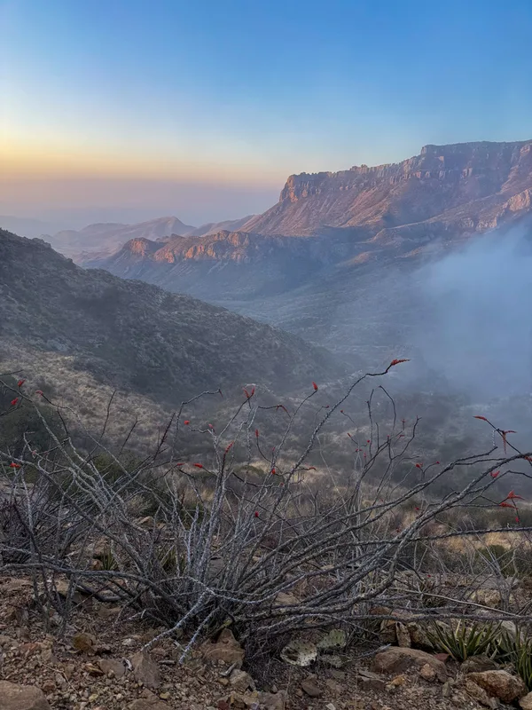
ocotillo Fouquieria splendens -
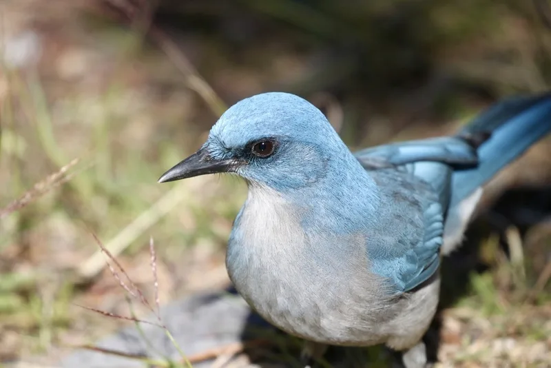
Mexican Jay Aphelocoma wollweberi -
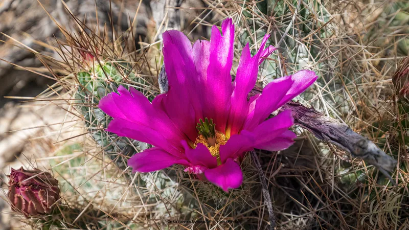
strawberry hedgehog cactus Echinocereus stramineus -
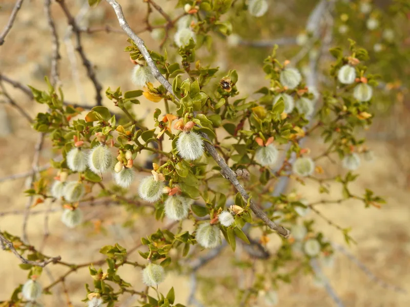
Creosote Bush Larrea tridentata -
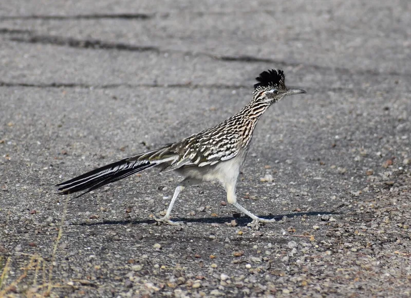
Greater Roadrunner Geococcyx californianus -
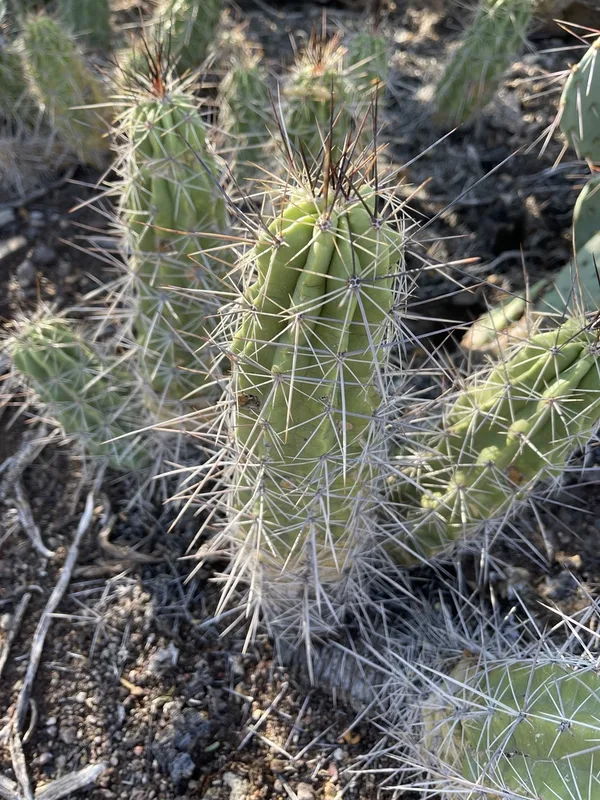
Strawberry Cactus Echinocereus enneacanthus -
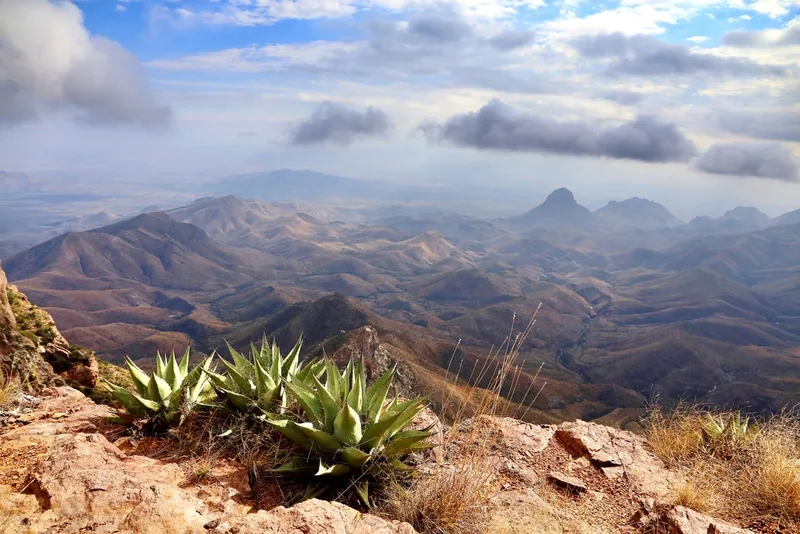
Havard's Century Plant Agave havardiana -
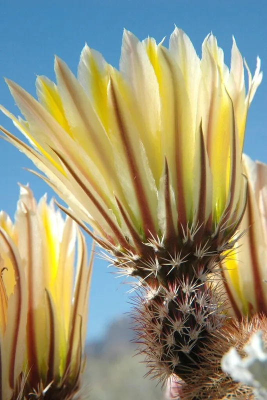
Texas rainbow cactus Echinocereus dasyacanthus -
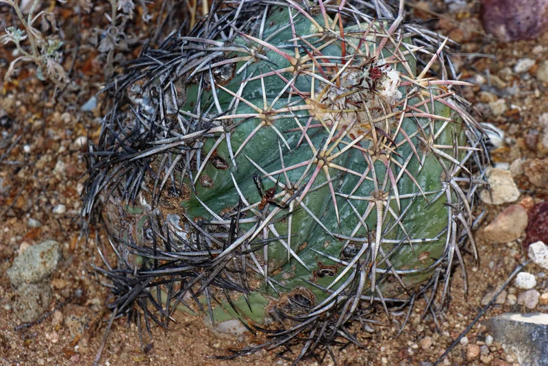
Devilshead Echinocactus horizonthalonius -
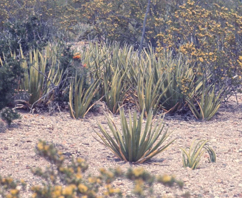
lechuguilla Agave lechuguilla -
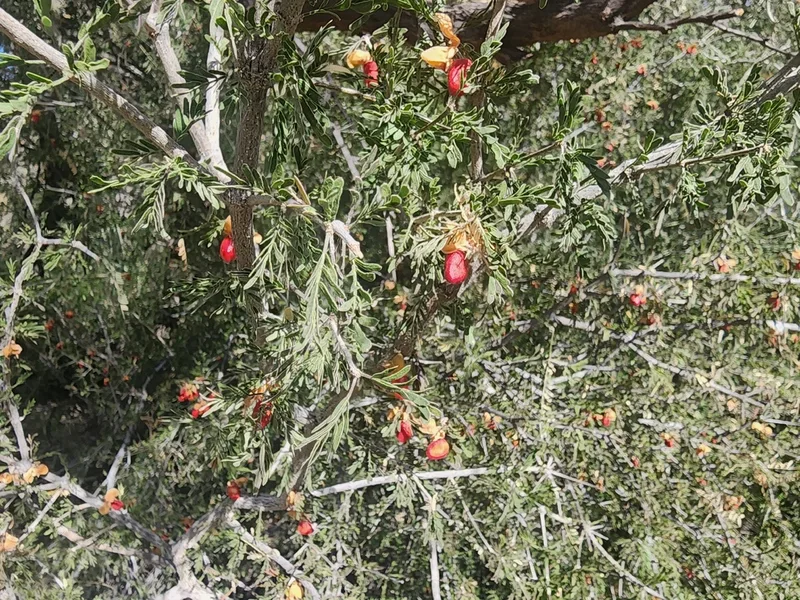
Texas lignum-vitae Guaiacum angustifolium -
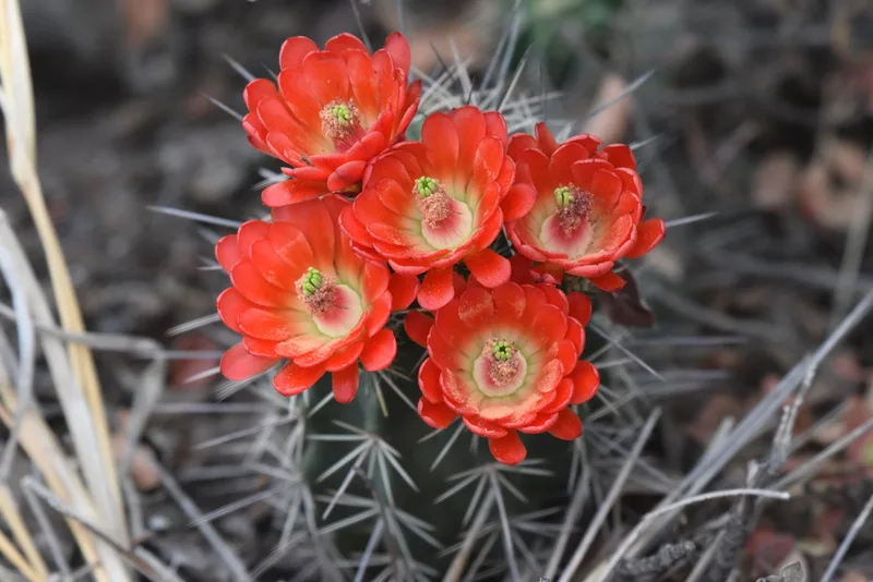
scarlet hedgehog cactus Echinocereus coccineus
Field Notes · Night Sky lens · Big Bend National Park · 29.3332, −103.1943