Zion
The canyon is a stack of old sand made legible by water.
Also seen through Rivers & Canyons · all at Zion Canyon →.
Why here
Zion is a desert made from a former landscape of sand. Navajo Sandstone and the older rocks beneath it rise in walls, domes, and benches, while the Virgin River cuts a route through the stack. The colors and lines are not decoration added to the canyon. They are the original layers, tilted, exposed, and slowly opened by water. Walk beneath the cliffs and then climb above them. The same rock changes from sheltering wall to distant country as your position changes. Zion rewards that movement because the canyon is not one object. It is a book of sediment, read one layer and one river bend at a time.
The sites
Reading the walls
Angels Landing
37.2693, −112.9480
Angels Landing places you among the canyon’s vertical layers. The route is demanding, but the reward is not only the view. From above, sandstone walls become lines in a larger pattern, and the river becomes the narrow force that keeps opening the book. Look for benches, streaks, and changes in color rather than one single landmark. Each difference records a change in sediment or weathering. The canyon reads best when you let distance simplify the layers before you return to the rock at hand.
Trace one horizontal band across the opposite wall. Follow it until a canyon or slope interrupts it; that continuity shows the old layer, while the cut shows the river’s later work.
- AccessHalf-day hike
- ExertionStrenuous
- TimeA full day
Cathedral Mountain
37.2750, −112.9577
Cathedral Mountain makes the sandstone’s scale hard to avoid. The wall rises as a mass of layered rock, but its surface is full of smaller evidence: ledges, cracks, desert varnish, and places where water briefly gathers. The desert is not an absence of life. Rock squirrels, mule deer, and lizards use the shade and open ground in different ways. Stand beneath the mountain and look for the line where the wall stops being a single face and becomes many surfaces shaped by water and wind.
Find a shaded ledge beneath the wall. Look for tracks or movement nearby; shade and a little retained moisture make these small shelves useful in a dry canyon.
- AccessShort walk
- ExertionEasy
- TimeAn hour
Water's narrow argument
Angels Landing Trailhead
37.2747, −112.9507
The trailhead is where the river’s deep argument becomes a route for people. Water cut the canyon through sandstone, but the trail climbs across the same resistant layers and follows their benches. Begin by looking at the wall rather than the path. The path is temporary; the rock records a much longer movement. As you rise, the river’s channel narrows and widens below, showing how a small stream can make a large landscape when given time and a stack of rock to work on.
Before climbing, locate the river below and the sandstone ledge above it. The trail crosses the same boundary between a low water route and a higher resistant layer.
- AccessShort walk
- ExertionModerate
- TimeAn hour
West Rim Trailhead South
37.2600, −112.9515
The West Rim Trailhead South opens the canyon from its upper edge. Desert country looks broad here, but the river has already begun to gather the surrounding slopes into one downward route. Walk a short distance and look for the transition from open plateau to incised canyon. The wall is the visible result of water working through a thick sedimentary stack. Plants and animals occupy the spaces left between those larger forces, using juniper, ledges, and seasonal water as a patchwork of shelter.
Find the first place where a shallow drainage becomes a deeper cut. That small change is the beginning of the canyon’s larger form.
- AccessShort walk
- ExertionModerate
- TimeHalf a day
Desert life on old sand
Deertrap Mountain
37.2375, −112.9438
Deertrap Mountain shows how desert life uses height and exposure. The mountain rises from sandstone country, but its slopes offer different temperatures, shadows, and food. Mule deer can move through open ground, while rock squirrels and fence lizards use warmer ledges and broken surfaces. Look at the mountain as habitat divided by aspect rather than as one uniform wall. The geology sets the stage, and sunlight sorts the living cast across it.
Compare a sun-facing ledge with a shaded slope. Look for a lizard on the warm surface and deer sign in the open ground; different animals use the same sandstone in different ways.
- AccessHalf-day hike
- ExertionStrenuous
- TimeA full day
When it's best
Spring and fall are the easiest seasons for reading the open rock without the full force of summer heat. Spring can bring flowers and flowing water, while fall cools the shaded canyon and changes the light on the walls. Summer mornings are useful for exposed trails; winter can bring snow and shadow to the high country. Water levels and storms can change canyon access, so stay attentive to the river and the rock above you.
Go deeper
The names behind what you saw. The walls include Navajo Sandstone, Kayenta, and Moenave formations. The ecology payload includes rock squirrel, Otospermophilus variegatus, mule deer, Odocoileus hemionus, and plateau fence lizard, Sceloporus tristichus.
To read next. - Zion’s geological map — for the sandstone layers and the sequence exposed by the canyon. - The park’s natural-history material — for desert life along the river and walls.
The names behind what you saw
What lives here, and what it's called. Photographs from open collections — an aid to identification, not decoration.
-
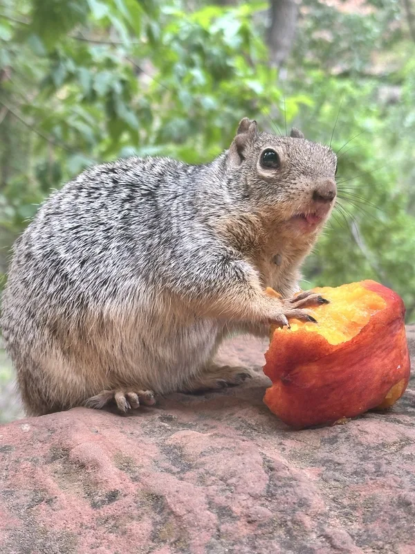
Rock Squirrel Otospermophilus variegatus -
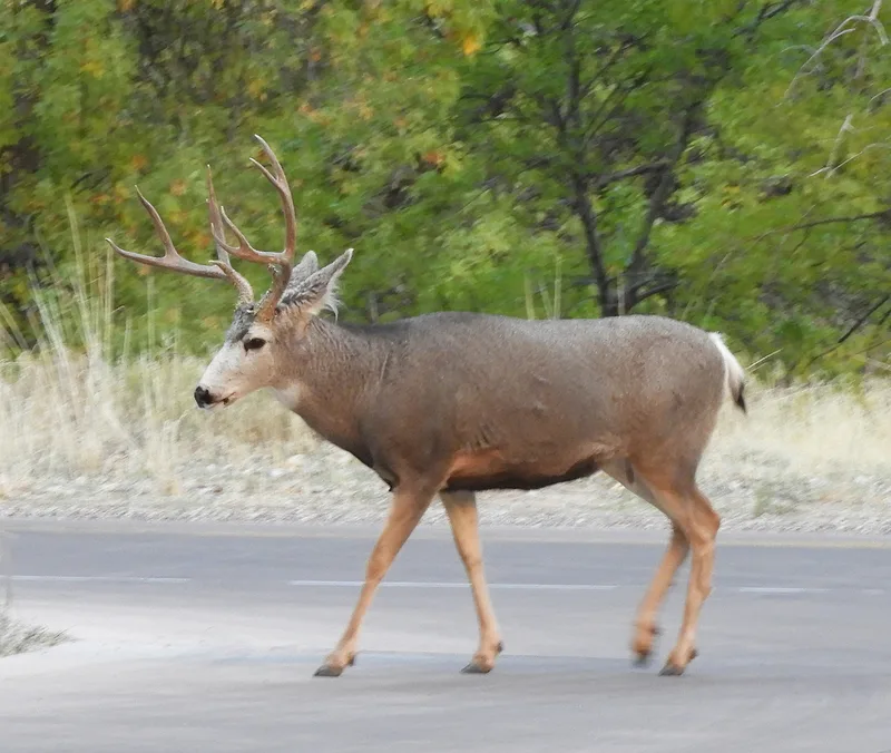
Mule Deer Odocoileus hemionus -
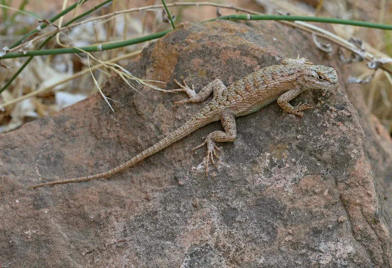
Plateau Fence Lizard Sceloporus tristichus -
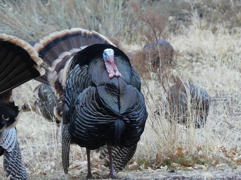
Wild Turkey Meleagris gallopavo -
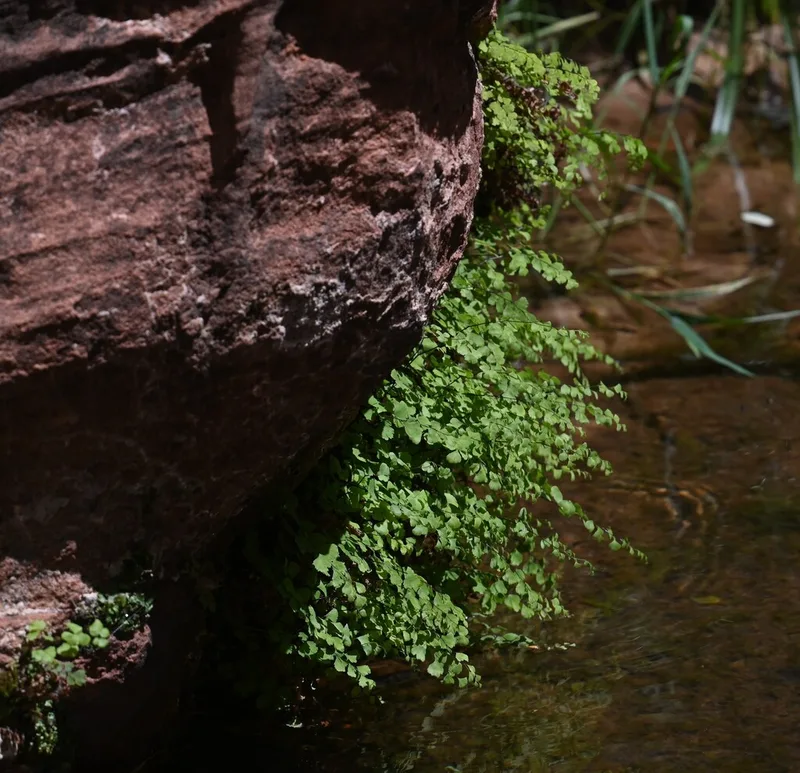
black maidenhair fern Adiantum capillus-veneris -
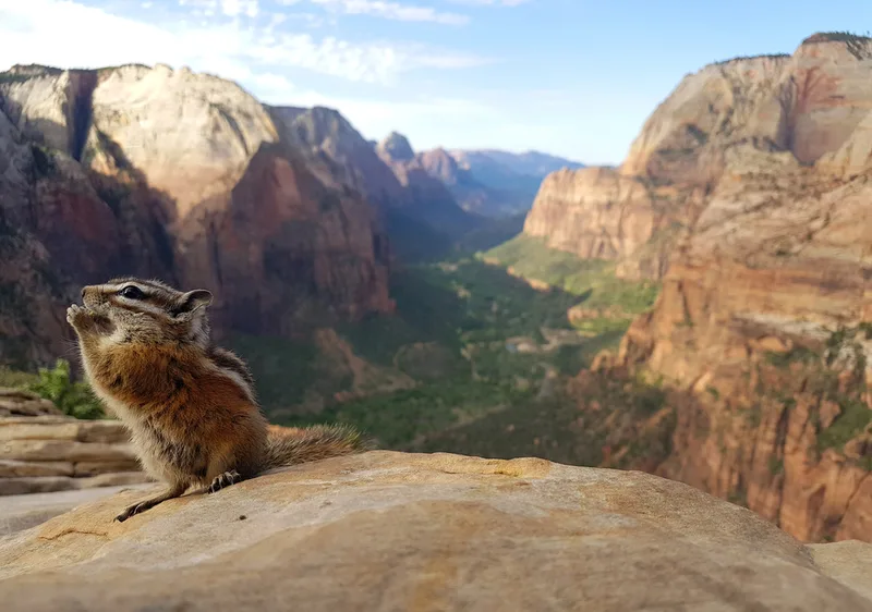
Uinta Chipmunk Neotamias umbrinus -
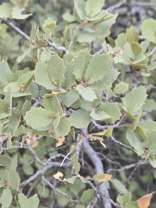
Sonoran scrub oak Quercus turbinella -
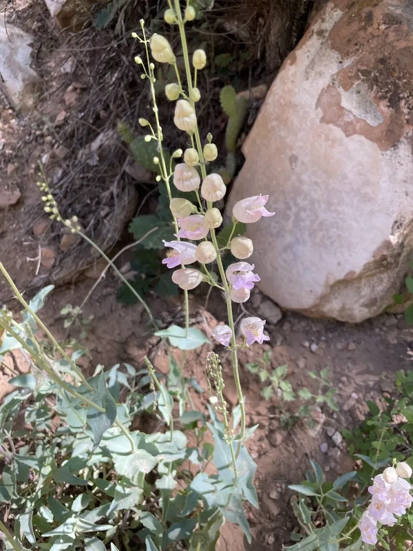
Palmer's penstemon Penstemon palmeri -
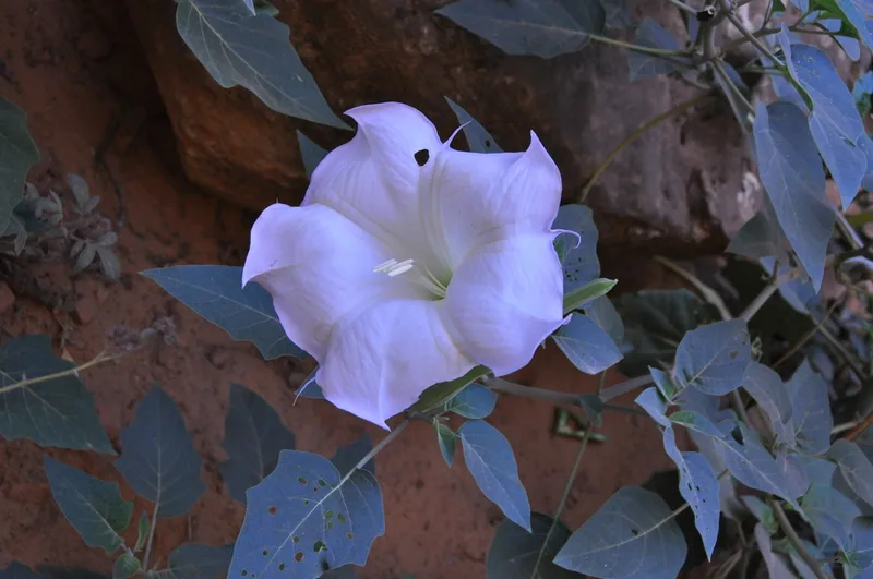
Sacred Datura Datura wrightii -
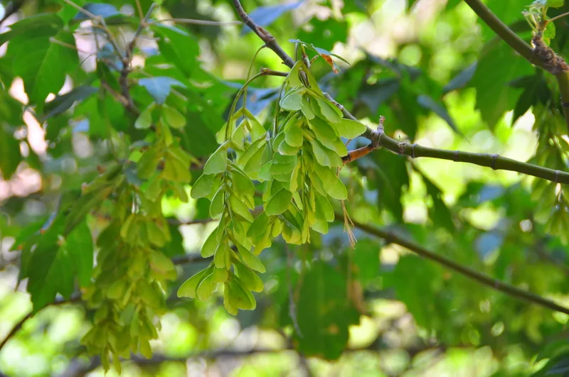
box elder Acer negundo -
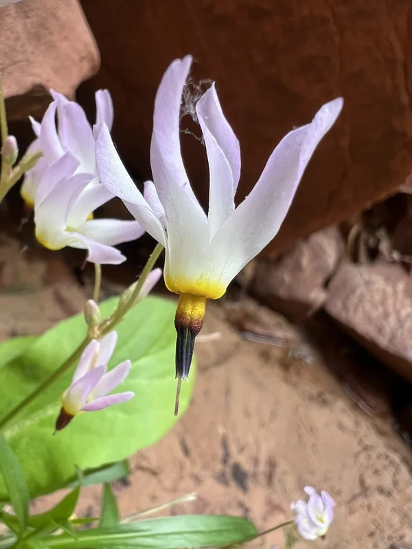
dark-throated shooting star Primula pauciflora -
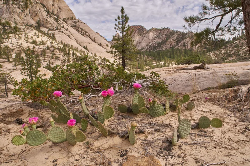
Golden Pricklypear Opuntia aurea
Field Notes · Desert & Deep Time lens · Zion Canyon · 37.2576, −112.9528