Yosemite
Yosemite Valley · California, USA
The rock came up hard and cold from deep underground, and the water has been arguing it down ever since.
Also seen through Ice & Glaciers · all at Yosemite Valley →.
Why here
Stand on the valley floor and look up. The walls around you are granite — rock that cooled slowly, miles underground, and came to the surface about as hard as anything on earth [src macrostrat:unit:3192002]. By rights it should have won. Instead, running water and, in colder ages, slow rivers of ice have spent longer than you can easily picture cutting a flat-bottomed trench thousands of feet down into it [src wikipedia:Yosemite Valley]. The Merced River drains the whole valley now, and nearly every side stream — Tenaya, Bridalveil, Yosemite, Illilouette — arrives the same way: over an edge, as a waterfall [src wikipedia:Yosemite Valley]. The reason is simple. The main valley was cut far deeper than the little side canyons could keep up with, so their creeks now reach the rim and drop. Those falls run hardest in spring, when the snow above is melting fast, and many fade to nothing by late summer. Follow the water and the ice, and every cliff, fall, and quiet meadow in this note becomes one long argument the rock is still, slowly, losing.
The story
Start with the rock. The granite that walls this valley began as molten rock cooling slowly, miles underground, in the age of the dinosaurs [src macrostrat:unit:3192002]. It came up hard and unbroken. Then water went to work on it — first rivers cutting a canyon, then, in colder ages, slow rivers of ice grinding that canyon wider and deeper and squaring off its walls. When the ice finally left, it laid the valley floor level with stream gravel and glacial rubble [src macrostrat:unit:2537610], and the Merced River settled in to drain the whole thing [src wikipedia:Yosemite Valley].
On that flat, well-watered floor a forest took hold. Pines stand tall across it; along the river and the meadows grow black oak, bigleaf maple, and dogwood, the dogwoods opening white in spring [src inat:taxon:76447]. Steller’s Jay and raven work the trees the year around [src inat:taxon:8234], mule deer step through the meadows at dawn and dusk [src inat:taxon:42220], and black bear move through with the seasons [src inat:taxon:41638].
People have lived in this valley for thousands of years [src wikipedia:History of the Yosemite area]. In the mid-1800s the Ahwahnechee, a band of Mono and Miwok people, made their home on the valley floor [src wikipedia:Ahwahnechee]. In 1851 a state militia, the Mariposa Battalion, entered the valley in pursuit of the Ahwahnechee under Chief Tenaya; they burned the villages and food stores and forced the people out [src wikipedia:History of the Yosemite area]. The flat land they had lived on was the same land the water and ice had spent ages making.
The sites
Where the water comes down
Bridalveil Fall Viewpoint
37.7176, −119.6483
Bridalveil Creek is one of the handful of streams that feed water into the valley [src wikipedia:Yosemite Valley]. Here it arrives the way most of the valley’s water does — over the lip of the main canyon and straight down its wall. The reason is the shape of the place. The deep valley was cut lower and faster than the small side canyon behind the fall could keep pace with, so the creek now reaches the edge and simply drops, hundreds of feet, to the floor. The fall runs hardest in spring, when the snow on the high country above is melting fastest and the creek is full [src wikipedia:Yosemite Valley]. That is when it thunders and throws spray across the whole viewpoint. In a dry late summer the same fall thins to a pale ribbon, or breaks into a drift of mist that never quite reaches the ground. It is worth remembering that the cliff it pours over is granite — rock that formed deep underground and came up hard [src macrostrat:unit:3192002]. The water has been finding its way down anyway.
Stand near the base on a breezy spring afternoon and watch the bottom of the fall rather than the top. The wind catches the water before it lands and lifts it back up the cliff as drifting mist — the fall is heavy enough to make its own weather and light enough to be blown around by it.
- AccessShort walk
- ExertionEasy
- TimeAn hour
Ribbon Falls Viewpoint
37.7345, −119.6484
A single thin thread of water falls down the sheer wall near El Capitan. Ribbon Fall has no lake or large creek behind it — it is fed only by snowmelt and spring rain gathering on the rim above. That makes it a creature of the season. When the snow is melting it runs full and loud down bare rock in one long unbroken drop; once the melt runs out it falls quiet, and through high summer it often stops altogether. It follows the same rhythm as the valley’s other low-water falls, which draw from small drainages and are usually dry by midsummer [src wikipedia:Sentinel Fall]. This is the honest character of a granite country: the rock holds almost no water, so what falls as snow runs off fast and dramatically in spring and is gone by the dry months. The wall it pours over is the same hard granite that cooled deep underground long before any of this water existed [src macrostrat:unit:3192002]. The fall is young and seasonal; the cliff is old and patient.
Look for the dark vertical streak on the cliff even when no water is falling. That stain is mineral and moss marking the fall’s usual path — proof the fall exists, drawn onto the rock, waiting for the next melt to fill it.
- AccessDrive-up
- ExertionEasy
- TimeAn hour
Yosemite Falls Trailhead
37.7427, −119.6032
This is the foot of the highest waterfall in North America [src wikipedia:Yosemite Valley]. From the trailhead a short, nearly flat walk brings you to the base of the lower fall, close enough to feel the cold air the falling water pushes ahead of it. The full trail to the top is a different matter — long and steeply switchbacked, climbing the entire height of the valley wall, work for a strong half-day or more. The fall is most prominent in spring, when the meltwater feeding it is at its peak [src wikipedia:Yosemite Valley]. That is when it fills the upper valley with sound and sends spray far out from the base. By late summer, with the snow gone from the high country, the same fall can slow to a thin trickle or stop entirely, leaving a dark streak on the cliff where the water usually runs. However you see it, the water is dropping the full depth the valley was cut — arriving from a creek on the plateau above that the deepening valley left stranded high on the wall.
From the base, tip your head back and pick out the two long drops with a stretch of half-hidden cascades between them. Then follow the line to the very top and picture the creek up there on the plateau, arriving at the edge of a valley the ice cut out from under it.
- AccessShort walk
- ExertionEasy
- TimeAn hour
Horsetail Fall viewing position
37.7288, −119.6132
A slender fall spills down the eastern flank of El Capitan, fed by snow and rain caught on the granite shoulders high above. Like the valley’s other thin falls, it runs only when there is water to feed it: lively in late winter and spring, dry through much of the rest of the year. What sets this spot apart is the backdrop. The fall drops in the open down a clean stretch of rock, with the vast pale face of El Capitan rising beside it — one of the high granite walls that stand over the valley [src wikipedia:Yosemite Valley]. The contrast is the lesson. It takes surprisingly little water to make a fall this tall; what matters is the height of the drop, and the height was made by ice and water working on the granite over a very long time [src macrostrat:unit:3192002]. Come when the snow is melting and there is a good chance the fall is running; come in the dry season and you may find only the stain where it was.
Find the fall against the huge pale face of El Capitan and notice how small a stream it takes to fall this far. The cliff dwarfs the water — but it was water and ice, given enough time, that shaped the cliff, not the other way around.
- AccessShort walk
- ExertionEasy
- TimeAn hour
The river doing the work
Valley View
37.7173, −119.6619
At the west end of the valley the Merced River runs wide and quiet, with El Capitan standing on one side and Bridalveil Fall coming down on the other [src wikipedia:Yosemite Valley]. This is the river that drains the entire valley [src wikipedia:Yosemite Valley]. Every creek and every fall in this note eventually gives its water to the Merced, and here, near the valley’s mouth, it gathers all of it and carries it out toward the lowlands. The character of the river has changed by the time it reaches this point. Up in its higher canyon it tumbles and cuts; here it is slow and level, spreading sand and gravel across the flat floor [src macrostrat:unit:2537610]. That is the gentlest stage of the same long work that carved the whole valley — the river no longer digging down but laying its load out smooth. It is an easy place to stand and take in both ends of the story at once: the tall cut walls above, and the level, river-built floor below.
On a still morning, look for the cliffs reflected in the river. The water lies nearly flat here because the valley floor is nearly flat, filled level with river gravel and old glacial rubble — you are looking at the leftovers of the cutting, spread out smooth.
- AccessDrive-up
- ExertionEasy
- TimeAn hour
Happy Isles Trailhead
37.7328, −119.5578
Near the east end of the valley the Merced River comes down out of its steep upper canyon and slows abruptly onto the flat floor [src wikipedia:Yosemite Valley]. This is the hinge of the river’s story. Above here it is a tumbling, cold, loud mountain stream, still actively cutting into rock; below here it becomes the calm, wide water you see at the valley’s west end. From the trailhead a short walk reaches the riverside, and a strenuous trail climbs on beside the water toward the falls in the canyon upstream — a long, steep, rewarding half-day if you take it. But you do not have to climb to read the change. The place where fast water meets flat ground is right in front of you, and it marks the edge of the work the ice and river have already finished. Come in spring and the river here runs high and fierce with the melt; come later in the year and it drops and quiets, the same water doing the same job at a gentler pace.
Stand near the river and watch for the place where the churning, tumbling water goes suddenly smooth and slow. That line is the edge of the flat valley floor: upstream the river is still cutting, downstream it is only carrying — one river doing two different jobs a few steps apart.
- AccessShort walk
- ExertionEasy
- TimeHalf a day
Mirror Lake Trailhead
37.7398, −119.5599
A short walk up Tenaya Creek leads to a wide, still stretch of water that holds the cliffs above it in reflection [src wikipedia:Yosemite Valley]. It is less a true lake than a slow, shallow place in the creek, and it changes hard with the season. In spring it fills brim-full and glassy with meltwater; through summer it shrinks steadily; by autumn it can be a bend of sand and meadow with the creek reduced to a quiet channel. That seasonal disappearing act is itself the point. Everywhere else in the valley the water is falling or rushing; here it spreads out wide enough to slow almost to stillness, and stillness is what lets it work as a mirror. The creek is on its way to join the Merced on the valley floor, part of the same drainage that gathers at the west end [src wikipedia:Yosemite Valley]. Catch it early in the year and early in the day, before wind and heat have their say, and it is the calmest water in a valley otherwise defined by water in a hurry.
Come early in the day, before wind stirs the surface, and look for the cliff reflected upside down in the water. The creek barely moves here because it has spread out wide and shallow — the same water that falls loud elsewhere, caught briefly at rest.
- AccessShort walk
- ExertionEasy
- TimeHalf a day
The canyon, read from above
Glacier Point
37.7307, −119.5737
From this cliff-edge lookout the whole valley opens out below — the flat green floor, the Merced River threading through it, and Half Dome standing across the way [src wikipedia:Yosemite Valley]. It is the single best place to read the shape that water and ice have made. From the floor you cannot always see it, but from up here it is unmistakable: a broad, deep, flat-bottomed trench cut down into solid granite [src macrostrat:unit:3192002]. The walls fall away steeply; the floor lies level and green far below. You are standing roughly at the height the land once held all the way across, before the cutting began — everything below you has been removed, carried out grain by grain and boulder by boulder by the river and the ice. The high viewpoints like this one are reached only after the winter snow melts back from the road, so this is a warmer-season overlook. On a clear day, with the valley laid out beneath you, the argument between the rock and the water is not something you have to imagine — it is the view.
Trace the flat valley floor with your eye, then the sheer walls, then the rounded domes on the skyline. Three shapes from three tools: the river laid the flat floor, the ice squared the walls, and weather slowly rounds the high rock the ice never reached.
- AccessDrive-up
- ExertionEasy
- TimeAn hour
Washburn Point
37.7206, −119.5729
A little below Glacier Point, this lookout faces up the Merced’s canyon, toward the country where the river comes down through a run of steep drops before it reaches the valley floor [src wikipedia:Yosemite Valley]. Where Glacier Point shows you the finished valley, Washburn Point shows you the work still in progress. Here the river has not yet leveled its bed; it descends in steps over bare granite [src macrostrat:unit:3192002], each drop a place where the rock is harder or the cutting is younger. It is the same process that made the broad valley below, caught at an earlier stage. Half Dome and the high country stand above it all. Give the view a moment and the two lookouts read as one lesson in sequence: upstream, the river is still cutting a steep canyon; downstream, it has already opened a wide flat valley. The only difference between them is time, and the river has plenty of that.
Look up the canyon at the steps the river takes coming down, and notice that its bed is not yet smooth. Each drop marks harder rock or a younger cut the river has not finished leveling — the same work, caught earlier, that already opened the wide valley downstream.
- AccessDrive-up
- ExertionEasy
- TimeAn hour
When it's best
Come in spring for the water. That is when the snow in the high country is melting and the falls are fullest — the highest of them most prominent when the meltwater peaks [src wikipedia:Yosemite Valley], the thinner ones running hard before they fade. Many of those smaller falls are usually dry by midsummer [src wikipedia:Sentinel Fall], so the show is a spring one. Spring mornings can still be cold, with frost at dawn even as the afternoons warm [src openmeteo:archive:37.733,-119.606], so bring a layer. The river and the great granite walls, though, are there in any season, and birds like Steller’s Jay and raven keep the valley company year-round [src inat:taxon:8010]. The high overlooks open only once the winter snow melts back from the road.
Go deeper
The names behind what you saw
The valley walls are granite, part of the Mesozoic intrusive rocks of the Sierra Nevada — molten rock that cooled deep underground during the Cretaceous [src macrostrat:unit:3192002], including the Early Cretaceous granitic bodies mapped through the valley [src macrostrat:unit:954070]. The flat valley floor is alluvium: stream deposits and glacial outwash laid down since the ice left [src macrostrat:unit:2537610]. The signature living things are Pacific dogwood, Cornus nuttallii [src inat:taxon:76447]; Steller’s Jay, Cyanocitta stelleri [src inat:taxon:8234]; common raven, Corvus corax [src inat:taxon:8010]; California black oak, Quercus kelloggii [src inat:taxon:49919]; bigleaf maple, Acer macrophyllum [src inat:taxon:48227]; mule deer, Odocoileus hemionus [src inat:taxon:42220]; and American black bear, Ursus americanus [src inat:taxon:41638].
To read next
- Geologic History of the Yosemite Valley (USGS Professional Paper, 1930) — the classic account of how ice and water carved the valley from solid granite [src openalex:https://doi.org/10.3133/pp160].
- A brief story of the geology of Yosemite Valley (Beatty, 1943) — a short, plain-language introduction if the professional paper is more than you want [src openlibrary:/works/OL43600471W].
- Bedrock Geologic Map of Yosemite Valley (1985) — maps the individual granite bodies that make up the walls and domes [src openalex:https://doi.org/10.3133/i1639].
- Geology and geochemistry of plutonic rocks in the Cretaceous intrusive suite of Yosemite Valley (2001) — for readers who want the detailed story of the granite itself, how and when it formed [src openalex:https://doi.org/10.1130/0016-7606(2001)113<1486:gagomt>2.0.co;2].
- From a virtual field trip to geologically reasoned decisions in Yosemite Valley (2022) — a guided exercise in reading the valley’s geology the way this note tries to [src openalex:https://doi.org/10.5194/gc-5-17-2022].
The names behind what you saw
What lives here, and what it's called. Photographs from open collections — an aid to identification, not decoration.
-
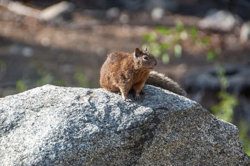
California Ground Squirrel Otospermophilus beecheyi -
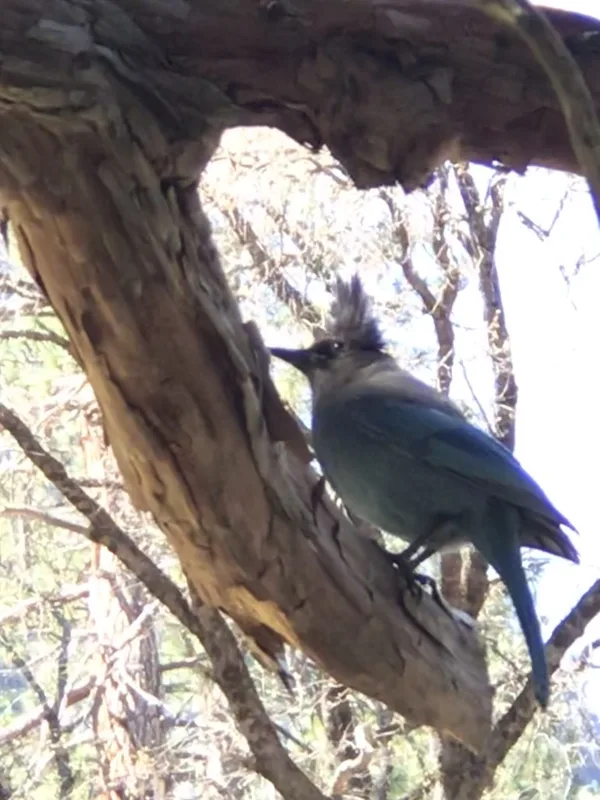
Steller's Jay Cyanocitta stelleri -
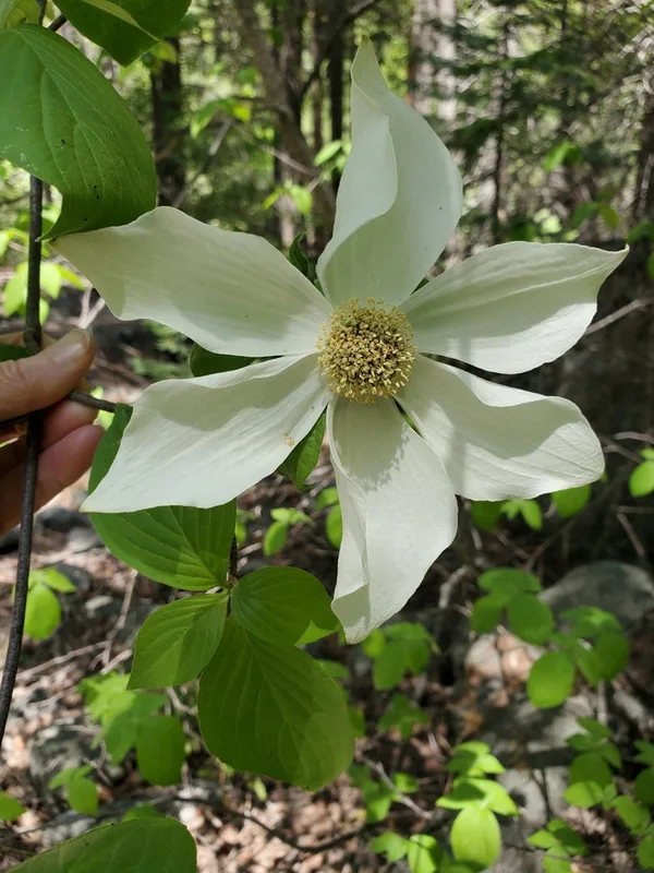
Pacific Dogwood Cornus nuttallii -
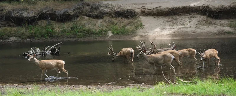
Mule Deer Odocoileus hemionus -
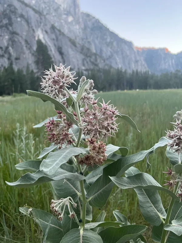
showy milkweed Asclepias speciosa -
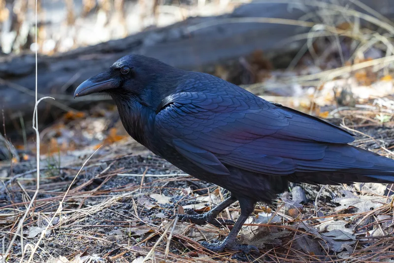
Common Raven Corvus corax -
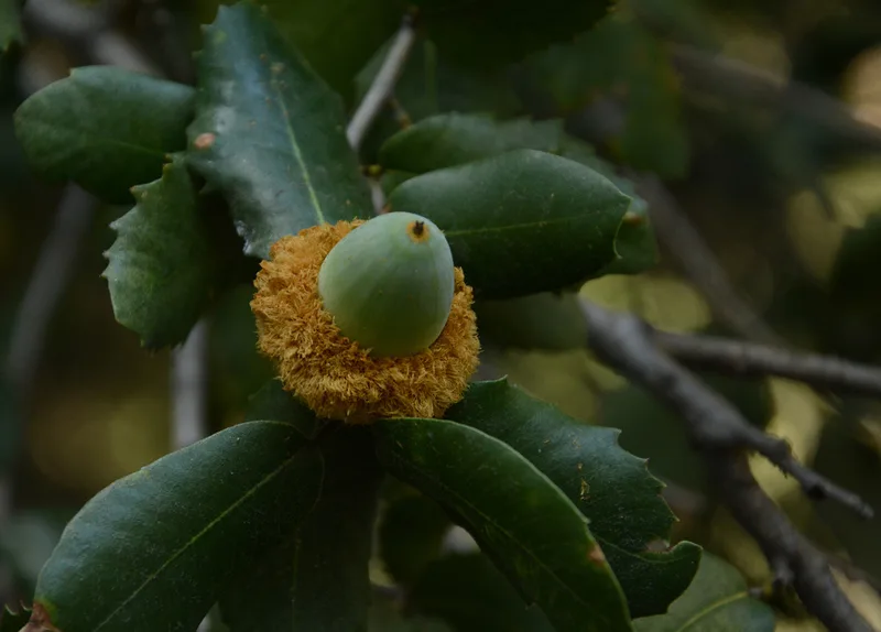
canyon live oak Quercus chrysolepis -
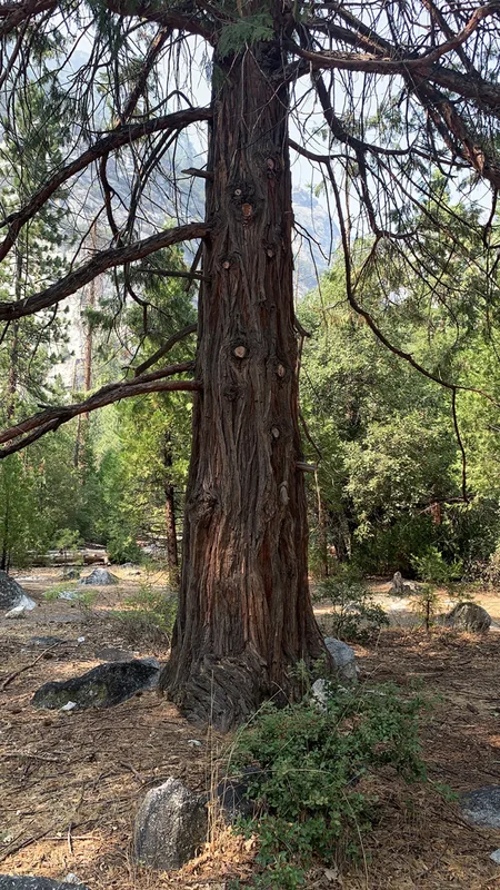
California incense-cedar Calocedrus decurrens -
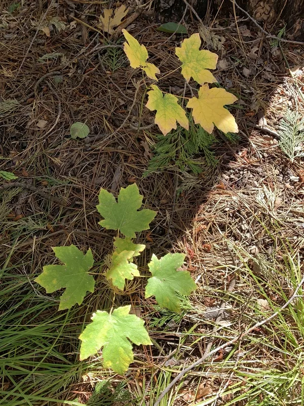
bigleaf maple Acer macrophyllum -
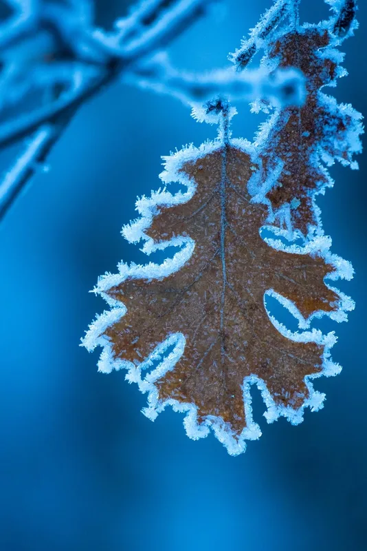
California black oak Quercus kelloggii -
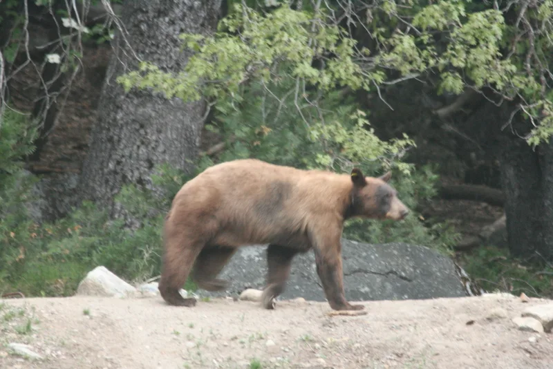
American Black Bear Ursus americanus -
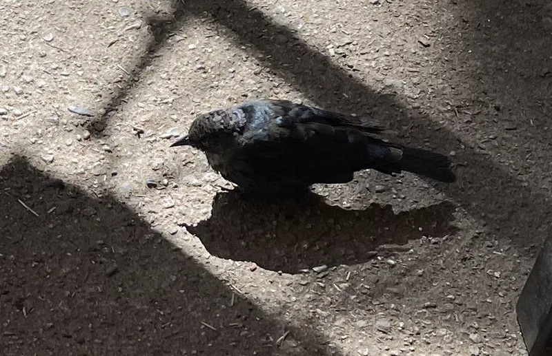
Brewer's Blackbird Euphagus cyanocephalus
Field Notes · Rivers & Canyons lens · Yosemite Valley · 37.7327, −119.6057