Yosemite
Yosemite Valley · California, USA
A river dug this valley; then a river of ice made it wide.
Also seen through Rivers & Canyons · all at Yosemite Valley →.
Why here
Stand on the valley floor and look up. The walls do not taper to a point the way a river’s canyon would; they rise sheer, and then the land goes flat, as if a great trough had been scooped out of the granite. It was. A river cut a narrow V here first, then ice filled the valley and ground it wide, deepening the floor and steepening the walls into the gates you now stand between. The rock itself is far older than the ice — granite that cooled slowly, deep underground, long before any glacier touched it. The ice only reshaped what was already there, and then it left. What it left is a flat-bottomed valley some seven miles long and over half a mile deep, drained now by a single quiet river where a glacier once flowed. Everything in this note — the leaping waterfalls, the rounded domes, the meadow underfoot — is the ice’s handwriting, still legible on the stone. Learn to read the shape of the valley, and the whole place becomes a record of what the ice cut away and what it carried off.
The story
Start with the rock. The granite here cooled slowly, miles underground, before it ever saw daylight — a mass of stone with few natural seams, which is why the walls can stand so tall and so sheer. Rivers cut the first narrow canyon into it. Then, in the cold ages, ice took over: a glacier filled the valley to the brim, plucking and grinding, widening the V into a broad U and leaving the smaller side streams to spill from cliffs the ice had cut away beneath them. When the ice melted, a lake sat where the valley floor now lies; it filled slowly with sand and gravel until it became the flat, forested ground you walk today.
On that floor grew pines, black oaks, and incense-cedar. Listen for the Steller’s jay, a crested, deep-blue bird loud in the pines and easy to find in the cold months when the valley is quiet. Mule deer step through the meadows at dawn; ravens work the cliff faces overhead.
People have lived here for the better part of ten thousand years. The band who made the valley home were the Ahwahnechee, of Mono and Miwok descent. Their time here ended hard: in 1851 a state militia rode into the valley in pursuit of Chief Tenaya’s people, burned the villages, destroyed the food stores, and forced the survivors out. The valley they had tended became, to the newcomers, a scenic wonder.
The sites
The valley the ice widened
Valley View
37.7173, −119.6619
This roadside pullout looks straight up the length of the valley, and it is the clearest place to read the whole shape at once. The Merced River slides past in the foreground; beyond it the granite walls rise on both sides and the floor runs flat between them. That flat floor and those sheer walls are the reason this is called a glacial valley — a river working alone would have left a narrow V, tapering to the stream at its bottom, but ice left a broad, flat-bottomed trough. The river you see now is the modest stream that remains where a glacier once filled the entire opening. It is the first full view many people get of the valley, and the easiest to understand: everything else in this note is a detail of the shape you are looking at here. Late in the day the light comes down the valley toward you and the walls glow.
From the pullout, follow the line where the cliff meets the flat valley floor on either side. Notice that the wall does not narrow to a point at the bottom the way a stream-cut canyon would — it drops sheer, and then the ground goes level. That squared-off trough is the track of the ice: a river cuts a V, a glacier grinds a U.
- AccessDrive-up
- ExertionEasy
- TimeAn hour
Gates of the Valley: Glaciers at the Gate
37.7203, −119.6490
An interpretive board stands here at the western gates of the valley, where the walls pinch close and the Merced River leaves the flat floor. The spot is well chosen. This narrowing is where the ice spilled out of the valley it had been carving, and from here you can look back east into the broad trough it left behind. Read the board, then look up. The two great masses framing the gate — El Capitan on the left, the Cathedral Rocks on the right — are granite the ice ground past on its way out of the valley. It is a good place to hold two ideas together: the tight notch you stand in, and the wide basin behind you that the same ice hollowed out. The board itself names glaciers as the shaping force, which is exactly the story the ground here tells.
Stand at the board and look back up the valley to the east. The walls that frame this gap stand sheer and close, then open into the wide flat basin beyond. You are standing in the notch the ice funneled through on its way out; the width behind you is the measure of what it hollowed away.
- AccessDrive-up
- ExertionEasy
- TimeAn hour
Mirror Lake Trailhead
37.7398, −119.5599
A nearly level path leads from here toward Mirror Lake, at the foot of the cliffs where Tenaya Creek enters the valley. The lake is the last open water of a much larger one. When the ice withdrew, a lake filled the valley floor; over time, sand and gravel filled it in until only this small pool remained. It is still filling. In the spring meltwater it spreads wide and, on a still morning, throws the cliff above back at you as a reflection; by late summer it often shrinks to a gravel flat and meadow. Either way, you are looking at the valley’s own future — the slow conversion of standing water into level ground, caught partway through. The flat floor you walked in on was once a lake exactly like this one.
At the lakeshore, wait for the water to go still and find the cliff reflected in it. Then look at the shallow, sandy margins and the meadow creeping in from the edges. This is a lake turning into flat valley floor in slow motion — the same filling-in that made the level ground you walked here on.
- AccessShort walk
- ExertionEasy
- TimeHalf a day
Walls the ice cut sheer
El Capitan
37.7342, −119.6376
El Capitan rises from the valley floor in one clean sweep of granite, a wall so sheer and so smooth it looks cut. Much of that is the rock itself: this granite cooled deep underground with few natural cracks, so it stands in great unbroken faces rather than crumbling into slopes. The ice did the rest, grinding along the base of the wall and steepening it as it passed. Stand in the meadow beneath it and the scale is hard to hold in the eye — the face keeps going up long after you expect it to stop. On a clear day you may pick out climbers as slow, bright specks partway up the stone, which is the only reliable way to feel how large it truly is. This is the plainest single lesson in why the valley walls stand the way they do.
From the meadow at its foot, look for the long vertical streaks of darker stain running down El Capitan’s face, then look for how few horizontal ledges break the wall. Rock with few seams stands in tall, smooth faces like this — the ice found little to pry loose, and left the wall nearly whole.
- AccessDrive-up
- ExertionEasy
- TimeAn hour
Sentinel Rock
37.7289, −119.5945
Sentinel Rock stands on the south wall of the valley as a tall, tapering blade of granite — a watchtower shape that gives it its name. It is the same deep-cooled granite as the rest of the valley walls, worked into this steep pinnacle where the ice and the weather cut along its seams. Beside it in spring, a long thread of water comes down the cliff: Sentinel Fall, a tiered cascade fed by snowmelt that is usually dry by midsummer. Together the rock and the fall make a plain seasonal clock — the blade of stone is there all year, the ribbon of water only while the high country is still shedding its winter. It is one of the more distinctive silhouettes on the valley’s south side, and easy to find from the floor.
From the valley floor, trace Sentinel Rock’s outline against the sky — narrow, upright, coming almost to a point. Then, in spring, find the ribbon of Sentinel Fall on the cliff beside it and follow it down in steps. That water is this year’s snow leaving the high country; come back in late summer and the ribbon is usually gone.
- AccessDrive-up
- ExertionEasy
- TimeAn hour
Side streams left hanging
Bridalveil Fall Viewpoint
37.7176, −119.6483
A short paved path leads to the foot of Bridalveil Fall, where a side stream leaps off the cliff and falls free to the valley floor. The waterfall exists because of how the ice worked. The main glacier cut the valley deep, but the smaller stream in its side canyon could not keep pace, so its floor was left hanging high on the wall when the ice withdrew. Now the stream simply runs off the edge and drops. In a breeze the fall drifts sideways and breaks into mist, which is where its name comes from. It runs strongest in spring, when the high snow is melting, and thins through the summer. Of all the valley’s waterfalls, this is the easiest one to walk to and the clearest illustration of a stream left stranded above the valley the ice deepened beneath it.
At the viewpoint, find where the falling water leaves the cliff, and notice that the little valley it comes from hangs well above the main valley floor, its mouth cut off in mid-air. A stream that size could never have carved a drop like that on its own — the main glacier cut deeper and faster, and left this side stream stranded high on the wall.
- AccessShort walk
- ExertionEasy
- TimeAn hour
Yosemite Falls Trailhead
37.7427, −119.6032
This trailhead sits below Yosemite Falls, where a creek comes off the north rim in a long series of drops — the highest waterfall on the continent. A short, mostly level path from here reaches the base of the lower fall; a much steeper trail climbs the wall beside it for anyone who wants the top, a strenuous half-day of switchbacks. Like Bridalveil, this is a side stream that was left hanging high when the ice deepened the main valley, and it now runs off the rim to make the descent in stages. It is loudest and fullest in the spring meltwater and quiets through the dry months, until in late summer it can dwindle to a faint streak. The sound of it carries a long way down the valley when the water is high.
From the base of the lower fall, look up and count the separate drops the water makes on its way down — an upper plunge, a middle cascade, and the lower fall in front of you. Then notice that the creek arrives from a hanging notch far up on the rim: the ice cut the valley out from under it, and left the stream to find its own way down.
- AccessShort walk
- ExertionEasy
- TimeAn hour
The view from the ice's high edge
Glacier Point
37.7307, −119.5737
Glacier Point stands on the valley’s south rim and looks down into the whole trough from above — the flat floor, the winding river, the domes on the far side, and the high country beyond, where the ice came from. From up here the U-shape reads at a single glance in a way it never can from the floor, where the walls crowd too close to see whole. The overlook is reached by a long road that climbs to the rim, open only after the snow clears the high country, generally from late spring into fall. The granite underfoot is the same rock that walls the valley far below — you are simply standing on the top edge of it now, looking down the cut. It is the one stop where the shape of the whole valley resolves into a single form.
From the railing, look straight down the length of the valley and follow the line where the walls meet the floor on both sides. From this height, the flat bottom and the steep sides make one clear, broad U. That is the ice’s signature, and this is the one place you can take in the whole letter at once.
- AccessDrive-up
- ExertionEasy
- TimeHalf a day
Sentinel Dome
37.7230, −119.5843
A walk from the high road reaches the bare granite crown of Sentinel Dome, a rounded summit standing above the valley rim. Its smooth curve is granite shedding itself in layers: the rock peels away in great curved shells, like the skins of an onion, rounding every edge over time. That is a different shape from the sheared walls of the valley below, made by a different process — the walls were cut steep and fast, while a dome rounds itself slowly from the outside in. The two shapes sit within sight of each other, the rounded crown and the squared trough, both worked from the same granite. Reaching the top means a climb from the high road, open only once the snow has left, generally from late spring into fall. From the summit the high country runs out in every direction.
On the bare summit, run your eye over the rock and look for the long, curved cracks that lift away in shells rather than sharp blocks — that is how granite rounds itself into a dome. Then look down at the valley’s squared-off walls below: rounded above, cut sheer beneath, two different processes working the same stone.
- AccessShort walk
- ExertionModerate
- TimeHalf a day
When it's best
Come in spring for water. The falls run hardest as the winter snow melts off the high country, and Yosemite Falls is at its fullest then; by high summer the lesser falls thin out, and some, like Sentinel Fall, usually run dry by July. The valley floor itself is open in every season, and quiet in the cold months. The rim overlooks are another matter: Glacier Point and Sentinel Dome sit high above the valley and can be reached only once the snow leaves the high road, generally from late spring into fall. Mirror Lake is fullest in the spring meltwater and often shrinks to a gravel flat by late summer.
Go deeper
The names behind what you saw. The valley walls and domes are cut from Mesozoic intrusive rock — the granite plutons of the Early Cretaceous, cooled deep underground. The flat valley floor is alluvium: stream sand and gravel that includes glacial outwash, the sediment that filled the old valley lake. The loud blue bird of the pines is the Steller’s jay, Cyanocitta stelleri; the deer are mule deer, Odocoileus hemionus; the cliff birds are common ravens, Corvus corax; the aromatic conifer is California incense-cedar, Calocedrus decurrens, growing alongside California black oak, Quercus kelloggii.
To read next. - Geologic History of the Yosemite Valley (USGS Professional Paper 160, 1930) — the classic long-form account that traces the valley from granite to glacier and set the terms of the debate. - A Brief Story of the Geology of Yosemite Valley, M. E. Beatty (1943) — a short, plain-language telling for the reader who wants the arc without the apparatus. - Geology and Geochemistry of Mafic to Felsic Plutonic Rocks in the Cretaceous Intrusive Suite of Yosemite Valley (GSA Bulletin, 2001) — for the reader who wants to know exactly how and when the granite itself formed. - Bedrock Geologic Map of Yosemite Valley (USGS, 1985) — a map that keys each cliff and dome to the rock unit beneath it.
The names behind what you saw
What lives here, and what it's called. Photographs from open collections — an aid to identification, not decoration.
-
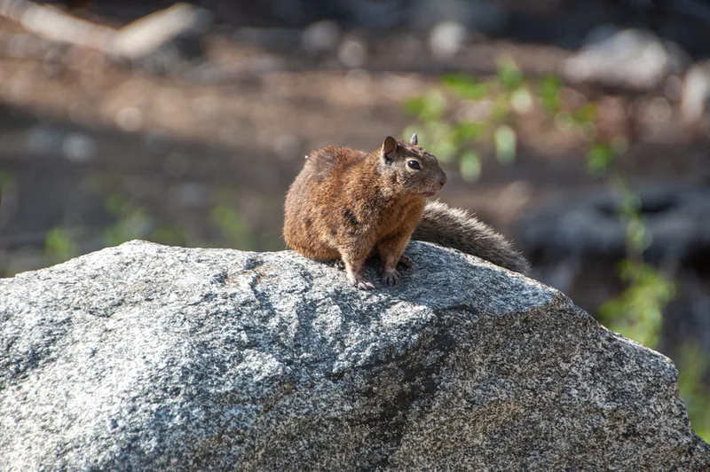
California Ground Squirrel Otospermophilus beecheyi -
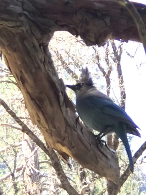
Steller's Jay Cyanocitta stelleri -
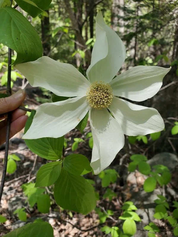
Pacific Dogwood Cornus nuttallii -
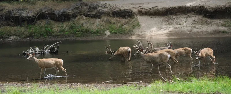
Mule Deer Odocoileus hemionus -
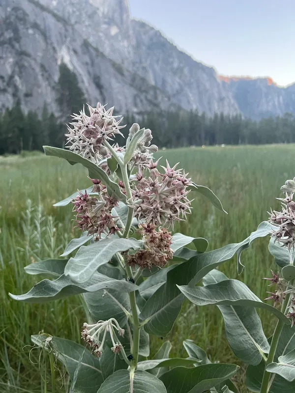
showy milkweed Asclepias speciosa -
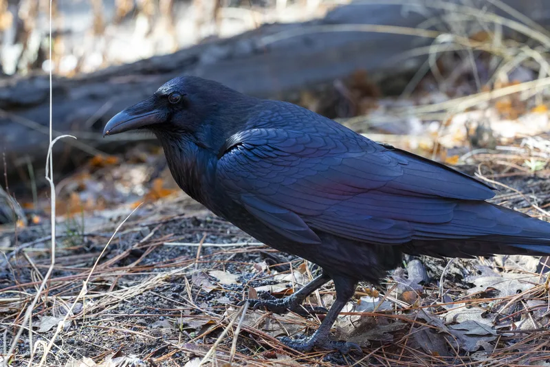
Common Raven Corvus corax -
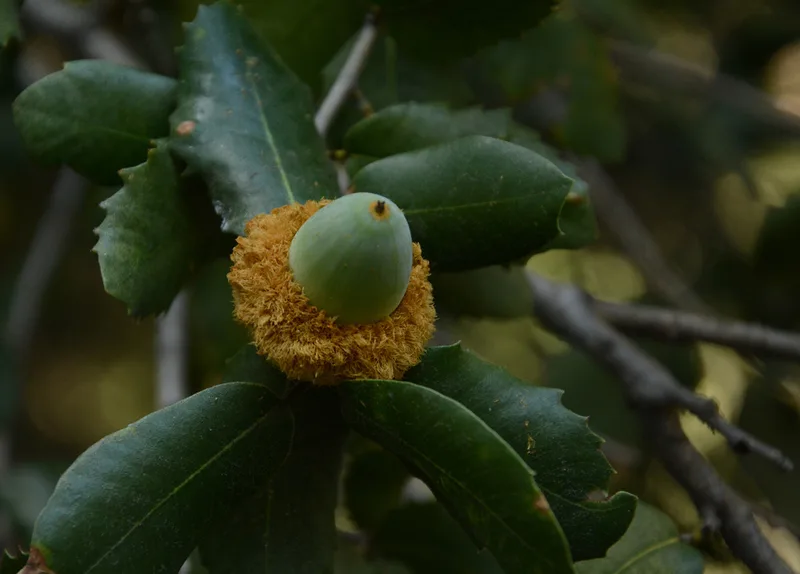
canyon live oak Quercus chrysolepis -
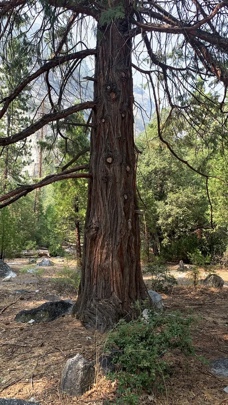
California incense-cedar Calocedrus decurrens -
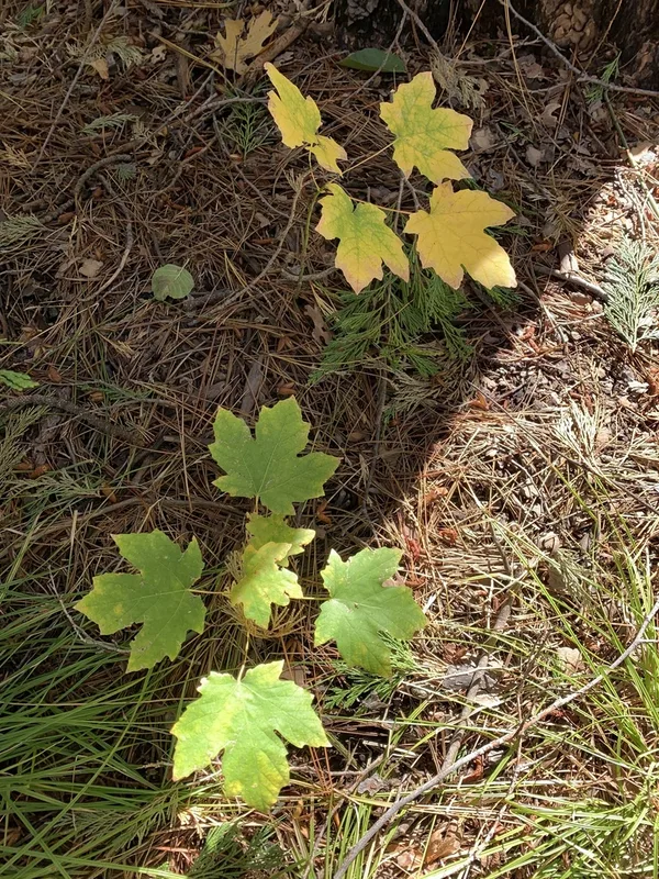
bigleaf maple Acer macrophyllum -
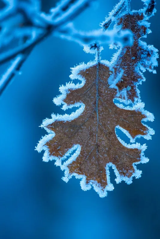
California black oak Quercus kelloggii -
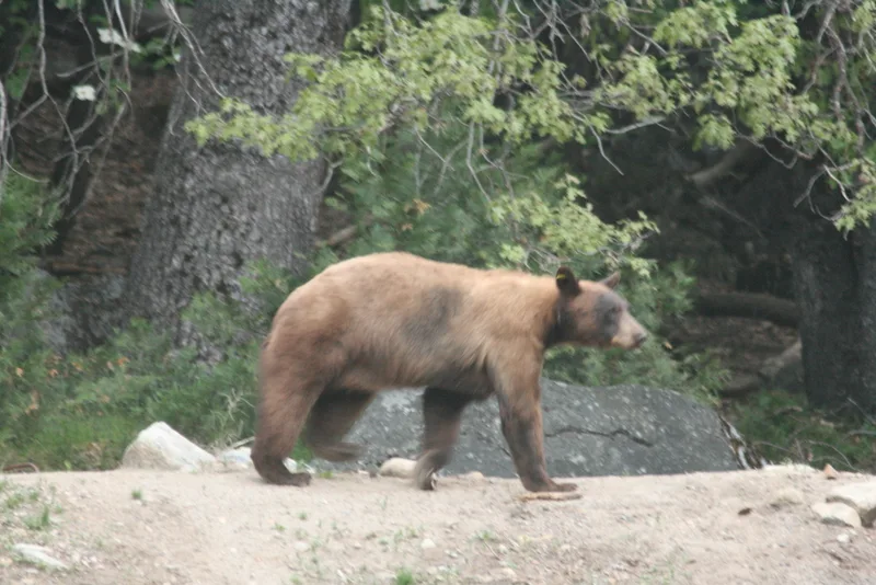
American Black Bear Ursus americanus -
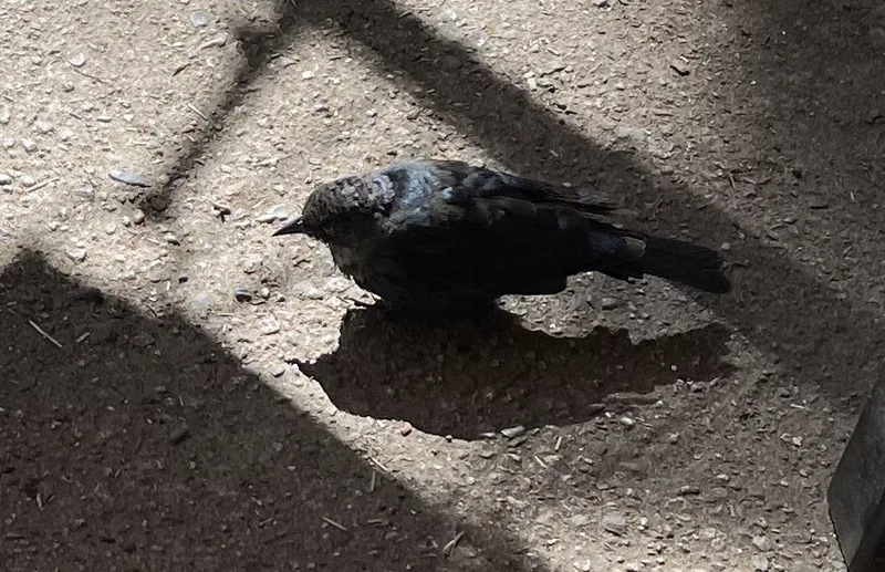
Brewer's Blackbird Euphagus cyanocephalus
Field Notes · Ice & Glaciers lens · Yosemite Valley · 37.7327, −119.6057