The Yellowstone
Upper Geyser Basin · Wyoming–Montana–Idaho, USA
Here the water does not carry the mountain away. It carries the mountain up, and sets it down as stone.
Also seen through Volcanic · all at Upper Geyser Basin →.
Why here
Water usually wins its long argument with rock by cutting down. A river saws a canyon and carries the mountain to the sea. Here, water wins by building up.
Rain and snowmelt sink into the ground, drop toward the heat of a buried volcano, and return to the surface superheated and loaded with dissolved stone. As that hot water cools and hisses into the air, it sets the stone back down, grain by grain, around every vent and pool. The light-colored volcanic rock underfoot — a close cousin of granite — is the raw material; the water is the mason. Give it centuries and it raises cones you can stand beside, rims around scalding pools, and whole terraces stepping down a hillside.
This is the same patient argument a river has with a canyon, run in reverse: instead of carrying rock away, the water brings it up and stacks it. Everything here — the cones, the colored pools, the steam standing in cold air — is one more line in that argument. Learn to read it, and the basin stops being a curiosity and becomes a conversation.
The story
Start underground. Beneath the basin lies the collapsed heart of an old volcano, a caldera still hot enough to boil the water that sinks into it. That water is the whole story. Where it rises through the pale volcanic rock of the geyser basins, it carries dissolved silica and lays it down as cones and rims; where it climbs through buried limestone to the north, it carries lime instead and builds terraces that grow like slow, wet stone.
The heat makes room for life that lives nowhere else nearby. On warm, bare ground that would cook an ordinary root, look for Yellowstone monkeyflower and Rocky Mountain fringed gentian, small plants that make a living at the edge of scalding water. Around them stands the ordinary forest of the plateau, lodgepole pine, thin and straight. In the cold runoff streams, the American dipper walks underwater to feed.
People came late and came arguing. A government survey mapped and named the geysers in the early 1870s. The next year Congress set the whole place aside as the country’s first national park, signed into law by President Grant. Later, storekeepers followed the tourists; one of them, Charles Hamilton, arrived as a young man and built shops that served travelers along the loop road for most of a century. Each generation found the same thing worth protecting: water, still winning.
The sites
What the water builds
Castle Geyser
44.4637, −110.8365
Castle Geyser is the clearest lesson in the basin on how water makes rock. Its cone is a heap of pale, knobby stone that the hot water built around its own vent over a very long time — enough of it that, from a distance, the mound looks like the ruin of a castle wall, which is how it got its name. Every drop that has ever erupted here left a little of its dissolved stone behind on the way out; the cone is the sum of all of them, and among the largest such deposits in the basin. Stand close and the surface gives away the method: crusty layer on crusty layer, each a thin film of stone laid down by cooling water. It is a slow monument to patience, still being added to, one eruption at a time.
Walk to the base of the cone and look at its surface up close. The pale, cauliflower-crust stone is not lava — it is dissolved rock the hot water carried up and left behind as it cooled, one thin film at a time. Run your eye up the mound and you are reading centuries of eruptions stacked into a wall.
- AccessShort walk
- ExertionEasy
- TimeAn hour
Mammoth Hot Springs
44.9706, −110.7056
To the north, the water tells the same story in a different stone. At Mammoth Hot Springs the hot water rises not through volcanic rock but through old buried limestone, dissolving it below and carrying the lime upward. At the surface it cools, gives up its load, and builds terraces — broad, pale steps that spill down the hillside like a waterfall turned to stone. Because the plumbing shifts underground, the terraces are restless: water abandons one lip and starts another, so the whole hillside is a work always half-finished. Where water still flows, the stone is bright and growing; where it has moved on, the terraces go grey and dry. It is one of the few places where rock builds fast enough to change within a human lifetime.
Find a terrace edge where water is actively spilling over the lip, and compare it to a dry, grey terrace nearby. The wet stone is being laid down right now, day by day, as the cooling water drops its dissolved lime; the grey stone is where the water quit and the building stopped. You are watching rock start and stop.
- AccessDrive-up
- ExertionEasy
- TimeHalf a day
The plumbing at the surface
Old Faithful
44.4605, −110.8281
Old Faithful is the basin’s most visited vent, and the mechanism behind it is plain once you picture it. Water fills a narrow, twisting pipe in the ground. The deep water, pressed down by the weight of everything above it, gets far hotter than boiling before it can turn to steam. When at last a little of it flashes, the whole column lifts and throws itself into the air. Then the pipe drains, refills, and the pressure builds again. What looks like a performance is really just water losing an argument with heat, over and over, on a rhythm the rock sets. It runs regularly enough to plan a wait around, and wild enough that no two are quite the same.
Before the water goes up, watch the vent itself. You will see it splash and surge and fall back several times — the deep water testing whether it can escape as steam. When one of those surges finally carries through, the eruption follows. You are watching pressure win.
- AccessShort walk
- ExertionEasy
- TimeAn hour
Grand Prismatic Spring
44.5250, −110.8381
Not all the water here erupts; some of it simply sits and glows. Grand Prismatic Spring is a wide, still pool ringed in bands of color — deep blue at the scalding center, then green, yellow, orange, and rust as you move outward. The colors are alive. The middle is too hot for almost anything, so it stays the clear blue of deep water; but each cooler ring toward the rim suits a different mat of heat-loving microbes, and each mat wears a different color. The rings are a temperature map you can read with your eyes: hottest where it is bluest, coolest where it is reddest. Steam usually drifts across the surface, tinted faintly by whatever it passes over.
Stand at the edge and trace the color from the middle outward — blue, then green, then the warm oranges and reds at the rim. You are reading temperature. The clear blue center is too hot for life; each colored ring is a different heat-loving microbe living at the warmth that suits it, cooling step by step toward the edge.
- AccessShort walk
- ExertionEasy
- TimeAn hour
Reading the whole basin
Observation Point
44.4647, −110.8244
For the argument as a whole, climb to Observation Point. From this bench above the basin, the individual features stop being separate attractions and become what they are: a single field of vents, all fed by the same hot plumbing under the same buried volcano. From up here you can see the pale ground for what it is — not soil but stone the water laid down, spread flat across the valley floor and dotted with steam wherever a vent still runs. It is the best place to grasp the scale of the water’s work, and the timing of it: from this height, several plumes and eruptions are usually in view at once, each on its own clock. The short uphill from the boardwalks below buys you the whole picture.
From the overlook, look for the pale, bare ground that the trees avoid, and notice how the steam plumes scatter across it. That paleness is not bare dirt — it is stone the hot water built and salted, ground too mineral for a forest to root in. The forest edge marks where the water’s country ends.
- AccessShort walk
- ExertionModerate
- TimeAn hour
Geyser Hill
44.4648, −110.8299
Geyser Hill is the crowded heart of the basin, a low rise packed with vents where the water’s work is close enough to study foot by foot. The features come in every size — full cones, quiet pools, and small vents that spit only a foot or two — and standing among them you understand that the famous giants are just the loudest members of a large family. Most of what the water does here is small and constant. Boardwalks keep you off the crust, which is thinner than it looks: the pale ground is often a fragile lid over scalding water, built by the same slow settling of stone that made the cones. Walk it unhurried and you can watch a dozen separate arguments between water and heat, each at its own stage.
Pick one small, unnamed vent and just watch it for a while. Notice the crust built up around its lip — the same pale stone the big cones are made of, only younger and lower. Every quiet vent here is a cone in its first chapter; you are seeing where the giants began.
- AccessShort walk
- ExertionEasy
- TimeHalf a day
When it's best
The water works in every season, which is the rare gift here — the geysers and hot springs never close for winter. Come in the cold months and the show is the steam itself, standing in tall white columns because frozen air can hold so little of it; the colder the morning, the bigger the plume. Come in the warm months and the colors take over, the banded rings around the pools brightening as the heat-loving life in them wakes up, with the small thermal wildflowers out on the warm ground. Wildlife rides the same rhythm — ravens and bison through the year, mountain bluebirds back once the plateau thaws. Early and late in the day beat midday for both light and quiet.
Go deeper
The names behind what you saw. The pale rock the water builds around the geysers is siliceous sinter, often called geyserite — silica the hot water dissolves from the light-colored volcanic rock below (the felsic rock and rhyolite of the caldera) and redeposits at the surface. At Mammoth the terraces are travertine, the lime-rich stone laid down where the water rises through buried limestone instead. The thermal wildflowers are Yellowstone monkeyflower, Erythranthe thermalis, and Rocky Mountain fringed gentian, Gentianopsis thermalis; the plateau forest is lodgepole pine, Pinus contorta; the streambird that walks underwater is the American dipper, Cinclus mexicanus.
To read next. - Geologic map of Upper Geyser Basin, Yellowstone National Park (USGS, 1982) — the actual map of what lies under the boardwalks, feature by feature, if you want to know which vent sits on which ground. - Database for the geologic map of Upper Geyser Basin (USGS, 2015) — the data companion to that map, the mapped units in searchable form. - Wikipedia, “Geothermal areas of Yellowstone” — the plumbing at park scale: how the basins are counted and how the same hot water feeds all of them. - Wikipedia, “Castle Geyser” — a close read of the one cone this note leans on hardest, and how its stone got its name.
The names behind what you saw
What lives here, and what it's called. Photographs from open collections — an aid to identification, not decoration.
-
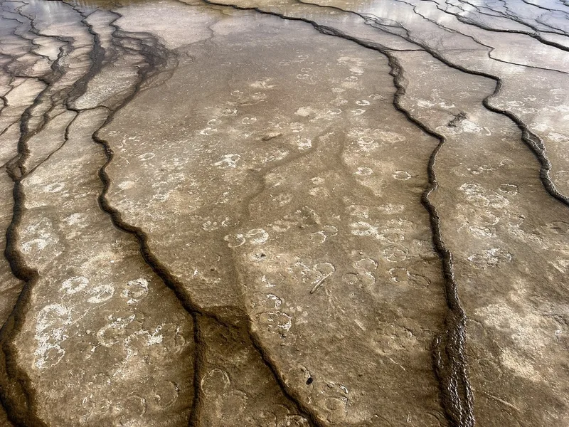
American Bison Bison bison -
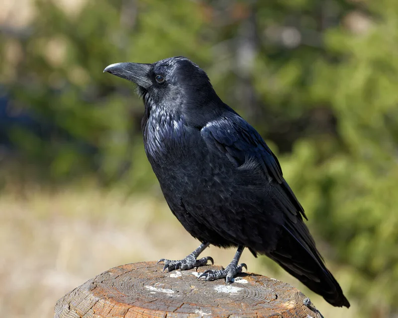
Common Raven Corvus corax -
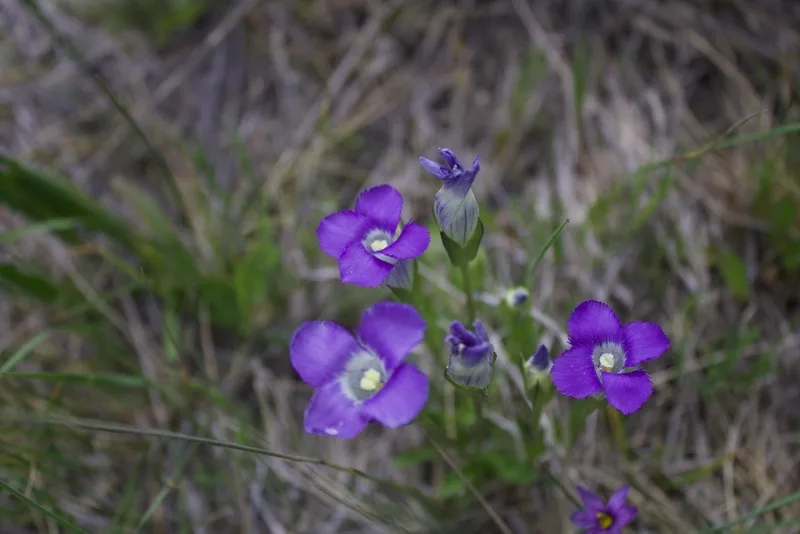
Rocky Mountain Fringed Gentian Gentianopsis thermalis -
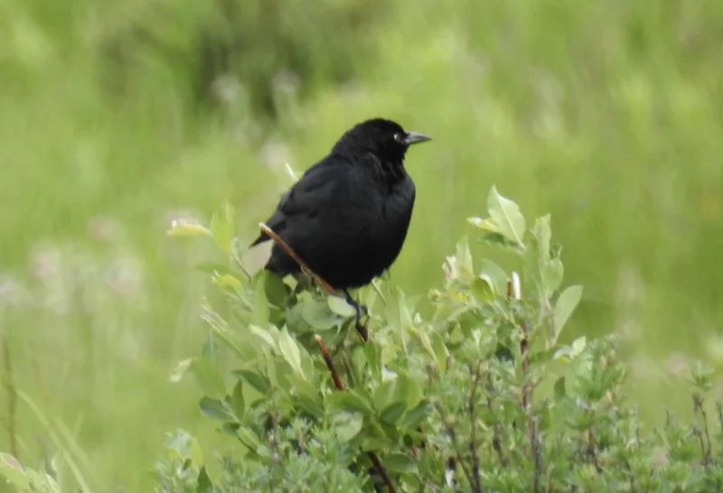
Brewer's Blackbird Euphagus cyanocephalus -
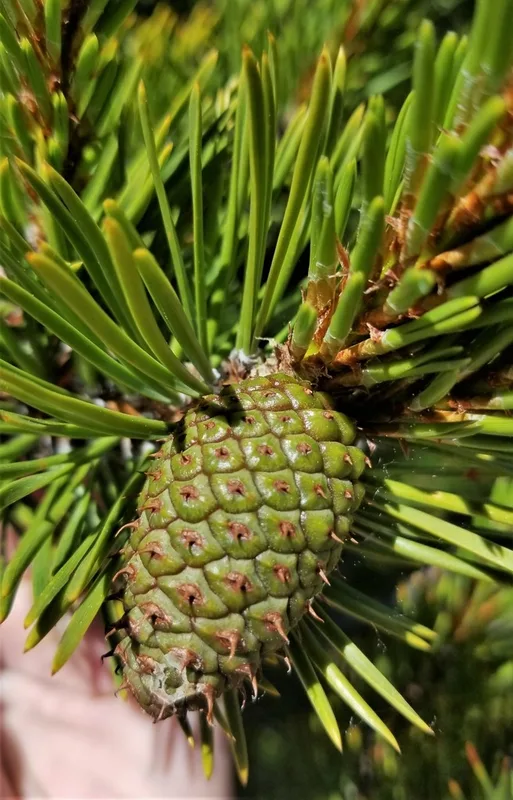
lodgepole pine Pinus contorta -
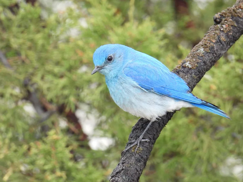
Mountain Bluebird Sialia currucoides -
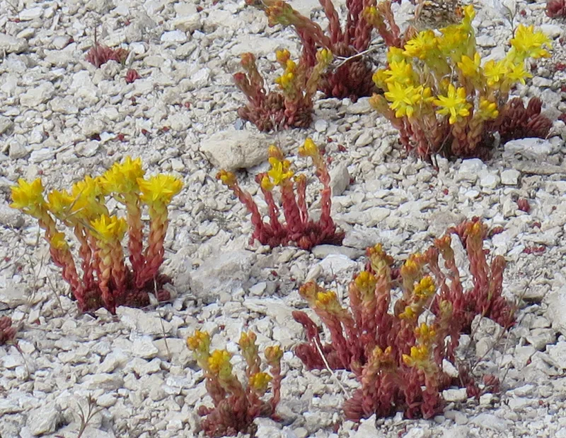
Lanceleaf Stonecrop Sedum lanceolatum -
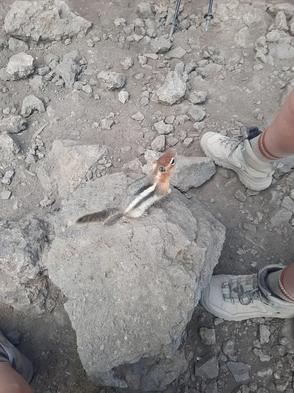
Common Golden-mantled Ground Squirrel Callospermophilus lateralis -
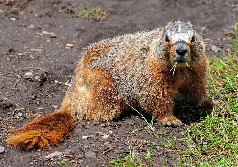
Yellow-bellied Marmot Marmota flaviventris -
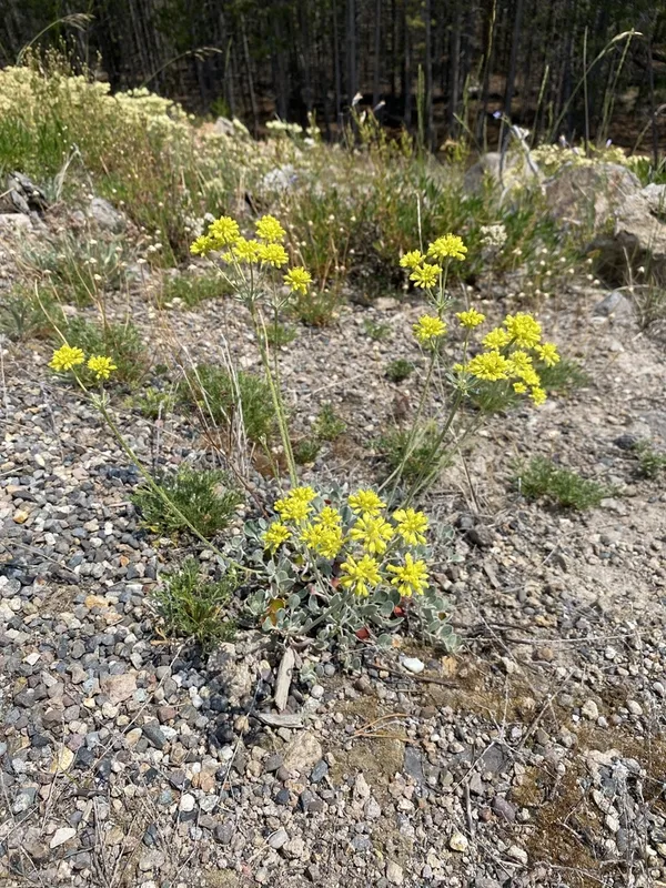
sulfur buckwheat Eriogonum umbellatum -
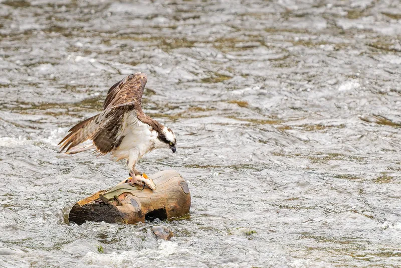
Osprey Pandion haliaetus -
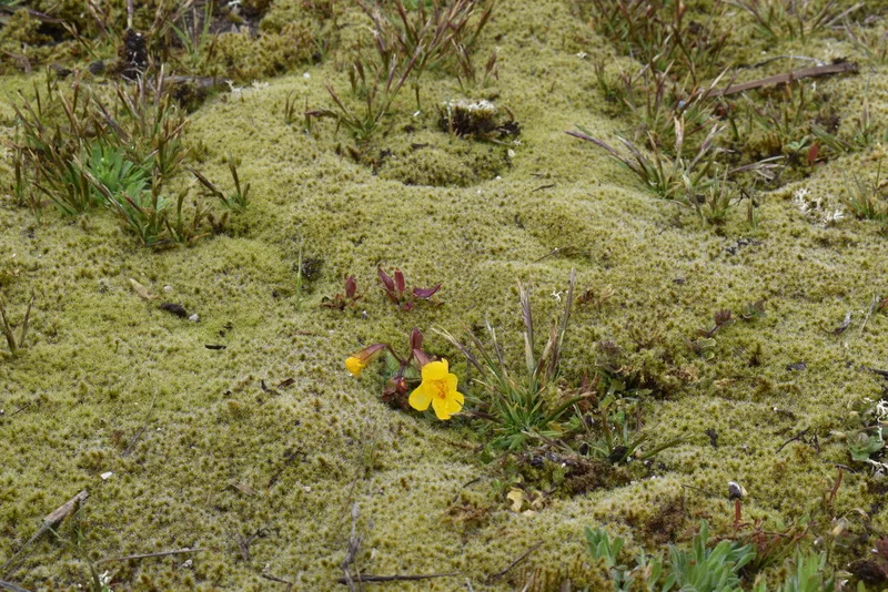
Yellowstone Monkeyflower Erythranthe thermalis
Field Notes · Rivers & Canyons lens · Upper Geyser Basin · 44.7155, −110.7718