Wadi Rum
They call it the Valley of the Moon, though the moon never had a book like this written into its rock.
Also seen through Night Sky · all at قرية وادي رم →.
Why here
Stand in the middle of Wadi Rum and the ground underfoot is almost perfectly flat, while the walls around it rise straight up out of the sand — red and sheer, like open pages of a book someone stood on end. That’s close to the truth. The rock here is a stack of very old sand and sediment, laid down layer over layer across hundreds of millions of years, cut through in places by granite. Wind and rare rain have spent that whole span doing one job: finding the softer rock and carrying it away, grain by grain, until only the hardest stone was left standing. What looks like a mountain range scattered across a desert is really one continuous layer cake, mostly eaten away — the missing rock is as much the story as the rock still there. Every stop in this note is a place to read a different page of that same, very old book.
The story
The valley is cut into sandstone and granite rock. Hundreds of millions of years of sand and sediment piled up in thick beds, first as one long stretch of ancient sand, later as another layer of sedimentary rock draped over it. None of that made a mountain by itself — it took the opposite process, water and wind stripping away everything but the hardest rock, to turn a flat stack of layers into the freestanding towers standing here now.
The life that has moved onto that stone works with what the desert gives it. The Desert Lark nests and forages right on the valley floor, its plumage the same sandy color as the ground it walks on. On the warm rock faces, the Sinai Agama suns itself through the day. Down in the sand, colocynth, a wild, bitter melon, sends a long taproot after water other plants can’t reach.
Of the people who named these mountains and this valley, the record collected here is quiet: little beyond the places themselves, and the Arabic names that mark them on the map today.
The sites
The valley floor
Wadi Rum
29.5084, 35.3362
This point marks the valley proper, the wadi that gives the whole region its name, and one of the largest valleys of its kind in Jordan. Stand here and the geometry of the place becomes obvious: a nearly flat floor of pale sand running between walls of much older, much harder rock. That flatness is not an accident. It is what is left after countless seasons of wind and the occasional flash of rain carried away everything soft enough to move, while the mountains on either side, built from tougher, older layers, stayed standing. The valley floor and the peaks above it are really one and the same rock, just at different stages of the same slow erosion. From the middle of the wadi, the mountains on both sides read almost like a matched set, split apart by whatever has been quietly removed between them. It is a good place to get your first sense of scale before heading toward any single peak, and an easy one to return to at the end of a day, when the low light makes the walls glow rather than glare.
Look down the length of the valley rather than up at the walls. Notice how flat and continuous the floor is compared with the broken, layered rock rising on either side — that contrast is the whole story of this place: soft rock removed, hard rock left standing.
- AccessDrive-up
- ExertionEasy
- TimeHalf a day
School
29.5756, 35.4194
A marked information point sits here at the edge of the settled part of the valley, a good place to get oriented before heading out onto the open sand. From here, the valley’s basic shape is already visible: a broad, level floor hemmed in by standing walls of rock, with more of the same landscape continuing well beyond what you can see. Because Wadi Rum covers a very large area for a single valley, a stop here to get your bearings is worth more than it looks; the mountains that seem close together from a map are often a considerable drive apart on the ground. Use the pause to notice the layering in the nearest rock face: bands of slightly different color and texture, stacked one on top of another. Those bands are the visible edges of the very old seafloor and sand deposits that make up this whole landscape, laid down long before there was a valley here to see them in. Everything else on this list is, in one way or another, a closer look at a band like the ones visible from this spot.
From this point, pick one nearby rock face and count the distinct colored bands running across it. Each band is a separate layer of ancient sand or seafloor, laid down at a different moment — the more you can count, the longer the stretch of time you’re looking at.
- AccessDrive-up
- ExertionEasy
- TimeAn hour
Where the rock stands up
Jabal Ram
29.5876, 35.4134
At close to the height of a small alpine peak, this mountain was long counted as the highest point in Jordan. Newer satellite measurement later showed that Jabal Umm al Dami, at 1,854 m to Jabal Ram’s 1,734 m, stands higher, but Jabal Ram lost that title only on paper; on the ground, it still reads as the anchor of the whole valley, the mountain every other view lines up against. Its rock face is a cross-section of deep time: band after band of old sandstone and sedimentary rock, laid down long before there were mountains here at all. Climbing any distance up its flank means climbing up through time as much as up in elevation, with older rock always underfoot and younger rock always overhead. Even a short approach from the valley floor changes how the mountain reads: what looks like a single reddish wall from a distance resolves, up close, into distinct, separately deposited layers, some harder and more resistant than others. Go slowly, and let the mountain’s history do the entertaining.
As you approach the base, look for places where the rock changes color or texture in a straight, roughly horizontal line. Each change marks a shift in what was being laid down here — sand in one stretch, finer seafloor mud in another — long before any of it hardened into mountain.
- AccessHalf-day hike
- ExertionModerate
- TimeHalf a day
Little Bridge
29.5204, 35.4430
Little Bridge is a modest span of rock, shaped enough like a bridge to earn the name. Bridges and arches like this form wherever a harder band of rock sits over or beside a softer one: wind and the valley’s rare, hard rains work fastest on the soft rock, undercutting it until only a thin connecting rib of the harder layer is left holding on. It is the same process shaping the tall mountains elsewhere in the valley, just caught at a smaller, more delicate scale, small enough to see the whole shape of the process in one glance rather than one mountain. Because it is a thin, exposed piece of rock rather than a solid mass, a bridge like this is also more fragile than it looks: erosion built it, and erosion will eventually finish taking it apart. There is no fixed timeline for that, but it is worth remembering that what looks permanent here is really just the current, temporary shape of an ongoing process. A short walk gets you underneath it, where the arch and the sky beyond frame each other in a way no photograph from a distance quite captures.
Stand underneath the arch and look up at its underside rather than its outline. Notice whether the rock there is smoother or more layered than the ground around it — that’s the same soft-over-hard erosion pattern that shapes the valley’s big mountains, working here in miniature.
- AccessShort walk
- ExertionEasy
- TimeAn hour
Beyond the valley
Al-Qūaīrah
29.7367, 35.4391
Al-Qūaīrah lies north of the valley proper, a district of the wider Aqaba governorate that most visitors pass through on the way in rather than stop for on purpose. It earns a place on this list anyway, because it marks the edge where the ancient rock story of Wadi Rum meets the present-day human one: roads, settlement, and daily life laid directly on top of a landscape that was already old before any of it arrived. Looked at from here, the valley’s mountains sit in the distance as a backdrop rather than a destination, which is its own useful way of seeing them, as a fixed, geological constant that people have simply built their lives around, rather than a place set apart from ordinary life. It is a reminder that the deep-time story this note tells did not stop when people showed up; it just gained a much faster-moving layer on top. There is little to see here in the way of a formal site, but it is an honest waypoint, and a good place to notice how abruptly settled ground gives way to open desert once you are through it.
Look toward the horizon where the built-up ground ends and the open desert begins. Notice how sudden that edge is — there’s little gradual transition, just settlement, then, quite quickly, the same old stone that has been there far longer than any of it.
- AccessDrive-up
- ExertionEasy
- TimeAn hour
When it's best
Wadi Rum is a desert valley, and its seasons run the way desert seasons do: cool, clear mornings that warm quickly once the sun is up, and rain rare enough that it barely factors into planning a trip. What doesn’t change is the dryness — the same clear, dust-free air that helped carve these mountains also keeps the sky reliably open after dark.
Go deeper
The names behind what you saw
The sandstone that makes up most of the valley’s mountains is catalogued in the geologic record as the Jordan unit, spanning the Cambrian into the Ordovician period. The younger rock draped above and around it is logged simply as Paleozoic sedimentary rocks, running from the Silurian into the Devonian. The small sandy bird underfoot is the Desert Lark, Ammomanes deserti; the lizard sunning on the rock is the Sinai Agama, Pseudotrapelus sinaitus; the bitter desert melon is colocynth, Citrullus colocynthis.
To read next
This region’s curated further-reading list came back empty, so here are the general, durable places worth starting instead:
- Macrostrat’s public rock-unit database — the full geologic column under this valley, layer by layer, for anyone who wants the formal ages behind “old sand” and “old seafloor.”
- iNaturalist’s records for the area — turns every lizard, bird, and plant named here into photographs and a range map.
- Wikipedia’s entries on Wadi Rum and on Jabal Ram — the valley’s basic geography, and the small, honest story of how its “highest point” title was later revised by better measurement.
The names behind what you saw
What lives here, and what it's called. Photographs from open collections — an aid to identification, not decoration.
-
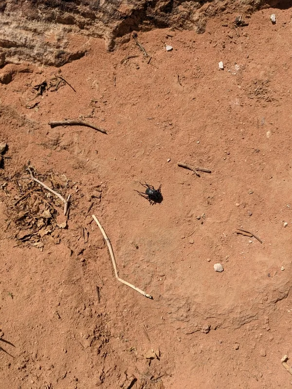
Pitted Beetle Adesmia cancellata -
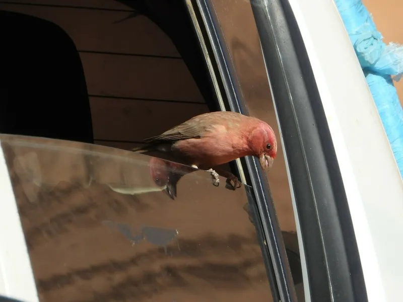
Sinai Rosefinch Carpodacus synoicus -
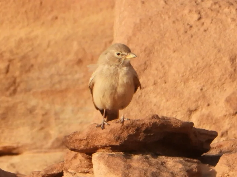
Desert Lark Ammomanes deserti -
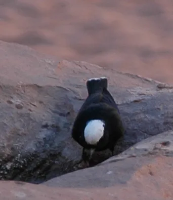
White-crowned Wheatear Oenanthe leucopyga -
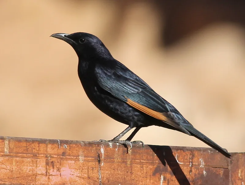
Tristram's Starling Onychognathus tristramii -
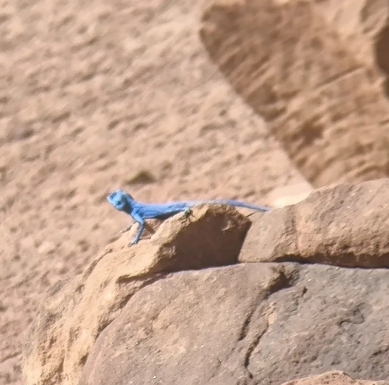
Sinai Agama Pseudotrapelus sinaitus -
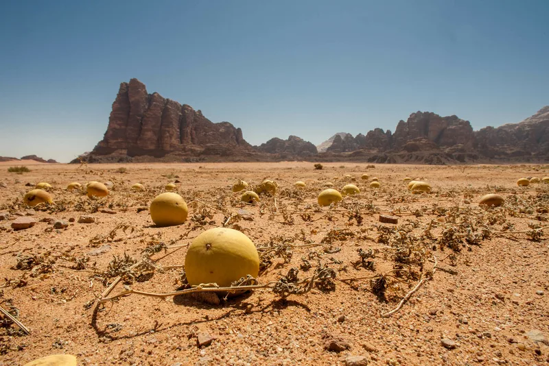
Colocynth Citrullus colocynthis -
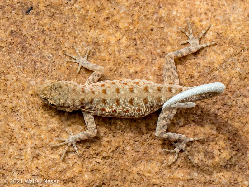
Guweira Semaphore Gecko Pristurus guweirensis -
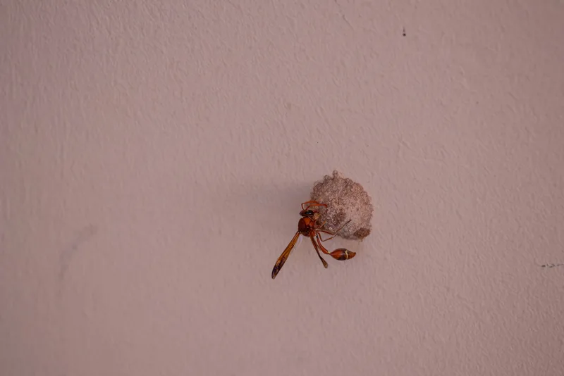
Delta hottentotum -
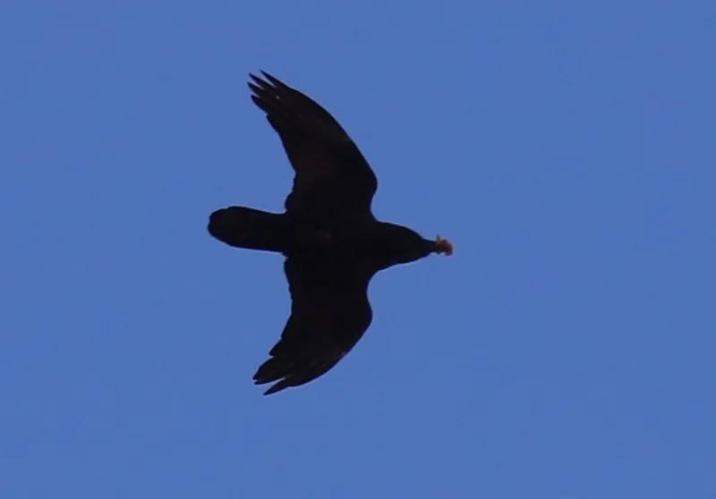
Brown-necked Raven Corvus ruficollis -
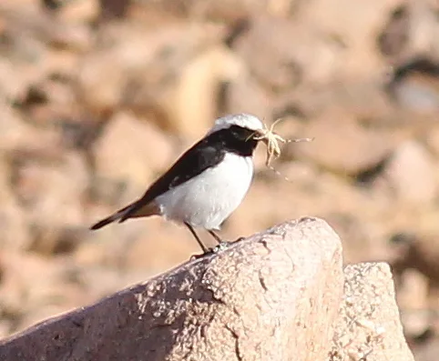
Mourning Wheatear Oenanthe lugens -
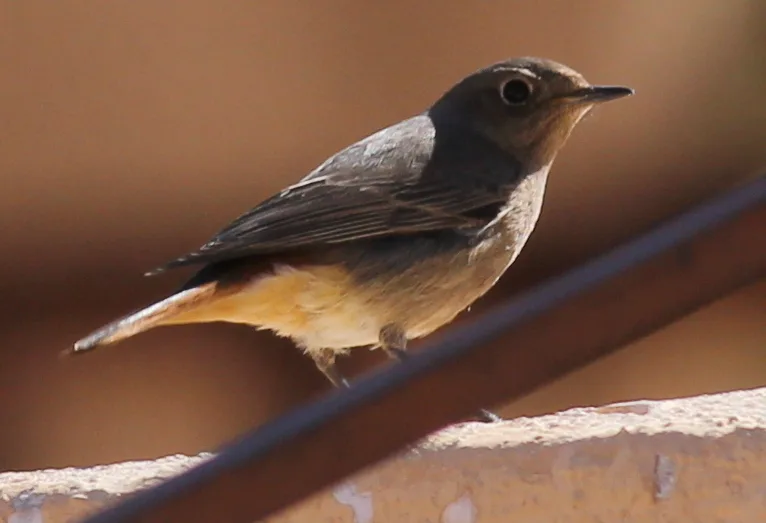
Black Redstart Phoenicurus ochruros
Field Notes · Desert & Deep Time lens · قرية وادي رم · 29.6226, 35.3896