The Verdon Gorge
Gorges du Verdon · Provence, France
A green river, patient with limestone, has spent a long time proving it can go straight down.
Also seen through Desert & Deep Time · all at Gorges du Verdon →.
Why here
The water is the wrong colour for rock country — a milky turquoise-green, the shade that gives the Verdon River its name. Follow that green thread and it leads into a slot the river has cut straight down through pale limestone, in places nearly seven hundred metres from rim to water. That limestone was once the floor of a warm Jurassic sea, a thick bed of lime mud and shells pressed into stone. The river did not go around it. It found a line and stayed on it, cutting downward faster than the rock could shoulder it aside, until an old sea floor stood on end as cliffs. The pale walls you look down from are that ancient sea bed, tipped upright and cut through. Between the town of Castellane and the lake at its western end, that one argument runs for miles. Everything in this note — the rim overlooks, the high bridge, the green water far below — is a single river, still making its point.
The story
Start with an old sea. The pale rock of the walls is limestone, laid down as lime mud and shells on the floor of a warm Jurassic sea, then lifted and dried into a high plateau. Into that plateau the Verdon cut its slot, and it is cutting still. At the western end the river runs out of canyon and spreads into the Lake of Sainte-Croix — not a natural lake but a reservoir, the river’s green water held behind a dam.
The walls make a living for things that like height. In the warm months the updrafts off the cliffs carry Eurasian griffon vultures, broad-winged and unhurried, while crag-martins and alpine swifts work the rock face for insects and a short-toed snake-eagle hangs over the dry plateau, hunting the open ground above the rim.
People have kept to the edges. This is old Occitan country, and the nearest town, Castellane, is among the least-peopled seats of local government in France — the canyon is easier to admire than to inhabit. Above the southern rim spreads the Canjuers plateau, dry limestone country now given over to a military camp. The river made a place too steep to settle and too striking to leave alone.
The sites
Where the river enters and leaves
Castellane
43.8465, 6.5134
Castellane sits at the upstream end of the story, where the Verdon leaves open valley and turns into the limestone. It is a small place — among the least-peopled seats of local government in France — set beneath a tall pale rock that is the same limestone the canyon will later stand on end. Here the river still has room. It runs broad and unhurried through the town, nothing like the green thread pinched between cliffs a few miles downstream. That contrast is the reason to start here. Everything the canyon does to the Verdon — narrowing it, deepening it, hiding it in shadow — is easiest to understand if you have first seen the river with room to spread. Look upstream and down from the bridges in town and you are looking at the same water before and after it goes to work on the rock.
Stand by the river in town and notice how wide and slow it runs here. Then look downstream to where the valley pinches shut between rock walls. That narrowing is where the limestone takes over, and where the river begins trading width for depth.
- AccessDrive-up
- ExertionEasy
- TimeAn hour
Moustiers-Sainte-Marie
43.8460, 6.2218
Moustiers-Sainte-Marie is built into a break in the limestone at the canyon’s western edge, where the plateau country gives way to the lake. The town sits at the point where the gorge’s walls step back and the country opens toward open water. From the upper part of town you look out over the mouth of the canyon country and the lake beyond, the whole western gateway of the gorge laid out below.
From the upper part of town, look out toward the lake and the canyon mouth beyond it. This is the point where hundreds of metres of limestone wall give way to open water — the western end of everything the Verdon has cut upstream.
- AccessDrive-up
- ExertionEasy
- TimeAn hour
The rim and the deep
La Palud-sur-Verdon
43.7797, 6.3414
La Palud-sur-Verdon is the small village at the top of the northern wall, and the base for the rim road that runs out to the belvederes over the deepest part of the gorge. This is where you meet the canyon from above, looking straight down the pale cliffs to the green river far below. From the rim the Verdon is reduced to a thread, and its scale only registers when you realise the whole drop — several hundred metres of wall — happened because the river never stopped cutting downward. Trace the river along its length from an overlook and you will see it does not run straight. It swings from one side of the canyon to the other in long bends, and each bend marks a place where the water leaned into one wall and cut sideways as well as down. The overlooks are spaced along the rim; move between two or three and the canyon turns from a picture into a length of river you can follow.
From a rim overlook, find the green river at the bottom and follow it upstream and down. Notice how it swings in wide bends rather than running straight — each bend is a place the river cut sideways into the wall, widening the slot even as it deepened it.
- AccessShort walk
- ExertionEasy
- TimeHalf a day
Pont de l'Artuby
43.7301, 6.3872
The Pont de l’Artuby carries the southern rim road across the Artuby, a tributary that joins the Verdon nearby. It is a two-lane road bridge over a deep, narrow side gorge, and from the middle of the span you look straight down into a slot the smaller river has cut for itself. The bridge earns its place in this note by repeating the main story at a scale you can stand directly above. The Artuby is a lesser river than the Verdon, but it has done the same thing — found a line in the same Jurassic limestone and cut straight down, leaving walls far taller than the stream is wide. Standing at mid-span, with the side canyon dropping away beneath your feet, you get the clearest possible feeling for what cutting down really means: not a gentle valley but a clean vertical slot, quarried by nothing more than moving water and time.
From the middle of the bridge, look straight down into the Artuby’s slot. The side canyon is narrower than the main gorge but just as sheer — a smaller river running the same argument, cutting straight down through the same pale limestone.
- AccessDrive-up
- ExertionEasy
- TimeAn hour
The country above
Canjuers
43.6894, 6.4566
Canjuers is the dry limestone plateau that spreads above the gorge’s southern rim — the high, flat country the river has been cutting down from all along. Much of the plateau is a military camp and closed to entry, but the southern rim road runs along its edge, and from there you can read the upland for what it is: a broad, waterless surface of pale stone. That dryness is the point. Limestone dissolves slowly in rain, and over time the plateau has become riddled with cracks and hollows, so water does not run across it. Rain sinks straight in and travels underground, surfacing far below as the springs that feed the canyon. The plateau is the before elevation, the level the land once stood at everywhere here; the gorge is simply how far the Verdon has managed to cut beneath it. Seeing the flat top and the deep slot in one view is the whole story of the place in a single frame.
From the southern rim road, look across the flat plateau and notice how little standing water it holds. Rain does not run off this limestone — it sinks straight in through cracks and moves underground, emerging far below as the springs that feed the river in the canyon.
- AccessDrive-up
- ExertionEasy
- TimeAn hour
When it's best
The canyon rewards the warm half of the year most, when the cliff birds are back and busy — swifts and martins working the rock face, vultures riding the midday updrafts off the walls. Spring runs cool. Summer brings the strongest thermals and the best soaring, along with the most company on the rim roads. Autumn clears the air and thins the crowds. Winter is cold and quiet, though the green water keeps its colour in any season.
Go deeper
The names behind what you saw. The pale walls are Late Jurassic limestone — an ancient carbonate sea floor, roughly a hundred and fifty million years old. The big soaring vulture is the Eurasian griffon (Gyps fulvus). The small dark fliers hugging the rock are the Eurasian crag-martin (Ptyonoprogne rupestris) and the alpine swift (Tachymarptis melba). The raptor hovering over the plateau is the short-toed snake-eagle (Circaetus gallicus).
To read next. - The Wikipedia entry for the Verdon Gorge — the plainest overview of the river, its colour, and the cut. - Any geological map of the Provence limestone country — for how a Jurassic sea floor ended up standing on end as a canyon wall. - The entry on Castellane — the small town that anchors the gorge’s upstream end. - The entry on the Canjuers plateau — the dry limestone upland the river drains, and why so little water stays on its surface.
The names behind what you saw
What lives here, and what it's called. Photographs from open collections — an aid to identification, not decoration.
-
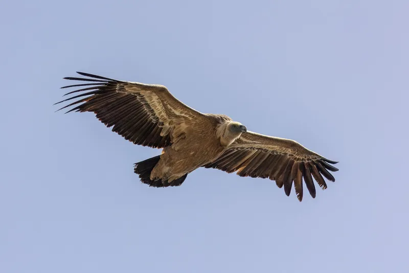
Eurasian Griffon Gyps fulvus -
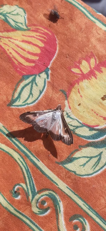
Box Tree Moth Cydalima perspectalis -
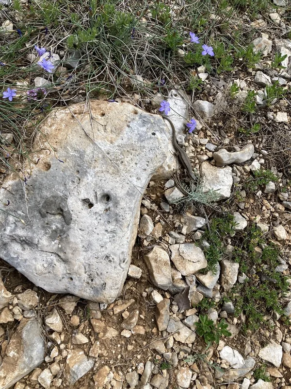
Common Wall Lizard Podarcis muralis -
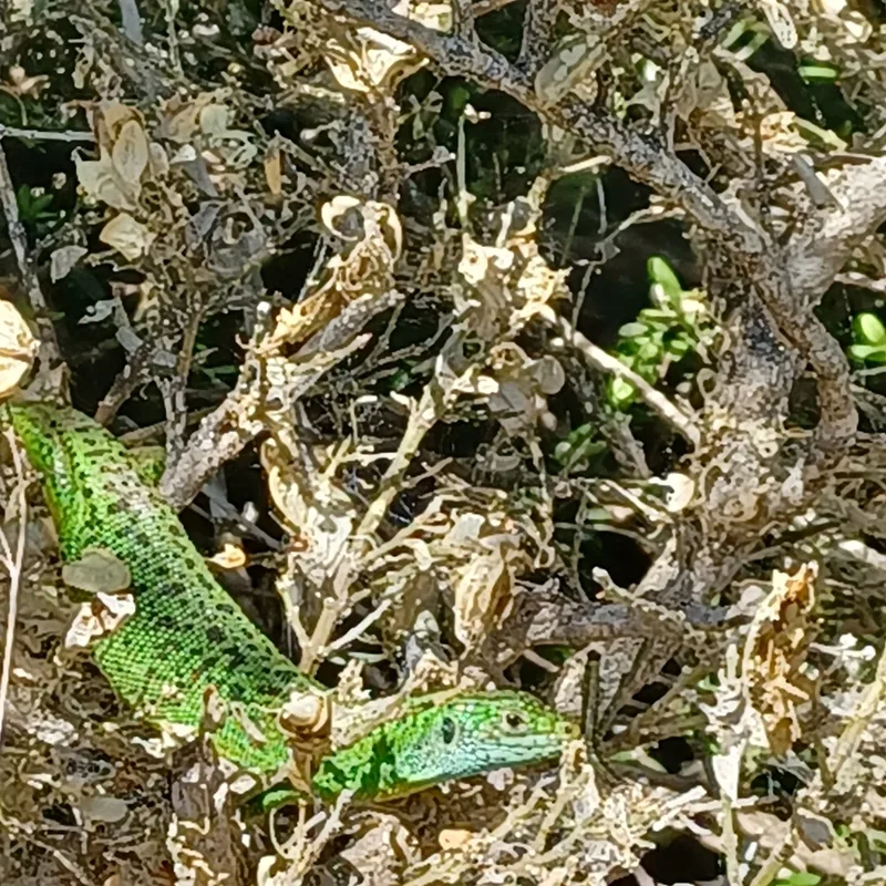
Western Green Lizard Lacerta bilineata -
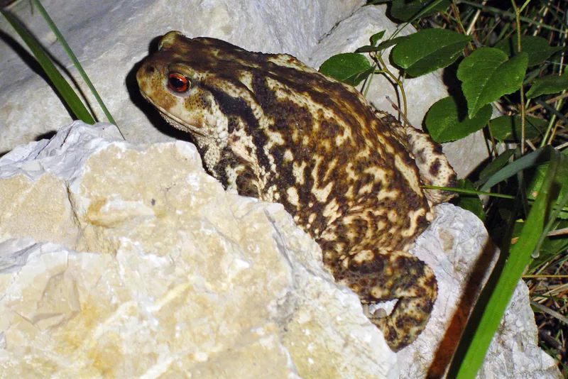
Spiny Toad Bufo spinosus -
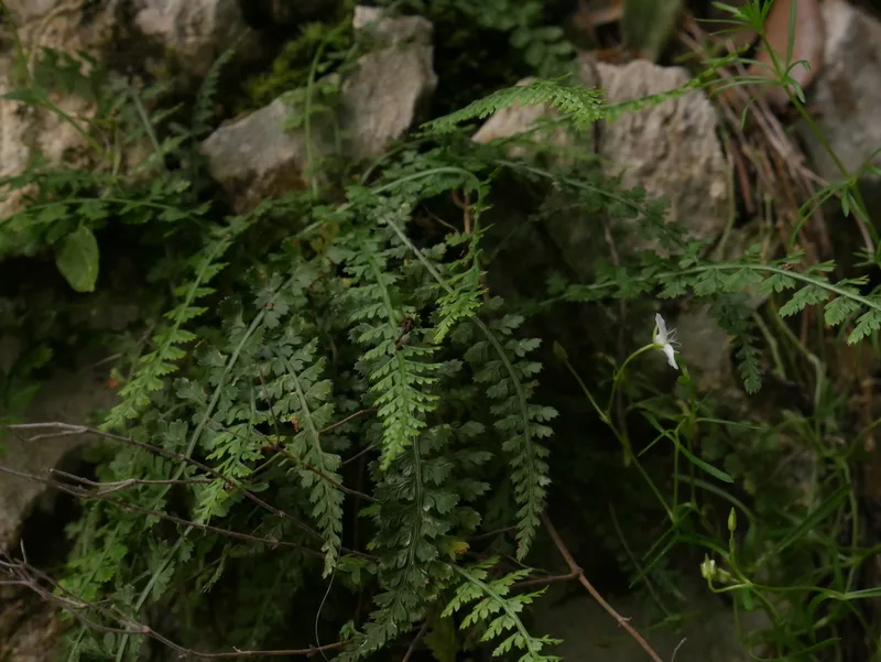
Smooth rock spleenwort Asplenium fontanum -
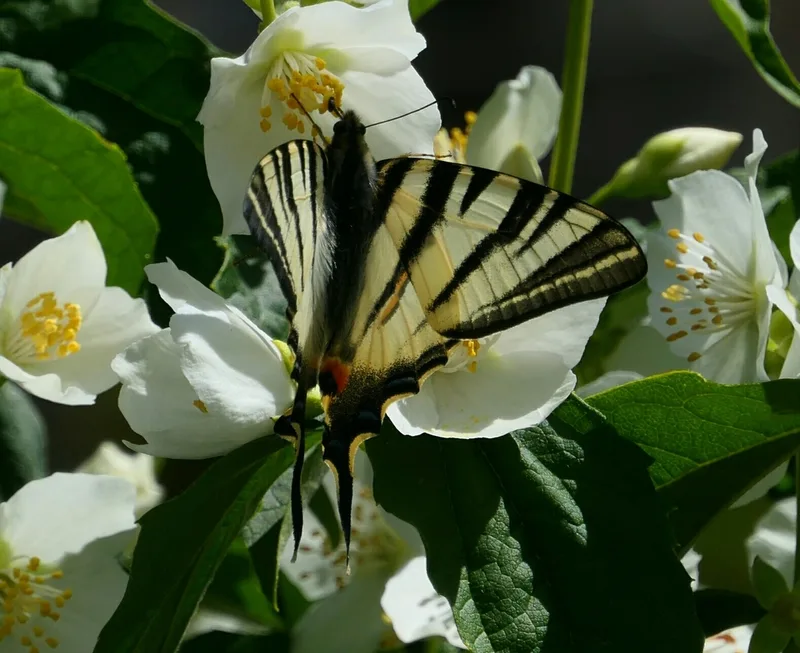
Scarce Swallowtail Iphiclides podalirius -
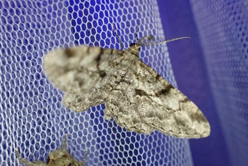
Willow Beauty Peribatodes rhomboidaria -
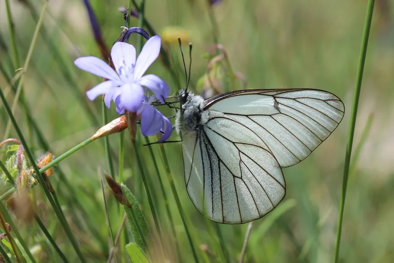
Black-veined White Aporia crataegi -
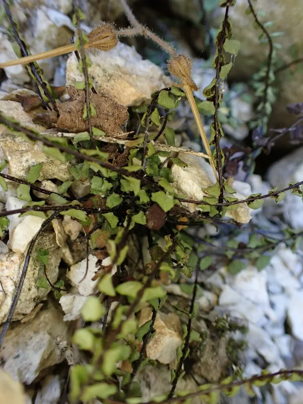
maidenhair spleenwort Asplenium trichomanes -
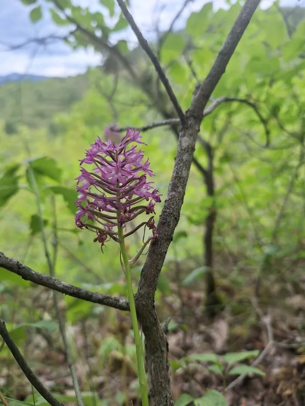
pyramidal orchid Anacamptis pyramidalis -
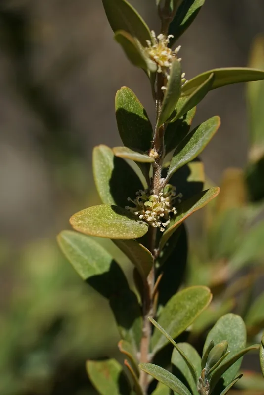
common box Buxus sempervirens
Field Notes · Rivers & Canyons lens · Gorges du Verdon · 43.7680, 6.3676