The Verdon Gorge
Gorges du Verdon · Provence, France
Every wall of the gorge is a page from an old sea, sliced open and left standing in the light.
Also seen through Rivers & Canyons · all at Gorges du Verdon →.
Why here
Most canyons hide their history under soil, forest, or a few centuries of a town built over the good parts. The Verdon does almost none of that. Its walls are close to bare limestone from rim to river, hundreds of meters of it in a single uninterrupted look, and what’s written into that rock predates the canyon itself by an enormous margin — a shallow sea laid down mud and shell here for tens of millions of years before any river existed to cut through the result. The gorge didn’t create the rock; it just found the rock and opened it up, the way a knife opens a book to a page you couldn’t otherwise reach. That’s the case for the detour to see it: nowhere nearby gives you this much geological time on open, honest display, readable without a hammer or a permit, just a rim road and a willingness to look at a cliff instead of past it. Every site below is really the same site — a different page of the same very old, very patient story, now standing in the light.
The story
The land came first, and it came slowly. For a very long stretch spanning the Jurassic into the Cretaceous, this part of the world sat under a shallow, warm sea, and mud, shell, and lime settled to the bottom of it, year after year, for something on the order of a hundred million years before anything resembling the modern Alps or coast existed nearby. That seabed hardened into limestone and was eventually lifted well above the water that made it — a slow, general uplift rather than any single dramatic event — leaving a thick plateau of rock with no canyon in it at all. The canyon came later and comparatively fast: a river committed to a course across that plateau and simply kept cutting down through it, finding softer seams and old fractures where it could and grinding through solid rock where it couldn’t, until the gorge you see today stood open.
Life arrived on the bare rock rather than in spite of it. Ferns wedge themselves into damp crevices too shaded for almost anything else; wall lizards and green lizards use sun-warmed stone the way other animals use open ground; griffon vultures nest directly on cliff ledges and ride the same up-drafts the gorge’s relief creates.
People arrived and largely worked around the rock rather than through it — roads following the rim, bridges crossing where tributaries insisted on gorges of their own, small communes like Castellane and Moustiers-Sainte-Marie anchoring either end of a canyon too deep to farm and too steep to build in.
The sites
The walls as an open book
La falaise des Cavaliers
43.7368, 6.3477
Stand here and you’re looking at the inside of a plateau that used to be sea floor. The rock across the gap is one long, undisturbed section through limestone that started as mud, shell, and sediment settling on the floor of a warm shallow sea, layer upon layer, for tens of millions of years, long before anything like the modern Alps rose nearby. That seabed was later lifted high above the water it formed in, and the river below has spent the time since cutting straight down through it, exposing the layers edge-on the way a knife exposes the pages of a closed book. Look at the cliff face and you can trace individual bands running nearly level across enormous distances — each one a single, patient deposit from the ancient sea, holding its thickness with a consistency that’s easy to miss and hard to unsee once you notice it. Griffon vultures ride the up-drafts along this same wall, turning the relief the river carved into a free elevator. There’s no railing at the edge here and the drop below is real, so keep an eye on where you’re standing while you look up rather than down.
Pick one pale band on the cliff face and trace it with your eye as far as you can see in either direction. Notice how level it runs and how steady its thickness stays across the whole wall — that steadiness is the signature of one deposit from an ancient sea floor, laid down the same way over a huge area, now exposed edge-on in the cliff.
- AccessDrive-up
- ExertionEasy
- TimeAn hour
Belvédère de l'Imbut
43.7576, 6.3206
The name here is a plain description: an imbut is a funnel, and it isn’t hard to see why once you’re standing above one. This stretch of the gorge is where the walls press in and the canyon narrows into a tight, half-lit slot, and the difference in feel from the open cliffs elsewhere on the rim is immediate — sound behaves differently, the air is cooler, and the strip of sky overhead shrinks. What you’re seeing is the same limestone as everywhere else in the gorge, but responding to a narrower, harder-fought passage: where the rock offered a soft seam or an old fracture, the river cut a wider bed; here the rock held, and the river had to work through a tighter gap instead. Fern species that need constant shade and damp air, ones you won’t find on the sun-exposed rim above, root directly in cracks in this rock, living proof that the microclimate down in a slot like this is a different place than the plateau just a few hundred meters away. Give your eyes a minute to adjust before trying to make out the bottom — the scale telescopes strangely in a space this narrow, and what looks close is often much farther than it seems.
Look for ferns growing directly out of cracks in the rock face here, low to the wall and often in deep shade — they need dampness and shelter the open, sunlit rim above can’t give them, and a slot canyon like this one can.
- AccessShort walk
- ExertionModerate
- TimeAn hour
Belvédère du Couloir Samson
43.7895, 6.3956
From here you can see how the gorge isn’t one single crack in the rock so much as a whole network of them, meeting and crossing at odd angles. The couloir below cuts a separate, shorter groove into the plateau, arriving at a steep angle to the main gorge rather than running parallel to it — the kind of pattern you get when a landscape’s drainage follows old fractures in the rock rather than choosing some smooth, even path. Limestone country tends to fracture into fairly regular sets of joints, straight cracks running in roughly the same one or two directions across a wide area, and water finds those cracks and works them wider over time long before it can cut a channel through solid, unfractured rock. Look at where the corridor meets the wider gorge and you’re looking at a literal intersection of two fracture trends, each one now a canyon in its own right. It’s a good spot to notice that the Verdon isn’t a single river valley so much as a fractured plateau being slowly taken apart along its own weaknesses, one joint-controlled gully at a time.
Look at the angle where the side corridor meets the main gorge below you — note it isn’t a smooth curve but more of a sharp junction. That kind of angular meeting is what happens when two separate cracks in the same rock, running in different directions, both get carved into canyons over time.
- AccessShort walk
- ExertionEasy
- TimeAn hour
Water's slower knife
Baume aux Pigeons
43.7842, 6.3928
Baume is an old regional word for a rock shelter — a shallow hollow cut into a cliff face, open on one side, roofed by an overhang of the same limestone. It’s an Occitan term, one of many local words for landscape features that have stuck long after the language itself became a minority tongue across most of southern France, and variants of it stud place names throughout this limestone country. This one gets its name from the birds that use it: pigeons and doves find shelters like this as good a home as any cliff-nesting bird could ask for, out of the wind and rain and awkward for most predators to reach. The hollow itself formed the slow way limestone shelters usually do — water finding a soft seam or a weaker band in the rock and working it back into the cliff far faster than the harder rock around it wore away, leaving an overhang standing proud of a recess. Stand back and look at the shape of it: a rounded scoop rather than a straight-sided notch, which is the signature of dissolution and slow undercutting rather than a clean mechanical break.
Look at the shape of the hollow itself — rounded and scooped rather than sharp-edged. That soft, undercut profile is the mark of slow dissolution working a weaker seam in the limestone, not a sudden fracture or rockfall.
- AccessShort walk
- ExertionModerate
- TimeAn hour
Aven
43.7541, 6.5331
An aven is the local word for a sinkhole — a vertical shaft dropping into the limestone from the surface, sometimes just a slot you could step over, sometimes a hole that swallows a substantial chunk of a hillside. It forms the same way a baume or any other karst feature in this country forms: rain falling on bare or thinly-soiled limestone finds a crack, and because limestone dissolves slowly in slightly acidic rainwater, that crack widens year after year into a channel, then a passage, then eventually a shaft big enough to fall into if you aren’t paying attention. What makes an aven different from a cave entrance is direction — it drops straight down rather than running back into a hillside, following gravity and a vertical fracture rather than a bedding plane. Look at the ground around the opening rather than just the hole itself: on limestone plateaus like this one, avens rarely appear alone, and a cluster of them is a sign of a wider network of dissolved fractures working beneath the surface. Keep back from the immediate rim when you look in — like most karst edges, this one can be undercut well past where the surface crack seems to end.
Look at the rock immediately around the opening for other small depressions or cracks nearby — avens on a limestone plateau rarely occur alone, and a cluster of them signals a wider network of dissolved fractures beneath the surface you’re standing on.
- AccessShort walk
- ExertionModerate
- TimeAn hour
Two rivers, one shelf of stone
Balcon de la Mescla
43.7393, 6.3811
Mescla is a local word for a mixture, and this balcony looks straight down on the reason for the name: the meeting point of the Verdon and one of its larger tributaries, the Artuby, which arrives from a side gorge of its own to join the main river here. Both rivers have spent a very long time cutting through the same limestone, which is one reason the confluence reads so cleanly from above — you’re looking at two canyons, carved through the same rock by the same basic process, arriving at the same point from different directions. Watch the color where the two currents meet, if the water is running; smaller tributaries carry their own particular sediment load and clarity, and a confluence is often the one place on a river where you can actually see two separate bodies of water for a while before they mix completely. The Artuby’s own gorge, visible curving away to the side, is a smaller, steeper echo of the main canyon you’ve been tracing along the rim: the same limestone, the same kind of cutting, at a smaller scale.
Look at the line where the Artuby’s water meets the Verdon’s below you. If there’s a visible difference in color or clarity between the two currents, follow it downstream and notice how far it travels before the two rivers fully mix — the visible seam is a rare chance to see one river’s water as a discrete thing.
- AccessDrive-up
- ExertionEasy
- TimeAn hour
Pont de l'Artuby
43.7310, 6.3868
This bridge crosses the Artuby’s own gorge just before that river reaches the Verdon, and it’s worth stopping for the view straight down as much as for the crossing itself. The Artuby is a comparatively modest river — a tributary of the Verdon, which is itself a tributary of the Durance, which then joins the Rhône — but it has cut a gorge here nearly as dramatic as its parent’s, through the same limestone, by the same slow method: water finding the path of least resistance in the rock and committing to that groove for a very long time. Standing on the bridge deck, you get a cross-section few of the main gorge’s viewpoints offer, because you’re looking down the throat of a canyon rather than across the face of a cliff. It’s a useful reminder that the Verdon Gorge itself isn’t a singular event; it’s what happens by default to almost any river running across this stretch of limestone plateau, given enough time. The scale is simply larger where the main river runs.
Lean on the rail and look straight down rather than across — from a bridge you get a rare vertical cross-section of the gorge instead of the usual side-on view. Notice how the walls read at depth compared with how they read from a rim viewpoint.
- AccessDrive-up
- ExertionEasy
- TimeAn hour
Tunnel du Fayet
43.7354, 6.3654
Somewhere along this stretch, the rim road runs out of ledge to follow and goes through the rock instead of around it. A tunnel is a blunt but honest way to take the limestone’s measure: whoever cut this one had to commit to boring through a solid thickness of the same rock forming the cliffs everywhere else in the gorge, rather than finding a natural gap or a softer detour. Stop at the mouth of it and look at the rock face immediately around the opening — the same pale, layered limestone you’ve been seeing in every cliff face on this rim, just seen end-on instead of from a distance. Passing through changes the light and the sound before it changes the view: a short stretch of dark and echo, then the gorge reappears on the other side, usually from a slightly different angle than the one you left. It’s a small, practical demonstration of just how much rock this plateau actually is — solid enough, in enough places, that going through it was sometimes a more sensible plan than going around.
At the tunnel entrance, run your eye along the exposed rock face just above the opening. Look for the same pale banding you’ve noticed at the gorge’s viewpoints — it’s the same limestone, just cut through rather than viewed alongside.
- AccessDrive-up
- ExertionEasy
- TimeAn hour
When it's best
The rock here doesn’t change with the seasons, but your experience of looking at it does. Early spring days tend to be cool and often clear, with chilly mornings that warm by midday — good conditions for long looks at exposed cliff faces without summer’s heat haze blurring the far walls, and a reasonable stretch to watch griffon vultures working the up-drafts along the rim. Summer brings warmth and the river’s color turns a more vivid, saturated turquoise, worth seeing in its own right but paired with more people at the well-known viewpoints and hotter, harder walking on any exposed trail. There’s no single best window here so much as a trade: come when it’s cooler for quieter viewpoints and clearer far-wall detail, or come in the warmer months for the water at its most vivid. The rock itself rewards any season roughly equally, since it isn’t going anywhere.
Go deeper
The names behind what you saw. The pale limestone in the walls belongs to the regional stratigraphic record as beds spanning roughly the Late Jurassic into the Early Cretaceous — limestone, marl, claystone, and sandstone, laid down as sediment settled onto a shallow seafloor over an immense stretch of that period. The vultures riding the up-drafts are Eurasian Griffons (Gyps fulvus); the lizards sunning on warm rock are Common Wall Lizards (Podarcis muralis) and Western Green Lizards (Lacerta bilineata); the ferns rooted in damp crevices are smooth rock spleenwort (Asplenium fontanum) and maidenhair spleenwort (Asplenium trichomanes). Words like baume, aven, and mescla are Occitan — the historic language of this stretch of southern France, still legible in the place names even where the spoken language itself has receded.
To read next. - Wikipedia’s entry on the Verdon Gorge, for the basic geography behind everything above: the river’s length, the canyon’s depth, and the limestone mass it cuts. - Wikipedia’s entry on the Artuby, for the tributary river behind two of the sites here and the smaller gorge it carved on its own. - Wikipedia’s entry on Occitania, for the language and cultural region behind terms like baume and aven. - Wikipedia’s entry on Castellane, one of the two towns anchoring the ends of the gorge, for a sense of how small a footprint people have left on a landscape this large.
The names behind what you saw
What lives here, and what it's called. Photographs from open collections — an aid to identification, not decoration.
-

Eurasian Griffon Gyps fulvus -
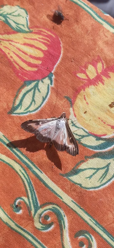
Box Tree Moth Cydalima perspectalis -
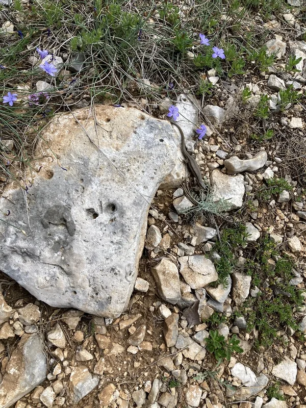
Common Wall Lizard Podarcis muralis -
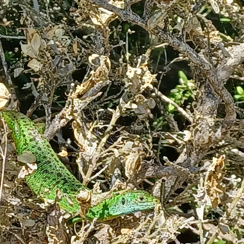
Western Green Lizard Lacerta bilineata -
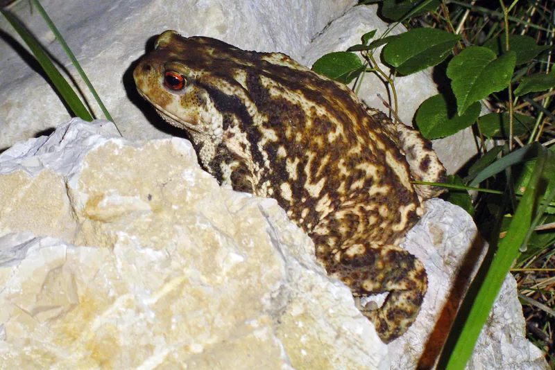
Spiny Toad Bufo spinosus -
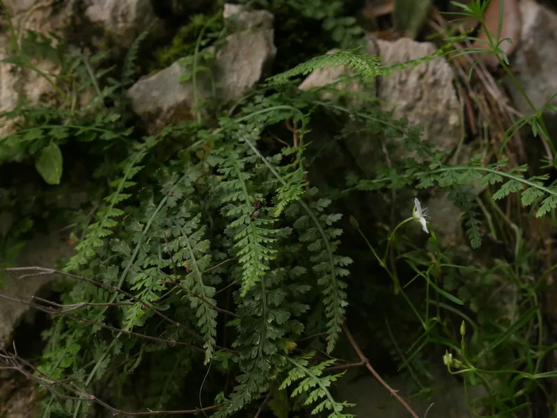
Smooth rock spleenwort Asplenium fontanum -
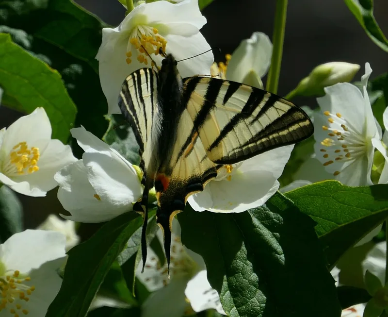
Scarce Swallowtail Iphiclides podalirius -
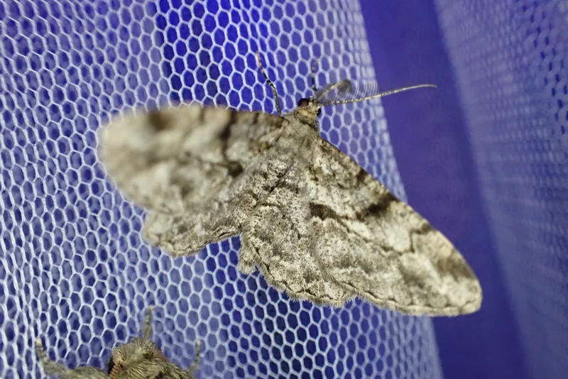
Willow Beauty Peribatodes rhomboidaria -
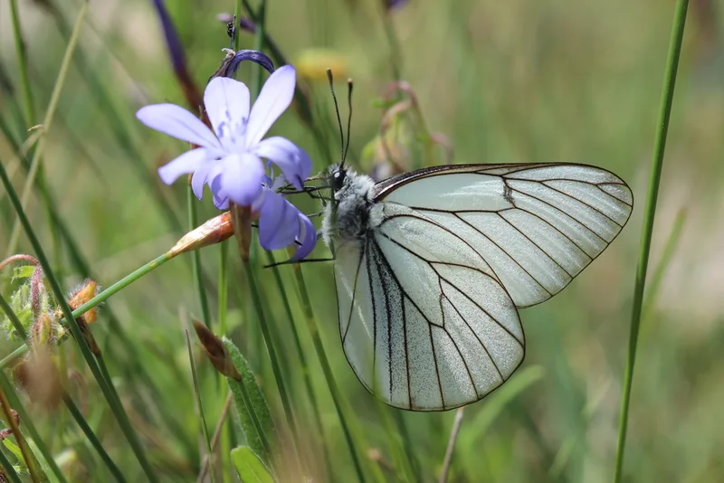
Black-veined White Aporia crataegi -
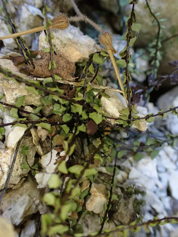
maidenhair spleenwort Asplenium trichomanes -
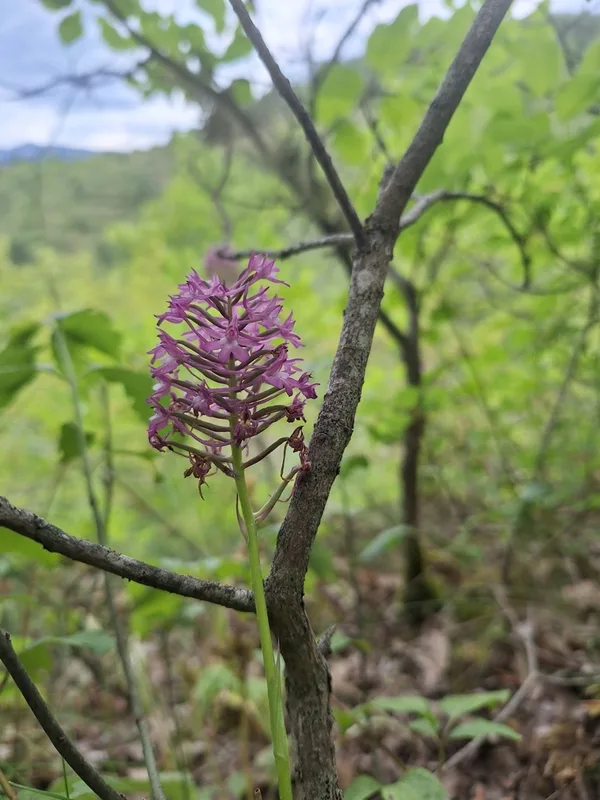
pyramidal orchid Anacamptis pyramidalis -
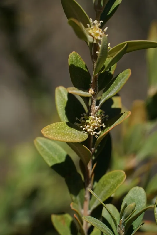
common box Buxus sempervirens
Field Notes · Desert & Deep Time lens · Gorges du Verdon · 43.7680, 6.3676