Vatnajökull
At Svartifoss, new rock breaks free faster than the water wears the old rock down.
Also seen through Ice & Glaciers · all at Skaftafell →.
Why here
Most waterfalls are sculptors: patient, slow, wearing stone down over spans of time longer than any visit. Svartifoss, in Skaftafell, does something closer to the opposite. Look at the base of the falls and you’ll find loose, sharp-edged rubble — column sections that let go of the cliff face faster than the falling water can wear their edges smooth. The rock is shedding material almost as fast as it’s being worked. That single reversal is a fair introduction to this whole stretch of Vatnajökull’s edge: a landscape built from a long run of volcanic rock, buried and re-exposed as ice has advanced and withdrawn, sitting today under an ice cap that is itself still actively retreating and, at its margins, still building and unbuilding lakes. None of this is ancient in the sense of finished. The columns are still cracking, the glacier’s edge is still moving, and the lake down the road wasn’t there when this land was still just a farm. Everywhere in this note, watch for that same thing: ground that hasn’t stopped changing shape.
The story
The rock underfoot was built in layers over a long volcanic span: repeated eruptions laid down thick country of basalt — several distinct kinds, from dense olivine basalt to more mineral-rich alkali basalt and basanite — across tens of millions of years, with younger glacial-age sediment settling over the top more recently. Some of that lava met ice or water as it erupted and quenched fast enough to freeze into rounded, pillow-shaped masses rather than columns, a different signature of the same volcanic country responding to a colder world layered on top of it. Later ice ages ground much of this rock down and rearranged it, leaving the mix of bare stone, moraine, and thin soil the park sits on now.
Life took hold in the gaps ice and lava left open: low birch woodland and bearberry now root in the quieter, older ground below the peaks, and rock ptarmigan hold the higher scrub through the seasons.
People arrived late to all this and left a light, legible mark. Skaftafell was a working farm before anyone set it aside — first as its own small park, later folded into the much larger park that now holds the entire ice cap above it. The record doesn’t say much more about that farm than that it was there, which is honest enough. The land had already been building and rebuilding itself for far longer than anyone had been farming it.
The sites
The rock still cracking
Stuðlaberg
64.0258, −16.9739
The sign at Stuðlaberg introduces a word before you’ve even reached the waterfall it describes: “stuðlaberg” is simply the Icelandic term for columned rock — lava that cooled slowly and evenly enough to crack into long, mostly six-sided columns as it hardened. It happens wherever thick lava cools from the top and bottom at once, the same way a drying mud puddle cracks into a network of connected polygons, only worked out in solid basalt instead of clay. Columns like this turn up wherever this area’s older lava country is exposed, and the ground under Skaftafell holds plenty of it, laid down across a long span of volcanic time and later cut into by ice and running water. Reading the board here first changes how you see Svartifoss a few minutes on: instead of an unusually tidy backdrop, the columns become a plain record of how one particular flow of lava finished cooling, long before anyone stood here to look at it.
Before continuing to the falls, look at the board’s diagram of how a column forms, then find a loose column fragment near the trail and turn it over in your hands — count its sides; most run five or six, the shape lava settles into as it shrinks while cooling evenly from a flat surface.
- AccessShort walk
- ExertionEasy
- TimeAn hour
Svartifoss
64.0277, −16.9753
Svartifoss drops over a shelf of dark basalt columns packed so tightly and evenly that early visitors read them as architecture — the name means “black falls,” for the wall of columns behind the white water. The columns are the same slow-cooling story as the ones on the sign at Stuðlaberg, but the falls add a second process on top: this is one of the few places you can watch new rock loosen while the old rock is still being worn down at the same time. The base of the falls has a scattered, sharp-edged look, and the reason is a small imbalance in speed — the falling water polishes exposed column faces only gradually, while whole hexagonal sections at the edges let go faster than that polishing can reach them. The waterfall isn’t simply sculpting older stone the way most falls do; it’s also shedding fresh material nearly as quickly as it smooths what’s already down. Stand close enough to see the columns’ clean geometric faces and it stops looking like scenery and starts looking like rock still finding its shape.
Look at the base of the falls rather than the curtain of water above it: find a column edge with a fresh, unweathered break versus one that’s rounded and water-polished, and you’re looking at two different ages of the same rock face, likely months or years apart.
- AccessShort walk
- ExertionModerate
- TimeAn hour
Where the ice edge meets the old lava
Skaftafell
64.0164, −16.9665
Skaftafell was farmed ground before it was protected ground — a working farm in this corner of southeast Iceland, later set aside on its own and eventually folded into the larger park that now holds the whole ice cap above it. That order matters for reading the landscape: people built a life on a strip of lowland squeezed between an active ice sheet and country built from a long, layered volcanic history, because the ground itself, for all its churn, supports it. Low birch and bearberry root in the older, quieter soil below the peaks, and rock ptarmigan work the higher scrub. Skaftafell sits at the literal edge where Vatnajökull’s ice comes down to meet vegetated ground, a boundary that has shifted over time as the ice has advanced and withdrawn. Treat it as this note’s base camp: paths from here reach both the columned falls uphill and, eventually, higher ground where the shape of ice over old volcanic rock becomes easier to read all at once.
From the visitor area, look up-valley toward where green ground gives way to bare rock and then to ice, and notice there’s no sharp line — just a gradient, the plants thinning out exactly as the ground gets colder and younger.
- AccessDrive-up
- ExertionEasy
- TimeHalf a day
Jökulsárlón
64.0783, −16.2274
Jökulsárlón didn’t exist as a lake within recent human memory of this land: it formed only after the glacier feeding it began pulling back from an old moraine dam in the late nineteenth century, opening a basin that has kept filling and widening as the ice keeps retreating. What you’re looking at is one of the youngest lakes in the country, still visibly growing rather than settled into a fixed shoreline. Lakes like this, dammed by ice or moraine, are also the classic setting for what geologists call an outburst flood — a sudden release when the dam holding back meltwater fails, whether from simple erosion, a buildup of pressure, an avalanche, or heat rising from the volcanic ground the ice sits on. Nothing about the lake’s current state signals an imminent event; the point is structural, not predictive: a body of water held in place by ice, over restless volcanic country, is inherently provisional. The icebergs drifting across the surface are themselves just glacier that has already let go.
Watch the icebergs for a few minutes rather than the shoreline: note which ones look dense and clear blue versus which are white and bubble-laden — a rough field sign of how much old, compressed ice versus more recent snowpack each fragment carried down.
- AccessDrive-up
- ExertionEasy
- TimeAn hour
The long view
Kristínartindar
64.0693, −16.9261
Kristínartindar rises as a knife-edge ridge with its summit straddling two separate glacier valleys at once, a useful way to think about what it actually is: not a single peak but a divide, the high ground left standing between two tongues of ice that have spent a long time working on either side of it. A marked trail climbs to the summit from the visitor center during the summer months, a full day’s circuit with serious elevation gain, and on a clear day the view from the top reaches as far as Iceland’s tallest waterfall in the distance. More useful for this note than any single view, though, is the vantage itself: from up there the whole relationship this landscape runs on is laid out at once — old volcanic rock underneath, ice actively carving and retreating on both sides, and the lowland farm-turned-park in between, all visible in one turn of the head. It’s the one place on this list where “land still being made” stops being an idea on a sign and becomes a shape you can see.
From the summit ridge, turn slowly and try to trace where bare, ice-scoured rock gives way to rock still holding soil and plant cover — that boundary marks roughly how far the ice has pulled back, a line unlikely to sit in exactly the same place on a return visit.
- AccessHalf-day hike
- ExertionStrenuous
- TimeA full day
When it's best
There’s no single best window here, and the honest read is that different parts of this note reward different seasons. The high circuit to Kristínartindar’s summit only opens up in summer, when the trail is clear and the days are long enough for a full day’s climb — outside that season, treat the mountain as a view from below rather than a destination. Down at Skaftafell and Svartifoss, even well into spring the ground still sits close to freezing overnight and only a few degrees above it by day, so old snow can linger on the approach paths later than the calendar suggests. Jökulsárlón, by contrast, rewards patience over precise timing: the lake and its icebergs are a year-round draw, less about picking a week than about being willing to watch the light and the ice change from one visit to the next.
Go deeper
The names behind what you saw - The layered lava under this whole stretch of ground is mapped as flood basalt — thick, wide-reaching lava flows — of Neogene and older Tertiary age, made of a mix of rock types including olivine basalt, tholeiite, alkali basalt, and basanite. - Where lava erupted into ice or water rather than open air, it can quench into pillow basalt: rounded, pillow-shaped masses distinct from the columned rock at Svartifoss and Stuðlaberg, and a different signature of the same volcanic country. - The mechanism behind a sudden lake release like the kind Jökulsárlón is built to experience is formally a glacial lake outburst flood, known locally as a jökulhlaup.
To read next - Skaftafell (Wikipedia) — the short official record of the farm-to-preservation-area history behind this note’s people thread. - Svartifoss (Wikipedia) — the original source for the detail on the columns breaking faster than the falls can wear them smooth. - Jökulsárlón (Wikipedia) — traces how much the lake has grown since the glacier first began retreating from it. - Glacial lake outburst flood (Wikipedia) — lays out the several distinct ways an ice-dammed lake like this one can fail, volcanic heat among them. - Geological Map of the Skaftafell Region, SE-Iceland: Glacial-Interglacial History 0–5 Ma (OpenAlex) — the closest thing to a technical map of exactly this ground, for anyone who wants the rock units named and dated precisely.
The names behind what you saw
What lives here, and what it's called. Photographs from open collections — an aid to identification, not decoration.
-
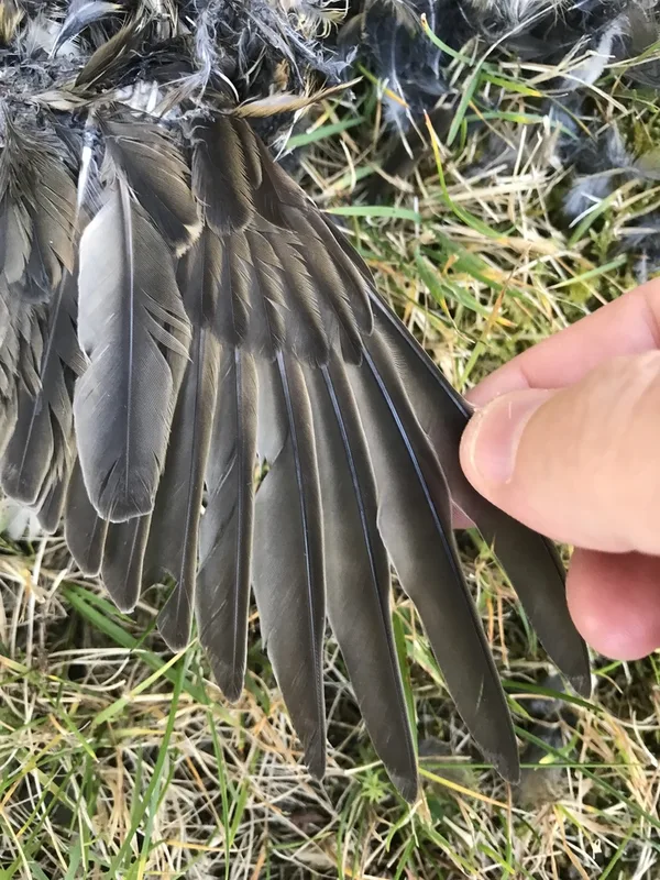
Redwing Turdus iliacus -
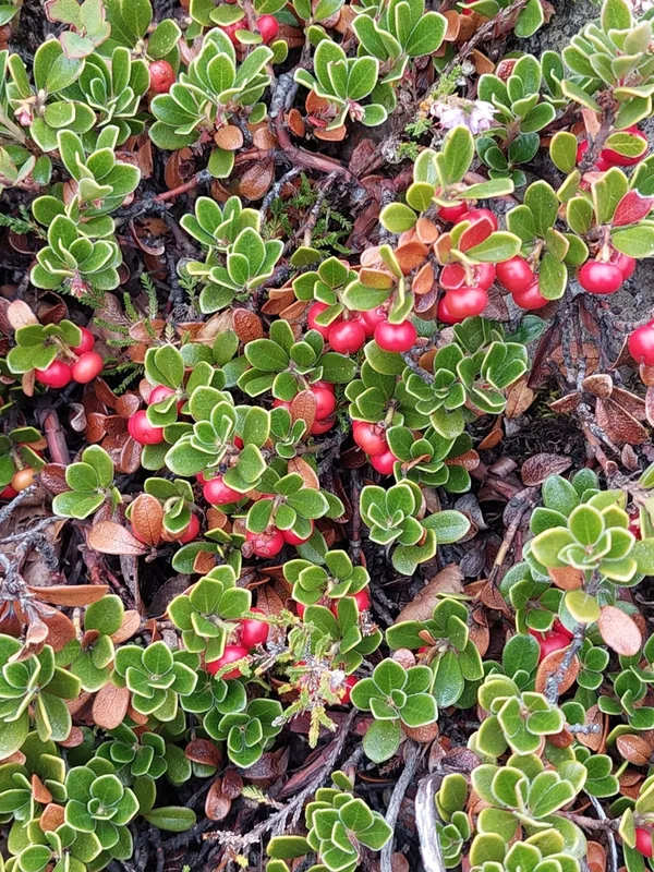
bearberry Arctostaphylos uva-ursi -
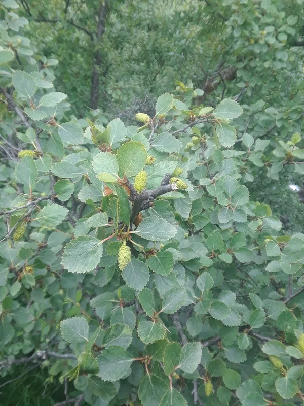
Downy Birch Betula pubescens -
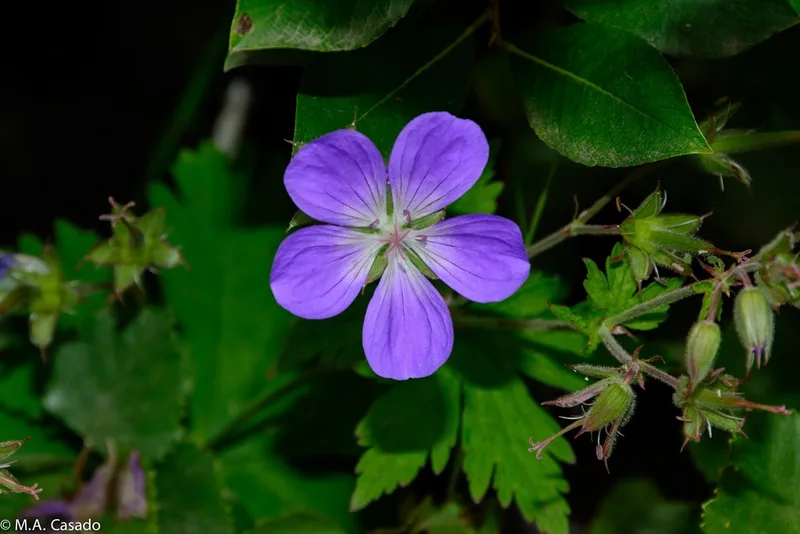
wood crane's-bill Geranium sylvaticum -
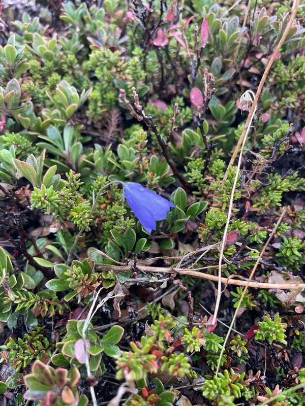
Common Harebell Campanula rotundifolia -
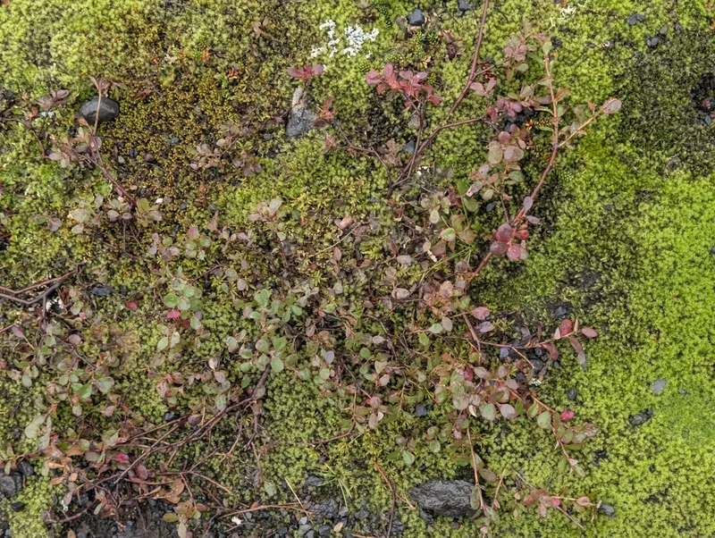
bog bilberry Vaccinium uliginosum -
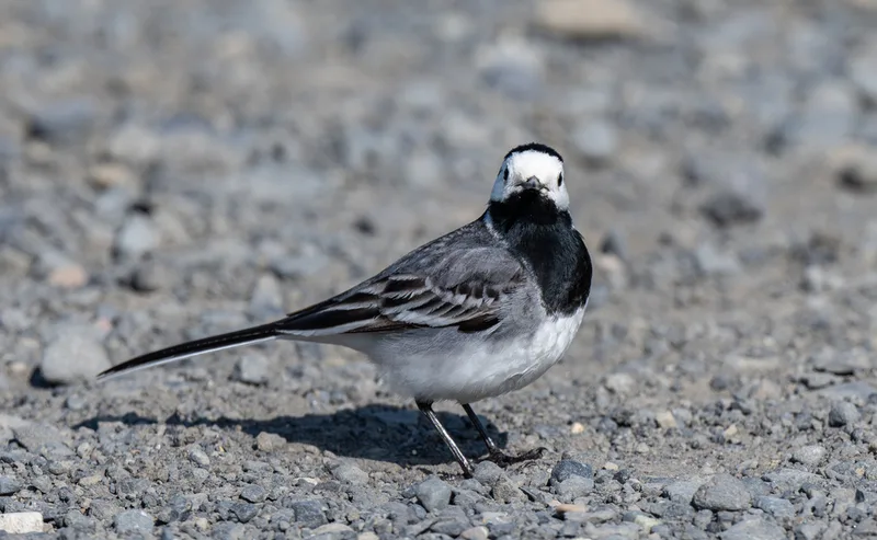
White Wagtail Motacilla alba -
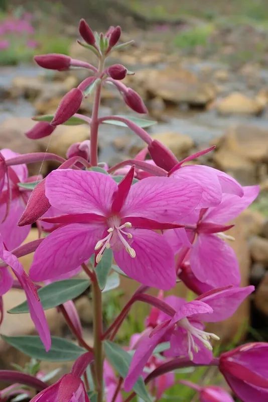
Dwarf Fireweed Chamaenerion latifolium -
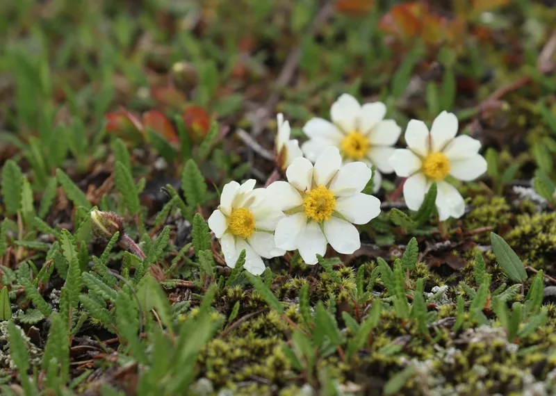
Eight-petal Mountain-Avens Dryas octopetala -
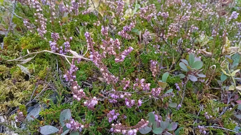
common heather Calluna vulgaris -
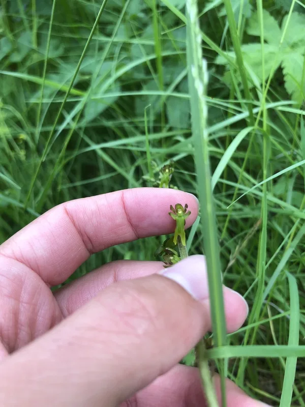
Common Twayblade Neottia ovata -
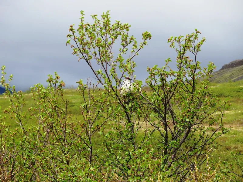
Rock Ptarmigan Lagopus muta
Field Notes · Volcanic lens · Skaftafell · 64.0474, −16.6014