Vatnajökull
The ice is a slow knife. It cut these valleys, and it has not yet finished deciding where to stop.
Also seen through Volcanic · all at Skaftafell →.
Why here
The glacier you never quite see made everything you can. Skaftafell sits as a green island between two tongues of ice, one corner of the vast park wrapped around the country’s great glacier. Look in any direction and you are reading the ice’s handwriting: the broad, flat-floored valleys that only a river of ice cuts; the knife-edge ridges left where two glaciers ground toward each other; the plain of raw gravel out front, dumped by meltwater and by floods that burst from beneath the ice. And the work is not finished. Where the ice presses forward it carves; where it pulls back it abandons — a day’s drive east, a lake now stands deep and growing on ground that held solid ice little more than a century ago. The glacier here is a sculptor still at the bench, adding and erasing. Everything in this note is one more thing it has cut, dumped, or walked away from, and the whole trip comes down to learning to read which is which.
The story
Begin with fire under ice. The rock beneath everything here is old lava, sheet upon sheet of dark basalt, and volcanoes still smoulder under the glacier’s cover. When one erupts beneath the ice it melts a hidden lake that eventually bursts out in a sudden flood — a jökulhlaup — that rakes down the valleys and spreads the plains of gravel you see in front of the green. Over far longer spans the ice itself did the slow shaping: grinding the flat-floored valleys, honing the knife-edge ridges, and, as it shrank back, uncovering columns of old lava and the cliffs where waterfalls now drop.
On the raw ground the ice leaves behind, life arrives in order. The first plants onto fresh glacial gravel are low and tough — mountain-avens with their white eight-petalled flowers, dwarf fireweed on the riverbanks, and mats of bearberry — the pioneers that hold the loose till until heath and a low woodland of downy birch, the island’s native tree, can follow. Among the rocks the rock ptarmigan stays all year, brown in summer and turning white to match the winter snow. The migrant thrushes and waders come only for the long light of the short summer.
People made a foothold here too. Skaftafell was a working farm for generations, a green wedge held between the floods and the ice, before it became a national park in its own name and then one corner of the larger reserve. What the ice carved and abandoned, in the end, people learned to live inside.
The sites
Between the glacier tongues
Skaftafell
64.0165, −16.9665
Skaftafell is a green wedge of birch and heath held between two tongues of ice, and it is the easiest place to stand inside the ice’s work without touching the ice itself. For a long time it was a farm; later a national park in its own name; now it is one corner of the reserve wrapped around the country’s great glacier. From the base, the valleys open on either side in the same broad, round-bottomed shape — the signature of a river of ice rather than a river of water, which grinds a valley flat-floored and steep-walled instead of cutting a narrow V. Trails climb from here toward the falls and the ridges, so the place works as a doorway more than a destination. Take a moment before you walk up. The flat gravel spread out in front of the green is washed-out debris, sorted and dumped by meltwater and by the floods that burst from under the ice — the raw material of everything the glacier leaves behind once it has finished carving.
From the base area, look at the shape of the valley walls on either side. A valley cut by ice has a broad, flat floor and steep sides — a wide U; a valley cut by water alone keeps a narrow V. The rounded trough here tells you a glacier once filled it to the brim.
- AccessDrive-up
- ExertionEasy
- TimeHalf a day
Kristínartindar
64.0693, −16.9261
Kristínartindar is the high seat above Skaftafell, a summit whose knife-thin crest straddles two glacier valleys at once, one falling away on each side. Standing on that edge is the clearest lesson the ice teaches here: the ridge is thin because two separate bodies of ice ground down toward each other for a very long time, each shaving its own valley until only a blade of rock was left between them. On a clear day the view reaches the country’s tallest waterfall, dropping off a cliff the ice uncovered as it shrank back. The way up is long and steep — a full day’s loop climbing more than a kilometre from the valley floor — and the trail opens only in the warm months, once the snow has cleared. Save it for good weather and an early start. The summit gives nothing in cloud, and the country it lays out is the whole reason to climb.
On the summit crest, straddle the ridge and look down both sides at once. Each valley was carved by its own glacier grinding toward the other; the knife-edge you are standing on is all the rock the two of them left behind.
- AccessExpedition
- ExertionStrenuous
- TimeA full day
Columns the lava left bare
Stuðlaberg
64.0258, −16.9739
Stuðlaberg is a reading stop on the walk up toward the falls, and its name is the local word for the very thing it explains: columns of old lava, stacked close like a bundle of dark pencils. The rock here began as a thick sheet of molten basalt that cooled slowly and evenly. As it hardened it shrank, and shrinking rock cracks — the fractures started from many centres at once, met in a honeycomb, and drove straight down, splitting the whole sheet into six-sided posts. The ice and its meltwater did the rest, stripping the soil and softer rock off the top and standing the columns bare for you to see. Pause at the board, then look past it to the exposed rock in the gorge walls around you. The same pattern repeats wherever the old lava has been laid open, which here is nearly everywhere the ice has scoured down to bone.
At the marker, find a face of the dark columns in the gorge wall and count the sides of a single post. Most come out six-sided — the shape slow-cooling lava settles into as it shrinks and cracks, the same way drying mud splits into rough polygons.
- AccessShort walk
- ExertionEasy
- TimeAn hour
Svartifoss
64.0277, −16.9753
Svartifoss is where the columns and the water meet. A stream off the high ground drops over a lip of dark lava, and behind the falling water the cliff is ranked with the same six-sided posts of old basalt, curving inward like the inside of a shell. The falls sit at the head of a gorge the ice and meltwater have opened, and the show is not only the water. Look at the ground at the base: it is littered with sharp broken columns. Here the rock is losing its lower supports and snapping off in fresh sections faster than the water can round their edges, so the wall stays angular — freshly quarried rather than worn smooth. It is a rare place to watch a cliff take itself apart on a human timescale.
Stand below the falls and look at the broken stone at your feet, then up at the cliff. The columns snap off at the base faster than the water can smooth them, so the face stays sharp-edged — you are watching a rock wall quarried by its own weight, a piece at a time.
- AccessShort walk
- ExertionModerate
- TimeHalf a day
Where the ice is letting go
Jökulsárlón
64.0783, −16.2274
Jökulsárlón is the ice’s other lesson: not what it carves, but what it leaves when it withdraws. A lifetime or two ago there was no lake here at all — solid ice reached down toward the sea. Then the glacier began to pull back, and the hollow it had gouged below sea level filled with meltwater. The lake has grown several times over within living memory, and it now ranks among the deepest in the country, floating slabs of ice that break from the retreating front and drift toward the ocean. The water is the plainest clock for the ice you will find: every stretch of open lake is ground the glacier has given up. Stand at the outlet where the ice crowds toward the sea and watch a slab go grey, then clear, then gone. The front is a few miles back from the water now, and the gap widens with the warm seasons. It is a quiet place to feel how fast a glacier can retreat once it starts.
Watch a single floating slab of ice from the outlet as it drifts toward the sea. The open water it crosses is all ground the glacier held little more than a century ago; the lake is a measure, in plain sight, of how far the ice has pulled back.
- AccessDrive-up
- ExertionEasy
- TimeHalf a day
When it's best
The short summer is when the high country opens: the long northern daylight, the cleared snow, and the only season the ridge trails are walkable. It is also when the meltwater runs hardest and the pioneer flowers make their brief showing on the gravel, and when the migrant birds are in. Winter shuts the high routes and turns the ptarmigan white, but it sharpens the contrast of ice, black rock, and snow, and the lagoon and the lower falls hold up in any season. Early spring is cold, near freezing, and wet, with the snowline still low — a quiet time, better spent on the valley floor than the summits.
Go deeper
The names behind what you saw. The dark rock and the six-sided posts are basalt — flood basalt and tholeiite, the lava that built Iceland; the columns themselves are columnar basalt, and the local word for them is stuðlaberg. A sudden flood released from beneath a glacier is a jökulhlaup, one kind of glacial lake outburst flood. The white-in-winter grouse is the rock ptarmigan, Lagopus muta. The pioneer plants on fresh glacial gravel are eight-petal mountain-avens, Dryas octopetala; dwarf fireweed, Chamaenerion latifolium; and bearberry, Arctostaphylos uva-ursi. The tree of the returning woodland is downy birch, Betula pubescens; the summer thrush is the redwing, Turdus iliacus.
Where to start reading. The formal record here is thin — one detailed source stands out, and the rest are good general starting points. - Geological Map of the Skaftafell Region, SE-Iceland: Glacial-Interglacial History 0–5 Ma (2000) — maps how ice and lava have traded the surface here across the last few million years, the long version of this note’s one idea. - The Jökulsárlón entry — a compact account of how the lagoon opened and grew as the glacier drew back, with the measured figures behind the retreat. - An overview of glacial lake outburst floods (jökulhlaup) — for how fire under the ice becomes a flood, and why the gravel plains are where they are. - The Vatnajökull National Park overview — for how the farm at Skaftafell became one corner of the reserve wrapped around the glacier.
The names behind what you saw
What lives here, and what it's called. Photographs from open collections — an aid to identification, not decoration.
-
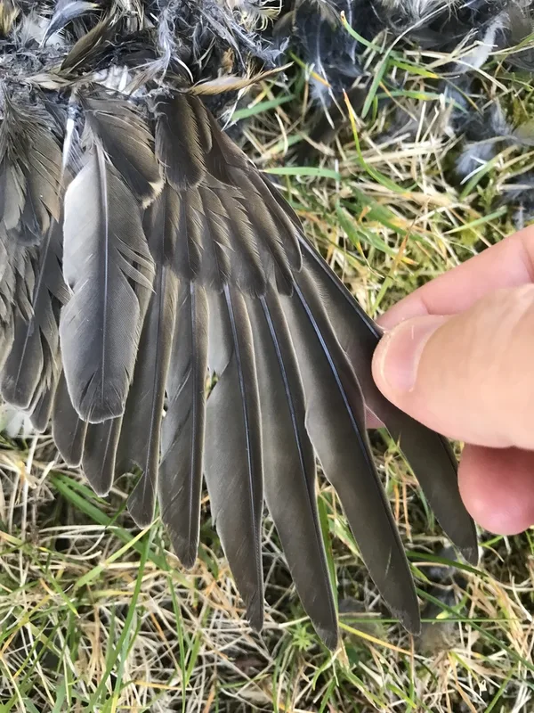
Redwing Turdus iliacus -
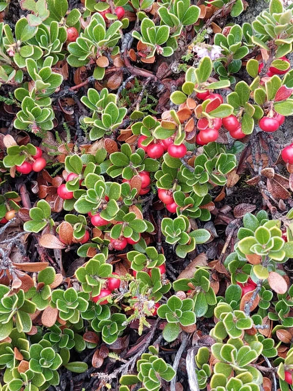
bearberry Arctostaphylos uva-ursi -
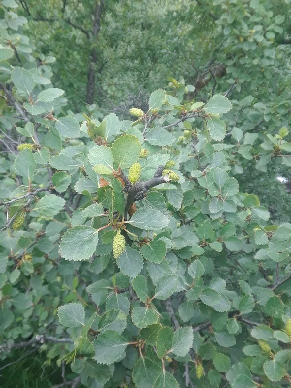
Downy Birch Betula pubescens -
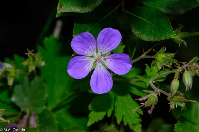
wood crane's-bill Geranium sylvaticum -
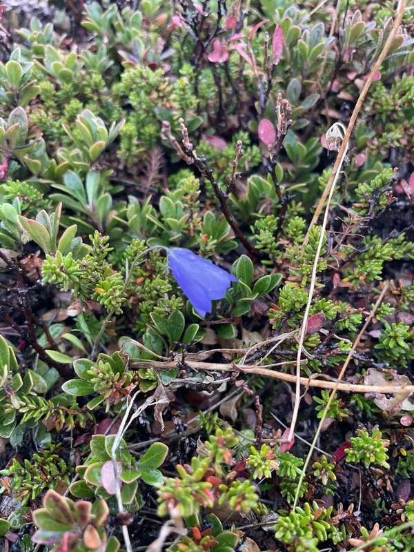
Common Harebell Campanula rotundifolia -
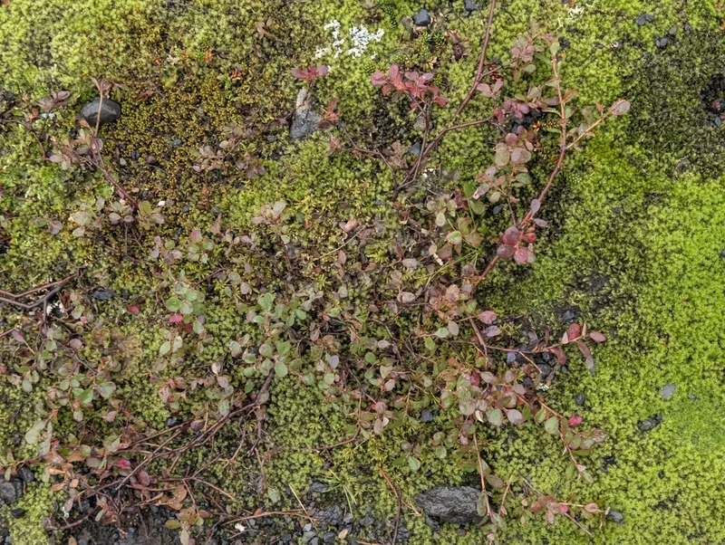
bog bilberry Vaccinium uliginosum -
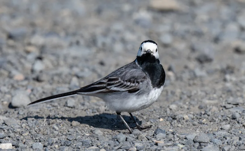
White Wagtail Motacilla alba -
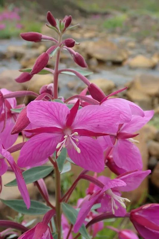
Dwarf Fireweed Chamaenerion latifolium -
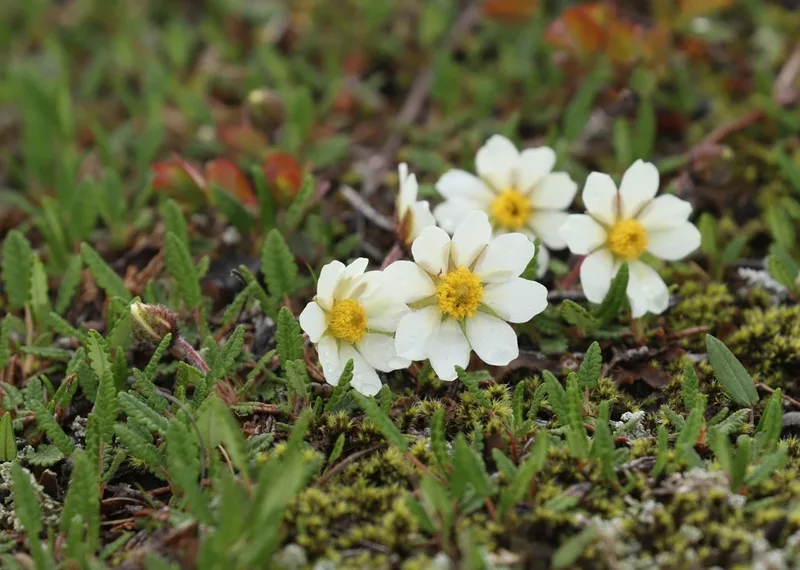
Eight-petal Mountain-Avens Dryas octopetala -
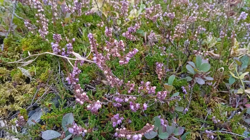
common heather Calluna vulgaris -
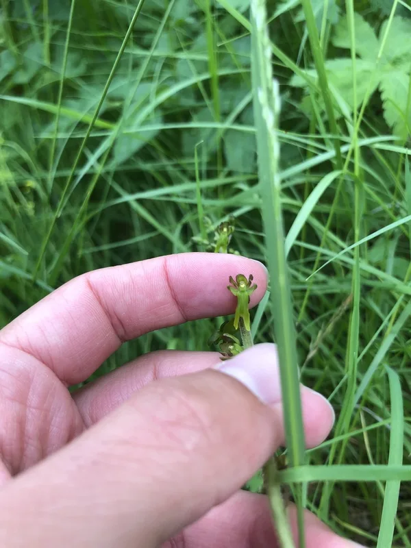
Common Twayblade Neottia ovata -
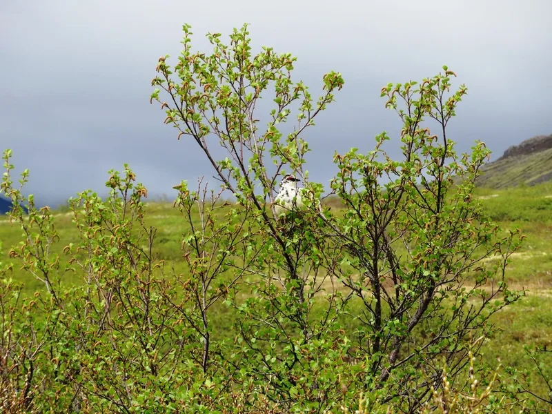
Rock Ptarmigan Lagopus muta
Field Notes · Ice & Glaciers lens · Skaftafell · 64.0474, −16.6014