Teide
Parque Nacional del Teide · Canary Islands, Spain
The high country here is a volcano's interior made visible.
Also seen through Night Sky · all at Parque Nacional del Teide →.
Why here
Teide is a landscape of volcanic layers exposed above the clouds. Peaks, craters, dark flows, and pale rock gather in a high basin where the air is thin and the horizon unusually open. The mapped geology includes trachyte and other volcanic rocks, but the useful idea is simpler: eruptions built a stack, erosion opened it, and each new surface became a place for plants and lizards to test the climate. The mountain is not one cone viewed from below. It is a country of forms around a high center. Move among the overlooks and the sequence stays visible, from older walls to younger-looking flows and the small life that survives between them.
The sites
The volcanic basin
Mirador del Llano de Ucanca
28.2114, −16.6351
This overlook gives the volcanic basin enough distance to become a map. High walls, open ground, and separate volcanic forms sit together rather than lining up as one mountain. The pale and dark surfaces show that eruptions did not build one uniform material. They laid down different rocks, and weather has since emphasized their differences. Stand here before moving on. The basin is the frame for every other stop, the place where the high country reads as a sequence of eruptions rather than a single peak.
Find one pale surface and one dark surface in the same view. Their contrast records different volcanic materials and cooling histories, not simply a change in sunlight.
- AccessDrive-up
- ExertionEasy
- TimeAn hour
Guajara
28.2170, −16.6123
Guajara rises from the basin as a solid piece of the volcanic structure. From its slopes, the surrounding country becomes a set of walls, hollows, and flows shaped by fire and later weather. Look for the way the land falls away from the high point. A volcano builds upward, but erosion and collapse make the surrounding country legible by lowering it again. The mountain’s living cover is sparse in the exposed places, with plants occupying protected soil and brief seasonal openings.
Trace a slope from bare rock into the first patches of vegetation. The plants gather where cracks and shallow soil provide shelter from the high, dry exposure.
- AccessHalf-day hike
- ExertionStrenuous
- TimeA full day
New rock, returning life
Tabonal Negro
28.2576, −16.6106
Tabonal Negro brings the eye close to a dark volcanic surface. Black rock absorbs light and heat, but it is not empty. Small plants find cracks, and a Tenerife lizard can use warm stone when the day allows. The contrast is a useful way to read recovery. Life does not cover the whole flow at once; it arrives in pockets, and the pockets reveal what the rock can offer. Move slowly and look down before looking toward the larger peak.
Search the warm side of a rock for a Tenerife lizard, then look for the nearest plant growing in a crack. Both use the heat and shelter of the volcanic surface differently.
- AccessShort walk
- ExertionEasy
- TimeAn hour
Mirador de Pico Viejo
28.2699, −16.6450
Pico Viejo gives the volcanic country a long view toward its younger-looking surfaces and broader forms. The overlook is useful because distance reveals alignment: one cone, wall, or flow makes more sense when another sits behind it. Teide’s geology is a stack and a family of eruptions, not one isolated object. Let your eye travel along the ridges before settling on the nearest rock. The high light makes small differences in color and texture unusually clear.
Follow the line of two ridges until they overlap. The overlap lets you separate older landforms in the foreground from later volcanic surfaces behind them.
- AccessDrive-up
- ExertionEasy
- TimeAn hour
Plants at the high edge
El Sombrero
28.1950, −16.6455
El Sombrero is a place for the plants that make the high volcanic basin more than bare rock. Red mount Teide bugloss and white-flowered broom belong to an exposed world with short growing opportunities and little shelter. Their presence marks the thin line between weathering and habitability. Look at the plants as part of the geology. They root in cracks, pockets, and older ground, turning a volcanic surface into living cover without hiding its shape. The mountain remains visible through the life it supports.
Find a plant rooted beside, rather than on top of, the most exposed rock. Its position shows where a little soil and protection have gathered in the volcanic surface.
- AccessShort walk
- ExertionEasy
- TimeAn hour
When it's best
The high park is clearest and most accessible in the warmer, drier part of the year, though cloud can gather quickly around the mountain in any season. Spring brings a chance of flowers on the volcanic slopes, while the open rock remains the central subject through summer and fall. Wind and cold can arrive even under strong sun. Carry layers and give the high country time to show itself between clouds.
Go deeper
The names behind what you saw. The rock record includes Pleistocene trachyte and Cenozoic volcanic rocks. The living high-country plants include red mount Teide bugloss, Echium wildpretii, and white-flowered broom, Cytisus supranubius.
To read next. - Geological values justifying the nomination of Teide National Park as a World Heritage Site — a formal account of the volcanic forms and their importance. - The park’s natural-history material — for the plants and lizards adapted to the high volcanic basin.
The names behind what you saw
What lives here, and what it's called. Photographs from open collections — an aid to identification, not decoration.
-
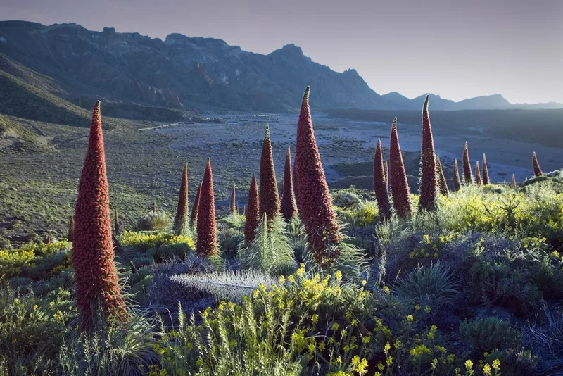
Red Mount Teide Bugloss Echium wildpretii -
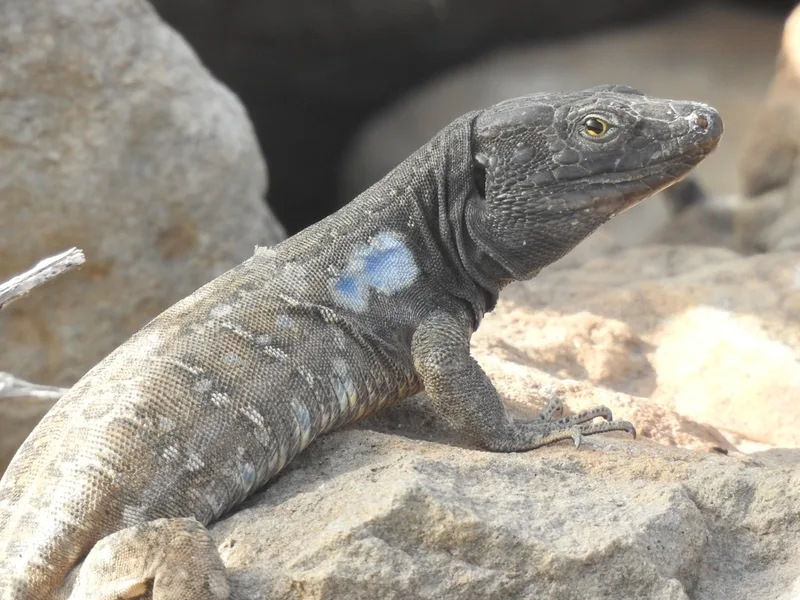
Tenerife Lizard Gallotia galloti -
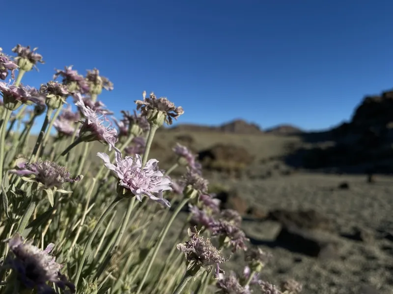
Hoary Pterocephalus Pterocephalus lasiospermus -
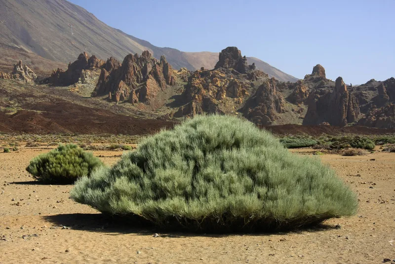
White-flowered Broom Cytisus supranubius -
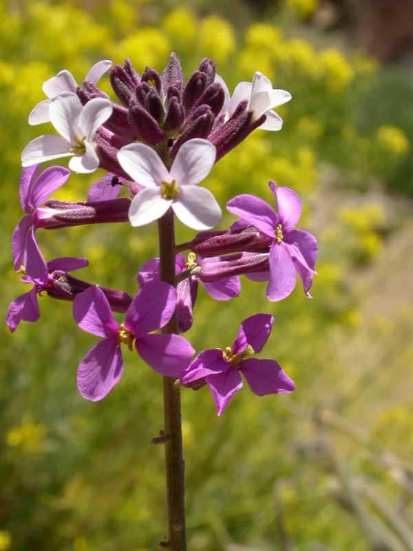
Icarian Treacle Mustard Erysimum scoparium -
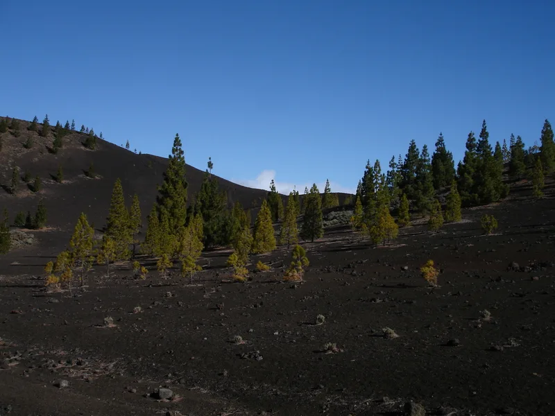
Canary Island pine Pinus canariensis -
Berthelot's Pipit Anthus berthelotii -
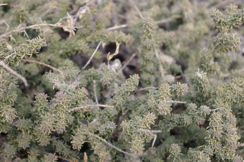
Bean-trefoil Adenocarpus viscosus -
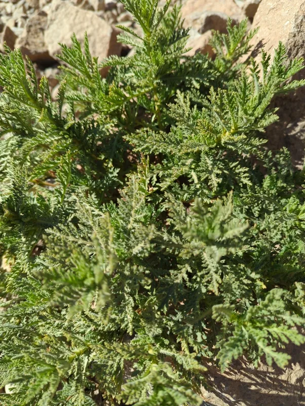
Tenerife Daisy Argyranthemum tenerifae -
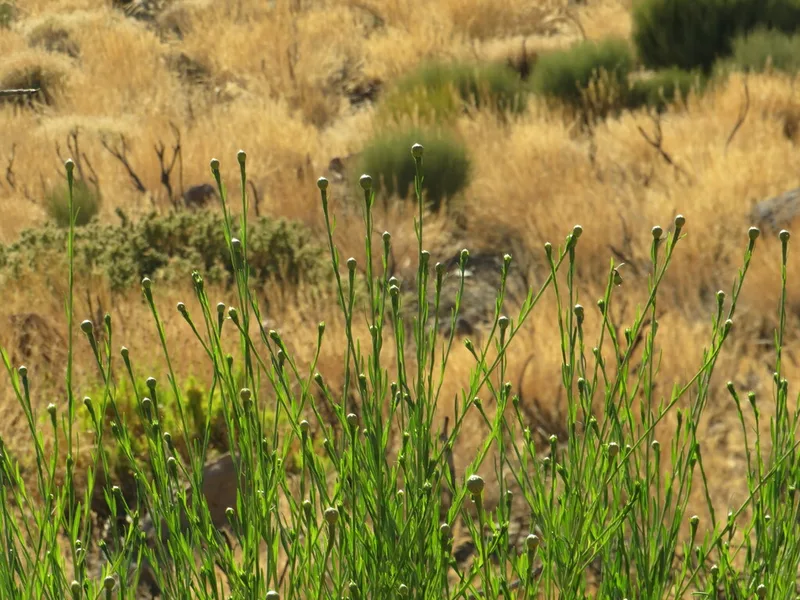
Cheirolophus teydis -
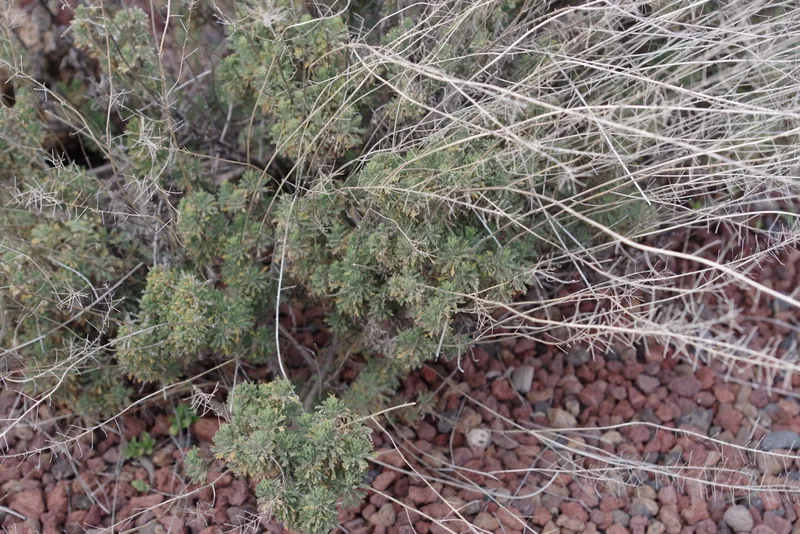
Descurainia bourgaeana -
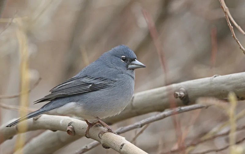
Tenerife Blue Chaffinch Fringilla teydea
Field Notes · Volcanic lens · Parque Nacional del Teide · 28.2688, −16.6374