The San Juan Islands
Friday Harbor · Washington, USA
Twice a day the sea pours between these islands, and everything that lives here has learned to hold on and take what the current brings.
Also seen through Fog Coast · all at Friday Harbor →.
Why here
Kneel at the edge of the water when the tide is out, and the rock is not bare. It is upholstered — crusted with anemones that pull shut into wet lumps in the open air, studded with the round green shells of urchins, worked over by crabs the color of the weed they hide in. That density is no accident. Twice a day the tide squeezes between these islands into fast, cold rivers of moving seawater, and moving water is a feeding line: it carries food past anything anchored in its path. So most animals here do not chase a meal. They hold on and let the current bring it. The plume-topped anemones, the filter-feeding crabs, the seals that haul out to rest between working the same rich water — all of them live off a sea that never stops moving. That is the thread this note follows. On these shores the tide does the hunting, and everything alive is built to catch what it delivers. Come at low water, kneel down, and you can watch it happen at your feet.
The story
Start with the rock, because it started at sea. The bones of these islands are scraps of an ancient ocean floor — old undersea lava and deep-sea mud, scraped off and stacked against the edge of the continent long before there were people to walk them. Much later, an ice sheet buried the whole country and then drew back, roughly twelve thousand years ago, smoothing the rock and gouging the deep channels that now separate one island from the next. Those narrow, glacier-cut channels are why the water moves so hard today: the tide has to squeeze through them, and it speeds up as it goes.
Fast, cold water is a gift to anything that eats by filtering. The channels feed a dense shore — plume-topped anemones, urchins, chitons, and crabs on the rocks, harbor seals working the current above them. It is one reason a marine research station and a museum given over to the whales of this sea both sit in the small harbor town on the main island.
People were reading this water long before the labs. The islands’ shores protect archaeological traces of the Coast Salish, who lived along these beaches; the record here is quiet on the daily detail, but the shell and stone remain. The sea floor became islands; the islands became a place built, still, around the sea.
The sites
Where the tide bares the rock
American Camp Trail
48.5312, −123.0264
Where the American Camp trail runs down to the water on the island’s south end, the shore turns to rock and cobble, and a falling tide turns it into a garden. This is the marine lens at its most literal: no boat, no mask, just the band of shore the sea uncovers twice a day and hands to you for an hour. The animals here are the ones built to wait out the dry spell. Anemones fold their tentacles inward and sit as glistening lumps until the water returns. Green urchins wedge into low pools. Chitons — oval, armored, banded in color — clamp so hard to the rock that they seem part of it. Crabs sidestep under the weed, and one kind carries a garden of its own, dressing its shell in bits of algae until it walks as camouflage. None of this is rare or fragile to look at, but it is easily trampled, so step on bare rock and sand, not on the living crust. Give it the hour the low tide allows and the shore stops being a place you pass and becomes a place you read.
At the lowest water, find an anemone closed up out of the sea — a wet, folded lump about the size of a fist on the rock. Wet it from a nearby pool and watch the tentacles ease open: it is a filter feeder caught between tides, holding its breath until the current comes back to feed it.
- AccessShort walk
- ExertionEasy
- TimeAn hour
Reading the water from a height
Mount Dallas
48.5218, −123.1309
Mount Dallas rises on the island’s western side, and the climb trades the tideline’s close focus for the long one. From up here the sea is not a flat blue sheet — give it a minute and it organizes into lines. Smooth slicks and ruffled streaks mark where bodies of water moving at different speeds slide past one another; darker patches are the tops of kelp beds anchored to the bottom. This is the same moving water the tideline animals live on, seen whole. In the channels below, the tide can run like a river, and where it does the surface tears into standing ripples. This is whale water, too — the Salish Sea the museum down in the harbor town exists to watch — though a fin from up here is a matter of luck and a steady pair of binoculars. Bring them: seals show as dark commas on the far rocks, and a raft of seabirds marks a place where the current has concentrated the food. Read the surface for a while and the sea below the tideline stops being a mystery and becomes a system you can watch working.
Pick a channel between two islands and watch its surface for a few minutes. Find the seam where glassy water meets rippled water — that line is a current, the moving edge of the tide, and it is drawing the food that feeds everything down at the shore. Binoculars help.
- AccessHalf-day hike
- ExertionModerate
- TimeHalf a day
Mount Grant
48.5407, −123.1267
Mount Grant gives the island a second high seat over the water, a little north and east of Mount Dallas, and it rewards a slower kind of looking. From the open summit the shoreline unrolls in both directions, and its shape is a record of the sea’s patience: every cove is a place where the moving water found a soft seam in the rock and worked it loose, every headland a place the rock held. Look at the color of the water itself. Cold, food-rich water often reads darker and greener than the thin blue of a calm bay, and the greenish bands trace where the sea is doing its most work. Along the near shore, brown mats at the waterline are kelp, a forest with its roots in the tide. The living sea this note keeps pointing at is mostly hidden below the surface, but from a height its outlines show: the coves it cut, the kelp it grows, the cold streams of it that feed the shore. Come on a clear morning, before the day’s wind stirs the surface into one flat glare.
From the summit, trace the shoreline until you find a deep, narrow cove. It marks a weakness in the rock that the moving sea has been prying open far longer than the island has looked the way it does now — the same water, working slower, that fills the tide pools below.
- AccessHalf-day hike
- ExertionModerate
- TimeHalf a day
Seals, and the study of this sea
Biological Hill
48.5559, −123.0274
Biological Hill sits above the harbor town, near the marine research station, and it is the right place to see this sea as a working thing. Below you the harbor is busy with boats, docks, and the low water where seals come and go. This is not wild coast; it is a place where people have leaned over the same water for generations, trying to learn it. The docks themselves are habitat. On the shaded sides of pilings, below the reach of the tide, tall white anemones stand in the current with their crowns of fine tentacles spread — the same feed-on-the-flow trick as their tidepool cousins, worked on a piling instead of a rock. You cannot see them from the hill, but knowing they are there changes how the harbor reads. Watch instead for the seals: dark heads that surface, hold, and slip under, hunting the same rich channel the researchers study. From up here the whole arrangement is visible at once — the town, the boats, the labs, and the moving water all of it is built around.
Look down at the harbor and wait for a smooth, dark head to break the surface and vanish — a harbor seal, hunting the channel. Count how long it stays under. It is working the same current-fed water the marine station below you exists to study, and its patience is a clue to how much food that moving water carries.
- AccessShort walk
- ExertionEasy
- TimeAn hour
American Camp Trail
48.5312, −123.0264
Follow the same American Camp trail past the rocks to where the shore opens out — a long, wind-raked beach backed by grassland, with open water in front. If the low-tide garden is the sea up close, this is the sea at arm’s length: the place to stand still and let the shore’s larger residents come to you. The offshore rocks are seal country. At low water harbor seals haul out to rest, lying like grey stones until one lifts its head; scan the far rocks and let your eye catch the ones that move. The wrack line — the ribbon of tossed kelp and shell along the high-tide mark — is its own small economy, picked over by shorebirds working the wet sand for what the sea delivered overnight. Come when the tide is low and the wind is down, sit above the beach, and give the seals and the birds time to forget you are there.
Scan the low offshore rocks for shapes that look like grey stones, then wait. If one lifts its head or hitches higher on the rock, it is a harbor seal hauled out to rest between feeds — they are easiest to find at low tide, when the most rock is bare. Binoculars turn a distant lump into a face.
- AccessShort walk
- ExertionEasy
- TimeHalf a day
When it's best
The tide, not the calendar, runs this shore. Come on a day the water drops far in daylight, and the low-tide hours will bare a band of rock that spends most of its life underwater — anemones, urchins, and chitons all within reach of your eyes. Those big daylight low tides come and go through the year, so it is worth checking a tide table before you pick a morning. Harbor seals are around in any season and easiest to spot at low water, when they rest on exposed rocks. Spring is cool and often wet here; dress for weather, and count a whale offshore as luck, not a plan.
Go deeper
The names behind what you saw. The island’s rock is the San Juan Complex — an ophiolitic mélange, meaning shuffled pieces of old ocean floor (undersea lava and deep-sea shale) scraped onto the continent’s edge. Over it lies a blanket of glacial drift left by the Vashon-age ice. The animals: harbor seal, Phoca vitulina; the tall dock anemone is the giant plumose anemone, Metridium farcimen, with the painted anemone, Urticina grebelnyi, on the rocks; the green urchin is Strongylocentrotus droebachiensis; the banded chiton is the lined chiton, Tonicella lineata; the self-decorating crab is the graceful decorator crab, Oregonia gracilis, sharing the weed with the northern kelp crab, Pugettia producta. The translucent orange sea slug some divers find is the golden dirona, Dirona pellucida.
To read next. - The Whale Museum, in the harbor town — for the whales of the Salish Sea this note only glances at. - Friday Harbor Laboratories — the marine station whose researchers work this exact water. - The San Juan region’s iNaturalist page — a living, updated catalog of what people are finding in these tide pools now. - Any overview of the San Juan Complex — for the full story of how an ocean floor became an island chain.
The names behind what you saw
What lives here, and what it's called. Photographs from open collections — an aid to identification, not decoration.
-
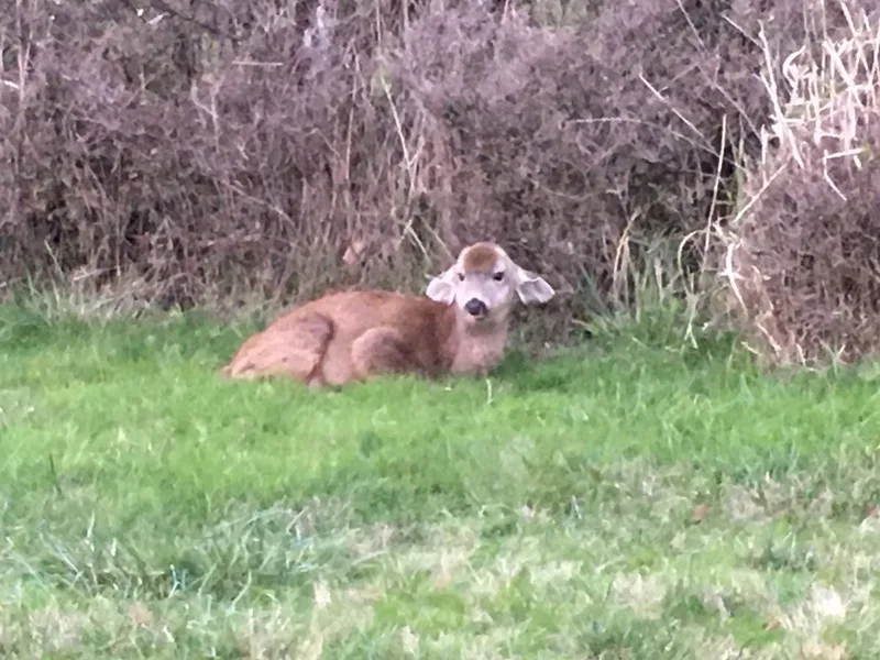
Mule Deer Odocoileus hemionus -
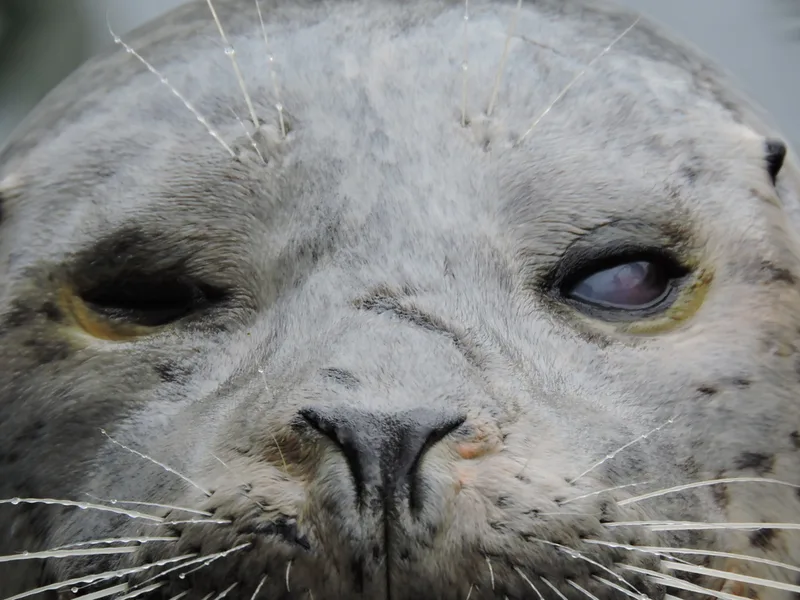
Harbor Seal Phoca vitulina -
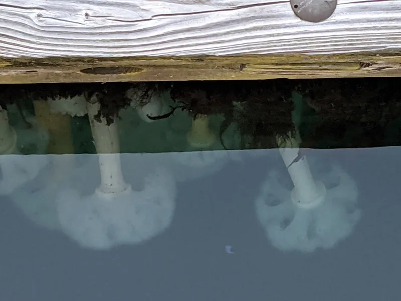
Giant Plumose Anemone Metridium farcimen -
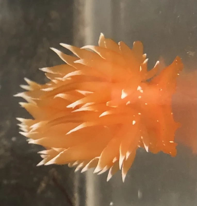
golden dirona Dirona pellucida -
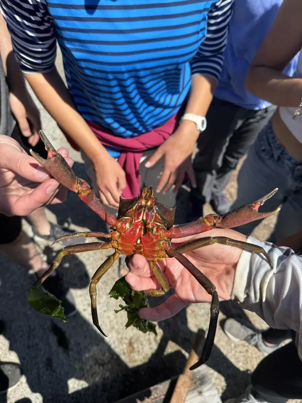
Northern Kelp Crab Pugettia producta -
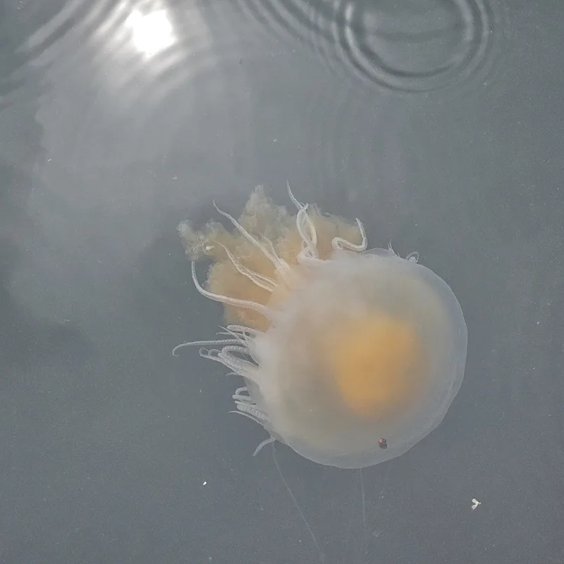
Egg-yolk Jelly Phacellophora camtschatica -
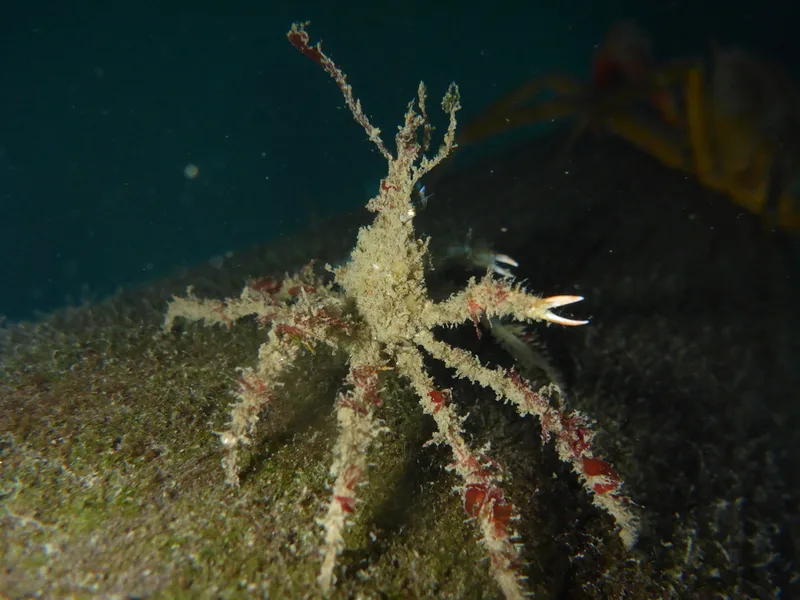
Graceful Decorator Crab Oregonia gracilis -
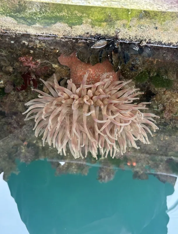
Painted Anemone Urticina grebelnyi -
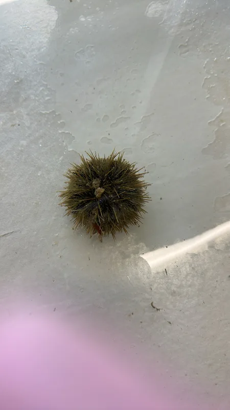
Arctic Green Sea Urchin Strongylocentrotus droebachiensis -
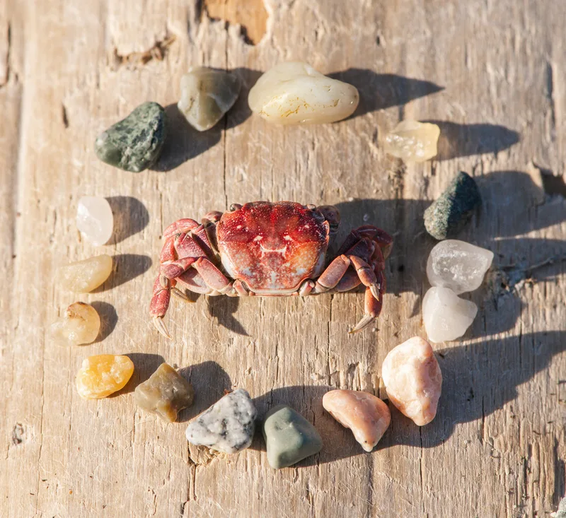
Purple Shore Crab Hemigrapsus nudus -
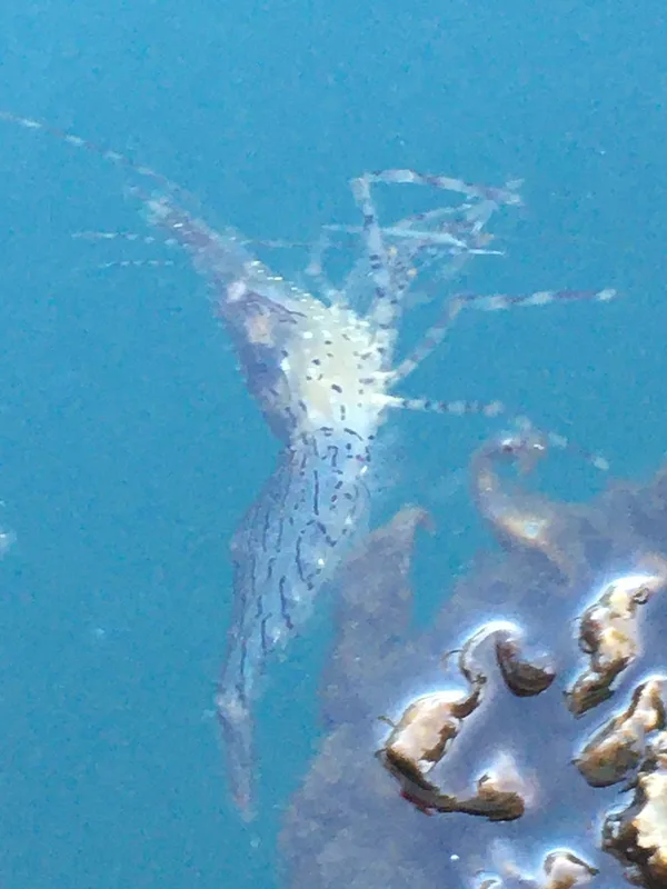
Dock Shrimp Pandalus danae -
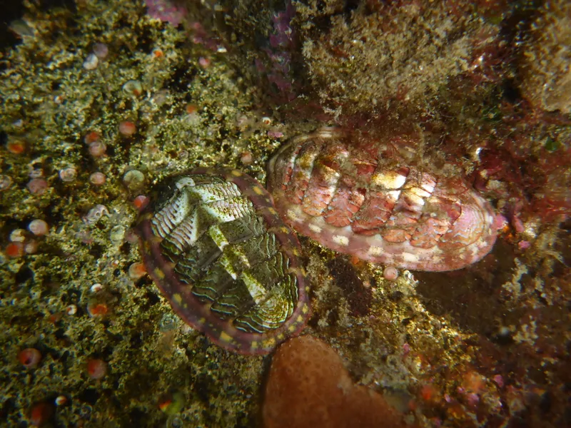
Lined Chiton Tonicella lineata
Field Notes · Marine lens · Friday Harbor · 48.5343, −123.0171