The San Juan Islands
Friday Harbor · Washington, USA
These are small islands in a wide, cold sea — and it is the water, not the land, that does most of the living here.
Also seen through Marine · all at Friday Harbor →.
Why here
Stand almost anywhere on these islands and you are never far from salt water. That nearness is the whole story. The San Juan Islands are small backs of glacier-worn rock set in a wide, cold sea, and it is the sea — moving, tide-driven, deep-cold — that does most of the living here. Strong currents push cold, nutrient-rich water up through the channels between the islands. That water keeps the summers cool and the winters mild, breeds the fog that drifts in off the strait, and feeds a dense marine life along every shore and just beneath the surface. The land itself is thin: a shallow skin of glacial soil over old sea-floor rock, so the real richness gathers at the edges, where ground meets water. Even the human story bends the same way — a town built as a harbor, a marine laboratory, a museum for whales. Everything in this note keeps returning to one fact: on these islands the sea is not the view. It is the engine.
The story
The rock underneath is a jumble — slabs of old ocean floor, hardened lava, and dark shale, scraped together and stacked long ago as this edge of the continent was assembled from pieces carried in on the sea. Then, in the last Ice Age, a great tongue of ice flowed down over all of it, grinding the islands into the low, rounded shapes they hold today and leaving behind only a thin blanket of sand, gravel, and till. That is why the soil here is shallow and the high ground stays bald.
Around that scraped-down land, the sea stayed cold and moving. Strong tides drag deep, cold, nutrient-rich water up through the narrow channels, and on it a crowded marine life feeds — anemones, urchins, crabs, and the seals and seabirds that hunt them. The richness is not in the ground; it is in the water at the ground’s edge.
People have leaned on that sea for a very long time. The islands hold archaeological sites of the Coast Salish peoples, who lived with this water for generations. Later came settlers and a harbor town, Friday Harbor, which grew into the islands’ hub, and in time a marine laboratory and a museum for whales — the newcomers, in their way, turning back to study the same sea that had fed everyone before them.
The sites
The bald hilltops
Mount Dallas
48.5218, −123.1309
This is one of the high points on the western side of San Juan Island, and from the top the logic of the whole place lays itself out: a low, rounded island, water on every side, and more islands beyond, each the same low back of rock. The Ice Age glacier that overrode all of this ground the land down and left only a thin soil behind, and on the exposed tops the wind and the shallow, dry ground keep the forest from taking hold. So the summits stay bald and open to the view while the lower slopes carry trees. On a cool, clear morning you may stand up here in sun and look down on fog lying in the channels below, filling the low water between islands and leaving the high ground clear. Those channels are where the tide runs hardest, dragging cold water through the narrows. From this height you are really looking at the machine of the place — the cold sea below, the thin land above, and the fog that ties them together.
From the top, find the line where the trees give way to open grass near the crown. On the thin soil the glacier left, wind and summer drought hold the forest back, so the highest ground stays bald. Trace that same treeline around the tops of the other islands across the water, and you will see the bald crowns repeat.
- AccessHalf-day hike
- ExertionModerate
- TimeHalf a day
Mount Grant
48.5407, −123.1267
Mount Grant rises a little inland, an open hill with a wide look south and west over the island and the water beyond. What surprises people is how dry and open the high ground feels for the wet Northwest — grass and moss and bare rock rather than deep, dripping forest. These islands sit in a drier pocket than the soaked country around them, and on the windswept tops the thin glacial soil and the salt air keep the trees low and scattered. The reward is the long view. From the summit the sea reads as a set of channels threading between low islands, and on a cool morning you can watch fog pool in those channels while the hilltops stand clear above it. The same cold water that makes the fog is the water that feeds the shorelines below. The hill and the tidepool are two ends of one system, and from up here you can see how the pieces fit.
From the summit, look out and pick apart how many separate islands you can count in the water. Each is a higher back of the same glacier-worn rock — the ground that stayed above the sea when the ice melted and the water rose to fill the low places between. On a cool morning, watch for fog settling into those channels first, while the hilltops stay clear.
- AccessShort walk
- ExertionEasy
- TimeAn hour
Down by the harbor
Biological Hill
48.5559, −123.0274
Biological Hill is a low rise on the island’s northeast side, close above Friday Harbor and the busy channel that carries the ferries and boats. It sits near the water rather than above the whole island, and that is the point: here you are down at the level where land and sea do business. The island’s marine laboratory works along this same stretch of shore, and people have long paid close attention to the living things of this water. Look out over the channel and you are watching the engine at close range — the tide pushing through, the cold water turning over, the gulls and cormorants and the occasional dark head of a seal all working the same rich current. It is an unglamorous view of a working waterway, and it may be the clearest place on the island to understand why so much life crowds these shores: because the moving water never stops delivering food to them.
From the rise, look down at the moving water in the channel and find the seams, lines, and swirls on its surface. Those are the tide running, pulling cold water up from below — and that upwelling is what feeds the thick life just under the surface and draws the seals and diving birds to hunt here. Watch a few minutes for a smooth dark head to break the surface: a harbor seal, up for air between dives.
- AccessShort walk
- ExertionEasy
- TimeAn hour
Where the land meets the sea
American Camp Trail
48.5312, −123.0264
The south end of San Juan Island opens into something you do not expect on a wooded island: a wide, treeless prairie of grass running out to a bluff above the sea. The American Camp Trail carries you into it. The openness is the sea’s doing as much as the soil’s — the glacier left thin, dry ground here, the wind comes straight and salt-laden off the water, and between them they hold the forest back and keep the grassland open. It is a landscape shaped by exposure. Deer graze the grass, most easily seen in the low light of dawn and dusk when they come out to feed, and overhead the open ground is good hunting for eagles and vultures riding the wind off the strait. Walk out far enough and the sound of the trees falls away entirely, leaving only wind and grass and, beyond the bluff, the sea that made it all this way.
Walk out onto the open grass and turn your face into the wind coming off the water; notice how few trees stand anywhere near you. The thin glacial soil and the steady salt wind together hold the forest back, which is why this end of the island stays open prairie rather than woods. Scan low across the grass at dawn or dusk for feeding deer, and up for an eagle hanging on the wind.
- AccessShort walk
- ExertionEasy
- TimeHalf a day
American Camp Trail
48.5312, −123.0264
Follow the same trail to its other reward: the edge, where the thin land drops to meet the cold water. This is where the note’s one idea shows itself most plainly. Along the bluff and down on the shore the sea gathers its richness against the rim of the island — seals hauled out to rest on offshore rocks, black oystercatchers working the tideline with their red bills, and in the cold months rafts of sea ducks like harlequins riding the chop. At low water the shore opens into pools, and in them lives the crowded cold-water world the tide keeps fed: anemones like soft columns, crabs, chitons clamped to the rock, urchins tucked in the shaded cracks. Little of this would be so alive without the moving sea behind it. This is the lens of the whole note in one place — the land thin and quiet, and the water at its edge doing the living.
At a low tide, crouch beside a rock pool and look under the ledges and overhangs for anemones — soft columns that open to pull cold plankton from the water each tide brings in. Turn a loose rock gently to see what shelters beneath, then set it back exactly as it lay. Bring a tide table: the shore only opens for a few hours around low water, and closes again as the tide climbs.
- AccessShort walk
- ExertionModerate
- TimeHalf a day
When it's best
Spring brings the low tides back into daylight, opening the shoreline for a few hours at a time — the season to time a trip around if the tidepools are what draw you, and worth carrying a tide table. In the cold months the channels fill with sea ducks, harlequins and mergansers riding the chop, while bald eagles hold the islands year round. Summers here run cool and often clear, though the late-summer and autumn air carries more fog rolling in off the water. Harbor seals are present in every season, easiest to spot hauled out on rocks at low tide, with pups appearing later in summer. Whales move through the Salish Sea in the warmer months; with luck and patience you might pick out a distant fin from a headland, though a boat greatly improves the odds.
Go deeper
The islands’ bedrock is the San Juan Complex — a stack of old ocean-floor rock, lava, and shale (an ophiolitic melange) thrust together as this edge of the continent was assembled. Over it lies a thin blanket of glacial drift left by the ice sheet of the last Ice Age (the Vashon glaciation). In the tidepools, the soft columns are the giant plumose anemone (Metridium farcimen) and the painted anemone (Urticina grebelnyi); the round grazers in the cracks are green sea urchins; the resting animals on offshore rocks are harbor seals (Phoca vitulina); the black shorebird with the red bill is the black oystercatcher.
- An overview of San Juan Islands geology / the San Juan Complex — for how slabs of ocean floor came to be stacked into islands.
- A guide to the Salish Sea — for the tides and cold, nutrient-rich currents that drive everything living here.
- The Whale Museum, Friday Harbor — for the whales of these waters and the work of watching over them.
- Friday Harbor Laboratories — the marine station whose science is, quite literally, this shoreline.
- iNaturalist for the San Juan Islands — a living, growing record of what people are finding in the tidepools and on the water.
- San Juan Islands National Monument — for the Coast Salish history and the protected stretches of shore.
The names behind what you saw
What lives here, and what it's called. Photographs from open collections — an aid to identification, not decoration.
-
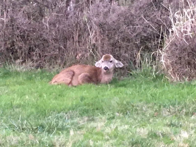
Mule Deer Odocoileus hemionus -
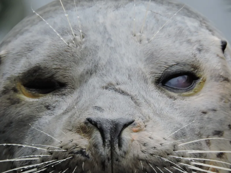
Harbor Seal Phoca vitulina -
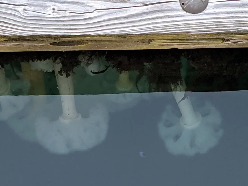
Giant Plumose Anemone Metridium farcimen -
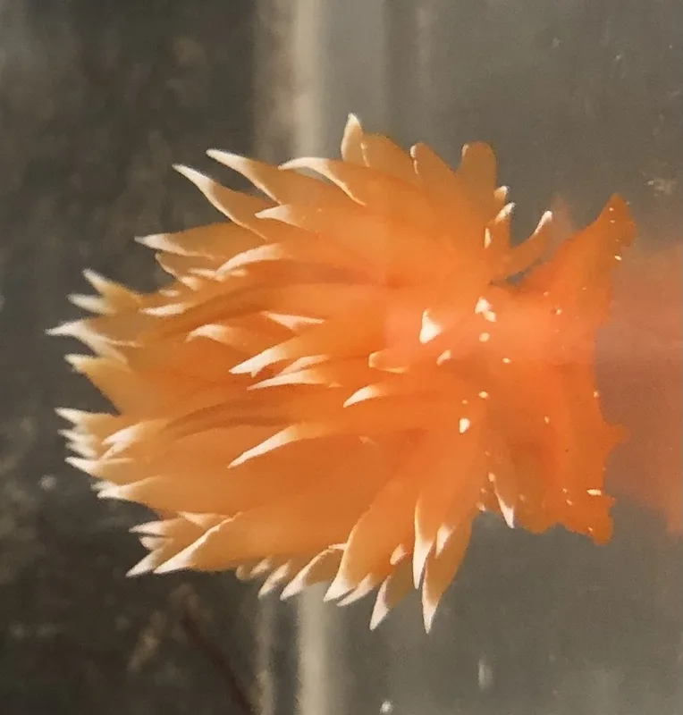
golden dirona Dirona pellucida -
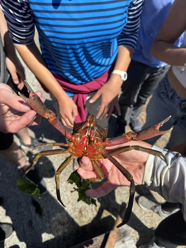
Northern Kelp Crab Pugettia producta -
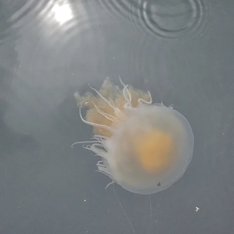
Egg-yolk Jelly Phacellophora camtschatica -
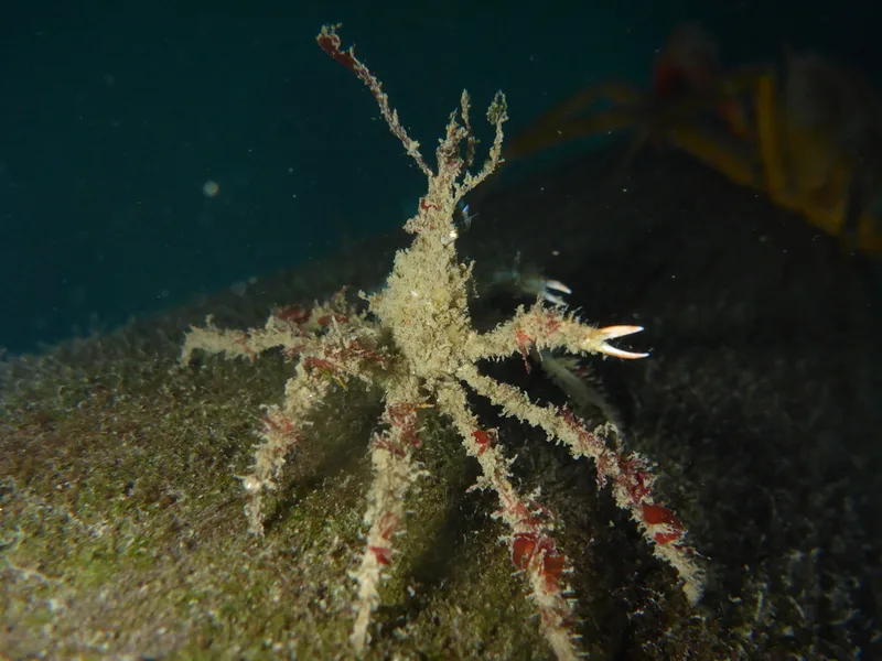
Graceful Decorator Crab Oregonia gracilis -
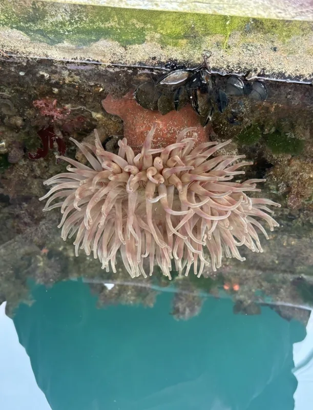
Painted Anemone Urticina grebelnyi -
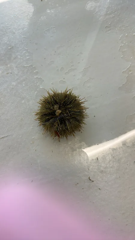
Arctic Green Sea Urchin Strongylocentrotus droebachiensis -
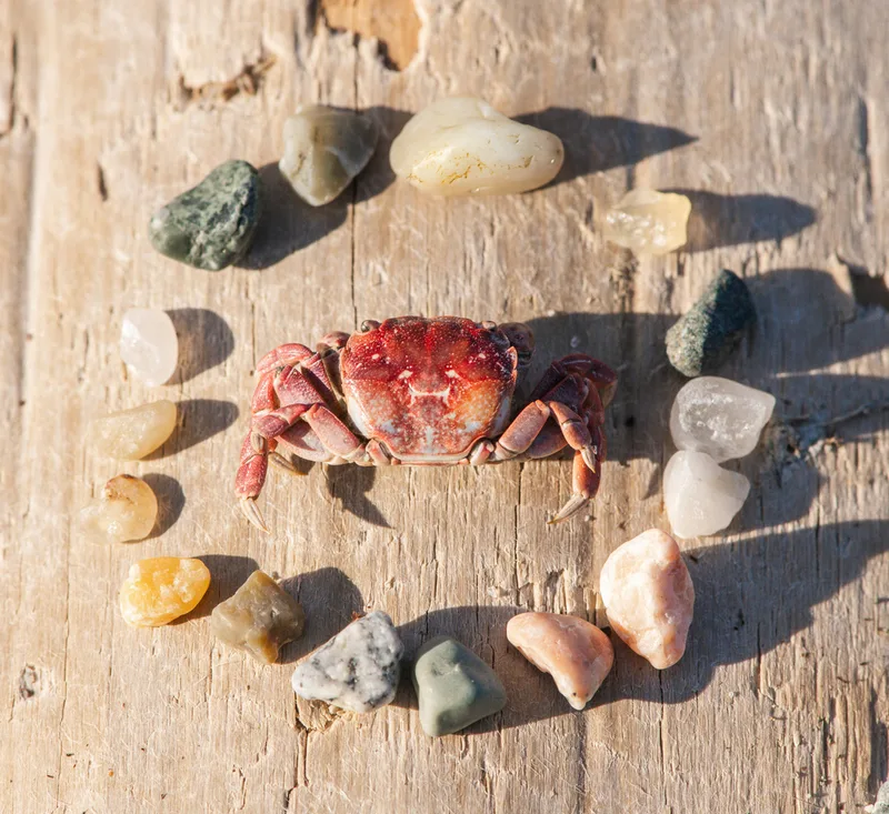
Purple Shore Crab Hemigrapsus nudus -
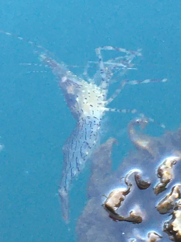
Dock Shrimp Pandalus danae -
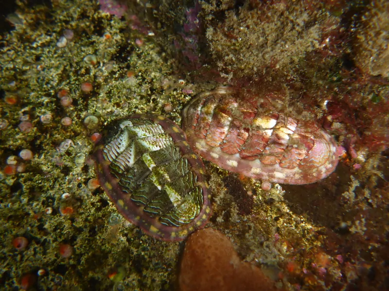
Lined Chiton Tonicella lineata
Field Notes · Fog Coast lens · Friday Harbor · 48.5343, −123.0171