Point Lobos
Point Lobos State Natural Reserve · California, USA
The shore is a place where the land keeps changing its mind about being land.
Also seen through Fog Coast · all at Point Lobos State Natural Reserve →.
Why here
Point Lobos is a coast made for looking down. Headlands, coves, and low shelves keep opening small windows into the water, where seals, cormorants, crabs, and tide-pool life share a narrow margin. Marine terrace deposits and older marine rock give the shore its structure, but the living sea supplies its motion. A rock can be dry in the morning, covered at noon, and already occupied by something small when the tide pulls back. Walk the points slowly and the reserve becomes a lesson in attachment: plants cling to soil, seals return to rocks, and shore animals hold fast against moving water. The sites here keep the ocean close enough to read without turning it into scenery.
The story
The payload’s geology includes marine terrace deposits and Paleocene marine sandstone, mudstone, and conglomerate. Those rocks form a shore of shelves and points, with cracks and coves that collect water.
The animals follow the edge. Harbor seals use the water and rocks, while sea birds work the air above them. Striped shore crabs and sea urchins occupy the lower shore, and Monterey paintbrush and seaside daisy bring color to the land above. The human extracts name Whalers Cabin and the Indigenous place-name Ishxenta, reminders that this coast has been observed and used by people as well as by wildlife.
The sites
The waterline
Sea Lion Point
36.5180, −121.9520
Sea Lion Point puts a large animal on a small piece of coast. Look toward the rocks and water, where harbor seals and sea lions may rest between movements offshore. The point is valuable even when the animals are absent because it makes the reserve’s edge clear: a short shelf of land opens directly into a much larger living system. Wind, salt, and wave action shape the rock, while the animals use the openings those forces leave. Give the view time. Marine life arrives in rhythms that are slower and less theatrical than a passing glance.
Scan the rocks for a resting seal, then compare its stillness with the moving water around it. The animal’s ability to rest on a small ledge is a reminder that the shore is habitat, not just a boundary.
- AccessShort walk
- ExertionEasy
- TimeAn hour
Granite Point
36.5227, −121.9367
Granite Point is a place to read the hard edge of the reserve. Marine deposits and older rock meet the sea in shelves, fractures, and projecting points, giving tide-pool life places to attach and water places to linger. Walk the edge with your eyes at two scales. First take in the headland and the open water. Then find a small channel where the tide has left a pool behind. The ocean’s work is visible in both views, from broad erosion to the tiny shelter that lets a crab or urchin survive the hours between tides.
Find a pool left behind by the falling tide and look for movement along its edge. The pool is a temporary pocket of sea that keeps intertidal animals wet until the next water arrives.
- AccessShort walk
- ExertionEasy
- TimeAn hour
Life in the cracks
Coal Chute Point
36.5210, −121.9373
At Coal Chute Point, the shore’s cracks are the main subject. A fissure can hold shade, water, and a little shelter from the force of a wave, making it more useful to small creatures than a broad exposed slab. Look for the differences between the two. Sea urchins and shore crabs do not need a picturesque cove; they need a place that stays within their limits when the tide changes. The point teaches a quiet lesson about marine habitat. Structure comes first. Life follows the shape that structure offers.
Compare an exposed slab with a nearby crack or hollow. Look for the wetter, darker place first. It offers protection from drying and wave force, which is why small shore animals gather there.
- AccessShort walk
- ExertionEasy
- TimeAn hour
The land above the tide
Sand Hill
36.5175, −121.9511
Sand Hill turns the view uphill. The marine terrace is an old shoreline surface lifted above today’s water, and its plants show what happens when a coast becomes land but keeps the memory of the sea in its shape. Monterey paintbrush and seaside daisy occupy the open ground, while the water remains visible below. Stand here to connect two kinds of coastline: the active shore at your feet and the former shore represented by the terrace. The reserve is not one fixed line. It is a stack of edges made at different times.
Look from the open terrace toward the lower shore. The higher flat surface is an older coastal position, while the waterline below is the active one. Notice how plants now occupy what was once marine space.
- AccessShort walk
- ExertionEasy
- TimeAn hour
People and the coast
Cannery Point
36.5210, −121.9405
Cannery Point keeps the human shoreline close to the same rocks used by seals and birds. The point belongs to a coast where people have read the waterline for work, travel, and shelter rather than simply viewing it from a distance. From here, look outward and then back at the paths and surfaces around the point. The shoreline is part of the landscape’s evidence: a place where human attention and marine life meet. Point Lobos becomes richer when those readings remain together instead of being separated into nature and history.
Look from the point toward the nearest working edge of the shore. Notice how paths, rock shelves, and tide pools all depend on the same narrow strip between land and water.
- AccessShort walk
- ExertionEasy
- TimeAn hour
When it's best
Low tide reveals the most shoreline, especially on calm days when the small pools are easier to inspect. Spring and early summer can bring flowers to the coastal slopes, while seabirds and seals remain part of the coast’s year-round life. Fog softens the headlands and often makes the water feel closer. Leave extra time for weather and tide rather than trying to fit the shore into a fixed sequence.
Go deeper
The names behind what you saw. The shore includes marine terrace deposits and Paleocene marine sandstone, mudstone, and conglomerate. The living coast includes harbor seal, Phoca vitulina, and Monterey paintbrush, Castilleja latifolia.
To read next. - Geological history of Point Lobos — a concise account of the rocks and shore forms beneath the reserve. - Whalers Cabin — the human-history thread that connects the working coast to the landscape around it.
The names behind what you saw
What lives here, and what it's called. Photographs from open collections — an aid to identification, not decoration.
-
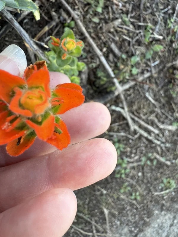
Monterey paintbrush Castilleja latifolia -
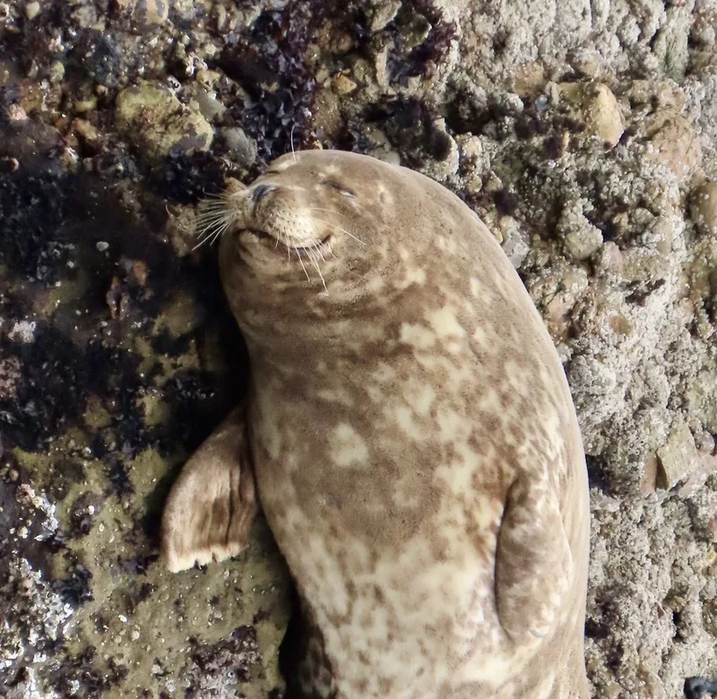
Harbor Seal Phoca vitulina -
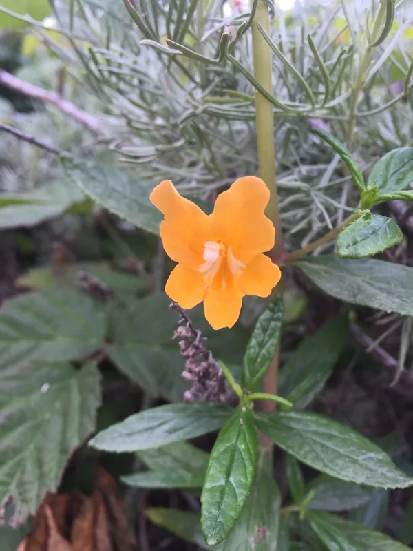
orange bush monkeyflower Diplacus aurantiacus -
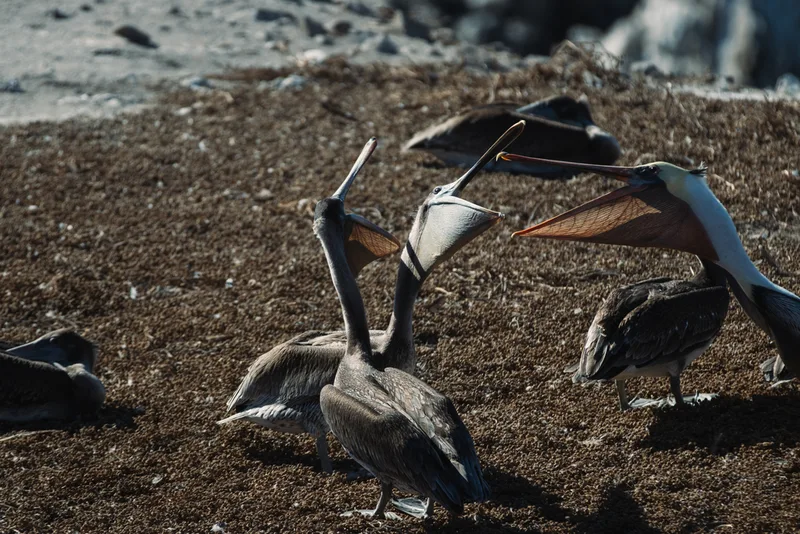
Brown Pelican Pelecanus occidentalis -
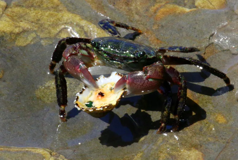
Striped Shore Crab Pachygrapsus crassipes -
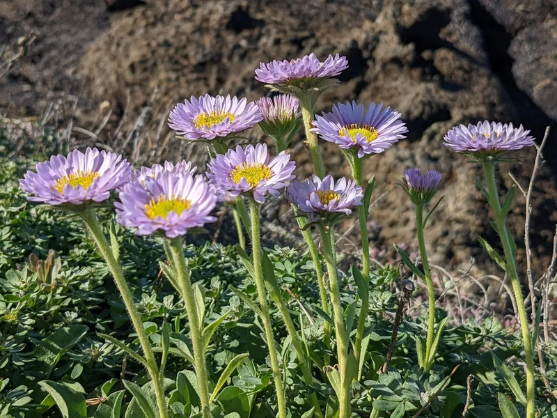
seaside daisy Erigeron glaucus -
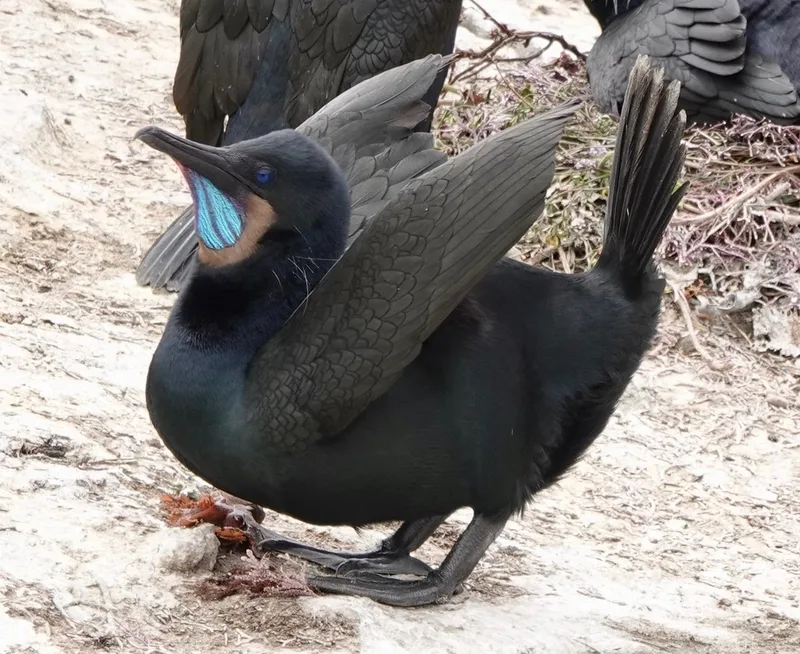
Brandt's Cormorant Urile penicillatus -
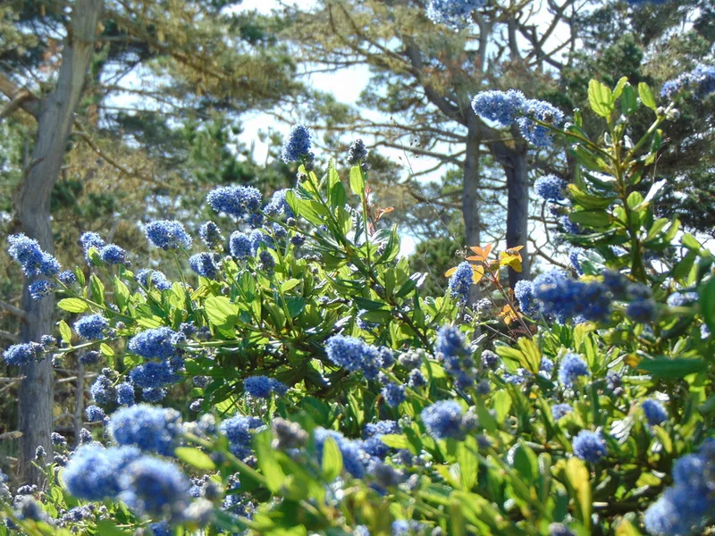
blueblossom Ceanothus thyrsiflorus -
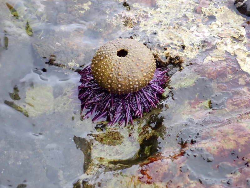
Pacific Purple Sea Urchin Strongylocentrotus purpuratus -
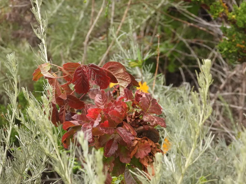
Pacific poison oak Toxicodendron diversilobum -
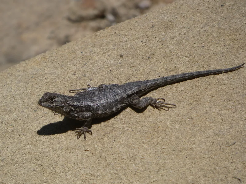
Western Fence Lizard Sceloporus occidentalis -
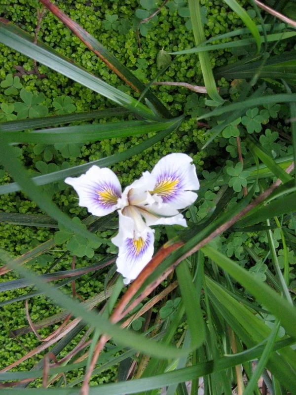
Douglas iris Iris douglasiana
Field Notes · Marine lens · Point Lobos State Natural Reserve · 36.5147, −121.9428