Pinnacles
Pinnacles National Park · California, USA
The fault that runs beneath these rocks carried them here, and it has not finished.
Also seen through Desert & Deep Time · all at Pinnacles National Park →.
Why here
The crags here are half a volcano. The rest of it lies about two hundred miles away, and the two pieces are still drifting apart. More than twenty million years ago, a volcano erupted a stiff, pale lava — too thick to run far, so it piled up into domes and thick sheets. Then the San Andreas Fault, which runs straight through the old volcanic field, went to work. Grinding northward a little every year, it sheared the volcano in two and began carrying the western half up the coast, mile by patient mile, to where you now stand. Weather did the rest, cutting the leftover rock into the towers, fins, and spires that give the park its name.
Nothing here is finished. The fault beneath your feet is still moving, still shaking blocks loose, still rearranging this ground on a clock too slow to watch and too steady to stop. Every overlook, every spire, every jumble of fallen boulders is the same story told at a different stage: a volcano on the move.
The story
Start with the rock. More than twenty million years ago a volcano built this country out of a thick, pale lava, piling it over an older floor of intrusive rock. Then the San Andreas Fault tore the volcano apart and began carrying this half of it north, where wind and rain have since carved the hard remains into spires and fins. The fault has not let go; the ground is still traveling.
On that broken rock grows chaparral — a low, tough scrub that thrives where soil is thin and summers are long and dry. Big berry manzanita holds it together, its bark smooth and dark red, and in spring the slopes catch color: the yellow of bush poppy, the red spikes of warrior’s plume, the gray-green of scattered gray pines heavy with fat cones. Lizards bask on the warm stone. Overhead, small swifts and canyon wrens work the cliff faces, and now and then a very large, dark bird — a condor — rides the updrafts along the crags on wings that look too broad for any bird.
The people came late to the record kept here. A president set the pinnacles aside as a monument early in the last century, and most of the park is now wilderness, left deliberately rough, with vineyard rows on the valley floor below. The record gathered here is quiet on who knew this country first — the older lives the sources do not name.
The sites
The spires up close
High Peaks
36.4858, −121.1983
This is the eroded heart of the old volcano — a dense cluster of rock towers, fins, and pinnacles standing where the thickest, hardest lava once pooled. The trail that threads through them is the reason many people come: it climbs steeply into the spires, passing close beside the towers. Everything you walk among here is what survived. The softer rock that once buried these shapes has long since weathered away and washed downhill, leaving only the toughest cores standing up against the sky. It is also a good place to watch for condors, which nest and roost among high crags like these and ride the warm air the sun-heated rock sends up. Give yourself the morning; the route is steep, exposed, and slow, and the point is not to hurry through but to stand inside the volcano’s broken center and look up.
As the trail climbs into the towers, stop and look up at the spires around you. Each one is a piece of the same body of old lava, still standing because it is harder than the rock that once surrounded it — everything softer has already washed away. Then watch the sky above the highest points for a very large, dark bird holding steady on flat wings: that is a condor, riding the warm air the rock throws up.
- AccessHalf-day hike
- ExertionStrenuous
- TimeHalf a day
The Fingers
36.4836, −121.2072
Off the high trails stands a row of slender spires, narrow towers of the same stiff lava that built the rest of the park, weathered down until only these thin fins remain. They are a clear lesson in how this landscape comes apart. The lava cooled with cracks running through it, and ever since, water, frost, and the slow shudder of the ground have worked those cracks wider, prying the solid rock into separate blades and columns. What stands is the rock between the cracks; what is gone was the rock along them. Seen from the side, the spires line up like a hand held edge-on. They are also good, quiet ground for the cliff birds — white-throated swifts that stitch back and forth across the rock faces, and canyon wrens whose falling song spills down the walls. Come for the shapes and stay for the sound.
From the trail, look at the row of narrow spires and notice how they line up, separated by clean vertical gaps. Those gaps follow cracks in the lava: water and frost pried each crack wider over ages until the solid rock was left standing as a set of separate fingers. Trace one gap from top to bottom, and you are reading the seam the rock split along.
- AccessHalf-day hike
- ExertionStrenuous
- TimeHalf a day
Monolith
36.4733, −121.1867
A single tall tower of rock stands here on its own, set apart from the main cluster of spires — a clean block of the old volcanic rock that the weather has been unusually slow to bring down. It is worth the walk even if you never leave the ground. A tower like this survives because it is made of especially solid, unbroken rock. Where the lava is riddled with cracks it comes apart into fins and rubble; where it is dense and whole, it stands, while the ground around it wears down and drops away, leaving the hard core exposed as a lone spire. Standing at its base and looking straight up is the plainest way to feel how much rock the weather has already carried off from everywhere else, and how slowly it is working on what remains.
Stand at the foot of this lone tower and look up its full height. It stands alone because it is a plug of especially tough rock the weather has been slow to break, while the ground around it wore down and left it exposed. Look for climbers on the faces, and notice they follow the natural cracks — the same lines along which the tower will one day come apart.
- AccessHalf-day hike
- ExertionModerate
- TimeHalf a day
Overlooks onto a moving land
Condor Gulch Overloook
36.4852, −121.1925
A short but steady climb out of the valley brings you to this overlook, set on the slope facing the main spires across a deep gulch. It is one of the easiest places to take in the eroded core of the volcano whole — the towers, the gullies between them, and the raw rock faces all laid out together rather than seen one at a time from below. The overlook takes its name from the great birds that use this airspace, and the open view makes it a natural place to stop, sit, and watch the sky over the crags. The warm air rising off the sunlit rock gives soaring birds an easy lift, so the gulch tends to hold whatever is aloft. Bring binoculars if you have them: the difference between a distant condor and a common vulture is much easier to read up close, and the wait is more rewarding when you can see the wings.
From the overlook, turn and face the wall of spires across the gulch — the eroded core of the old volcano, seen whole. Then scan the open sky above the crags, better with binoculars, for the big soaring birds riding the updrafts. A condor holds its broad wings flat and steady; a turkey vulture is smaller and rocks and tilts as it goes.
- AccessShort walk
- ExertionModerate
- TimeAn hour
Telescopes
36.4928, −121.1469
On the drier east side of the park stands this knot of weathered rock, reached by trail through open chaparral and oak. It is a good place to step back from the spires and see them in their setting — the towers standing highest on the skyline, the country falling away below toward the valley, and the whole tilted, broken landscape reading as one piece. The rock here has been sculpted the way it is everywhere in the park: cut and hollowed along its cracks, left standing where it is hardest. From a viewpoint like this the pattern is easier to see at a distance than from directly beneath a single tower. It is also a quieter corner than the popular high trails, with the chaparral birds — wrentits, towhees, and the granary-building acorn woodpeckers in the oaks — going about their business in the brush.
From this east-side viewpoint, look out over the weathered rock and the dry country falling away toward the valley. The spires stand highest where the lava was thickest and hardest; the low saddles between them mark where it was weaker. Pick the highest towers on the skyline, then follow the land down and out — you are looking across ground the fault beneath has carried a long way north.
- AccessHalf-day hike
- ExertionModerate
- TimeHalf a day
Teaching Rock
36.4748, −121.1869
Teaching Rock earns its name: it is a good place to stop and actually read the stone the whole park is made of. Up close, the rock is not the smooth, even sheet you might expect from cooled lava. It is a jumble of angular chunks — pebbles, cobbles, and blocks of older rock set into a finer background — the sign of an eruption that blew itself apart and then welded and cemented the pieces back together as they settled. This kind of shattered volcanic rubble is a minor feature amid the clean flows that built most of the park, but it is part of why the rock here weathers into such rough, pitted towers instead of smooth cliffs. Give the surface a close look before you move on. Once you have seen the embedded fragments here, you will start to notice them in every spire and wall you pass for the rest of the trip.
Get close to the rock face here and look at its surface. It is full of angular chunks — pebbles and blocks of older rock set in a finer paste — a sign this is not a single smooth flow but the rubble of an explosive eruption, blasted apart and cemented back together. Run a finger over the embedded fragments; each one rode out of the volcano in a cloud of hot ash.
- AccessHalf-day hike
- ExertionModerate
- TimeHalf a day
Beyond the crags
Balconies
36.5016, −121.2046
On the park’s west side, the trail runs beneath high rock walls where the country closes in. This is the best place to see what happens to a landscape this steep and this broken over time. Blocks of rock, pried loose from the cliffs above by frost, roots, and the shudder of the ground, tumble into the narrow gaps and jam against the walls before they ever reach the bottom — piling into rough archways and choked passages of fallen stone. It is a slow, ongoing collapse, and standing among it is a plain reminder that the tidy word erosion means, up close, actual rock coming down. The west side is also cooler and shadier than the exposed high country, and the walls throw sound around, so the cliff birds here carry a long way. Move through with an eye upward as well as underfoot.
Where the walls close in overhead, look up at the huge boulders wedged between them and then down at the ones underfoot. In a place this steep and broken, blocks pried loose from the cliffs fall into the gap and jam against the walls before they reach the bottom. Stand beneath one and consider that the same slow prying — frost, root, and the shudder of the fault — is still going on above you.
- AccessShort walk
- ExertionModerate
- TimeHalf a day
North Chalone Peak
36.4476, −121.1956
This is high ground in the park, and reaching it is a long, steady climb well beyond the popular spire trails — a half-day’s effort at least, out through chaparral and open slope with little shade. The reward is distance. From the top the crags that fill most people’s visit drop into their true setting: a small, hard knot of old volcanic rock set in a wide sweep of California ranch and valley country. Off to the west the land falls toward the long trough of the Salinas Valley; east, the dry ranges roll away in fold after fold. Somewhere across that view runs the fault that tore this volcano in half and carried this piece of it north to where you stand. You cannot see the fault move, but from up here you can begin to grasp how far the rock has come — a long reach of country between it and the half it left behind.
From the highest ground in the park, the land opens in every direction — the crags below you, the Salinas Valley trough off to the west, the dry ranges rolling east. Somewhere across that view runs the fault that carried this whole volcano north. Face out over the lower country and take in how far these rocks have traveled to end up beneath your feet.
- AccessHalf-day hike
- ExertionStrenuous
- TimeA full day
When it's best
Come in spring. The chaparral saves its color for the wetter months at winter’s end, when bush poppy, warrior’s plume, and paintbrush open across the rock — usually well along by March, earlier after a warm, wet winter. This is also when the fence lizards return to the warm stones and the cliff birds are busiest. Summers here run hot and dry, and the exposed high country offers little shade, so the spires are best walked in the cool of morning whatever the month. Condors ride the updrafts in most seasons, easiest to pick out on clear days when the air over the crags is moving.
Go deeper
The names behind what you saw. The pale, spire-forming rock is the Neenach Volcanic Formation — mostly rhyolite, with lesser dacite and andesite, erupted in the late Oligocene and early Miocene. It rests on older Cretaceous intrusive rock, the basement of the Coast Ranges. The signature plants are big berry manzanita (Arctostaphylos glauca), bush poppy (Dendromecon rigida), warrior’s plume (Pedicularis densiflora), felt paintbrush (Castilleja foliolosa), and gray pine (Pinus sabiniana). The great soaring bird is the California condor (Gymnogyps californianus); the lizard on the warm rocks is the western fence lizard (Sceloporus occidentalis), and the granary-building bird of the oaks is the acorn woodpecker (Melanerpes formicivorus).
To read next. Only one source in this dossier speaks directly to the place: Philip Andrews, Geology of the Pinnacles National Monument (1936). The other readings gathered here concern unrelated “pinnacle” formations elsewhere and do not bear on this park, so the shelf is honestly short — for more, search the formation and species names above.
The names behind what you saw
What lives here, and what it's called. Photographs from open collections — an aid to identification, not decoration.
-
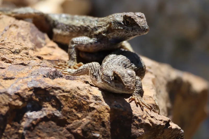
Western Fence Lizard Sceloporus occidentalis -
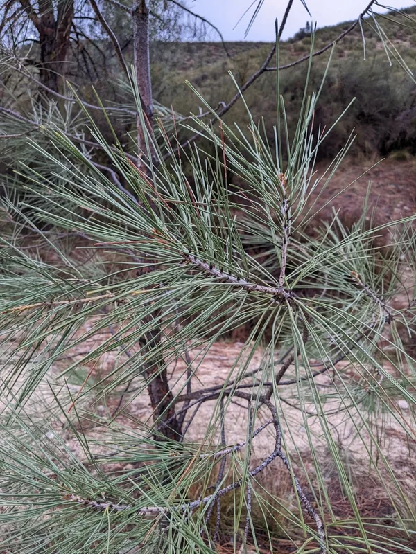
gray pine Pinus sabiniana -
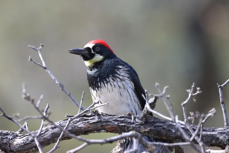
Acorn Woodpecker Melanerpes formicivorus -
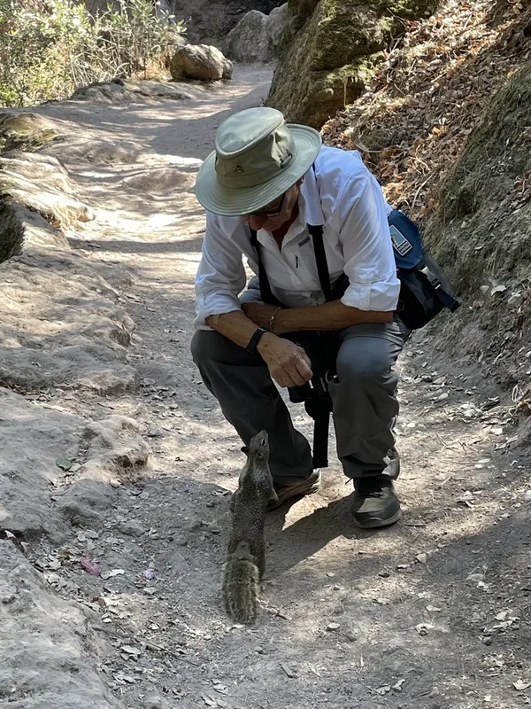
California Ground Squirrel Otospermophilus beecheyi -
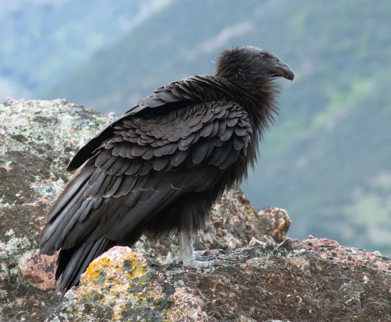
California Condor Gymnogyps californianus -
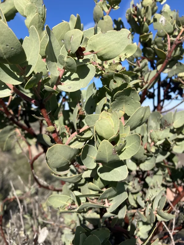
Big Berry Manzanita Arctostaphylos glauca -
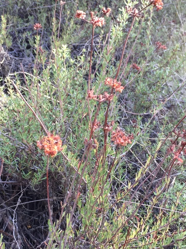
California Buckwheat Eriogonum fasciculatum -
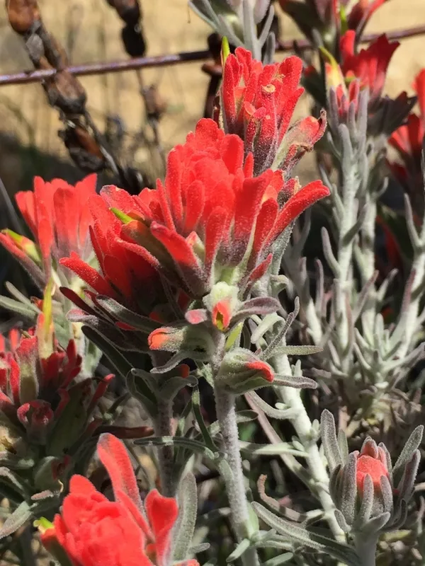
Felt Paintbrush Castilleja foliolosa -
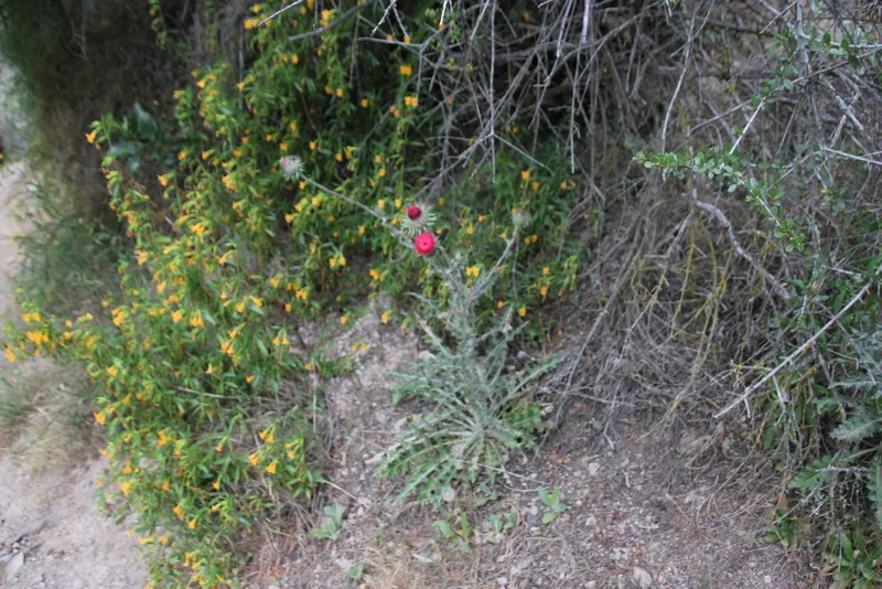
Cobwebby Thistle Cirsium occidentale -
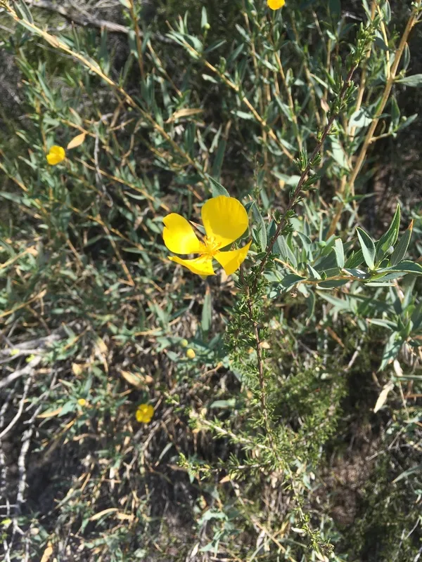
Bush Poppy Dendromecon rigida -
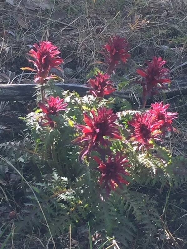
Warrior's Plume Pedicularis densiflora -
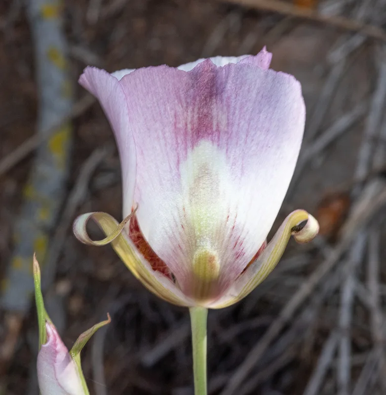
Butterfly Mariposa Lily Calochortus venustus
Field Notes · Volcanic lens · Pinnacles National Park · 36.4863, −121.1711