The Petrified Forest
Petrified Forest National Park · Arizona, USA
Every trunk in this basin was carried by a river before it was ever turned to stone.
Also seen through Desert & Deep Time · all at Petrified Forest National Park →.
Why here
Nothing at the Petrified Forest looks like it has anything to do with water. The ground is bare clay and stone, cracked with drought, and the nearest live stream is a trickle you could step over. But every log scattered across these badlands got here because a river carried it, and every badland you’re standing in was cut by a river’s descendants doing the opposite job. Long before there were mountains to look at, a broad, slow river system crossed this basin, burying whole logs in mud thick enough to keep air and rot away long enough for groundwater to turn wood into stone. Then, much more recently, rain started taking the mud back, cutting gullies, sculpting the striped hills, and one drainage at a time, uncovering the very logs the old rivers had buried. This note follows water doing both jobs: first burying a forest, now slowly giving it back. Look closely at any badland slope and you can usually tell which stage you’re watching.
The story
The land came first, and it came twice. More than two hundred million years ago, a river system crossed this basin under a wetter, greener sky, carrying logs downstream and burying them fast enough in mud and ash that oxygen and rot lost the race. Groundwater loaded with dissolved silica moved in afterward and replaced the wood, cell by cell, with stone. The mud itself, later named the Chinle Formation, is a clay that swells when wet and shrinks when dry, exactly the kind of rock erosion works fastest on. So the second river story is still running: seasonal rain and snowmelt cut the soft clay into the banded, fluted badlands you see today, one gully at a time, and along the way they’ve started giving back what the first river buried.
Life here follows the water that’s left. Pronghorn and mule deer move through the grasslands between badland exposures, and ravens work the thermals over the cliffs. Spring brings a scatter of wildflowers to the flats, undependable from year to year the way desert blooms always are.
People built where the water was. The largest known archeological site in the park grew up along the Puerco River: a pueblo of more than a hundred rooms that reached its height around 1300. Today the same low ground still carries traffic east to west, an interstate, a rail line, and old Route 66, following the river’s path across the basin, the same route water always found easiest.
The sites
The river that buried a forest
Giant Logs Trailhead
34.8153, −109.8656
Giant Logs earns its name honestly: the trunks scattered here are some of the largest and most complete in the park, whole sections of tree still lying roughly where they came to rest. None of them grew anywhere near this spot. They were floated and stranded by a river system that crossed this basin long before badlands existed here, a slow-moving network of channels competent enough to carry entire logs and bury them fast in mud and volcanic ash. Speed mattered: a log that lingers exposed rots and scatters, but one buried quickly enough loses its air supply before it loses its shape, and holds that shape while groundwater loaded with dissolved silica works its way in and replaces wood, cell by cell, with stone. That’s why these trunks still show bark texture, growth rings, even insect damage from the living tree, all now rendered in mineral. Stand next to one of the larger logs and the scale argues for itself, this took a river with real carrying power, not a trickle. The same process happened to countless trees here; these are simply the ones broad and heavy enough that well over two hundred million years of erosion since hasn’t managed to break them down to rubble yet.
Walk the loop and find a trunk broken cleanly across its width rather than lengthwise. Petrified wood usually fractures like glass, across the grain, because stone doesn’t bend the way living wood does — count how many segments one original tree has split into, and you’re looking at how far a log has traveled without moving, just settling in place over time.
- AccessShort walk
- ExertionEasy
- TimeAn hour
Crystal Forest Viewpoint
34.8645, −109.7910
Crystal Forest is named for what’s inside the logs, not just their shape. As groundwater carried dissolved silica through buried wood, it didn’t just fill empty cells; under the right slow, steady conditions it grew actual quartz crystals inside cracks and hollows within the wood, sometimes stained purple or smoky by traces of other minerals carried in the same water. That coloring is a bonus of the same river-and-burial story told at every stop in the park: an ancient river system laid these logs down in a floodplain of mud and ash, and the silica-rich water that later moved through them came from that same waterlogged ground. What makes this stretch distinctive is how completely the mineral filled in, full crystal growth rather than a plain stone cast, which took patient, undisturbed groundwater working for a very long time. Walk the loop slowly and the light picks out the difference between a section of quietly gray, chalky stone and a section that catches and throws it back. Both are petrified wood. Only one had the right conditions to grow crystal.
Look at a broken log end for a patch that looks glassy or faceted rather than uniformly chalky — that’s where silica had room and time to grow as crystal rather than just fill space. Compare a few different logs along the loop; not every one crystallized the same way, and the differences tell you something about how each was buried.
- AccessShort walk
- ExertionEasy
- TimeAn hour
Jasper Forest Viewpoint
34.8889, −109.8075
From this overlook the badland slope below is scattered with logs lying loose on the surface, and that scattering is itself a story about erosion undoing burial. The mudstone that buried these trees is soft and prone to washing away fast, especially since it’s a clay that swells when wet and shrinks when dry, cracking itself apart with every cycle. Petrified wood, meanwhile, is just stone, as resistant to weather as anything else on this landscape. So as rain and runoff strip mudstone off the slope, logs that were sealed inside it for a couple hundred million years are left sitting exposed on top, freed but going nowhere, too heavy and too resistant to travel far once they’re out. Given enough time, even these logs eventually break down under sun and frost, so what you’re seeing at any one overlook is a snapshot: some logs freshly exhumed and still whole, others already crumbling into fragments and drifting downslope. The name comes from the reddish, patterned stone common among these particular logs, colored by the same mineral-laden water that turned wood to rock everywhere else in the park.
Scan the slope below for logs lying in short, broken rows rather than one continuous trunk. A log breaks into segments as it’s exposed, and gravity nudges the pieces slightly downhill from where they started — the more spread out a row looks, the longer that log has probably been sitting in the open.
- AccessDrive-up
- ExertionEasy
- TimeAn hour
The bridge still being cut
Agate Bridge Viewpoint
34.8926, −109.7940
Agate Bridge is the clearest single lesson in the park on how water works against stone. A petrified log lies here spanning a shallow wash, propped over open air on both ends rather than resting on solid ground the whole way across. It didn’t start that way; the log was buried flat, like every other log here, in the same ancient floodplain mud. But a channel eventually formed beneath it, one of the countless small drainages that carry runoff across these badlands after rain, and that channel simply kept cutting down and widening, the way any watercourse does when it hits softer ground. The mudstone underneath and around the log washed away. The log itself, being solid stone, didn’t. What’s left is a natural bridge, not built, just uncovered, by removing everything around a piece of rock too resistant to remove. It’s a small, legible version of the same argument every canyon in the world is having with the rock underneath it: water moves, stone waits, and given enough time the water usually finds a way through or under, leaving behind whatever the rock refused to give up.
Look at the gap under the log and follow the wash a short distance in either direction. It’s dry most days, but the smooth-cut walls and gravel floor are the signature of moving water — picture that channel running after a rain, doing in an afternoon the same kind of work that carved out the space under the bridge.
- AccessDrive-up
- ExertionEasy
- TimeAn hour
The badlands water left behind
Blue Mesa Viewpoint
34.9395, −109.7562
Blue Mesa is badlands at their most legible: bare, banded, blue-gray hills with almost nothing growing on them, cut by a dense network of small gullies fanning down every slope. The color and the bareness are both explained by the same rock. This is Chinle Formation mudstone, a clay-rich rock that swells when it takes on water and shrinks hard as it dries, a cycle that keeps the surface constantly cracking apart, too unstable for most plants to root in and too easily washed away to build up soil. That instability is exactly what makes badlands form fast, geologically speaking: instead of one channel doing the work, hundreds of small rills and gullies erode the slope more or less at once, carving the fluted, corrugated look you’re standing above. The blue-gray tone comes from minerals in the mudstone itself rather than anything growing or painted on. Every hard rain redraws this landscape a little, moving clay downhill grain by grain. What looks static from the overlook is one of the more actively changing landforms in the park, just changing too slowly, most days, for a visitor to see it happen.
Trace one of the narrow gullies from the rim down to where it disappears into a wash. Each one is a miniature river channel, cut by runoff after rain and following the same rules any river does — steepest path downhill, cutting fastest where the ground is softest — just built at a scale you can take in with a single glance.
- AccessDrive-up
- ExertionEasy
- TimeAn hour
The Tepees Viewpoint
34.9447, −109.7766
The Tepees are conical badland hills, each one built of the same mudstone as the rest of the park’s badlands but banded in distinct layers of red, gray, and lavender stacked like a layer cake. Those bands aren’t decoration; they’re separate deposits laid down at different times by the ancient river system that built this whole formation, each with its own mix of minerals and its own resistance to weather. Erosion works on all of them, but not equally: some bands hold together and stick out as small ledges, while others wash away faster and leave the slope stepped in. Given enough time and enough of that uneven erosion working on a rounded hill, you get a cone rather than a jagged badland ridge, because water cutting down from all sides at once smooths a hill toward that shape faster than it does anything angular. It’s the same rain and runoff carving Blue Mesa’s channels a short distance away, working a slightly different starting shape of rock into a distinctly different result, proof that badland erosion isn’t one uniform process, but depends heavily on exactly what layer of mud it’s cutting into that day.
Look closely at the color bands wrapping each cone and find one that forms a small ledge or shelf rather than a smooth slope. That’s a layer more resistant to water than the mud above and below it — trace it around the hill and watch a single band hold its line while the softer rock around it keeps eroding away.
- AccessDrive-up
- ExertionEasy
- TimeAn hour
Where the whole basin drains
Pintado Point
35.0815, −109.8016
Pintado Point looks north into the Painted Desert, the badland country that the northern end of this park spills into, and from up on the cliff edge the whole drainage pattern is visible at once: ridge after banded ridge, each one separated by a wash carrying runoff toward the Puerco River, which still crosses this basin today the way ancient rivers once did. It’s a useful place to see erosion’s shape rather than its detail, from the trailheads and lower viewpoints you can read individual logs and gullies, but from up here the pattern reads as a whole watershed still doing the same job it’s done for a very long time, cutting the basin down and carrying it away in pieces small enough to be invisible from this distance. The cliff itself is worth a look too. It’s the same resistant sandstone capping the softer mudstone underneath, which is why there’s an edge here at all rather than a smooth slope, sandstone holds its line while the badlands below it keep eroding back.
Watch the cliff face itself rather than the view beyond it. White-throated swifts and cliff swallows both work faces like this one, using cracks and pockets in the rock to nest — the same erosion carving the badlands below also opens up the ledges these birds need above.
- AccessDrive-up
- ExertionEasy
- TimeAn hour
Kachina Point
35.0845, −109.7881
Kachina Point sits on the same cliff edge as the other Painted Desert overlooks, and the view here makes a specific point about how that edge holds its line. A resistant caprock sits on top of much softer mudstone, and as rain and runoff eat away at the mudstone underneath, they eventually undercut the caprock enough that a slab breaks off and the cliff edge retreats a little, a slow process driven at its base by the same erosion carving every badland slope in view. Look along the base of the cliff for places where the rock steps back in a rough shelf rather than a clean vertical face: that shelf is usually where undercutting is actively happening, a few feet at a time, over stretches of time too long to watch directly. It’s a different scale of the same argument playing out at Agate Bridge, a few miles south, water removing soft rock from underneath something harder, until the harder rock has no choice but to give way too, just far more slowly up here than it did around one narrow petrified log.
Find a spot along the cliff base where the rock steps back into a shallow shelf rather than dropping straight down. That undercut shelf is where water is actively working beneath the resistant caprock — a small-scale preview of the next piece of cliff edge that will eventually break away.
- AccessDrive-up
- ExertionEasy
- TimeAn hour
When it's best
The badlands here are dry most of the year, but come in spring and you’ll usually find cooler days and nights still holding onto a hint of frost, with an occasional light rain that darkens the clay and sharpens the color bands for a day or two before it dries out again. That’s also when the erosion on display is most active — a modest wet spell does more visible carving than months of dry heat. By early summer the cliffs along the Painted Desert rim start drawing cliff swallows and white-throated swifts working the ledges, worth watching for at any of the overlooks. There’s no season here water fully sits out; even a dry, sun-baked visit is standing on ground still being cut, just more slowly than you can see.
Go deeper
The names behind what you saw: The mudstone underfoot and behind every overlook is the Chinle Formation, deposited by a river system a little over two hundred million years ago, in the Triassic period. Petrifaction — what turned buried wood to stone — is a mineral-replacement process called permineralization, in which dissolved silica fills and eventually replaces the wood’s original cell structure. The cliff-working birds at the Painted Desert overlooks are the white-throated swift (Aeronautes saxatalis) and the cliff swallow (Petrochelidon pyrrhonota).
To read next: - “Geology and paleontology of the Chinle Formation, Petrified Forest National Park and vicinity, Arizona” (1989) — the fullest account of the ancient river system that buried this forest and the Triassic life alongside it. - “Geologic Map of Petrified Forest National Park, Arizona” (University of Arizona, 2012) — for tracing exactly which rock unit sits under which overlook. - Wikipedia, “Petrified wood” — a plain explanation of how mineral-laden water turns buried wood to stone, cell by cell. - Wikipedia, “Petrified Forest National Park” — park-wide context, including how the Puerco River, an interstate, a rail line, and old Route 66 all still cross the basin along the same low ground. - Wikipedia, “Puerco Ruin and Petroglyphs” — the largest known archeological site in the park, built along the river that still drains these badlands.
The names behind what you saw
What lives here, and what it's called. Photographs from open collections — an aid to identification, not decoration.
-
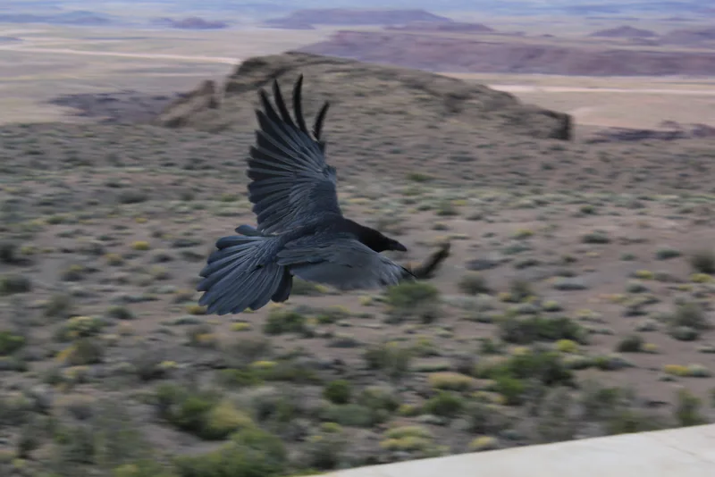
Common Raven Corvus corax -
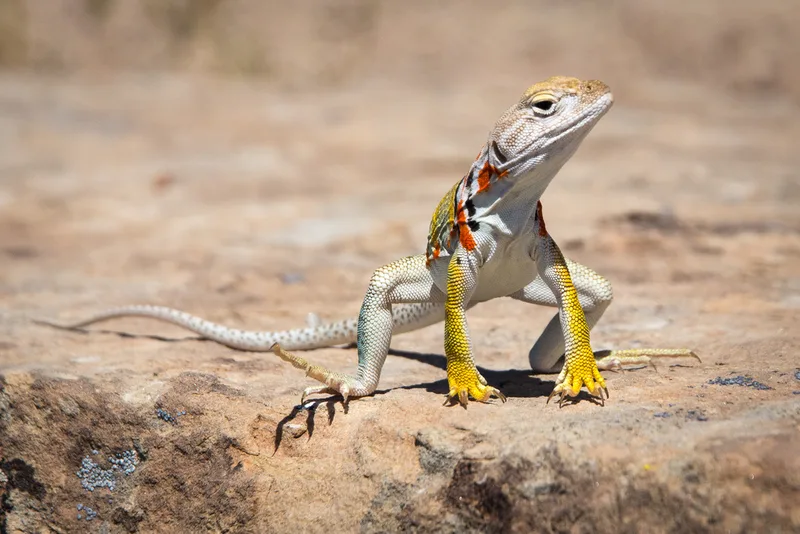
Eastern Collared Lizard Crotaphytus collaris -
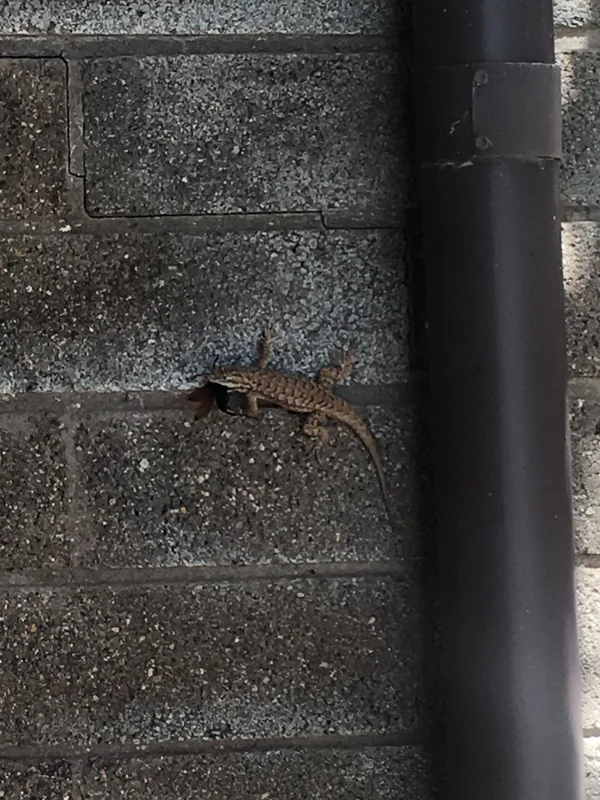
Plateau Fence Lizard Sceloporus tristichus -
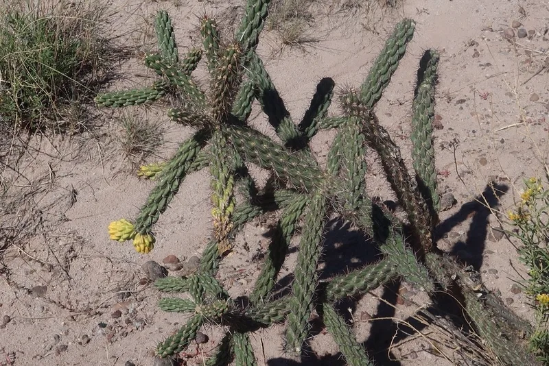
tree cholla Cylindropuntia imbricata -
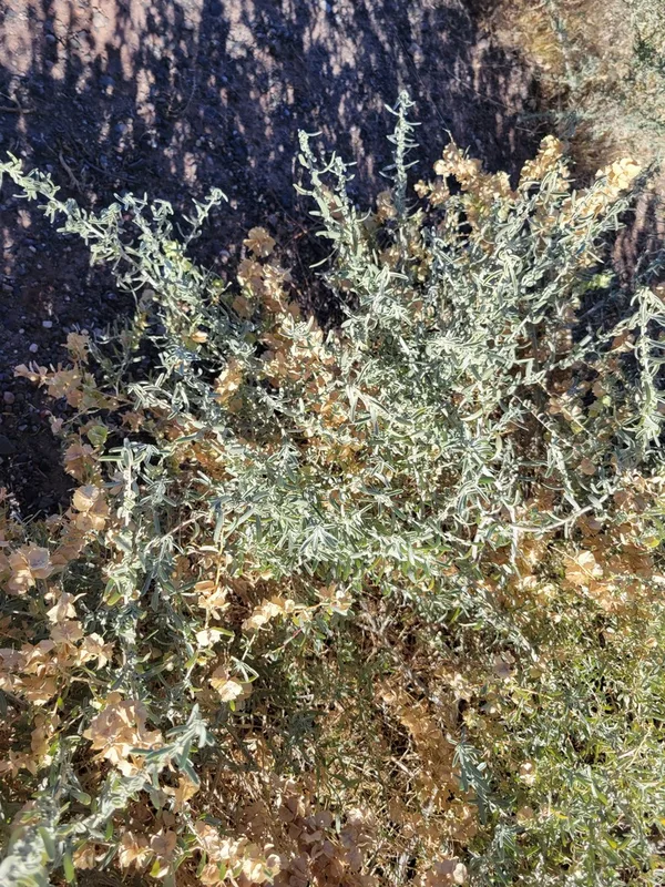
Fourwing Saltbush Atriplex canescens -
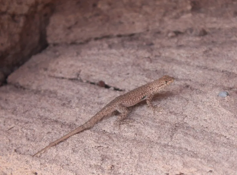
Common Side-blotched Lizard Uta stansburiana -
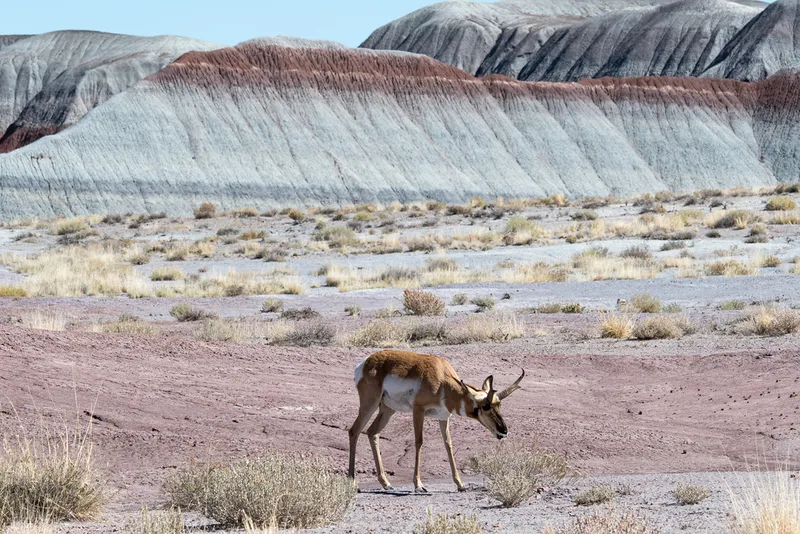
Pronghorn Antilocapra americana -
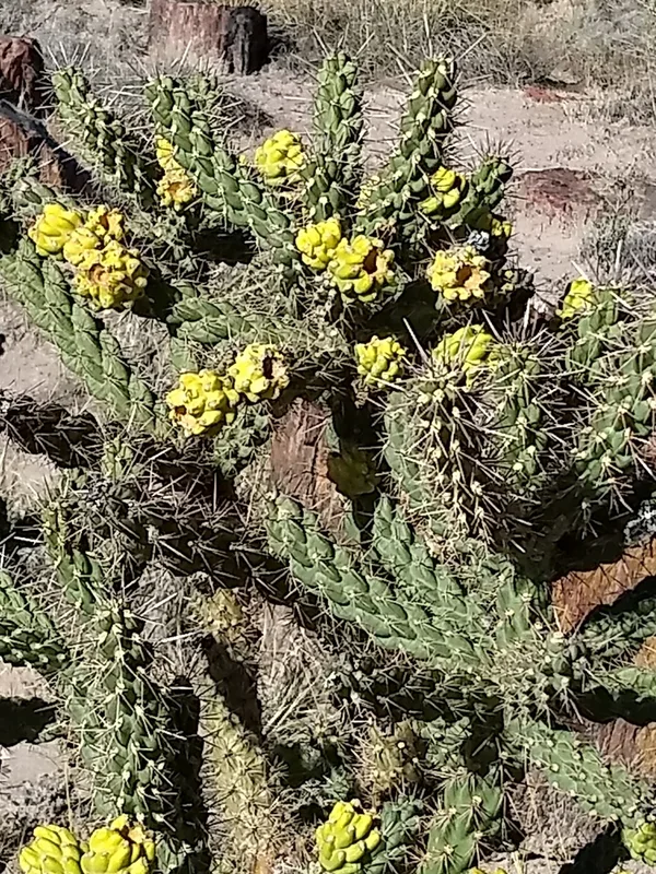
Whipple Cholla Cylindropuntia whipplei -
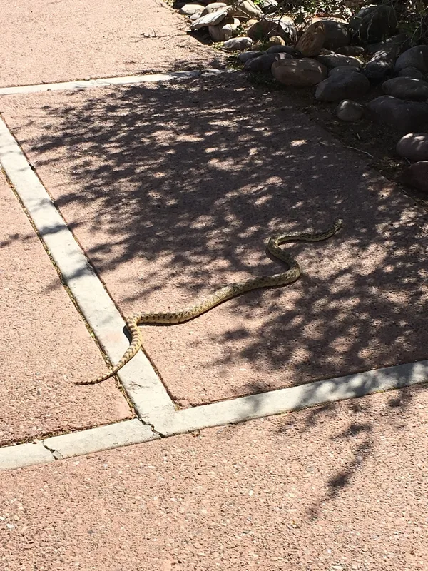
Gopher Snake Pituophis catenifer -
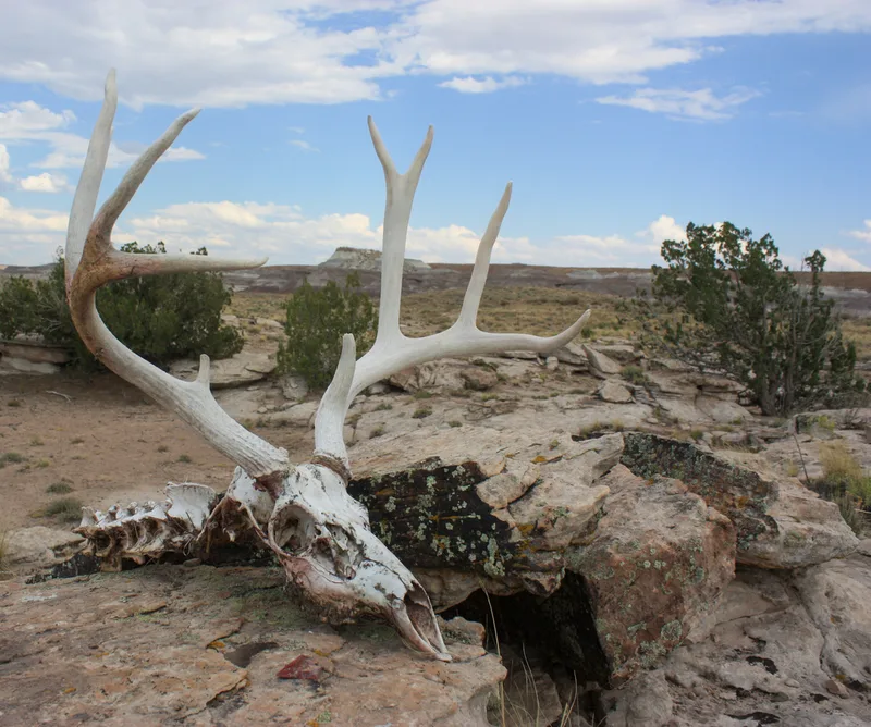
Mule Deer Odocoileus hemionus -
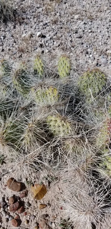
Plains Pricklypear Opuntia polyacantha -
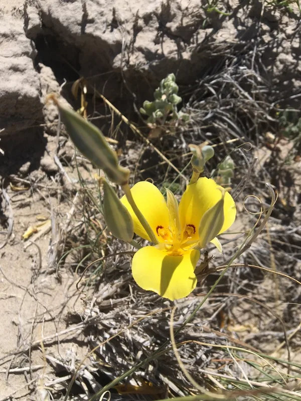
golden mariposa lily Calochortus aureus
Field Notes · Rivers & Canyons lens · Petrified Forest National Park · 34.9745, −109.7080