The Olympic Coast
Olympic National Park · Washington, USA
The forest begins where the sea has finished throwing its weather inland.
Also seen through Fog Coast · all at Olympic National Park →.
Why here
The Olympic Coast is a marine landscape with a forest behind it. Waves meet sedimentary rock, fog enters the trees, and the wet ground supports a living edge that keeps changing with tide and storm. The coast is not a strip separating two worlds. It is the place where they exchange moisture, drift, nutrients, and shelter. Walk from the forest trail to the beach and notice how the air changes before the view does. Banana slugs and sword ferns belong to the damp interior; sea stars and anemones belong to the rocks below the tide. Together they show why the sea keeps the land alive.
The sites
Forest to beach
Salt Spray Forest (Beach 3) Nature Trailhead
47.6414, −124.3849
Salt Spray Forest begins with the coast’s moisture before it reaches the open beach. The forest carries fog, rain, and salt on its leaves, while the trail eventually opens toward marine rock and moving water. Walk slowly and notice how the air changes under the trees. The coast is already present in the damp understory. Banana slugs and sword ferns belong to this sheltered side of the same exchange that produces surf and tide pools beyond it.
Look beneath the ferns for a Pacific banana slug, then listen for the sea beyond the trees. The forest floor and the beach are connected by the same wet air.
- AccessShort walk
- ExertionEasy
- TimeHalf a day
Eagle Point Trailhead
47.9319, −123.4113
Eagle Point is a high doorway into the coastal system. From the trail, the forest and exposed shore alternate, showing how quickly the land changes with wind and salt. The rock below is part of a marine sedimentary record, but the view is also a living map. Open points support seabirds and wave weather; sheltered folds carry trees and wet ground. The trailhead is a useful place to look for the transition rather than a single destination.
Find where taller forest gives way to wind-shaped vegetation. That edge marks the increasing reach of salt and ocean air.
- AccessShort walk
- ExertionModerate
- TimeHalf a day
Rock in the tide
Big Creek West Trailhead
47.4959, −123.2138
Big Creek West brings freshwater into the marine note. A creek carries the forest’s water toward the coast, joining the larger exchange between land and sea. Look at the ground beside the channel and compare it with the higher forest floor. Water makes a corridor of softer soil and denser growth, then continues toward the beach where tides take over the work. The creek is a small route through a large coastal system.
Follow the creek downhill as far as you can see. Its channel is a visible link between wet forest ground and the marine edge.
- AccessShort walk
- ExertionEasy
- TimeHalf a day
Boulder Creek / Olympic Hot Springs
47.9867, −123.6517
Boulder Creek keeps the coast’s water story inland. Warm ground, stream water, and forest create a different kind of wet habitat from the open beach, but the same principle holds: water makes places where life can gather. The creek’s route through rock is a reminder that the marine coast begins far from the visible tide line. Walk beside the water and watch how it sorts stone, soil, and leaf litter as it moves.
Find a place where the creek shifts from bedrock to gravel. The change in channel shows how moving water sorts the material it carries toward lower ground.
- AccessHalf-day hike
- ExertionModerate
- TimeA full day
Colonel Bob Peak Trailhead
47.4967, −123.7936
Colonel Bob Peak brings the high forest and marine horizon into one view. The mountain’s elevation changes the weather, but fog and rain still connect the summit country to the sea below. Look for the broad routes where water descends through the forest, then imagine the same material reaching the coast. The marine story is not confined to the surf. It begins in these wet slopes and travels downhill through creeks, soil, and sediment.
Trace a drainage from the high slope toward the lower country. The route shows how mountain water carries the forest’s material toward the marine edge.
- AccessHalf-day hike
- ExertionStrenuous
- TimeA full day
When it's best
The coast is wet and changeable in every season. Summer often gives longer breaks between rain, while winter brings stronger surf and a fuller sense of the ocean’s force. Low tide reveals more intertidal life, but the rocks can be slippery and exposed. Fog is part of the habitat rather than a problem to solve. Keep a sheltered forest walk in mind when the beach is rough.
Go deeper
The names behind what you saw. The coast includes Mesozoic-Tertiary marine rocks and Eocene-Oligocene sedimentary rocks. Life includes Pacific banana slug, Ariolimax columbianus, ochre sea star, Pisaster ochraceus, and giant green anemone, Anthopleura xanthogrammica.
To read next. - The Olympic Coast geological material — for the marine rocks and shore forms. - Coastal-forest ecology resources — for the connection between fog, forest, and tide pools.
The names behind what you saw
What lives here, and what it's called. Photographs from open collections — an aid to identification, not decoration.
-
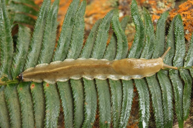
Pacific Banana Slug Ariolimax columbianus -
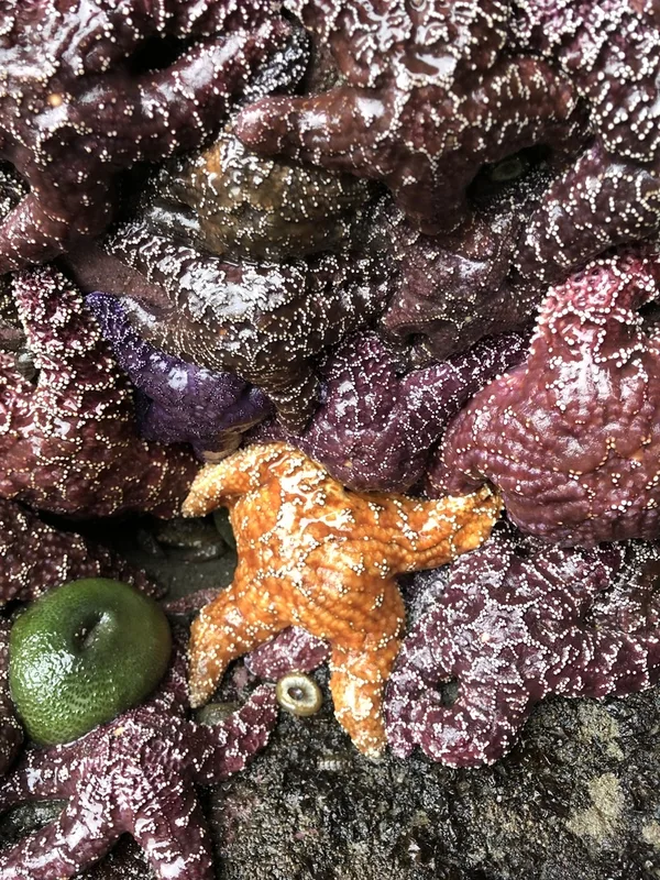
Ochre Sea Star Pisaster ochraceus -
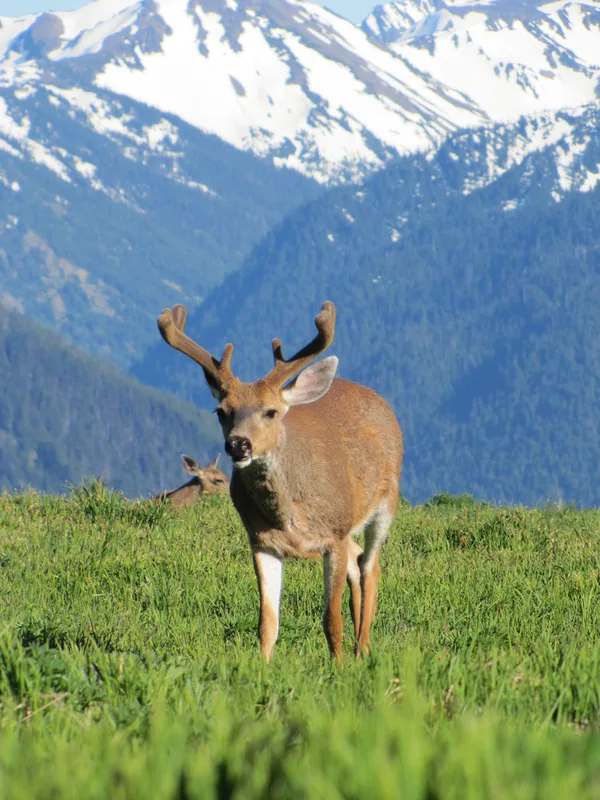
Mule Deer Odocoileus hemionus -
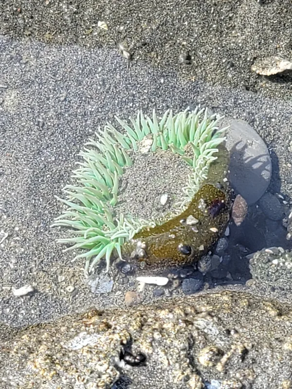
Giant Green Anemone Anthopleura xanthogrammica -
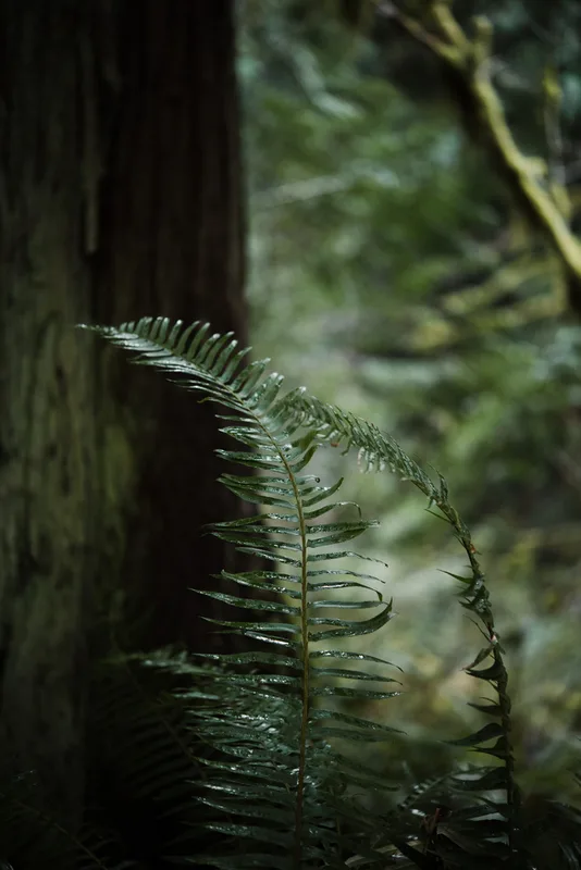
western sword fern Polystichum munitum -
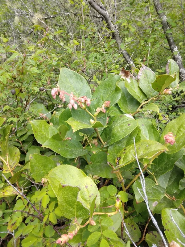
salal Gaultheria shallon -
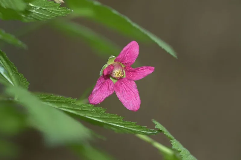
Salmonberry Rubus spectabilis -
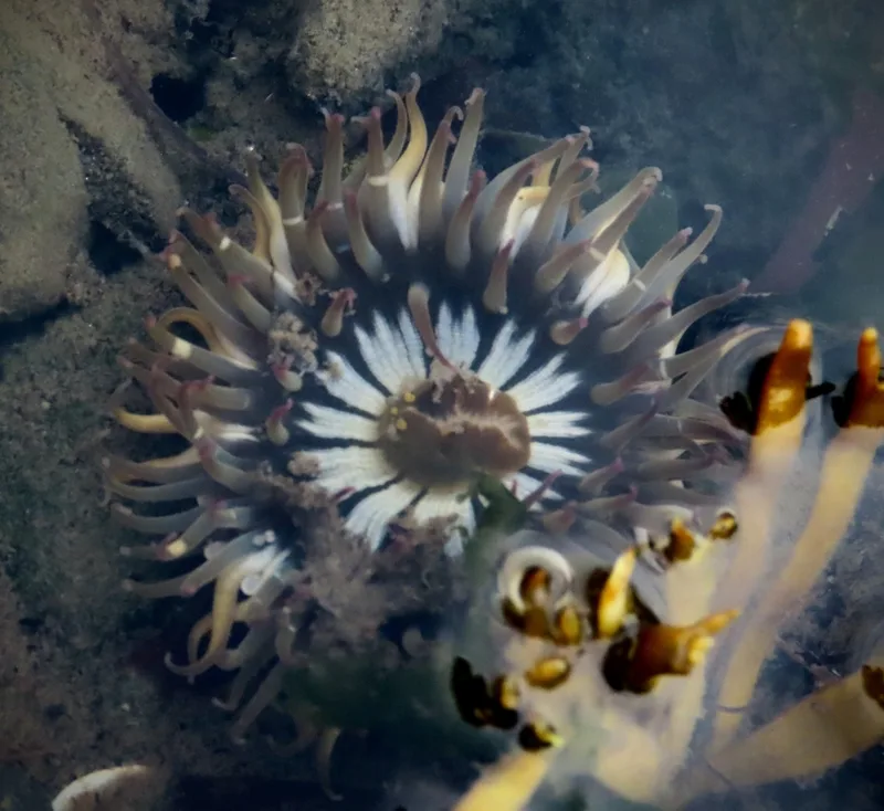
Aggregating Anemone Anthopleura elegantissima -
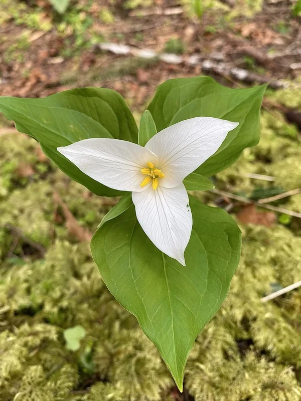
Pacific trillium Trillium ovatum -
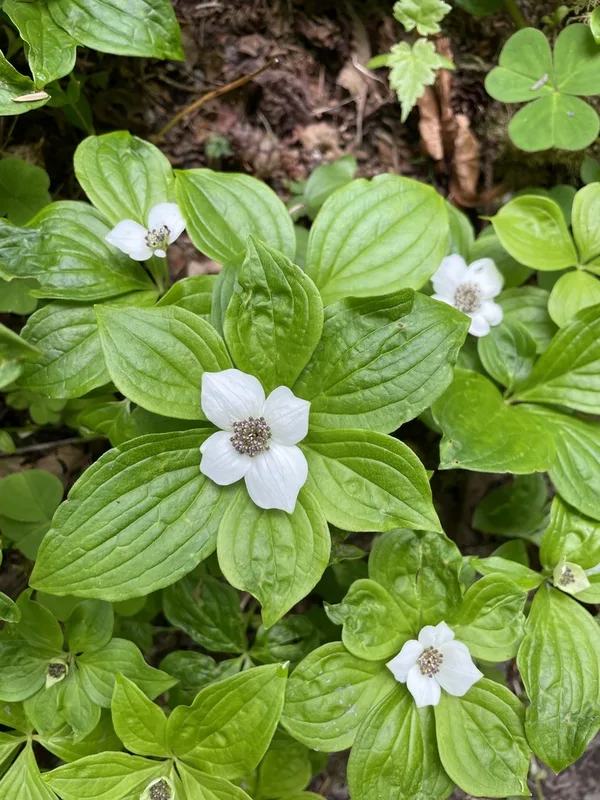
Western Bunchberry Cornus unalaschkensis -
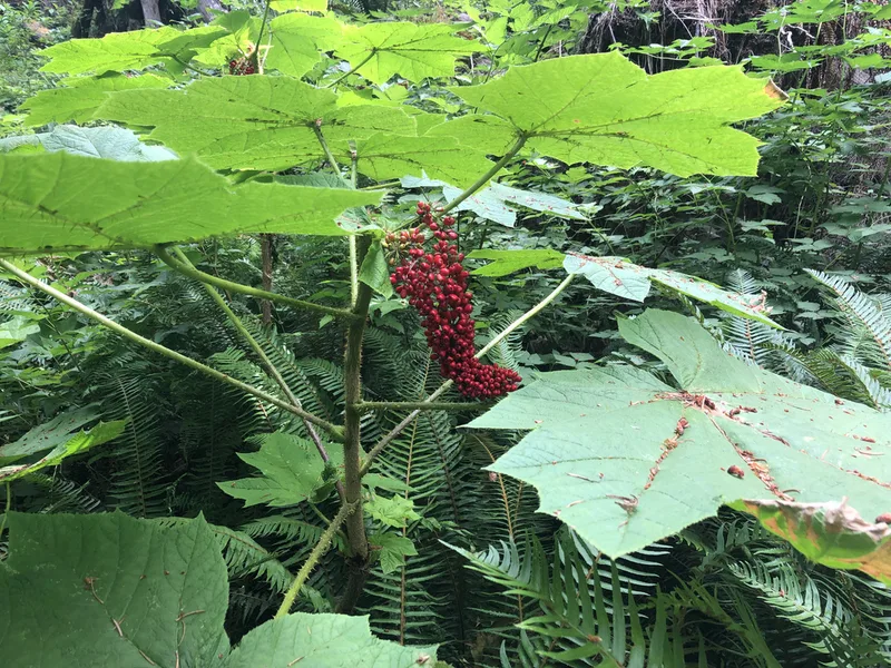
Devil's Club Oplopanax horridus -
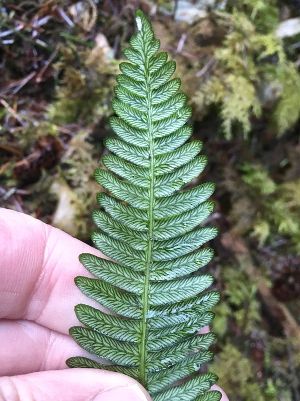
deer fern Struthiopteris spicant
Field Notes · Marine lens · Olympic National Park · 47.7865, −123.5360