The North Cascades
Between granite walls less than a hundred feet apart, the Skagit still finds its way through.
Also seen through Ice & Glaciers · all at Diablo Lake →.
Why here
Stand at the Diablo Lake Overlook and the water below does not look like a mountain lake. It glows a milky turquoise, the color of fine rock flour that glaciers upstream grind out of the mountains and the river carries down as a suspended cloud. The lake sits on the Skagit River, in a slot cut through some of the oldest rock in this range, a crystalline basement of gneiss that has been here since long before there were Cascades to drain. The canyon the river carved through that rock is so narrow that when engineers went looking for a place to dam it, they found granite walls less than a hundred feet apart, rising more than a hundred and fifty feet above the riverbed. They did not defeat the river so much as move into the exact groove it had already spent a very long time cutting. Everywhere you look here, water is still arguing with rock, through a spillway now instead of open air, and every site on this note is a place to watch a different round of that same old argument.
The story
Before there was a lake here, there was rock and a river. The gneiss in these canyon walls is metamorphic, older ground remade under heat and pressure long before the Cascades rose around it, and the river has been working it ever since, following whatever cracks the rock allowed until it had worn a canyon barely wide enough to stand across. Douglas-fir and vine maple now crowd the slopes above the water, holding what soil the canyon has managed to keep.
People came for the canyon’s narrowness, not its scenery. In the late 1920s, Seattle City Light built a company town here, Diablo, to house the crews pouring concrete into that hundred-foot gap in the granite. The dam went up between 1927 and 1930 and began generating power for the city in 1936; two more dams followed upstream and down, stacking reservoirs the length of the canyon. The arrangement holds, but the canyon still sets the terms: in 2023, a wildfire above Sourdough Mountain forced the evacuation of all three hydroelectric dams and closed the North Cascades Highway, a plain reminder of how exposed a river town built in a slot this narrow is when fire reaches it.
The sites
Where the river met solid rock
Diablo Lake Overlook
48.7098, −121.0972
This pull-off above Diablo Lake is the fastest way to see this note’s whole argument at once. Below you, the Skagit River pools into a reservoir the color of sea glass, an opaque, glowing turquoise that has nothing to do with a clear mountain lake and everything to do with fine rock flour, ground off the mountains upstream by ice and carried down suspended in the current. The lake sits in a canyon cut through some of the oldest rock in this range, a crystalline basement the river has been working since long before there were Cascades to drain. Below and behind you, the concrete of Diablo Dam sits in the same narrow slot the river carved on its own, the gorge here so tight that its granite walls run less than a hundred feet apart. Come for the color; stay to notice how little room the river ever needed to do this much work.
Look at the color of the water, not just its surface. On a bright day it reads almost artificial, a cloudy, glowing blue-green. That’s rock flour, fine silt ground by glaciers upstream and carried down still suspended; the more meltwater feeding the river, the thicker and brighter the color gets.
- AccessDrive-up
- ExertionEasy
- TimeAn hour
Diablo Dam
48.7141, −121.1320
Diablo Dam sits inside the actual gorge the Skagit River cut for itself: solid granite walls that rise about a hundred and sixty feet from the riverbed and, at their narrowest, come to less than a hundred feet apart. Engineers did not choose this spot for scenery. They chose it because the river had already done the hard part, wearing a slot narrow enough to dam cheaply and deep enough to hold a reservoir behind it. Construction ran from 1927 to 1930, and the dam has been generating power for Seattle since 1936, one of three built in sequence up this same canyon. Stand near the structure and it is worth remembering that concrete is the newest thing here by a wide margin; the granite it is wedged into has been in place since long before there were mountains around it to erode. The dam is a short chapter in a much longer argument between this river and this rock. It just happens to be the chapter with a building in it.
Find the point where the canyon walls come closest together above the dam. Rock this hard doesn’t yield easily — a river needs a very long time and a very specific weakness in the stone to cut a gap this narrow, which is exactly why it was worth damming here.
- AccessDrive-up
- ExertionEasy
- TimeAn hour
Peaks the river cut around
Ruby Mountain
48.6945, −121.0429
From the Diablo Lake Overlook, look south: Ruby Mountain rises directly out of the reservoir, climbing more than a mile of vertical relief in a couple of miles of horizontal distance. That kind of drop is what young, hard country looks like before water has had time to soften it. Ruby Mountain’s own rain and snowmelt split at its summit: the east side drains toward Ross Lake by way of Ruby Creek, the west side drains into Diablo Lake by way of Thunder Creek. Every drop that falls on this one mountain ends up in this note’s river one way or another, just by two different routes. You do not need to climb it to read the story; the shape alone tells you how much elevation the Skagit’s tributaries are cutting through, one small stream at a time.
Trace the mountain’s skyline down to the water and notice how little of it is gentle. A slope this steep, dropping straight into a lake, is a sign of how much relief this basin carries in a short distance.
- AccessDrive-up
- ExertionEasy
- TimeAn hour
Pinnacle Peak
48.6712, −121.1493
Pinnacle Peak rises straight out of Diablo Lake’s south shore, a wall of rock more remarkable for how fast it gains height above the water than for its total elevation. Like its neighbors, its runoff drains straight back into the lake and the river below it, a small, steep piece of the same drainage this whole note follows. The Pyramid Lake Trail starts near Diablo Dam and gives a real approach into this group of peaks, climbing through forest and eventually route-finding toward the glacier country above. You do not have to go far up it to feel the trade this canyon makes everywhere: flat ground is scarce, so the trail earns elevation quickly, and the reward is a widening view back down onto the lake and the dam that backs it up. Peaks like this one are the unglamorous half of a river’s story; they are not the water, but they are the reason the water has anywhere steep to fall from.
From the Pyramid Lake trailhead, look up at how abruptly the slope rises above the parking area. Note where the forest thins to bare rock, a visible marker of just how steep this terrain gets above the lake.
- AccessHalf-day hike
- ExertionStrenuous
- TimeHalf a day
Paul Bunyans Stump
48.6662, −121.1498
Paul Bunyans Stump shares the same steep rise as its neighbor Pinnacle Peak, climbing out of Diablo Lake as part of the same chain of summits that runs south toward better-known climbing country. Its name is local color, but its position is the point: it is another piece of evidence for how much elevation the peaks around this lake carry above the water, and how directly their runoff still feeds the Skagit. Seen from across the lake, it reads as one more tooth in a skyline shaped less by any single event than by a long argument between hard rock and moving water, every stream on its flank still cutting, however slowly. This is not a site to visit up close so much as one to read from a distance, ideally paired with Pinnacle Peak and Ruby Mountain, so the shape of the whole basin comes into view at once: a lake pinched between walls this steep on every side.
Pick out Paul Bunyans Stump on the skyline and compare its slope to the gentler ridge lines farther from the lake. The steepest ground is always closest to the water.
- AccessDrive-up
- ExertionEasy
- TimeAn hour
Water held back, water still working
Ross Dam
48.7318, −121.0679
Ross Dam is a concrete arch rising well over five hundred feet above the Skagit River, and it backs up a reservoir long enough to reach north across the Canadian border. Where Diablo Dam sits wedged into a narrow granite gorge, Ross Dam holds back a much longer, gentler stretch of the river, proof that this canyon does not have one character but several, tight in places and broad in others, depending on what the river found to cut through. Ross Lake is bordered on both sides by protected wilderness, wild country running right down to the shoreline even with the dam at its foot. Standing here, you are looking at the upstream end of a chain of three reservoirs that together have replaced free-flowing river with slack water for a long stretch of the Skagit’s course, the clearest place in this note to see how completely people have answered the river’s argument, at least for now.
Look at how the water sits still above the dam compared with any stretch of river you’ve seen below it. A reservoir has no current worth mentioning; the difference in surface texture, glassy above and moving below, is the plainest sign you’ll find of where a dam starts and stops a river’s work.
- AccessDrive-up
- ExertionEasy
- TimeAn hour
When it's best
This is high, glacier-fed country, and the water tells you more about the season than the calendar does. Through the warmer months, meltwater off the surrounding peaks keeps the Skagit running high and carries the most rock flour, so the lake’s turquoise runs deepest and cloudiest; later in the year the color fades toward an ordinary green-blue. Snow lingers late on the approaches to peaks like Pinnacle Peak, so an early-season visit favors the lake and overlooks over a summit push. Nights still drop near freezing into spring, so dress for a mountain canyon, not a valley. The overlooks and dams reward any season; the high peaks are more of a summer proposition.
Go deeper
The pale, glowing blue of the lake is rock flour: fine glacial silt, ground by ice and carried suspended in meltwater, sometimes called glacial milk. The oldest rock in these canyon walls belongs to a body of Precambrian-to-Phanerozoic crystalline metamorphic rock, a paragneiss and metavolcanic gneiss mapped as part of the Manning Park stratigraphic column.
The formal literature on file for this exact stretch of river does not hold up under a close look — the one candidate on record turns out to describe a different Diablo, in Oregon — so there is no citation to hand off here. In its place, a few search terms worth following on your own, each grounded in something this note already showed you:
- Skagit River Hydroelectric Project — the umbrella name for the three dams on this stretch of the Skagit, including Diablo and Ross; the fullest account of how and why this stretch got dammed.
- Rock flour (glacial flour) — the general mechanism behind the lake’s color, useful for comparing Diablo Lake to any other glacier-fed reservoir you visit.
- Manning Park stratigraphic column (Macrostrat col. 1451) — the geologic record behind the “oldest rock” claim, for anyone who wants the full age range and rock types in one place.
- Sourdough Fire (2023) — a recent, well-documented case study in how fire behaves in a canyon this narrow, and how exposed the hydroelectric infrastructure is to it.
The names behind what you saw
What lives here, and what it's called. Photographs from open collections — an aid to identification, not decoration.
-
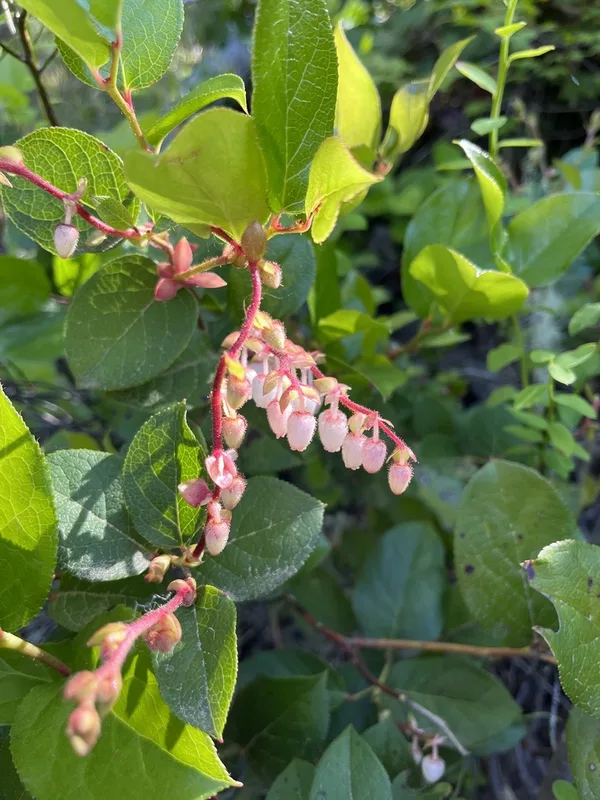
salal Gaultheria shallon -
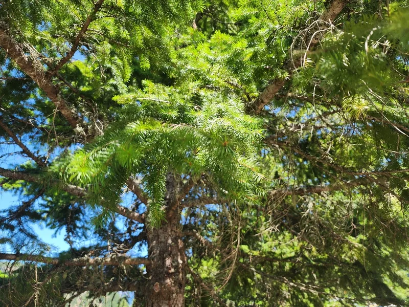
Douglas-fir Pseudotsuga menziesii -

Vine Maple Acer circinatum -
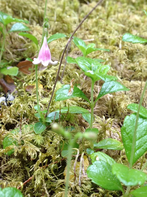
Twinflower Linnaea borealis -
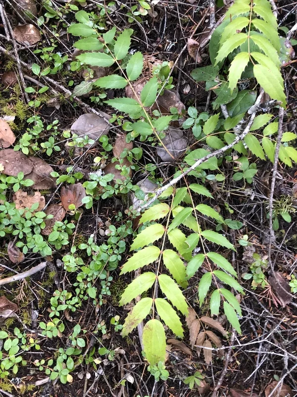
Cascade Oregon-grape Berberis nervosa -
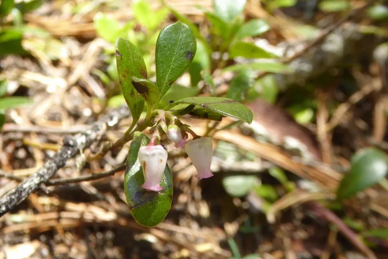
bearberry Arctostaphylos uva-ursi -
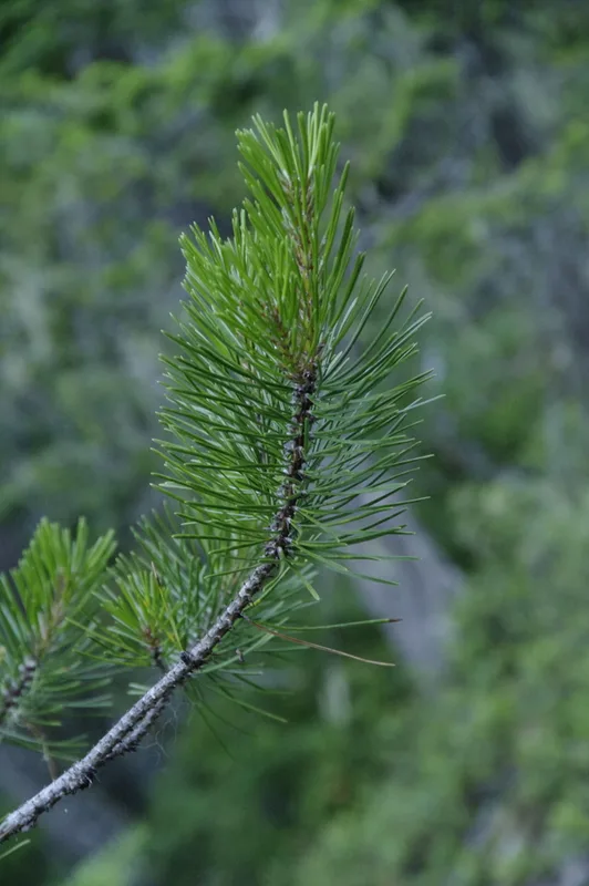
lodgepole pine Pinus contorta -
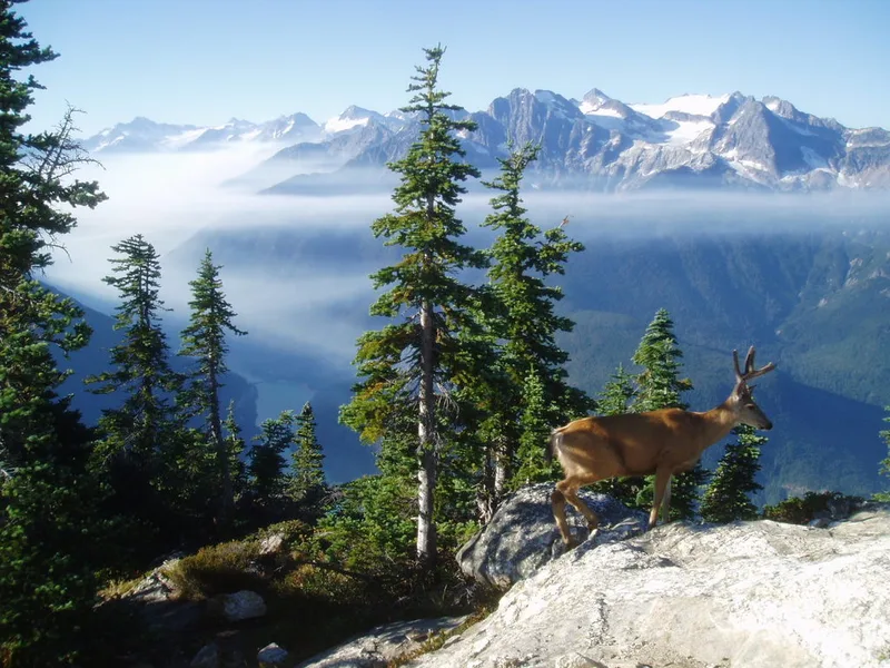
Mule Deer Odocoileus hemionus -
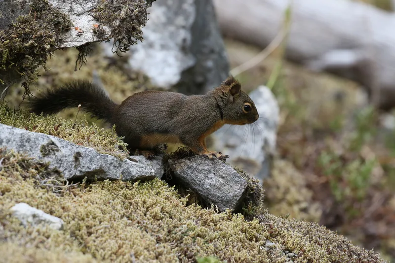
Douglas's Squirrel Tamiasciurus douglasii -
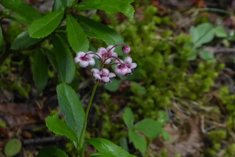
pipsissewa Chimaphila umbellata -
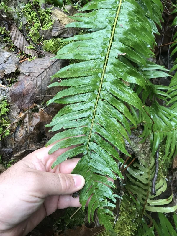
western sword fern Polystichum munitum -
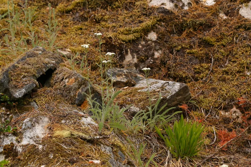
common yarrow Achillea millefolium
Field Notes · Rivers & Canyons lens · Diablo Lake · 48.6990, −121.0964