The North Cascades
The green in the water is not the sky. It is the mountains themselves, ground to powder and carried down by the ice.
Also seen through Rivers & Canyons · all at Diablo Lake →.
Why here
The water is the wrong color for water. On a bright day Diablo Lake glows a milky jade, far greener than any lake should be, and the sky has nothing to do with it. The color is rock. High in the peaks above, ice still grinds against stone and turns it to a powder so fine it never sinks. Meltwater carries that powder down into the lake, where it hangs suspended and throws the light back green. The lake is not reflecting a color — it is full of the mountains, ground fine.
The same ice cut the shape you are standing in: a deep, steep-walled trough of hard old rock, its walls climbing thousands of feet straight from the water. Every feature here follows from that patient, heavy work — the color of the lake, the sheerness of the walls, the narrow rock slot that let engineers plug the river with a single wall of concrete. Come to read the two things ice leaves behind: the shape it carves, and the powder it is still making.
The story
Start with the ice. Long before there was a lake here, glaciers filled this valley to its rim and ground downward through old, hard crystalline rock, cutting a trough so deep and steep that the peaks now rise thousands of feet straight from the waterline in the space of a mile or two. When the ice drew back into the high country, it left that narrow slot behind, with a river running down its floor.
Then came the engineers. In the late 1920s, Seattle City Light began building dams on the upper Skagit to help power a distant city, and the glacier’s work made the job easier: at Diablo Canyon the rock walls stand barely a hundred feet apart, a natural gate the builders had only to close. Diablo Dam went up between 1927 and 1930, and a company town, Diablo, was built to house the crews. The reservoirs rose behind the concrete and drowned the old glacial reaches of the river; upstream, another dam backed water some twenty miles north into Canada.
The ice never entirely left. It still clings to the high peaks above the lake, still grinding, still sending down the fine powder that keeps the water its improbable green. In 2023 a lightning fire near Sourdough Mountain closed the road and emptied the dam towns for a season — a reminder that this remains rough, unfinished country, its shape and its color both handed down by the ice.
The sites
The color, made of rock
Diablo Lake Overlook
48.7098, −121.0972
This pullout on the highway is the front-row seat, set on the flank of Ruby Mountain with the whole reservoir spread out below. It is the easiest place anywhere to meet the color head-on and understand it. The lake sits at around twelve hundred feet, ringed by peaks that climb thousands of feet on every side, and its surface can range from pale milk to deep jade depending on the light. That range is the tell. The green is not a pigment dissolved in the water and not the sky reflected off it — it is sunlight scattering off countless grains of rock, ground so fine by glaciers that they never settle out. On a clear day the color is almost too much to believe; under heavy cloud the same water goes gray. Nothing about the lake has changed but the light it has to work with.
From the railing, find a stretch of deep, open water in full sun, then look at a shaded inlet close to shore. The bright jade and the dull gray are the same water — the color is sunlight bouncing off billions of grains of glacier-ground rock too fine to sink, so it blazes in the sun and dies in shadow. If the day is overcast, hold the picture in your mind and come back when it clears.
- AccessDrive-up
- ExertionEasy
- TimeAn hour
The narrow slots the ice cut
Diablo Dam
48.7141, −121.1320
The road crosses the Skagit here on the crest of Diablo Dam, and the setting explains why a dam could be built at all. The builders drove it into Diablo Canyon, a gorge of hard, ancient rock whose vertical walls stand barely a hundred feet apart and rise well over a hundred feet from the old riverbed. Work began in 1927 and the dam was closed by 1930, though it did not start making power until several years later. A slot that narrow and that sheer is not the ordinary work of a river, which tends to widen and wander as it cuts. It is the signature of ice: a glacier filling the valley and grinding straight down through hard rock leaves a steep, narrow trench behind. The engineers found the hard part already done for them — all they had to do was close a gap the glacier had cut and walled in solid stone.
Standing on the dam, look at how tightly the rock walls squeeze in on either side of the river. Ask yourself what could cut a slot this deep yet this narrow — a river left to itself would have opened it wider. This is a glacier’s trench: ice grinding straight down through hard rock, leaving walls too steep and close for water to have made alone.
- AccessDrive-up
- ExertionEasy
- TimeAn hour
Ross Dam
48.7318, −121.0679
A trail drops off the highway to the foot of Ross Dam, a tall, thin curve of concrete that holds back Ross Lake — a reservoir that runs some twenty miles north, all the way into British Columbia. The walk down and back is the price of admission, and it puts you inside the glacier’s trough rather than looking down at it. What the reservoir floods is another deep, straight reach of the Skagit, cut by the same ice that shaped the lake below. The higher and farther upstream you go here, the more plainly you are traveling up the inside of a valley a glacier plowed — long, straight, and steep-walled, the opposite of the meandering course a river carves on its own. The dam is young; the shape of the canyon it fills is old, and the ice that made it is only just out of sight in the peaks.
From the trail above the water, follow the lake north with your eye and notice how straight and parallel the walls run. Rivers wander; glaciers plow dead straight. That long, ruler-straight reach between steep walls is the fingerprint of ice that once filled this valley to the brim and scraped its sides clean.
- AccessShort walk
- ExertionModerate
- TimeHalf a day
The walls, and the ice still on them
Ruby Mountain
48.6945, −121.0429
Ruby Mountain is the great wall on the east side of the lake; the highway overlook sits right at its foot. From the water its summit stands more than six thousand feet up, and it reaches that height in only about two miles — a rise so steep it reads as a wall rather than a slope. The mountain also sits on a divide: rain and snowmelt off its east side run to Ross Lake by one creek, while its west side drains straight down to Diablo Lake by another. You do not need to climb it to read it, and climbing it is a serious, route-finding undertaking best left to those equipped for it. The lesson is in the steepness. Slopes this abrupt are not the patient work of streams; they are the over-steepened walls a glacier leaves when it grinds down a valley floor, undercuts the sides, and then melts away, leaving the rock standing far too steep to be the work of water.
From the overlook at its foot, tip your head back and take in how fast Ruby Mountain climbs out of the lake — thousands of feet in the length of a short walk. A wall this steep is not carved by streams. It is the over-steepened side of a valley a glacier ground down and then abandoned, left standing far steeper than running water could ever cut it.
- AccessExpedition
- ExertionStrenuous
- TimeWorth two days
Pinnacle Peak
48.6712, −121.1493
Pinnacle Peak is one of the sharp summits that rise almost straight out of the lake on its south side, notable less for its height than for how abruptly it stands above everything around it. The way up begins near Diablo Dam and climbs a steep spur toward Colonial Glacier — a patch of living ice still tucked in the high rock. Reaching the ice is real mountaineering — steep, trackless, and only for those with the skills and gear for it — but it closes the loop the whole note has been drawing. Everything you saw at the water’s edge, every shade of impossible green, begins as stone under a glacier that is still slowly, patiently at work in these peaks.
If you make the climb toward Colonial Glacier, kneel where a meltwater stream runs out from under the ice and look closely at the water. It comes out cloudy, almost milky — that is rock flour, freshly ground, before it has traveled anywhere. Let a little settle in your cupped hand; the fine grit left behind is mountain on its way to becoming the color of the lake.
- AccessExpedition
- ExertionStrenuous
- TimeWorth two days
Paul Bunyans Stump
48.6662, −121.1498
Paul Bunyans Stump is the blunt, flat-topped tower on the ridgeline south of the lake, its odd name a bit of local humor for a summit shaped like a giant’s leftover stump. Like its neighbors, it stands almost directly above the water, part of the chain of peaks that walls the lake in on that side. What is worth noticing is the near-total absence of anything between the summits and the lake — no gentle foothills, no long ramp of debris, just rock dropping toward water. That is how a filled valley looks after the ice leaves. A glacier thick enough to reach these heights scours the walls clean as it moves, and when it melts the peaks are left standing right at the shoreline, with nothing to soften the drop. Reaching the summit itself is a climber’s project; the point it makes can be read from the lake or the road below.
From the water or the highway, pick out the blunt, flat-topped tower named for a giant’s stump, then look at what lies between it and the lake. There is almost nothing — the peak stands nearly at the shoreline. Ice fills a valley to the brim and scrapes its walls bare, so when it melts the summits are left rising straight out of the water, foothills and all ground away.
- AccessExpedition
- ExertionStrenuous
- TimeWorth two days
When it's best
The color is the whole point, and it is a warm-season thing. Rock flour reaches the lake in meltwater, so the green runs richest through summer and into early fall, when the ice above is melting hardest and the water is thick with fresh-ground stone; it needs sun to show, and goes flat gray under cloud. Summer is also when the high country opens up — even in spring, nights here still drop to around freezing, and snow lingers late on the peaks. Late summer can bring wildfire smoke to these valleys, as a lightning fire near Sourdough Mountain did in 2023. The forest along the water stays green and quiet in any season, but come in summer if you want the lake at its most unlikely.
Go deeper
The names behind what you saw. The turquoise is glacial rock flour — bedrock ground to a silt so fine it stays suspended in the meltwater, sometimes called glacial milk. The “solid granite” the dam builders describe is mapped as much older crystalline metamorphic rock, paragneiss and metavolcanic gneiss. Among the plants along the shore are Douglas-fir (Pseudotsuga menziesii), salal (Gaultheria shallon), vine maple (Acer circinatum), and western sword fern (Polystichum munitum).
To read next. The automated source search turned up little that speaks directly to this particular place — the one geologic map it surfaced is for a different Diablo, far away in Oregon, and does not belong here. So the honest next steps are searches rather than a reading list: look up glacial rock flour for why the water is green; and the Skagit River Hydroelectric Project for how Seattle came to build three dams inside a glacier’s canyon.
The names behind what you saw
What lives here, and what it's called. Photographs from open collections — an aid to identification, not decoration.
-
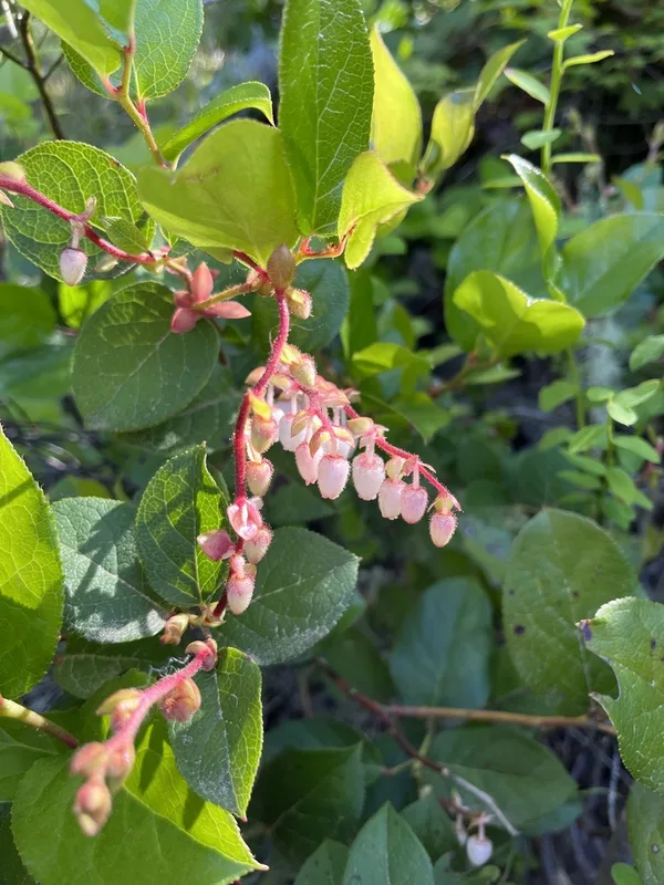
salal Gaultheria shallon -
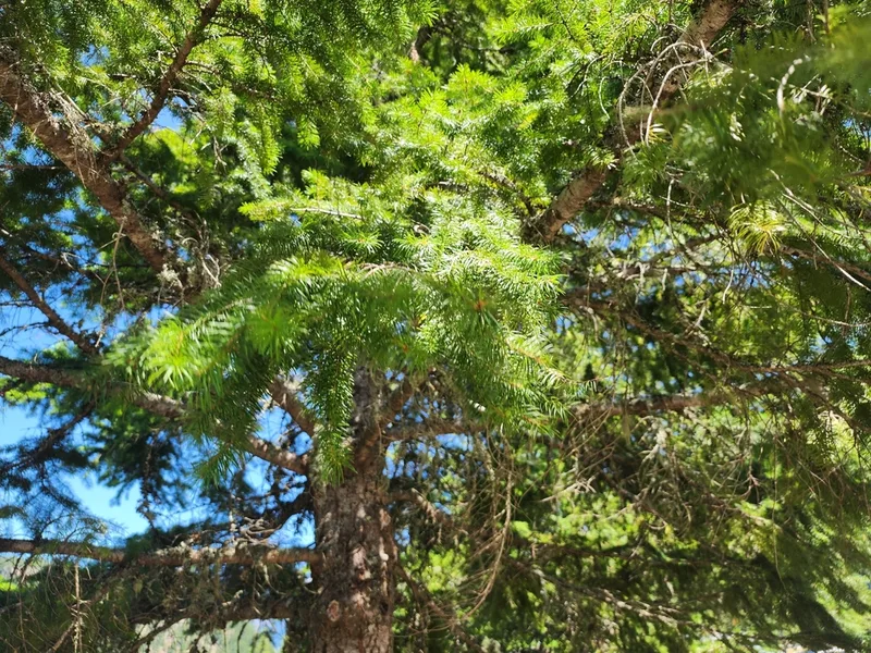
Douglas-fir Pseudotsuga menziesii -
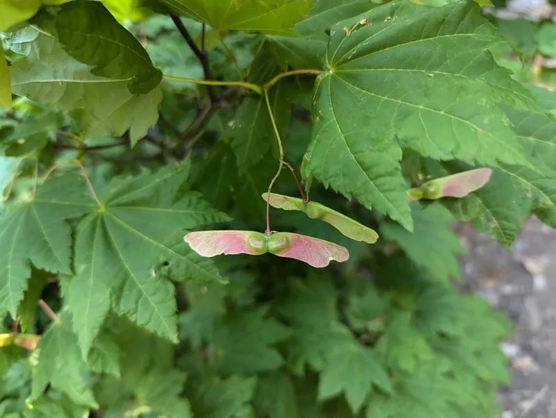
Vine Maple Acer circinatum -
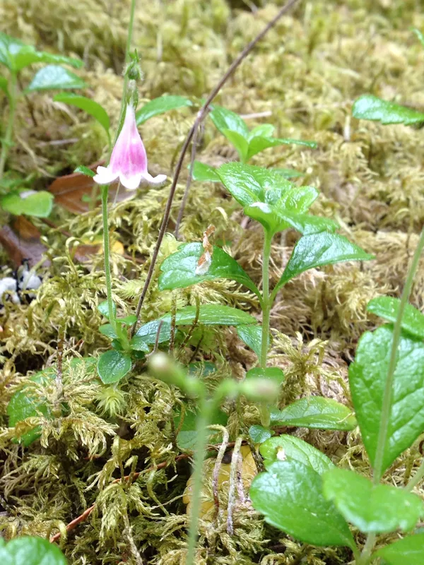
Twinflower Linnaea borealis -
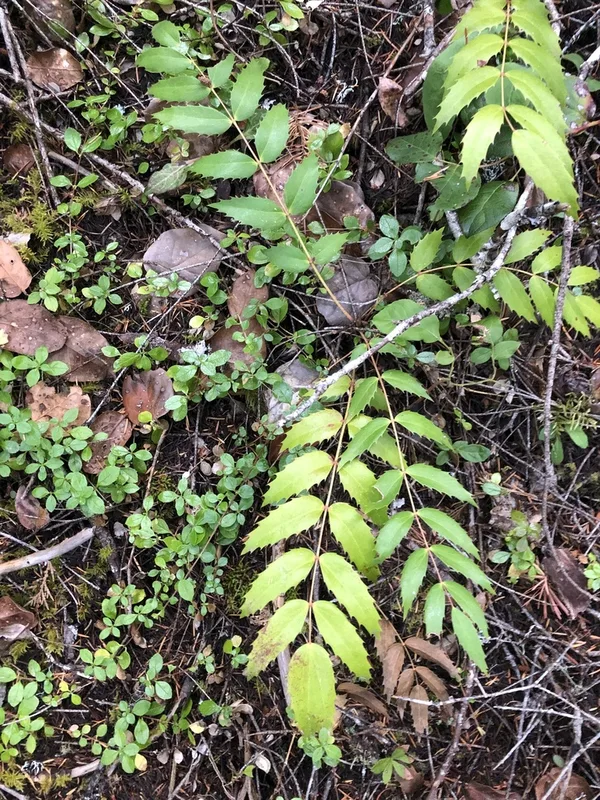
Cascade Oregon-grape Berberis nervosa -
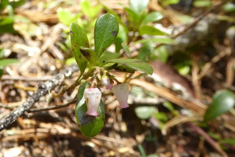
bearberry Arctostaphylos uva-ursi -
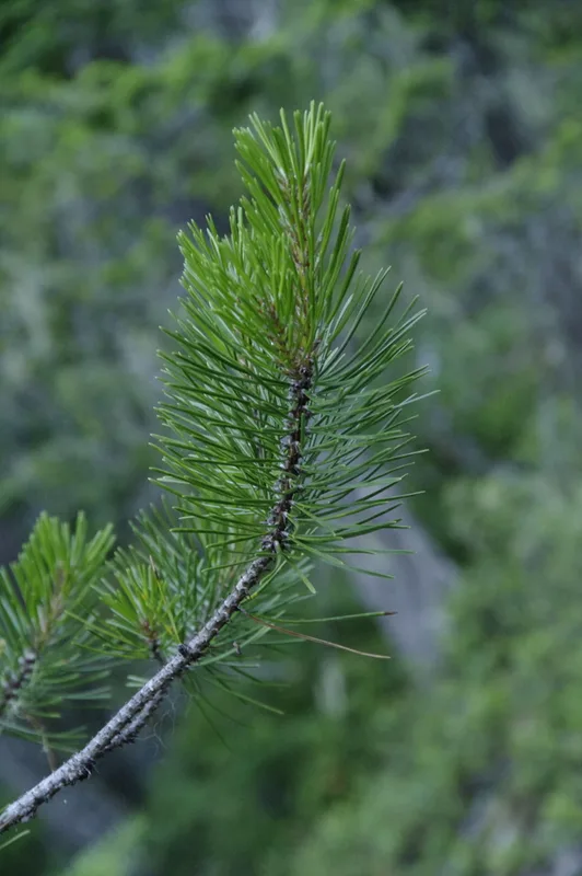
lodgepole pine Pinus contorta -
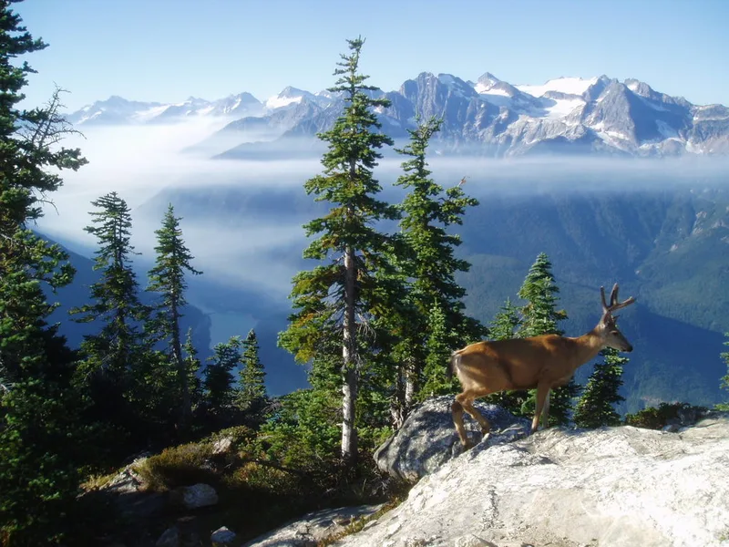
Mule Deer Odocoileus hemionus -
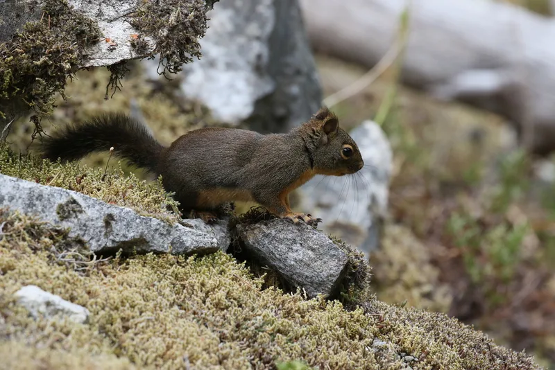
Douglas's Squirrel Tamiasciurus douglasii -
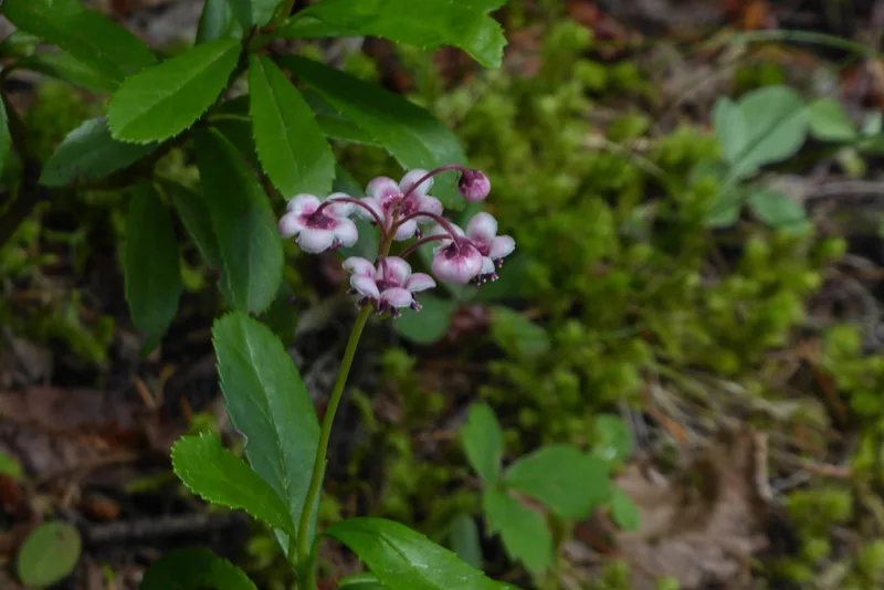
pipsissewa Chimaphila umbellata -
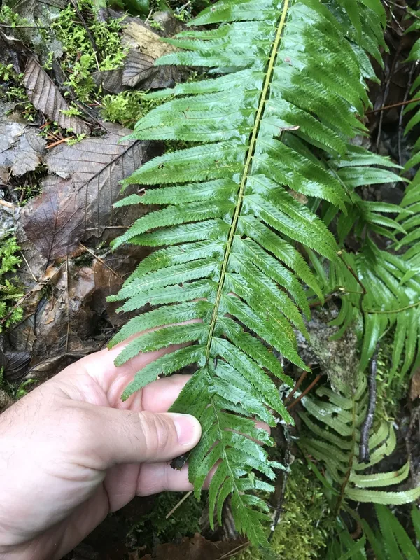
western sword fern Polystichum munitum -
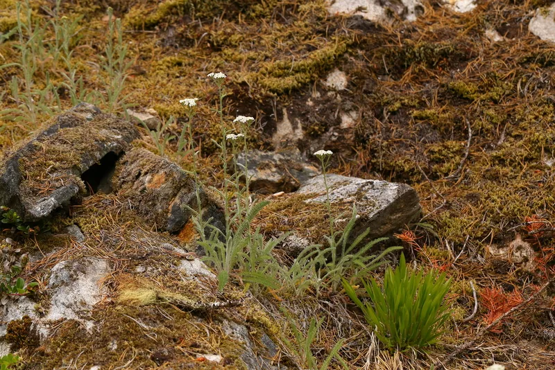
common yarrow Achillea millefolium
Field Notes · Ice & Glaciers lens · Diablo Lake · 48.6990, −121.0964