Natural Bridges
Natural Bridges National Monument · Utah, USA
The bridges did not appear all at once. Somewhere beneath each one, water is still working the shortcut a little wider.
Also seen through Night Sky · all at Natural Bridges National Monument →.
Why here
Most rock erodes too slowly for anyone to watch — a grain blown loose here, a flake of frost-cracked stone there, all of it invisible inside one human lifetime. Natural Bridges is the rare place where you can watch the process caught in the act, three times over. Two desert canyons cut down through a stack of ancient sand turned to stone, and along the way each one found a shortcut: a narrow neck of rock, worn thin from both sides at once by a looping stream, until floodwater finally broke straight through instead of going the long way around. What’s left standing afterward is a bridge — a true hole punched clear through solid rock by moving water, not an arch shaped mainly by wind and frost. The monument holds three of these, each one a different stage of the same unfinished argument: one worn down to a ribbon, the others still thick with rock the water hasn’t gotten to yet. The streams that cut them are still down there, in the same canyons, still working. This note is your look at rock in the middle of losing an argument it has been having for a very long time.
The story
Long before there were canyons here, this was flat, low ground on a shifting desert coast — layer after layer of sand pressed by time into pale stone, with the occasional thinner band of mud or quiet-water limestone marking where the coast briefly crept back in. That stone sat mostly undisturbed for an immense stretch of time, until two washes found their way across it and began cutting down. Where a stream looped hard enough to nearly meet itself again, it eventually punched straight through the last thin wall of rock separating one loop from the next, abandoning the long way around for the shortcut. Three of those punched-through walls still stand today as bridges, at different stages of being slowly worn away.
Little softens this country, but a few things hold on. Tough, drought-built shrubs and stunted pinyon and juniper trees crowd the rims where there’s a little more soil and shade, and small, low cactus find enough purchase in bare rock to flower most years. Lizards work the sunny ledges by day, quick enough to vanish the moment a shadow crosses them.
People made a home in this canyon country too, well before any of it was set aside as a monument — a small stone structure still stands tucked into one canyon wall. The record here is quiet on exactly who built it or when, and this note won’t guess past that. What the rock does say plainly is that human time is the newest, thinnest layer in a place built mostly out of far older ones.
The sites
Two bridges, two points in the same argument
Owachomo Bridge Overlook
37.5845, −110.0137
Owachomo is the oldest of the monument’s three spans, and it looks it — a slender ribbon of pale sandstone worn down to a shape that seems almost too thin to still be standing. That thinness is not decay so much as arithmetic: every bridge starts out as a solid neck of rock, and every year that passes since the water first broke through takes a little more of it away, top and sides both, gravity and frost doing what the stream started. Owachomo has simply had longer than its neighbors to lose that argument. From this overlook, the span reads almost delicate against the canyon behind it, a curve of stone with more air than rock left in the middle of it. It is also the easiest of the three bridges to reach, a short walk from the road rather than a hike down into the canyon, which makes it a good place to start if you want the whole shape of the erosion story before chasing its earlier chapters elsewhere in the monument. Stand here and you are not looking at a finished monument. You are looking at what happens to a bridge that keeps aging long after the interesting part — the actual breaking-through — is over.
Look at where the span is thinnest, usually near the top of the arc, and follow that thin line down to where the rock is still thick at each end. The middle goes first because it has the least rock supporting it and the most weather reaching it from every side; the ends, braced by the canyon wall, will be the last part of Owachomo standing.
- AccessShort walk
- ExertionEasy
- TimeAn hour
Kachina Bridge Overlook
37.5974, −110.0284
Where Owachomo has been worn down to a ribbon, Kachina Bridge is still a heavy, blunt mass of the same pale rock — proof that the thinning Owachomo shows off didn’t happen overnight. A natural bridge isn’t carved by wind or frost slowly picking at exposed stone; the opening itself is punched by a stream, looping hard against a narrow neck of rock until it finds a shortcut straight through, then pouring its whole flow into the new opening instead of the long way around. What was left standing is Kachina — thick, squared-off, obviously still carrying most of the rock it started with. From this overlook it fills a good share of the view, a solid wall of stone rather than a delicate arc. Whatever comes next for it is a matter of time and weather working on exposed rock, the same slow process that has already thinned Owachomo down to a thread elsewhere in the monument. There is no way to say from here exactly how much time separates the two spans, only that the difference in how much rock remains is the honest record of it — a thickness you could read the way you’d read growth rings, if you knew how.
Compare the bulk of this span with how thin a bridge can eventually get — the sheer mass of standing rock still overhead here is the plainest evidence that erosion works in centuries, not seasons. Notice how squared and solid the underside looks, rock that hasn’t yet had enough time and weather to round it into a curve.
- AccessDrive-up
- ExertionEasy
- TimeAn hour
Where the cutting is still happening
Sipapu Bridge View
37.6141, −110.0045
This rim pullout looks down and across White Canyon at Sipapu Bridge, set deep in the gorge below rather than close enough to touch. From up here the span reads small against the walls around it, which is the most useful thing about the view: it puts the bridge back in scale with the rock it came out of. The canyon takes its color from the same pale sandstone every bridge in the monument is cut from, laid down as sand long before there was a canyon here to cut. What you’re looking at, from this distance, isn’t really a single arch — it’s a cross-section of a process, the narrow gap where a looping stream finally broke through the wall of rock separating one bend of the canyon from the next. The stream that did the cutting is very likely still down there, in the same channel, still carrying grit and gravel through the opening it made. A bridge like this is never really finished; it just moves slowly enough that any one visit only catches a single frame of it. Give the view a few minutes rather than a glance — at this distance, the canyon does more of the talking than the bridge does.
From the rim, trace the line of the canyon on either side of the bridge and notice how the walls pinch in right where the span is, then open back out. That pinch is the old neck of rock the stream cut through; the bridge is what’s left of the wall between two bends of the same canyon.
- AccessDrive-up
- ExertionEasy
- TimeAn hour
Sipapu Bridge View
37.6150, −110.0132
A second pullout along the same rim catches Sipapu Bridge from a different angle than the first. The span looks thick and solid from one side, almost a window from another — a reminder that a bridge is a three-dimensional hole in a wall of rock, not the flat cutout it becomes in a single photograph. Standing here, you’re still looking at the same process described from the other overlook: a stream that abandoned the long way around a bend of White Canyon for the shortcut it wore straight through the rock instead. What differs is how much of the story you can see from any one spot. Between the two viewpoints you get something close to a full circuit of the bridge without ever leaving the rim — above the canyon rather than down in it, which keeps the view uninterrupted. It’s a small, useful lesson in how much a single overlook can hide: the same span that looks massive from one angle can look almost hollow from another, and neither view is the whole shape of the thing.
Compare the outline of the bridge here with how it looked from the other rim pullout — same stone, two different silhouettes. Notice which parts of the opening you can see through from this angle that were hidden from the last one; that changing gap is the actual hole the water cut, seen from around its edge rather than straight on.
- AccessDrive-up
- ExertionEasy
- TimeAn hour
A newer, thinner layer on top of all that rock
Horsecollar Ruin Overlook
37.6114, −110.0203
This overlook looks down into the canyon at a small stone structure built into the cliff below, left by people who made a home in this canyon country. The payload here is quiet on exactly who they were or when they built it, and this note won’t guess past what the evidence supports. But set against everything else in this note, the ruin makes a plain point about scale: the rock behind it took an immense stretch of time to accumulate as sand, and untold time since to be cut into canyons and bridges by moving water — and the dwelling, however old it truly is, is a comparatively recent addition to a much older wall. Human time is the newest, thinnest layer here, laid down on top of a stack of far older ones. That doesn’t make it small. It makes it a useful measuring stick: everything else in this monument, the bridges included, was already standing and slowly wearing away long before anyone built anything at all, and will likely still be standing and still wearing away long after any dwelling built here today has gone the way of this one.
Find the straight, human-made lines of the structure tucked into the far canyon wall — look for corners and level courses that don’t match the broken, weathered rock around them. Those straight edges are the tell: nature rarely cuts a right angle, and the ones you’re looking at are the newest thing in view by a wide margin.
- AccessShort walk
- ExertionEasy
- TimeAn hour
When it's best
The rock itself keeps no calendar — it is the same pale stone to look at in any month you come. What changes is your comfort doing the looking. Like the rest of this high desert country, summer here turns fierce by midday, while the shoulder seasons split the difference: cool, sometimes genuinely cold, mornings that warm fast once the sun clears the canyon rim, then chill again after dark. Early spring can still carry a real overnight bite, worth a jacket you’ll shed by noon. There’s no wrong season for tracing how a canyon cuts, but comfortable light for standing at an overlook and simply looking is easiest to find outside the height of summer.
Go deeper
The names behind what you saw. The pale rock every bridge here is cut from is the Cedar Mesa Sandstone, the signature layer of the Cutler Group, laid down through the end of the Pennsylvanian period and on into the Permian that followed. It sits within the wider Paradox Basin, itself one corner of the Colorado Plateau. The scrubby trees on the rim are Colorado pinyon (Pinus edulis) and Utah juniper (Juniperus osteosperma); the pale, silvery-leaved shrub is roundleaf buffaloberry (Shepherdia rotundifolia); the low cactus is kingcup cactus (Echinocereus triglochidiatus). The quick lizard on sun-warmed rock is the common side-blotched lizard (Uta stansburiana).
To read next. A fair warning first: most published writing with “natural bridge” in the title concerns an unrelated formation in Virginia, so this list stays short and each entry is chosen carefully.
- Geological evolution of the Colorado Plateau of eastern Utah and western Colorado (2011) — a book-length treatment that places Natural Bridges in its full regional context, alongside the San Juan River country, Canyonlands, and Arches.
- Geological influence on the formation of Samar natural bridge and collapse valley of Ravna River (2015) — a case study from another continent entirely, on the formation of a different natural bridge and its collapse valley.
- On the Geological Formation of the Natural Bridge of Virginia (1818) — about a different, much-older-studied span across the country.
The names behind what you saw
What lives here, and what it's called. Photographs from open collections — an aid to identification, not decoration.
-
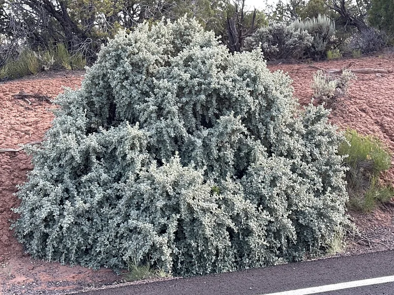
Roundleaf buffaloberry Shepherdia rotundifolia -
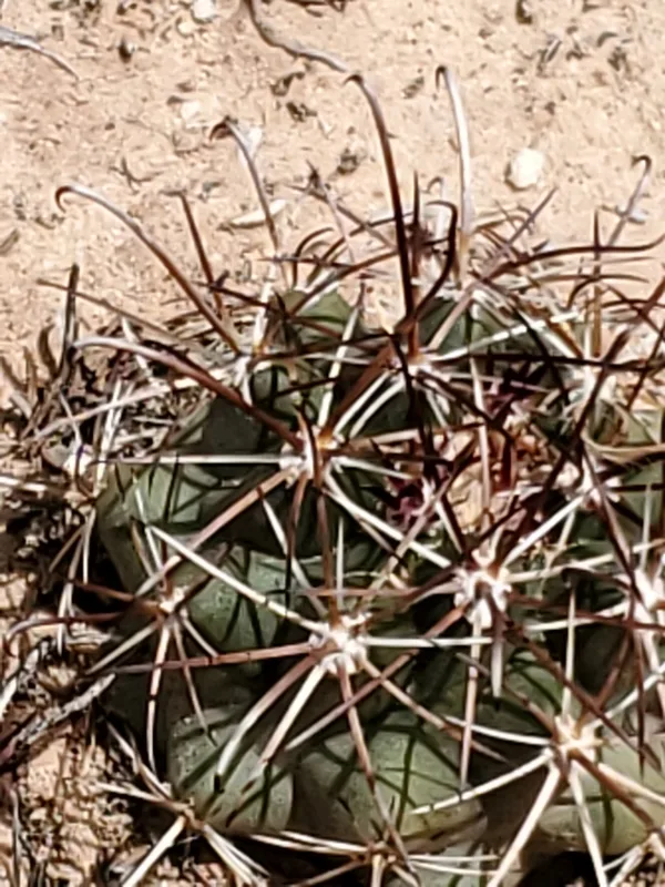
Smallflower Fishhook Cactus Sclerocactus parviflorus -
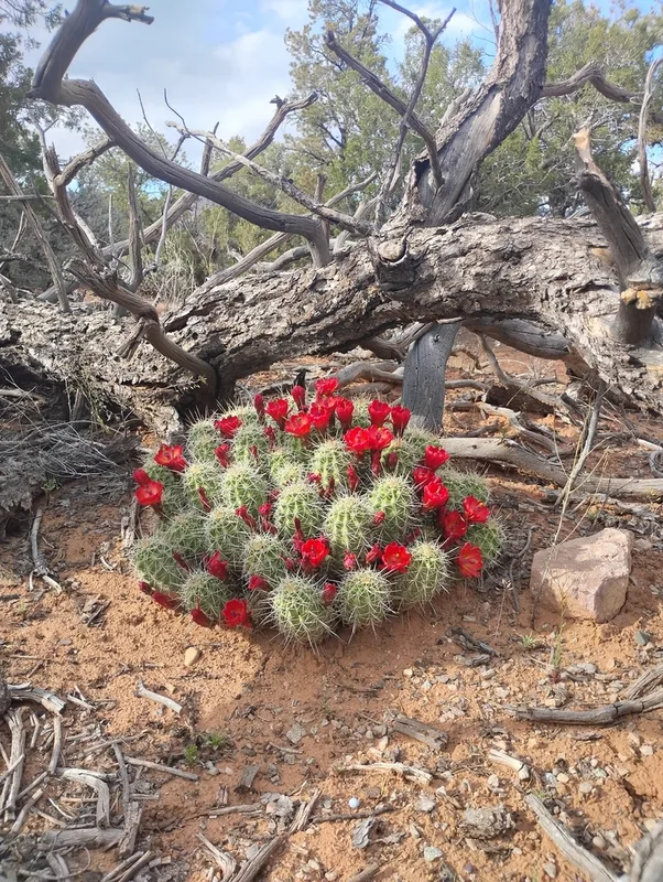
Kingcup Cactus Echinocereus triglochidiatus -
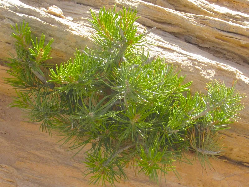
Colorado Pinyon Pinus edulis -
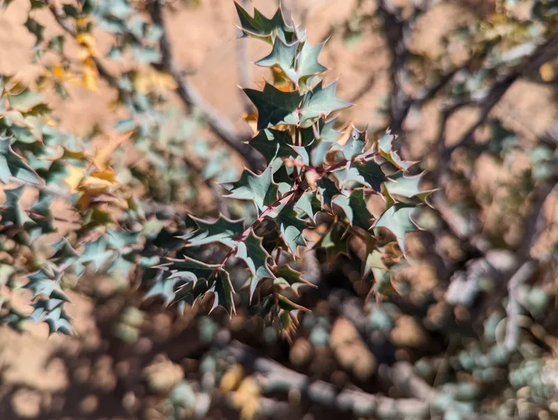
Fremont barberry Berberis fremontii -
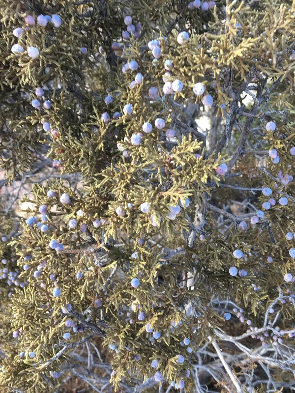
Utah Juniper Juniperus osteosperma -
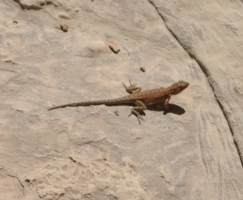
Common Side-blotched Lizard Uta stansburiana -
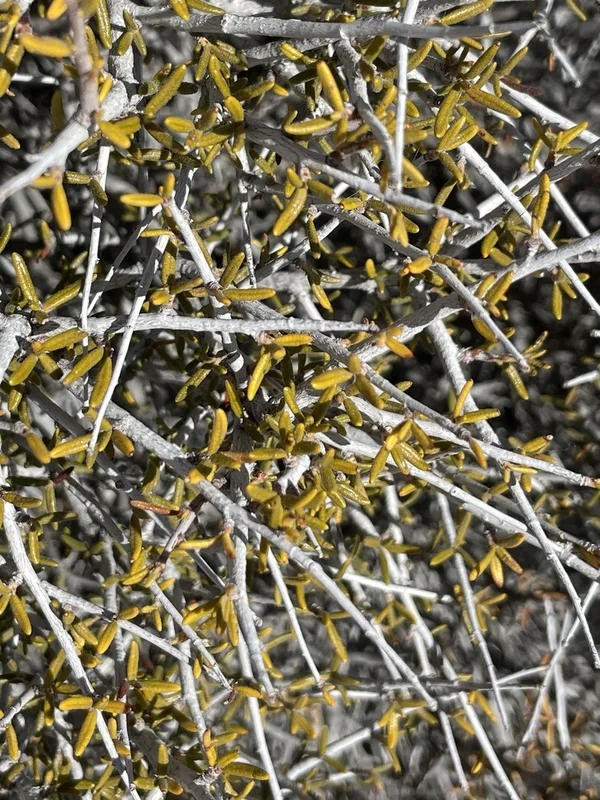
Littleleaf Mountain Mahogany Cercocarpus intricatus -
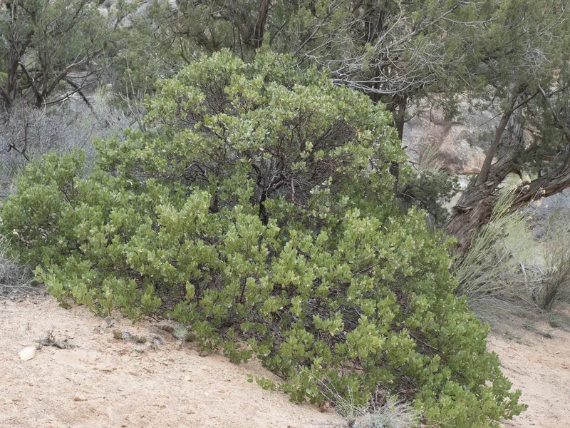
greenleaf manzanita Arctostaphylos patula -
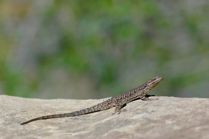
Ornate Tree Lizard Urosaurus ornatus -
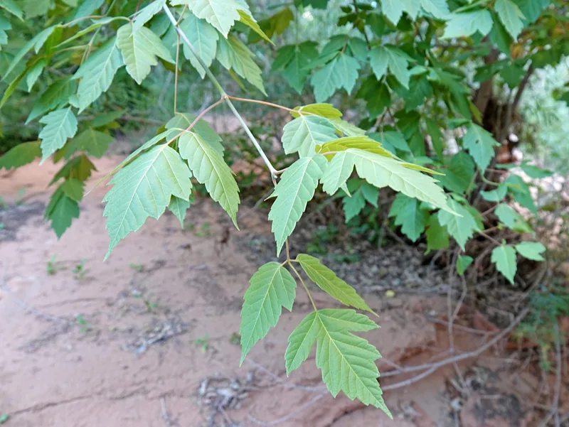
box elder Acer negundo -
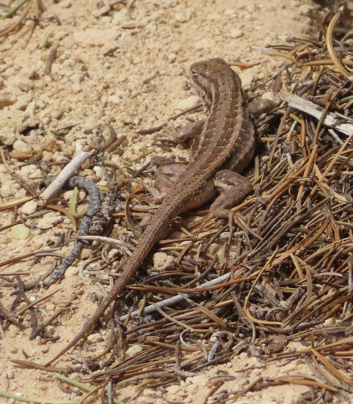
Common Sagebrush Lizard Sceloporus graciosus
Field Notes · Desert & Deep Time lens · Natural Bridges National Monument · 37.6026, −110.0112