Mount Rainier
Mount Rainier National Park · Washington, USA
An active volcano is not a monument. It is a project still underway.
Also seen through Ice & Glaciers · all at Mount Rainier National Park →.
Why here
Stand at almost any overlook here and you are looking at some of the youngest rock in this landscape — and it is still not finished. Mount Rainier is an active volcano, a tall cone built by lava flow stacked on lava flow, rising abruptly out of much older, quieter country that had already been shaped by fire long before this particular mountain existed. Everything about the shape of the place follows from that one fact: the steep, symmetrical sides a thick, slow lava builds close to its own vent; the ice that has draped itself over the cone almost as fast as the cone has grown; the bare, hard outcrops that poke through that ice wherever the rock has proven too tough for the glaciers to wear down to their own level. This is not a finished landscape being slowly worn away. It is a working one, actively adding to itself even as everything around it works just as hard to tear it back down. Keep that argument in view — rock going up, ice and water going down — and every stop on this trip starts to read as one chapter of the same ongoing story.
The story
Before this particular volcano existed, this stretch of the Cascades had already been built and rebuilt by fire more than once, a broad country layered with older lava. Then, within only the last couple of million years — a blink of an eye by rock’s usual clock — a new cone began rising out of that older ground, stacking flow on flow into the steep, symmetrical shape that now dominates the skyline. It has never stopped counting itself active.
The rock that finishes cooling here doesn’t stay bare for long. Once the deep winter snowpack finally lets go, the high meadows fill fast with white pasqueflower and avalanche lily, two of the first flowers to open on ground just freed from snow, gone again once the cold and new snow return. Hoary marmots and golden-mantled ground squirrels keep watch from the talus and rock piles between the flowers, right at home on a mountain that keeps producing fresh rubble for them to den in.
People have long known the peak by more than one name — Tahoma as well as Rainier — and in 1899 the United States set aside the mountain and the country around it as the fourth national park anywhere in the country. The record here is quiet on who lived at its base and shaped this land before that; the sources this note draws on simply don’t carry it.
The sites
The shape of an active volcano
Nisqually Vista
46.7869, −121.7477
This paved overlook near the mountain’s south side gives a plain, close-up look at the volcano’s flank and the ice draped over it — a glacier fills the valley just below, one tongue of the ice sheet that has been working on this shoulder of the mountain for a very long time. Because the viewpoint sits almost exactly where bare rock meets moving ice, it is a good first stop for seeing the mountain as one working system rather than as scenery: rock piling up from within, ice grinding down from above, meltwater carrying pieces of both away in the river underneath. The paved loop out to the viewpoint takes little effort and no special gear, which makes it an easy way to get the whole argument of this note in view before committing to anything harder. Come for the short walk; stay long enough to trace the boundary between what the mountain has built and what the ice is still taking apart.
Look down into the valley below the platform for the pale, gray-brown river threading out from under the ice. Its cloudy color comes from rock the glacier has ground to powder on its way down the mountain — visible proof that the ice is still actively wearing the volcano down even as the volcano keeps building itself back up.
- AccessDrive-up
- ExertionEasy
- TimeAn hour
Panorama Point
46.8036, −121.7297
A steady climb up open meadows ends at a wide bench with a straight-on view of the summit ice cap and the folded rock below it. From here the mountain reads as a textbook stratovolcano: a tall, steep-sided cone built from many separate flows and eruptions stacked one on top of the last, rather than the low, broad shield a runnier, faster-spreading lava would build. The peak is still counted as an active volcano, and standing at this distance it is easy to believe — the cone looks less like a finished monument than a stack that is still, slowly, being added to. The climb up is real work, on maintained trail through meadow rather than glacier, and the reward is the single clearest whole-mountain view in this note. Give it the better part of a day and you’ll have time to sit with the shape of the thing rather than just photographing it.
From the point, trace the mountain’s outline from base to summit with your eyes. Notice how steep and symmetrical the sides are compared with the gentler ridges around them — that steepness is what thick, slow-moving lava builds when it piles up close to its own vent instead of spreading far and flat.
- AccessHalf-day hike
- ExertionModerate
- TimeHalf a day
Glacier Overlook
46.9084, −121.6598
On a quieter side of the mountain, this overlook sits right at the boundary where bare volcanic rock gives way to permanent ice. It’s a useful second angle on the same argument the busier viewpoints make: a different flank of the same mountain, its own glacier holding the same basic contrast between rock built by fire and ice built by snow. Watching where the two meet — a dark edge of open rock against pale ice — is one of the clearest ways to see that the volcano and its ice are still actively working on each other, not a finished landscape but one still being negotiated. The walk in is modest by this mountain’s standards, and the view rewards patience more than effort: give the boundary line a long look rather than a glance.
Look for the line where pale ice gives way to darker, bare rock, and notice how ragged or clean it looks. That edge is where two of the mountain’s competing processes meet head-on — rock piling up from within, ice grinding down from above — and it never sits still for long.
- AccessShort walk
- ExertionModerate
- TimeHalf a day
Lava that stands clear of the ice
Gibraltar Rock
46.8458, −121.7454
High on the mountain’s southeast flank, Gibraltar Rock is a dark buttress of solid old lava standing clear of the ice around it — tough enough, and steep enough, that even this mountain’s grinding glaciers have not managed to wear it down to their own level. Seen from a distance it reads instantly as different from everything around it: a hard, angular outcrop holding its shape while softer ground and moving ice wear away on either side. It has long marked one of the more direct lines toward the summit for those equipped to use it. This is not a casual destination — it sits deep in glaciated terrain and is reached only as part of a serious, roped climb — but it is one of the clearest single objects on the whole mountain for seeing what solid lava looks like once the softer material around it is gone. Even from a lower, safer vantage, its outline is worth picking out against the ice for exactly that reason.
From below, pick out Gibraltar Rock’s dark, angular face against the white ice around it. Its steepness is the tell: soft or broken rock can’t hold a cliff that sheer under a moving glacier for long, so whatever is left standing this steep is whatever was hardest to begin with.
- AccessExpedition
- ExertionStrenuous
- TimeA full day
Glacier Island
46.8208, −121.8139
The name says exactly what you would see: a patch of bare rock standing up out of the ice like an island in a slow, white sea. Features like this are sometimes called nunataks — plain old rock that has stayed high or hard enough to keep its head above a glacier even as the ice files everything lower down into a smoother shape. On a mountain built almost entirely of stacked lava flows, a spot like this is a rare chance to see that lava up close, at real elevation, without needing to reach the true summit. It sits deep in glaciated country, well off any maintained trail, and reaching it safely takes mountaineering skill and route-finding rather than simple hiking effort — a destination to plan a full, serious day around, not a stop to add to an easier itinerary. Even the name is a small lesson: ice is patient, but it doesn’t win everywhere at once.
Compare the texture of the rock making up the “island” to the smoothed, rounded stone at lower elevation nearby. Rock a glacier flows over gets polished; rock the ice never gets a long grip on keeps its rougher, more broken surface — the giveaway that this is one of the mountain’s own outcrops, not just a boulder the ice dropped there.
- AccessExpedition
- ExertionStrenuous
- TimeA full day
Observation Rock
46.9018, −121.8065
Observation Rock is a rounded knob of old lava on the mountain’s north side, reached by a long, steady climb through meadow and talus rather than glacier travel — which makes it one of the more approachable places in this note to stand directly on the mountain’s own rock instead of only looking at it from a distance. From the top, the view opens across a wide bowl scoured by ice, with the summit ice cap rising beyond it: the same mountain, seen from underneath its usual angle. The name is a fair description of what the place is for — a solid, stable perch with nothing but old rock underfoot, built for looking rather than for climbing any further. Plan a full day for the round trip; the trail earns its elevation gain honestly, with no glacier crossing required, and the last stretch across open talus makes the mountain’s rocky bones hard to ignore.
Once on top, run a hand over the rock itself rather than only looking at the view. Old lava like this often has a rough, slightly bubbly surface where gas escaped as it cooled — a texture the rock keeps long after it has gone solid and silent.
- AccessHalf-day hike
- ExertionStrenuous
- TimeA full day
Cowlitz Rocks
46.8144, −121.7042
On the mountain’s southeast shoulder, Cowlitz Rocks is another outcrop where old lava holds firm above the ground around it, reachable by trail rather than by technical climbing — a useful middle option between the easy paved overlooks and the expedition-only rock islands higher on the mountain. The story here is the same one told at the more remote outcrops, just easier to reach: hard lava that has resisted being ground down and carried off by moving ice and water, standing a little proud of everything softer around it. It’s a good place to feel that idea in your legs on an honest trail, rather than only reading it off a viewpoint far below. The walk is long enough to count as a full day out but asks for no special equipment beyond sturdy boots and a reasonable level of fitness, which makes it the most accessible of this note’s rock-through-ice stops.
Stand at the base of the rocks and look uphill and downhill along the slope. Notice how the ground around the outcrop looks worn smooth and rounded while the rock itself keeps sharper edges — a small, walkable version of the same hardness contrast that holds up the mountain’s bigger rock islands higher on the ice.
- AccessHalf-day hike
- ExertionStrenuous
- TimeA full day
The active summit
Liberty Cap
46.8630, −121.7749
Liberty Cap is one of the high points on Mount Rainier’s summit dome, permanently capped in ice on a volcano the record still counts as active and capable of erupting again. Standing here means standing on ground built by the mountain’s young lava, now buried under its own summit ice cap. It is also about as demanding a destination as any in this note: reaching it means a full glaciated mountaineering climb, with real objective hazard, not simply a hard hike. For most visitors the honest way to take in this site is from a safe, lower vantage point elsewhere in this note, understanding what it represents rather than standing on it. Treat it as the note’s high-water mark — the place every other stop is, in one way or another, pointing toward, and the clearest single answer to what “still being made” actually means here.
From a distance, pick out the highest, whitest dome on the mountain’s skyline. Everything up there is at once some of the oldest ice on the mountain and, underneath that ice, some of the youngest rock — the summit keeps building even as the glaciers keep trying to wear it back down.
- AccessExpedition
- ExertionStrenuous
- TimeWorth two days
When it's best
High on the mountain, snow and ice hold on for most of the year — even in early spring the upper slopes stay reliably below freezing, and the true summit stays capped in ice regardless of season. Lower meadows run on a slower clock: once the snowpack finally lets go, usually well into summer, the ground fills fast with pasqueflower and avalanche lily, classic first flowers of ground just freed from snow, before cold and new snow shut the season back down. There is no wrong season to see the volcano’s basic shape and the old lava that holds it up — only a narrow window each year to see the high country out from under its usual coat of white.
Go deeper
The young lava that built the visible cone is mapped as the Andesite of Mount Rainier, part of a broader blanket of Pleistocene-to-Recent Cascade volcanic rock; the much older lava country underlying the wider region belongs to the Columbia River Basalt Group. Two of the meadow flowers are white pasqueflower (Pulsatilla occidentalis) and avalanche lily (Erythronium montanum); the marmot is the hoary marmot (Marmota caligata).
To read next: - “Roadside Geology of Mount Rainier National Park and Vicinity” (Pringle, 2008) — the most approachable, trip-ready account of what’s underfoot at stops like these. - “Geology of Mount Rainier National Park, Washington” (Fiske, USGS Professional Paper, 1963) — the foundational full-length survey most later work on the volcano builds on. - “Surficial Geology of Mount Rainier National Park, Washington” (Crandell, USGS, 1969) — a close look at the loose material, ash, and mudflow deposits the volcano has draped across its own flanks. - “The Geologic Story of Mount Rainier” (USGS, 1969) — a compact official account of how the cone itself came together. - “Petrogenesis of Mount Rainier Andesite: Magma Flux and Geologic Controls on the Contrasting Differentiation Styles at Stratovolcanoes of the Southern Washington Cascades” (Geological Society of America Bulletin, 2013) — the technical paper behind the young-lava, old-country contrast this note leans on.
The names behind what you saw
What lives here, and what it's called. Photographs from open collections — an aid to identification, not decoration.
-
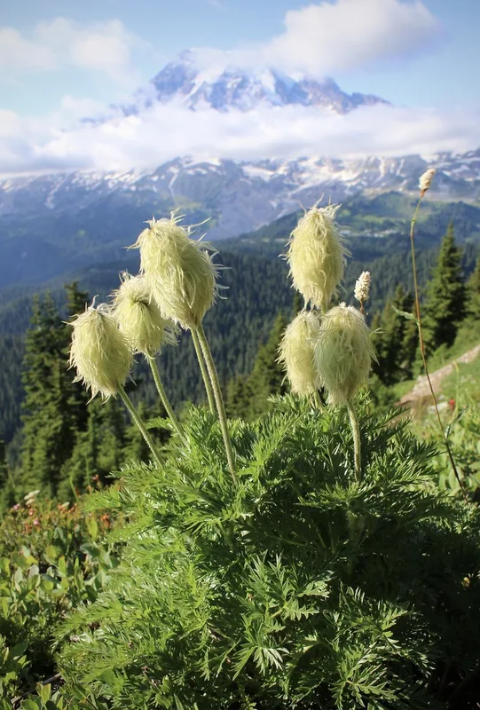
white pasqueflower Pulsatilla occidentalis -
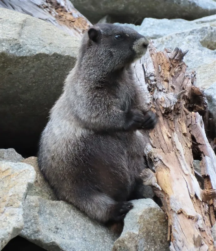
Hoary Marmot Marmota caligata -
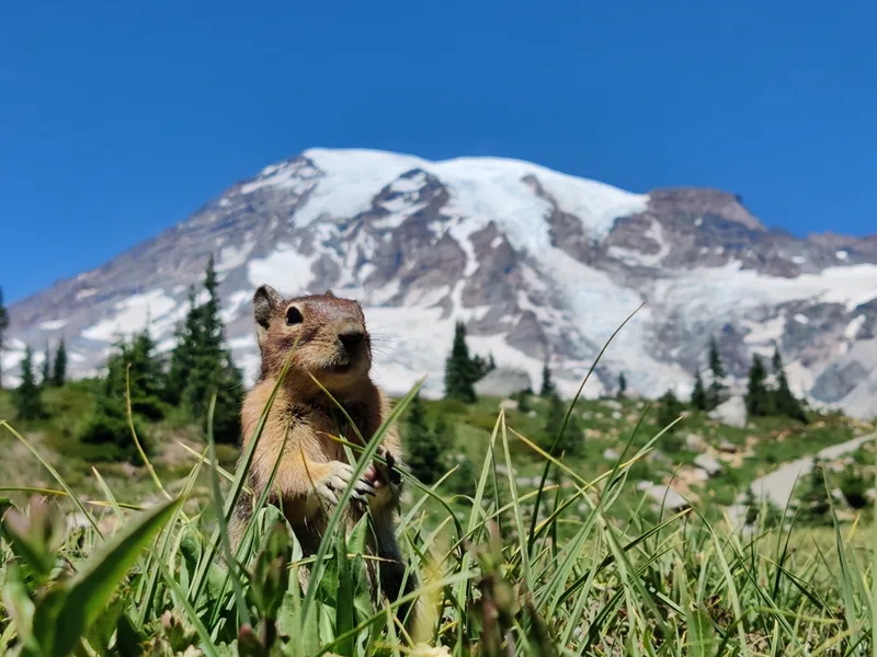
Cascade Golden-mantled Ground Squirrel Callospermophilus saturatus -
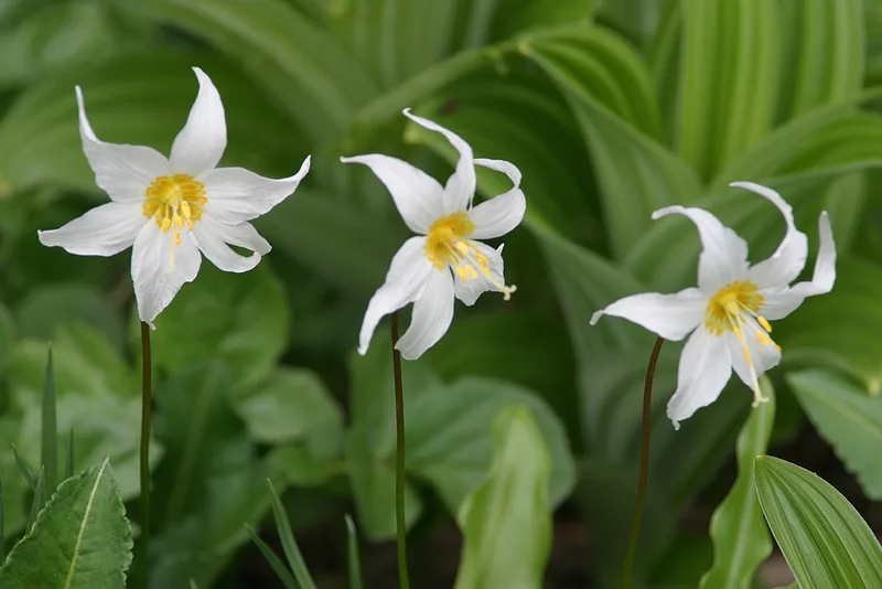
Avalanche lily Erythronium montanum -
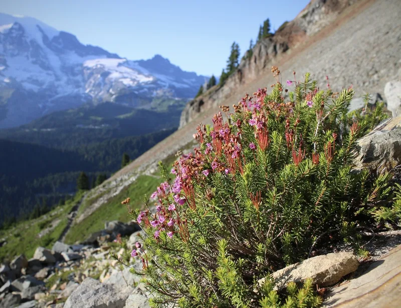
pink mountainheath Phyllodoce empetriformis -
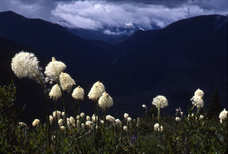
common beargrass Xerophyllum tenax -
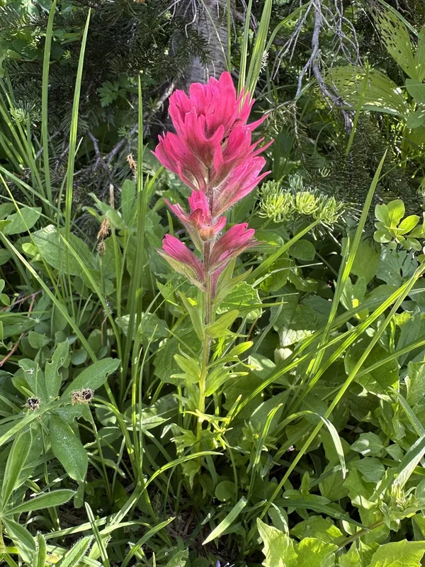
mountain paintbrush Castilleja parviflora -
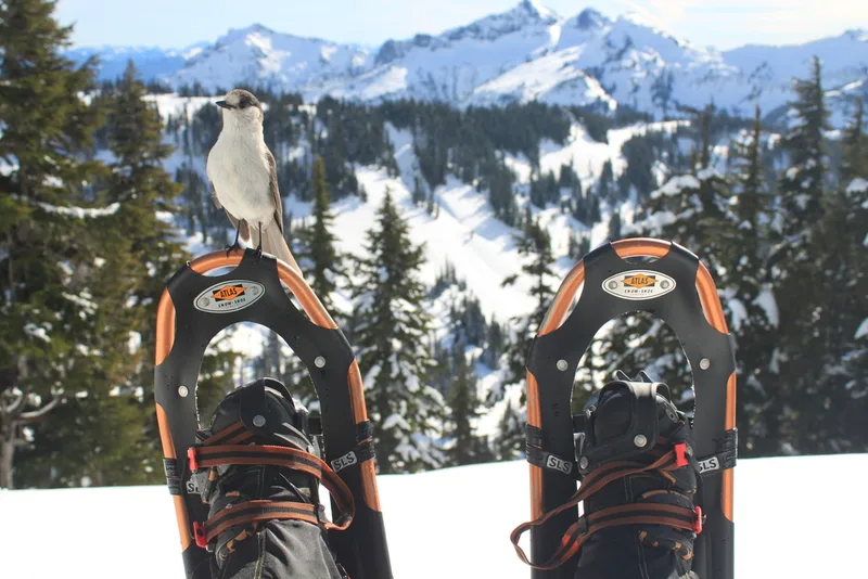
Canada Jay Perisoreus canadensis -
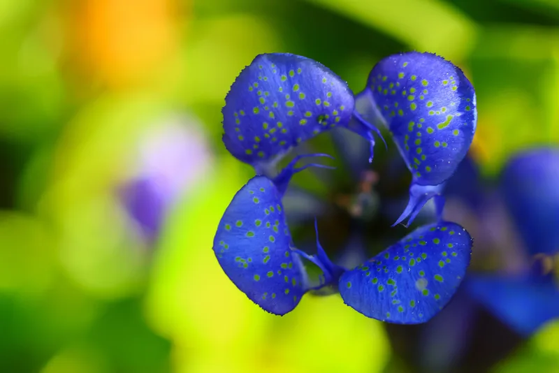
Mountain Bog Gentian Gentiana calycosa -
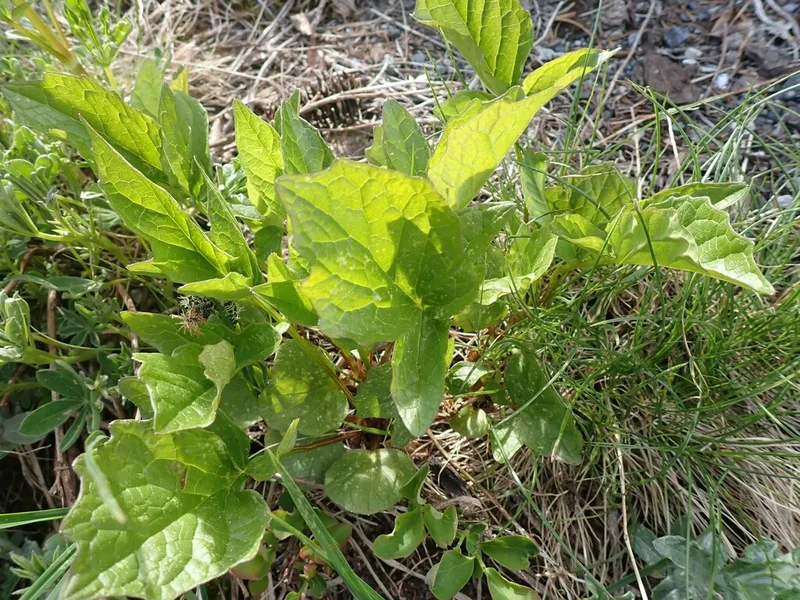
Sitka valerian Valeriana sitchensis -
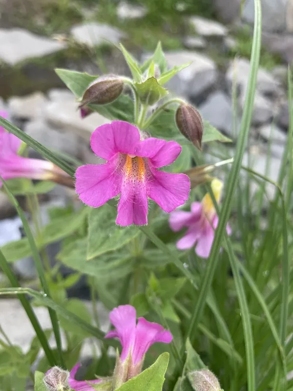
Lewis' monkeyflower Erythranthe lewisii -
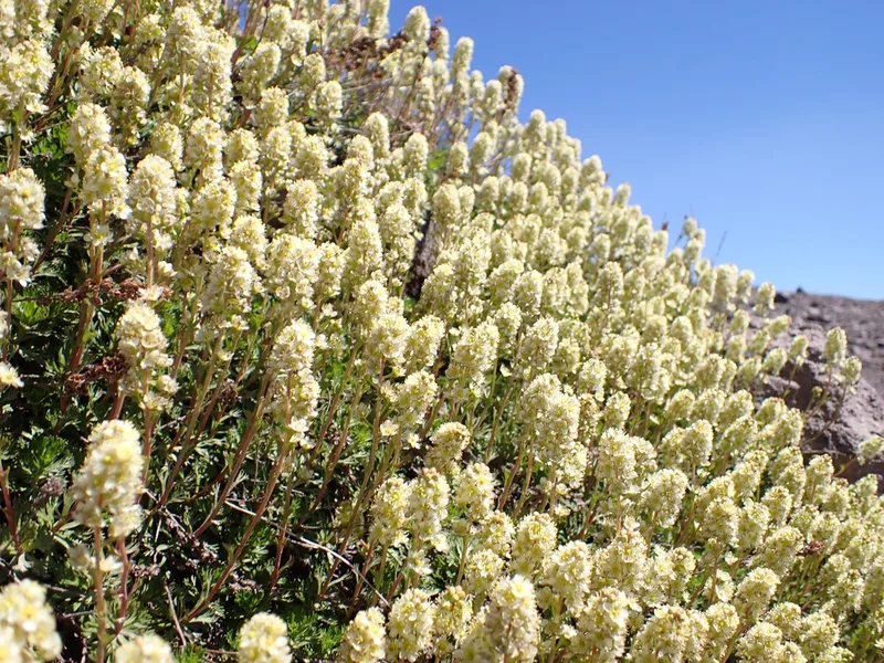
Partridgefoot Luetkea pectinata
Field Notes · Volcanic lens · Mount Rainier National Park · 46.8543, −121.7063