Mount Rainier
Mount Rainier National Park · Washington, USA
The mountain makes its own weather, and the weather makes the ice that is slowly taking the mountain apart.
Also seen through Volcanic · all at Mount Rainier National Park →.
Why here
Mount Rainier is a volcano, but it is the ice, not the fire, that shapes almost everything you will see. The peak stands high enough to stop Pacific storms cold and wring them out as snow, so much of it that it never fully melts. That snow packs into more than two dozen rivers of ice creeping down every flank — one of them the largest glacier anywhere in the country outside Alaska. Slow as they look, these glaciers are the mountain’s demolition crew. They pluck the old lava loose, grind it to flour, and haul it down the valleys, cutting the deep troughs and knife-edged ridges that give Rainier its shape. The volcano built the mountain up; the ice is patiently taking it apart, held off only because the summit keeps making more snow than the glaciers can carry away. Everywhere on this trip — a scoured ridge, a lone rock the ice spared, a valley too broad for its creek — you are reading one story: what the ice carved, and what it left behind.
The story
Long before there was ice here, the mountain built itself from lava — sheet upon sheet of gray andesite stacked into the tallest peak in the Cascade Range. Then the climate cooled, the snow stopped fully melting, and ice gathered in every hollow and began to move. For tens of thousands of winters it has been carving the volcano back down — steepening its faces, hollowing its valleys, and wearing a satellite peak like Little Tahoma into a lone tooth of rock ringed by glaciers. The mountain keeps building with snow even as the ice tears it apart.
In the short summer, the ice loosens its grip on the lower slopes and the meadows chase it uphill. Avalanche lily opens right at the melting edge of the snow, so the bloom climbs the mountain as the drifts shrink back. Hoary marmots sprawl on sun-warmed rock and whistle when a shadow crosses; gray Canada jays work the timberline in every season.
Long known as Tahoma, the mountain became the country’s fourth national park in 1899. Beyond that the payload is quiet on the generations who lived beneath this ice and read it long before any surveyor climbed it.
The sites
Ice on the move
Nisqually Vista
46.7869, −121.7477
A short, paved loop brings you to a railing above a broad valley, with the mountain filling the sky at its head. Look up the valley and you’ll see where a river of ice has spent thousands of years bulldozing straight down the mountain toward you, one of the more than two dozen glaciers that ride the volcano’s flanks. The glacier’s snout sits behind its own wreckage — a jumble of gray rubble and rock flour it has plucked from the andesite lava above and hauled downhill. Below it, a pale, sediment-heavy creek runs off toward the lowlands, colored by the rock the ice is still grinding away. The valley itself is older glacier-work: too wide and too flat-floored for the small creek that drains it now, a trough scooped when the ice reached much farther down than it does today. This is the easiest place on the whole trip to watch the demolition happening at human range, and to see that the mountain is less a finished thing than a work in progress.
From the railing, follow the valley up to the ragged front of the ice, then look at the creek leaving it. The water runs pale and cloudy rather than clear — that milkiness is rock ground to flour beneath the glacier, so fine it stays suspended for miles. Scoop a little into a clear bottle and let it stand to watch the grit settle out.
- AccessShort walk
- ExertionEasy
- TimeAn hour
Glacier Overlook
46.9084, −121.6598
From the high, open country on the mountain’s northeast side, this viewpoint looks straight across at the broadest sheet of ice on Rainier — the largest glacier by area anywhere in the country outside Alaska. From here the scale finally makes sense: a cracked highway of ice pouring off the upper mountain, streaked with long dark lines of rubble where separate ice streams have merged and pinned their loads of broken rock between them. The gray andesite the glacier is chewing through is the same lava that built the entire mountain, layer on layer, before the ice ever gathered. On a still morning you may hear the work going on — a distant crack or low grumble as the ice shifts over the rock beneath it, or the clatter of a rockfall loosed from a thawing cliff. Little on the mountain gives a better sense of ice as an active force rather than a frozen backdrop.
Find the long dark stripes that run down the middle of the ice, parallel to its flow. Each marks where two glaciers met and now travel as one, carrying a seam of shattered rock along the join. Trace one stripe uphill to the notch of bare rock where the two ice streams first came together.
- AccessHalf-day hike
- ExertionModerate
- TimeHalf a day
Panorama Point
46.8036, −121.7297
The climb up through the subalpine meadows earns a rocky bench where the whole south face of the mountain lines up in front of you, glacier after glacier hanging in its own valley. This is the view that explains the lens: from a single spot you can count ice streams filling nearly every hollow on the upper mountain, each grinding its trough a little deeper into the lava. Between them stand sharp ridges and rock spurs — the leftovers, the walls the ice has not yet managed to cut through. The mountain wrings so much snow from passing storms that these glaciers rarely run short of feed, which is a large part of why so many of them survive this far south. Give the panorama a few minutes and the upper mountain stops reading as one white mass and resolves into dozens of separate ice tongues, each at work on its own piece of rock.
Pick two neighboring glaciers and study the ridge that divides them. Notice how thin and sharp its crest is — the two ice streams are cutting toward each other from both sides, paring the rock between them down to a blade. Where three or more valleys bite into a single high point, what is left standing is a lone horn of rock.
- AccessHalf-day hike
- ExertionStrenuous
- TimeHalf a day
Rock the ice spared
Glacier Island
46.8208, −121.8139
The name says what it is: a knuckle of rock that stands up out of the ice like an island in a sea. Around it, the glaciers of the mountain’s western flank have flowed and split and rejoined, yet this one lump of hard lava has held its ground while the ice ground the country down on either side. Reaching it is a serious backcountry undertaking, off any maintained trail, but the idea it carries is the heart of the lens: not everything gives way. Where the rock is strong enough, or the ice runs thin enough, an island of stone survives — and as the glaciers pull back over time, more of these islands come out of the ice. It is a quiet place to grasp that the white flanks of the mountain are not solid ice at all, but ice threaded around stubborn ribs of rock.
Stand on the high point and see how the ground falls away on every side toward old ice paths. The rock underfoot is scraped and polished where ice has ridden over and against it; look for smooth, rounded surfaces carrying faint parallel scratches, gouged by stones the glacier dragged along. Run a hand across them — the grooves point the way the ice was moving.
- AccessExpedition
- ExertionStrenuous
- TimeWorth two days
Meany Crest
46.8584, −121.6629
A crest is a ridge worn to an edge, and this one earns the word. It rides between valleys the ice has carved on either side, a long spine of andesite lava that stood too high or too tough for the glaciers to level. From its line you look down into broad, round-bottomed troughs — the signature shape of a valley a glacier has filled, scooped into a smooth U rather than the narrow V a river cuts. The heavy ice is mostly gone from the lower reaches now, but the mold it pressed into the land is unmistakable, and standing on the divide between two such valleys is the clearest way to feel how the ice sorted this whole country into troughs and the walls between them. Reaching the crest is a full backcountry effort, but the shape it reveals is written across the entire mountain once you have seen it here.
Look down into the valley on each side of the crest and read its cross-section. A river cuts a narrow V, always working at a single point; a glacier fills the whole floor and grinds it into a broad U with steep sides and a flat bottom. Where the walls show bare rock, look for benches and hollows stranded partway up — side-valleys the main glacier cut off, now left hanging above the floor.
- AccessExpedition
- ExertionStrenuous
- TimeA full day
Old Desolate
46.9251, −121.7501
A bare, broad-shouldered height on the mountain’s north side, scraped to rock and stubborn alpine ground — the name fits the place. This is high country the ice worked over and then abandoned, leaving behind polished stone, loose rubble, and thin soil that plants are still slowly reclaiming. It sits far enough back from the summit that no glacier reaches it today, which makes it a fine place to study the aftermath rather than the machine: what the land looks like once the ice has finished its cutting and pulled away. Where the glaciers on the upper mountain show you the process underway, a scoured height like this shows you the result — a whole landscape smoothed, gouged, and littered with the rock the ice left where it melted. The walk in is long and mostly off trail, which is part of why the ground here reads so cleanly.
Walk the open top and look at what lies underfoot. Loose, angular rock heaped into low mounds and ridges is glacial debris — rubble the ice carried and dropped where it melted out. Where bedrock shows through, check its profile: often it is smoothed and rounded on one side and plucked rough on the other. That lopsided shape is a compass — the smooth side faced the oncoming ice.
- AccessExpedition
- ExertionStrenuous
- TimeA full day
What the ice left in the low country
Pinnacle Peak
46.7579, −121.7326
Across the valley from the main mountain, a row of sharp rock peaks makes a jagged wall along the southern skyline, and this is one of its high points. These summits are smaller and older than the volcano they face, but the ice sculpted them by the same method — glaciers biting into the range from several sides at once, meeting near the top and leaving steep, narrow spires of rock between their bowls. A trail climbs to the saddle just below the summit; the final pull to the top is a rocky scramble best left to those steady on loose ground. From the saddle, the view back across the valley takes in the whole ice-clad face of the mountain at once, which makes this a rare place to see the carver and the carved in a single glance.
From the saddle, look along the ridge at the shape of the peaks. Each is steep on more than one side, pinched to a point where cirques — the armchair-shaped hollows glaciers gnaw at their heads — have eaten in from opposite directions. Find one such bowl scooped into the rock below a summit; that curved wall of cliff is where a small glacier once sat and worked backward into the mountain.
- AccessHalf-day hike
- ExertionStrenuous
- TimeHalf a day
Tolmie Peak
46.9581, −121.8773
A trail on the mountain’s northwest corner climbs to a lookout set on a rocky peak, and just below it lies a round mountain lake cupped in a hollow of bare rock. That hollow is glacier-work: a small mass of ice once sat in this basin, grinding a bowl down into the bedrock, and when it melted, meltwater filled the scoop it left behind. Lakes like this one — held in a rock bowl high on a slope rather than strung along a river valley — are among the ice’s quieter signatures, and from the lookout above you can see straight down into the shape of the basin. It is a gentler counterpart to the raw glaciers on the main mountain: the same cutting force, read long after the fact in the calm surface of a lake it dug and then filled.
From the peak, look down at the lake and read the ground that holds it. The steep back wall of rising rock is where the ice bit hardest into the slope; the lower lip that dams the water is often a low bar of rubble the glacier pushed ahead and left behind. Trace the shoreline and notice the basin is closed tight on the uphill side and barely held on the down — a bowl, not a channel.
- AccessHalf-day hike
- ExertionModerate
- TimeHalf a day
When it's best
The glaciers are here in every season, but the mountain guards its high country well. Deep into spring the upper slopes stay buried; through the cold months the heights sit well below freezing and storm after storm keeps stacking snow. The meadows open late, usually not until high summer once the drifts finally pull back, and the bloom climbs with them — avalanche lily at the melting edge, then paintbrush and beargrass across ground the snow has just left. That short warm stretch is also when marmots are out on the rocks and the highest overlooks are walkable. Come in winter to watch the ice being fed; come in late summer to see what it uncovers.
Go deeper
The names behind what you saw. The gray rock the ice is carving is the andesite of Mount Rainier — andesite is the medium-gray lava that builds most of the big Cascade volcanoes. The broad glacier on the northeast flank is the Emmons Glacier; the ice ringing the satellite spire of Little Tahoma Peak includes the Fryingpan and Whitman glaciers. The snow-line flower is the avalanche lily, Erythronium montanum; its early companion is white pasqueflower, Pulsatilla occidentalis. Later meadow color comes from mountain paintbrush, Castilleja parviflora, and common beargrass, Xerophyllum tenax. The whistler on the warm rocks is the hoary marmot, Marmota caligata.
To read next. - Roadside Geology of Mount Rainier National Park and Vicinity (Pringle, 2008) — plain-language geology keyed to places you can drive and walk to, the friendliest way into the story. - The Geologic Story of Mount Rainier (1969) — a short, readable overview of how the volcano and its ice built the mountain together. - Surficial Geology of Mount Rainier National Park (Crandell, 1969) — the standard account of exactly what this lens is about: the debris, moraines, and scoured ground the glaciers left behind. - Geology of Mount Rainier National Park, Washington (Fiske, 1963) — the full technical bedrock map and description for readers who want the rock in detail. - Petrogenesis of Mount Rainier Andesite (2013) — for the deeper question the lens skips: why the lava the ice carves is the particular rock it is.
The names behind what you saw
What lives here, and what it's called. Photographs from open collections — an aid to identification, not decoration.
-
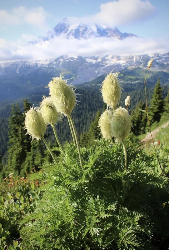
white pasqueflower Pulsatilla occidentalis -
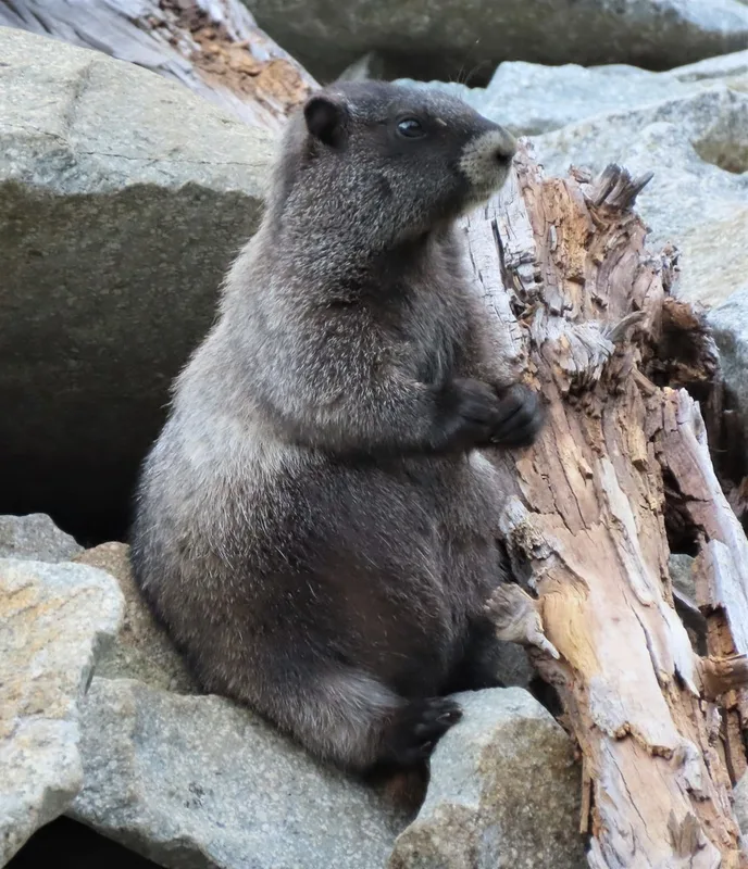
Hoary Marmot Marmota caligata -
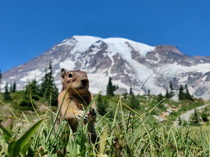
Cascade Golden-mantled Ground Squirrel Callospermophilus saturatus -
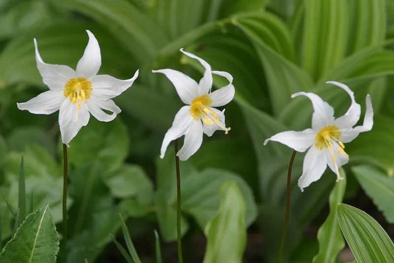
Avalanche lily Erythronium montanum -
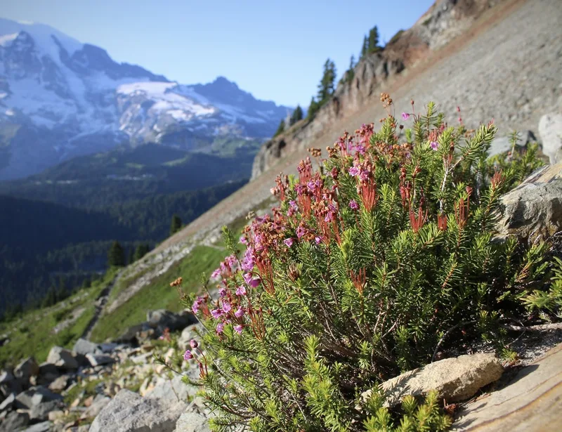
pink mountainheath Phyllodoce empetriformis -
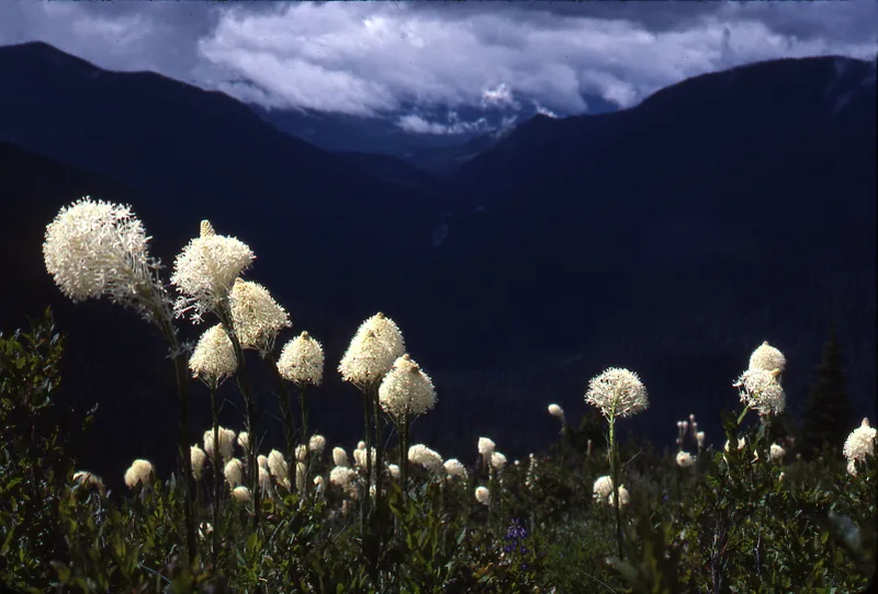
common beargrass Xerophyllum tenax -
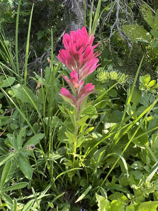
mountain paintbrush Castilleja parviflora -
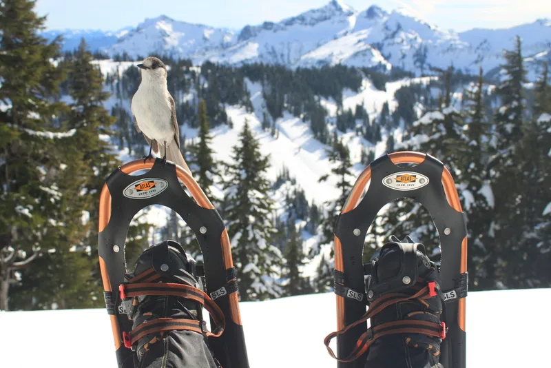
Canada Jay Perisoreus canadensis -
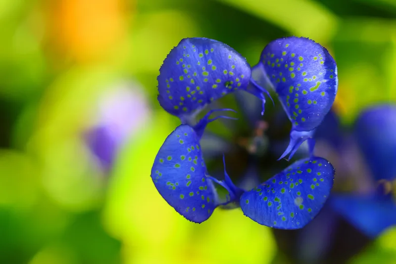
Mountain Bog Gentian Gentiana calycosa -
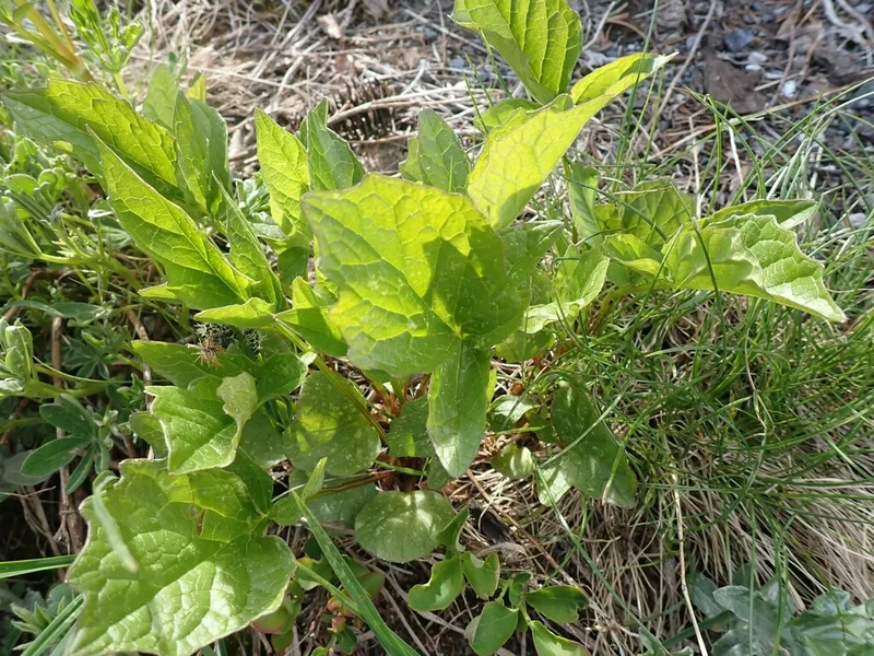
Sitka valerian Valeriana sitchensis -
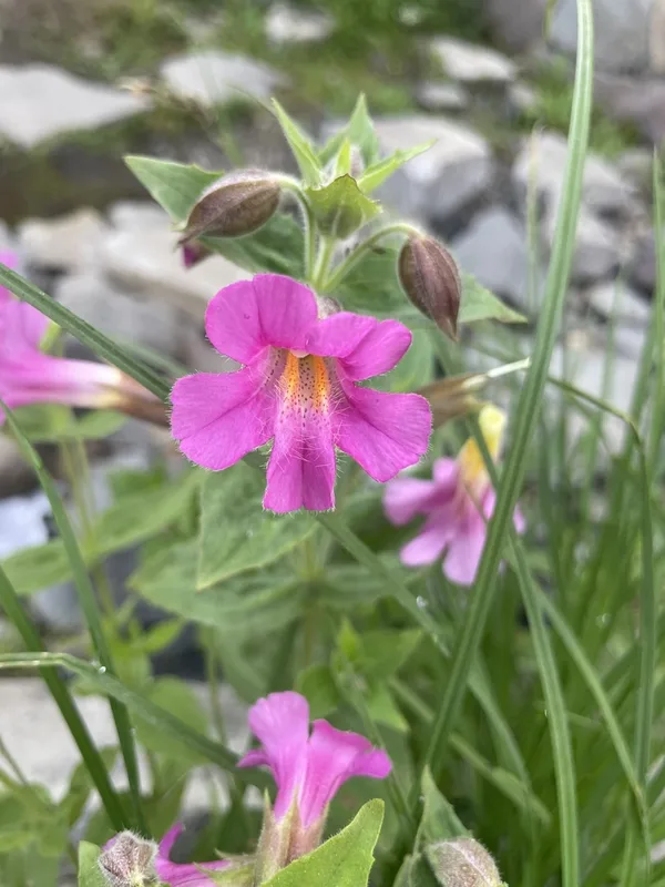
Lewis' monkeyflower Erythranthe lewisii -
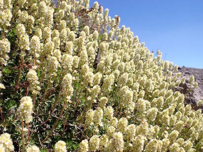
Partridgefoot Luetkea pectinata
Field Notes · Ice & Glaciers lens · Mount Rainier National Park · 46.8543, −121.7063