The Monterey Peninsula
Pacific Grove · California, USA
At low tide the rock stops being scenery and becomes a crowd.
Also seen through Fog Coast · all at Pacific Grove →.
Why here
Twice a day the sea backs off the edge of the Monterey Peninsula and leaves a few hours of its own floor exposed. The peninsula is a blunt thumb of granite pushed into a cold ocean, and hard rock holds a shoreline that soft cliffs cannot. Instead of crumbling into sand, the granite keeps its pools, its ledges, and its cracks. Cold water does the rest. The sea here stays cold through the year, and cold water carries the food that warm water does not, so the rock’s edge fills up: sea stars, anemones, urchins, crabs, all of it packed into pools you can crouch beside. The town that grew up facing this eventually set much of the shoreline aside as a place where you may look but not take. That is the whole trip: a hard rim of granite, a cold sea leaning on it, and at the low-tide line a living floor you can walk out and meet.
The story
Start with the rock. The pale, coarse stone of the headlands is granite, born deep underground when this coast sat over a belt of molten rock, then lifted and scoured bare by the sea. In places it is buried under old, hardened dune sand, a former beach the wind piled up and time cemented into stone. Granite is stubborn. Where softer coasts wear down to smooth sand, this one holds its ledges and pools, and that stubbornness is why there is anything to see at the tideline at all.
Onto that rock the cold sea loads life. Ochre sea stars and purple urchins wedge into the cracks; bat stars fan across the pool floors; anemones pull shut into wet green buttons when the water leaves them. Just offshore, sea otters ride the kelp and crack urchins against stones on their chests, and harbor seals and sea lions haul out on the rocks to dry.
People came late to protecting it. The town along this shore set much of its waterfront aside as a reserve where nearly all taking of sea life is banned. The record here is quiet on who worked these pools before the town.
The sites
The rock at low tide
Point Pinos Lighthouse
36.6334, −121.9337
The peninsula’s northern tip is a low apron of granite, and the lighthouse stands back from a shoreline of tide pools and wave-washed ledges. This is the classic place to meet the intertidal, because the rock is broken into pools at every level: high ones the sea only splashes, low ones it barely leaves. Work down toward the water as the tide allows and the life changes with each step: barnacle and snail near the top, then anemones, then the sea stars and urchins that need near-constant cover. Keep to the dry rock between pools, and set back anything you lift exactly as it lay, because this whole shore is a reserve where the animals are protected. Wet granite is slick, and a stray wave off a low point is the real hazard here, so keep one eye seaward the whole time.
At the lowest pools, look for the ochre sea star, a thick, five-armed star in dull orange or deep purple, gripping the rock hard. It lives this low because it hunts the mussels and barnacles the tide keeps wet, prying a shell open slowly with hundreds of tiny suckered feet.
- AccessShort walk
- ExertionEasy
- TimeHalf a day
China Rock
36.6055, −121.9593
China Rock is a huddle of granite boulders and low ledges on the peninsula’s western shore, right where the rock meets the surf. It makes a good, low-key tidepool stop away from the busier coves: the same cold-water life, fewer people leaning over it. The dark, sea-worn rock is cut with channels and shallow basins that trap water as the tide falls, so the pools hold their crowd for hours after the sea pulls back. Between the pools, the bare rock is worth as much attention as the water; this is prime ground for the small crab that scuttles sideways into a crack the moment your shadow lands on it. Footing is uneven and the lower rock is slick with algae, so move slowly and keep watching the sea.
On the damp rock just above the waterline, watch for the striped shore crab, a squarish, purple-and-green crab about the width of two fingers. It holds to this narrow band because it can breathe both in air and water, ducking into a wet crack when threatened and coming back out to graze algae once the coast is clear.
- AccessShort walk
- ExertionEasy
- TimeAn hour
Where the water turns on itself
Point Joe
36.6098, −121.9569
Point Joe sits at the peninsula’s southwest corner, where the open ocean wraps around the headland and swells arrive from more than one direction at once. The result, over the submerged rocks just offshore, is water that never settles: crossing wave trains, sudden peaks, and white churn even on a calm day. This is a viewpoint, not a tidepool stop, and the draw is the sea itself doing something you rarely see so plainly from land. Stand a safe distance back from the edge; the same crossed swell that makes the view also sends unpredictable surges up the low rocks. Come on a big-swell day for the full effect, or on a calm one to read the pattern more quietly.
Watch one patch of open water offshore for a minute. Instead of neat lines of swell rolling in, you’ll see waves crossing each other at angles and leaping up where they meet. That happens because the headland bends incoming swell around itself from two sides, and the two sets collide over the shallow rocks here.
- AccessDrive-up
- ExertionEasy
- TimeAn hour
The Restless Sea
36.6099, −121.9559
The Restless Sea is the viewpoint just along the shore from Point Joe, and its plain name is the whole description. Here the water stays agitated when nearby coves lie flat, because currents and swell meet over a shallow, uneven bottom and have nowhere smooth to go. It is a place to stand and read the surface: rips pulling seaward, boils rising where deeper water shoulders up, foam streaking in lines that mark where two flows shear past each other. On a windy day with a big swell running, the whole panel of sea in front of you can be moving in several directions at once. Keep back from the wet rock; the interest here is entirely offshore, and the low ledges take surprise waves.
Look for a band of choppier, whiter water offshore while the water nearer the coves stays calmer. That rougher strip marks where a current runs over shallow rock: the bottom rises, the moving water piles up, and the surface breaks into standing chop even with no wave breaking on shore.
- AccessDrive-up
- ExertionEasy
- TimeAn hour
The warm-blooded in cold water
Lover's Point
36.6267, −121.9155
Lover’s Point is a small granite headland and cove near the middle of the Pacific Grove shore, with calm, kelp-fringed water tucked in its lee. The point is a good place to slow down and watch the warm-blooded animals that share this cold sea. In the sheltered water and the kelp just offshore, look for the smooth dark heads of harbor seals resting low in the swell, and for sea otters wound into kelp fronds. Because the whole shore is a protected reserve, the animals here are used to being watched from a distance and often stay close in. Bring something to sit on and let them come to you; binoculars help, though a resting seal will often drift within easy sight. Give any hauled-out animal room, since a seal forced back into the water loses the rest it came ashore for.
Scan the calm water off the point for a harbor seal at rest, a plump, spotted animal floating nose-up with just its head and hind flippers breaking the surface, a posture called bottling. It can doze this way because it holds a lungful of air like a built-in float, waking every few minutes to breathe.
- AccessDrive-up
- ExertionEasy
- TimeAn hour
Sea otters
36.6181, −121.9010
This marked overlook on the bay side of the peninsula is set aside for one animal: the sea otter. Otters spend most of their lives in the kelp just off this shore, and from here you can often find them without a boat. Look for what seems to be a floating log that rolls, grooms, or lifts a paw, an otter resting on its back in the swell, sometimes wound into a strand of kelp to keep from drifting while it sleeps. Unlike the seals and sea lions, the otter carries no blubber; it survives the cold sea on the densest fur of any animal and on a large appetite, part of which it feeds on the same urchins you saw wedged in the tidepools. Binoculars turn distant dots into whole small dramas of feeding and grooming.
Find an otter floating on its back and watch its front paws. It may be using a stone balanced on its chest as an anvil, hammering a hard-shelled urchin or snail against it to break in, one of the few animals that keeps and reuses a tool.
- AccessDrive-up
- ExertionEasy
- TimeAn hour
When it's best
The lever here is the tide, not the calendar. The pools open only when the water drops, so time a visit to a low tide; the lowest ones bare the most rock and the most life, and a printed tide table is worth more than any date. The sea stays cold and full in every season, so there is no wrong month for the rock’s edge. Winter throws the biggest swells against the outer points, where the water turns loud and confused. Through spring and summer, look for dark cormorants crowding the offshore rocks to nest.
Go deeper
The names behind what you saw. The pale headland rock is Cretaceous granite, formally undivided granitic (plutonic) rock, part of the belt of Mesozoic intrusive rock under the peninsula. The hardened old sand that caps it in places is mapped as Pleistocene older dune sand. The tidepool animals, by their scientific names: ochre sea star, Pisaster ochraceus; Pacific purple sea urchin, Strongylocentrotus purpuratus; bat star, Patiria miniata; sunburst anemone, Anthopleura sola; striped shore crab, Pachygrapsus crassipes; and the small orange sea slug, the white-speckled dorid, Doriopsilla fulva. Offshore: harbor seal, Phoca vitulina; California sea lion, Zalophus californianus; Brandt’s cormorant, Urile penicillatus; western gull, Larus occidentalis.
To read next. The payload carried no curated reading list, so these are solid starting points drawn from it rather than a vetted syllabus. The Pacific Grove Museum of Natural History bills itself as a living field guide to this coast’s plants, animals, and geology, the place to put names to what you found. For the rules and boundaries of the protected shore, read up on the Pacific Grove Marine Gardens State Marine Conservation Area, where nearly all taking of sea life is banned. The iNaturalist pages for these species are a living calendar of what people are seeing and when. For the rock beneath your feet, the Macrostrat geologic column for Carmel Valley lays out the full stack under the peninsula. And before any trip, the NOAA tide predictions for Monterey Bay tell you when the pools will open.
The names behind what you saw
What lives here, and what it's called. Photographs from open collections — an aid to identification, not decoration.
-
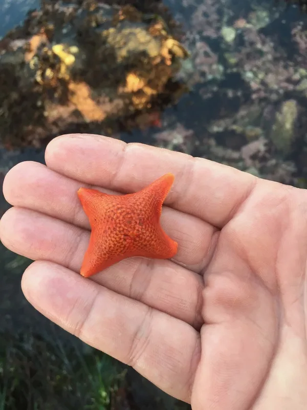
Bat Star Patiria miniata -
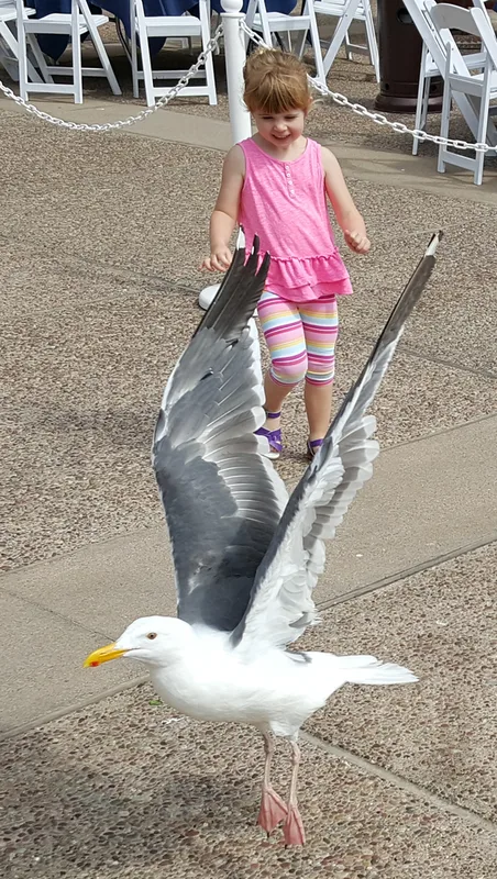
Western Gull Larus occidentalis -
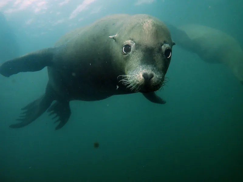
California Sea Lion Zalophus californianus -
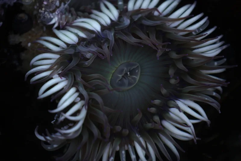
Sunburst Anemone Anthopleura sola -
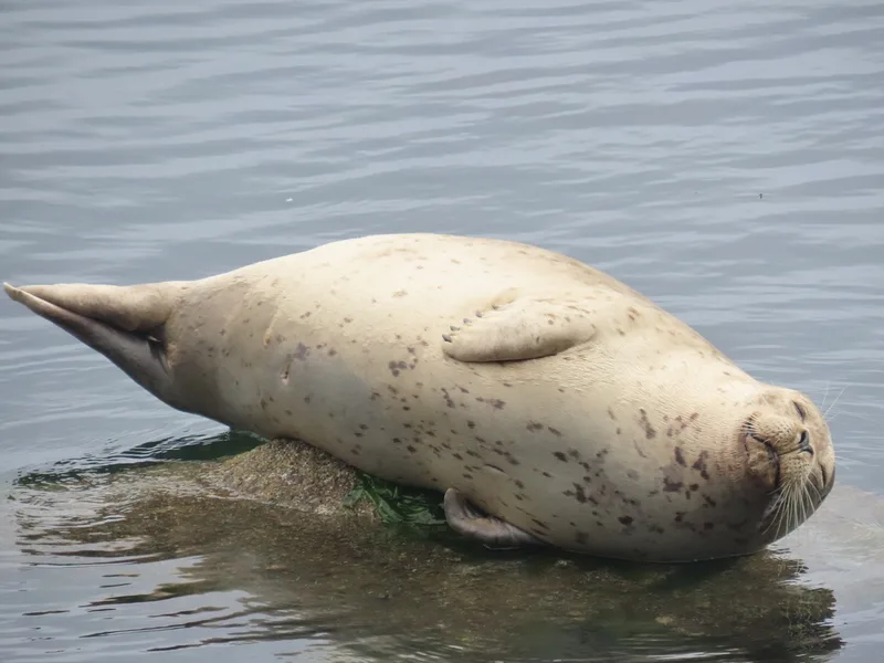
Harbor Seal Phoca vitulina -
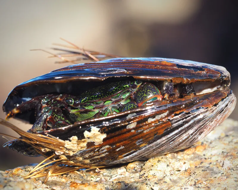
Striped Shore Crab Pachygrapsus crassipes -
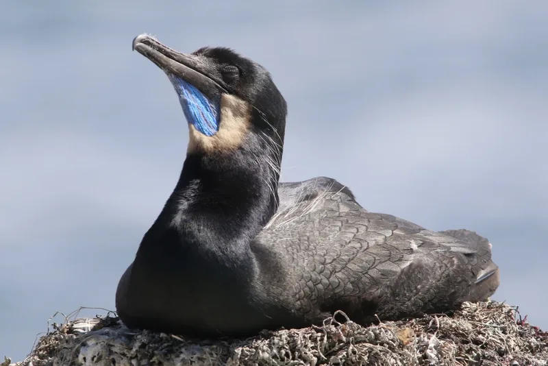
Brandt's Cormorant Urile penicillatus -
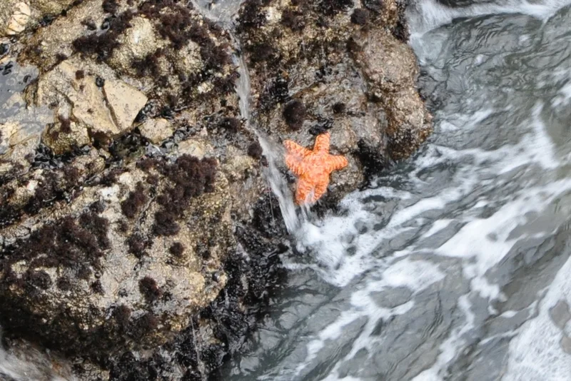
Ochre Sea Star Pisaster ochraceus -
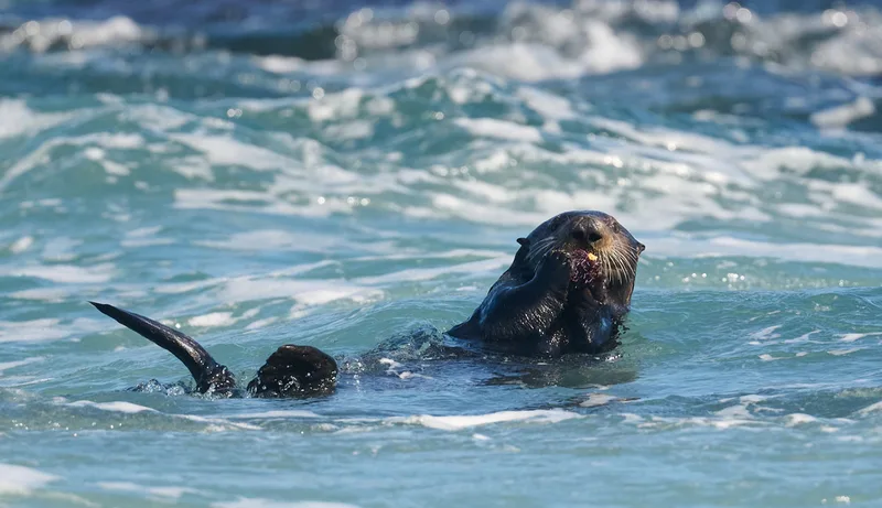
Pacific Purple Sea Urchin Strongylocentrotus purpuratus -
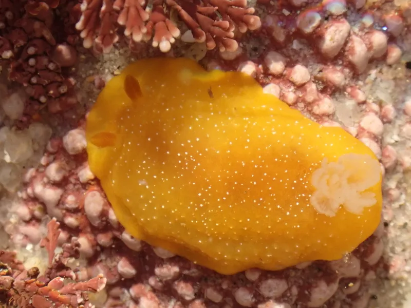
White-speckled Dorid Doriopsilla fulva -
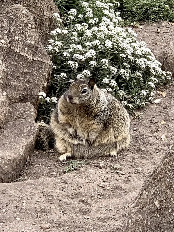
California Ground Squirrel Otospermophilus beecheyi -
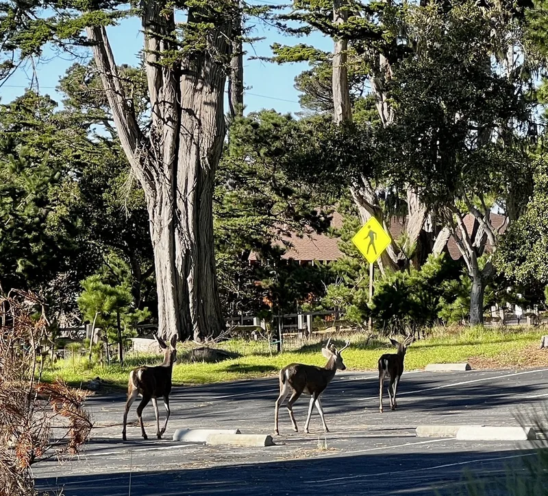
Mule Deer Odocoileus hemionus
Field Notes · Marine lens · Pacific Grove · 36.6211, −121.9178