The Monterey Peninsula
Pacific Grove · California, USA
The fog keeps the land cool enough for the sea to remain close to shore.
Also seen through Marine · all at Pacific Grove →.
Why here
The Monterey Peninsula is a coast of close attention. Fog softens the horizon, then the tide pulls your eyes down to rock pools, kelp edges, and birds working the water. The peninsula’s rocks remember a different coast: older dune sand, marine sandstone and mudstone, and granitic rock all meet around the shore. That variety gives the fog a living surface to work on. It cools the air, keeps the exposed edge from drying too quickly, and makes the intertidal zone a place of constant exchange. Walk from the lighthouse to the rocky points and the story stays the same. Sea, air, and stone keep changing one another, while the land holds just long enough for you to see it happen.
The story
The payload’s geology includes Miocene marine rocks, older dune sand, and granitic rock. Those materials weather differently, so the peninsula presents a broken shoreline of points, coves, and shelves rather than one uniform edge.
The living coast follows the structure. Sea lions and harbor seals use the water and rocks; anemones, sea stars, crabs, and urchins occupy the spaces left by the tide. The Custom House and Mission San Carlos Borromeo carry a human history in the payload, but the fog-coast lens stays with the meeting between marine life and the shore.
The sites
Where fog meets rock
Point Pinos Lighthouse
36.6334, −121.9337
Point Pinos puts the outer peninsula under a wide sky. The lighthouse is a human marker on a coast shaped by marine rock, wind, and fog, and its position makes the weather feel like part of the view rather than an interruption. Look toward the water, then back at the land immediately around you. The same moisture that blurs the horizon settles on the low vegetation and cools the shore. This is a good place to begin because it shows the peninsula as a headland, a point where air and water meet before the coast turns inward.
Watch the fog’s edge move across the water and then compare the color of the land beneath it. The cooler, damp air changes the look of the shore before it changes the shape of the view.
- AccessDrive-up
- ExertionEasy
- TimeAn hour
The Restless Sea
36.6099, −121.9559
At The Restless Sea, wave energy turns the shore into a moving demonstration. Water enters cracks and shelves, rebounds, and breaks into foam, while the rock beneath it keeps the boundary firm enough for tide-pool life to hold on. Fog makes the scene quieter in color but not in motion. Stand back and watch several waves rather than waiting for one dramatic break. The useful pattern is repetition: the sea tests the same ledges again and again, and the shore answers with a shape that can support anemones, crabs, and sea stars between tides.
Find a channel that fills and empties with each wave. The repeated flow leaves a small pocket of water behind, giving tide-pool animals a refuge when the main water pulls away.
- AccessShort walk
- ExertionEasy
- TimeAn hour
The tide's small world
Point Joe
36.6098, −121.9569
Point Joe is a rocky lookout over the narrow band where the peninsula’s land becomes living shore. Look down rather than only out. At low tide, color and movement gather in cracks, channels, and shallow pools: anemones hold their shape, crabs work the margins, and sea stars cling to rock that will soon be covered again. Fog matters here because it slows drying on the exposed coast, but the tide sets the larger rhythm. A good visit leaves room to stand still. The animals are small, and the shore reveals itself by degrees.
Find an anemone in a pool and watch its tentacles move with the water. It can stay attached to rock between tides because the pool holds moisture after the surrounding shore drains.
- AccessShort walk
- ExertionEasy
- TimeAn hour
China Rock
36.6055, −121.9593
China Rock keeps the focus on the material of the shore. Marine sandstone and mudstone weather into ledges, cracks, and softer pockets, while harder surfaces remain available to the organisms that need attachment. The geology is not background here. It decides where water can collect and where a sea star or anemone can hold fast. Walk the edge with care and resist the urge to turn every dark patch into a creature. First read the rock’s grain and its fractures. Then look for the living things using those small differences in shelter.
Compare a smooth exposed slab with a nearby crack. The crack stays damp longer and gives tide-pool life protection from sun and waves, so it is a better place to search.
- AccessShort walk
- ExertionEasy
- TimeAn hour
A coast built from layers
Lover's Point
36.6267, −121.9155
Lover’s Point turns the peninsula back toward its settled edge, where people and marine life share a narrow shoreline. The water remains the main architect below the promenade: tides fill rock pools, gulls work the surface, and harbor seals may appear farther out. Behind you, the land carries older geological layers and the traces of a long human coast. Use the point as a place to connect those scales. The fog can arrive without drama, cooling the same rocks that hold the tide’s smaller communities. A short walk here can make the peninsula feel less like a view and more like a working boundary.
Look from the built shoreline toward the rocks below it. Notice how human paths concentrate attention on the same narrow strip where tides, birds, and marine animals also gather.
- AccessShort walk
- ExertionEasy
- TimeAn hour
When it's best
Fog is most characteristic in the warmer part of the year, though the coast can turn gray in any season. Low tide reveals the greatest variety of rock-pool life, and calm mornings make the small movements easier to see. Winter storms reshape the mood of the shoreline and can make exposed points rough. Bring time for the weather to change rather than treating a clear forecast as the whole experience.
Go deeper
The names behind what you saw. The peninsula includes Miocene marine sandstone and mudstone, older dune sand, and Cretaceous granitic rock. The tide-pool animals include the ochre sea star, Pisaster ochraceus, and sunburst anemone, Anthopleura sola.
To read next. - Pacific Grove Marine Gardens State Marine Conservation Area — an introduction to the protected shore and its living communities. - Monterey Peninsula — a broad account of the land and communities around the coast.
The names behind what you saw
What lives here, and what it's called. Photographs from open collections — an aid to identification, not decoration.
-
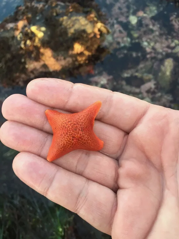
Bat Star Patiria miniata -
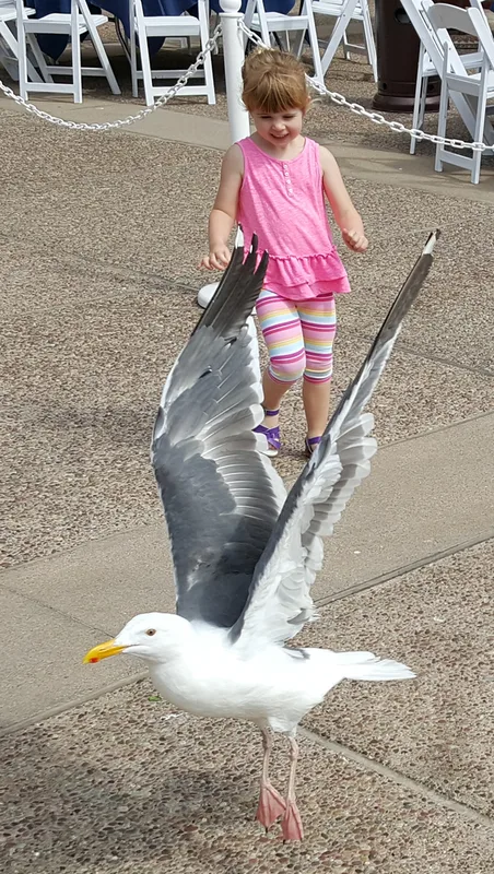
Western Gull Larus occidentalis -
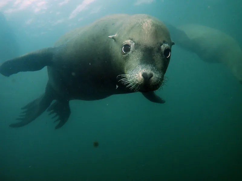
California Sea Lion Zalophus californianus -
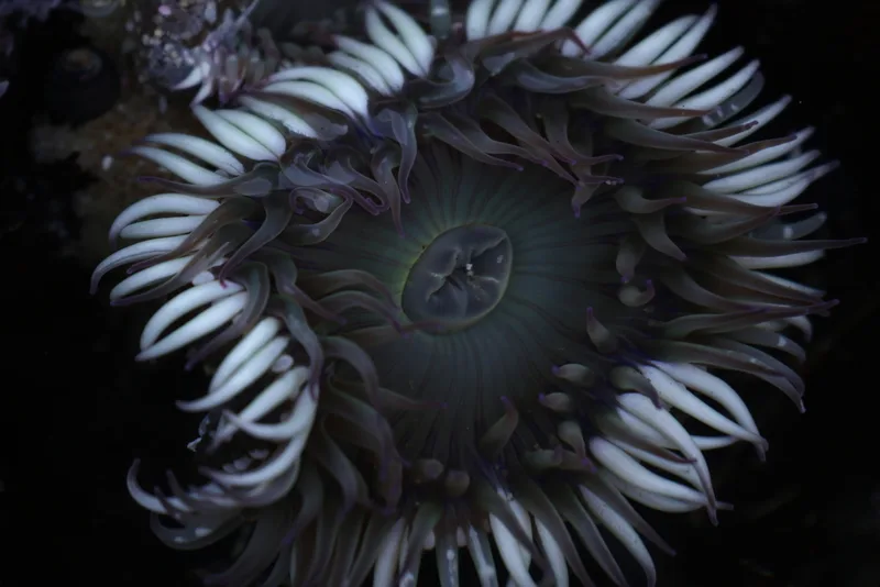
Sunburst Anemone Anthopleura sola -
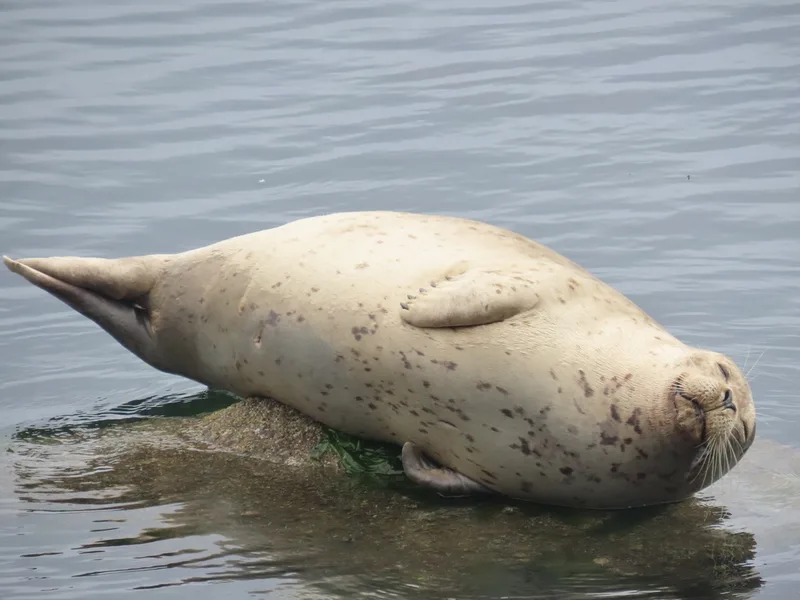
Harbor Seal Phoca vitulina -
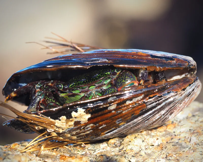
Striped Shore Crab Pachygrapsus crassipes -
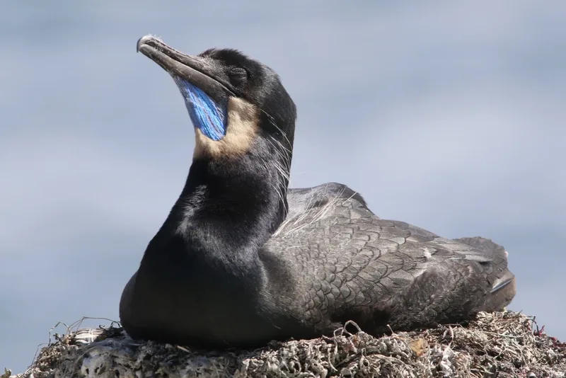
Brandt's Cormorant Urile penicillatus -
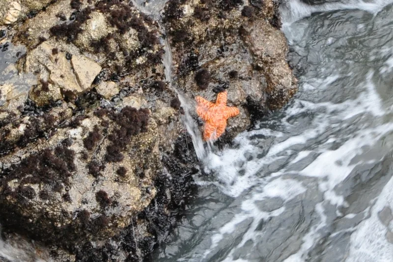
Ochre Sea Star Pisaster ochraceus -
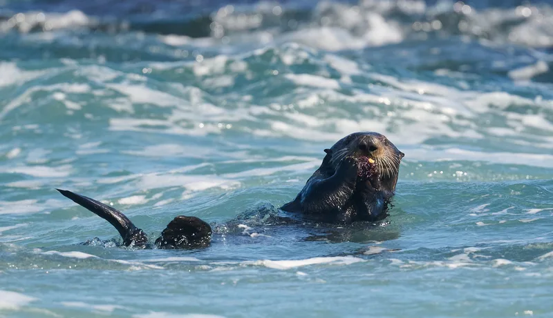
Pacific Purple Sea Urchin Strongylocentrotus purpuratus -
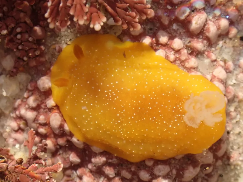
White-speckled Dorid Doriopsilla fulva -
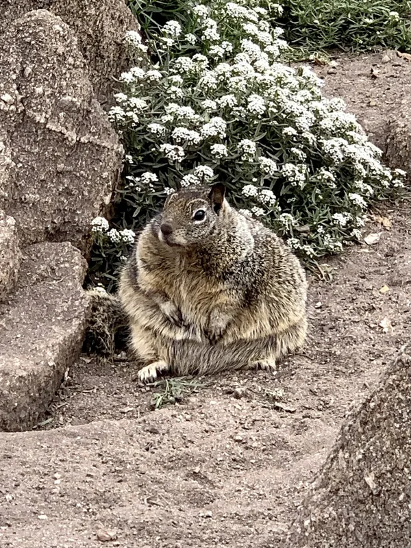
California Ground Squirrel Otospermophilus beecheyi -
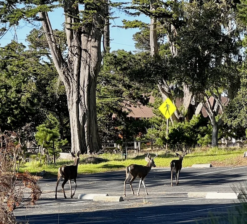
Mule Deer Odocoileus hemionus
Field Notes · Fog Coast lens · Pacific Grove · 36.6211, −121.9178