Mauna Kea
Mauna Kea Access Road · Hawaii, USA
A mountain built not from one eruption, but from countless small ones, and still, by its own telling, not finished.
Also seen through Night Sky · all at Mauna Kea Access Road →.
Why here
The road up Mauna Kea crosses a line you can actually see. Below it, the mountain wears grass and low forest, gentled by long weathering. Above it, the ground turns to bare hill after bare hill, and none of them mark a single grand eruption, because none of them are one. Mauna Kea is not the record of one event; it is a broad shield built low and wide by an enormous number of separate, mild lava flows, laid down again and again over a stretch of time so long, and yet so recent, that geologically speaking almost none of the rock up here counts as old. Near the end of that long building, the eruptions changed style. Instead of spreading out as sheets, they piled straight up into small, freestanding hills, cinder cones the Hawaiian language calls puʻu, and it is one of those cones, not a single sharp peak, that holds the true summit. Mauna Kea is dormant, not finished. Every stop on this trip keeps returning to that one shape, a thin sheet, then a standing cone, repeated at every scale, from a roadside hill to the summit itself.
The story
Mauna Kea is the sum of an enormous number of small, mild eruptions rather than one dramatic one: lava spreading thin and going quiet, over and over, until a broad shield stood where open ocean floor once was. Even now, none of that rock is older than a few million years. Late in the mountain’s life the eruptions changed character. Instead of spreading out, they piled straight up, building the small standing cones, puʻu, that crown the summit today, the true top among them.
On the lower slopes, that young volcanic ground carries a forest of māmane, a native tree with yellow flowers, growing where soil has had time to form on old lava. The palila, a small yellow-green finch, depends on the tree’s seed pods to feed its young, and birders still report it in these woods.
The summit carries a longer human story than its bare rock suggests. Hawaiian tradition holds it as the most sacred of the island’s dormant volcanoes, home to the sky god Wākea and other gods. That reverence collided directly with astronomy’s ambitions in the mid-2010s, when plans for a major new telescope, the Thirty Meter Telescope, drew sustained protest: a blockade of the summit road, the arrest of dozens of people, and a movement that spread from the island to a global audience. The mountain remains, in every sense, contested ground.
The sites
The shield you drive up
Mauna Kea Visitor Information Station
19.7614, −155.4560
This station sits partway up Mauna Kea’s long flank, at the boundary between the green, forested lower shield and the bare volcanic country above. It is a support point for people headed higher on the mountain, but for this lens its real value is as a vantage: from here you can look back down the broad, gentle slope that makes Mauna Kea a shield volcano rather than a steep-sided peak, built low and wide by a huge number of thin, mild lava flows rather than a handful of violent ones. Look uphill and the character of the ground changes: fewer plants, more bare rock, and the first small standing hills start to break the skyline. Those hills mark a shift late in the mountain’s life, when the eruptions stopped spreading out and started piling straight up. Give yourself a few minutes here to take in the whole shape of the volcano at once, something that is hard to do once you are inside the summit’s crowded field of cones.
Face uphill and trace the mountain’s outline against the sky. Where the smooth curve of the slope breaks into small separate bumps, you’re looking at the first of the summit’s cinder cones, each one a short-lived eruption that piled straight up instead of spreading out.
- AccessDrive-up
- ExertionEasy
- TimeAn hour
Puʻukalepeamoa
19.7539, −155.4589
Puʻukalepeamoa is one of the smaller standing hills scattered along Mauna Kea’s upper flank, a cinder cone in its own right, well below the crowded field of cones at the true summit. Up close, a cone like this reads less like a mountain and more like a heap: loose, coarse cinder, piled by a short, sharp eruption that threw fragments of magma into the air fast enough for them to cool and fall as solid pieces rather than run out as a flow. Cones like this are common wherever a shield volcano is winding down; they mark the later, more explosive-tempered eruptions that follow age after age of gentler, sheet-forming flows. Walking its slope, you are standing on debris rather than a solid flow, and the ground underfoot is looser and coarser than the smoother lava lower on the mountain. It is a small stop, but a clear one: the same process that built the cones crowding the true summit, in miniature, close enough to the road to visit without committing to the high mountain.
Look at the ground itself rather than the view: the loose, fist-sized reddish rubble underfoot is cinder, not solid lava. Each piece cooled in mid-air during a single explosive burst, which is why a cone like this is built of separate fragments instead of one hardened sheet.
- AccessShort walk
- ExertionModerate
- TimeAn hour
Ho'okomo
19.7265, −155.4507
Not far from Puʻukalepeamoa, Ho’okomo marks a vent, one of the actual points on the mountain’s flank where lava or cinder once reached the surface. Most of Mauna Kea’s bulk was built from flows fed by vents like this one, each active for a short spell before falling silent, rather than from one long-lived central crater doing all the work. That is part of what makes a shield volcano a shield: instead of a single throat erupting again and again from the same spot, the mountain grows from many separate points along its flanks and summit, each contributing its own small share. Standing at a vent, there is little drama to see today; no crater lake, no steam, nothing that announces what the ground once did. What is here instead is the plainer, and in its way more useful, fact: this exact spot, and hundreds like it across the mountain, is one of the actual places the volcano built itself, piece by piece, rather than a viewpoint looking at that story from a distance.
Look for a subtle low mound or shallow depression in the ground rather than a dramatic crater. A flank vent like this rarely leaves more than a gentle swelling or sag; the drama was in the eruption itself, long ago, not in what it left behind.
- AccessShort walk
- ExertionModerate
- TimeAn hour
A crown of cones at the summit
Mauna Kea Summit (Puʻu Wēkiu)
19.8206, −155.4681
The true summit of Mauna Kea is not a single sharp point but Puʻu Wēkiu, one cone among a cluster crowding the mountain’s top. That fact alone tells the mountain’s story in miniature: after ages of gentle, sheet-building flows raised the broad shield below, the last phase of activity switched to smaller, steeper, pile-up eruptions that left a crowd of separate hills rather than one final summit dome. Puʻu Wēkiu simply happens to be the tallest of that crowd. Reaching it means climbing through some of the thinnest air and coldest, most exposed ground on the mountain, well above where plants can hold on. In Native Hawaiian tradition the summit region is held sacred, and visitors are asked to move through it with that meaning in mind. For this lens, the summit is best understood less as a single destination and more as the densest patch of the same cone-building process visible in smaller doses lower on the mountain, the mountain’s most recent chapter, still legible underfoot.
From the summit area, count the separate rounded hills crowding the skyline rather than fixing on the one you’re standing on. Each is its own short-lived eruption; together they show that the mountain’s last chapter was written cone by cone, not as one final event.
- AccessExpedition
- ExertionStrenuous
- TimeHalf a day
Lake Waiau
19.8112, −155.4774
Lake Waiau sits inside one of the summit’s cinder cones, a small lake cupped in what was once a vent for eruption debris rather than water. Here it survives mostly on rain and fog rather than any inflowing stream, collecting in a natural rock-and-ash basin that the surrounding cone happens to hold shut. The setting says as much about the mountain’s structure as any exposed rock face: a cinder cone is not solid through and through, it is loose, permeable debris that can nonetheless pond water if the shape is right and the climate cooperates, even at an elevation where almost nothing grows. Visiting means a walk across bare, high-altitude cinder alongside the very hills this whole note has been pointing you toward, with the lake itself as a quiet, unexpected payoff — water where the surrounding landscape otherwise reads as dry, broken rock.
Look at the basin holding the lake, not just the water in it: notice how the surrounding slope is loose cinder rather than solid rock. The lake exists because that loose, cone-shaped bowl happens to hold water instead of draining it away.
- AccessHalf-day hike
- ExertionModerate
- TimeAn hour
Built on the cones
Submillimeter Array
19.8243, −155.4780
The Submillimeter Array sits at the summit among the crowd of small volcanic cones, its dishes arranged across ground that is, underfoot, the same loose cinder as the more anonymous hills elsewhere on this trip. It is easy to look at the telescopes up here and think first about the sky; it is worth also looking down. The summit facilities were sited on this particular patch of mountain in part because the cones sit above much of the atmosphere’s turbulence and moisture, a fact about the volcano’s shape and elevation before it was ever a fact about astronomy. The array itself has no casual public access, and there is little to see up close beyond its dishes and support buildings, but from a respectful distance it is a clear marker of how much built infrastructure now shares the ground with the mountain’s own cone field, on rock that finished forming, geologically, only a moment ago.
From a distance, compare the ground the dishes stand on with the bare cone slopes nearby. It’s the same loose cinder throughout the summit area, a reminder that the observatories were built onto the volcano’s own recent handiwork, not beside it.
- AccessDrive-up
- ExertionModerate
- TimeAn hour
Gemini North Observatory
19.8238, −155.4691
Gemini North stands within the same crowded field of small volcanic cones as its neighboring observatories at the summit, its wide dome an unmistakable landmark against a skyline of hills. Like the ground beneath the other summit facilities, the telescope’s foundation sits on cinder and rock built up during the mountain’s last, most explosive phase of activity, proof that even the summit’s newest additions are built directly on top of volcanic history rather than beside it. From a distance, the dome makes a useful scale reference: measure it against the cone it sits beside and you get a sense of just how large those small hills actually are up close, each one substantial enough to carry a major research facility on its slope. As with the array nearby, there is no casual public access to the interior, but the exterior and its setting are visible from the summit road, one more data point in the same cone-building story told across this whole trip.
Compare the dome’s width against the cone it sits beside or on. What looks like a modest hill from the access road turns out, next to a building this size, to be a genuinely large landform — each cone here is a small mountain in its own right.
- AccessDrive-up
- ExertionEasy
- TimeAn hour
When it's best
There is no wrong season to see Mauna Kea’s shape; the shield and its cones do not change with the calendar. What changes is the weather, and it changes fast: even on a mild day, the access road climbs from warm coastal air into cool, thin-aired country, and conditions higher up run colder still. Winter is the snow season at the summit, when the highest cones can carry a white cap for stretches; the lower slopes stay milder and drier, and are the easier season for walking among the roadside cinder hills.
Go deeper
The young lava across this mountain’s upper slopes is mapped as the Laupahoehoe Volcanics, a formation of basaltic lava flows laid down within roughly the last few million years, essentially all of it Quaternary in age. Mauna Kea itself is classed simply as a shield volcano built of mafic, basalt-family rock. The native yellow-flowered tree on the lower slopes is māmane, Sophora chrysophylla; the finch that depends on it is the palila, Loxioides bailleui. The true summit cone carries its own name, Puʻu Wēkiu.
This place doesn’t yet have a vetted further-reading list attached to it. Rather than pad the list with guesses, the honest move is to point you back to the names above: search any of them and you land on solid, verifiable ground. Two are worth the first search if you only make two — Laupahoehoe Volcanics, for the lava that built the mountain you’re standing on, and the Thirty Meter Telescope protests, for the modern chapter of who this summit belongs to.
The names behind what you saw
What lives here, and what it's called. Photographs from open collections — an aid to identification, not decoration.
-
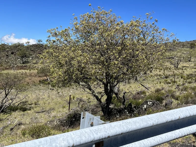
Māmane Sophora chrysophylla -
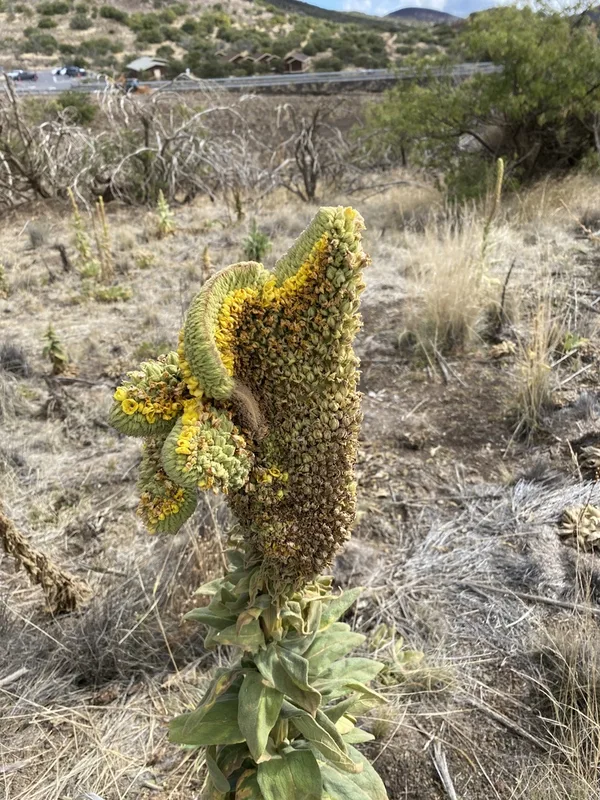
great mullein Verbascum thapsus -
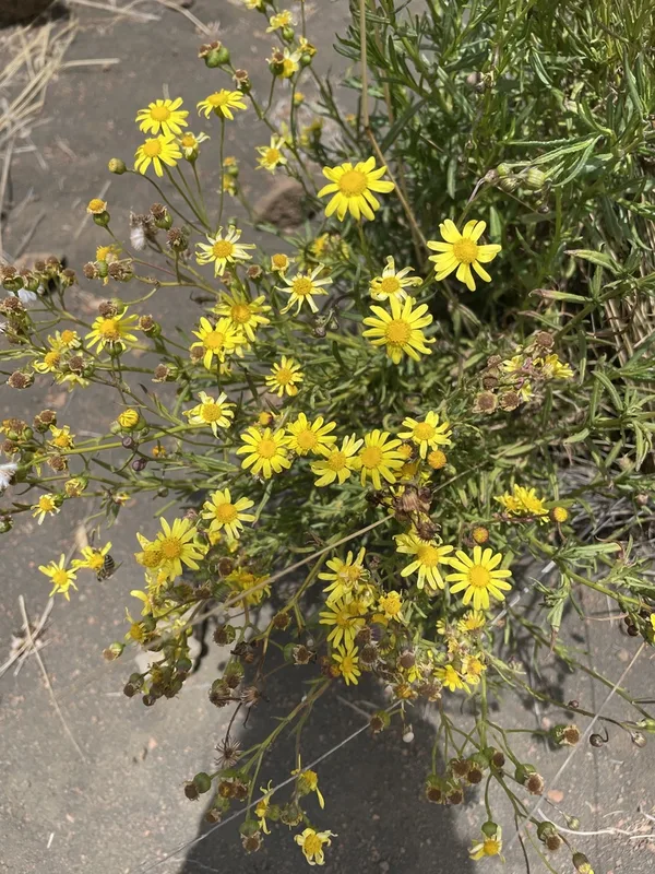
Madagascar Ragwort Senecio madagascariensis -
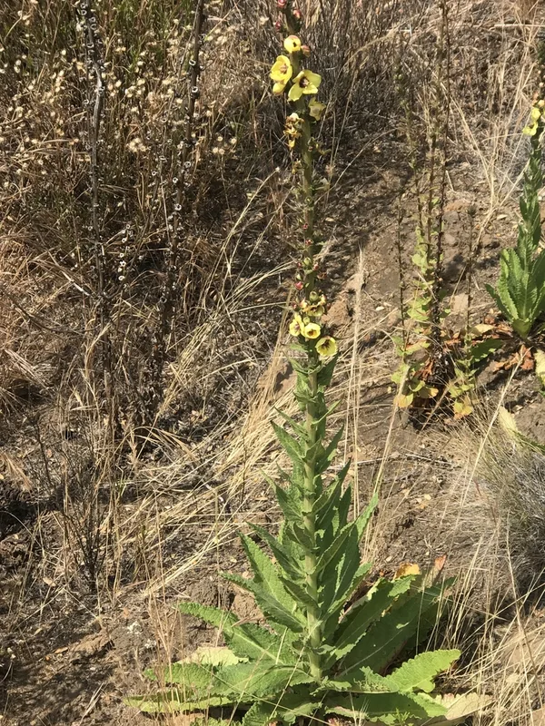
Wand Mullein Verbascum virgatum -
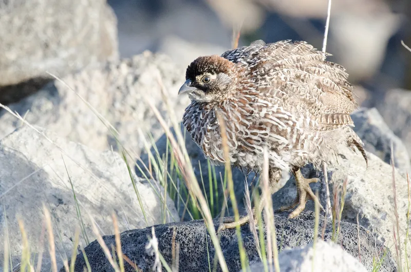
Erckel's Spurfowl Pternistis erckelii -
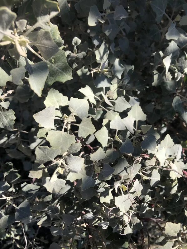
ʻAweoweo Chenopodium oahuense -
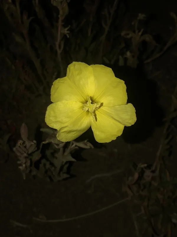
fragrant evening-primrose Oenothera stricta -
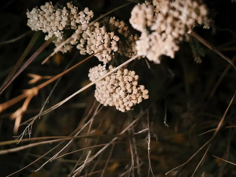
common yarrow Achillea millefolium -
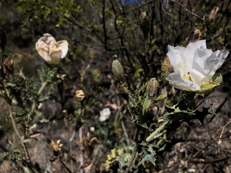
pua kala Argemone glauca -
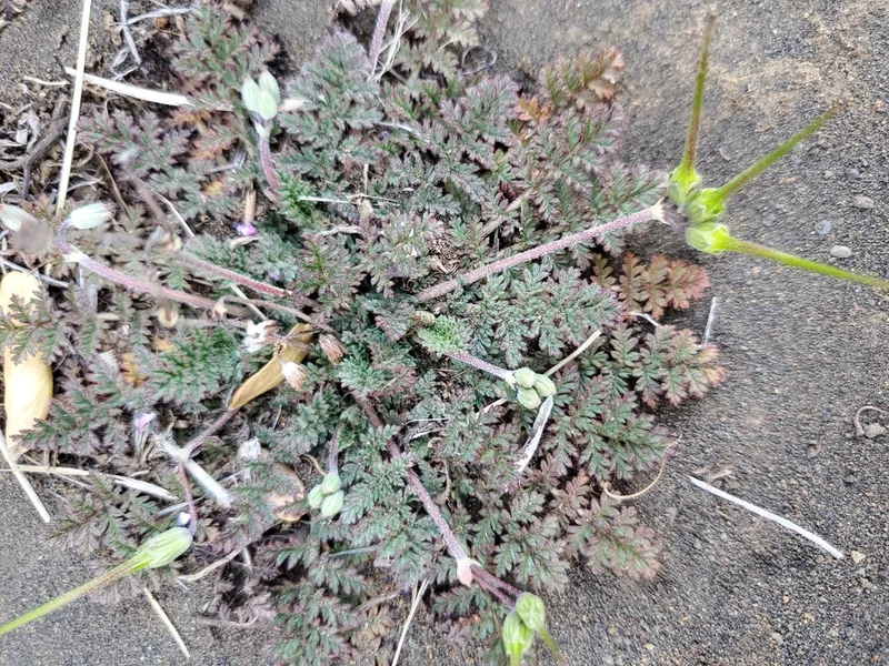
Redstem Stork's-bill Erodium cicutarium -
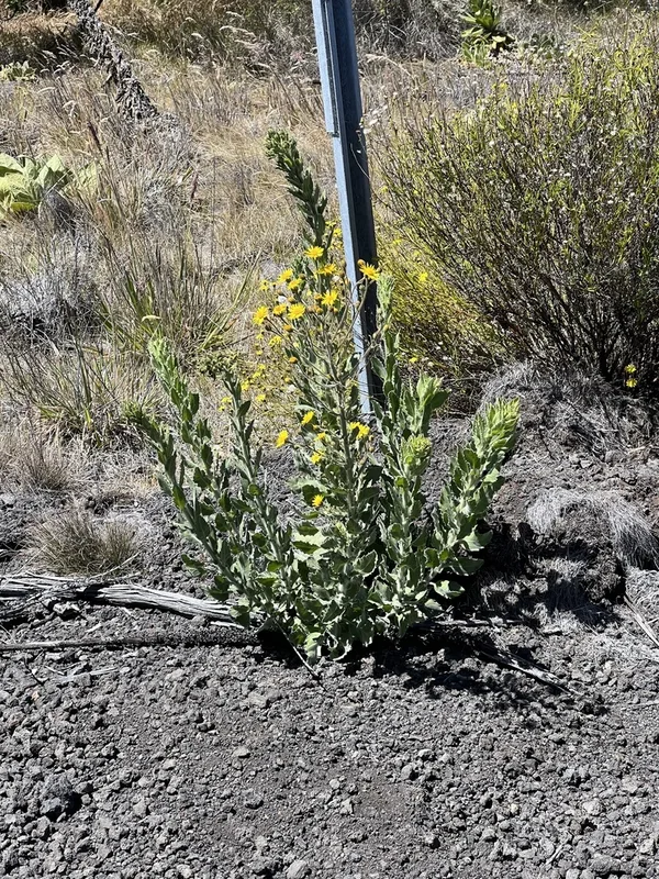
Telegraphweed Heterotheca grandiflora -
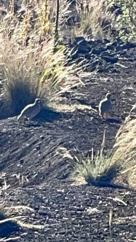
Chukar Alectoris chukar
Field Notes · Volcanic lens · Mauna Kea Access Road · 19.7242, −155.4474