Lassen
Lassen Volcanic National Park · California, USA
The ground here has not finished cooling. Walk far enough in, and you can feel it breathe.
Also seen through Rivers & Canyons · all at Lassen Volcanic National Park →.
Why here
Walk a few miles into the middle of this park and the ground begins to breathe. Steam slips out of bare clay, water mutters where no stream should be, and the air goes sharp with sulphur. This is not scenery that finished long ago and cooled into a view. Far below your boots, an old slab of ocean floor is still grinding down under the western edge of the continent, and the heat it drags into the earth has fed one volcano after another along this seam for tens of millions of years. Lassen stands at the southern end of that chain, the last still-active volcano before the Cascade Range gives out. What earns it a week rather than an afternoon is the sheer range of the evidence: this is one of only a handful of places on Earth where all four kinds of volcano — the tall cone, the broad shield, the loose cinder heap, and the stiff plug of lava — stand inside a single park. Everything that follows is the same thing seen from a new angle: land still being built, and still cooling.
The story
Start underground. For tens of millions of years, a slab of ocean floor has sunk beneath this coast, and the melt it releases has risen here again and again to build mountains straight out of the ground. Most of the rock underfoot is the record of that long process — dark old flows of andesite and basalt, with lighter, stiffer rock where the melt cooled slowly and piled up steep instead of running. Some of those piles are barely cooled. The land is still warm to its core.
Life takes the fresh ground quickly. As the snow pulls back each year, a blunt red stalk with no green leaf on it pushes up through the pine litter — snowplant, which lives off the fungal threads in the soil rather than off the sun. In good summers, loose clouds of a single orange-brown butterfly, the California tortoiseshell, drift over the high passes. On any warm rock, a ground squirrel with a bright side-stripe suns itself and keeps one eye on you.
People and fire are the newest chapter. In 2021 the largest single wildfire in California’s record swept through this country, burning into Warner Valley on its way. The black trunks it left standing are already feeding a woodpecker that hunts almost nowhere but burned forest. Who first lived beneath these volcanoes, and what they made of them, the sources gathered here do not say.
The sites
The volcano still cooling
Lassen Peak Trailhead
40.4749, −121.5057
This is the mountain the park is named for, and the reason the whole place looks the way it does. Some lava runs thin and fast, like syrup poured downhill; the lava that made this peak was stiff and pasty, too thick to flow far. Instead it welled up over its vent and stacked on itself, higher and higher, into a steep dome of its own broken rock — the largest mountain of its kind found anywhere. It is also the last still-active volcano at the southern end of this long line of Cascade volcanoes, which is only another way of saying that the heat that built it has never fully gone out. The trail to the top is a long, open climb, switchbacking up bare rock with no shade and thinning air near the summit. It rewards a clear, settled day and an early start, and it puts the whole park at your feet: cones, domes, lakes, and the pale scars of steaming ground, all laid out below in a single view.
Partway up, stop where the trail cuts through pale, blocky rock and pick up a loose piece. Turn it over — it is pocked with holes, like frozen froth. Those are gas bubbles caught in lava too stiff to let them escape, the very reason this became a steep dome instead of a wide, flat flow. Now look uphill: the whole mountain is built of the same piled, broken rock.
- AccessHalf-day hike
- ExertionStrenuous
- TimeHalf a day
Bumpass Hell Trailhead
40.4661, −121.5140
The trail here leads to the plainest proof that the volcano is still alive. Rain and melting snow soak into the ground, sink until they reach rock still heated by magma not far below, and rise back to the surface as steam and boiling water. What they make is a raw, open basin: hissing vents, pools the colour of milk, mud that plops and churns, and bare ground stained yellow, orange, and grey, all crossed by a boardwalk built to keep you off it. Stay on the boards. The crust is thin in places, the pools are scalding, and the ground that looks solid often is not. This is not the tidy aftermath of an old eruption but the volcano’s plumbing laid open — the same underground heat that raised the surrounding peaks escaping here through one weak, wet seam in the rock. Give it time. The longer you stand, the more separate vents and springs you pick out, each with its own voice.
Stand where the steam blows thickest and breathe in — the rotten-egg smell is sulphur, carried up from deep rock by the rising gas. Then fix on a single pool and watch it for a full minute. The bubbling is not a fire boiling it from below but steam and gas forcing up through the water, the heat of the whole park leaking out one pool at a time.
- AccessHalf-day hike
- ExertionModerate
- TimeHalf a day
The shapes a volcano takes
Cinder Cone Trailhead
40.5639, −121.3021
Out on the park’s quieter eastern side stands a clean example of the simplest kind of volcano there is. A cinder cone is built in a hurry: a single vent throws frothy, half-molten blobs of lava into the air, they harden as they fall, and the loose cinders pile up around the opening into a steep, almost perfectly round heap. This one did just that, and at the same time thick lava oozed from its base and spread across the flats below as dark, jagged fields of broken rock that have barely begun to weather. The way up is short but punishing — the cinders are loose as dry gravel, and every step forward slides you half a step back. From the rim you look straight down into the bowl the eruption left, and out across the black lava the same event poured onto the plain. It is about as close as the ground comes to showing its work.
On the climb, scoop up a handful of the black-and-red cinders. Feel how light they are for their size and how riddled with holes — this is lava that came out so full of gas it set as froth in mid-air. Then look at the cone’s neat, round rim: nothing shapes that but gravity pulling falling cinders into a pile, the same on every cinder cone on Earth.
- AccessHalf-day hike
- ExertionStrenuous
- TimeHalf a day
Chaos Crags and Jumbles Scenic Pull-out
40.5417, −121.5432
From this pull-out you can read a single fast, violent event written across the slope. Above you stand steep, raw domes of pale lava — stiff rock shoved up in a pile, much like the main peak but younger-looking and barely touched by weather. Below and in front of you spreads a wild jumble of broken blocks, tumbled out across the flat ground for a long way. The two are one story. Steep domes of stiff lava are unstable things, and when a piece of one lets go it does not trickle — it comes down all at once as a dry avalanche of shattered rock, moving fast and running far over open country. What you are looking at is a mountainside that collapsed and spread out here, then stopped, and has sat unfinished ever since. Nothing has had time to soften it. Give the scene a slow look and the crags above and the rubble below stop being two things and become before and after.
Look up at the pale domes, then down at the field of broken rock at their foot, and connect the two by eye. The blocks in the jumble are the same stone as the crags above — pieces that broke off the steep front and ran out onto the flat. Try to trace the path they took downhill; the whole slope is one fallen mountainside, caught in the middle of moving.
- AccessDrive-up
- ExertionEasy
- TimeAn hour
Manzanita Lake Trailhead
40.5359, −121.5628
At the park’s western entrance, a still lake lies below the pale domes, and on a windless morning it doubles them. This is the gentlest stop in the note and one of the best places to simply take in the shapes the rest of these pages try to explain — the broad shoulders of the main peak farther off, and nearer at hand the steep, young domes, all held upside down in flat water. A level path follows the shore, so it asks little of you beyond time and an early alarm. The lake is also a good deal livelier than it first looks: the forest that rings it is full of birds, and its edges are busy with small mammals working the rocks and logs. Come before the day’s wind ruffles the surface and the reflection is as sharp as the mountain itself. It makes a fitting first or last stop, the whole volcanic story gathered into a single calm view.
Come at first light and find the stretch where the water lies dead still and the peak stands mirrored in it. Then walk the shoreline and look for the golden-mantled ground squirrel — chipmunk-sized, with a bold stripe down each flank but, unlike a chipmunk, no stripe across its face. It suns itself on warm rock and will often hold still just long enough for you to be sure.
- AccessShort walk
- ExertionEasy
- TimeHalf a day
Water works the fresh rock
Kings Creek Falls Viewpoint
40.4597, −121.4412
Here a clear mountain creek gathers in the high meadows, then drops in a bright, noisy falls over a lip of hard lava. It is a small, exact lesson in what happens once a volcano goes quiet: water gets to work on the fresh rock at once, seeking out the soft seams and cutting down through them, while the toughest old lava flows resist and stand as ledges — and every ledge becomes a waterfall. The walk down to the falls is easy and shaded; the climb back up is where you earn it, so leave enough in the tank for the return. In early summer the meadows along the way run wet and green, and the creek is at its loudest with the last of the snowmelt. Later in the season it quiets and thins, and the rock it pours over shows more plainly. Either way, the falls make audible a process that is usually far too slow to watch.
Stand near the drop and look hard at the rock the water pours over. The creek has not cut a smooth ramp but falls in a sudden step — it has bitten down quickly through softer ground above and then stalled against a band of tougher old lava. Every waterfall in volcanic country marks exactly this: a place where the rock changed and the water met something it could not cut as fast.
- AccessHalf-day hike
- ExertionModerate
- TimeHalf a day
Summit Lake South Trailhead
40.4888, −121.4227
Near the middle of the park, this lake rests in a shallow basin ringed by hemlock and fir, a central, easygoing place to slow down between the harder climbs. The water is shallow enough that it loses its winter chill by late summer, and the forest that surrounds it is thick with birdsong morning and evening. Its position makes it a natural base: much of the high country the rest of this note describes lies only a short drive up or down the road from here, so you can range out to the peak, the steaming basin, or the falls and come back to still water at the end of the day. It asks nothing strenuous of you. A slow lap of the shore, an hour with the light on the trees, and the volcanic country feels, for a while, like an ordinary and very pleasant mountain lake — which, between eruptions, is exactly what it is.
Walk the shore at dusk and pick out the tall trees whose very tips droop to one side — mountain hemlock, a tree of cold, snow-buried heights that always nods its leader downhill. Then just listen. The soft, flutey phrases of a thrush carry a surprising distance across still water in the last light.
- AccessDrive-up
- ExertionEasy
- TimeHalf a day
Fire, and what comes after
Drakesbad Trailhead
40.4439, −121.4047
At the park’s southern edge, a long gravel road climbs Warner Valley to its head, a warm, meadowy pocket with a small hot spring — more mild proof of the heat still held in the rock below. It is also where you come face to face with the park’s newest shaping force. In 2021 the largest single wildfire in California’s record burned across this country and pushed into Warner Valley. In a forest like this, fire is less an ending than a hard turn in a long life, and the black, standing trunks it left behind are already crowded with new work. Walk in quietly. The burned stands are stark and open, easy to move through, and they belong for a few years to a set of creatures that need exactly this — freshly killed wood, and the insects that rush to it. Then the wood rots, the insects fade, and the forest moves on to its next chapter without them.
Watch the standing dead trees for a stocky black woodpecker working steadily up a burned trunk — the black-backed woodpecker, a bird that hunts almost only in freshly burned forest, prying under loose bark for the fat beetle grubs that swarm fire-killed wood. Listen for its even tapping. Within a few years, as the dead wood softens and the beetles thin out, it will move on to the next burn.
- AccessDrive-up
- ExertionEasy
- TimeHalf a day
When it's best
Lassen is a high, cold place, and snow sets its rhythm. The heart of the park lies under deep snow for much of the year, and the road that crosses it opens only once summer has finally cleared the drifts. High summer into early fall is the reliable window — the passes, the peak, and the steaming ground all reachable and mostly dry. As the snow pulls back at the forest edges, look for the blunt red spike of snowplant pushing through the pine litter; in a good year, loose clouds of California tortoiseshell butterflies drift across the high country in late summer, though some years bring almost none. Come the first storms, the high road closes again, and the quiet lower valleys are what stay open to a walk.
Go deeper
The names behind what you saw. The mountain the park is named for is Lassen Peak, a plug dome — geologists also call it a lava dome — at the southern end of the Cascade Range and its line of volcanoes, the Cascade Volcanic Arc. The dark “old lava” underfoot is mapped as Quaternary volcanic flow rock of the Cascade Volcanic Field, mostly andesite and basalt with lesser rhyolite and dacite. The red, leafless spike is snowplant, Sarcodes sanguinea; the striped sunbather is the golden-mantled ground squirrel, Callospermophilus lateralis; the drifting orange butterfly is the California tortoiseshell, Nymphalis californica; the nodding-topped tree is mountain hemlock, Tsuga mertensiana; and the burned-forest specialist is the black-backed woodpecker, Picoides arcticus.
To read next. - Geologic field-trip guide to Lassen Volcanic National Park and vicinity (2015) — a stop-by-stop tour of the very domes, cones, and steaming ground in this note, written to be followed on the road. - Geologic map of Lassen Volcanic National Park and vicinity (2010) — the modern map that names, colours, and dates each separate flow and dome, if you want to know which eruption you’re standing on. - Geology of the Lassen Volcanic National Park, California, Howel Williams (1932) — the classic early study that first pieced the volcanoes’ history together, still cited a lifetime later. - Geology and Rock Magnetism of Cinder Cone Lava Flows (1966) — narrow but rewarding if the cinder cone caught you, tracing its flows by the faint magnetism frozen into the rock2.0.co;2].
The names behind what you saw
What lives here, and what it's called. Photographs from open collections — an aid to identification, not decoration.
-
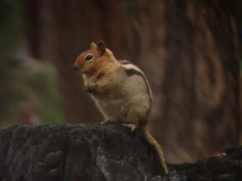
Common Golden-mantled Ground Squirrel Callospermophilus lateralis -
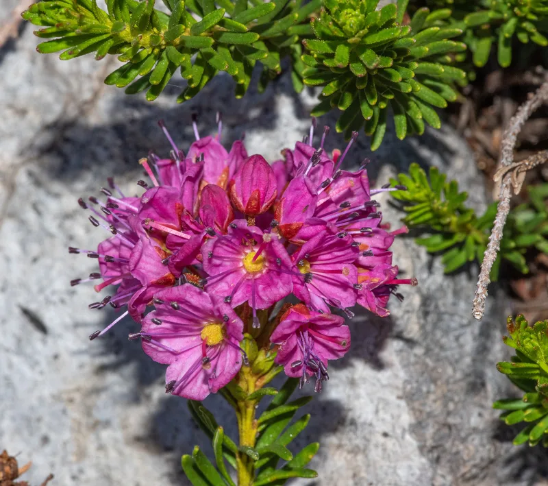
Purple Mountain-heath Phyllodoce breweri -
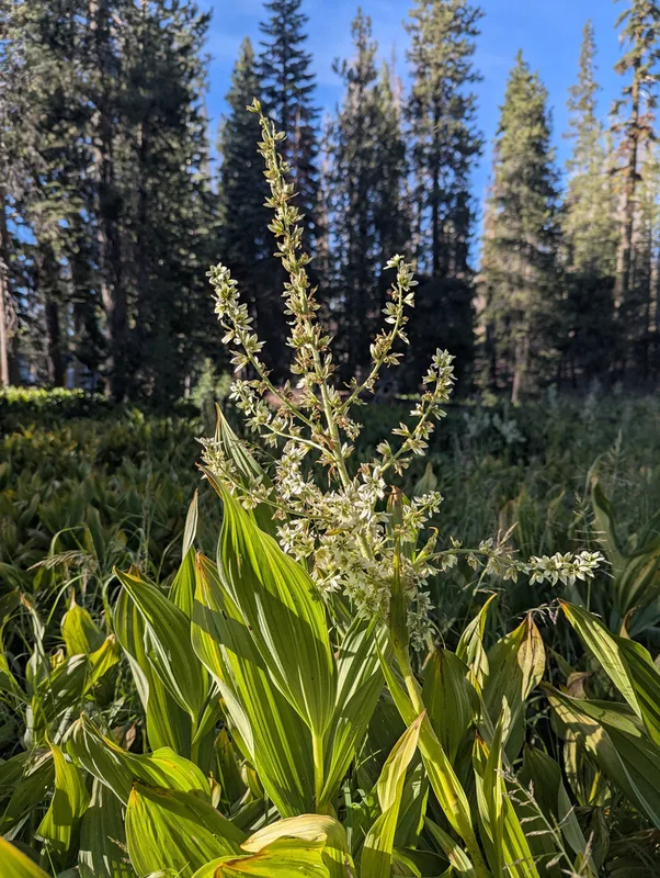
Corn Lily Veratrum californicum -
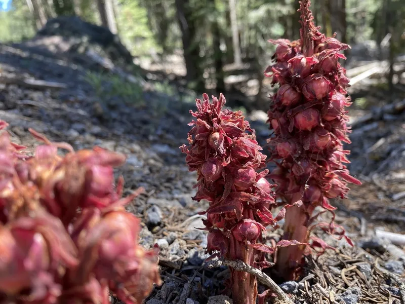
Snowplant Sarcodes sanguinea -
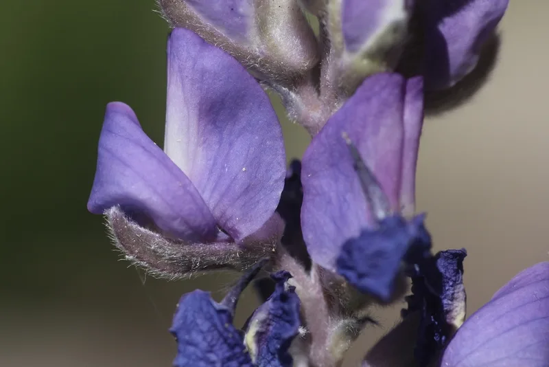
Satin lupine Lupinus obtusilobus -
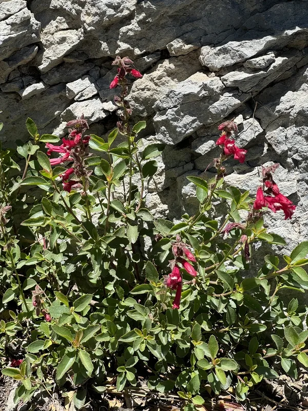
Mountain Pride Penstemon newberryi -
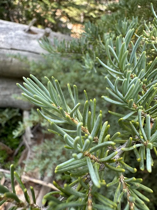
mountain hemlock Tsuga mertensiana -
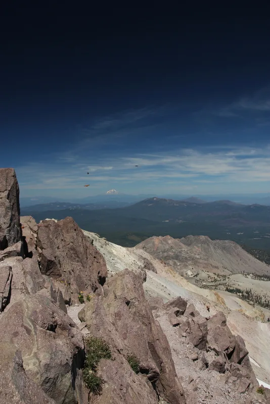
California Tortoiseshell Nymphalis californica -
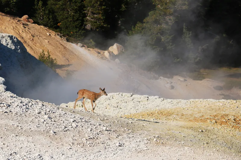
Mule Deer Odocoileus hemionus -
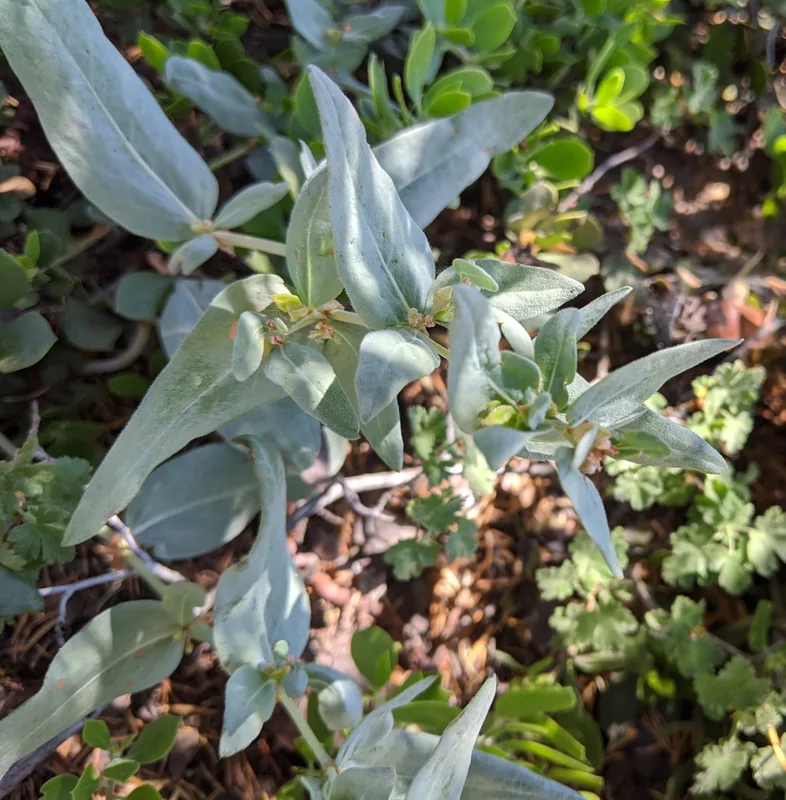
Davis' knotweed Koenigia davisiae -
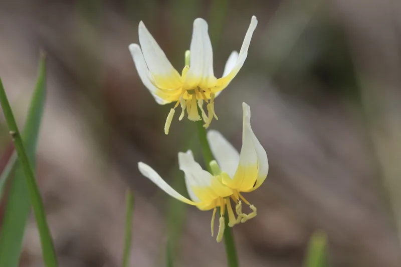
Purple Fawn Lily Erythronium purpurascens -
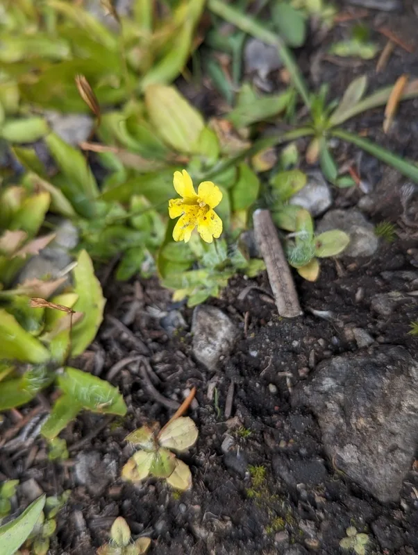
primrose monkeyflower Erythranthe primuloides
Field Notes · Volcanic lens · Lassen Volcanic National Park · 40.4938, −121.4045