Lassen
Lassen Volcanic National Park · California, USA
Every lava flow here thought it had the last word. The creeks kept arguing anyway.
Also seen through Volcanic · all at Lassen Volcanic National Park →.
Why here
Every creek at Lassen is cutting through rock that was liquid within the last few hundred thousand years — recent enough, geologically, that the argument between water and stone is still clearly in progress here. This is a park built almost entirely by fire: plug dome, shield, cinder cone, and stratovolcano have all stacked lava and ash in overlapping layers, each flow a little different in hardness from the one below it. Water does not care how a rock got there. It only cares whether the rock is soft enough to lose to. Where a resistant lava cap sits over something softer, a creek stalls, then drops, and a waterfall is born exactly at that seam. Where the rock resists more evenly, the creek slows into a lake instead — patient rather than aggressive, waiting for a lower place to reveal itself downstream. Follow the creeks here and you are watching the same negotiation play out again and again, at a different pace in every drainage. This note follows that argument from its first small cascades to the valley it eventually widened.
The story
Lassen’s rock arrived first, and violently. The park sits above a stretch of coast where one plate has been sliding beneath another for a very long time, and the heat from that friction has fed volcano after volcano here — enough different kinds, stacked closely enough, that the park can show off plug dome, shield, cinder cone, and stratovolcano within a short drive of each other. Each eruption left behind a layer with its own hardness: andesite, basalt, dacite, rhyolite, laid one on top of the last.
Water arrived second, and it has been patient rather than violent. Snowmelt found the softer layers and started working them loose, dropping over the harder ones in falls, or pooling behind them in lakes. Streamside ground stayed wet enough, long enough, for plants like corn lily and primrose monkeyflower to take hold in the seep and spray, plants that would wither anywhere drier.
People came late to this argument and mostly just watched it. Where a creek ran warm with heat rising from below, at the head of Warner Valley, a ranch eventually grew up around the water rather than against it — a small case of people reading what the water had already decided about where a valley could be livable, and building there instead of fighting it.
The sites
Where the creek starts arguing
Kings Creek Falls Trailhead
40.4605, −121.4592
Kings Creek begins its public life gently, threading through open subalpine meadow with barely a ripple. This trailhead is where that calm stretch ends. From here the creek’s gradient steepens by stages, and the trail follows it downhill as the water goes from wandering to purposeful. Watch the banks as you walk: where the ground stays saturated, streamside plants like corn lily and primrose monkeyflower crowd right up to the water’s edge, plants with no tolerance for dry ground. Their presence is itself a kind of map of exactly how wet the soil is, season to season.
Further down, the creek’s character changes again as it meets older, harder rock beneath the meadow’s softer surface deposits. That change sets up everything downstream — the cascades and the falls both are consequences of what happens where soft ground gives way to a resistant volcanic layer the creek cannot simply erode through. This trailhead is the calm beginning of that story, worth noticing precisely because of how unremarkable the water still looks here, before the real argument starts.
Walk the first stretch of trail slowly and look for where the creek’s surface changes from glassy to riffled. That’s the point where the streambed underneath has changed — usually from soft sediment to something harder — and it is the first sign of the argument that produces the falls further down.
- AccessHalf-day hike
- ExertionModerate
- TimeHalf a day
Upper Cascades Viewpoint
40.4611, −121.4478
“Upper” is the tell in this name: these cascades are a rehearsal for something bigger downstream. Here Kings Creek breaks into a series of short, stepped drops rather than one clean fall, each step marking a place where the water has found a slightly weaker seam in the rock and pushed through it before running into more resistance a few feet on. It’s a smaller, faster version of the same process that will eventually produce the main falls — visible in miniature, and easier to study up close because the drops are short enough to watch individually rather than all at once.
Stand here for a few minutes and the cascades stop looking random. Each ledge is a small, temporary victory for the rock; each plunge below it is where the water briefly won instead. Over a long enough time the softer ledges will erode back and the pattern will simplify, but on any single visit what you’re seeing is a mid-argument snapshot — neither side has settled anything yet, and the creek is still working its way down step by uneven step.
Count the distinct steps you can see in the cascade rather than trying to take in the whole thing at once. Each one is a separate ledge of harder rock; the water pooling briefly above each step, then dropping again, shows you where the next argument starts.
- AccessShort walk
- ExertionEasy
- TimeAn hour
Kings Creek Falls Viewpoint
40.4597, −121.4412
This is where the argument between Kings Creek and the rock beneath it resolves, for now, into its clearest statement: a real fall, water leaving the lip of a resistant volcanic ledge and dropping into a pool below. Where the smaller cascades upstream show the process piecemeal, the main falls show it all at once — a single hard layer holding its ground while the creek pours over rather than through it.
Look closely at the cliff the water drops from and you can often make out banding in the rock, alternating lighter and darker layers that mark separate lava flows laid down at different times. The falls exist exactly where the water finally met a layer tough enough to make it go over instead of straight through. Below the plunge pool, the streambed softens again for a stretch, and the creek regains its patience — until the next resistant layer downstream forces the same decision all over again. It’s worth remembering, standing here, that this exact drop will migrate slowly upstream over a very long time, as the falls themselves erode the ledge they’re standing on.
Look at the rock face the water falls from for horizontal banding — lighter and darker bands mark separate lava flows. Each band is a different volcanic event; the falls sit precisely where the water met one hard enough to resist it.
- AccessHalf-day hike
- ExertionModerate
- TimeHalf a day
The valley water opened
Mill Creek Falls Trailhead
40.4377, −121.5330
Mill Creek cuts a narrower, steeper drainage than Kings Creek, and the trail from this trailhead makes that clear early: instead of an open meadow, you’re walking through mixed conifer forest with the creek increasingly boxed in below you. That narrowing is the visible signature of a stream that has had a long time to work — where a creek can only widen its channel slowly, it instead cuts down, and the banks steepen into something closer to a small canyon than a simple streambed.
The forest here is a fire-adapted one, and this part of the park has burned within recent memory, which makes the exposed rock along the creek’s cut easier to read than it would be under heavier cover. As you descend toward the falls, watch how the trail and the creek converge — by the time you reach the viewpoint below, the two are running nearly parallel, both funneled into the same narrow space the water has spent a very long time opening. It’s a useful contrast to Kings Creek’s gentler meadow start: this drainage shows the same rock-versus-water argument playing out on a tighter, steeper stage.
Watch for the point where the trailside vegetation changes from open forest floor to something closer to a narrow, damp corridor. That shift marks where the creek has cut deep enough to create its own cooler, wetter microclimate — a small canyon effect in miniature.
- AccessHalf-day hike
- ExertionModerate
- TimeHalf a day
Mill Creek Falls Viewpoint
40.4408, −121.5135
The reward for the walk down is a fall dropping into a pool framed by a rock face worth spending real time looking at, not just photographing. As at Kings Creek, the fall exists because harder rock is resisting erosion better than the material around and beneath it — but here the surrounding canyon is narrower and the walls steeper, so the whole scene feels more enclosed, more clearly cut rather than merely shaped.
Spray from the falls keeps the immediate rock face and the ground nearby persistently damp, which shows up in small colonies of moisture-loving plants clinging to ledges that would otherwise be too exposed and dry to support them. It’s a small, local exception to the surrounding forest, maintained entirely by the fall itself. Take a few minutes here away from the main viewing spot, if the trail allows it safely, to look at how the pool below has undercut the base of the rock face — the fall’s next move, geologically speaking, is being prepared right now, slowly, at the waterline where you can’t quite see it happening.
Look for a band of small ferns, mosses, or other moisture-dependent plants growing directly on the rock face near the spray line. Their presence marks exactly how far the falls’ mist reaches — a living measurement of the water’s influence beyond the streambed itself.
- AccessHalf-day hike
- ExertionModerate
- TimeHalf a day
Drakesbad Trailhead
40.4439, −121.4047
Warner Valley is a different kind of water story than the falls elsewhere in this note. Here, at the head of the valley, a creek runs warm in places — heat rising from below meeting cold water arriving from above as rain and snowmelt. That combination has kept a small patch of ground consistently livable in a way the surrounding high country isn’t, and people noticed: a ranch grew up here around the warmed water rather than in spite of it, one of the older continuously used sites in the park.
The valley itself is broader and gentler than the narrow drainages upstream, and that shape matters. A valley this open usually means water has had a long run at softer ground here, wearing the sides back rather than cutting a narrow slot. Standing at the trailhead, you’re at the edge of a place where the same water-versus-rock argument produced a wide, livable basin instead of a slot canyon, a genuinely different outcome from the same basic forces at work everywhere else in the park.
If you can safely approach the creek here, notice any places where the water feels warmer than the air or the recent weather would explain. That mismatch is heat arriving from underground rather than from the sun — a second source of energy, besides gravity, shaping this particular stretch of water.
- AccessDrive-up
- ExertionEasy
- TimeAn hour
Where water pools and pauses
Manzanita Lake Trailhead
40.5359, −121.5628
Not every argument between water and rock ends in a cut. Sometimes the water simply stops, pools, and waits — and a lake like this one is that outcome made visible. Where the falls elsewhere in this note show water actively winning ground, a lake shows a temporary truce: for now, this basin holds water rather than routing it straight downhill, and the surface stays calm enough to reflect the peaks around it on a still morning.
That calm surface is exactly what draws water birds. Ospreys have turned up hunting over park lakes this season, along with ducks like bufflehead working the open water, both taking advantage of a food supply that only exists because the water paused here instead of continuing to run. It’s worth treating this lake as part of the same larger system as the falls elsewhere in the park rather than a separate feature — the same water arrived here by the same general route, snow and rain working downhill, and it will eventually leave again through whatever outlet the basin allows, however slowly that outlet does its work.
Scan the open water for a while rather than glancing once. A sudden splash or a bird folding its wings and dropping toward the surface usually means an osprey or another fish-eating bird has spotted something — activity that depends entirely on the lake staying calm enough for fish to be visible from above.
- AccessDrive-up
- ExertionEasy
- TimeAn hour
Summit Lake South Trailhead
40.4888, −121.4227
Summit Lake sits close to 6,700 feet up, east of the park’s main road, high enough that its water spends a real part of the year locked up as ice and snow rather than flowing at all. Two campgrounds sit close by, evidence that this particular pause in the water’s journey has long been recognized as a good place for people to pause too.
Like Manzanita Lake, Summit Lake is best read as a quiet interlude in the same long story told more dramatically by the falls elsewhere in this note. Water arriving here as rain and melting snow slows down, pools, and sits for a while before finding its way out again through whatever drainage the basin allows — a much gentler version of the same downhill argument playing out step by step at Kings Creek. Walk the shoreline and look for where the lake visibly feeds a stream, either coming in or going out; that point is where the pause ends and the more familiar, faster version of the argument picks back up again, however modestly, on its way further downhill.
Walk part of the shoreline looking specifically for an inlet or outlet stream rather than just admiring the lake as a whole. Finding that thread of moving water is the clearest way to see that even a still lake is only ever a pause, not an ending.
- AccessDrive-up
- ExertionEasy
- TimeAn hour
When it's best
Lassen carries real snow well into the warmer months at these elevations, and that snowpack sets the rhythm for everything in this note. Creeks like Kings Creek and Mill Creek generally run fullest and loudest in late spring and early summer, swollen with snowmelt, and after a heavier winter the falls tend to stay dramatic longer into the season than in a lean one. By late summer, flows usually ease off considerably, and the falls become quieter, more contemplative versions of themselves rather than the version most photographs show. The higher lakes tend to hold ice and snow at their margins later than the lower ground around them, so a lake that looks fully open in the valley can still be edged with ice a little higher up. The warmed water at the head of Warner Valley is the one year-round exception worth timing a trip around less precisely, since its heat comes from underground rather than from the season above.
Go deeper
The names behind what you saw The layered rock behind the falls and along the creek cuts is mostly andesite and basalt, with some dacite and rhyolite closer to the park’s dome complexes — the range of lavas produced by the park’s several kinds of volcanoes. The streamside plants noted at the wetter sites: corn lily (Veratrum californicum) and primrose monkeyflower (Erythranthe primuloides), both species that require consistently wet ground. The older bedrock beneath the park’s younger lava belongs to what geologists call the Taylorsville sequence, the framework used to describe rock here going back tens of millions of years before any of Lassen’s volcanoes existed.
To read next 1. Howel Williams, Geology of the Lassen Volcanic National Park, California (1932) — the original field survey that mapped the very flows these creeks are still cutting through, and the starting point for nearly everything written about the park’s rock since. 2. Geologic map of Lassen Volcanic National Park and vicinity, California (USGS Scientific Investigations Map 2899, 2010) — lets you match any creek on the ground to the exact lava unit it is working through. 3. Geologic field-trip guide to Lassen Volcanic National Park and vicinity, California (USGS Scientific Investigations Report 2015-5067) — a stop-by-stop itinerary for walking the same rock contacts described here. 4. Geology of Lassen Volcanic National Park (American Geophysical Union, 1989) — a fuller synthesis for readers who want the deeper academic picture behind Williams’s original account.
The names behind what you saw
What lives here, and what it's called. Photographs from open collections — an aid to identification, not decoration.
-
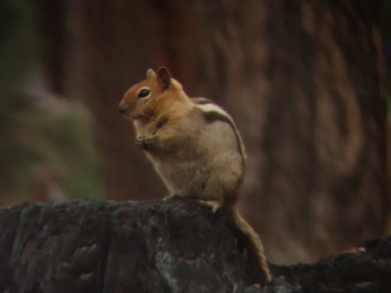
Common Golden-mantled Ground Squirrel Callospermophilus lateralis -
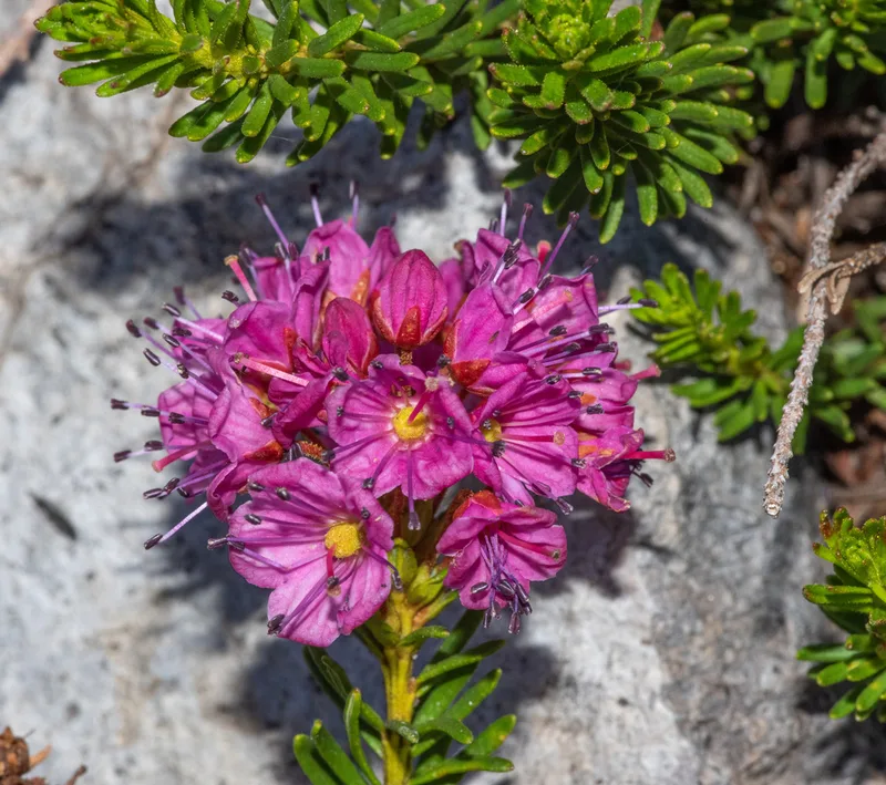
Purple Mountain-heath Phyllodoce breweri -
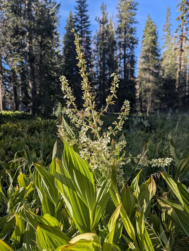
Corn Lily Veratrum californicum -
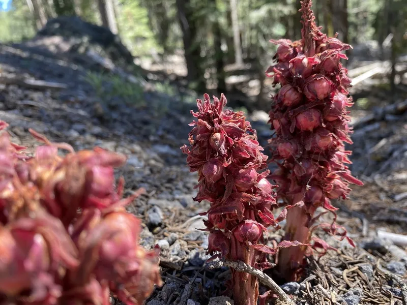
Snowplant Sarcodes sanguinea -
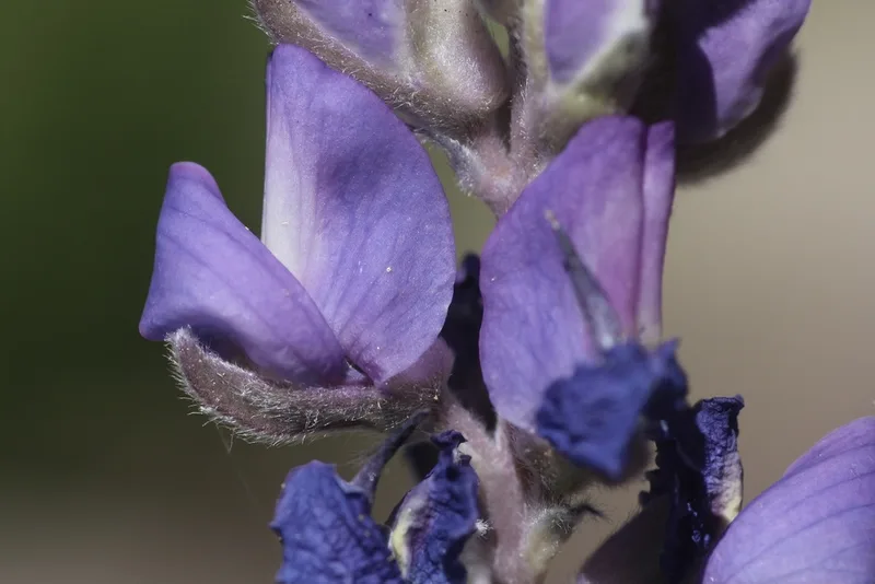
Satin lupine Lupinus obtusilobus -
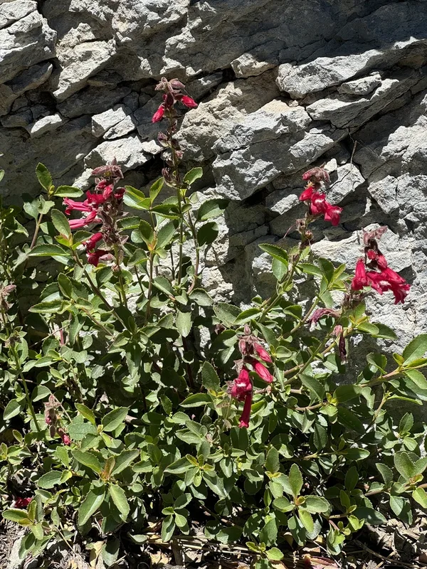
Mountain Pride Penstemon newberryi -
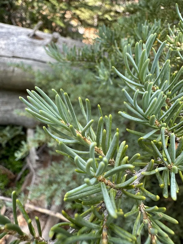
mountain hemlock Tsuga mertensiana -
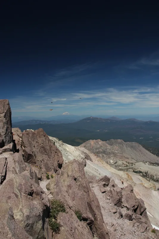
California Tortoiseshell Nymphalis californica -
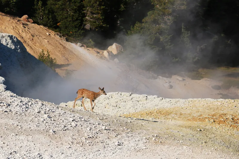
Mule Deer Odocoileus hemionus -
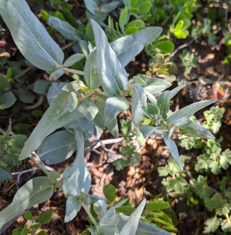
Davis' knotweed Koenigia davisiae -
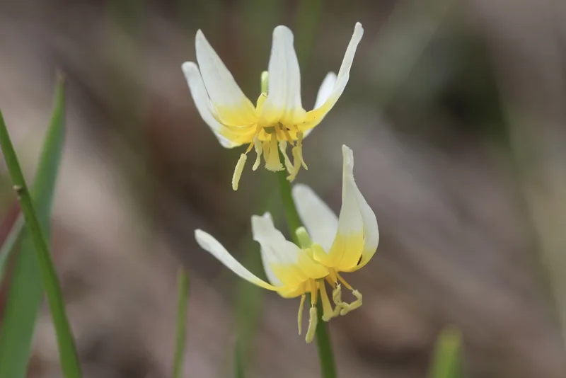
Purple Fawn Lily Erythronium purpurascens -
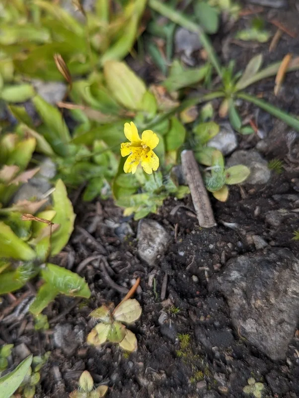
primrose monkeyflower Erythranthe primuloides
Field Notes · Rivers & Canyons lens · Lassen Volcanic National Park · 40.4938, −121.4045