Lanzarote
Parque Nacional de Timanfaya · Canary Islands, Spain
Here the ground is younger than the villages that ring it, and in places it is still learning to hold a plant.
Also seen through Desert & Deep Time · all at Parque Nacional de Timanfaya →.
Why here
Over six years in the 1730s, eruptions buried farms, wells, and whole hamlets under lava and cinder, and a last burst of fire came about a century later. What was left is bare volcanic rock and ash from edge to edge — the one national park in Spain made entirely of geology, with no forest and no coastline to soften it. And it stays raw. Almost no rain falls here, so wind and dust have barely begun the slow work of turning stone into soil. The cones still hold their first shape; the lava still lies the way it stopped moving. Stand anywhere in the park and you are looking at what most places hide under grass and time: land in the act of being made, before life has moved in to cover it. This whole note follows that unfinished surface.
The story
The land came first, and fast. Over six years in the 1730s, molten rock poured across the southwest of the island; a final eruption followed about a century later. Fluid lava ran out in dark sheets, while gassier lava broke apart in the air and fell back as cinder, building cones around each vent. That single difference — lava that flowed and lava that was thrown — is written all over the park.
Life returns slowly to ground this young and this dry. The first plants are low, tough, and widely spaced: milky spurge and balsam spurge holding pockets of grit, with lichens staining the older rock. Atlantic lizards warm themselves on the black stone, and Berthelot’s pipit and the odd raven work the open ground. Nothing here is crowded. The surface simply has not had time to make soil enough for a thicker cover.
People made something of the rock at the edges. On the coast, lava from the eruptions walled off a lagoon, and generations later islanders turned it into salt pans, letting the sun draw thousands of tons of salt from trapped seawater. Inland, villages ring the lava — Yaiza, the wine hamlet of Uga, and Mancha Blanca with its chapel to the island’s patron saint — farming the black volcanic grit the fire left behind.
The sites
The youngest ground
Mar de lavas
29.0443, −13.7176
The name says it plainly: a sea of lava. This roadside overlook opens onto the widest reach of the flows that poured out in the 1730s, a dark field that runs to the horizon with barely a plant to break it. Fluid lava, hot and thin, can travel a long way from its vent before it stiffens, and that is what spread across this ground — sheet after sheet of it, cooling in place. What looks at a distance like a still black ocean is really frozen motion. The surface hardened while the rock beneath was still creeping forward, and the strain of that shows in every ridge and swirl. This is the best first stop in the note because distance makes the flows readable. Before you walk in among the cones, stand back and take in how much country a single stretch of eruptions can cover, and how little has grown back on it since.
Look out over the dark plain and find the places where the surface is wrinkled into long, low ridges. Those are the folds a flow leaves when its cooling skin is shoved along by the still-molten rock underneath. Pick a spot where the rock looks ropy, almost braided — that is lava that ran thin and fast, like syrup off a spoon.
- AccessDrive-up
- ExertionEasy
- TimeAn hour
La Cascada de Lava
29.0440, −13.7206
A short way along the road, this stop is named for a lava cascade — a place where a moving flow reached a step in the ground and poured over it. Lava, when it is hot enough, behaves a great deal like water: it runs downhill, pools, spills over drops, and drapes whatever it crosses. Here it went over an edge and then stopped, all at once, as the front cooled and locked. What you see is that fall caught in mid-motion, the rock still hanging in the shape of its pour. It is one of the clearest places in the park to shed the idea that stone is always still. Everything solid here was once liquid, and moving, and this is where it shows most honestly. The cascade is a small feature in a large field, but it holds the whole lesson of the place in one frozen gesture.
Find where the dark rock steepens and hangs like a frozen waterfall. Lava spilling over a drop stretches and folds much as water does, then freezes the instant its surface loses heat. Look for the folds running straight downslope — each one records the direction the rock was still flowing when it stopped.
- AccessDrive-up
- ExertionEasy
- TimeAn hour
Reading the fire
Cuando Envejecen los Volcanes
29.0459, −13.7271
This interpretive stop takes its name from a good question — when do volcanoes grow old. The 1730s eruptions gave the park a great deal of very young ground, but not everything here is the same age, and this is a place to see the difference. Set a fresh, sharp-edged cone against an older one and the passage of time becomes visible in the rock itself. A young cone is bare and angular, its cinders loose and dark. An older one is rounded, its slopes streaked with pale lichen and the first low plants, its outline softened by wind and the rare rain. Nothing here ages quickly, because so little weather reaches it. But given long enough, even a volcano wears down, loses its clean shape, and begins to gather a skin of living things. This stop is where the park lets you read that slow clock by comparing one hill to another.
Compare two cones on the skyline — one sharp and bare, one rounded and mottled with pale lichen and low plants. The softer, greyer one is simply older. Wind, dust, and the occasional rain have had longer to blunt its edges and give the first roots somewhere to hold.
- AccessDrive-up
- ExertionEasy
- TimeAn hour
Volcanes Humanizados
29.0438, −13.7191
Its name means the humanized volcanoes, and it marks the place where the story stops being only about rock. For all its rawness, this is not empty country. People have long turned the volcano’s leavings to use, folding the black grit and broken stone into field walls, cleared plots, and the salt pans down on the coast. The eruptions that buried farms in the 1730s also laid down the very material later generations would learn to work. This stop sits at the seam between the wild lava and the worked land, close enough to the villages that ring the park to feel both at once. It is worth pausing here to notice that a landscape this hostile still supports a way of life, and has for a long time. The rock did not only destroy. Given patience and hard work, it became ground to farm and stone to build with.
Look for the low dry-stone walls and cleared pockets set into the black grit near the road. People here plant directly in the loose volcanic gravel the eruptions scattered, working ground that began as raw cinder. Notice how the cleared plots follow the flattest, deepest patches of grit.
- AccessDrive-up
- ExertionEasy
- TimeAn hour
Rofes
29.0464, −13.7320
Rofes is the local word for the loose volcanic gravel — the light, sharp, cinder-sized rock that the eruptions flung into the air and scattered for miles. It is one of the defining materials of the island, and this stop is named for it. When gas-rich lava breaks apart as it erupts, it cools in flight into countless small porous fragments, and these rain down around the vent to build cones and blanket the ground. The same grit that makes the cones also, spread by the barrowload, makes fields workable across the island. Here you can meet the raw material of both the land and the life on it at close range, before it is gathered or planted. It is easy to walk past as mere gravel. Look closer and it is a record of lava torn apart in mid-air and frozen before it could fall back together.
Crouch by the roadside and look closely at the loose black gravel. Turn one piece over in your hand, then set it back: feel how light and sharp it is, and see the frozen gas bubbles riddling it. Each fragment is a droplet of lava that cooled in the air before it hit the ground.
- AccessDrive-up
- ExertionEasy
- TimeAn hour
The cones themselves
Caldera Blanca
29.0344, −13.7318
On the western side of the park stands a broad crater whose pale rim rises above the darker lava around it. A walking track climbs from the plain near the villages, reaches the rim, and follows it around a wide, open bowl. Unlike the fresh black cones of the 1730s, this one has weathered to a lighter, softer grey, and the young flows from the historic eruptions ran up against its base rather than over its top. That contrast is the reason to make the climb. From the rim you stand on older ground and look out across the newer lava that surrounds it, seeing two chapters of the island’s fire-making at once. The bowl below is the clearest way to grasp the scale of a single vent — a full crater you can walk the edge of. It is the most demanding stop in the note and the one that rewards the legs most plainly.
From the rim, look down into the wide bowl, then out across the dark flows that lap against the mountain’s foot. The paler rock under your boots has weathered far longer than the black lava below. You are standing on an older cone that the newer eruptions flowed around rather than buried.
- AccessHalf-day hike
- ExertionModerate
- TimeHalf a day
Montaña Rajada
28.9949, −13.7737
Deep in the protected heart of the park rises a cone whose name means the split mountain. The core of Timanfaya is kept closed to protect the young surface, so this is a peak to read from a distance rather than to climb, picked out from the road that skirts the lava. A cinder cone usually grows as a fairly even ring of thrown fragments around its vent. But if a surge of lava wells up and breaks out through one side, it can drain the vent and carry away part of the wall, leaving a gap where the ring should close. A cone that has been opened like that tells you the eruption did not end quietly. Look for that break in the outline, and the mountain stops being a simple hill and becomes a record of its own last act. Even from afar, it is one of the more legible shapes on the skyline.
From the road across the flows, pick out Montaña Rajada and look for the notch cut into its rim. A cone can rise as a near-perfect ring until a late surge of lava breaks through one side, draining the vent and leaving the gap you see against the sky.
- AccessDrive-up
- ExertionEasy
- TimeAn hour
El Mojón
28.9950, −13.8253
Near the western edge of the lava stands El Mojón, a cone set close to where the black flows give out and older country takes over. Below and beyond it, the land eases into the Rubicón, a broad plain of gentler, browner ground that slopes down to the sea. This is a good place to find the edge of the young eruptions. The lava of the 1730s covered a great deal, but not everything; it stopped where it stopped, and past that line lies land the recent fire never reached. Standing here, you can take in both at once — the raw dark rock behind you and the softer, longer-settled plain ahead. Edges are where a landscape explains itself, and this is one of the clearest in the park. The change underfoot from black cinder to pale, worked soil marks the boundary between two very different ages of the same island.
Standing near El Mojón, look west to where the black lava ends and a browner, gentler plain begins. That line is the outer edge of the young eruptions; beyond it lies older ground the recent fire never covered, sloping away toward the coast.
- AccessShort walk
- ExertionEasy
- TimeAn hour
When it's best
This is a dry, even-tempered place, and it does not swing hard between seasons. Spring days are mild and rain is scarce all year, so the lava is walkable and readable in almost any month; the low light of morning and late afternoon does the most to bring out the texture of the flows. Small birds — Berthelot’s pipit and the occasional raven — work the open ground through the cooler months, easiest before the summer heat settles in. Come in high summer and the black rock throws real heat, so carry water and shade. In truth, the surface rewards a visit in any season.
Go deeper
The names behind what you saw. The young rock is Quaternary basalt and basaltic pyroclasts — mafic (iron- and magnesium-rich) volcanic rock, the dark, fluid kind of lava. The lizard basking on it is the Atlantic lizard, Gallotia atlantica; the small brown bird is Berthelot’s pipit, Anthus berthelotii. The low pioneer plants are milky spurge, Euphorbia regis-jubae, and balsam spurge, Euphorbia balsamifera, alongside Canary Island sorrel, Rumex lunaria; the stout-billed finch of the open ground is the trumpeter finch, Bucanetes githagineus.
To read next. - Timanfaya National Park (Wikipedia) — the clearest overview of the 1730s eruptions and why this is Spain’s only wholly geological national park. - Salinas de Janubio (Wikipedia) — how a lava-walled lagoon became working salt pans, the human half of this story. - The iNaturalist pages for the Atlantic lizard and Berthelot’s pipit — living records of what has been seen on the lava, and when. - Any overview of Canary Island volcanism — the mapped Quaternary basalt units are a starting point for how these young islands are built.
The names behind what you saw
What lives here, and what it's called. Photographs from open collections — an aid to identification, not decoration.
-
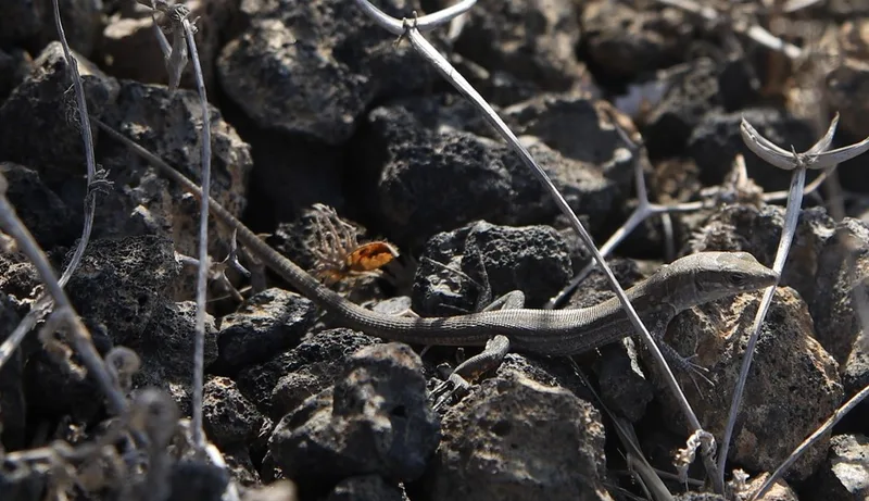
Atlantic Lizard Gallotia atlantica -
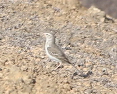
Berthelot's Pipit Anthus berthelotii -
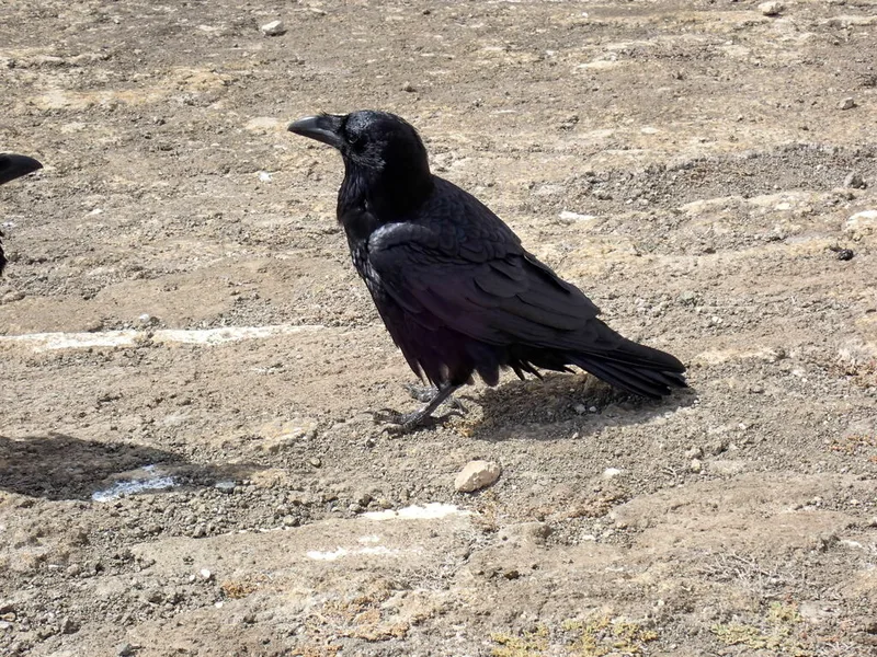
Common Raven Corvus corax -
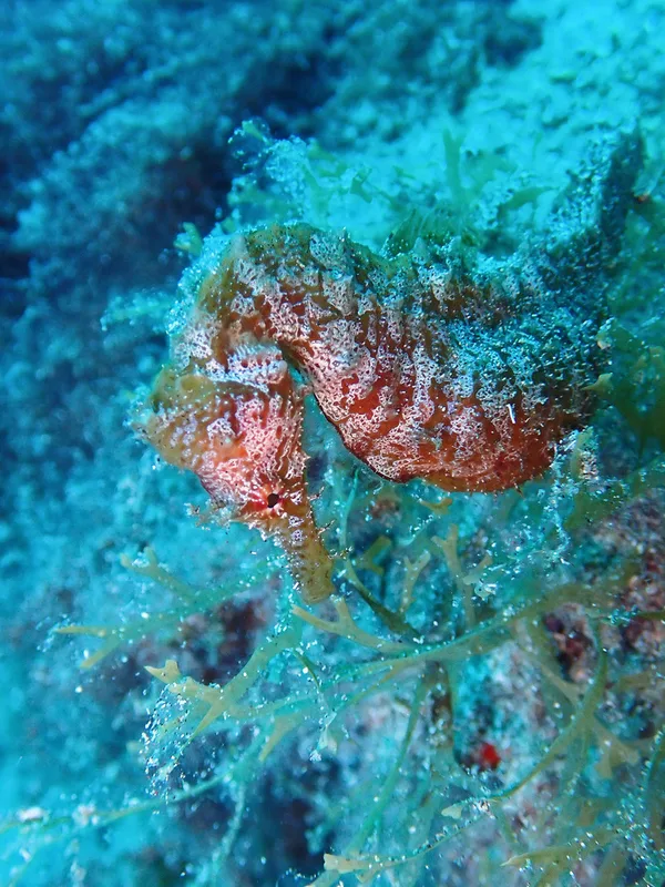
Short-snouted Seahorse Hippocampus hippocampus -
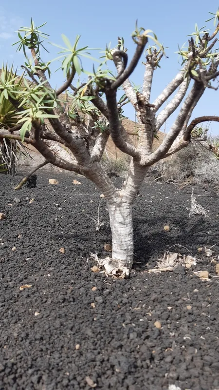
milky spurge Euphorbia regis-jubae -
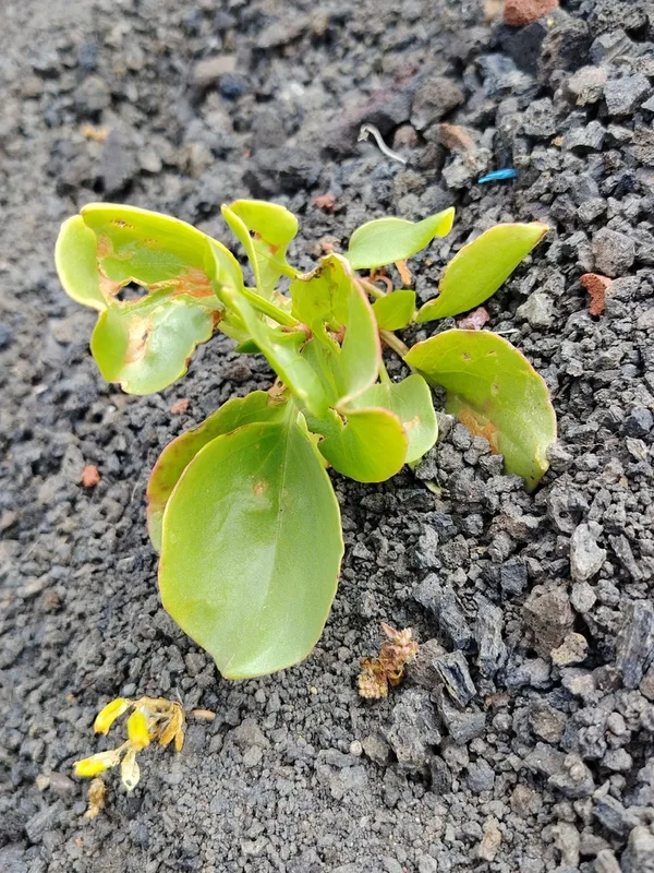
Canary Island Sorrel Rumex lunaria -
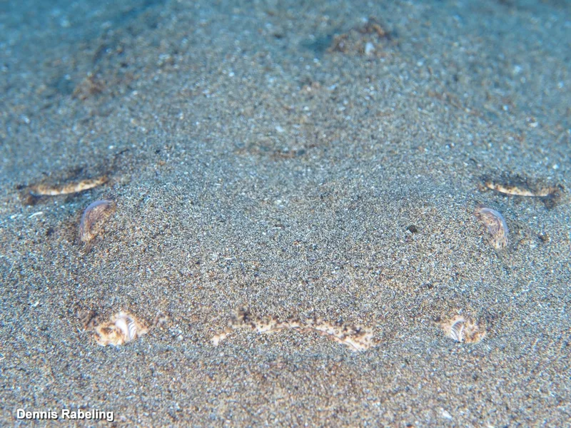
Angelshark Squatina squatina -
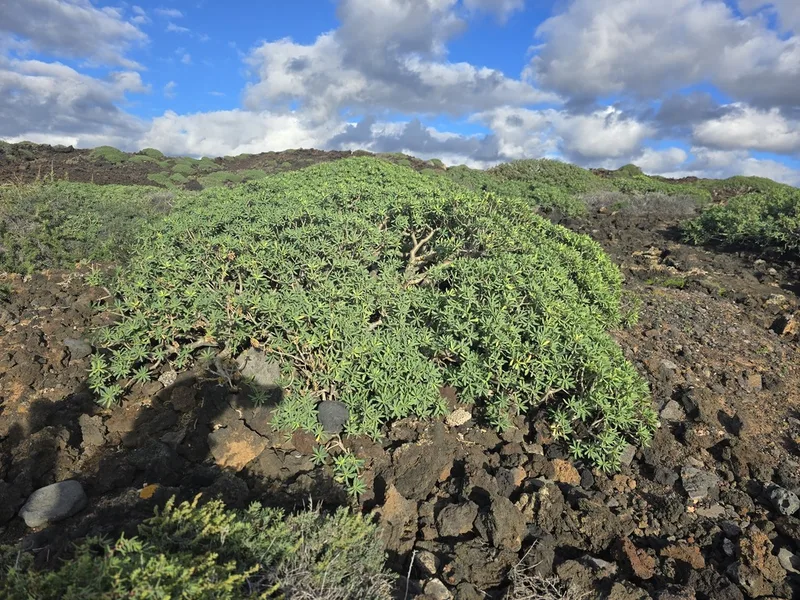
balsam spurge Euphorbia balsamifera -
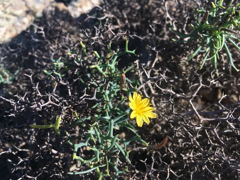
Mol-albina Launaea arborescens -
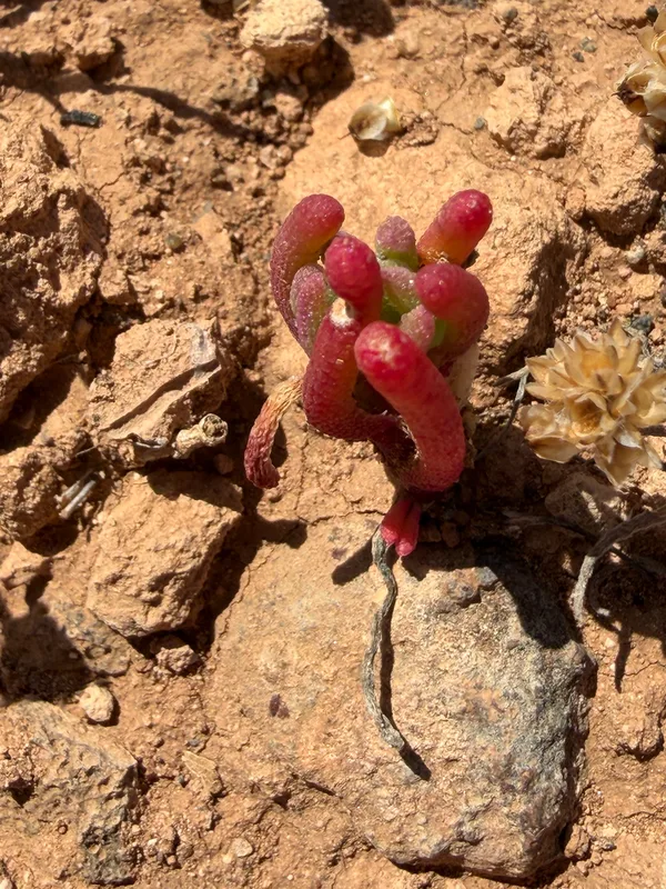
Slender Iceplant Mesembryanthemum nodiflorum -
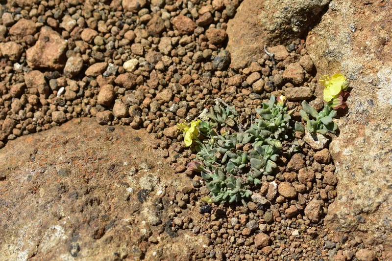
Helianthemum canariense -
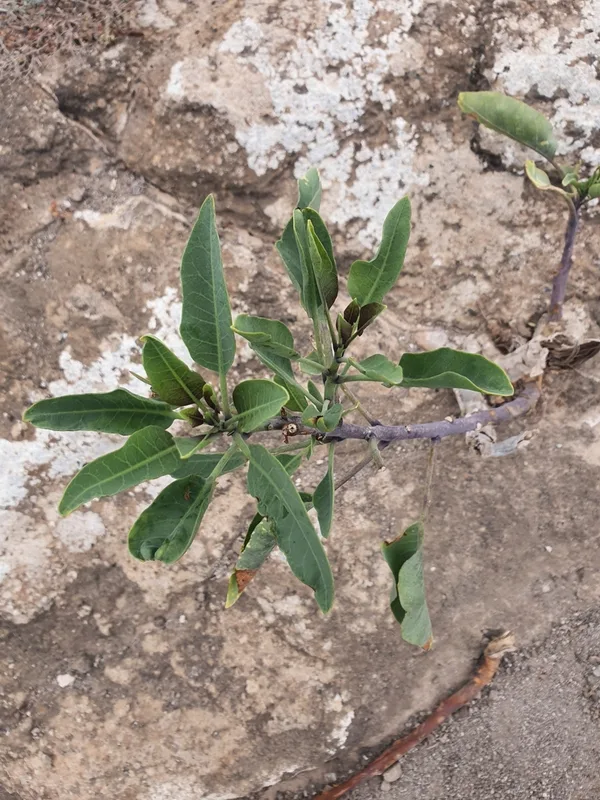
tree tobacco Nicotiana glauca
Field Notes · Volcanic lens · Parque Nacional de Timanfaya · 29.0216, −13.7812