Lanzarote
Parque Nacional de Timanfaya · Canary Islands, Spain
Most islands bury their own making under soil, forest, and time. Lanzarote's south never got the cover — the rock here is still close enough to its own beginning to read like a page instead of a fossil.
Also seen through Volcanic · all at Parque Nacional de Timanfaya →.
Why here
Most landscapes hide the process that made them, folded away under soil, forest, and centuries. This one never got the cover. Spain’s only national park defined entirely by geology sits here because, in the early 1730s, the ground opened along a line of vents and did not stop for years — burying farms and villages and the older, gentler island underneath a skin of black rock that has barely begun to soften. Walk it now and you are not reading about an eruption; you are standing on one, close enough in time that lichen has only just started arriving and the wind has only just started grinding the sharpest edges round. Elsewhere a national park protects a forest, a reef, a herd of animals. This one protects a single event — stretched across some fifty-some square kilometers so you can walk through it at your own pace and read, cone by cone and flow by flow, how a piece of ground goes from catastrophe to ordinary country over the surprisingly short span that turns out to take. That span, and what it looks like in the rock underfoot, is what this note keeps coming back to.
The story
The island’s bones go back a long way — layer under layer of basalt, some of it beneath this park pushing two and a half million years old, the ordinary slow accumulation of a volcanic island building itself up out of the Atlantic. Then, for several years beginning in the early 1730s, that patient process broke into a sprint: vents opened one after another across the southwest, and lava kept coming until it had buried whole villages and remade the shape of the coast. A last, smaller eruption followed roughly a century later. Everything you walk across in the park’s core is that recent skin, not the older rock beneath it.
Life had to start from nothing on it. On the bare flows, spurges take hold first — low, grey-green shrubs built to lose almost no water — followed by mats of iceplant in the cracks where a little sand collects. Lizards find the warm rock early; birds that favor open, sparse ground follow once there is anything at all to perch on or hunt from.
People came back too, carefully. Villages at the flow’s edge, like Uga and Yaiza, rebuilt on what the eruption spared. Where lava walled off a stretch of coast, the resulting lagoon was later turned to salt pans rather than fought — proof that even here, the newest ground gets put to use.
The sites
The vents themselves
Caldera Blanca
29.0344, −13.7318
Caldera Blanca is one of the cones raised by the same eruptive episode that filled the valleys below with black rock, and it is large enough that its rim gives a full view down into the vent it encloses. Walk that rim and you are tracing the outline of a single vent: the wide, shallow bowl at the center is where the ground itself opened, and the pale color that gives the cone its name — white crater — comes from ash and altered rock rather than the darker, glassier lava that spread from its base. From up here the whole lava plain below reads as one continuous event: ridge after ridge of frozen flow, radiating outward from vents like this one, cooling in place rather than being carried anywhere else. Few plants interrupt the view, because on rock this young there has not been time for much more than scattered shrubs to take hold — an absence that tells you, more plainly than a date on a sign could, how recently this ground stopped being liquid. Bring water and expect full exposure: there is no shade on the ascent or along the rim, and the pale ash underfoot throws a surprising amount of heat back up even on a mild day.
From the rim, pick one point on the crater wall and follow its color down toward the base. Where it stays pale and ashy, the ground never got hot enough afterward to glaze over; where it turns dark and glassy, lava pooled and cooled slowly enough to shine. The same eruption produced both — only the ground’s exact behavior in that one spot differed.
- AccessHalf-day hike
- ExertionStrenuous
- TimeHalf a day
Montaña Rajada
28.9949, −13.7737
Montaña Rajada takes its name from a split running down one flank of the cone, and the fracture is not decoration. Cones built quickly out of loose ash and cinder are structurally weak; they can slump or crack open along a line of least resistance during or soon after an eruption, and this one did. Standing below it, you can trace the break as a long pale scar running from near the summit down toward the base, cutting across the darker, more uniform slope on either side. This is a good place to slow down and look rather than climb: the crack tells a structural story that a wider, gentler cone would hide. Seen from a distance, Rajada sits as one more point in a scattered field of vents across this stretch of the island, each one a separate pulse of the same long eruptive episode, each shaped slightly differently depending on how fast it built and how much of itself it could hold together as it did.
Look for the pale crack running down the cone’s flank. Trace it from top to base with your eye and notice how the slope on either side stays smooth and unbroken — the crack marks a single line of failure in an otherwise stable pile of ash and cinder, not a general crumbling of the whole cone.
- AccessHalf-day hike
- ExertionModerate
- TimeAn hour
Lava caught in the act of moving
Mar de lavas
29.0443, −13.7176
The marker at Mar de lavas names the plain in front of you honestly: a sea of lava, solid rather than liquid, but still recognizably a sea in shape — swells, troughs, and a horizon that keeps going past where you can see clearly. Lava this fluid does not stop as a single sheet; it advances as lobes and fingers that override each other, cool unevenly, and freeze mid-motion, which is why the surface has topography at all instead of lying flat. Stand here and try to follow one ridge of rock with your eye as far as you can — it will disappear behind another ridge that arrived slightly later or moved slightly differently, the same way one wave gets lost behind the next. That layering, lobe over lobe, is the clearest visual argument in the whole park that this ground was built in stages rather than all at once. The name is doing real work: once you see the plain as a sea rather than a static field, the movement that made it stops requiring imagination and starts being visible in the rock’s own shape.
Pick a single ridge of dark rock on the plain below and try to trace it to where it ends. Watch for the point where it disappears under a second ridge — that overlap is one lobe of lava arriving after, and on top of, another.
- AccessShort walk
- ExertionEasy
- TimeAn hour
La Cascada de Lava
29.0440, −13.7206
La Cascada de Lava — the lava cascade — marks a spot where a flow met a drop in the ground and did exactly what its name suggests: it poured over the edge the way water would, then stopped mid-fall once it cooled below the point where it could keep moving. The result is a frozen waterfall in black rock, complete with the ropy, folded texture that fast-moving, still-fluid lava takes on as its outer skin cools while the inside keeps flowing underneath, dragging the surface into folds the way skin wrinkles on a cooling custard. It is one of the more legible single features in the park, because the shape only makes sense as an action interrupted — nothing about a lava cascade looks piled or built; it looks like it was still going somewhere. Elsewhere on the plain that sense of arrested motion is present but diffuse, spread across an entire landscape of lobes and ridges. Here it is concentrated into one drop, one clear before-and-after, which makes it a good place to explain the idea to anyone who has not quite pictured lava as a liquid before, rather than as loose rock.
Look at the surface texture on the steepest part of the cascade rather than the flat ground nearby. The folded, ropy pattern forms when an already-cooling skin gets dragged and wrinkled by still-molten lava moving underneath it — the same shape a spoon leaves dragging through thick, half-set custard.
- AccessShort walk
- ExertionEasy
- TimeAn hour
Reading how rock ages
Rofes
29.0464, −13.7320
This stop takes its name from the reddish, crumbly volcanic gravel that turns up across parts of this landscape, and its color is a clue rather than a coincidence. Basalt is rich in iron, and where erupting rock meets enough oxygen — thrown high as spatter, or exposed on the surface of a slow-moving flow — that iron oxidizes and rusts, turning the rock from black toward red and brown the same way exposed metal will. Where the rock stayed buried and airless, it kept its black, unoxidized color instead. So a patch of rofe next to a patch of black clinker is not two different eruptions; it is very often the same eruption, one part of it briefly exposed to air while still hot enough to react, the other sealed away from it. Elsewhere on the island this same reddish gravel gets put to direct use in agriculture — a detail worth knowing even where you are only looking at rofe rather than farming through it.
Find a patch of reddish, gravelly rock and compare its color to the nearest black lava. Both can come from the same iron-rich basalt — red where the rock met enough air to rust while still hot, black where it stayed sealed away from oxygen.
- AccessShort walk
- ExertionEasy
- TimeAn hour
Cuando Envejecen los Volcanes
29.0459, −13.7271
This marker takes on the question the whole park raises without quite saying so: what happens to a volcano once it stops being dramatic. Fresh basalt is black, sharp-edged, and nearly bare. Left alone, it does not stay that way. Wind and the occasional rain round off the sharpest points first; lichen arrives before almost anything else can, finding a living on bare rock that would starve most plants; a little dust and sand collects in every crack and hollow, and that thin start of soil is what finally lets a spurge or a sorrel take root. None of this happens quickly by a human clock, but it happens faster than the rock’s own age would suggest — a flow only a few hundred years old already shows patches of lichen and a scatter of hardy shrubs, while the older basalt underneath the whole park, laid down over a far longer stretch of the island’s history, is fully weathered, soil-covered, and unrecognizable as lava at all without digging. Aging, here, is not abstract. It is a visible gradient you can walk across in a single day, from ground that is still obviously fresh to ground that has finished obviously being anything at all.
Compare the ground right at your feet to a patch a short distance away that looks grayer or dustier. The difference in shade is age doing its slow work — wind, rain, and the first lichen breaking down the same black rock at different rates depending on how exposed each patch has been.
- AccessShort walk
- ExertionEasy
- TimeAn hour
Volcanes Humanizados
29.0438, −13.7191
Volcanes Humanizados — humanized volcanoes — names something easy to miss on a landscape this stark: people did not simply survive this eruption and move on, they built a working relationship with the ground it left behind. Villages at the flow’s edges were rebuilt where the lava had spared them. Vineyards nearby, most visibly around villages like Uga, grow directly out of volcanic ground rather than despite it, using the same porous, mineral-rich rock and gravel that makes the rest of the park look barren. None of this happened inside the strictly protected core, where the freshest, starkest lava is left alone, but the boundary between untouched flow and inhabited, farmed flow is close enough here that you can stand near one and look toward the other. It is a useful corrective to the instinct to read bare volcanic rock only as ruin. For the people who came back afterward, it was also raw material — a difficult, mineral surface that, handled the right way, holds a little more moisture and a little more warmth than ordinary soil, and can be made to grow something on.
Look toward the settled land at the park’s edge rather than into its core, and notice where cultivated ground begins against the bare flow. The line between the two marks a working choice, not a natural boundary — someone decided this rock was farmable and this rock was not.
- AccessShort walk
- ExertionEasy
- TimeAn hour
When it's best
Because this is a desert built on rock rather than sand, the seasonal signal here is fainter than almost anywhere else: the coastal, mild climate typical of the Canary Islands keeps temperatures gentle for most of the year, and the trade winds that cross this stretch of the Atlantic rarely let it get properly cold or properly wet. There is less reason to time a trip around a season here and more reason to time it around the hour. Early or late in the day, when the sun rakes the surface at a low angle, every ridge, crack, and lobe in the lava throws a shadow and the terrain reads clearly; at midday the same ground flattens under overhead light into something closer to a single black plain. If any season deserves a slight edge, it is the cooler stretch of the year, simply because walking the exposed, shadeless routes is more comfortable without full summer heat — but this is a place that rewards showing up whenever you can, and adjusting the hour rather than the month.
Go deeper
The names behind what you saw - The black rock underfoot on most of these routes is basalt, part of the current geological period, the Quaternary — some of the deeper units beneath the park reach back roughly two and a half million years, though the surface you actually walk is far younger. - Milky spurge — Euphorbia regis-jubae - Balsam spurge — Euphorbia balsamifera - Canary Island sorrel — Rumex lunaria - Slender iceplant — Mesembryanthemum nodiflorum - Atlantic lizard — Gallotia atlantica - Berthelot’s pipit — Anthus berthelotii
To read next - Timanfaya National Park (Wikipedia) — lays out why this is Spain’s only national park defined entirely by geology, and gives the plain outline of the eruptive period that built most of what you walk on. - Salinas de Janubio (Wikipedia) — traces how the same lava that buried land also walled in a lagoon that was later turned into salt flats, the clearest local example of ground put to use rather than left alone. - Yaiza (municipality) (Wikipedia) — situates the park within its wider municipality and marks where the protected, untouched flow gives way to settled, farmed ground. - Uga (Lanzarote) (Wikipedia) — a short profile of one of the small villages built on and farmed from this same volcanic ground, for a sense of what came after the eruption stopped.
The names behind what you saw
What lives here, and what it's called. Photographs from open collections — an aid to identification, not decoration.
-
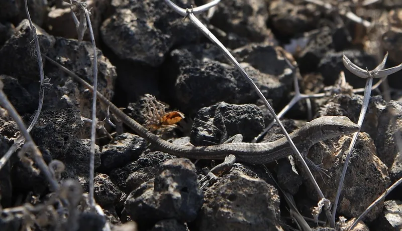
Atlantic Lizard Gallotia atlantica -
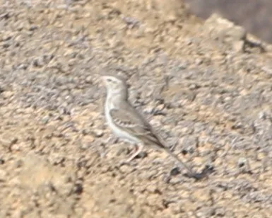
Berthelot's Pipit Anthus berthelotii -
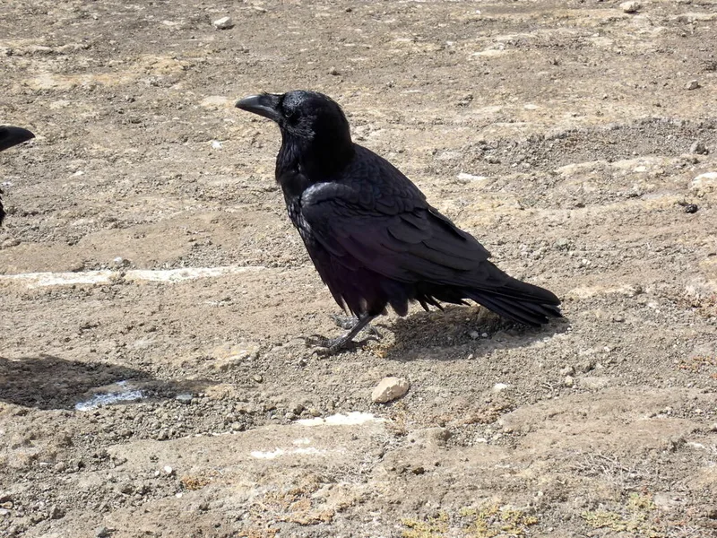
Common Raven Corvus corax -
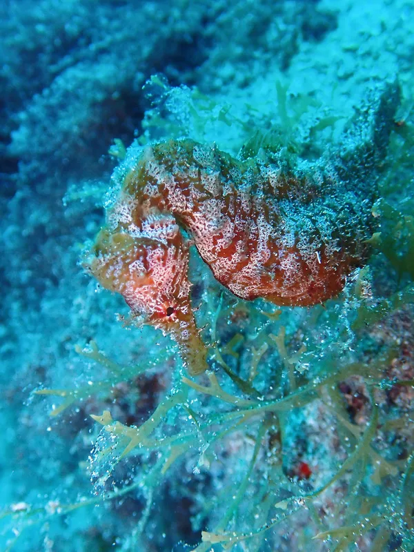
Short-snouted Seahorse Hippocampus hippocampus -
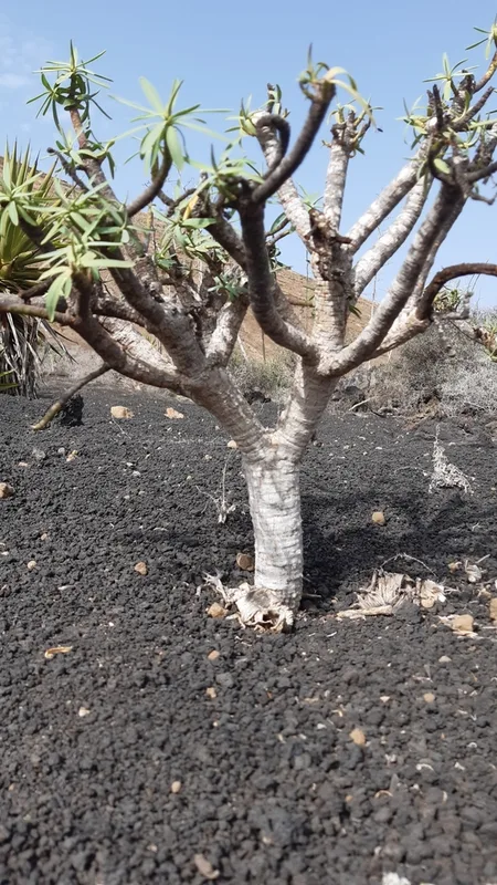
milky spurge Euphorbia regis-jubae -
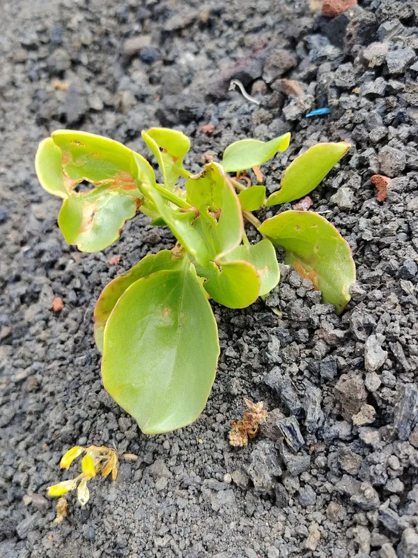
Canary Island Sorrel Rumex lunaria -
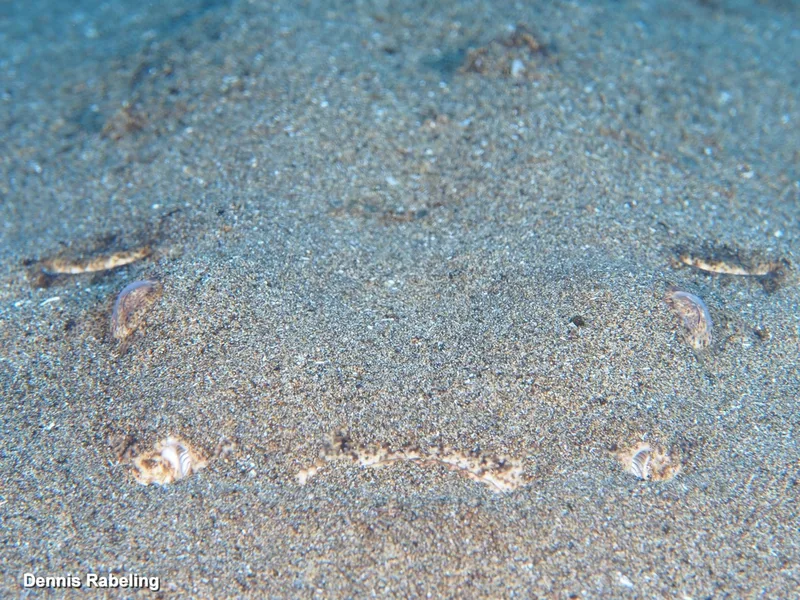
Angelshark Squatina squatina -
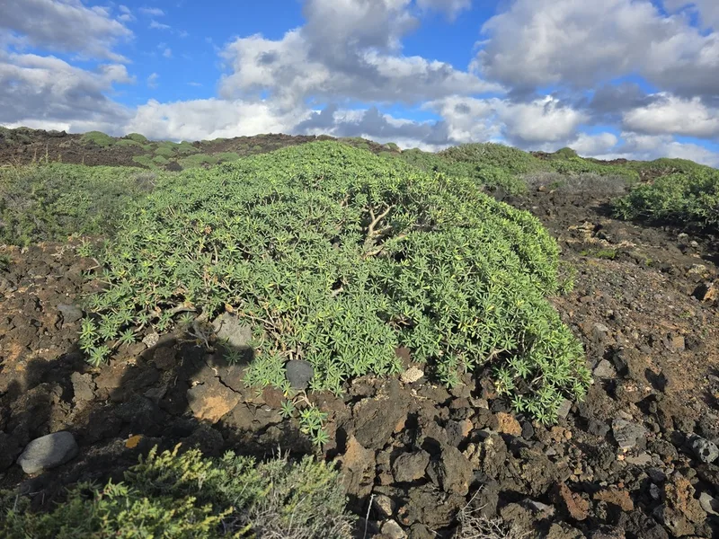
balsam spurge Euphorbia balsamifera -
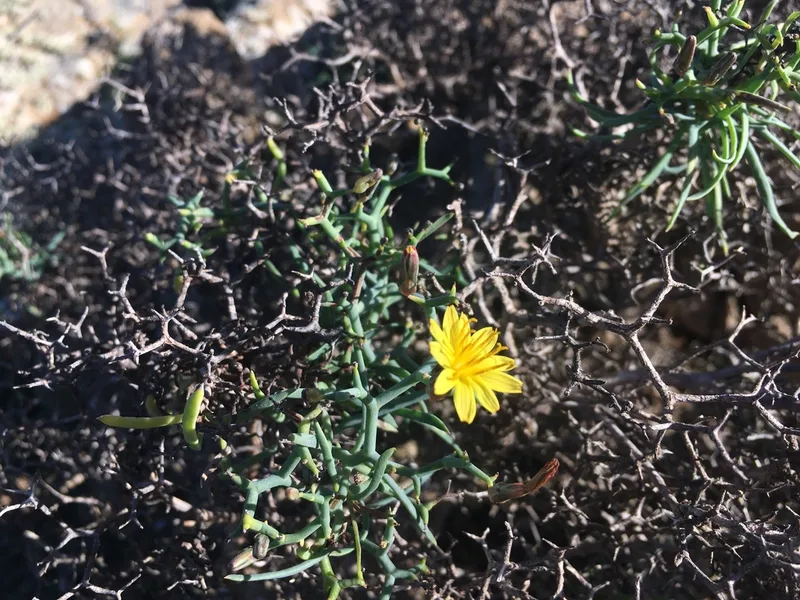
Mol-albina Launaea arborescens -
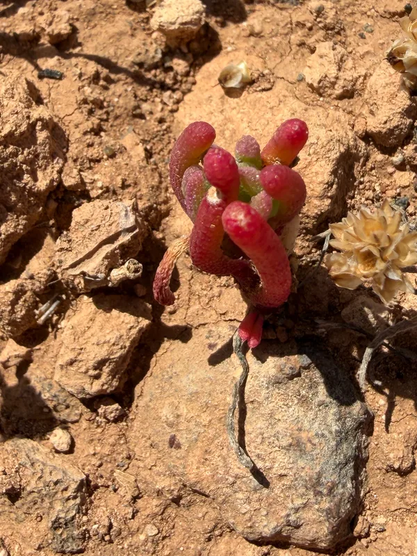
Slender Iceplant Mesembryanthemum nodiflorum -
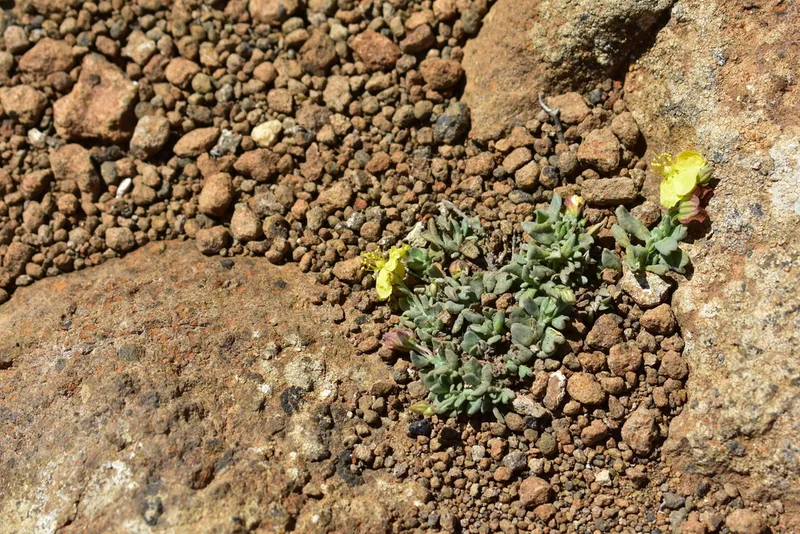
Helianthemum canariense -
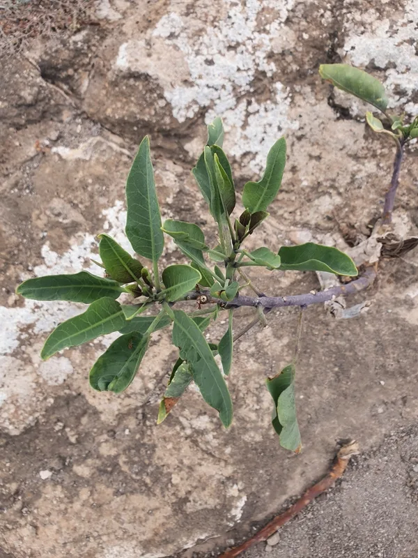
tree tobacco Nicotiana glauca
Field Notes · Desert & Deep Time lens · Parque Nacional de Timanfaya · 29.0216, −13.7812