La Palma
Carretera Roque de Los Muchachos · Canary Islands, Spain
The youngest rock on this island has no closing date.
Also seen through Night Sky · all at Carretera Roque de Los Muchachos →.
Why here
Stand on the rim of the Caldera de Taburiente and look down: you are looking into the cut-away anatomy of a mountain that has not finished building itself. The rock stacked in those walls carries its own age, layer on layer — an old base laid down over a long stretch of deep time, a shield-building phase that piled the island higher through a later era, and then, resting right on top, a final layer of lava young enough that its record simply runs out at today, with no line underneath it that says finished. Most islands you visit are old news: the mountain-building happened somewhere back in the geologic past, the story closed, and you are walking on the epilogue. La Palma is still writing its. The caldera is the clearest window into that unfinished work, but it is not the only one — drive its rim road, or look at the capital city built where a nearby volcano’s lava once reached the coast, and the same lesson holds. This island is not scenery left over from an eruption. It is a project still underway.
The story
The island’s rock keeps a rough diary of its own construction. The oldest layer here formed over a long span of the deep past, plain basalt built up the way undersea and early island lava usually does. On top of that came a distinct shield-building phase, a period when eruption after eruption piled the mountain higher and gave it the broad, gently domed profile a young volcanic island wears. And on top of both sits the youngest layer of all — lava whose age, in the record, simply runs forward to the present, with nothing above it yet. Three chapters, stacked, still open.
Life arrived on that raw rock the way it does on any young volcanic ground: slowly, and led by tough colonizers. The Canary pine is the obvious one — a tree built for bare, mineral slopes, its thick, plated bark letting it hold a footing where softer trees can’t yet.
People read the same layers without necessarily naming them. The island’s capital was built along an old lava flow that once ran from a volcano just south of the city down to the sea — the town simply settled onto the newest flat ground the mountain had made. A large stretch of the caldera itself was set aside and protected in the middle of the last century, once its role as the record of the island’s own making was understood. The record here is otherwise quiet on who lived on these slopes before that — the sources speak mostly to the rock and what grew on it.
The sites
Standing inside the volcano
Caldera de Taburiente National Park
28.7211, −17.8730
Caldera de Taburiente sits in the north-center of the island, a wide bowl cut deep into the mountain’s own construction, and it has been protected as a national park since 1954. Its walls form a cross-section of banded lava, layer stacked on layer, each band a separate chapter of the island’s building. The oldest rock sits low in the walls, laid down over a long stretch of the deep past. Above it comes a distinct shield-building layer, from the era when eruption after eruption piled the mountain higher. And at the top of the stack, forming the rim itself, is the youngest layer of all — lava whose recorded age simply runs forward to the present, with nothing above it yet. Walk any distance into the bowl and you are walking through geologic time laid out in cross-section, the deep past underfoot and the near-present somewhere above your head, at the rim where the caldera meets the sky.
From a rim viewpoint, look for the horizontal bands of different color and texture running through the caldera’s walls below you. Each band is a separate lava flow from a different stage of the island’s construction, oldest near the base of the exposed wall and youngest closer to the rim where you’re standing. Try tracing one band with your eye as far around the bowl as you can follow it before it disappears into shadow or scree.
- AccessHalf-day hike
- ExertionModerate
- TimeA full day
Roque de los Muchachos
28.7542, −17.8849
The summit at Roque de los Muchachos sits on the caldera’s rim, at the topmost point of the same stack of lava you can trace in the walls far below. Its clear, dark air has drawn an international observatory to build close by the summit, taking advantage of the same height and isolation that make the view down into the caldera so complete. Stunted pines hold on in the thin, mineral soil near the top — tough trees built for exactly this kind of bare volcanic ground, their thick, plated bark helping them survive fire and cold that would finish off softer species. Standing at this summit puts you at the youngest, highest rung of the island’s ladder, looking down into everything that came before it: the shield-building layer, and beneath that, the oldest basalt of all.
Look for Canary pines growing straight out of bare rock near the summit, with little else growing alongside them. Their thick, deeply furrowed bark is built to survive where softer trees can’t yet get a foothold. Run a hand over the bark if one grows within reach, and notice how different it feels from a pine you might know from elsewhere.
- AccessDrive-up
- ExertionEasy
- TimeAn hour
Carretera Roque de Los Muchachos
28.7201, −17.7928
The road up to Roque de los Muchachos is a drive through the island’s own timeline. It climbs from lower ground toward the caldera’s rim, and the rock exposed in the cuts alongside it changes as you climb: older, plainer basalt low on the mountain, younger and rawer-looking lava higher up, closer to the layer whose recorded age reaches all the way to the present. The road threads through pine forest for much of the climb, the same tough trees that colonize bare volcanic ground wherever it’s fresh enough that little else has taken hold, thinning out as the elevation and the air both grow thinner near the top. No single stop along this route tells the whole story on its own; the drive itself is the site, and the changing composition of the roadside rock is the plot, unfolding a little more with every switchback and every few hundred meters of elevation gained, until the road finally runs out at the rim where the youngest rock on the island is exposed to open sky.
Pull off wherever the road cuts through bare rock and look closely at the texture of the exposed lava. It tends to look smoother and more weathered lower on the mountain, rougher and fresher the higher you climb. Compare two pullouts at noticeably different elevations and notice how different the same basic material can look, depending only on how long it’s had to weather.
- AccessDrive-up
- ExertionEasy
- TimeHalf a day
Where the mountain reaches the sea
Santa Cruz de La Palma
28.6819, −17.7663
Santa Cruz de La Palma, the island’s capital and second-largest city, sits on the east coast along an old lava flow that once ran from a volcano just south of the city down to the water. The mountain-building this note keeps pointing to didn’t stop at the caldera rim — in this direction it ran all the way to the sea, cooled, and became the flat, level ground a city was later raised on. Walking the old town’s streets and harbor today is, in a small way, still walking on the youngest rock the volcano made in this particular direction, now carrying a working port and centuries of building rather than bare stone. It is a useful counterweight to the wilder sites on this trip: a reminder that land being made is not only something that happens in remote, uninhabited country, but under the feet of an entire working city as well.
Look at the dark stone underfoot in the old town, and in the older harbor walls and buildings around it — much of it is the same basalt that once flowed down from the volcano just south of the city. Notice where the ground reads flattest and most level; that’s the old flow’s original surface, later paved and built on.
- AccessDrive-up
- ExertionEasy
- TimeAn hour
Puntallana
28.7438, −17.7834
Puntallana sits on the island’s northeastern flank, at a modest elevation above the sea and only a short distance up the coast from the capital. It’s a useful reminder that the same shield volcano that rises to the caldera rim runs the length of the island’s edge, not just its summit — the ground under this town is built from the same family of lava, just further from the source and further downhill, weathered into gentler slopes than the raw rock near the top. Towns like this one sit on the volcano’s outer skin the way the capital sits on its youngest flow near the coast, and the caldera sits on its exposed interior: three different ages of the same construction, all inhabited or visited in their own way. The pine forest that spreads across these slopes also holds some of the island’s signature resident birds, several species found nowhere else in the world.
Listen for finch calls in the pines around town. The Canary Islands chaffinch and the island canary are both common in this belt of forest. Try to pick out one bird by its call before you manage to spot it by eye.
- AccessDrive-up
- ExertionEasy
- TimeAn hour
When it's best
The rim road climbs high enough that the air up top stays cool and thin no matter when you make the drive, a sharp contrast to the mild coast below at any time of year. Spring visits tend to trade sun for brief passing showers on the summit, with clear nights once the weather breaks — worth the climb after dark if the sky is open. Lower down, the town and the caldera’s lower flanks stay comfortable for walking most of the year. One thing needs no timing at all: the island’s resident birds, several found nowhere outside the Canaries, have been recorded on these slopes.
Go deeper
The names behind what you saw
The oldest of the three lava layers described here is catalogued simply as Neogene basalt. The middle, shield-building layer has no formal name on record — geologists have logged it only as an early mafic stage. The youngest layer, the one whose age reads to the present, is recorded as Cenozoic volcanic rocks. The pine that colonizes the bare summit ground is the Canary Island pine, Pinus canariensis — a species found only in this archipelago.
To read next
The sourced material behind this note didn’t come with a vetted further-reading list — the usual “to read next” picks are thin here, so rather than pad the list, this note leaves it short and says so plainly. If you want to go deeper on your own, the strongest search terms to start from are the geological ones above — Neogene basalt and Cenozoic volcanic rocks in the Canary Islands — and the Caldera de Taburiente’s history as a national park protecting that record.
The names behind what you saw
What lives here, and what it's called. Photographs from open collections — an aid to identification, not decoration.
-
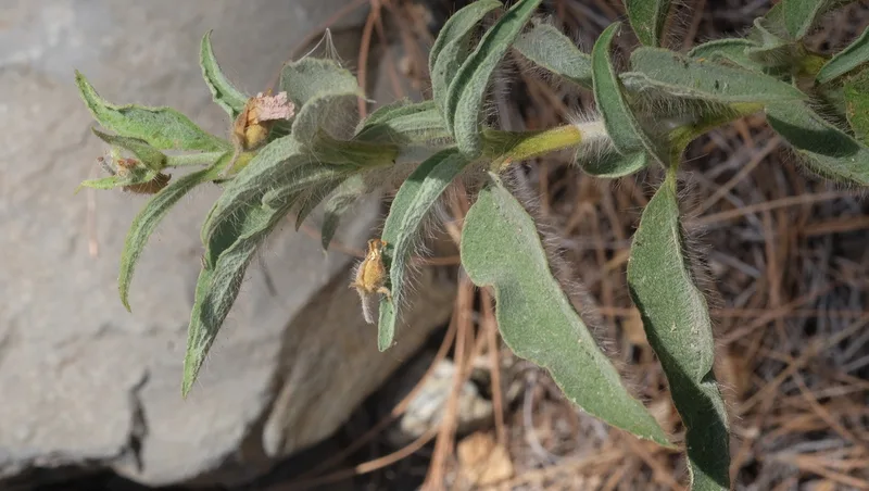
Cistus symphytifolius -
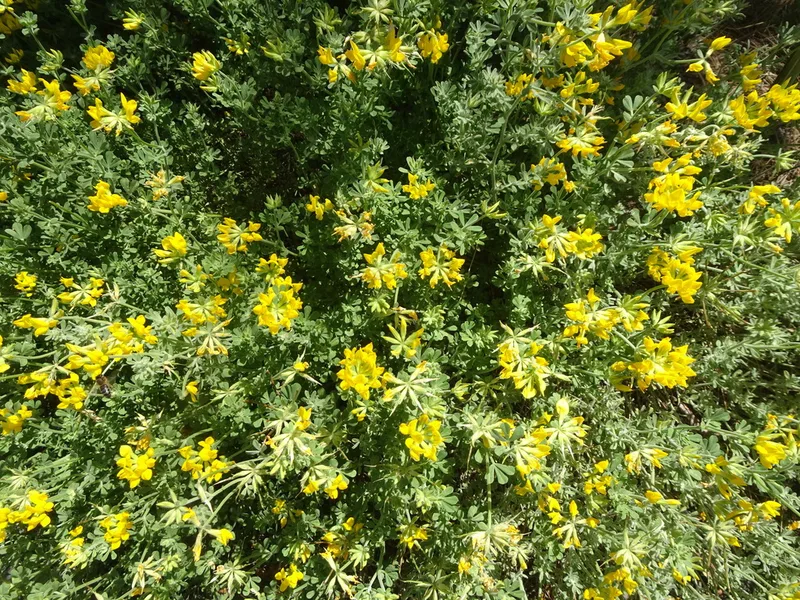
Lotus campylocladus -
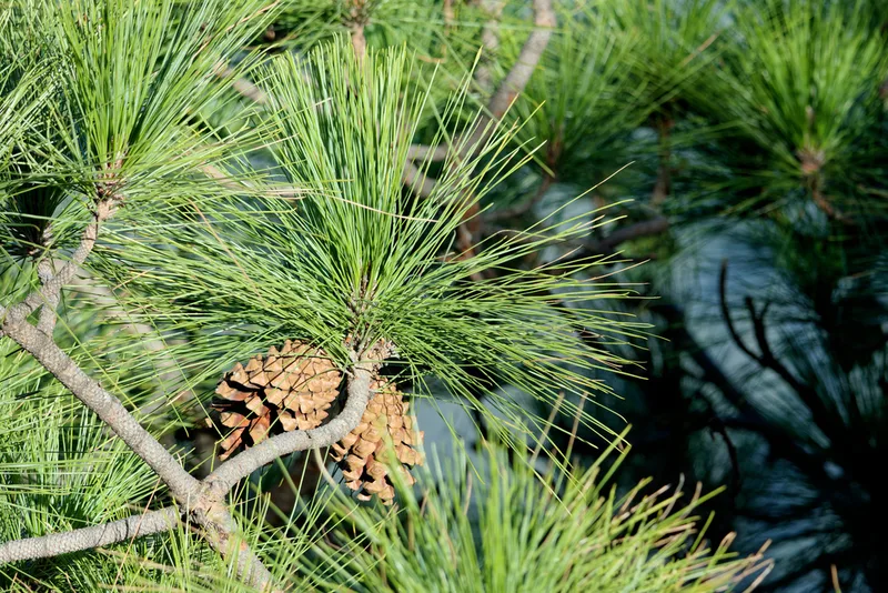
Canary Island pine Pinus canariensis -
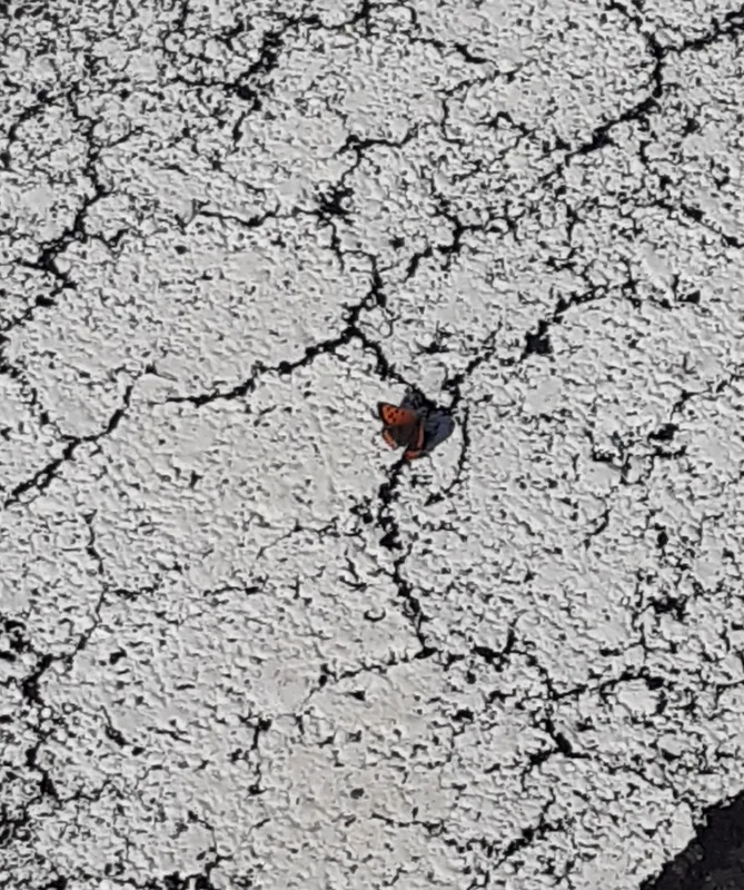
Small Copper Lycaena phlaeas -
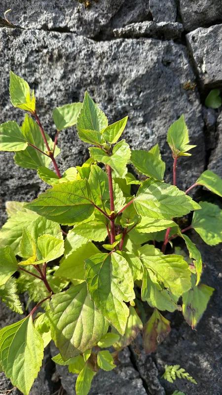
Crofton Weed Ageratina adenophora -
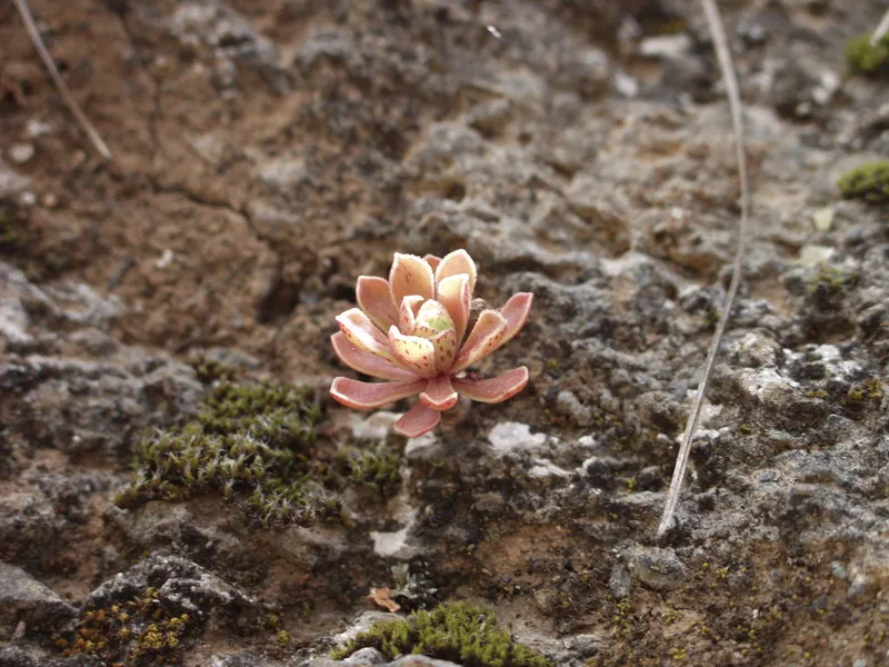
Aeonium spathulatum -
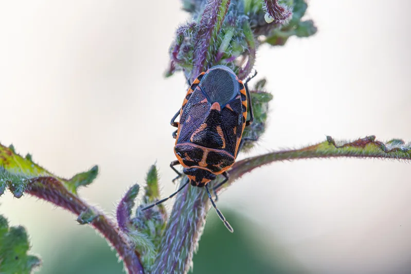
Eurydema lundbladi -
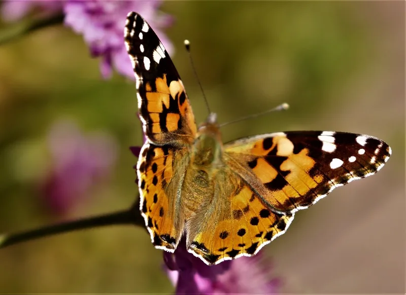
Painted Lady Vanessa cardui -
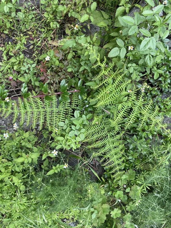
common bracken Pteridium aquilinum -
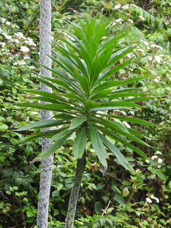
Giant Viper's-bugloss Echium pininana -
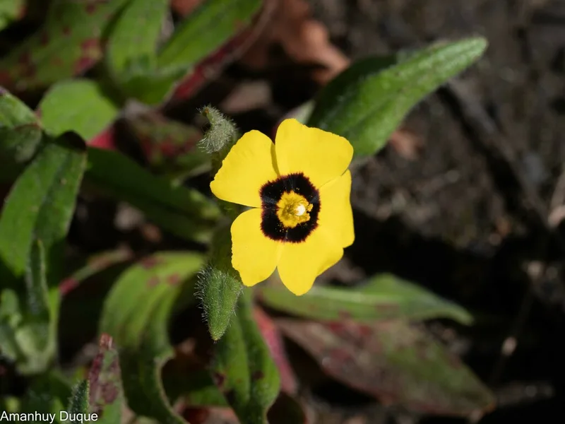
Spotted Rock-rose Tuberaria guttata -
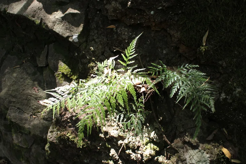
western black spleenwort Asplenium onopteris
Field Notes · Volcanic lens · Carretera Roque de Los Muchachos · 28.7181, −17.8256