La Palma
Carretera Roque de Los Muchachos · Canary Islands, Spain
The light you came to see is older than the island that lifts you toward it.
Also seen through Volcanic · all at Carretera Roque de Los Muchachos →.
Why here
Somewhere on the drive up, the world turns grey and close, and then you come out the top of it. La Palma’s clouds don’t tower — they lie flat, a level deck the trade winds press against the island’s slope and rarely climb past. Below that deck the air is damp and stained with the light of towns; above it, up near the summit, the air runs dry, dark, and unusually still. That is the whole reason the telescopes are set close to the top of the island — to get above the weather and the glow, into thin clear air where the stars hold steady instead of swimming. And the starlight itself is the oldest thing you’ll look at all trip: it left its stars long before it reached this ridge, and the summit’s only job is to waste as little of it as possible. Everything that follows is arranged around that one climb — up out of the cloud, away from the light, into the dark.
The story
The island is a volcano that never stopped stacking itself higher. Flow after flow of dark, runny lava piled up from the seabed until the heap broke the surface and kept climbing, through a long stage of quiet, building eruptions that raised the broad base you now drive across. Some of the lava here is young, geologically last-week. What matters for the sky is only the height it reached — high enough that the summit stands clear above the trade-wind clouds most nights.
Life climbs only so far up it. The Canary Island pine covers the mid-slopes, a tall, fire-hardy tree at home in thin volcanic ground; higher up the forest gives way to bare rock and low scrub, and the air keeps thinning toward the top.
People came for the height itself, and came last. The great summit bowl was ringed as a national park in the middle of the last century, and the observatory’s domes were set near the peak — not for the view of the island below, but for the view of everything beyond it.
The sites
The light you climb away from
Santa Cruz de La Palma
28.6819, −17.7663
Santa Cruz de La Palma is the island’s capital, strung along the east coast on top of an old lava flow that once ran down from a volcano just south of the city. For a sky trip it plays a particular part: it is the largest gathering of light on the island, the warm glow that spills up into the night from streets and harbour. That glow is precisely what the summit domes were placed so far away and so high to escape. Start your trip here, low and lit, and the darkness you find at the top of the road lands all the harder for the contrast. Even the harbour, bright as it is, cannot fully drown the sky — a reminder that darkness on this island is a matter of degree, and of altitude.
After dark, stand on the seafront with the town lights behind you and look straight up. Count the stars you can actually pick out over the harbour — there won’t be many. That thin scatter is what a town’s light does to a sky, and it is the plainest reason the telescopes sit at the far, high end of the island rather than down here.
- AccessDrive-up
- ExertionEasy
- TimeAn hour
Puntallana
28.7438, −17.7834
Puntallana is a small town on the northeastern slope, set a few hundred metres above the sea and a short way up the coast from the capital. It sits at a useful middle height — above the brightest coastal lights, well below the summit — and makes a fair place to feel how the sky changes as you climb. Every hundred metres of altitude puts more of the haze-holding air beneath you, and every town you leave behind takes its glow with it. From here the land tilts up toward the dark crest of the island in one direction and drops to the lit coast in the other, so the difference between a washed-out sky and a clean one is laid out in a single view. Nothing here is a destination in itself, but as a rung on the way up it earns a pause.
On a clear night, face uphill, away from the coast, toward the black bulk of the summit ridge. Notice that the darkest, richest part of the sky sits over the mountain, not over the sea — the island’s own height is blocking the coast’s glow for you. Then turn around and watch the same sky wash pale above the lit shoreline.
- AccessDrive-up
- ExertionEasy
- TimeAn hour
Above the sea of cloud
Carretera Roque de Los Muchachos
28.7201, −17.7928
The climb to the summit is an event in itself, and worth timing for the last of the daylight. The road switchbacks up out of the settled coast and into a broad belt of Canary Island pine — a tall, open forest of long-needled trees that grip the thin volcanic soil and hold it to the slope — before the trees thin out onto bare, dark ground near the top. Somewhere in the middle of the climb you pass through the cloud itself: first a thickening grey, then a moment when the car breaks out the top of it into clear, low light, the cloud spread solid and white below. Drive it slowly toward dusk and you get to watch the sky change from the inside of the weather to a place above it. Stop only at marked pullouts — the drop is real, and the light will be going fast.
As you climb near sunset, watch for the exact moment the windshield clears — grey, then thinning, then suddenly open sky with a flat white floor of cloud beneath you. That deck is the trade-wind cloud, pinned at a steady height against the island’s slope; breaking above it is the same trick the observatory uses every clear night.
- AccessDrive-up
- ExertionEasy
- TimeAn hour
Roque de los Muchachos
28.7542, −17.8849
The road climbs to a bare, wind-scoured crest of dark rock, and this is where it ends. The white domes strung along the ridge belong to the observatory, set here because it is about as far above the weather and the island’s own glow as the land reaches. Come after dark, well wrapped against the cold, and stand away from any dome light while your eyes adjust — give them a good ten minutes. On a clear, moonless night the sky overhead loses almost nothing to haze or town glow; the thin, dry air is exactly what the telescopes were carried all the way up here to use. Underfoot is nothing but old volcanic rock and the wind; overhead is as much sky as solid ground can offer. This is the point the whole climb has been aiming at, the top of the note as much as the top of the road, and the darkness is worth the drive and the chill to reach it.
On a clear, moonless night, turn your back to the domes and look for the flat, pale floor of cloud lying below the ridge. Notice a faint orange stain glowing up through it in one direction — that is a coastal town’s light, trapped under the cloud deck the trade winds hold in place. Overhead, with that glow shut out beneath you, is the darkest part of your whole sky.
- AccessDrive-up
- ExertionModerate
- TimeHalf a day
The dark the island keeps
Caldera de Taburiente National Park
28.7211, −17.8730
Just below the summit ridge the ground falls away into an enormous bowl of eroded rock — the great caldera that dominates the north of the island and gives the national park its name. Steep walls rise on nearly every side, and the observatory stands high on its rim. For a night-sky visitor the bowl’s gift is simple: those high walls cut the low horizon out of your view, and the horizon is where a sky is always dirtiest — the most air to see through, the most distant town glow, the most haze. From a viewpoint on the rim, the rock does that filtering for you, hiding the worst of the low light and leaving the clean sky overhead. Come back by day and the same walls read as a page of the island’s making — flow upon flow of old lava stacked all the way up to the height where you stand.
From a viewpoint on the rim after dark, notice how the far walls of the bowl rise up and swallow the lowest slice of sky. That is the haziest, most light-fouled part of any sky, cut off here by rock. Now compare it to the sky straight overhead, which stays clean because you are already standing above most of the air.
- AccessDrive-up
- ExertionEasy
- TimeHalf a day
When it's best
The sky here is ruled first by the moon, not the calendar: aim for the nights around a new moon, when there’s no moonlight to wash out the faint band of the Milky Way. Beyond that, the summit is cold and dry in every season — a day’s warmth falls away fast once the sun is down, so a real coat is a summer item up top. Whenever you come, let your eyes adjust in the dark for a good ten minutes before judging the sky.
Go deeper
The names behind what you saw. The island is built of basalt — dark, iron-rich lava — piled up flow on flow through the volcano’s long shield-building stage and on into recent, Quaternary times. The tall pine of the mid-slopes is the Canary Island pine, Pinus canariensis. The summit bowl is the Caldera de Taburiente, which names the national park around it; the domes on its rim belong to the Roque de los Muchachos Observatory.
To read next. Search for the Roque de los Muchachos Observatory to see which telescopes share the ridge and what each was built to watch. Read up on the trade-wind inversion — the everyday weather that lays a flat sea of cloud below island summits and keeps the air above it dry and steady, the single fact this whole note turns on. Look up the Caldera de Taburiente National Park for the trails that drop into the bowl the observatory sits above. And for the ground itself, read about shield volcanoes and basalt, to see how patient, flow-on-flow eruptions build an ocean island tall enough to break its own weather.
The names behind what you saw
What lives here, and what it's called. Photographs from open collections — an aid to identification, not decoration.
-
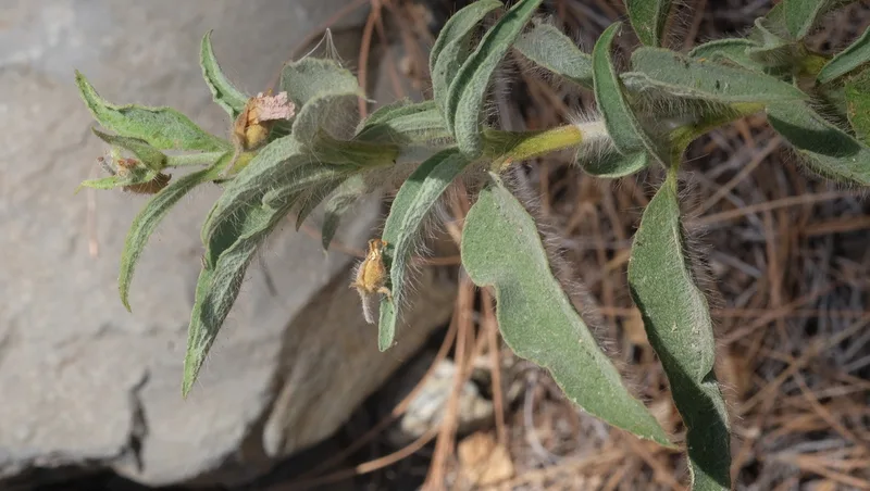
Cistus symphytifolius -
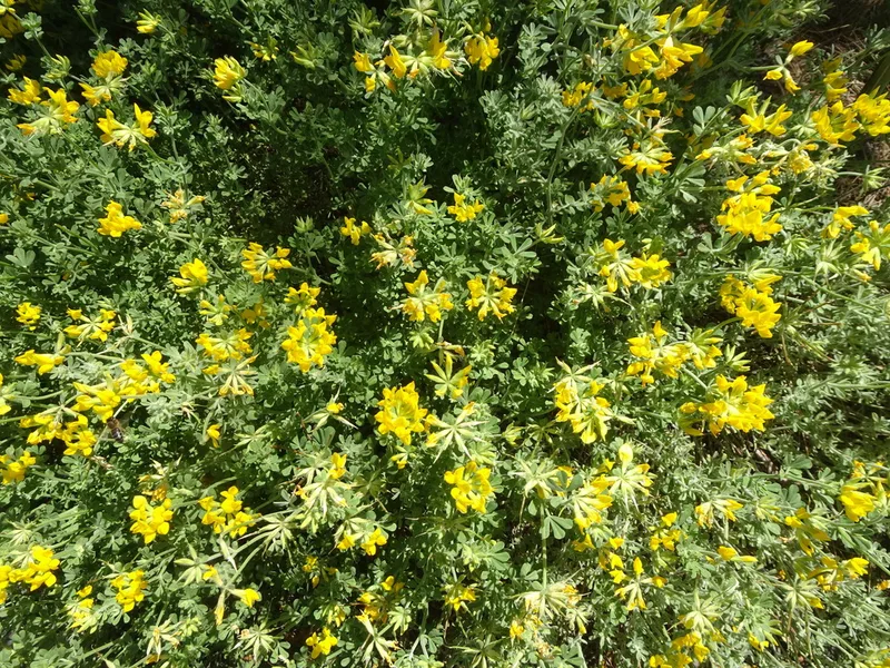
Lotus campylocladus -
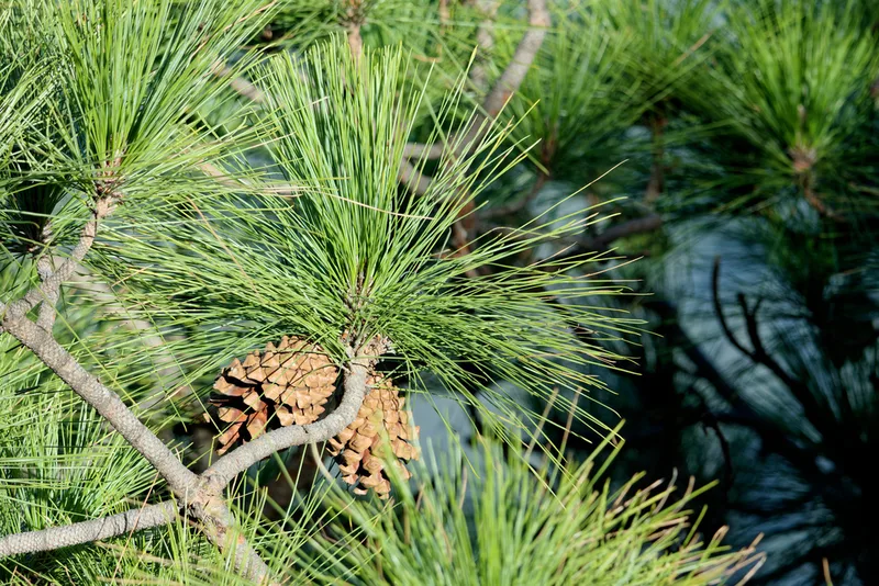
Canary Island pine Pinus canariensis -
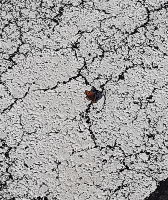
Small Copper Lycaena phlaeas -
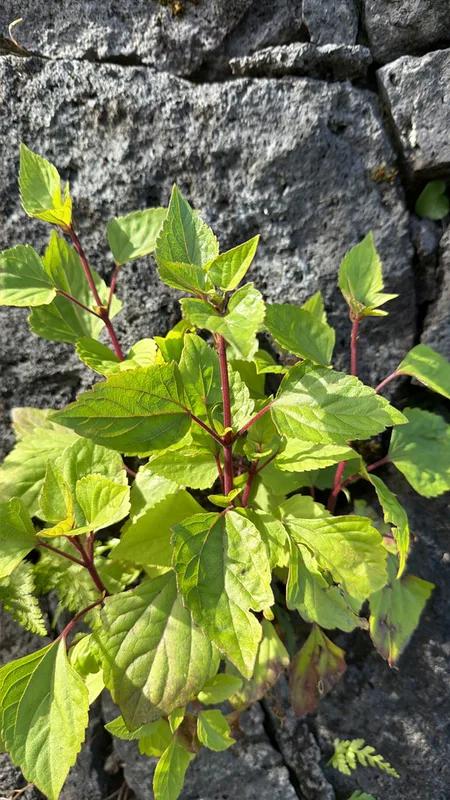
Crofton Weed Ageratina adenophora -
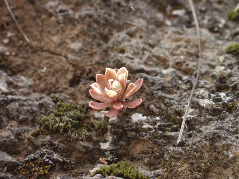
Aeonium spathulatum -
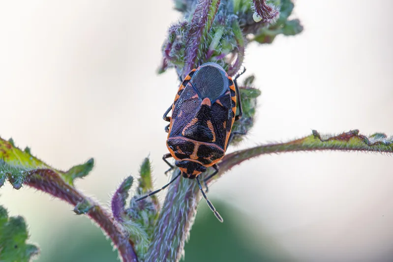
Eurydema lundbladi -
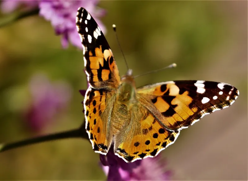
Painted Lady Vanessa cardui -
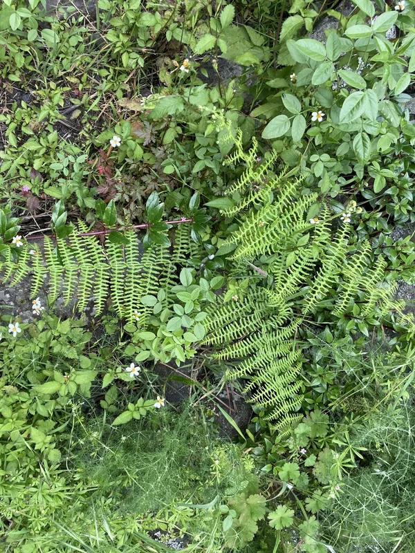
common bracken Pteridium aquilinum -
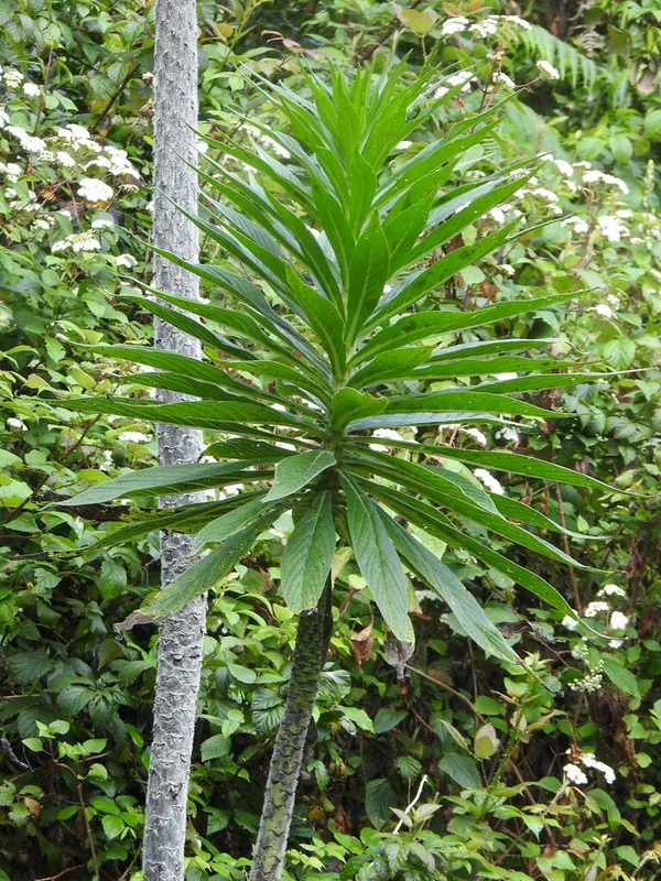
Giant Viper's-bugloss Echium pininana -
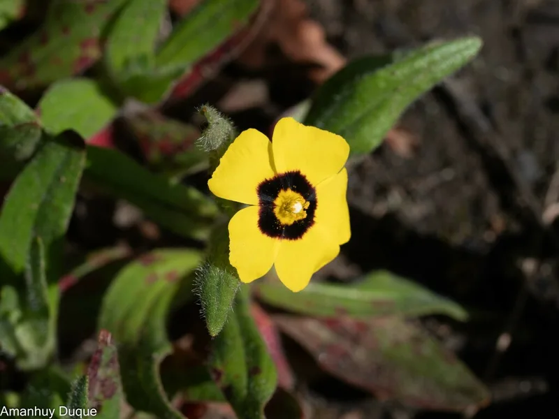
Spotted Rock-rose Tuberaria guttata -
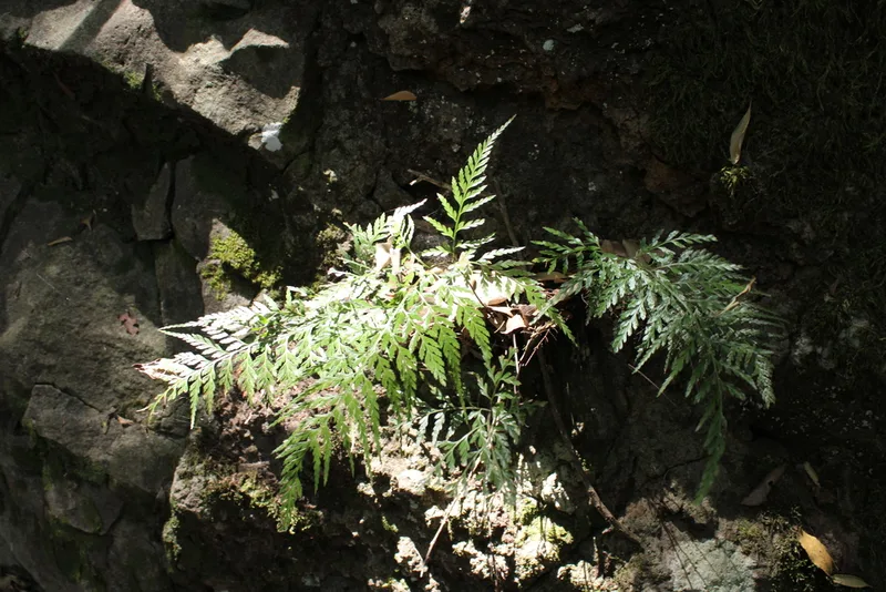
western black spleenwort Asplenium onopteris
Field Notes · Night Sky lens · Carretera Roque de Los Muchachos · 28.7181, −17.8256