Kings Canyon
Cedar Grove Visitor Center · California, USA
The ice did the digging; the river only keeps the argument going.
Also seen through Ice & Glaciers · all at Cedar Grove Visitor Center →.
Why here
The canyon is more than a mile deep, and the river at the bottom did not dig most of it. The deep carving was done by ice. For long stretches of the last few million years, glaciers filled this valley, grinding down through granite that had cooled solid far underground. When the ice pulled back, it left a trench with a flat floor and walls that stand thousands of feet almost straight up. The South Fork of the Kings River inherited that trench and has been working it ever since — carrying off what the ice loosened, sharpening the cut a little more each spring. That is the long argument this place records: water in two forms, ice and river, against the hardest rock the Sierra can offer. The granite is winning nothing; it is only slow. Stand on the canyon floor and the whole story is arranged around you — the polished walls above, the loose rubble underfoot, the river doing the quiet finishing work. These stops follow the floor the ice planed flat, the walls it left standing, and the high country that keeps the water coming.
The story
Start with rock made in the dark. The pale granite of these walls cooled from molten rock a mile or more underground, in the age of dinosaurs, and waited there while everything above it wore away and the Sierra slowly rose to bring it into the light.
Then came the cold. Again and again over the last couple of million years, ice gathered in the high country and poured down this valley, quarrying the granite and hauling the broken rock downstream. The gravel ridges and loose piles on the canyon floor are its leavings. Where the rock was sound, the ice could only polish it and slide past, leaving the clean vertical faces that stand today; where it was cracked, the ice pried it apart. When the last of the ice left, forest climbed the slopes and the river settled into the flattened trench.
People came late and lightly. The floor at Cedar Grove is the only developed corner of the park down here, and the road that reaches it closes with the first heavy snow and does not reopen until spring — the mountains still set the schedule. A weathered cabin near the river is one of the few marks the early years left. The park itself began small, gathered around a grove of giant trees, and grew to take in the whole glacier-cut canyon and the peaks that feed it.
The sites
The floor the ice left
Cedar Grove Visitor Center
36.7908, −118.6711
Cedar Grove sits on the flat floor of the canyon, beside the South Fork of the Kings River, and it is the natural place to begin reading the valley. This is the only developed corner of the park down here, which is a clue in itself: the floor is flat and wide because a glacier planed it that way, and flat ground is rare and useful in a range this steep. Step away from the buildings toward the river and look up. The walls do not lean back gently the way river-cut canyons do; they rise close to vertical and then round off at the top. That shape is the ice’s signature. A river alone cuts a narrow V; a glacier fills the whole valley and grinds it into a broad trough. The water you hear now is the smaller, later worker, sorting and carrying off what the ice tore loose. Everything else in this note is a variation on what you can see from right here: the flat floor, the steep walls, and the water that made both.
From the riverbank, read the shape of the canyon’s cross-section — steep walls rounding off to a broad top. A river alone cuts a narrow V; this wide U was carved by a glacier filling the valley wall to wall.
- AccessDrive-up
- ExertionEasy
- TimeAn hour
Zumwalt Meadow
36.7916, −118.5961
A short way up the canyon from Cedar Grove, the walls step back and the floor opens into Zumwalt Meadow, a flat green break in the forest with the river easing through it. Meadows like this are a stage in a canyon’s life. When a glacier leaves, it often dams the valley with rubble and strands shallow lakes on the flattened floor behind it; over centuries those lakes fill with silt the river carries in, turn to marsh, then to meadow. Walk the loop and you are crossing an old lakebed in the slow act of becoming dry land. Notice how differently the river behaves here than in the narrows. It slows, widens, and begins to wander in loose curves, because on flat ground moving water has no reason to hurry. Above the grass, the granite walls stand close on both sides, so the meadow reads as a quiet pause held between them. It is one of the easiest places in the canyon to feel the floor as a floor — level, soft, and slowly built.
Stand at the meadow’s edge and watch how the river moves — slow, wide, looping in gentle curves. On the flat floor the water has almost no slope to rush down, so it wanders; the same river runs straight and fast where the canyon narrows.
- AccessShort walk
- ExertionEasy
- TimeAn hour
The walls left standing
Grand Sentinel
36.7831, −118.5840
Grand Sentinel is the great granite pillar that stands over the upper canyon, its north face rising thousands of feet almost straight up from the floor across a short stretch of ground. It is the best single lesson here on why some walls stand while others slump. Granite has no layers to speak of; it cools as one huge mass, and where it is solid and unbroken it can hold a near-vertical face for ages. Where it is split by cracks, weather and ice pry it apart block by block until it breaks down into slopes and rubble. The Sentinel is a place where the rock happened to be sound, so the ice sheared past it and left a clean, steep face instead of a pile of debris. Look at the wall and you are looking at the glacier’s reach made permanent — the ice stood at least as high as the polished, unbroken rock. Everything below the pillar’s base is the loose story; the pillar itself is the part that refused to move.
Look up at the Sentinel’s sheer face, then at the broken, gullied slopes beside it. The clean rock is unbroken granite the ice could only polish; the crumbling slopes are cracked granite that ice and frost pried apart. Same rock, different luck.
- AccessShort walk
- ExertionEasy
- TimeAn hour
The Sphinx
36.7712, −118.5504
Near the head of the canyon, where the road ends and the trails begin, a tall granite pinnacle called The Sphinx stands out on the skyline. From the floor it reads as a single pale tooth of rock set above the forest. It marks the place where the wide, ice-planed floor gives out and the canyon splits into steeper, tighter side canyons climbing toward the crest. That change is worth pausing on. Downstream, the valley is broad and flat because a large glacier filled it and had room to grind; up here, near the sources, the ice was thinner and divided among smaller tributary glaciers, so the canyons are narrower and the rock more jagged. The Sphinx is a marker on that transition — one of the last of the big, clean granite faces before the country breaks up into the high, rough headwaters. Crane up at it from the valley floor and you are standing roughly where the main glacier’s power began to thin out.
From the end of the road, look up at the pale pinnacle on the ridge, then notice how the canyon around it grows narrower and rougher than the broad floor behind you. This is where the main glacier thinned and split into smaller ones, leaving sharper rock.
- AccessShort walk
- ExertionEasy
- TimeAn hour
The high country that feeds the water
Kennedy Mountain
36.8790, −118.6683
High above the canyon floor, on the Monarch Divide that walls in the north side of the valley, stands Kennedy Mountain — one of a crowd of granite summits over eleven thousand feet that ring the headwaters. You will not reach it on a short outing; it is remote, high, and hard-won, first climbed by a government survey party more than a century ago and still mostly the province of people who seek out summits. But it earns a place in this note without being underfoot, because peaks like it are where the whole system starts. Snow piles deep on these divides through winter and holds late into summer in the shaded folds; as it melts, it feeds the streams that gather into the South Fork and run the length of the canyon below. The water that slows through the meadow and sharpens the walls downstream begins as snow on ground like this. Look north from the floor toward the high, pale divide and you are looking at the source — the store of frozen water that keeps the long argument supplied.
From the canyon floor, look north to the high divide and find the snow still lying in the shaded gullies below the summits, long after the floor has thawed. That lingering snow is the canyon’s water supply, released slowly through the warm months into the river below.
- AccessExpedition
- ExertionStrenuous
- TimeWorth two days
When it's best
The canyon runs on the mountain calendar. The road down to the floor closes with the heavy snows of late fall and stays shut until spring, so this is a warm-season place whether you like it or not. Come soon after the road opens and the river is at its loudest — snowmelt from the high country crowds the channel through late spring and early summer, and the sound of it fills the whole trench. By late summer the river quiets and the meadows dry to gold. Early in the season, before the road has been open long, nights on the floor can still drop below freezing and snow lingers in the shaded high country; the peaks along the divides hold their white far longer than the floor does. Fall brings cooler, clearer air and thinner company before the road closes again for the winter.
Go deeper
The names behind what you saw. The pale rock of the walls is granite of the Sierra Nevada batholith — molten rock that cooled deep underground and mapped here as Late Cretaceous granitic and Mesozoic intrusive rock. The gravel ridges and loose piles on the canyon floor are glacial till and moraine, dropped by Pleistocene ice. The valley itself is a textbook glacier-carved, U-shaped canyon.
To read next. - Any overview of the Sierra Nevada batholith — for how a whole range’s worth of granite forms underground before it is ever exposed. - A short primer on alpine glacial valleys, moraines, and U-shaped troughs — the key to reading the canyon’s cross-section and the rubble on its floor. - The park’s own material on Cedar Grove and Kings Canyon — for the human history of the only developed corner and the seasonal road. - A regional bird list for the Sierra conifer forest — the woodpeckers, nutcrackers, and crossbills working these pines reward a morning with binoculars.
The names behind what you saw
What lives here, and what it's called. Photographs from open collections — an aid to identification, not decoration.
-
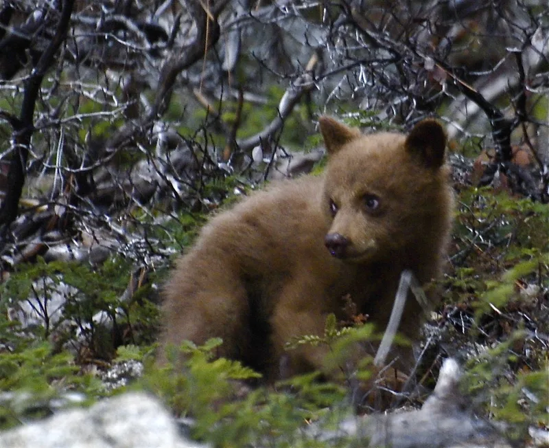
American Black Bear Ursus americanus -
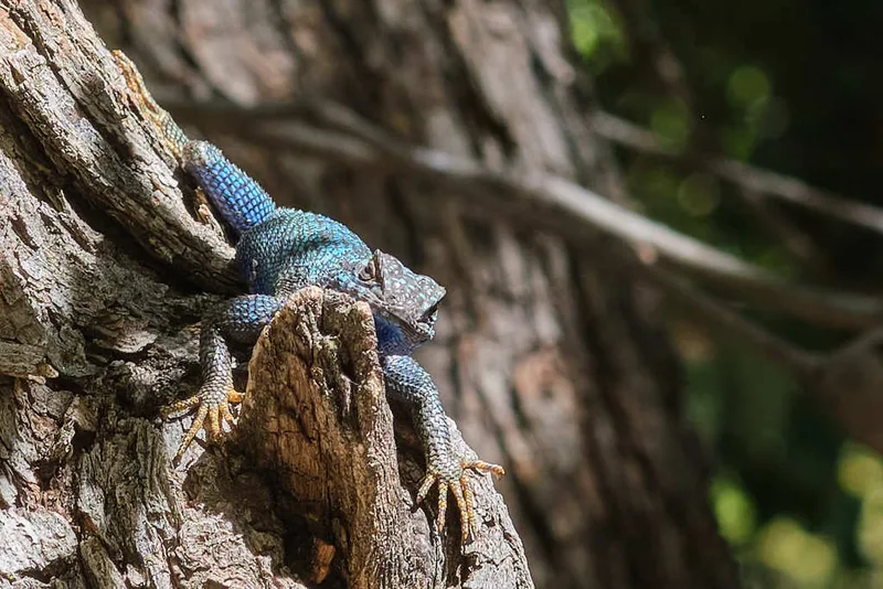
Western Fence Lizard Sceloporus occidentalis -
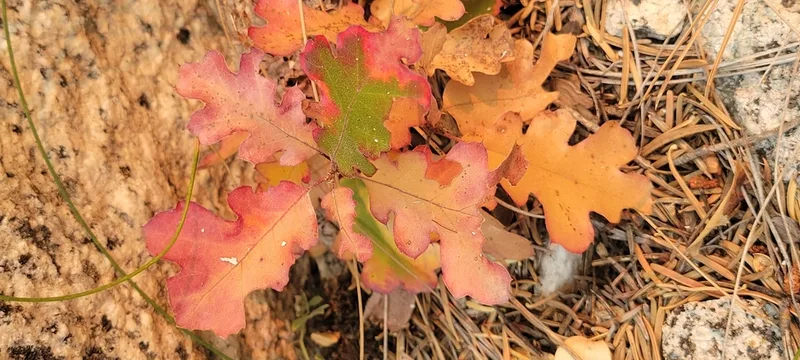
California black oak Quercus kelloggii -
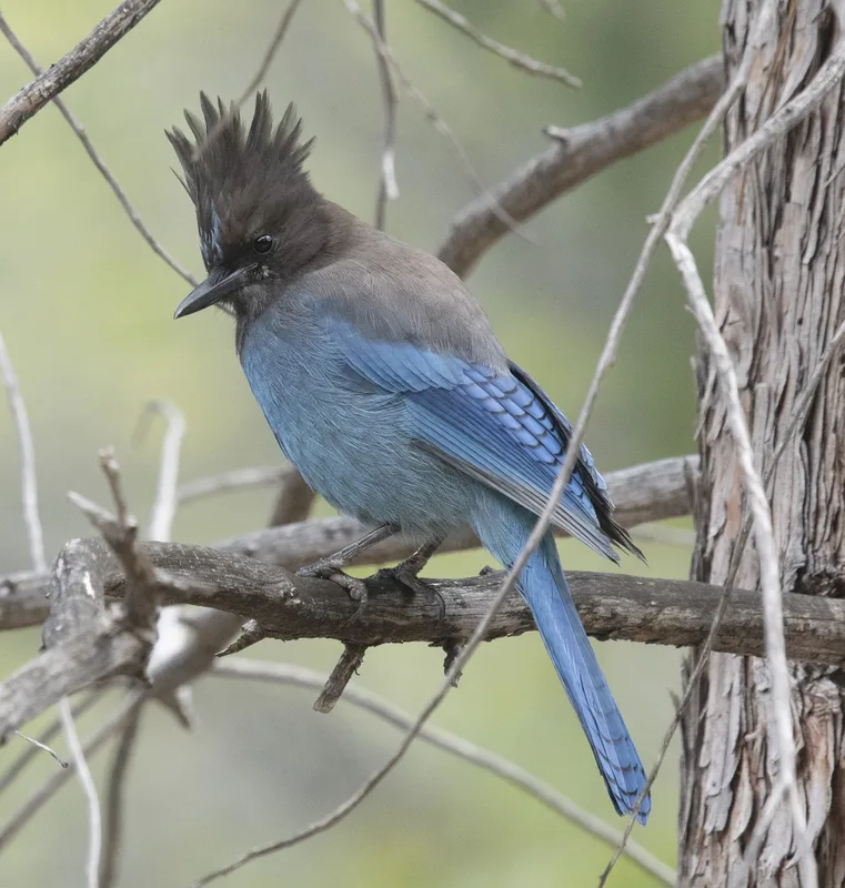
Steller's Jay Cyanocitta stelleri -
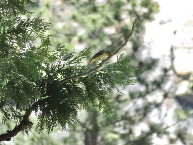
California incense-cedar Calocedrus decurrens -
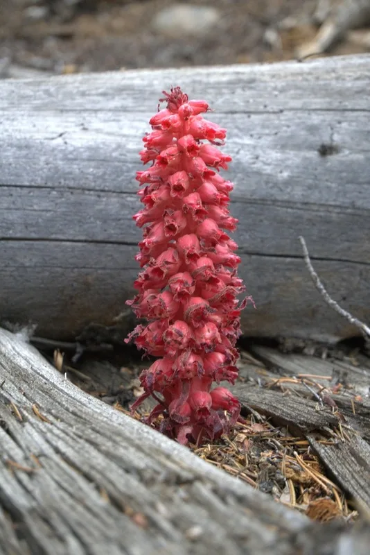
Snowplant Sarcodes sanguinea -
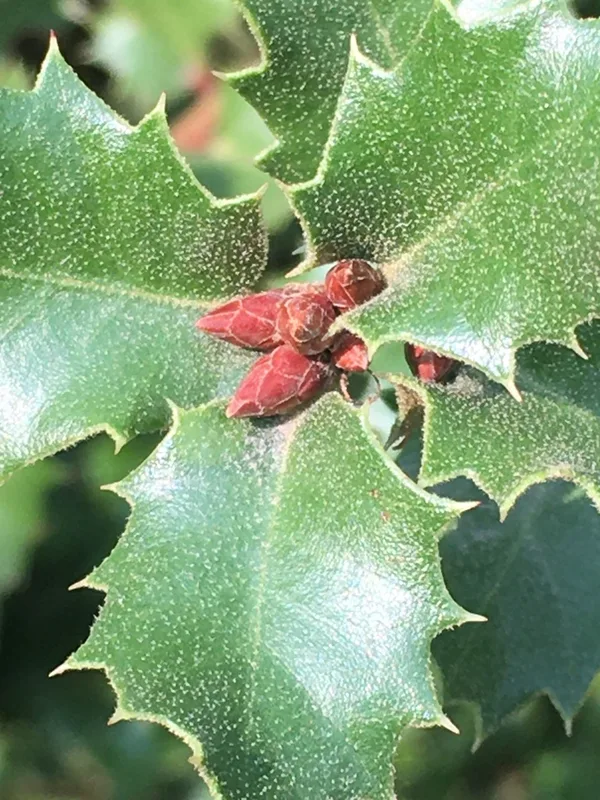
canyon live oak Quercus chrysolepis -
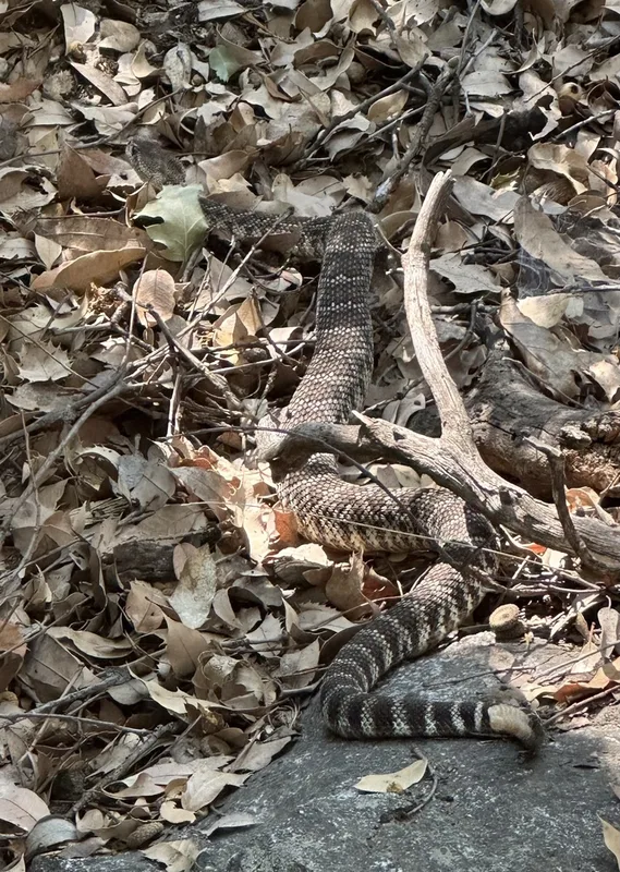
Western Rattlesnake Crotalus oreganus -
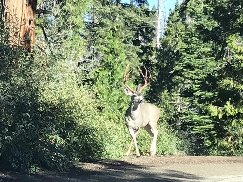
Mule Deer Odocoileus hemionus -
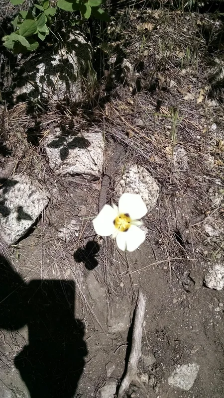
Leichtlin's Mariposa Lily Calochortus leichtlinii -
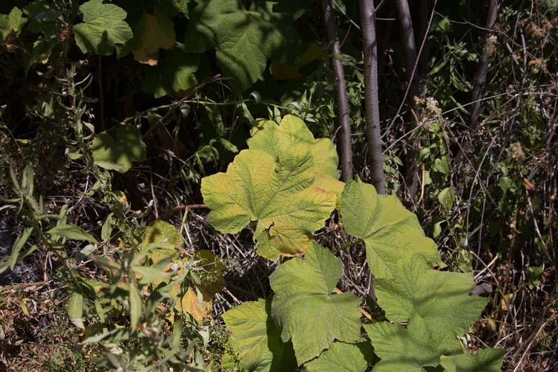
thimbleberry Rubus parviflorus -
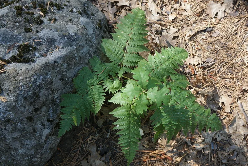
common bracken Pteridium aquilinum
Field Notes · Rivers & Canyons lens · Cedar Grove Visitor Center · 36.8251, −118.6108