Kings Canyon
Cedar Grove Visitor Center · California, USA
Every wall in this canyon still wears the shape of the ice that filled it.
Also seen through Rivers & Canyons · all at Cedar Grove Visitor Center →.
Why here
Walk to the middle of Zumwalt Meadow and look up. The canyon walls don’t taper to a point the way a river-cut valley does — they rise almost straight for thousands of feet, on both sides at once, like the inside of a bathtub. No river running alone carves that shape. It takes ice, moving as a single mass thick enough to fill the whole trough, grinding along the bottom and both walls at the same time. For long stretches of the last couple of million years, that is exactly what stood here: a glacier reaching from crest to crest, quarrying granite that had already cooled solid deep underground millions of years before any ice arrived. It scraped the low ground wide and flat, plucked away everything not soundly anchored, and dropped what it couldn’t carry as ridges and rubble on its way out. The ice let go of this valley only a geological moment ago, and it left in a hurry — almost nothing on the canyon floor or the walls above it is untouched by that departure. This note follows what the ice built, and what it left behind.
The sites
The floor the ice planed flat
Cedar Grove Visitor Center
36.7908, −118.6712
Cedar Grove sits on the floor of the canyon, and it is the place to get your first sense of scale. Look up from the parking area at the granite walls closing in on both sides — they don’t lean back gradually, they stand close to vertical for most of their height. That profile only happens one way: a glacier filled this valley from wall to wall, not just running along the bottom like a river, and its own mass and weight ground the floor wide and the sides steep at the same time. The ice here was not a shallow scrape. To plane a floor this broad and hold walls this steep, the glacier had to stand deep enough to bury the lower slopes completely, moving as one slow, immense body rather than a channel of water finding the easiest path. The forest and the river arrived only after the ice left. Everything downstream in this note — the meadow, the standing rock, the high peaks — reads off the same fact: a glacier, not a river, set the dimensions of this place, and it did so more recently than the granite underneath it would suggest.
Stand at the visitor center and find the point where each canyon wall stops leaning and turns nearly vertical. That’s roughly the old ice line — below it, a glacier once filled the valley wall to wall and ground both the floor and the walls into shape at once; a river working alone could never touch the walls, only the bottom.
- AccessDrive-up
- ExertionEasy
- TimeAn hour
Zumwalt Meadow
36.7916, −118.5961
A short walk up-canyon from Cedar Grove, the walls pull back and the floor opens into Zumwalt Meadow — flat, green, and startlingly level for country this steep. Meadows like this are common wherever glaciers have recently pulled out of a valley, and they form because the ice left more than a smooth floor: retreating glaciers pile up their loosened rock and gravel in low ridges called moraines, often right across a valley, and one of those ridges is usually enough to dam the water behind it into a shallow lake. Left alone for a few thousand years, a lake like that fills with sediment, turns to marsh, and dries into meadow — flat because a lake bottom is flat. Walk the loop here and you are almost certainly walking on old lake floor, the last stage of a process the glacier set in motion when it quit the valley. The granite walls stand close on both sides, holding the meadow the way they held the ice that came before it.
Walk the meadow loop and notice how flat the ground stays underfoot, edge to edge, with almost no slope. That flatness is a former lake bottom, filled in with sediment behind glacial debris that once dammed the valley here; look for the abrupt line where flat meadow meets steep granite wall, with nothing gradual in between.
- AccessShort walk
- ExertionEasy
- TimeAn hour
Rock the ice couldn't take with it
Grand Sentinel
36.7831, −118.5840
Grand Sentinel is the granite pillar that dominates the skyline above the upper canyon, its face climbing roughly two-thirds of a mile of solid rock in barely half a mile of horizontal ground. A wall that steep and that tall is a record of exactly how high the ice stood. Below a certain line, glacial ice scours rock smooth as it slides past — you can trace that line on peaks like this one, where the lower slopes run clean and rounded and the upper reaches turn suddenly rougher and more broken. Above the old ice surface, weather alone has been doing the work, freezing into cracks and prying the rock apart, which is a slower and messier sculptor than moving ice. Grand Sentinel’s lower face is clear evidence of just how deep the glacier ran — deep enough to bury peaks that, from the floor today, look impossibly tall. Stand back far enough to take in the whole face and you’re reading a rough gauge of the ice at its thickest.
Trace the face of Grand Sentinel from the ground up and look for where smooth, rounded rock gives way to rougher, more broken rock higher on the peak. The clean lower section is what a moving glacier could scour smooth; the ragged upper section sat above the ice, left to weather on its own.
- AccessShort walk
- ExertionEasy
- TimeAn hour
The Sphinx
36.7712, −118.5504
The Sphinx is a pale granite pinnacle standing apart from the canyon wall, a short distance southeast of Grand Sentinel, and it rewards a closer look than the big peaks get. Walk to its base if the trail allows and run a hand over the lower rock. Where glacial ice has been at work, granite often takes on a smooth, almost soapy polish, sometimes with fine parallel scratches pressed into the surface — the signature of rock and grit dragged across bedrock by ice under enormous pressure, all of it pointing the same direction the glacier once flowed. Higher up, out of the ice’s reach, the same granite turns rougher and more angular, broken up by frost instead of ground smooth by ice. The Sphinx is a compact place to see both textures within arm’s reach of each other: the close, tactile evidence of moving ice near the ground, and the older, untouched rock above where the glacier never rose high enough to reach.
At the base of The Sphinx, run a hand across the lower rock and look for a smooth, almost polished surface, sometimes with faint straight scratches pressed into it. That texture is glacial polish, ground in by rock and grit dragged along the bedrock as the ice moved past — the scratches point the direction it was traveling.
- AccessShort walk
- ExertionEasy
- TimeAn hour
The high country that made the ice
Kennedy Mountain
36.8790, −118.6683
Kennedy Mountain rises on the high divide that walls in the north side of the canyon, one of a run of granite summits just over two miles above sea level. It’s a serious objective, not a short outing, but it belongs in this note because peaks like it are where a glacier actually begins. Snow that piles deep on a north-facing slope, sheltered from direct sun, can survive a whole summer instead of melting off; add enough winters like that in a row and the snow compresses into ice, then starts to move downhill under its own weight. The bowl-shaped hollows carved into the upper mountain by that process — high on north and east faces, where shade lingers longest — are where this canyon’s ice was born before it ever reached the valley floor. Kennedy Mountain and its neighbors are still doing a smaller version of that job every winter: gathering snow, shedding it slowly, feeding the valley below. Look north from the canyon floor toward the high divide and you’re looking at the birthplace of everything this note describes.
From the canyon floor, look north to the high divide and find the shaded, bowl-shaped hollows tucked into the mountainside below the summits, usually on faces that get the least direct sun. Snow lingers longest in hollows like these; they’re the kind of place a glacier starts, one long-lasting snowbank at a time. Binoculars help pick them out from a distance.
- AccessExpedition
- ExertionStrenuous
- TimeWorth two days
When it's best
This is high country, and the ice’s old habits still set the calendar here. The road into the canyon closes under snow each winter and doesn’t reopen until spring, so the trough itself is a warm-season place no matter how you plan around it. Even once it opens, early-season mornings on the canyon floor can still dip below freezing while afternoons turn mild — a small, yearly rerun of the freeze and thaw that once worked this granite apart. Come early in the season to see the high divides still holding real snow in their shaded hollows, the closest thing left to the ice that made the place; come later for warmer nights and a quieter, drier meadow.
Go deeper
The names behind what you saw. The granite you stood against is mapped as Late Cretaceous plutonic rock, cooled and solidified roughly 100 million years ago, part of the same broad family of intrusive rock mapped nearby as Mesozoic in age. The till and moraine draped across the high country and damming the meadows are classed as Quaternary glacial deposits — the debris record of the most recent ice, dated to the very end of the Pleistocene, only about twelve thousand years ago.
To read next. The pre-vetted further-reading list for this place came back empty for this note, so there’s nothing further to hand off honestly beyond what’s already cited above — the Wikipedia entries for Kings Canyon National Park and for Cedar Grove, used throughout, are the fullest published starting points until a fuller reading list exists for this place.
The names behind what you saw
What lives here, and what it's called. Photographs from open collections — an aid to identification, not decoration.
-
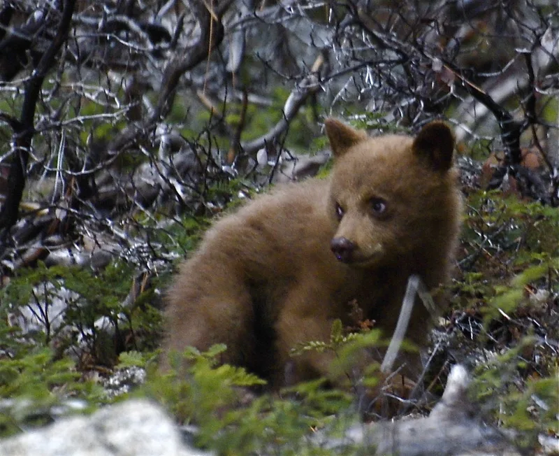
American Black Bear Ursus americanus -
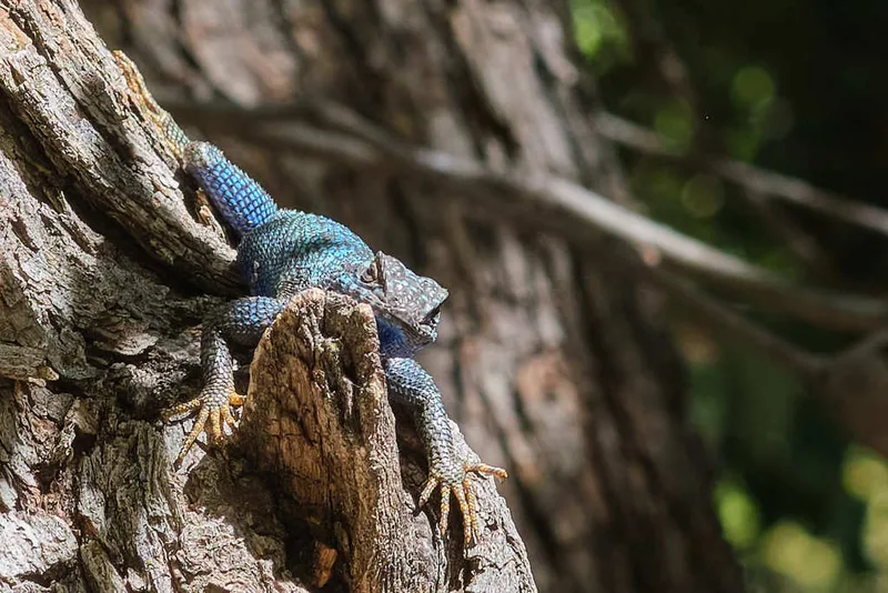
Western Fence Lizard Sceloporus occidentalis -
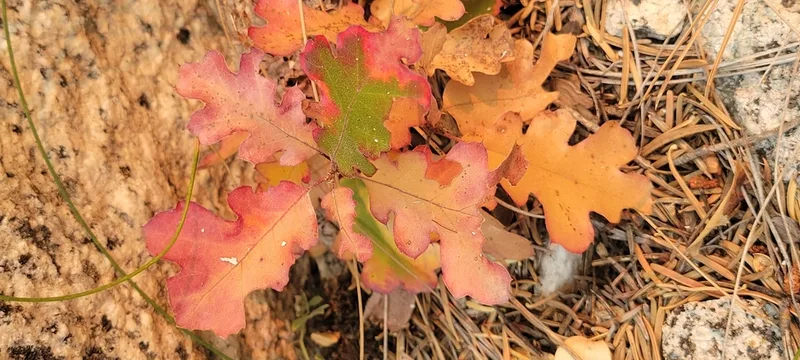
California black oak Quercus kelloggii -
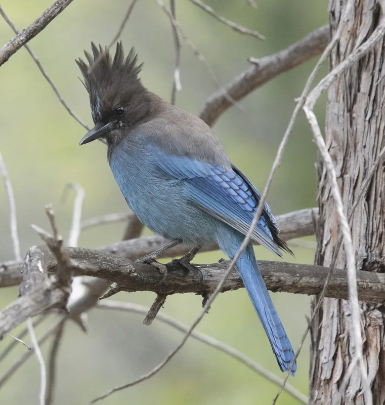
Steller's Jay Cyanocitta stelleri -
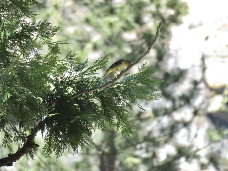
California incense-cedar Calocedrus decurrens -
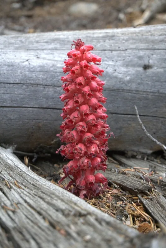
Snowplant Sarcodes sanguinea -
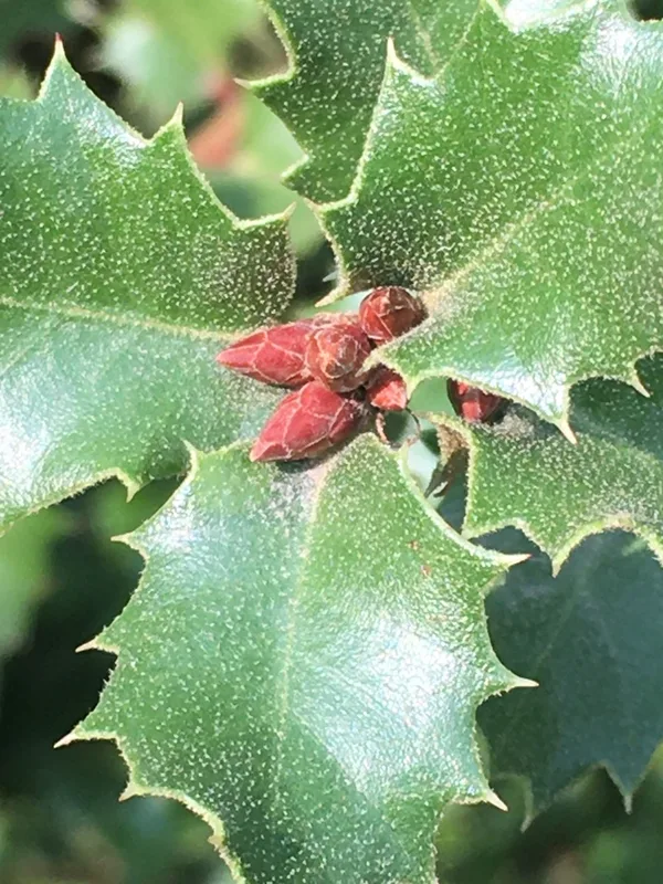
canyon live oak Quercus chrysolepis -
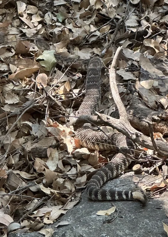
Western Rattlesnake Crotalus oreganus -
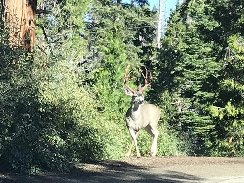
Mule Deer Odocoileus hemionus -
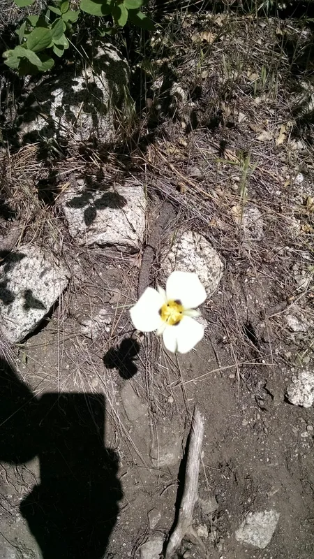
Leichtlin's Mariposa Lily Calochortus leichtlinii -
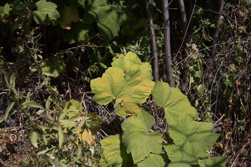
thimbleberry Rubus parviflorus -
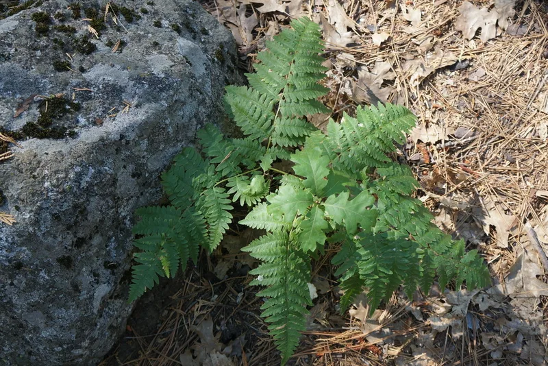
common bracken Pteridium aquilinum
Field Notes · Ice & Glaciers lens · Cedar Grove Visitor Center · 36.8251, −118.6108