Reykjanes
Here the ocean floor comes ashore, and the land is still arriving.
Also seen through Fog Coast · all at Reykjanesskagi →.
Why here
The great crack that runs down the floor of the Atlantic, where two of the planet’s plates pull slowly apart, does not stay underwater the whole way. On Reykjanes it walks out onto dry land. You can stand on the seam. Everything here is made of what the seam produces: dark lava, some of it old and weathered, some so fresh it still looks poured. The two plates drift apart a little each year, and the gap fills from below with molten rock that cools into new ground. For eight centuries this stretch stayed quiet. Then in 2021 a fissure opened south of Fagradalsfjall and lava ran for half a year, and the peninsula grew. This is the rare place where you don’t read about the land being made — you look at it. Every cliff, every black field, every cone in this note is the same story told at a different moment. Once you see it, Reykjanes stops being scenery and becomes a process you happen to be standing in.
The story
Start with the rock, because here everything does. Reykjanes is the top of the Mid-Atlantic Ridge where it lifts above the sea — two plates, the North American and the Eurasian, easing apart while lava wells up to fill the space. Some of the hills are flat-topped and steep-sided, built when eruptions melted their way up through Ice Age glaciers and cooled against the ice. Much of the ground is younger, a thin skin of black lava only a few thousand years old, and some of it younger still: the 2021 eruption near Fagradalsfjall added fresh rock within living memory.
Life takes the new land slowly. Low mats of crowberry and thyme and sea thrift work into the cracks; on the sea-cliffs, fulmars hold their ledges the year round. The birds were here long before the people.
People came late. Iceland was one of the last places in Europe to be settled, by Norse voyagers around the ninth century, onto ground still young. They fished from points along this coast and built small towns like Vogar on the lava. Today two signs near the tip name the plates you are standing between — the clearest admission anywhere that this is not finished country, only country caught mid-sentence.
The sites
Where the ridge comes ashore
Welcome to the North American Plate
63.8684, −22.6758
A roadside sign near the southwestern tip marks the edge of the North American plate. It is not a metaphor: the ground west of here rides one of the planet’s great plates, drifting slowly away from its neighbor. The sign stands where the Mid-Atlantic Ridge, mostly an undersea feature, has climbed onto land.
Stand at the sign and face its twin a short walk east, which names the Eurasian plate. The low, broken ground between them is the widening gap the two plates leave as they part, filled again and again by lava from below. Walk from one sign to the other and you have crossed between two continents on foot.
- AccessDrive-up
- ExertionEasy
- TimeAn hour
Welcome to the Eurasian Plate
63.8682, −22.6752
The companion sign a few steps away marks the Eurasian plate — the same plate that carries Europe and much of Asia, ending here at a seam in the Icelandic rock. Between the two signs runs the boundary itself, a rift valley shrunk to walking scale.
Look down at the fissured, sunken ground along the boundary. Those open cracks are the plates pulling apart, a slow tearing that here happens at the surface rather than miles down under the sea. Drop a small stone into a crack and listen for how far it falls.
- AccessDrive-up
- ExertionEasy
- TimeAn hour
Reykjanestá
63.8005, −22.6979
Reykjanestá is the peninsula’s southwestern point, where the ridge finally meets open ocean and dives back beneath it. A lighthouse stands above a coast of black lava and steam. Offshore, the rift keeps going as a line of low rocks and volcanic islets.
From the point, look out to sea along the run of low rocks and islets. They are the ridge continuing underwater, its summits breaking the surface. On a clear day the farthest large stack is Eldey, its flat summit the ridge itself breaking the surface far offshore.
- AccessShort walk
- ExertionEasy
- TimeAn hour
The new country: Fagradalsfjall
Fagradals-Hagafell
63.9270, −22.2496
This is a shoulder of the Fagradalsfjall volcanic system, the stretch that woke in 2021 after eight silent centuries. South of here a fissure opened and effusive lava — runny, not explosive — spread across the valleys for half a year. Some of the rock nearby is younger than most things people have built on this coast.
Look for the difference between the older grey-brown hills and the newer lava: the fresh flows are blacker, sharper-edged, and nearly bare of plants. Where crowberry and thyme have started to green a flow, you are reading its age — the more life, the older the rock.
- AccessHalf-day hike
- ExertionModerate
- TimeHalf a day
Langhóll
63.9051, −22.2726
Langhóll is the high point of the Fagradalsfjall massif, a broad old volcano built up under the ice of the last glacial age. From its top the whole spreading zone lays out: a run of cones, craters, and lava fields following the rift line from northeast to southwest.
From the summit, pick out how the cones and fissures line up in a single direction, like beads on a thread. That line is the plate boundary. Everything volcanic on the peninsula, old and new, sits along it, because that is where the crust is being pulled open.
- AccessHalf-day hike
- ExertionStrenuous
- TimeHalf a day
Litlikeilir
63.9276, −22.2159
Litlikeilir — ‘little Keilir’ — is a small, steep, cone-shaped hill of the sort the Ice Age built here: lava that erupted up through a glacier and chilled against it into a sharp peak. Its larger namesake, Keilir, is a landmark seen from across the peninsula.
Notice the cone’s regular, almost drawn outline, unusual among these lumpy hills. It got that shape from the ice that once packed around the erupting vent, holding the lava in like a mold. Look north to find the taller Keilir with the same profile.
- AccessShort walk
- ExertionModerate
- TimeHalf a day
Where fire meets water
Brimketill
63.8193, −22.6060
Brimketill is a bowl in the rock at the sea’s edge, worn smooth by the surf that pounds this coast. It is old lava that once ran all the way to the water and hardened there; the waves have been carving it back ever since.
Watch a few sets of waves fill and drain the natural rock pool below the viewpoint. You are seeing the two forces that shape this coast at once — lava that built the land out, and the North Atlantic taking it back a little with every tide. Stay behind the railing; the surf here is stronger than it looks.
- AccessDrive-up
- ExertionEasy
- TimeAn hour
Rauðhóll
63.8434, −22.6906
Rauðhóll means ‘red hill,’ and its color is the tell: a cone of loose, rusty cinder thrown up around a vent. The red is iron in the lava, oxidized — rusted — by heat and air as it erupted. Grey-black almost everywhere else on the peninsula, the rock here went the color of embers.
Watch the ground color as you approach — it shifts from the usual grey-black to deep red and rust. That red marks where a vent once fountained loose, airy cinder rather than flowing lava. Pick up a light, holey piece and feel how much air is trapped in it.
- AccessShort walk
- ExertionEasy
- TimeAn hour
Eldey
63.8127, −22.7159
This is the viewpoint and marker for Eldey, the sheer rock standing offshore beyond the surf. Eldey is a piece of the same volcanic ridge, its top breaking the sea — the last of these rocks before the open ocean.
Look straight out to the lone flat-topped stack on the horizon. That is Eldey, the volcanic ridge surfacing one last time before the open sea. Bring binoculars to pick out its sheer, flat sides against the water.
- AccessDrive-up
- ExertionEasy
- TimeAn hour
When it's best
Reykjanes keeps two calendars. The living one is ordinary sub-Arctic: seabirds pack the cliffs from spring into late summer, when the light barely quits and the black lava fields are easiest and safest to walk; winter shortens the days, ices the tracks, and empties the ledges, though the long dark buys the clearest skies and, with luck, the northern lights. The other calendar belongs to the ground, and it keeps no season at all. This stretch sat silent for roughly eight centuries before it woke in recent years, and an eruption can begin in any month. Come in summer for the walking and the birds, and know that the main event here has never once consulted the weather.
Go deeper
The dark rock is basalt — including olivine basalt, tholeiite, and pillow basalt formed where lava met water — and the oldest floods of it are grouped as flood basalt; the youngest ground is mapped simply as Holocene basalt. The steep, flat-topped hills, Fagradalsfjall and Keilir among them, are tuyas: volcanoes that erupted upward through Ice Age ice and froze into that shape. The plants named plainly above are sea thrift (Armeria maritima), mother of thyme (Thymus praecox), black crowberry (Empetrum nigrum), and sea campion (Silene uniflora); the year-round cliff bird is the northern fulmar (Fulmarus glacialis).
A few places to read further: - Fagradalsfjall — the volcanic system and its 2021 eruption, the peninsula’s first in over eight hundred years. - Seltún Hot Springs — the geothermal field in the Krýsuvík volcanic area, where the ridge steams at the surface. - Keilir — the textbook cone-shaped tuya, a landmark seen from across the peninsula. - History of Iceland — how and when people first reached this young coast.
The names behind what you saw
What lives here, and what it's called. Photographs from open collections — an aid to identification, not decoration.
-
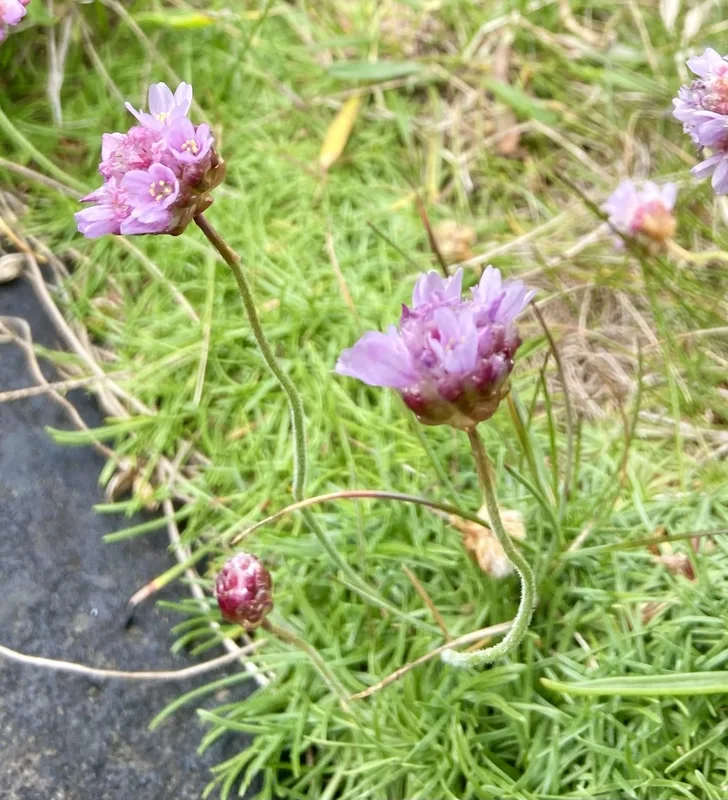
Sea Thrift Armeria maritima -
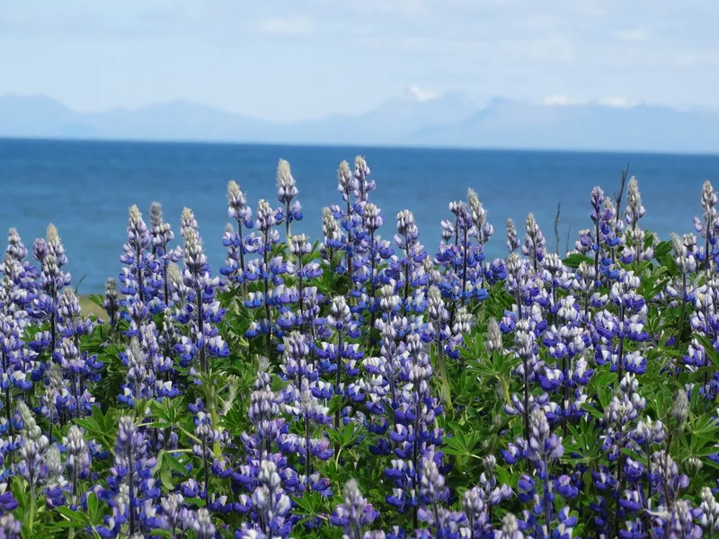
Nootka Lupine Lupinus nootkatensis -
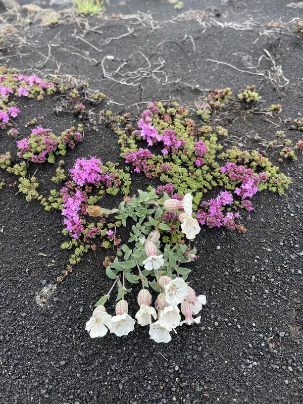
Sea Campion Silene uniflora -
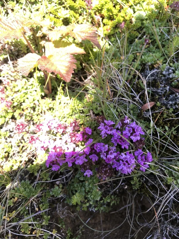
Mother of Thyme Thymus praecox -
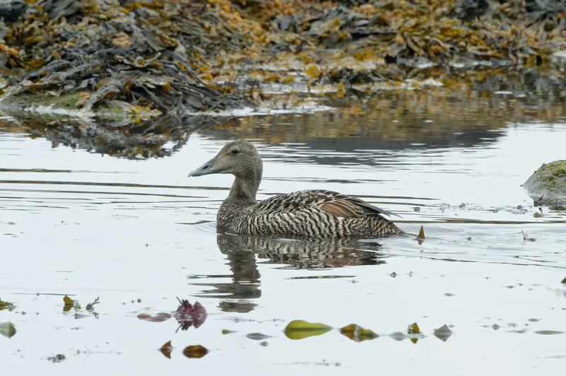
Common Eider Somateria mollissima -
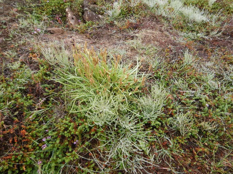
black crowberry Empetrum nigrum -
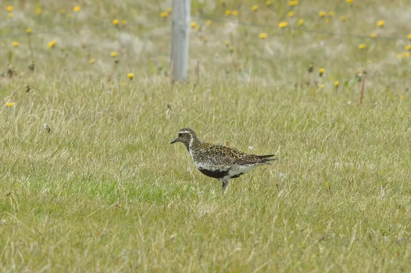
European Golden-Plover Pluvialis apricaria -
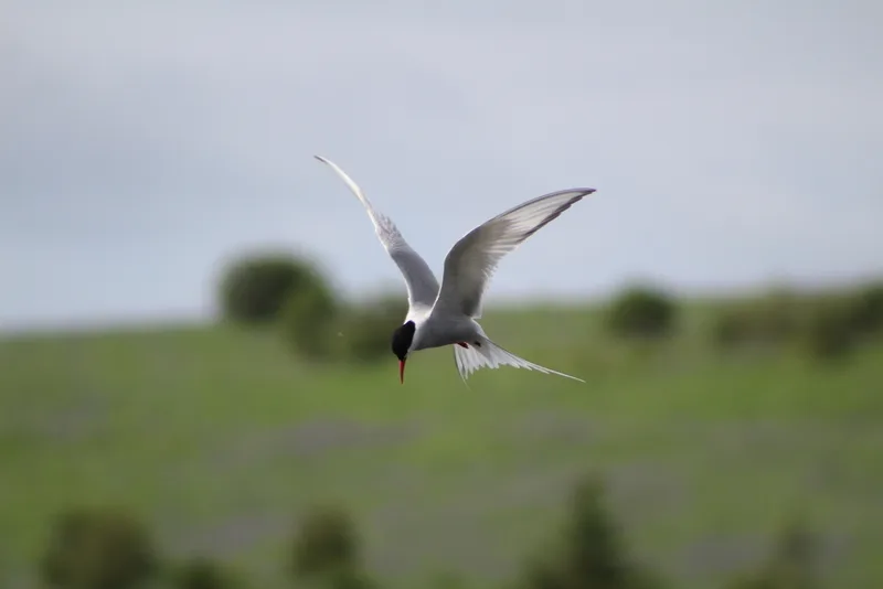
Arctic Tern Sterna paradisaea -
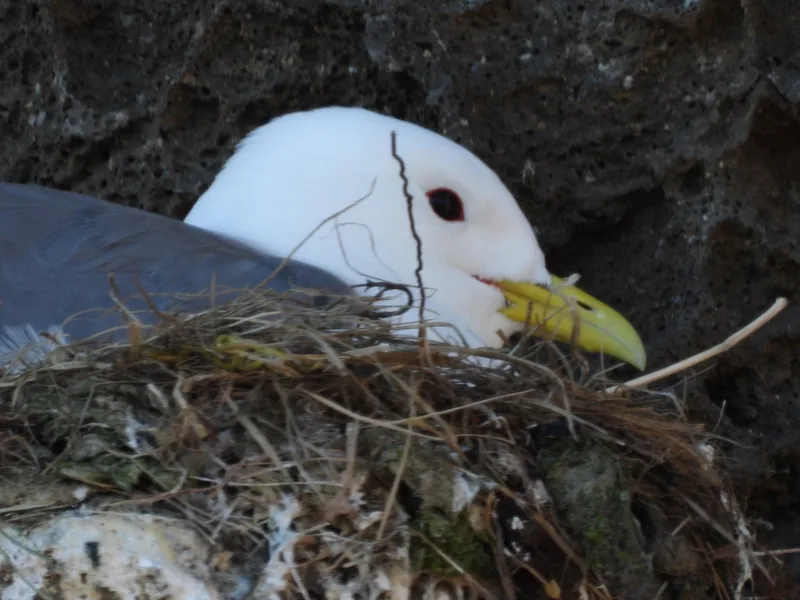
Black-legged Kittiwake Rissa tridactyla -
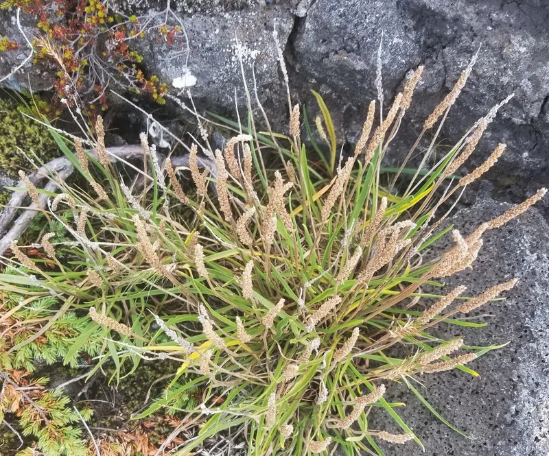
Sea Plantain Plantago maritima -
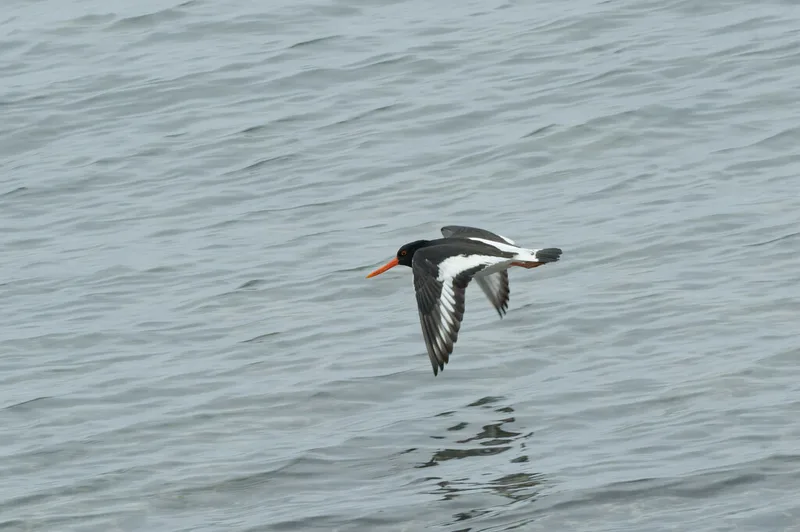
Eurasian Oystercatcher Haematopus ostralegus -
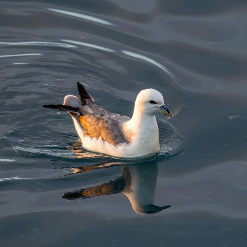
Northern Fulmar Fulmarus glacialis
Field Notes · Volcanic lens · Reykjanesskagi · 63.9415, −22.2560