Reykjanes
Nothing here softens the wind on its way in from the ocean — and everything alive on this coast has learned to use that.
Also seen through Volcanic · all at Reykjanesskagi →.
Why here
Reykjanes offers almost no shelter. It is a low tongue of young lava reaching into the open North Atlantic, sea on nearly every side, with nothing between the coast and the weather but more coast. Walk a few hundred meters inland from the shore and the color drains out of the world — black rock, pale moss, not much else. But right at the edge, where salt spray reaches hardest, small flowers hold on: pink sea thrift, white sea campion, sea plantain — plants built to take salt that would kill an ordinary one. The same narrow margin feeds the birds: eiders riding the swell just offshore, kittiwakes and fulmars working the sea cliffs, gannets fishing the water beyond the island of Eldey. None of it depends on soil or shelter. It depends only on the sea being close enough to reach. Inland, this peninsula holds little life; along its edge, almost everything that lives here does. That’s the shape of the whole trip: a barren interior, and a living line drawn exactly where the ocean can touch the land.
The story
The rock underfoot is almost all lava, and young by geological standards — much of it formed within the current geological age, some of it more recent still. Bare and black through the interior, it takes the ocean to soften it: salt-laden wind and sea spray reach nearly every part of this narrow peninsula, and along the immediate coast that moisture is enough to hold a fringe of low, tough plants that never make it further inland — sea thrift, sea campion, sea plantain — and the birds that feed and nest on the same strip: eiders riding just offshore, kittiwakes and fulmars on the ledges, gannets working the water past Eldey.
People have used this edge for as long as the record runs. Norse settlers reached Iceland by sea in the ninth century, and this coast has needed watching ever since — it still carries a lighthouse at nearly every point of note along its shoreline, evidence of how much of it needed marking for people moving past by water. Centuries later the same open coast drew a different kind of watching: information boards along the coast still mark where U.S. Army camps once stood, part of a watch kept on the sea approaches during the Second World War. Down the coast at Vogar, the reliance on clean, cold seawater continues in a quieter form — a roe-incubation center there still raises Atlantic salmon. The land changes slowly here. What people do with its coast keeps changing faster.
The sites
A shore with no harbor, marked by light
Garðskagaviti
64.0830, −22.6936
Garðskagaviti stands at the peninsula’s northern tip, the point where the coast finally runs out of land and meets the full width of the open Atlantic. This is as exposed as Reykjanes gets: wind comes in off open water with nothing ahead of it to slow it down, and on a clear day the sea fills the view in three directions. Weather here tends to announce itself early — mist rolling in off the water, or a squall visible miles out before it arrives. The lighthouse marks a spot that has needed marking for as long as boats have passed this way, a plain tower keeping watch over water with no shelter behind it. It is one of several such towers around this peninsula’s edge, each guarding a different stretch of the same exposed shore. Stand here and the whole logic of this coast becomes obvious: land this low and this open either gets marked for the people moving past it, or it gets avoided.
Face the open water and watch for a low string of birds moving fast and close to the surface — eiders, usually, riding the swell in loose rafts just offshore. They favor this exposed water because it keeps them clear of predators that hunt from land. Give it a few minutes of steady watching; they surface and dive in bursts.
- AccessDrive-up
- ExertionEasy
- TimeAn hour
Reykjanestá
63.8005, −22.6979
Reykjanestá is the peninsula’s southwestern point, the last dry ground before the ridge running beneath the Atlantic dives back under the sea. A lighthouse stands above a shore of black lava worked over by steady surf. This is one of the more exposed walks on the peninsula: the path from the parking area crosses open lava with no windbreak, and the wind and spray can be constant even on an otherwise calm day. The reward is the sense of standing at an edge in more than one sense at once — a coast, a plate boundary, and the point where the ocean simply takes over. Little grows on the open lava itself, but right at the water’s edge, in the cracks the spray reaches every day, a different, tougher kind of plant life takes hold. Fog tends to sit longest at exactly this kind of low point where warm, moist sea air meets cool ground, so a clear morning drive can still end in a grey, close-in view once you reach the point itself.
Look at the bare rock closest to the sea, not further inland, and search the cracks for a cushion of small pink flowers pressed low against the wind — sea thrift, one of the few plants able to grow this close to the spray. Notice how quickly they stop appearing as you move even a short distance from the shoreline.
- AccessShort walk
- ExertionModerate
- TimeAn hour
Where the surf still shapes the rock
Brimketill
63.8193, −22.6060
Brimketill is a smooth, rounded bowl worn into the lava right at the sea’s edge, carved by the same surf that keeps working this coast today. It formed in rock that once ran molten to the water and hardened there — soft enough, once cooled, for the waves to keep shaping it ever since. On a rough day the bowl fills and empties with each incoming swell; on a calm one it sits still and reflective, a quiet pool a few steps from open ocean. Stay well back from the rim regardless of the weather: the same waves that carved this bowl over a long span of time can still reach it without warning. The site is a small, concentrated example of what this whole coastline is doing everywhere, more slowly — taking the hardest rock the land can offer and wearing it down, one wave at a time. The spray that clears the bowl also drifts inland a short distance, enough to keep a rim of salt-tolerant plants growing in the cracks around it where nothing else manages to take hold.
Watch one wave arrive and drain from the bowl, start to finish. Notice how the water pours back out through the lowest notch in the rim rather than over the top — the rock has worn down fastest exactly where the water moves fastest, and the shape keeps sharpening itself.
- AccessShort walk
- ExertionEasy
- TimeAn hour
Krísuvíkurberg
63.8300, −22.0693
Krísuvíkurberg is a long run of sea cliffs on the peninsula’s south coast, where the land simply stops and drops to the water below. Unlike the low, gentle shore typical of much of the peninsula, this stretch rises steeply, giving a clear sense of how much of this coast is really cliff rather than beach. Fog and low cloud gather here more readily than at the flatter sites nearby, rolling in off the water and softening the edge between rock and sky. Walking the clifftop path gives long views west and east along a shoreline with almost no interruption — no towns, no harbors in sight, just rock meeting ocean for as far as the fog allows you to see. Keep a firm distance from the edge; the drop is real and the ground is not always as solid as it looks. The ledges below hold seabirds through their nesting season, and the steady updraft off the cliff face means fulmars and kittiwakes often ride the air right at eye level, close enough to watch without needing to look down.
Stand back from the edge and listen before you look — on a still day the sound of the surf below carries clearly up the cliff face well before you can see the water it’s coming from. Try to judge how far below the sea is by sound alone, then check yourself by eye.
- AccessShort walk
- ExertionModerate
- TimeHalf a day
The living fringe
Stafnes
63.9708, −22.7523
Stafnes sits on a low, rocky point on the peninsula’s west side, with a lighthouse marking a spit that all but disappears into tidal rock at its outer edge. The ground here is flatter and more open than most of the coast, giving an unusually wide view of where dry land ends and the tide zone begins. It is a good stretch for slowing down: the rocks close to the water hold a different mix of small plants and animals than the lava further inland, all of it shaped by regular soaking in salt water. Shorebirds work the tideline here on a falling tide, picking through what the retreating water leaves behind, and the flat, open ground makes them easier to watch here than on the peninsula’s steeper, cliffier stretches. There is little to block the wind, so come prepared for it even on an otherwise mild day. The open sightlines here also make it one of the more reliable spots on the peninsula to watch eiders and other sea ducks riding just past the breakers without needing to climb or scramble for a vantage point.
Walk the rocks near the waterline at low tide and watch for oystercatchers and turnstones working the seaweed, using their bills to flip over loose stones and shell fragments most people would walk past. They favor open, rocky shore like this because nothing tall stands between them and an approaching threat.
- AccessDrive-up
- ExertionEasy
- TimeAn hour
Hópsnes
63.8264, −22.4065
Hópsnes is a low point on the southern coast, another lighthouse standing over a shoreline of dark rock and short, salt-tolerant plants. This is one of the easiest places on the peninsula to see the pattern that defines the whole coast at close range: bare lava a short distance inland, then a narrow band of green — moss, sea campion, sea plantain — exactly where the salt spray reaches and no further. The point itself sits low enough that the sea is audible and visible from almost anywhere nearby, and the walk out along it is flat and easy compared to the peninsula’s cliffier stretches. It rewards an unhurried pace: little on this coast announces itself loudly, and most of what makes it worth visiting is close to the ground, close to the water, or both. Between the lighthouse and the tideline there is enough open, low rock to make this a comfortable place to sit still for a while and simply watch what the retreating tide uncovers.
Walk a straight line from the waterline inland and note where the low mat of green plants stops and bare rock takes over. That boundary is not random — it marks roughly how far the salt spray reaches in ordinary weather, and it shifts a little with every storm.
- AccessShort walk
- ExertionEasy
- TimeAn hour
Eldey
63.8127, −22.7159
This marker looks out toward Eldey, the steep-sided rock rising alone out of the sea beyond the surf. It is far enough offshore that its birds can only really be picked out with binoculars, but the island is worth knowing about even at a distance: the Northern gannet is the largest seabird in the North Atlantic. What you can see from the mainland is the outline of the island and, on a good day, a haze of birds working the water around it. The rest of this coast’s cliffs and points host smaller numbers of the same general kind of bird life, at a scale close enough to watch without glass. Treat this marker as an introduction to the pattern rather than the only place to see it: everywhere along this shore, the birds are a direct read on how much the sea is offering that day.
With binoculars, scan the water on either side of the distant rock rather than the rock itself — gannets fishing nearby fold their wings and drop straight down from height, a dive worth watching for even at this distance.
- AccessDrive-up
- ExertionEasy
- TimeAn hour
When it's best
This is a coast, not a garden, so timing is less about a narrow window than which layer you want to see. The salt-loving flowers along the shore — sea thrift, sea campion, sea plantain — usually show color through the warmer half of the year and go quiet the rest of it. Seabirds are a better bet across more months: eiders raft just offshore for much of the year, and kittiwakes and fulmars work the cliffs through their nesting season, easiest to watch on a calm morning. Expect weather off the open Atlantic in any season — cool, damp, and often wrapped in mist, which is exactly the condition that keeps this coast alive.
Go deeper
The dark rock across Reykjanes is basalt, part of Iceland’s young volcanic pile: much of it is Quaternary in age, laid down within the last couple of million years, with some flows dated to the current Holocene stretch of that same story. The salt-tolerant shore flowers are sea thrift (Armeria maritima), sea campion (Silene uniflora), and sea plantain (Plantago maritima) — three unrelated plants that converged on the same trick. The common eider is Somateria mollissima; the kittiwake working the cliffs is Rissa tridactyla; the fulmar is Fulmarus glacialis. The gannets fishing past Eldey are Northern gannets, the largest seabird in the North Atlantic.
No further-reading list has been verified for Reykjanes yet — nothing in the source pool for this note passed review. When sources for this place clear that bar, they will appear here first.
The names behind what you saw
What lives here, and what it's called. Photographs from open collections — an aid to identification, not decoration.
-
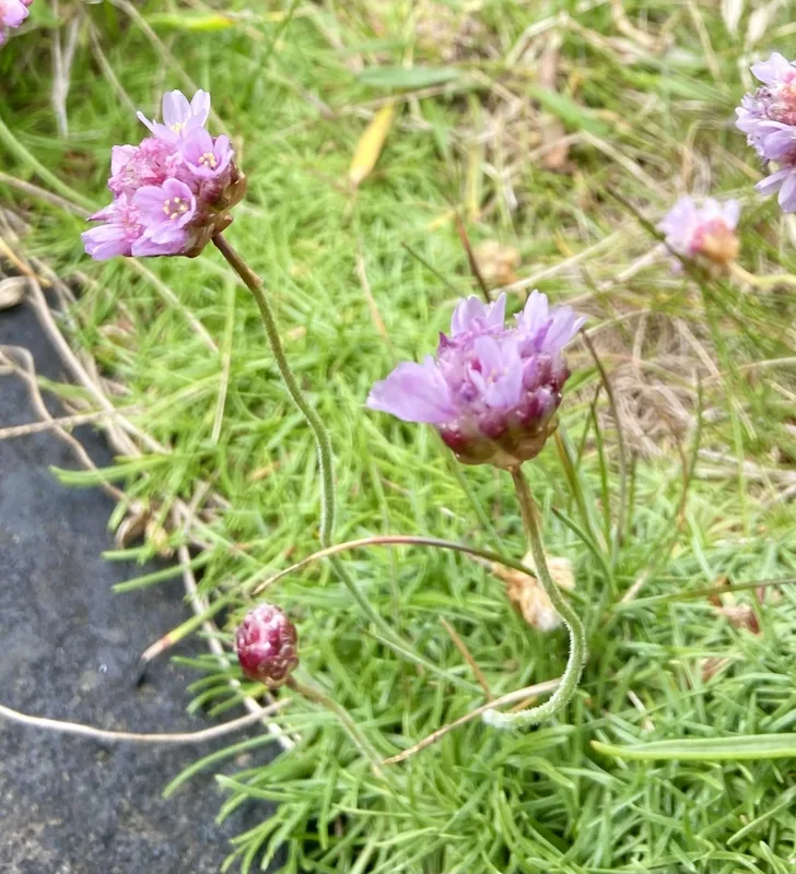
Sea Thrift Armeria maritima -
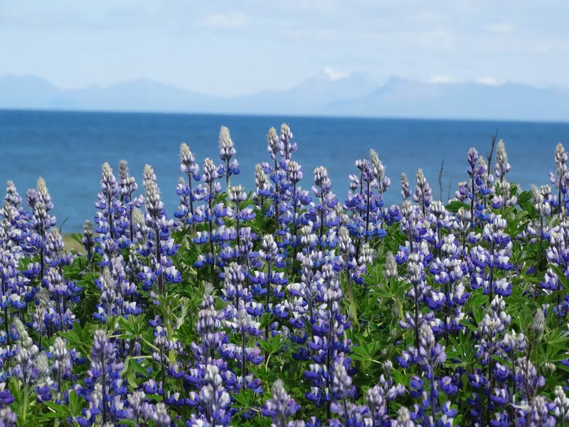
Nootka Lupine Lupinus nootkatensis -
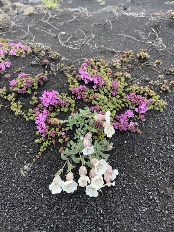
Sea Campion Silene uniflora -
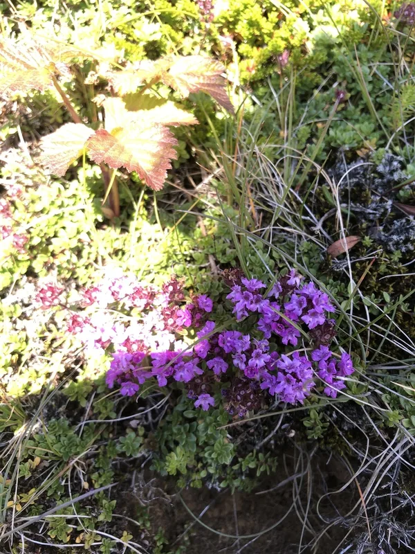
Mother of Thyme Thymus praecox -
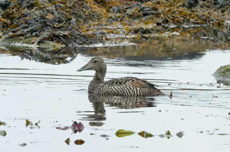
Common Eider Somateria mollissima -
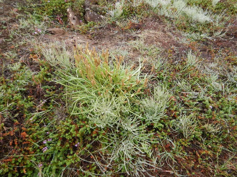
black crowberry Empetrum nigrum -
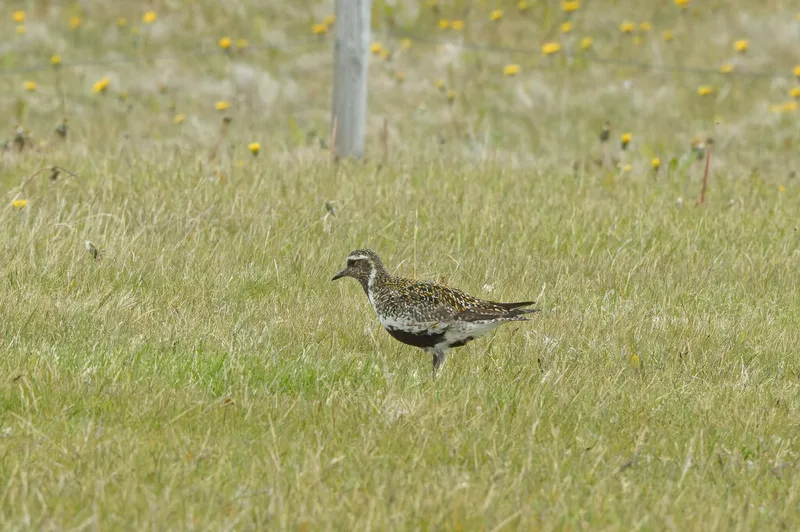
European Golden-Plover Pluvialis apricaria -
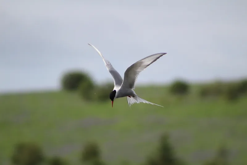
Arctic Tern Sterna paradisaea -
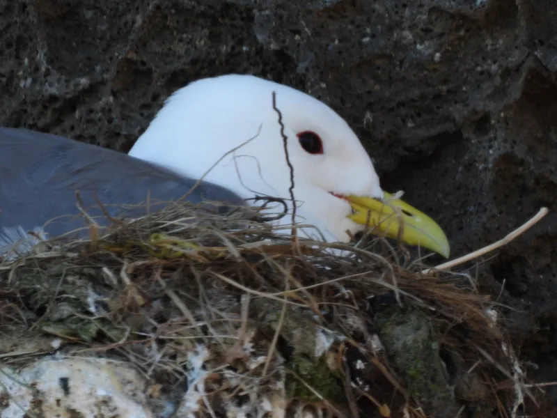
Black-legged Kittiwake Rissa tridactyla -
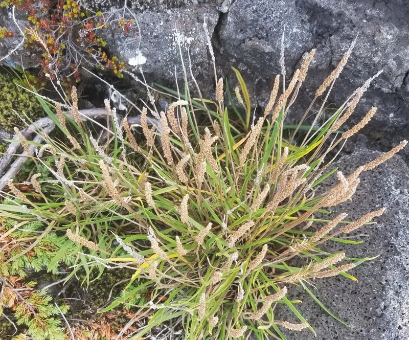
Sea Plantain Plantago maritima -
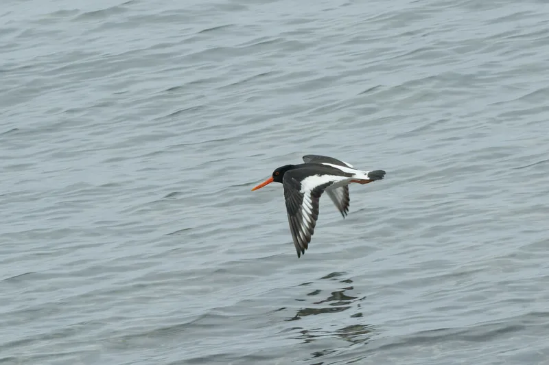
Eurasian Oystercatcher Haematopus ostralegus -
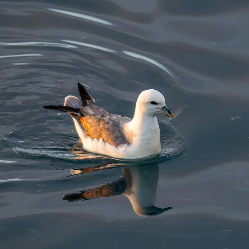
Northern Fulmar Fulmarus glacialis
Field Notes · Fog Coast lens · Reykjanesskagi · 63.9415, −22.2560