Great Basin
Great Basin National Park · Nevada, USA
Every ridge in this range is a page, and this mountain has kept 1.7 billion years of them in order.
Also seen through Night Sky · all at Great Basin National Park →.
Why here
Pick up any loose stone on these slopes and you are holding a small piece of an argument that has been going on for 1.7 billion years. Nowhere else on this trip will you get to read so much time laid out in so little space. The rock stacked in these mountains runs from some of the oldest rock in this range up through gravel washed down last spring, a column tall enough to hold an immense span of time in view at once. For most of that time this was not desert at all: it was sea floor, an ordinary shallow sea depositing lime and mud, layer on layer, for hundreds of millions of years. Then, comparatively recently, molten rock forced its way up into all that old sea floor and cooled hard within it, before the whole package was lifted, cracked, and set out to dry as one range among hundreds in a basin that no longer drains to any ocean. Every site below reads a different chapter of that same book.
The story
The story of this rock starts underwater. For a very long stretch of deep time, a shallow sea lay over this part of the continent, laying down lime and mud that hardened into the limestone, dolomite, and quartzite that still make up most of these mountains. Then, well into the age of dinosaurs, molten rock forced its way up into that older sea floor and cooled slowly underground, forming the pale granite exposed today around Pyramid Peak and Granite Peak. As the granite cooled, mineral-laden water moved through the cracks around it and left behind veins of quartz laced with metal. Millions of years later, and only a heartbeat ago by comparison, people found those same veins worth digging for: the tungsten mine at Johnson Lake, worked high above the timberline on the south end of the range, took its ore straight out of rock the cooling granite had seeded. Long before any mine, Indigenous peoples of the Great Basin, including Shoshone and Goshute communities, lived across this arid country, shaped by a landscape where rain rarely reaches the ground. The record here says little about the details of life in these particular mountains before the mines and the park, but the wider human story of the Great Basin is one of people making a living on some of the driest ground in North America, on a mountain that has been quietly keeping its own account of deep time in open rock the whole while.
The sites
The floor of an ancient sea
Why Is There A Cave Here?
39.0056, −114.2201
The sign at this stop asks the same question this whole note is trying to answer, standing at the edge of a cave carved into rock that was once the floor of a shallow sea. The limestone and dolomite that make up a large share of these mountains formed from lime mud settling on that old sea floor, bed after bed, over an enormous stretch of time long before there were mountains here at all. Water is patient with rock like this: given enough centuries, it dissolves slowly along cracks and bedding planes, hollowing out passages and chambers in what looks from the surface like solid, unbroken stone. Nothing about the desert above hints at what is happening below it, which is exactly why a question like the one on this sign is worth stopping for. Stand here and the ground starts to make a different kind of sense: not rock that has always been rock, but an old seabed that has had a very long time to change its mind about what it wants to be.
Look at the exposed rock near the sign for pale, layered banding, like stacked pages. Each band is a separate pulse of sediment that settled on an ancient sea floor and later hardened into rock. Run a hand along a seam where two bands meet; that line marks a change in what was falling into the water on that particular day, sometimes thousands of years apart from the layer above.
- AccessShort walk
- ExertionEasy
- TimeAn hour
Mather Overlook
39.0203, −114.2748
From this overlook the mountain reads like a cross-section: layer on layer of pale rock rising out of the valley floor, tipped and set at angles that had nothing to do with wind or water to arrange them. Most of what is visible from here formed on the floor of a shallow sea, long before any desert existed in this part of the world, then was buried, hardened, and eventually lifted into daylight as one range among many in this stretch of basin-and-range country. Beyond the near ridge, the valley floor stretches away pale and flat: younger sediment, washed down off the mountains and dumped into a basin that today drains to nowhere at all, since no river out here ever reaches the sea. Between the old rock overhead and the young sediment underfoot lies most of the story this note is telling. The view does something no single rock sample can: it shows the whole stack at once, valley to summit, and lets you see how many separate layers it actually takes to build a mountain.
Trace the skyline of the range with your eyes from valley floor to summit. Notice how the color and texture of the rock seem to shift in bands as you look upward; each band is a different age and a different environment, stacked in the order it was laid down. Try to guess, before reading on, which bands might be old sea floor and which might be rock that arrived later as molten intrusion from below.
- AccessDrive-up
- ExertionEasy
- TimeAn hour
Rock that once was liquid
Pyramid Peak
38.9484, −114.2951
This peak sits inside a body of granite that did not always look like rock at all. It began as molten material, forced upward from deep in the crust, and cooled slowly while still buried under the older sea-floor rock around it, which is why the granite here grew large, well-formed crystals: cooling underground, slowly, gives minerals time to grow big before they lock in place. Around the edges of that cooling body, heat and mineral-laden water baked and altered the surrounding rock, leaving bands of quartz veins that cut through the older stone at odd angles. Geologists studying this peak have used those veins, and the minerals grown in the baked rock around them, to work out roughly when the granite arrived and how thoroughly it changed everything it touched. Stand near the peak and you are standing inside what was once a slow-cooling pocket of liquid rock, now sitting in open air only because everything that used to bury it has since eroded away.
Look closely at a piece of the pale rock here for individual mineral grains large enough to see without help: usually pale quartz, white or pink feldspar, and dark flecks of mica. Their size is a clue. Rock that cools slowly, buried deep and insulated by the ground around it, grows much larger crystals than rock that cools fast at the surface.
- AccessHalf-day hike
- ExertionStrenuous
- TimeHalf a day
Granite Peak
38.8438, −114.2553
A short distance from Pyramid Peak, Granite Peak wears its name plainly: this whole summit is built from the pale intrusive rock that pushed up into the older sea-floor stone around it. Where Pyramid Peak sits nearer the geologically busy contact zone, laced with altered rock and mineral veins, Granite Peak sits worn instead into the rounded, blocky shapes typical of granite left to weather in open air for a very long time. Granite tends to erode unevenly along the joints and cracks that formed as it cooled and later cracked under the weight of its own overlying rock, which is why granite country so often ends up looking less like a smooth dome and more like a pile of enormous, weathered blocks stacked on a summit.
Look for granite boulders that have broken along straight, roughly parallel cracks rather than crumbling at random. Those cracks, called joints, formed as the buried rock cooled and later as the weight of everything above it wore away. Frost and roots widen them further over time, which is why granite so often breaks into blocks instead of wearing down smooth.
- AccessHalf-day hike
- ExertionStrenuous
- TimeHalf a day
Johnson Lake Mine Historic District
38.9415, −114.2840
High on the east side of the southern part of the range, this old tungsten mine took its ore directly out of mineral veins left behind when the nearby granite cooled and hardened underground. As that molten rock solidified, the last mineral-rich fluids trapped inside it were squeezed out into cracks in the surrounding stone, where they cooled into veins carrying quartz and metal-bearing minerals: the raw material for a mining operation that later hauled ore off this mountain at a lofty and difficult elevation. What remains today is a historic district of mining structures, a rare spot in this note where the deep-time story and the human story sit directly on top of one another. People came here for what the cooling granite had left behind, whether or not they understood exactly how it got there, only that it was worth the long, difficult climb to carry down the mountain, load after load, year after year.
Look at the waste rock scattered around the old workings for pieces of white or gray quartz veined through with darker mineral streaks. That quartz is a fossil fluid: it once flowed as hot, mineral-charged water through cracks in the rock, then froze solid as the whole system cooled, locking the ore in place for people to find much later.
- AccessHalf-day hike
- ExertionStrenuous
- TimeHalf a day
Two ways to keep time
Wheeler Peak Overlook
39.0266, −114.2865
From here the whole logic of basin-and-range country lays itself out. One long mountain block rises steeply out of a flat desert valley, with another range visible in the distance doing the same thing, separated by a basin that collects its own runoff and sends none of it toward any ocean. This is what makes the Great Basin the Great Basin: not a single basin but hundreds of them, each pinned between two ranges of old, uplifted rock. The overlook does not explain how each block got tilted into place, but it lets you see the pattern clearly enough to notice that it is a pattern at all, rock lifted here, rock and sediment dropped there, over and over, across a very wide stretch of country. Once you have seen the shape from up here, it is hard to look at any other Nevada range again without noticing the same block-and-basin rhythm repeating toward the horizon.
Pick out the straightest, most abrupt edge of the range, where mountain meets valley floor. A sharp, nearly straight boundary like that usually marks a place where one block of the crust has been lifted relative to its neighbor, rather than a slope simply worn down by water over time.
- AccessShort walk
- ExertionEasy
- TimeAn hour
Bristlecone-Alpine Lakes Trailhead
39.0100, −114.3070
The rock in these mountains keeps time in layers; the trees rooted on it keep time a different way. This trailhead is the gateway to a grove of Great Basin bristlecone pine, among the longest-lived trees known anywhere, growing slowly and stubbornly on some of the poorest, rockiest ground the mountain offers. A bristlecone does not grow fast or grow tall so much as it simply persists, adding a narrow ring of wood most years and sometimes none at all in a hard one, building up a record inside its own trunk that can rival the rock around it for sheer patience. Standing at this trailhead, at the edge of old stone and old wood both, is as good a place as any to notice that this mountain keeps two separate archives of deep time running side by side, and that neither one is in any hurry to finish its account.
Find a bristlecone with a strip of bare, weathered wood running up one side of an otherwise living trunk. That combination, part living bark and part bare wood, is normal for very old bristlecones: as the tree ages, sections of the trunk die back while a narrow living strip keeps feeding the rest, letting the tree keep growing for centuries after most of it has technically stopped.
- AccessShort walk
- ExertionModerate
- TimeHalf a day
When it's best
High in these mountains, winter holds on. The climate here runs cold well into spring, with snow lingering at the passes and around the higher peaks long after the valley floor has dried out, so the granite outcrops, the old mine sites, and the high overlooks are easiest to reach once the snowpack has cleared, usually by summer. The lower slopes and the cave country open earlier and stay walkable most of the year. There is no wrong season to read the rock itself; it holds still. But the high country rewards patience, and a trip timed for the warmer months is the only one that reaches every site in this note, not just the low ones.
Go deeper
The names behind what you saw
The old sea-floor rock underneath the granite carries several formal names in the geologic literature of the southern Snake Range: the McCoy Creek Group Quartzite, the Prospect Mountain Quartzite, the Pioche Shale, and the Pole Canyon Limestone, among others — search any of these for the full stratigraphic column exposed here. The pale granite around Pyramid Peak is formally the Snake Creek/Williams Canyon pluton, dated to the Jurassic. The wide desert region this note sits inside is defined, technically, by its basin-and-range topography and by being endorheic — its rivers and streams never reach an ocean. The bristlecone at the trailhead grove is Great Basin bristlecone pine, Pinus longaeva.
To read next
- Geology of the Great Basin, Bill Fiero — the standard, accessible introduction to how this whole region’s rock got put together and pulled apart.
- The broken land: adventures in Great Basin geology — a narrative account for a reader who wants the story of how this rock got read, not just the findings.
- Western Great Basin geology, Calvin H. Stevens — a closer, more technical look at the specific rock units exposed in ranges like this one.
- Quaternary geology of the Great Basin, George I. Smith — for the far more recent chapter: how the desert basins themselves filled with sediment and took their present shape.
- “Geology and Ore Deposits of the Great Basin,” Journal of Geochemical Exploration — for anyone curious about the mineral veins behind sites like the Johnson Lake mine, and how they form.
The names behind what you saw
What lives here, and what it's called. Photographs from open collections — an aid to identification, not decoration.
-
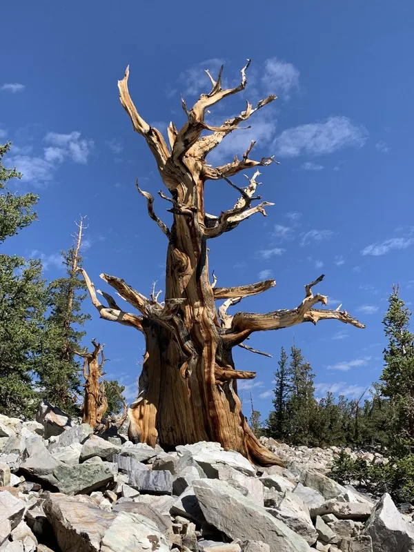
Great Basin bristlecone pine Pinus longaeva -
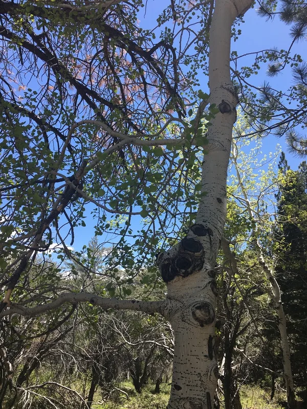
quaking aspen Populus tremuloides -
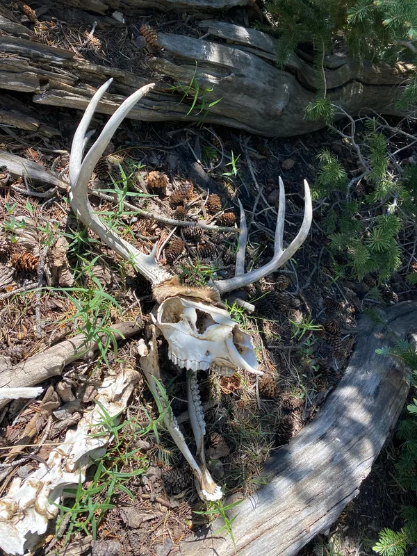
Mule Deer Odocoileus hemionus -
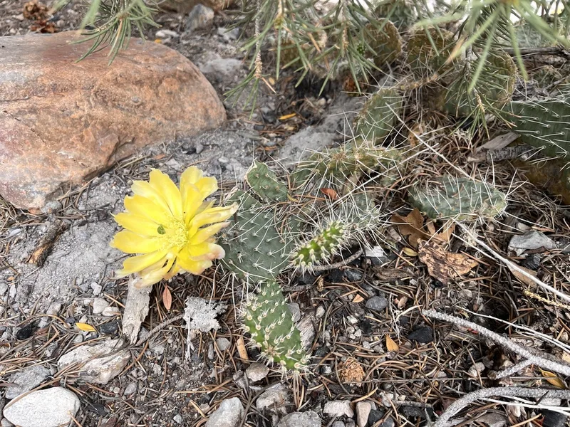
Plains Pricklypear Opuntia polyacantha -
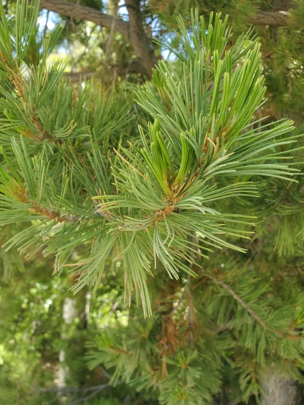
limber pine Pinus flexilis -
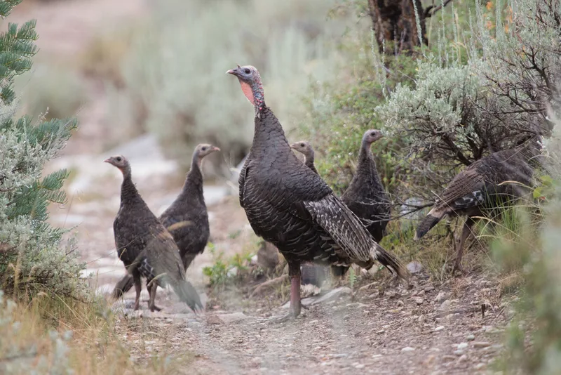
Wild Turkey Meleagris gallopavo -
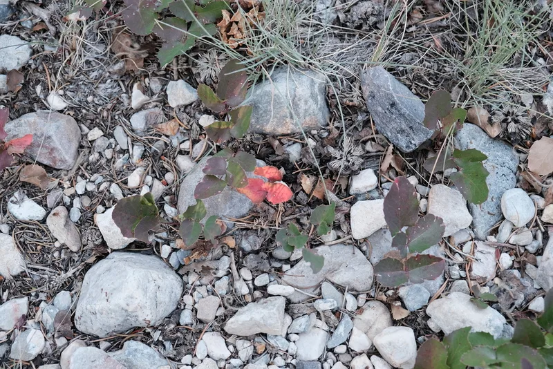
creeping mahonia Berberis repens -
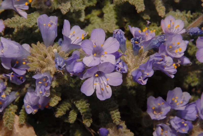
sky pilot Polemonium viscosum -
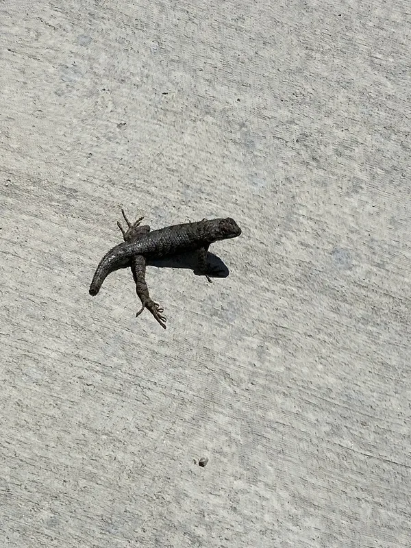
Western Fence Lizard Sceloporus occidentalis -
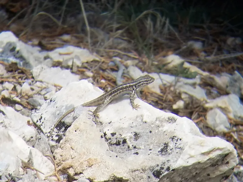
Common Sagebrush Lizard Sceloporus graciosus -
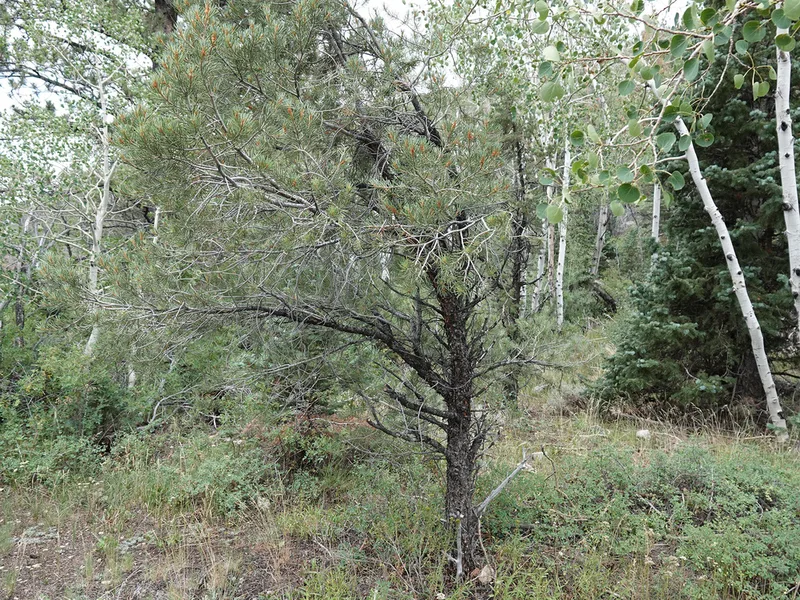
singleleaf pinyon Pinus monophylla -
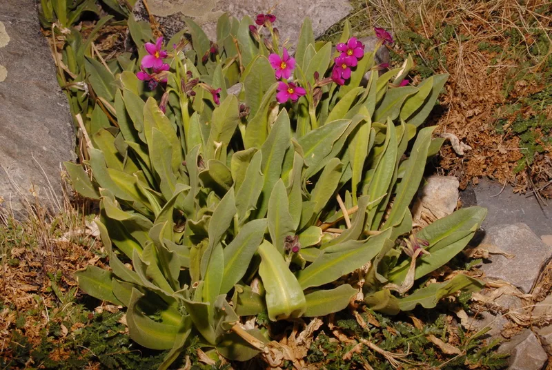
Parry's primrose Primula parryi
Field Notes · Desert & Deep Time lens · Great Basin National Park · 38.9442, −114.2349