Grand Canyon
Grand Canyon Village · Arizona, USA
Give water enough time and it takes the mountain apart, one layer at a time.
Also seen through Night Sky · all at Grand Canyon Village →.
Why here
The Colorado River is older than the canyon it runs through. It was here first, a river crossing a rising land, and as the land pushed up the river simply cut down through it — never moving aside, never giving way. What it cut through was stack after stack of old sea floor and buried dune, laid down flat and waiting. The river turned that patient stone into a wall you can read from the rim: bands of rock stacked a mile deep, the youngest at your feet and the oldest far below, near the water that made all of this. The rock at the edge is limestone from a shallow sea about 270 million years ago; the river has since cut down toward stone nearly two billion years old. Everything here follows from that one long argument between water and rock — which the water won, slowly, and is still winning. Spend a few days watching how, and the canyon stops being a view and becomes a story you can read downward.
The story
Start with the water. The Colorado gathers snowmelt from far upstream and carries it through here cold and steady, and for millions of years it has done one thing well: cut down. As the whole plateau lifted, the river held its course and sawed straight through, exposing the flat layers in order — sea-floor limestone at the top, older sandstone from ancient dunes below it, and deeper still the worn roots of mountains far older than either.
Life sorts itself by that same depth. On the cool rim, pinyon pine holds the thin soil, and elk graze the forest edge at first light. Out over the gap the air does the work: ravens tumble along the cliff, white-throated swifts pour off the rim in fast dark arcs, and on a warm afternoon California condors ride the updrafts that rise out of the heated canyon, using the depth as a highway.
People came late and stayed near the edge. A railroad reached the South Rim from Williams in 1901, and a village grew along the rim to bring travelers to the one place the river’s work could be seen whole. Bright Angel Lodge sits right on that edge, its cabins gathered where the ground simply ends. Almost everything people built here faces one direction — down, toward the water still at work at the bottom.
The sites
Reading the rim
Mather Point
36.0616, −112.1079
This is the first edge most people reach, and it opens the whole idea at once: a mile-deep gap with the far wall banded in level stripes. Every stripe is a separate layer of rock, stacked flat and then cut clean by the river far below. It is the plainest place to see that the canyon is not a shape but a record.
Facing the far wall, pick one pale band near the top and follow it sideways with your eye. It runs level for miles, the same layer on both rims because the river cut down through it rather than pushing it aside. Trace it until it disappears around a bend.
- AccessDrive-up
- ExertionEasy
- TimeAn hour
Yavapai Point
36.0660, −112.1168
A short walk west of the first overlook, this point sits a little higher and squares up to the inner canyon. From here the layers read as a staircase stepping down toward the river, each step a different age of rock. It is a good place to slow down and count.
Look straight down into the canyon rather than across it. Count how many distinct benches and cliffs step down before the rock disappears into the deep inner gorge — each is a different layer, and the river cut through all of them in order, youngest first.
- AccessDrive-up
- ExertionEasy
- TimeAn hour
The Abyss
36.0583, −112.1690
Here the rim drops in one of the sheerest plunges on the South Rim, a near-vertical wall falling away beneath your feet. The steepness is the point: hard layers of rock stand up in cliffs while softer ones wear back into slopes, and this is where the hard rock wins. The river set the depth; the rock decides the shape.
Lean over the rail and watch where the wall goes vertical and where it steps back into a slope. The sheer stretches are the tougher layers; the slopes are the soft rock crumbling away faster. The canyon’s whole profile is that contest, repeated top to bottom.
- AccessDrive-up
- ExertionEasy
- TimeAn hour
Where the river shows itself
Powell Point
36.0734, −112.1510
This point pushes out on a narrow neck toward the middle of the canyon, and from its tip the walls fall away on three sides. It is one of the rim spots where the eye finally reaches past the near cliffs to the deeper channel the river cut. Standing here you are surrounded by the gap on almost every side.
Walk to the far end of the point and look for the deepest, darkest V in the distant rock — the narrow inner gorge. That is the river’s newest cut, where it is still grinding into the oldest and hardest rock at the bottom.
- AccessDrive-up
- ExertionEasy
- TimeAn hour
Plateau Point
36.0933, −112.1161
Reached by a long descent from the rim, this flat bench juts out over the inner gorge, and from its edge the Colorado River finally comes into full view far below. Here you stand on the broad step the river cut early, looking down into the narrow slot it is cutting now. The two levels tell the same story at two different ages.
From the edge, find the river directly below and notice how narrow its gorge is compared with the wide canyon above. The broad upper canyon is the river’s old, patient work; the tight slot around the water is what it is carving today.
- AccessExpedition
- ExertionStrenuous
- TimeA full day
Colorado River View
36.1045, −112.0917
Deep in the canyon near the bottom, this overlook brings you almost level with the water that made everything above. Up close the Colorado runs green and cold and unhurried, carrying sand and stone downstream the way it has for millions of years. This is the tool that cut the mile of rock over your head.
Watch the surface of the water and the color of it. The green carries fine rock ground from upstream, and the whole load is sandpaper — this is the exact process, still running, that lowered the canyon floor to where you stand.
- AccessExpedition
- ExertionStrenuous
- TimeWorth two days
Walking down into the cut
South Kaibab Trailhead
36.0529, −112.0837
This is where a rim walk turns into a walk through time. The trail leaves the edge and drops straight down the layers, so that every few minutes underfoot the rock changes to something older. Starting here, the canyon stops being a picture across a gap and becomes ground you move through.
Before you start down, crouch at the trailhead and look at the rock at your feet — pale limestone full of the grain of an old sea floor. Remember it, because within an hour of walking down you will be standing on rock millions of years older.
- AccessDrive-up
- ExertionEasy
- TimeAn hour
Ooh Aah Point
36.0615, −112.0870
A short way down the trail, the path rounds a corner and the canyon opens on both sides at once. You have already dropped through the top layer, and from here the rim you started on stands above you as its own banded cliff. It is the first place the descent’s logic becomes physical.
Turn and look back up at the rim you came from. The pale cliff at the top is the layer you were standing on an hour ago; you have already walked down past it. Find your starting point and measure how far the trail has carried you into the rock.
- AccessHalf-day hike
- ExertionModerate
- TimeHalf a day
Skeleton Point
36.0817, −112.0904
Farther and steeper down the trail, this point is the first place on the walk where the Colorado River comes into view below. By now you have passed through several layers of rock, each older than the last, and the river appears exactly where it belongs — at the bottom, still cutting. Turning back here is honest; the climb out is the hard half.
Rest at the point and find the river far below. Then look at the rock around you and up at the rim: you are standing in the middle of the stack, with younger layers above and older ones dropping to the water. The whole descent is a walk down through time toward the thing that made it.
- AccessHalf-day hike
- ExertionStrenuous
- TimeA full day
When it's best
The rim sits high and cold, and the season you come changes the canyon more than the hour does. In winter and early spring the rim can hold snow while the inner canyon stays mild, so the walls show two climates at once; nights near the edge drop below freezing well into spring. Summer flips it: the rim is pleasant, but the depths turn brutally hot by midday, and a walk down that felt easy in the cool morning becomes the hardest part of the trip on the way back up. Elk are easiest to see grazing the forest edge at dawn and dusk, harder in the heat of the day. Condors and swifts ride the rising air on warm afternoons, when the canyon breathes heat back up to the rim. Whatever the season, the river at the bottom runs cold and steady year round, indifferent to the weather on the rim.
Go deeper
The pale cliff-rock at the rim is the Kaibab Formation, a sea-floor limestone; just below it lie the Toroweap Formation and the Coconino Sandstone, the old dune rock — search any of these for the layer-by-layer story the walls tell. The whole stack belongs to the Plateau Province geologic column, which reaches down to rock almost two billion years old near the river. The birds riding the canyon air are the California condor, Gymnogyps californianus, and the white-throated swift, Aeronautes saxatalis; the tumbling black birds along the cliff are the common raven, Corvus corax. The rim forest is held together by the Colorado pinyon, Pinus edulis, and the largest grazers are elk, Cervus canadensis. For a living record of what is active in any given month, the iNaturalist observations for the South Rim read like a calendar; for the rock, any overview of the Grand Canyon’s geologic column follows the layers from rim to river.
The names behind what you saw
What lives here, and what it's called. Photographs from open collections — an aid to identification, not decoration.
-
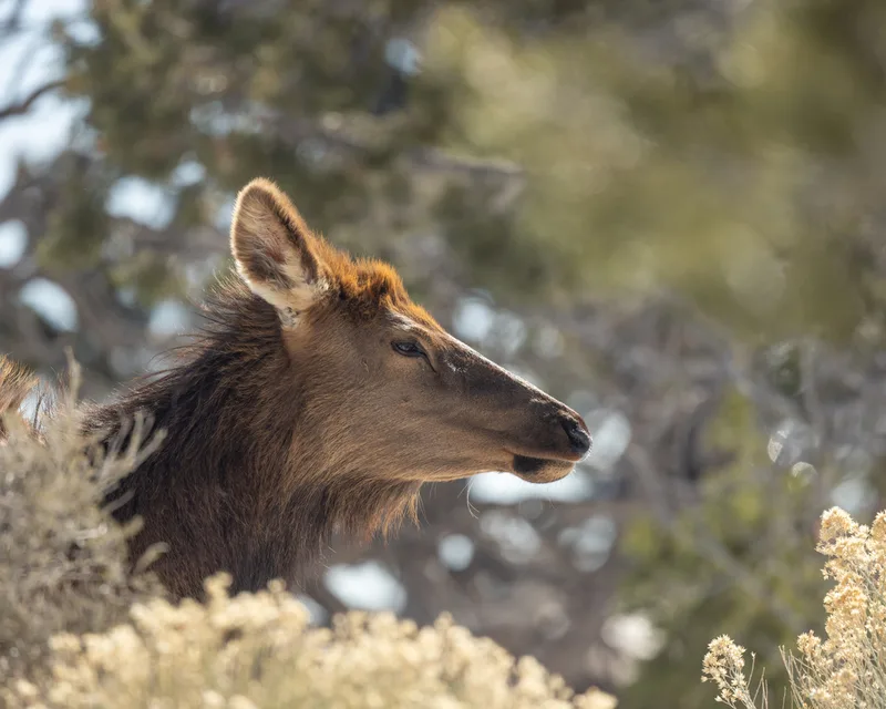
Elk Cervus canadensis -
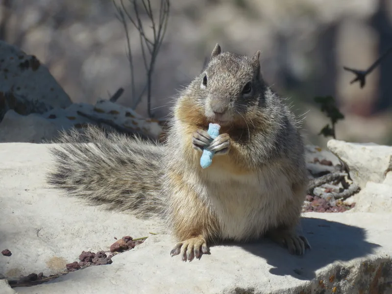
Rock Squirrel Otospermophilus variegatus -
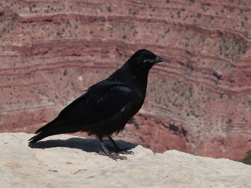
Common Raven Corvus corax -
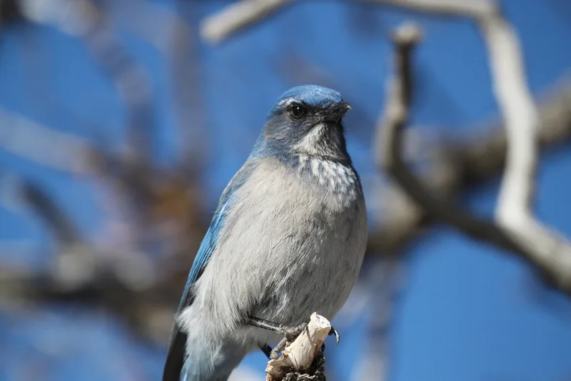
Woodhouse's Scrub-Jay Aphelocoma woodhouseii -
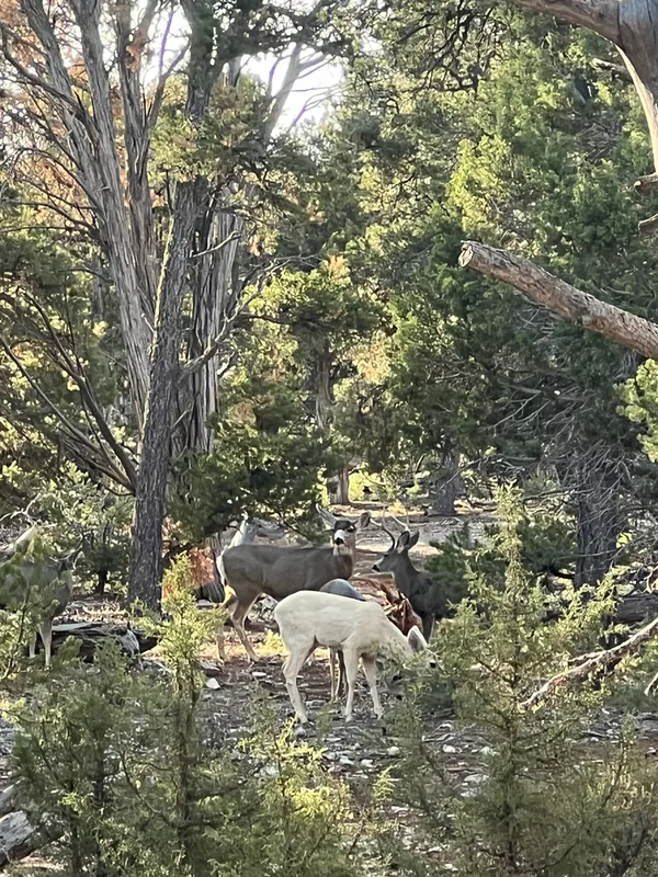
Mule Deer Odocoileus hemionus -
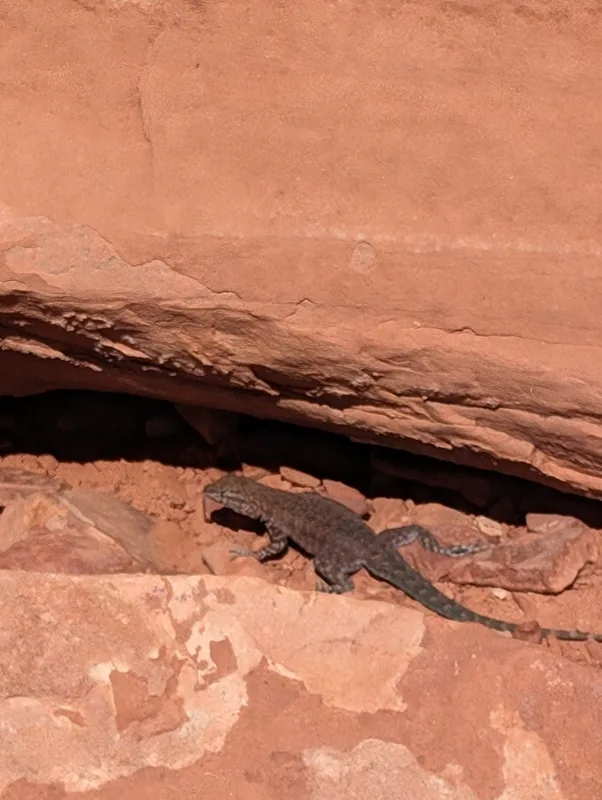
Plateau Fence Lizard Sceloporus tristichus -
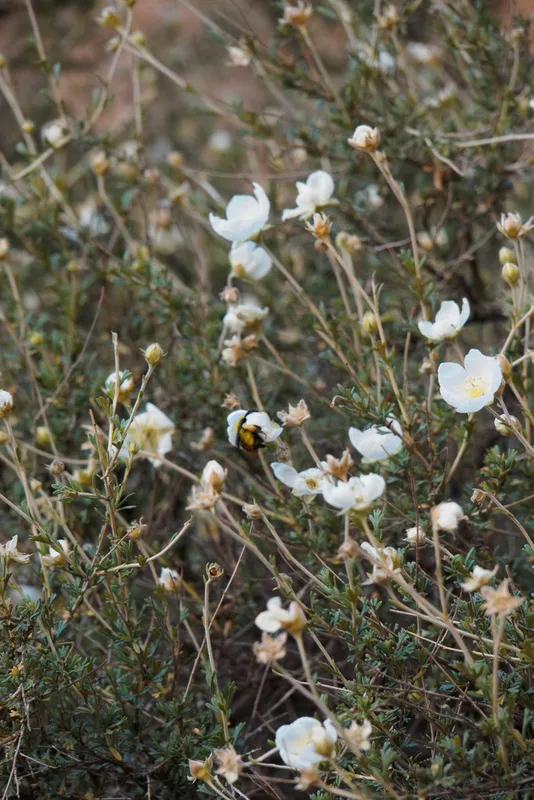
Apache plume Fallugia paradoxa -
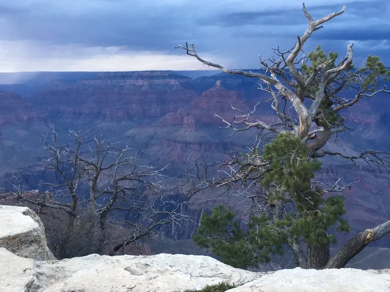
Colorado Pinyon Pinus edulis -
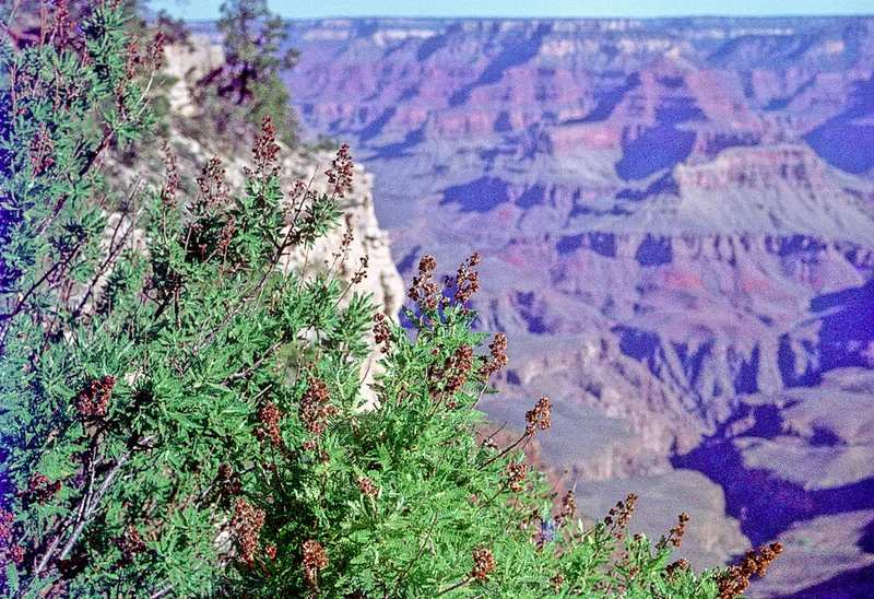
fernbush Chamaebatiaria millefolium -
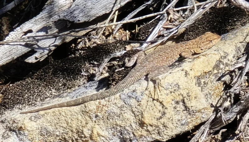
Common Side-blotched Lizard Uta stansburiana -
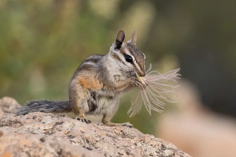
Cliff Chipmunk Neotamias dorsalis -
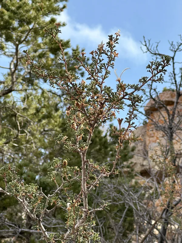
Stansbury's Cliffrose Purshia stansburyana
Field Notes · Rivers & Canyons lens · Grand Canyon Village · 36.0578, −112.1282