Glacier Bay
The ice makes its country by leaving it.
Also seen through Marine · all at Bartlett Cove →.
Why here
Stand at the water in Bartlett Cove and look down the bay: you are looking along a valley a glacier cut, not a river carved. Glacier Bay is a fjord — a mountain valley ground so deep by moving ice that when the ice pulled back, the sea poured in behind it and never left. The bay earns its plain name honestly: mountains and glaciers still ring it, and the ice that dug this valley is the same ice still working at its edges, retreating a little further up the inlet each year.
A glacier is really a slow river of ice, heavy enough to plane down solid bedrock and drag the broken rock away with it. Where it pulls back, it leaves bare stone, water gone suddenly deep, and ground with nothing living on it yet. That is the one thing worth carrying through this whole trip: every forest, every nesting seabird, every low young island in this bay is life catching up to ground the ice only just gave up.
Everywhere you look here, you are watching that same handoff still in progress.
The story
Start with the rock. Long before any ice, this stretch of coast was seafloor — a stack of Paleozoic limestone, hardened mud, and volcanic rock laid down when Southeast Alaska sat under a shallow sea, hundreds of millions of years before a glacier existed here. The ice came later and did the carving: grinding a valley far below sea level, then withdrawing enough for the ocean to flood in behind it. What’s left is Glacier Bay, a drowned glacial valley boxed in by the mountains and glaciers that made it, tied by ice and wilderness to protected land well beyond the park’s own boundary, across the border into Canada.
Life moves in behind the retreating ice. Bare ground gives way first to low plants, then to a wet coastal forest of spruce and hemlock, loud in season with small birds — a hooting sooty grouse, the ringing song of a varied thrush. The cold, well-mixed water offshore feeds seabirds that spend most of their lives at sea and only come to rock to nest: puffins, murres, guillemots, a black oystercatcher working the tideline.
People arrived mostly to protect what the ice was doing. The bay went from a national monument to a much larger national park and preserve, with most of it now kept as wilderness. The record here says little about who worked this coast before the parks and ferries came — a story worth seeking elsewhere. What it does hold is a place still being made, handed back to life piece by piece as the ice keeps letting go.
The sites
Ground the ice gave back
Bartlett Cove
58.4579, −135.9064
Bartlett Cove is the sheltered elbow of shore just inside the bay’s mouth, and the easiest place in the park to stand on ground the ice has already given back. Behind the narrow beach, a coastal forest of spruce and hemlock has taken hold on ground that is young by the measure of trees — deep moss underfoot, a canopy still filling in, more light reaching the forest floor than in an older stand further down the coast. In summer the woods fill with sound: the ringing, flute-like phrases of a varied thrush drifting out of the understory, the deep hoot of a sooty grouse somewhere upslope, a kingfisher rattling along the shallows where forest meets water. Eagles hold the tall snags at the water’s edge, watching the tide the way they watch everything else here — patiently.
The cove sits exactly where the glacier-cut valley widens out to meet the sea, so it is a small place that tells a large story: bare ground, then plants, then forest, then birdsong, arriving in that order as the ice keeps retreating up-bay. Little about this forest is old. That is the point of standing in it.
Walk the forest edge at first light and listen before you look. A ringing, flute-like phrase drifting out of the mossy understory is a varied thrush, drawn to this damp, young woodland because it is exactly the cover a thrush needs. Count how few large, old trees you pass on the way — the forest is still filling in behind the retreating ice.
- AccessShort walk
- ExertionEasy
- TimeHalf a day
Lester Island
58.4682, −135.8927
Lester Island is the southernmost of the Beardslee Islands, a scatter of low, forested islands riding shallow water just inside Bartlett Cove. These islands are some of the youngest ground in the park: flat and quiet, low enough that forest, rocky shore, and tide flat all sit within a few steps of one another. The water around them is shallow and the passages narrow enough that reaching Lester Island takes a small boat or a paddle across sheltered channels rather than a trail — effort that keeps the islands calm.
Their shorelines are working coastline, not scenery. Black oystercatchers pick along the rocks with bright orange bills, gulls loaf on the exposed flats at low water, and eagles hold the tallest trees. Because the islands sit so low and are still settling, the line between land and sea shifts noticeably with every tide, opening channels and flats at the lowest water that close again within hours.
Lester Island is worth the crossing for one reason beyond the birds: it is a fair, present-day picture of how the whole bay must have looked when the ice first pulled back from it — new ground, barely above the water, still waiting to be claimed.
From a boat or a drifting kayak, watch the rockline at low tide for a black shorebird with a long, bright-orange bill working at the shellfish. That is a black oystercatcher, feeding here because the falling tide keeps resetting its table. Notice how little dry ground separates the forest from the water.
- AccessExpedition
- ExertionModerate
- TimeHalf a day
The tide that keeps rewriting the shore
Bartlett Cove
58.4579, −135.9064
Return to Bartlett Cove at a very low tide and the same shore reads differently. The water here rises and falls by several yards twice a day, among the larger swings on this coast, and at the lowest tides the sea pulls back far enough to expose a wide band of shore it usually keeps hidden. What is bare rock and mud at low water is fully underwater again a few hours later — an entire zone of the cove that exists only part of the time.
That daily uncovering is a working shift, not a spectacle staged for visitors. Gulls and shorebirds move onto the flat as soon as it clears, working the mud for whatever the retreating water leaves behind; a kingfisher and the resident eagles use the same brief window from the air. The flat is also a plain demonstration of how young this shoreline still is — the tide is simply rewriting, twice a day, a boundary the ice only recently set in the first place.
Time a visit around the biggest low tide of your stay if you can manage it. It costs nothing but patience, and for an hour or two it turns a quiet beach into the busiest part of the cove.
At the lowest point of the tide, walk the exposed flat slowly and watch where the birds concentrate. They are working the same falling water you are standing on, feeding on whatever it strips bare; try to catch the moment the flat starts refilling and see how quickly the ground beneath you disappears.
- AccessShort walk
- ExertionEasy
- TimeAn hour
Where the fjord meets the open sea
Icy Strait
58.2569, −135.5138
Icy Strait is the broad channel across the mouth of the bay, where the water Glacier Bay empties meets the wider sea. Its name is an honest description: this is water fed by ice and mountain runoff. The strait’s open water and rocky margins draw species that spend most of the year at sea and only come close to shore to feed or nest.
None of this is passing through by accident. It is a working system, visible from a boat or any high point above the strait: water draining out of the bay, and birds gathered to take advantage of it for as long as the conditions hold. Stand above Icy Strait and you are watching, in real time, where everything the ice makes eventually drains — out of the fjord and into the open Pacific system beyond it.
Scan the open water with binoculars for small, stocky birds that dive rather than fly off as a boat approaches — puffins, murres, and guillemots feeding here. Time one dive and count the seconds before it resurfaces.
- AccessExpedition
- ExertionModerate
- TimeHalf a day
Icy Strait
58.2569, −135.5138
Icy Strait has been a thoroughfare as long as boats have run this coast, long before it was scenery. It is the water road between Glacier Bay and the smaller communities further along Southeast Alaska’s shore, and it still carries traffic today: state ferry boats built to serve small towns work these channels, picking up passengers in communities like Hoonah on their way to larger ports. The strait has also kept a harder memory of that traffic. In the late nineteenth century, an early coastal steamship that had spent years running passengers and freight along the Pacific coast ran aground on a rock in these waters — its name still marks the rock where it happened.
None of that history is visible from the water the way the ice or the birds are, but it changes how the strait reads. This is not an untouched channel recently discovered; it is a working passage that has carried people, freight, and occasionally their wrecks for well over a century, running alongside glaciers that have been retreating the entire time. Watch the strait for a while and you may see both stories at once: a modern ferry crossing water a nineteenth-century steamship once wrecked in.
Watch the strait for passing boat traffic — the same channel a small ferry system still uses to reach coastal communities. Consider that this working water has carried people across it for well over a century, long before anyone came here to watch glaciers.
- AccessExpedition
- ExertionModerate
- TimeAn hour
When it's best
Summer is when this coast is most alive and easiest to reach: long daylight, a forest full of birdsong, seabirds crowding the water to feed and nest. Even well into spring, though, the bay can still hover right around freezing by day and night, with precipitation moving through often — this is a cold, wet coast in any season, not only its officially wintry months. Whatever the month, plan a day around the biggest low tide if you can: the water here rises and falls by several yards twice a day, and the lowest tides pull back to show a stretch of shore usually kept hidden.
Go deeper
The names behind what you saw. The old seafloor beneath the ice is Paleozoic (Silurian) sedimentary rock — limestone, greywacke, and argillite, with some syenite and volcanic rock mixed in — recorded in the Northeastern Chilkat Range rock column (Macrostrat column 423). The drowned, ice-carved inlet itself is a fjord. Among the seabirds: tufted puffin, Fratercula cirrhata; horned puffin, Fratercula corniculata; marbled murrelet, Brachyramphus marmoratus; black oystercatcher, Haematopus bachmani; red-necked phalarope, Phalaropus lobatus. The forest voice at Bartlett Cove is the varied thrush, Ixoreus naevius, alongside the sooty grouse, Dendragapus fuliginosus.
To read next. The payload carried no pre-vetted reading list for this note, so these are its own underlying sources, each worth the search on its own. - Glacier Bay Basin (Wikipedia) — how the bay and its ice field fit into one of the largest protected wild landscapes on the continent, shared across the US–Canada border. - Glacier Bay National Park and Preserve (Wikipedia) — the plain administrative history of how this coast went from monument to park. - Icy Strait (Wikipedia) — where the strait sits within the wider Alexander Archipelago. - Lester Island (Wikipedia) — the Beardslee Islands and their place at the bay’s mouth. - Ancon (1867 ship) (Wikipedia) — one wooden steamship’s working life and wreck on this coast, for the strait’s older, harder history. - MV LeConte (Wikipedia) — the ferry system still running this same water today.
The names behind what you saw
What lives here, and what it's called. Photographs from open collections — an aid to identification, not decoration.
-
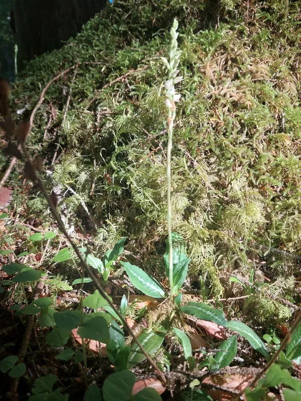
Western Rattlesnake Plantain Goodyera oblongifolia -
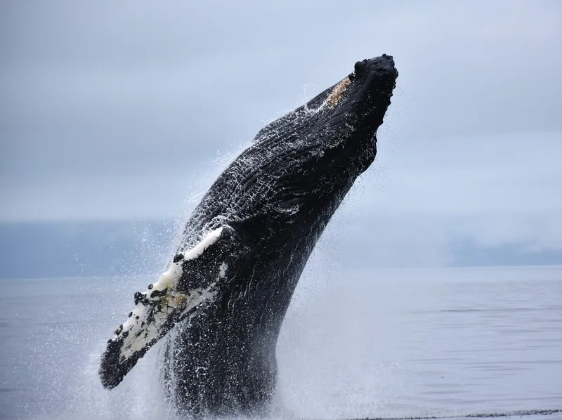
Humpback Whale Megaptera novaeangliae -
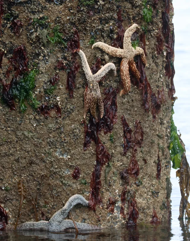
Mottled Star Evasterias troschelii -
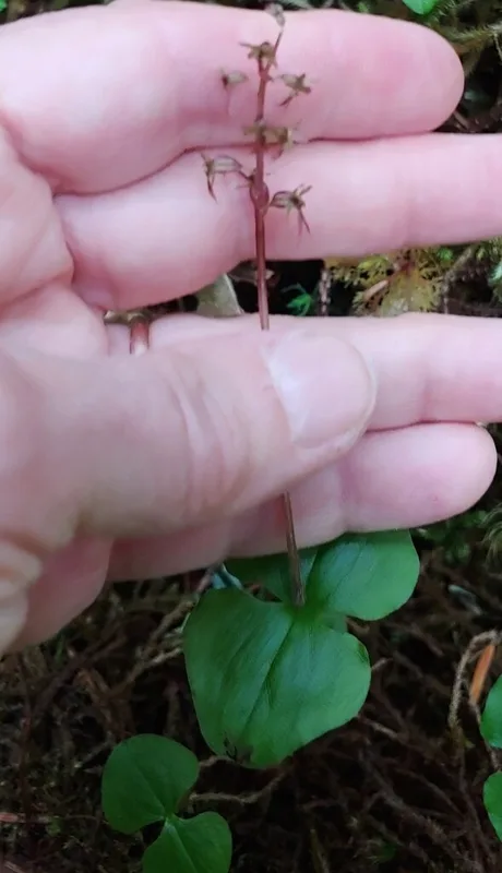
Heartleaf Twayblade Neottia cordata -
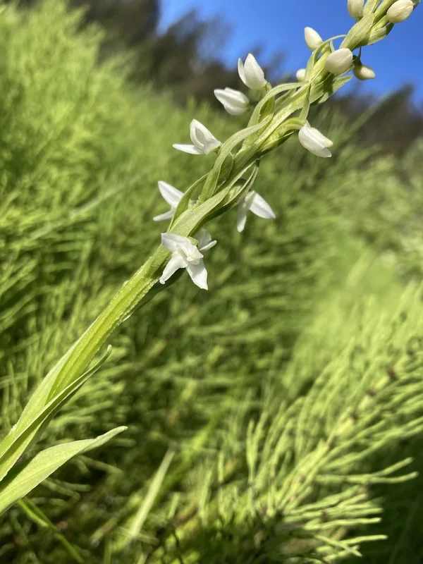
white bog orchid Platanthera dilatata -
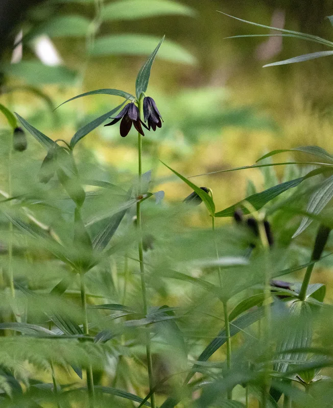
Rice root Fritillaria camschatcensis -
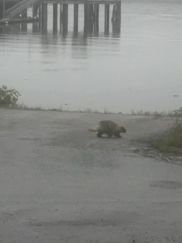
North American Porcupine Erethizon dorsatum -
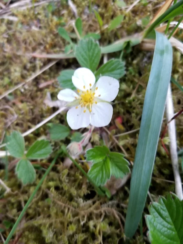
beach strawberry Fragaria chiloensis -
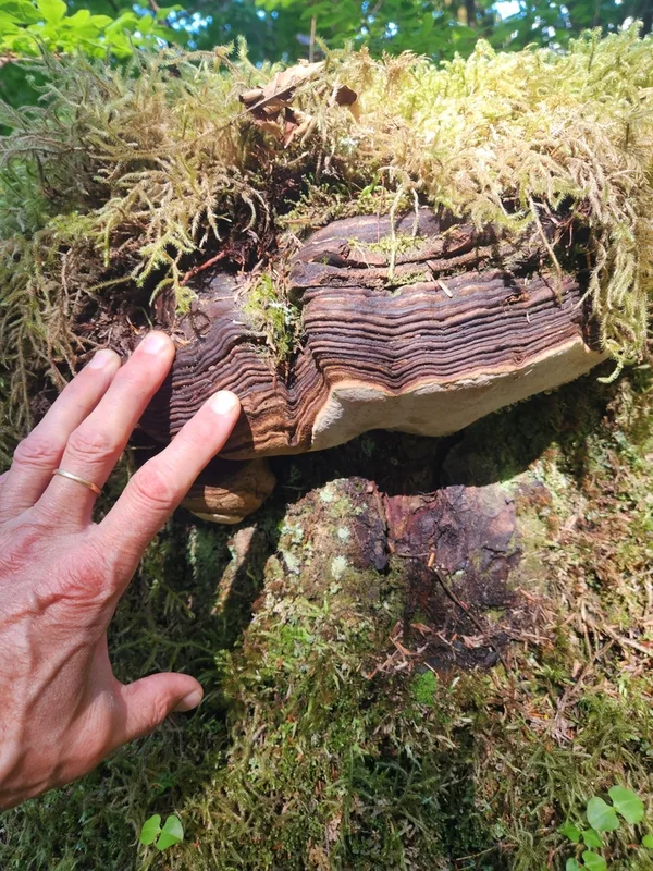
Ochre-banded Conk Fomitopsis ochracea -
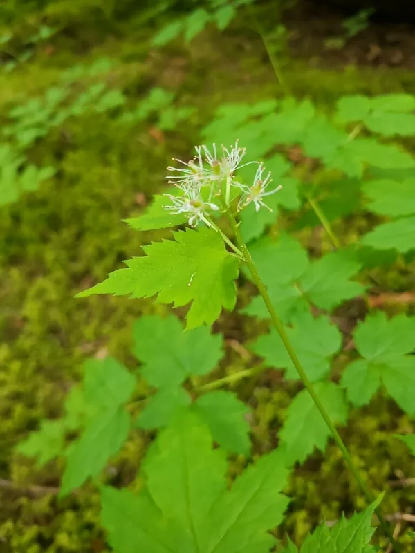
red baneberry Actaea rubra -
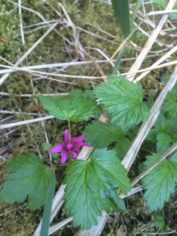
Arctic raspberry Rubus arcticus -
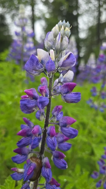
Nootka Lupine Lupinus nootkatensis
Field Notes · Ice & Glaciers lens · Bartlett Cove · 58.3625, −135.7101