The Eastern Sierra
Owens Valley · California, USA
The ice is long gone from these canyons, but its work stands on every skyline.
Also seen through Desert & Deep Time · all at Owens Valley →.
Why here
Owens Valley is the deepest valley in the country. Its floor sits near four thousand feet; the peaks on its west wall stand above fourteen thousand, close enough that you take in both at a single glance. The Sierra Nevada wrings the storms dry before they can cross, which is why the valley is desert — the Land of Little Rain. But the same snow those storms drop high on the range once did something the valley floor never saw. It packed into ice, and the ice flowed downhill, and over long cold spells it ground the range’s east face into the shape it holds now. Every deep canyon notched into that wall is a track the ice cut. Every sharp peak above them was carved from three or four sides at once. The rubble the glaciers pushed ahead of themselves still banks the canyon mouths. This note follows the ice down the escarpment — into the canyons it cut, past the peaks it sharpened, to the debris it left behind when it melted.
The story
Start with the wall. The Sierra Nevada rose along the fault at its foot, tilting a block of pale granite up toward the sky. Then the cold came. High on the range, more snow fell each winter than melted each summer, and where snow piles deep enough it turns to ice and begins to move. Glaciers slid down the east canyons, grinding them from a narrow V to a broad U, quarrying the peaks above into blades and pinnacles, and shoving broken rock ahead of them. When the climate warmed the ice drew back, leaving ridges of that rubble across the canyon mouths and cold ponds in the hollows it had scooped.
Meltwater ran the rest of the way down. It fed the Owens River and the green marshes on the valley floor, and in a desert that otherwise gets little rain, that water decided where life gathered. Herons, avocets, and white-faced ibis still work the wet ground; the dry benches above hold beavertail pricklypear and side-blotched lizards basking on the warm rock.
People followed the water too. The Owens Valley Paiute lived along these streams for generations. Then Los Angeles built an aqueduct and sent the river south, and the fight over that water became the California water wars — a story that still runs underneath everything green in the valley.
The sites
Canyons the ice cut
Whitney Portal Trailhead
36.5869, −118.2401
The road climbs the wall of the range and ends here, at the foot of the deep canyon below the Sierra crest. The trail from this point runs straight up a trough that glaciers ground out — wide-bottomed and steep-sided, the shape ice leaves behind. It is the main way onto the high peaks, and a good place to stand at the boundary between dry valley and cold country.
Turn and face up the canyon, and notice its shape: a broad, rounded floor between steep walls, not a narrow V. A river alone cuts a V; it took a tongue of ice, far wider than any stream, to plane the bottom flat like this. Trace the walls upward to where they steepen into bare rock — that marks about how high the ice once stood.
- AccessDrive-up
- ExertionEasy
- TimeAn hour
Tuttle Creek Trailhead
36.5573, −118.1728
This trailhead sits out on the apron of loose rock that spills from the canyon mouth onto the valley floor. Much of that debris was delivered by ice and meltwater, then spread wide by the streams that followed. From here the whole east face of the range stands up in one view, canyon after canyon notched into it.
Look at the low, rounded ridges of loose boulders flanking the canyon mouth above you. These are moraines — rock the glacier carried along its edges and dumped when the ice melted back. Walk up to one and notice the stones are all sizes at once, jumbled together, the way ice drops its load rather than sorting it the way a river would.
- AccessDrive-up
- ExertionEasy
- TimeAn hour
Cottonwood Canyon Trailhead
36.4410, −118.0871
At the south end of the range, the road reaches unusually high before the trail even begins, into country that was buried under ice more than once. The canyon above holds a string of lakes in rock basins — hollows the glaciers gouged and then left to fill with meltwater. It is one of the gentler ways into the glaciated high country.
Follow the trail until the first lakes come into view, then look at how they sit: shallow bowls scooped straight into bedrock, often stepped one above the next like a staircase. Glaciers cut these basins where the rock was weakest, and snowmelt filled them once the ice was gone. Notice there is no dam of debris holding the water back — the rock itself is the basin.
- AccessHalf-day hike
- ExertionModerate
- TimeHalf a day
Where the ice crossed the crest
Shepherd Pass Trailhead
36.7270, −118.2790
The trail from here climbs toward one of the low saddles in the Sierra crest, a notch where the range dips between higher peaks. Passes like this are where ice found the range’s weak points and wore them down, opening a gap deep enough to cross. It is a long, hard climb, but the route itself traces the work of the glaciers.
From the trailhead, pick out the low notch in the skyline the trail aims for. A pass sits where two glaciers, grinding back into the crest from opposite sides, met and cut the ridge down between them. Compare its rounded, worn profile to the jagged peaks on either side — the saddle is softer because far more ice passed through it.
- AccessExpedition
- ExertionStrenuous
- TimeWorth two days
Taboose Pass Trailhead
37.0095, −118.3274
This is one of the steepest climbs off the valley floor, rising from desert to crest in a single relentless canyon. That canyon is a glacial trough stood nearly on end — the ice ran down it, and the trail runs straight back up. The abrupt rise is the whole east face of the range compressed into one route.
From the desert floor, look up the canyon and watch how the walls close in and steepen almost at once. This is a trough the ice cut, now drained and dry; the stream in its bottom is far too small to have shaped walls this size. That mismatch between the little creek and the big canyon is the ice’s signature.
- AccessExpedition
- ExertionStrenuous
- TimeWorth two days
Peaks the ice sharpened
Mount Russell
36.5900, −118.2910
Mount Russell rises just north of the highest peaks as a long, thin blade of rock. Glaciers working into it from more than one side cut its flanks back until only a narrow crest remained. The result is a summit ridge sharp enough to read from the valley as a distinct edge against the sky.
From a clear spot on the valley floor, find Russell’s summit and follow its ridgeline: it reads as a knife edge, not a rounded dome. Two glacial bowls carved into opposite sides of the same ridge leave exactly this — a wall of rock with steep drops on either hand. The sharper the crest, the harder the ice worked.
- AccessDrive-up
- ExertionEasy
- TimeAn hour
Lone Pine Peak
36.5619, −118.2256
Lone Pine Peak stands out in front of the higher crest, so it often looks like the tallest thing on the wall even though it is not. Its steep, shaded walls were scooped by ice that lingered on the north side long after the sunnier slopes had cleared. Those cold, sheltered hollows are where the last glaciers held on.
Look at the peak and compare its two sides: the slopes facing the sun are smoother and more even, while the shaded side drops away in steep, scooped bowls. Ice lasts longest where the sun reaches least, so the shaded side took far more carving. This lopsided shape shows up on peak after peak along the range.
- AccessDrive-up
- ExertionEasy
- TimeAn hour
University Peak
36.7481, −118.3619
University Peak sits high on the crest above the northern canyons, a broad pyramid of pale granite. Glaciers biting into it from several directions squared off its faces and left a summit that tapers toward a point. It anchors a stretch of the range where the glacial sculpting is especially clean.
Pick out University Peak’s summit and notice how it narrows toward a point rather than a flat top or a dome. When ice carves a peak from three or more sides at once, the faces meet in sharp edges and the top pinches to a horn. Look for the steep bowls just below the summit where the ice began that work.
- AccessDrive-up
- ExertionEasy
- TimeAn hour
Dragon Peak
36.7907, −118.3761
Dragon Peak earns its name from a serrated summit ridge, a run of rock teeth along the crest. That saw-toothed profile is glacial work at its most extreme: bowls of ice cut into both sides of a thin ridge until the wall between them broke into separate spires. It is one of the more ragged skylines on this part of the range.
Find Dragon Peak’s crest and look at the row of points along it, like teeth on a saw. Each gap was cut where ice on either side of the ridge gnawed inward and finally met. Where the range looks smooth, the ice was thin or brief; where it looks like this, the ice worked long and from both sides.
- AccessDrive-up
- ExertionEasy
- TimeAn hour
When it's best
The valley floor and the high country run on opposite clocks. Down low, the desert is at its most alive in early spring, when the pricklypear and desert wildflowers open before the summer heat clamps down, and when the wetlands along the river fill with migrating and nesting birds. The canyons and passes, though, stay locked in snow well into summer — the same snow that once fed the glaciers. The high trailheads open late and close early, and the ponds near the crest can hold ice into the warm months. For the peaks and the glacial canyons, aim for high summer, once the routes have cleared; for the desert bloom and the birds, come early, while the tops are still white.
Go deeper
The pale rock of the peaks and canyon walls is granite — the plutonic core of the range, which makes up close to a quarter of the local rock column. The Inyo and White Mountains across the valley expose an older set of volcanic and metavolcanic rocks (the Inyo Mountains Volcanic Complex and related units) for contrast.
The desert plants named plainly above are beavertail pricklypear (Opuntia basilaris) and desert trumpet (Eriogonum inflatum); the small lizard on the warm rock is the common side-blotched lizard (Uta stansburiana). The valley wetlands hold white-faced ibis (Plegadis chihi), American avocet (Recurvirostra americana), and great blue heron (Ardea herodias).
Readings: - Robert P. Sharp, Geology Underfoot in Death Valley and Owens Valley (1997) — the region’s landforms explained stop by stop. - Kenneth J. Hollett, Geology and Water Resources of Owens Valley, California (1991) — how water has shaped and still shapes the valley. - Structural Geology and Volcanism of the Owens Valley Region, California (USGS, 1964) — the deep structure beneath the deepest valley. - Willis T. Lee, Geology and Water Resources of Owens Valley, California (1906) — an early, readable survey of the valley.
The names behind what you saw
What lives here, and what it's called. Photographs from open collections — an aid to identification, not decoration.
-
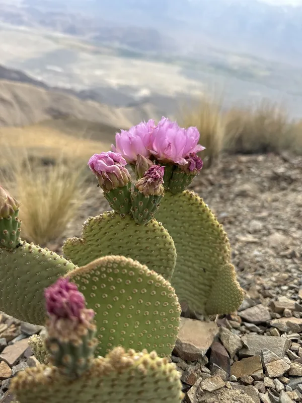
Beavertail Pricklypear Opuntia basilaris -
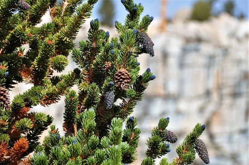
foxtail pine Pinus balfouriana -
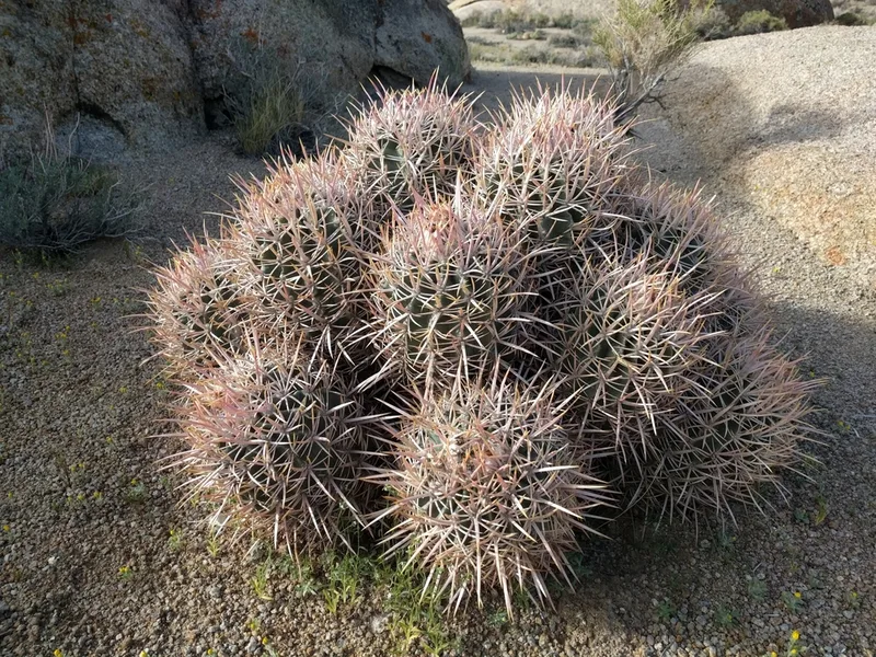
Cottontop Cactus Homalocephala polycephala -
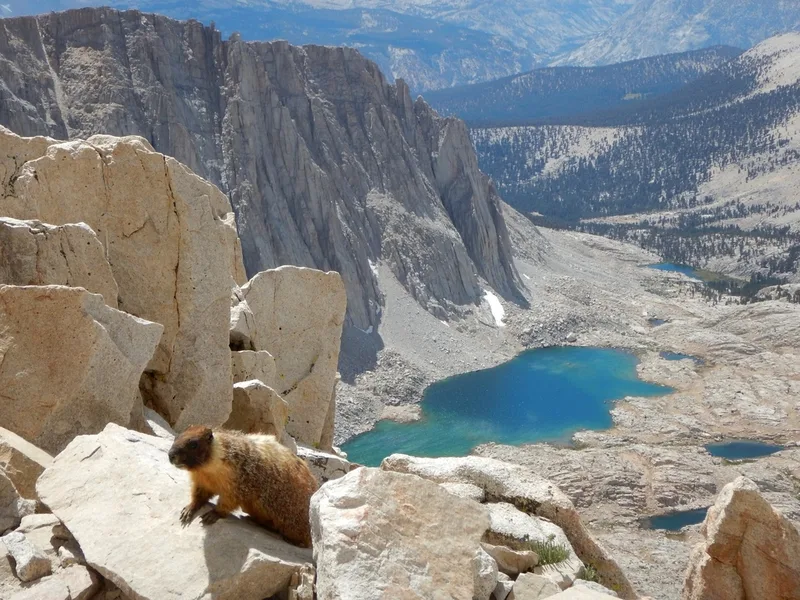
Yellow-bellied Marmot Marmota flaviventris -
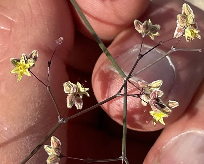
Desert Trumpet Eriogonum inflatum -
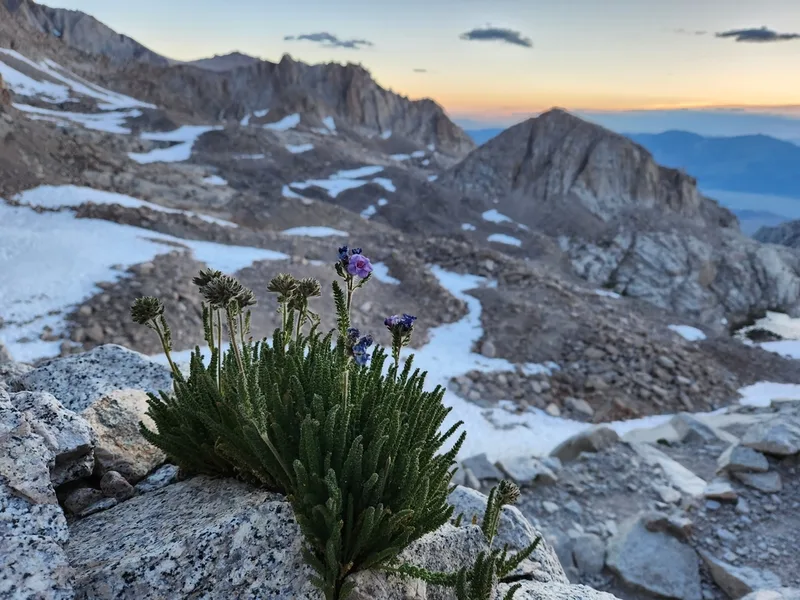
Sierra Nevada Sky Pilot Polemonium eximium -
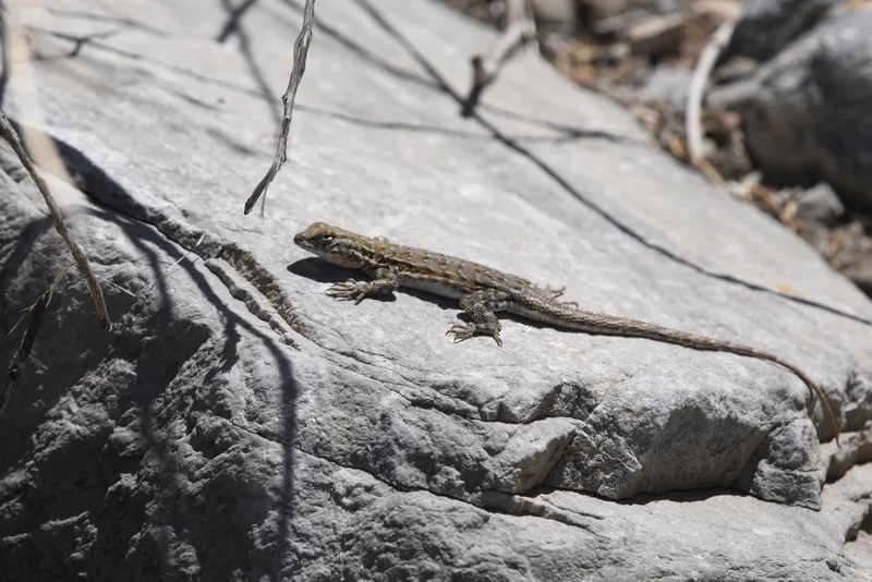
Common Side-blotched Lizard Uta stansburiana -
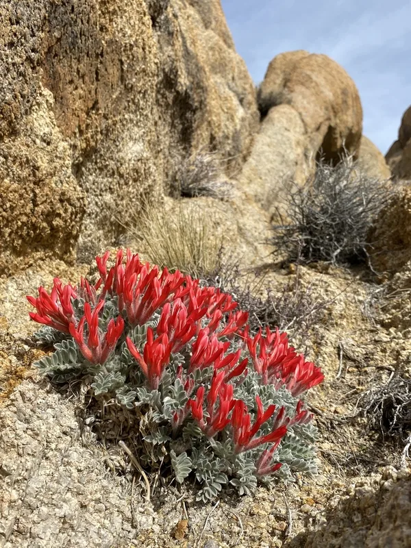
Scarlet Milkvetch Astragalus coccineus -
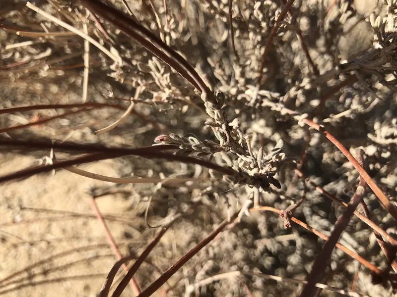
California Buckwheat Eriogonum fasciculatum -
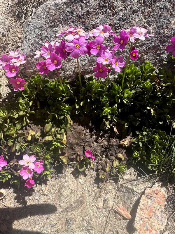
Sierra primrose Primula suffrutescens -
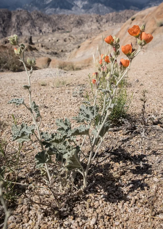
apricot globemallow Sphaeralcea ambigua -
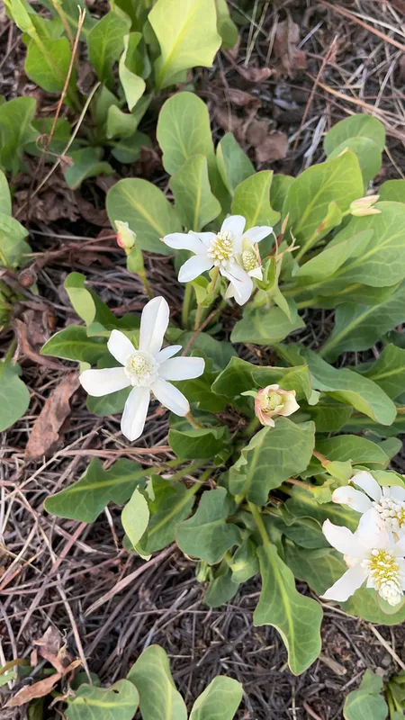
Yerba Mansa Anemopsis californica
Field Notes · Ice & Glaciers lens · Owens Valley · 36.6156, −118.1096