The Eastern Sierra
Owens Valley · California, USA
In a country this dry, the land has nowhere to hide its bones.
Also seen through Ice & Glaciers · all at Owens Valley →.
Why here
Stand in Owens Valley and look both directions at once. To the west, granite peaks climb more than 10,000 feet above you, jagged and pale; to the east, an older, lower range rises in quieter shapes. Between them lies a floor so low that this is the deepest valley in the country, cut off from the coast’s storms by the wall on its western side — country dry enough to have earned the old name Land of Little Rain. Most places, that gap in age and elevation would be buried under forest, soil, and centuries of leaf litter. Here it isn’t. Without enough rain to grow much cover, the valley’s walls stay bare, and bare rock is a record you can actually read: a very long one on the range to the east, a much younger and still-rising one to the west, with restless, unsettled ground caught between them. This note is a walk along that open book — proof that a desert doesn’t erase history so much as leave it lying in plain sight.
The story
The valley’s two walls did not start out as neighbors. The rock in the older range to the east carries an unusually long memory — a stack of layers that, taken as a whole, reaches back to a time before there was complex animal life on land, with a real share of old sea-floor sediment, hardened into limestone and dolomite, mixed in among younger volcanic rock. The granite peaks to the west are a different and much younger story: rock that cooled slowly, deep underground, and was only pushed into daylight later, when the crust here broke and the ground between the two ranges dropped. It kept dropping faster than either range rose, opening the trench that is now Owens Valley.
Little grows on bare rock, but where wind-blown soil collects on the valley floor, a thin desert flora holds on: pricklypear and cottontop cactus rooted in gravel, desert trumpet and scarlet milkvetch flushing color onto the fans for a few weeks most springs.
People have lived with this restless ground for a long time — among them the Paiute and the Mono, whose language a few elders still speak today. The valley has never quite settled: roughly a century and a half ago, the same fault that built it let go beneath the town of Lone Pine, flattening it in moments and killing dozens of its few hundred residents. The valley you are walking is not a finished landscape. It is one still being made.
The sites
Where the valley drops away
Whitney Portal Trailhead
36.5869, −118.2401
At Whitney Portal Trailhead the valley floor and the high Sierra meet almost without transition. A few dozen strides in one direction you are still in desert scrub on gravel washed down from the mountains above; a short walk further and the trail is climbing bare granite switchbacks toward the range crest. Few places let you stand on that boundary so plainly. The wall above the trailhead rises more than 10,000 feet above the valley floor in only a few miles of horizontal distance, because the valley beneath it did not simply erode down; it dropped, along a break in the earth, faster than the range beside it climbed. The desert air that keeps this country dry also keeps the wall bare enough to see all of that relief at once, unsoftened by forest. This is the cleanest single view in the note of the fault that built Owens Valley: not a gentle slope worn down by rivers, but a sudden edge, still holding the shape of the drop.
Look up from the trailhead at where the steep granite wall meets the gentler valley floor. That line is close to true — it marks where the ground below you has been dropping, relative to the mountains, for a very long time. Trace it with your eye along the base of the range as far as you can see; a straight line at the base of a mountain front like this is usually a fault, not a coincidence of erosion.
- AccessDrive-up
- ExertionEasy
- TimeAn hour
Tuttle Creek Trailhead
36.5573, −118.1728
Tuttle Creek Trailhead sits lower and further out on the valley floor than the trail up to Whitney Portal, on the long apron of loose rock and sediment that the mountains have been shedding onto the desert floor for a very long time. This apron is the valley’s youngest rock in the making: sand and gravel washed down canyon by canyon, spreading out and burying whatever fell here before it. Stand here and you’re standing on the last chapter of a very long book, still being written. Older sedimentary rock elsewhere in the valley spans an even greater stretch of time — the reason a short walk in the Eastern Sierra can move you between rock recently dropped by a flash flood and rock laid down long before there were plants, all within an afternoon. Because the valley is arid, none of it is buried in soil or forest the way it would be almost anywhere wetter.
Look down at the ground at your feet rather than up at the mountains. The gravel and sand under this trailhead came from the canyon behind it, carried down by water and gravity a little at a time. Find a rock that looks different from the rest — its color or texture likely traces back to a specific point higher in that canyon, dropped here on its way toward the valley floor.
- AccessDrive-up
- ExertionEasy
- TimeAn hour
Cottonwood Canyon Trailhead
36.4410, −118.0871
At the south end of the valley, Cottonwood Canyon Trailhead sits at the same kind of boundary as the other valley-floor trailheads in this note — desert scrub giving way, within a short climb, to bare high country above. What makes it worth its own stop is the view back across the valley it offers once you’ve gained a little elevation: from partway up the canyon, the full width of Owens Valley opens out below, flanked by two ranges of very different age and history. Standing here, the desert’s usual trade — a harder climb for a longer view — buys something rarer than scenery. It buys a cross-section: the valley floor, the fault at its edge, and mountains on both sides that took the same years and turned them into two very different kinds of rock. Nothing about that cross-section is hidden by trees or turf here; the same dryness that makes this a hard trailhead to hike from is what leaves the whole story sitting in the open, waiting to be noticed rather than dug for.
Climb even a short distance up the trail and turn around. Compare the shape of the range across the valley to the range you’re standing on — one tends to hold sharper, more angular peaks, the other rounder, older-looking shapes. Neither shape is decoration; each records how that range’s rock has worn down over a very long time.
- AccessShort walk
- ExertionModerate
- TimeAn hour
The young rock still rising
Lone Pine Peak
36.5619, −118.2256
Lone Pine Peak is not the tallest summit above the valley, but it may be the most legible from below: a single, near-vertical mass of pale rock standing alone in front of the higher peaks behind it, visible along most of the valley floor without leaving the road. It is a good stand-in for what the whole range is made of — rock that cooled slowly, deep underground, long before there was a mountain range here to see, and was only pushed into the light much later as the crust around it broke and lifted. Up close the peak is a serious mountaineering objective; from a pullout on the valley floor it does something almost as valuable for free — it shows, in one clean shape, how much of this range’s height is simply raw uplift with very little softening by time. Later in the day, low light rakes across its face and turns every crack and ledge into shadow, which is often the easiest hour to actually see the texture of the rock rather than just its silhouette.
From anywhere on the valley floor with a clear line of sight, pick out Lone Pine Peak by its steep, pale, almost featureless face, standing slightly forward of the jagged summits behind it. That bareness is the point: little has worn it down yet, which is one way to read a mountain’s relative youth without ever setting foot on it.
- AccessExpedition
- ExertionStrenuous
- TimeWorth two days
Mount Russell
36.5900, −118.2910
Mount Russell sits back in the high country above Whitney Portal, part of the same wall of granite that defines the western skyline of the valley. Rock like this — plutonic rock, meaning it froze slowly from melted material far below the surface rather than pouring out as lava — makes up a real share of what’s underneath these mountains, and it wears differently than the older rock across the valley: not into gentle domes but into sharp arêtes and towers, because granite tends to fracture along clean planes rather than crumble evenly. Reaching the summit is serious mountaineering, but its ridgeline is visible from many points lower down, a good reminder that most of what makes this range look the way it does was decided miles underground, long before erosion ever got a chance to carve it. Everything since has been subtraction: wind, frost, and ice slowly taking rock away rather than adding anything new.
From a vantage with a clear view into the high country west of the valley, look for sharp, angular ridgelines rather than rounded ones. Granite tends to break along straight planes, which is why peaks made of it end up faceted and knife-edged instead of worn smooth — a shape you’re reading, not just admiring.
- AccessExpedition
- ExertionStrenuous
- TimeWorth two days
The old rock to the east
Cerro Gordo Peak
36.5377, −117.7865
Cerro Gordo Peak stands in the Inyo Mountains on the valley’s east side, a much older and, from a distance, gentler-looking range than the Sierra across the valley. The rock record on this side of the valley is unusually deep: taken as a whole, it reaches back to a time before there was complex animal life on land, layer upon layer of it, with a real share of old sea-floor sediment — limestone and dolomite — mixed in among younger volcanic and granite-family rock. None of that record announces itself in a single dramatic cliff the way the granite across the valley does; it shows itself instead in variety — a slope that changes color and texture every so often is usually a slope changing rock type, and therefore changing age. Cerro Gordo is a good place to notice that quieter kind of drama, and a useful pair with any of the granite peaks across the valley — same desert, same dry air keeping both ranges bare, two very different answers underfoot.
Walking up toward the peak, watch the color and texture of the slope change every so often rather than staying uniform. Each change is likely a boundary between rock laid down at a different time — some of it, on this side of the valley, older than almost anything you’ll see in the mountains across the valley floor.
- AccessHalf-day hike
- ExertionStrenuous
- TimeA full day
Waucoba Mountain
37.0218, −118.0079
Waucoba Mountain rises near the northern end of the Inyo Mountains, on the same old range that carries most of the deep-time record on the valley’s east side. From its slopes the difference between the two mountain walls that frame Owens Valley is easiest to feel: to the west, sharp young granite; underfoot here, a much longer and more varied record, built up in layers over an immense stretch of time and only later folded, faulted, and lifted into a mountain range of its own. The peak is remote enough that few visitors reach it, which is part of its use in this note — the rock here has had comparatively little disturbance from foot traffic, and what natural weathering has done to it is visible without much human alteration. It rewards the kind of visitor willing to trade a long, quiet approach for a mountain that still looks close to how it has looked for a very long time.
From high on the mountain, look east away from the valley rather than toward it. The country falls away into drier, quieter desert basins with none of the drama of the Sierra front — a reminder that Owens Valley’s steep young wall is the exception in this region, not the rule.
- AccessExpedition
- ExertionStrenuous
- TimeWorth two days
Keynot Peak
36.7074, −117.9623
Keynot Peak sits roughly across the valley from the cluster of granite summits around Mount Russell and Lone Pine Peak, and the contrast is the point of including it. Where those peaks are steep, pale, and comparatively unweathered, the mountains around Keynot Peak read as older and more textured — evidence of far more time spent at the surface, exposed to wind, frost, and the slow chemistry of a dry climate. Neither range is right or wrong about how a mountain should look; each is simply showing its age. Seen together across the valley floor, they make an argument more effectively than any single overlook could: that Owens Valley is not just a scenic gap between two mountain ranges, but a seam between two different rock records, dropped to the same elevation by the same fault and left, by the dry climate, plainly visible on both sides. Few single vantage points make that argument as clearly as this one.
From a vantage on Keynot Peak or its approach, look west across the valley to the sharp granite skyline opposite. Then look at the rock immediately around you. The difference in sharpness between the two is a rough measure of how much longer this side of the valley has been exposed to weather.
- AccessHalf-day hike
- ExertionStrenuous
- TimeA full day
When it's best
The bare rock that makes this valley worth reading doesn’t keep a calendar — it looks much the same in any month, which makes deep time one of the few things here that rewards a visit any time of year. The living valley floor does keep a calendar, though. Desert wildflowers and cactus blooms tend to flush onto the alluvial fans in spring, usually strongest by mid-spring and fading fast once the heat sets in. The high granite country works on a slower clock: marmots and the alpine wildflowers that live above the treeline stay snowbound and out of sight well into the season, not really active until the range lets go of its snow.
Go deeper
The names behind what you saw
The old volcanic rock on the valley’s east side goes by several formal names depending on exactly where you’re standing — the Inyo Mountains Volcanic Complex, the Sidewinder Volcanic Series, the Warm Spring Formation, the Soda Mountain Formation, and the Ord Mountain Group among them. The regional rock column beneath the Inyo and White Mountains, taken as a whole, runs from the Ediacaran — before there was complex animal life even in the sea, let alone on land — up to the present, and carries real proportions of limestone, dolomite, quartzite, and plutonic (granite-family) rock. The desert plants named in this note are beavertail pricklypear (Opuntia basilaris), cottontop cactus (Homalocephala polycephala), desert trumpet (Eriogonum inflatum), and scarlet milkvetch (Astragalus coccineus).
To read next
- Geology Underfoot in Death Valley and Owens Valley, Robert P. Sharp (1997) — a stop-by-stop field guide built for exactly this kind of walk, matching what you can see at a pullout to what put it there.
- Geology Field Trip to Mono/Owens Valleys, Mark D. Milliken (1990) — a guided traverse of the valley aimed at driving and walking the ground, not just reading about it.
- Structural Geology and Volcanism of Owens Valley Region, California: A Geophysical Study, USGS Professional Paper (1964) — the deeper technical account of the faulting and volcanism that built the valley’s shape.
- Geology and Water Resources of Owens Valley, California, Kenneth J. Hollett (1991) — shows how the same fault-bounded basin that shaped the rock also shaped where the valley’s water collects and moves.
The names behind what you saw
What lives here, and what it's called. Photographs from open collections — an aid to identification, not decoration.
-
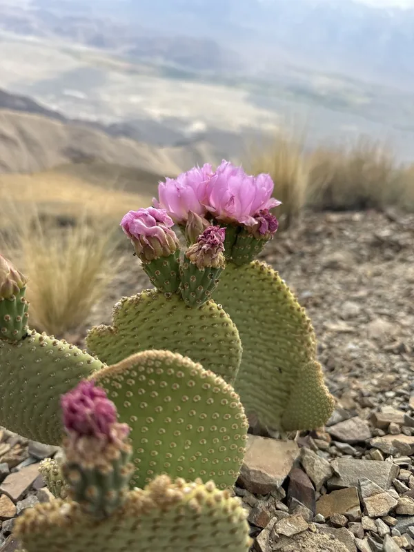
Beavertail Pricklypear Opuntia basilaris -
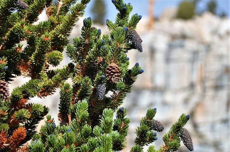
foxtail pine Pinus balfouriana -
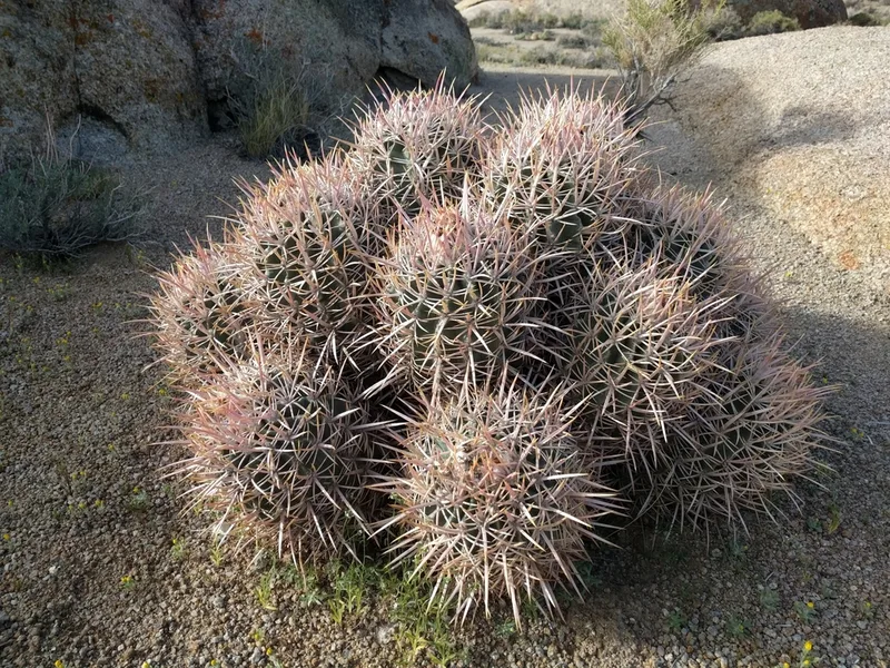
Cottontop Cactus Homalocephala polycephala -
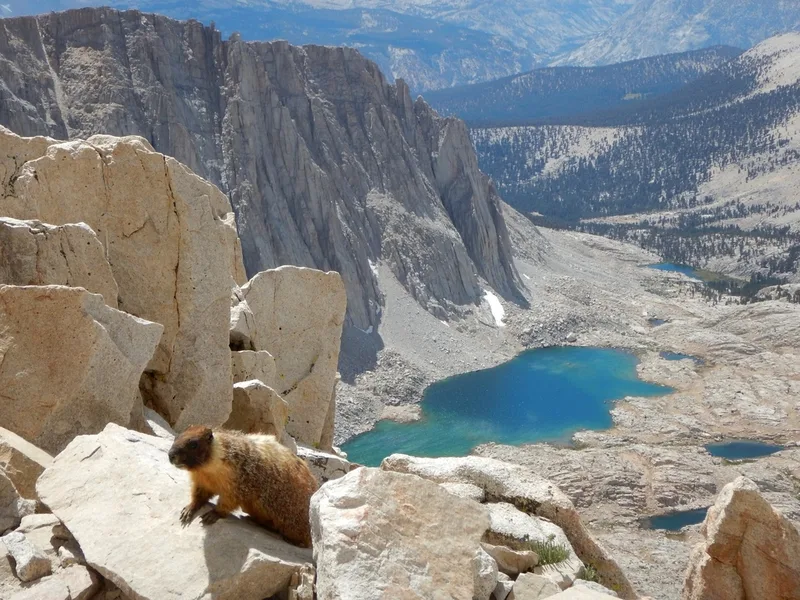
Yellow-bellied Marmot Marmota flaviventris -
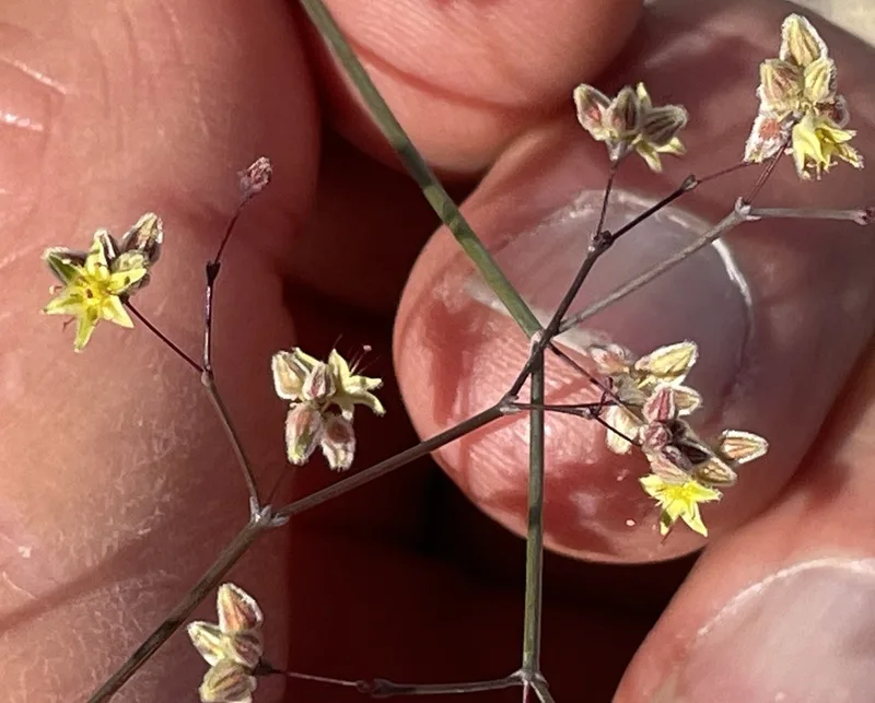
Desert Trumpet Eriogonum inflatum -
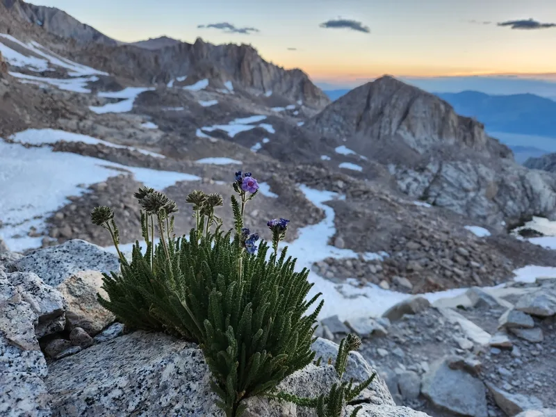
Sierra Nevada Sky Pilot Polemonium eximium -
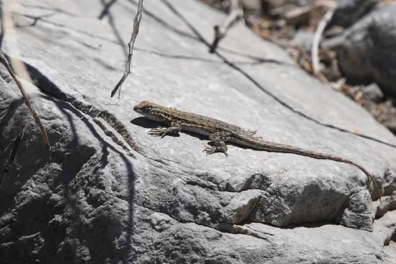
Common Side-blotched Lizard Uta stansburiana -
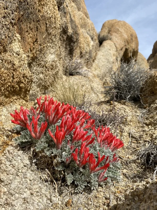
Scarlet Milkvetch Astragalus coccineus -
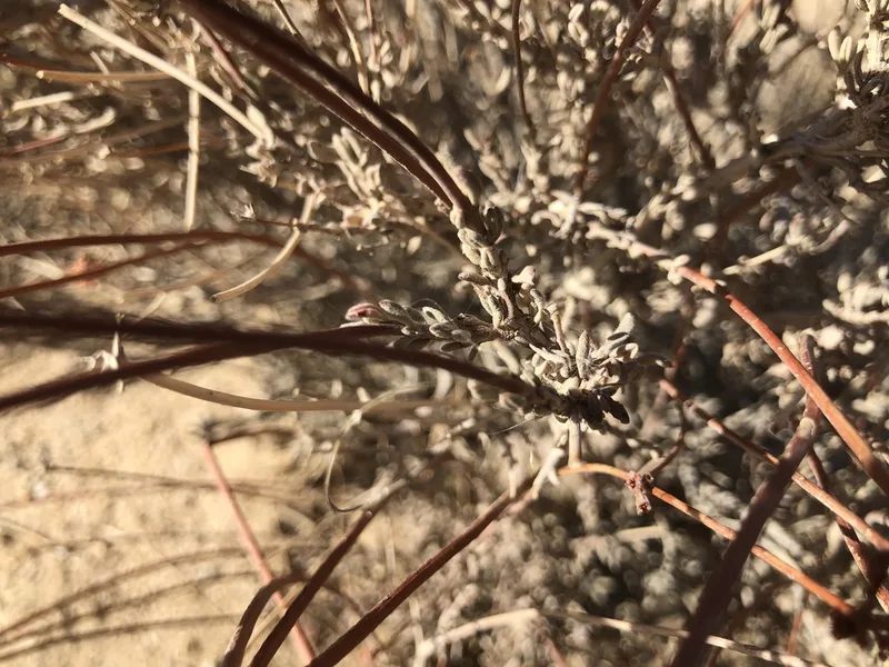
California Buckwheat Eriogonum fasciculatum -
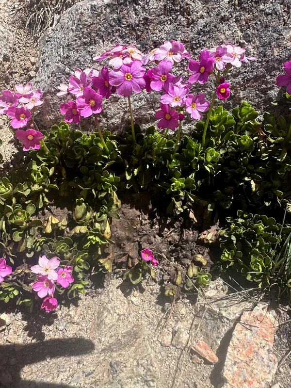
Sierra primrose Primula suffrutescens -
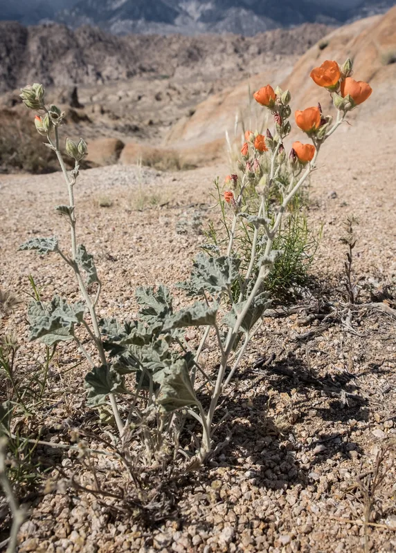
apricot globemallow Sphaeralcea ambigua -
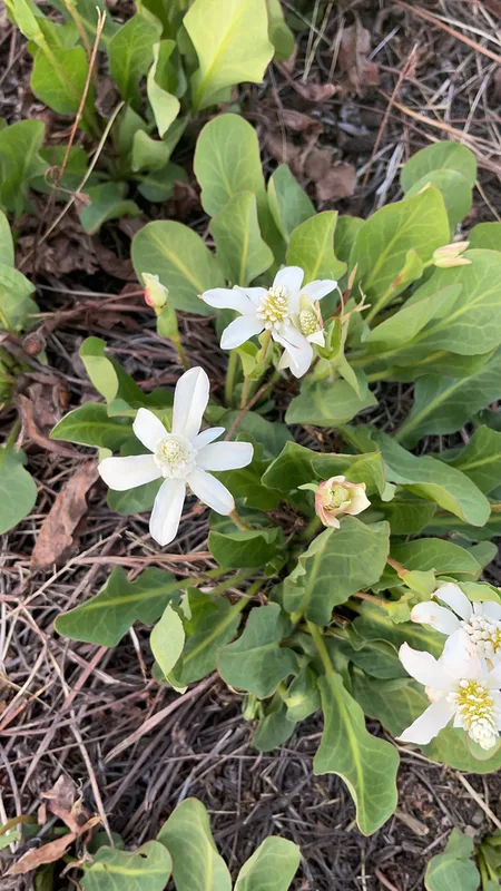
Yerba Mansa Anemopsis californica
Field Notes · Desert & Deep Time lens · Owens Valley · 36.6156, −118.1096