Death Valley
Furnace Creek · California–Nevada, USA
Where nothing grows to cover it, the ground says everything.
Also seen through Night Sky · all at Furnace Creek →.
Why here
Most landscapes keep their history hidden. Soil, grass, and forest grow over the rock and file its story away where you cannot read it. Death Valley does the opposite. Here the summer heat is the hottest ever measured on Earth, the rain is almost nothing, and almost nothing grows, so the ground has no cover at all. The bones of the place lie in plain sight. Walk into a canyon and you pass between folded and tilted rock stacked in bands you can trace with a finger. Stand on the valley floor and you stand below the level of the sea, on a crust of salt left behind by water that dried and dried again. Look up at the ridges and the whole basin reads like a diagram: the tilt of the land, the cut of old floods, the slow pull of a valley coming apart. This is a desert stripped to bare rock, and bare rock is an open book. Everything in this note is a page of it.
The story
The rock here goes deep in time. The oldest layers beneath the valley formed while the continent itself was young, more than two billion years ago, long before anything lived on land. On top of them lie beds of limestone and dolomite laid down under ancient seas, then sand, gravel, and salt washed in from eroding highlands. For the last several million years two blocks of crust have been pulling apart along faults, dropping the valley floor lower and lower while the ranges climb. That is why the basin sits below the sea today.
Almost nothing softens this. What lives here lives narrowly: creosote bush spaced out across the gravel, desert holly holding pale leaves against the glare, and, in the weeks after a wet winter, a thin wash of desert sunflower and other annuals that sprout, flower, and set seed before the heat returns.
People read the valley too. The Timbisha Shoshone have lived in and around it for a very long time, and still speak their own language, Timbisha, near the valley’s heart. Later arrivals saw money in the salt. Crews scraped borax off the valley floor and hauled it out by wagon from works near Furnace Creek. The desert gave up its chemistry as plainly as it gives up its rock.
The sites
The floor, below the sea
Badwater Basin
36.2503, −116.8258
The valley floor here is a crust of salt, the residue of water that pooled and dried with no outlet to escape to. The ground lies below the level of the sea, low enough that what little rain falls runs down to this spot and then has nowhere to go but up into the air. The salt is laid out in a rough honeycomb of ridges where the crust has buckled and grown.
Crouch at the edge of the salt and look closely at the pale crust. The little ridges between the flat plates are salt pushed up as the ground dries, hard to the touch rather than soft mud, so press one gently and feel it hold. Follow the crust outward and watch the ridges repeat all the way to the foot of the far mountains.
- AccessDrive-up
- ExertionEasy
- TimeAn hour
Devils Golf Course
36.3283, −116.8600
A little north of the lowest floor, the same salt stands up in a field of jagged, ankle-high spires. Here the crust has been eaten and rebuilt into rock-hard pinnacles rather than a smooth pan, all of it salt and mud dried past the point of giving. Walk out onto it and the ground crunches underfoot.
Step a few feet onto the salt and stand still in the quiet. On a warm afternoon you can sometimes hear faint ticking and crackling around you as the salt shifts in the heat. Look at a single spire up close and see that it is built of countless small blades of salt packed together.
- AccessDrive-up
- ExertionEasy
- TimeAn hour
Badlands, read aloud
Zabriskie Point
36.4200, −116.8123
From this overlook the land falls away in bare, wrinkled ridges of golden rock, worn into a maze of gullies with not a plant to soften them. These are old layers of mud and fine sediment, laid down flat long ago, then lifted and tilted and left for the rare rains to carve. Because nothing grows on them, every fold and cut stands out clean.
From the railing, trace one ridgeline down into the gullies below and notice how the bands of rock all tilt the same way. That shared tilt is the old flat-lying sediment lifted and turned as the valley works itself open. Pick out a pale layer and follow it with your eye across several gullies.
- AccessDrive-up
- ExertionEasy
- TimeAn hour
Manly Beacon
36.4236, −116.8262
The sharp golden peak rising out of the badlands below Zabriskie Point is Manly Beacon, a tougher mass of the same tilted sediment left standing while softer rock washed away around it. It is the same stuff you see everywhere here, just hard enough to hold its ground. It makes a natural landmark over the maze of canyons at its foot.
From the viewpoint, find the tallest golden pinnacle and look at how its rock layers run up the flank at an angle. The whole peak is tilted sediment; the softer beds around it have already been carried off by flash floods. Notice that nothing grows on it at any height.
- AccessDrive-up
- ExertionEasy
- TimeAn hour
Golden Canyon Trailhead
36.4208, −116.8466
This trailhead leads on foot into the same golden badlands you see from the rim above, but from the inside. Walking up the wash you pass between walls of the same tilted rock, close enough to touch, cut and smoothed by the rare floods that come through. The canyon reads like a cross-section of the whole hillside.
Walk a short way up the wash and put your hand flat on the canyon wall. Feel how the rock is really dried mud and fine sand, soft enough to crumble under a fingernail, which is why water carves it so fast. Look up at the layers overhead and find the same tilt you saw from the rim.
- AccessShort walk
- ExertionModerate
- TimeHalf a day
Red Cathedral
36.4276, −116.8250
At the head of Golden Canyon a wall of rust-red rock rises above the pale badlands. The red marks a different band within the same stacked sediment, its color set apart from the gold around it. Against the surrounding rock it stands as the back wall of the canyon.
Stand below the red cliff and compare its color to the golden rock you walked in through. The sharp change is one rock layer giving way to another, each with its own color, all of it bare to the eye. Look for the line where gold meets red.
- AccessHalf-day hike
- ExertionModerate
- TimeHalf a day
Color in the rock
Artists Palette
36.3677, −116.8034
On the face of the hills here the rock breaks into patches of green, pink, and pale purple, bare mineral color with no plants to interrupt it. The tints are the rock’s own chemistry showing through where nothing covers it. The band of colors runs across the slope in soft, unlikely shades.
Pull off at the viewpoint and pick out the green, the pink, and the purple across the hillside. These are the natural colors of the minerals in the rock, laid open because nothing grows to hide them. Notice that the colors follow the rock layers, not the shape of the land.
- AccessDrive-up
- ExertionEasy
- TimeAn hour
Ubehebe Crater
37.0097, −117.4503
At the north end of the valley the ground drops away into a wide, deep crater with steeply banded walls. Whatever tore it open cut straight down through the layered ground, and those layers now stand exposed all around the bowl. It is a clean slice through the desert’s stacked history, opened all at once instead of worn away slowly.
Stand on the rim and look at the banding in the far wall of the crater. Those stripes are the ordinary layers of the ground, sliced open in cross-section. Trace one band around the bowl and see how the crater exposes in a single face what erosion elsewhere takes ages to reveal.
- AccessDrive-up
- ExertionEasy
- TimeAn hour
The long view, and what people took
Dante's View
36.2206, −116.7264
From this high pull-out on the range crest the whole basin lies open below, the white salt floor running the length of the valley with the bare ranges walled up on either side. From here the shape of the place makes sense at a glance: a block of ground dropped low between mountains that are still rising. There is no green to blur the lines.
From the overlook, look straight down at the white salt floor, then up at the ridge you are standing on. You are seeing a valley pulled open by faults, the floor sinking, the walls climbing, the whole basin below the sea. Follow the salt with your eye from one end of the valley to the other.
- AccessDrive-up
- ExertionEasy
- TimeAn hour
Harmony Borax Works
36.4800, −116.8735
Just north of Furnace Creek stand the remains of a works where crews once processed borax scraped off the valley floor. The salt flats that make the desert look dead were, to the miners, a chemical crop, borax left behind by the same drying that made the salt pans. Hauled out by long wagon teams, it was the valley’s rock chemistry turned into cargo.
Walk among the old equipment and look out at the flat white ground it faces. That crust is where the borax came from, left behind as mineral-rich water dried in the basin. Picture the salt pan not as scenery but as the raw material this whole works was built to gather.
- AccessDrive-up
- ExertionEasy
- TimeAn hour
When it's best
The valley runs on heat. Summer here is genuinely dangerous. The air has been measured hotter than anywhere else on Earth, and the open floor gives no shade and no relief. It is a season to avoid, not to endure. The cooler months are the time to come. In the weeks after a wet winter, the gravel flats can carry a brief showing of desert wildflowers, desert sunflower and gravel ghost and small purple phacelias among them, though a dry winter brings little or nothing, and the bloom passes quickly once the days warm. Lizards wake and sun themselves on rock in the same mild stretch. Nights can be cold and the skies are dark and open; near a new moon the stars come out over the salt with nothing to dim them. By late spring the heat is already climbing back toward its summer extreme.
Go deeper
The valley sits in the northern Mojave Desert, against the edge of the Great Basin. The rock column beneath it (Macrostrat column 464, “Death Valley, California”) runs from the Proterozoic to the present and is dominated by dolomite and limestone, with quartzite and shale, the record of long-vanished seas, capped by younger Cenozoic and Neogene sedimentary rocks and loose Holocene alluvium on the active washes.
The signature plants are creosote bush (Larrea tridentata), desert holly (Atriplex hymenelytra), and the spring annuals desert sunflower (Geraea canescens), gravel ghost (Atrichoseris platyphylla), notch-leaf scorpionweed (Phacelia crenulata), desert fivespot (Eremalche rotundifolia), and browneyes (Chylismia claviformis). The common lizard sunning on rock is the side-blotched lizard (Uta stansburiana).
Readings, all circling the salt and its chemistry:
- Geology of the Furnace Creek borate area, Death Valley, Inyo County, California (1970) — the classic account of how borax came to lie in the valley beds.
- Geology of the Monte Blanco borate deposits, Furnace Creek Wash, Death Valley, California (2019) — a modern look at the same borate country.
- A brief geologic and hydrologic reconnaissance of the Furnace Creek Wash area, Death Valley National Monument, California (1963) — rock and water together in the wash behind Zabriskie Point.
- Pliocene Changes in Kinematics and Long-Term Geologic Slip Rates along the Furnace Creek–Fish Lake Valley Fault Zone, California and Nevada (2017) — the faulting that is pulling the valley open.
The names behind what you saw
What lives here, and what it's called. Photographs from open collections — an aid to identification, not decoration.
-
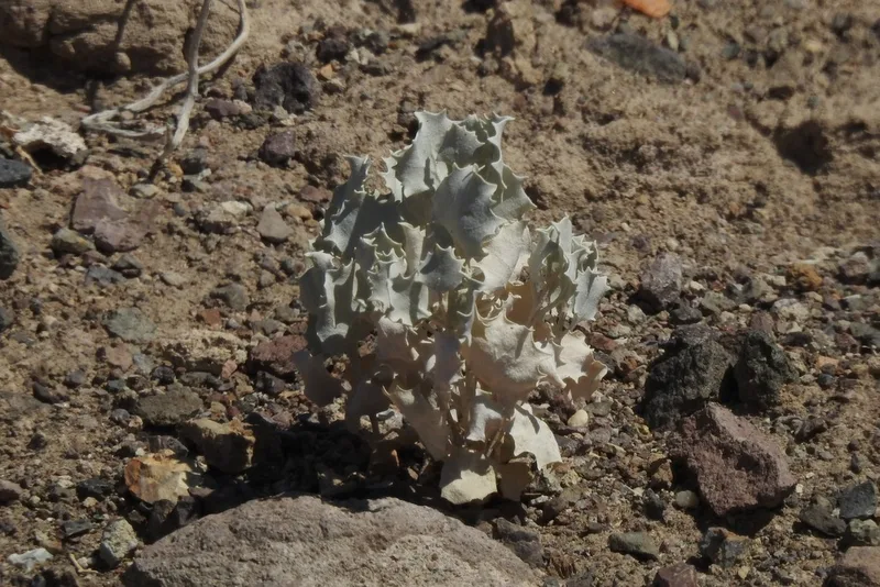
Desert Holly Atriplex hymenelytra -
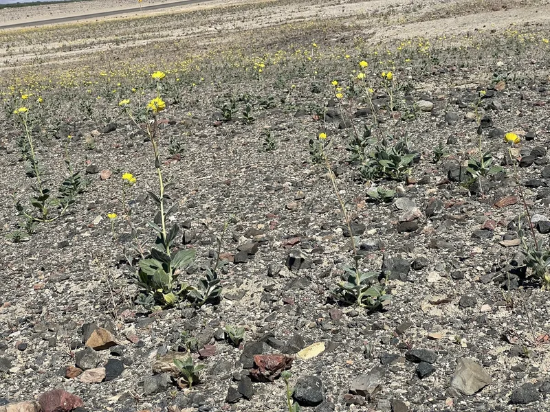
Desert Sunflower Geraea canescens -
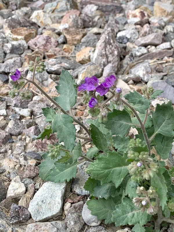
Caltha-leaf Phacelia Phacelia calthifolia -
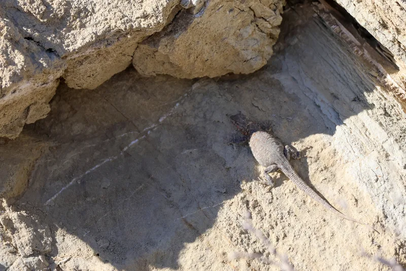
Common Side-blotched Lizard Uta stansburiana -
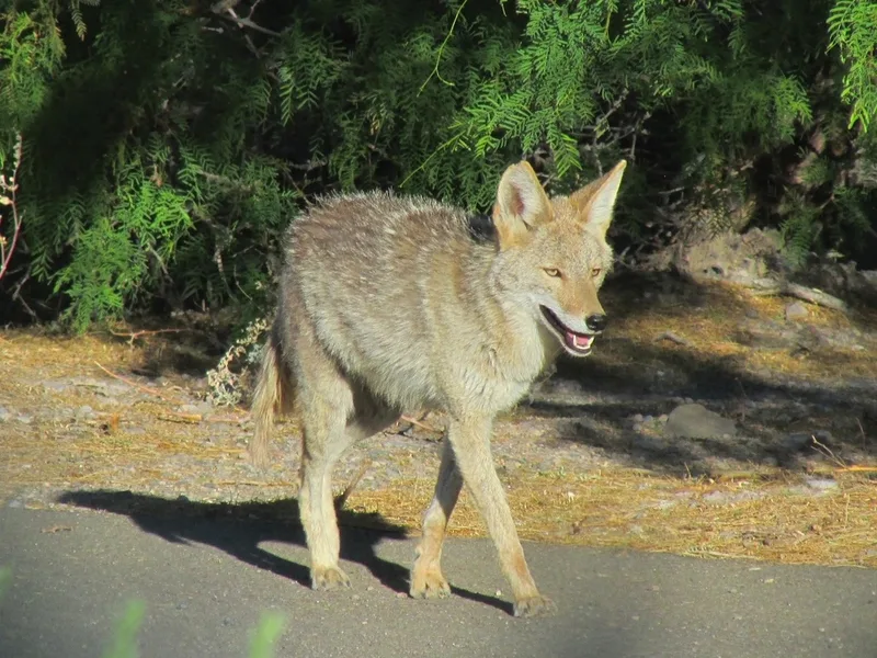
Coyote Canis latrans -
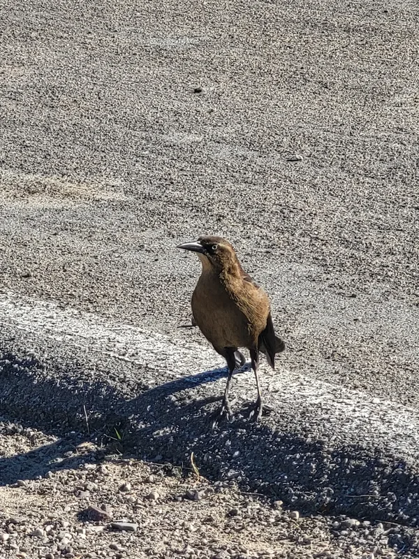
Great-tailed Grackle Quiscalus mexicanus -
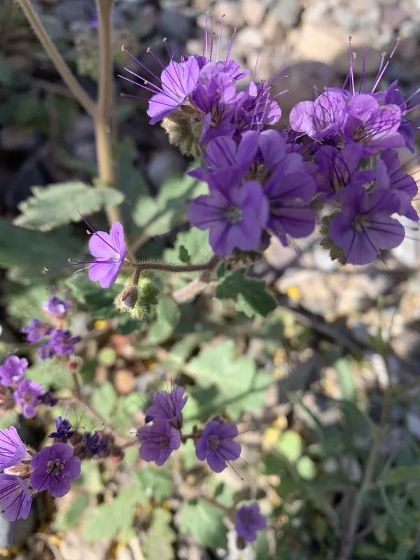
Notch-leaf Scorpionweed Phacelia crenulata -
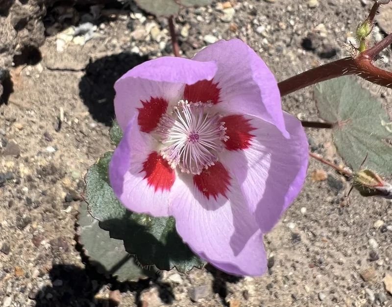
desert fivespot Eremalche rotundifolia -
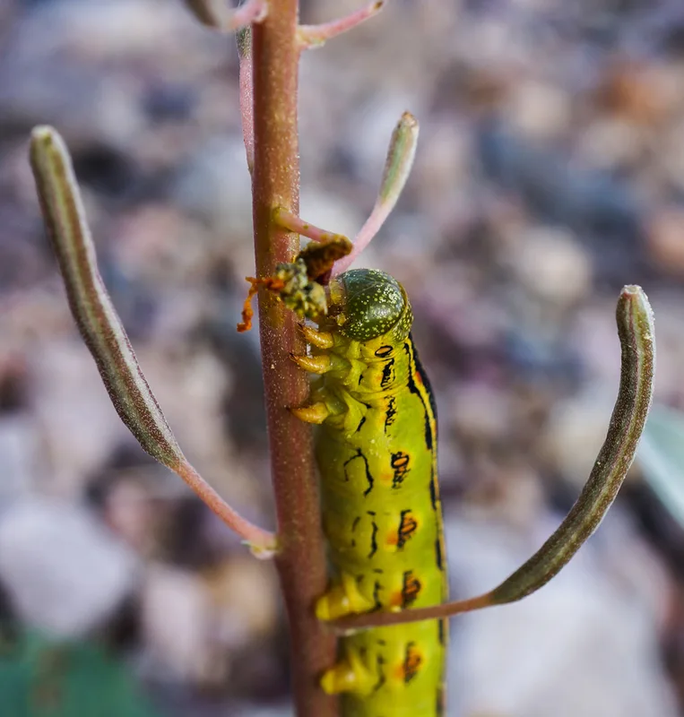
White-lined Sphinx Hyles lineata -
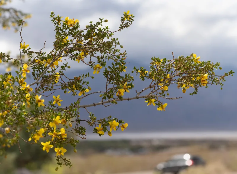
Creosote Bush Larrea tridentata -
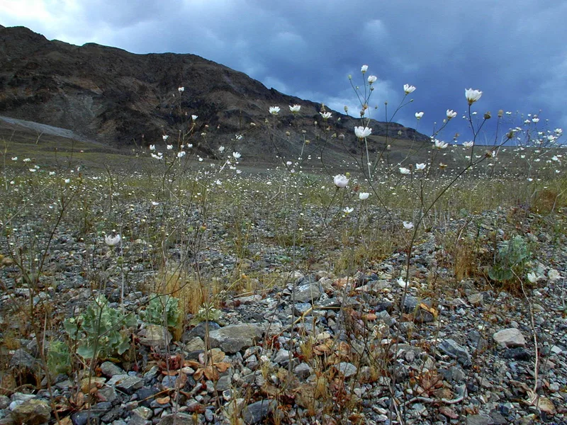
gravel ghost Atrichoseris platyphylla -
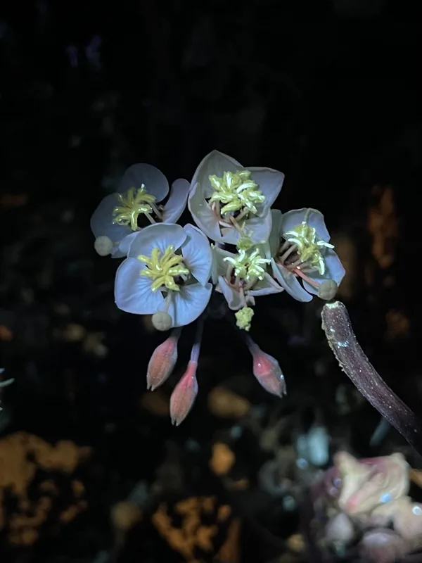
Browneyes Chylismia claviformis
Field Notes · Desert & Deep Time lens · Furnace Creek · 36.4344, −116.8628