Craters of the Moon
Craters of the Moon National Monument · Idaho, USA
Here the land is still close to the moment it came out of the ground.
Also seen through Night Sky · all at Craters of the Moon National Monument →.
Why here
Craters of the Moon looks less like a mountain range than a fresh skin stretched over the Snake River Plain. Dark lava folds across the ground, cones rise from it, and the road keeps finding another opening into the black. The rock is young in the geological sense, but the important thing is how plainly it keeps its first shape. Gas made the lava froth. Cooling cracked it. Water and wind have only begun to soften the edges. Walk among the cones and tubes and the difference between a volcano and its aftermath disappears. You are looking at both at once: molten rock becoming land, and land beginning to invite plants back. This note follows that unfinished surface from the open view to the small pockets where life takes hold.
The story
The payload’s rock record begins with young basalt and cinder cones, alongside older volcanic rocks. Basalt can run far from a vent when it is hot and fluid; cinders pile close to the opening when gas-rich lava breaks apart in the air. That simple difference makes the landscape legible. A cone, a flow, a sink, and a lava tube are not separate curiosities but different parts of one eruption’s work.
The plants arrive unevenly. Limber pine and bitterbrush hold the older ground, while small flowering plants find protected soil among the lava. A kipuka, an island of older ground surrounded by a flow, keeps a patch of living country inside the black. The human record in this payload is mostly about the monument and its interpretive stops; the surface itself remains the clearest story.
The sites
Cones and flows
Scenic Overlook Craters of the Moon
43.4683, −113.5506
Start here for the whole argument in one view. The dark field is not a single smooth sheet but a collection of flows, small cones, and broken channels, each preserving a different way for basalt to move and cool. From the overlook, let your eye separate the low, rough lava from the higher cinder forms. The scene is spare because young volcanic ground begins with very little soil. It takes time for dust, cracks, and windblown seeds to make a place where plants can stay. This is a good first stop because the distance makes the pieces readable before you enter them.
Look for the low black flow and the taller cinder cone behind it. The cone is a pile of fragments thrown from a vent, while the flow spread outward before it cooled. Notice how two kinds of lava can sit side by side.
- AccessShort walk
- ExertionEasy
- TimeAn hour
Sunset Cone
43.4686, −113.5675
A cone is a volcano’s simplest visible sentence: material comes up through one opening and gathers around it. Sunset Cone gives that sentence a clear outline, with a summit that stands above the rougher field around it. The loose surface makes the climb feel different from walking on a solid flow. Every step shifts a little because the ground is made of fragments rather than a single slab. From higher up, look back at the plain and notice how small the cone is within the larger volcanic field. The scale is part of the lesson. A vent can build a landmark without building a mountain range.
Pick out the loose red and black pieces underfoot. Their broken, porous texture records lava that cooled in the air rather than in one continuous sheet. Look for the place where the cone meets the smoother ground below.
- AccessHalf-day hike
- ExertionModerate
- TimeHalf a day
The ground opening
Big Sink Overlook
43.4314, −113.5416
Big Sink shows what happens when a volcanic surface is not only built but removed. The opening is a collapse in the lava field, a place where a roof or pocket gave way and left a hollow in the dark ground. It changes the scale of the landscape. The surrounding lava can feel sealed and unbroken; here, the surface admits depth. Stand at the edge and read the walls as a cross-section through the flow. The roughness is not random. Cooling, gas, and later collapse leave different textures, and the sink gathers them into one visible place.
Trace the rim of the sink with your eyes. Find where the dark surface breaks into a steeper wall, then look for blocks that have fallen inward. The opening is a record of the lava field losing its roof.
- AccessShort walk
- ExertionEasy
- TimeAn hour
Lava Tube
43.4448, −113.5310
A lava tube begins with a contradiction: the outside hardens while the inside keeps moving. A crust forms over a stream of molten rock, and when the stream drains away it leaves a hollow passage. The tube is therefore both a cave and a frozen flow channel. At this stop, the name is enough to orient the idea, but the surface around it supplies the evidence. Look for broken edges, dark folds, and the way the ground changes around the opening. The tube belongs to the same eruption as the lava outside. It is simply the part that kept its space after the rock moved on.
At the entrance, compare the roof and floor. A tube’s rounded surfaces came from lava moving beneath a cooling crust, not from water slowly dissolving the rock. Notice how different that shape is from a collapsed surface flow.
- AccessShort walk
- ExertionModerate
- TimeAn hour
Older ground in the black
Carey Kipuka
43.3252, −113.6359
A kipuka is an island of older ground left inside a younger lava field. Carey Kipuka lets you see the contrast without needing a map: living soil and established plants on one side, dark volcanic surface on the other. Limber pine and bitterbrush belong to the older country, where roots can find more than cracks and dust. The lava surrounding it is a reminder that an eruption does not cover a landscape evenly in the way a blanket does. It leaves pockets, edges, and survivors. Walk the boundary slowly. The meeting line is the story: new rock can make an island without moving the old ground at all.
Stand where the vegetation meets the lava and find the first plant growing beyond the soil. That narrow edge is where windblown dust, moisture, and roots begin to turn bare basalt into ground.
- AccessDrive-up
- ExertionEasy
- TimeAn hour
When it's best
The monument rewards the warmer part of the year, when the trails and overlooks are easiest to follow and the high desert plants have had a chance to flower. Spring can bring a brief display of small blooms, while summer gives the lava its strongest contrast against the sky. Clear, dry weather makes the rough rock easier to read. Come prepared for sharp surfaces and little shade, and let the changing light do some of the teaching.
Go deeper
The names behind what you saw. The dark rock is Quaternary basalt, including olivine tholeiite basalt and minor latite and alkaline basalt. The plants include limber pine, Pinus flexilis, and bitterroot, Lewisia rediviva.
To read next. - Geology of the Craters of the Moon National Monument, Idaho — the detailed geological account behind the cones, flows, and caves. - Geology of the Craters of the Moon Idaho — a shorter entry point for reading the monument’s volcanic surface.
The names behind what you saw
What lives here, and what it's called. Photographs from open collections — an aid to identification, not decoration.
-
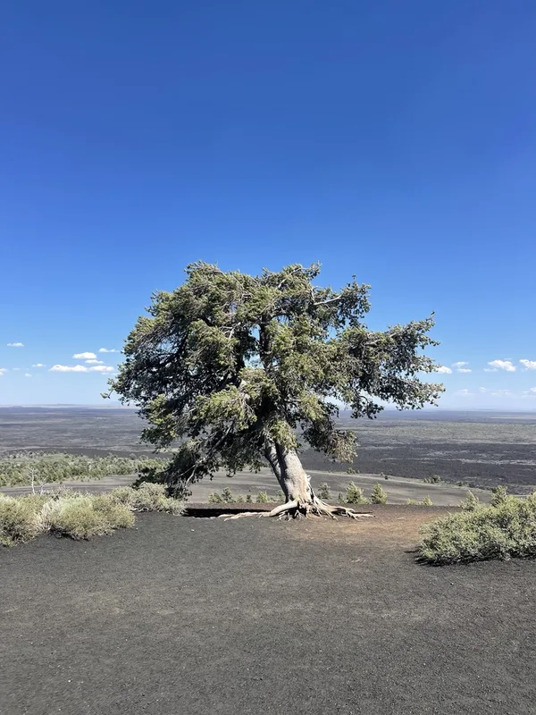
limber pine Pinus flexilis -
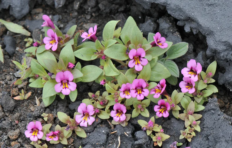
Dwarf Purple Monkeyflower Diplacus nanus -
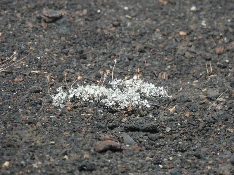
cushion buckwheat Eriogonum ovalifolium -
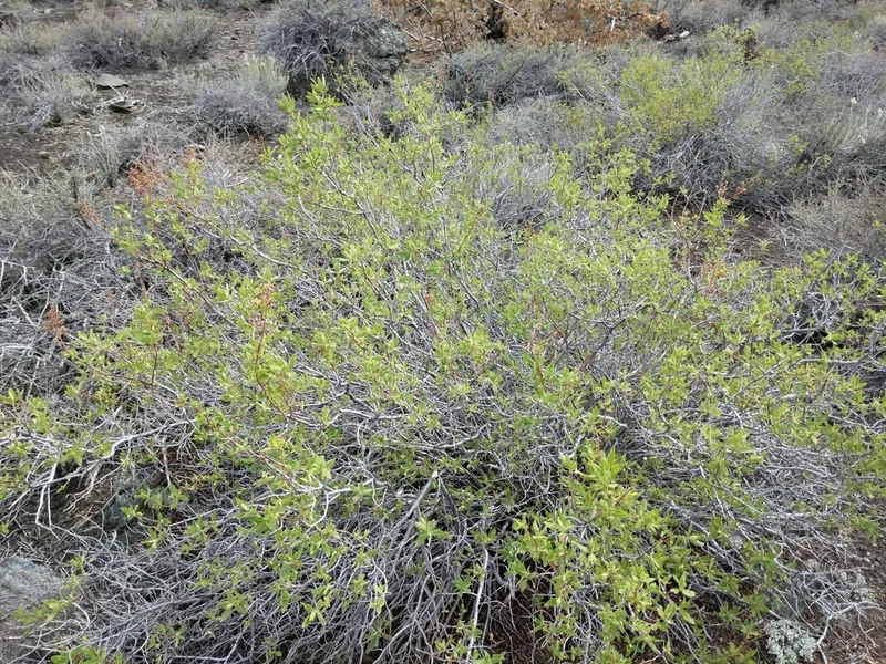
fernbush Chamaebatiaria millefolium -
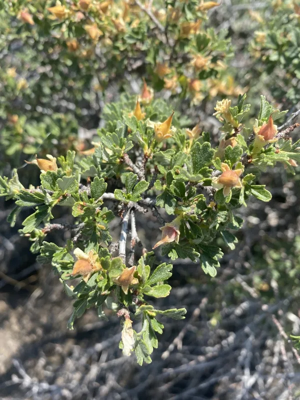
Antelope Bitterbrush Purshia tridentata -
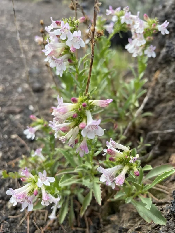
Hot Rock Penstemon Penstemon deustus -
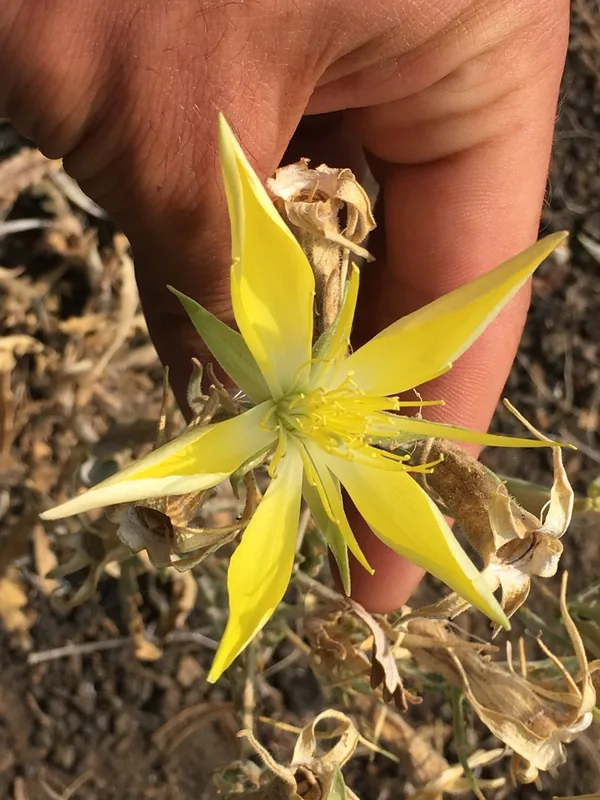
Giant Blazingstar Mentzelia laevicaulis -
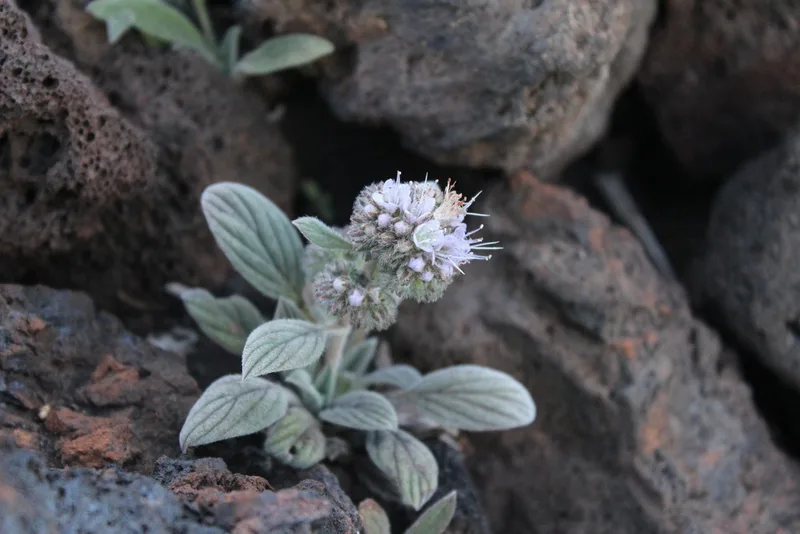
Silverleaf phacelia Phacelia hastata -
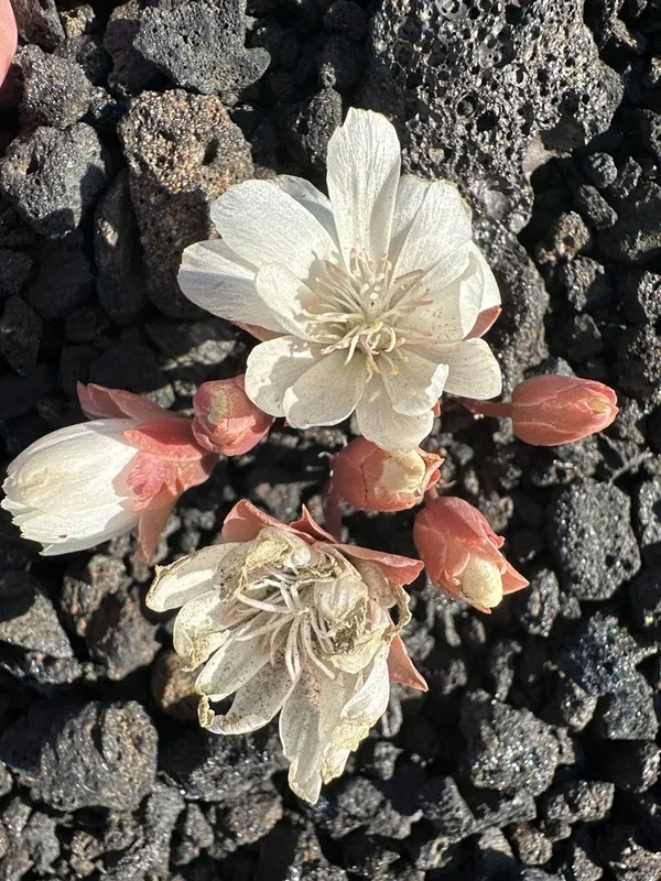
Bitterroot Lewisia rediviva -
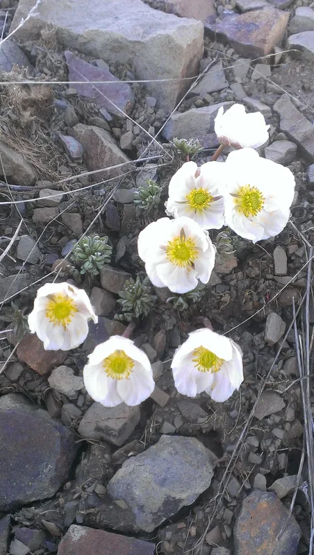
Anderson's buttercup Ranunculus andersonii -
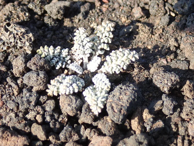
Hoary Pincushion Chaenactis douglasii -
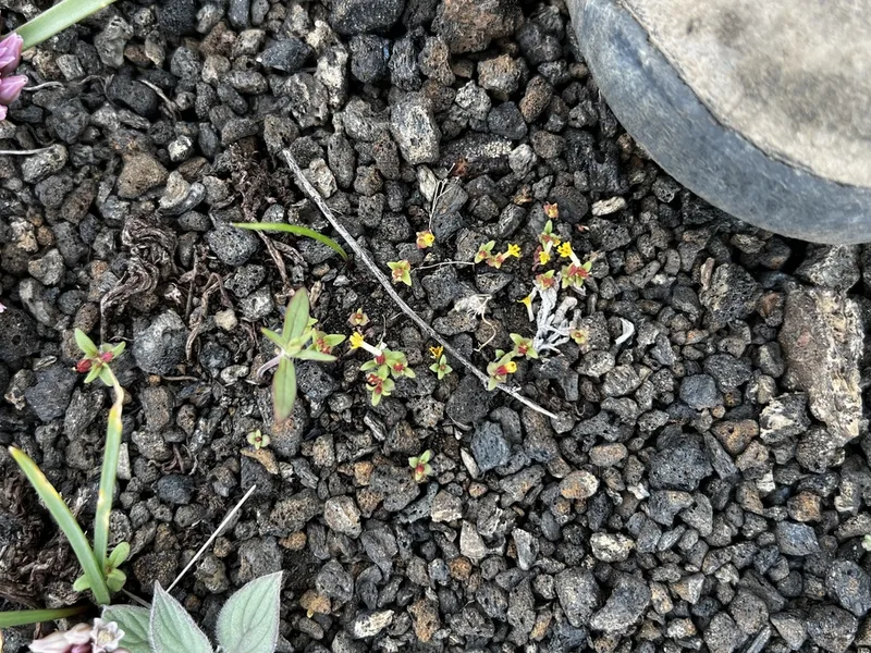
miniature monkeyflower Erythranthe suksdorfii
Field Notes · Volcanic lens · Craters of the Moon National Monument · 43.4050, −113.5061