Crater Lake
Crater Lake National Park · Oregon, USA
A volcano can leave a mountain behind by leaving its center empty.
Also seen through Night Sky · all at Crater Lake National Park →.
Why here
Crater Lake begins with a mountain that is no longer there. The rim is the surviving edge of a volcanic story, while water now occupies the hollow at its center. Around it, young volcanic rocks, older flows, and dark peaks keep the former shape legible. The lake is not simply a blue view inside a crater. It is the part of the volcano that remained after the summit changed. Walk the rim and the relationship keeps shifting: peak, wall, water, and sky trade places as you move. The best way to understand Crater Lake is to watch the landscape hold two times at once, a volcano being built and a volcano after collapse.
The story
The payload maps late High Cascade volcanic rocks, the Mazama volcano, and deposits associated with caldera collapse. It also names water as a major part of the local record. That combination makes the rim a readable boundary between volcanic construction and the basin that followed.
Mountain hemlock and golden-mantled ground squirrels occupy the high country, while white pasqueflower marks the shorter flowering season. Clark’s nutcracker moves through the trees. Life here follows the same rim: it gathers where rock, snow, and water make a foothold.
The sites
The rim of a vanished mountain
The Watchman
42.9430, −122.1724
The Watchman stands on the rim, where a surviving volcanic high point looks across the hollow left at the center. It is a useful place to read the lake as a structure rather than a picture. The water fills the middle; the rim holds the outline; the outer peaks show that this is still a volcanic country. Move your gaze from the near rock to the far wall and then down to the lake. Each distance answers the next. The mountain is present as an edge, a basin, and a collection of older forms around the water.
Trace the rim from the Watchman toward the water, then follow the inner wall downward. The visible slope is the inside of a volcanic basin, not an ordinary valley cut by a stream.
- AccessShort walk
- ExertionModerate
- TimeHalf a day
Applegate Peak
42.8999, −122.1053
Applegate Peak shifts the view from the lake’s surface to the rock around it. Its peak is part of the volcanic framework that remains outside the collapsed center. Look for the difference between a raised form and the lower, water-filled basin. The distinction is easy to miss when the lake’s color takes over the view, but it is the whole story. Crater Lake is made legible by contrast: a high rim, a deep hollow, and peaks that keep their separate shapes beyond both.
Find the line where the peak’s dark rock meets the open sky, then compare it with the lower line of the lake. The paired outlines show construction above and collapse below.
- AccessHalf-day hike
- ExertionStrenuous
- TimeA full day
Water inside the fire
Arant Point
42.8554, −122.1678
At Arant Point, water becomes the calmest part of a volcanic landscape. The lake occupies a space made by fire and collapse, yet the surface can look almost detached from that violence. Use the point to hold both facts together. The water is quiet because it has settled into the basin; the walls around it remain evidence of a mountain that changed form. Watch how clouds alter the lake before they alter the rim. The shifting surface makes the basin visible in another way, as a container whose shape controls every reflection.
Watch a cloud shadow cross the lake and compare it with the fixed rim. The moving shadow reveals the basin’s shape by showing how the water receives the changing sky.
- AccessShort walk
- ExertionEasy
- TimeAn hour
Life above the water
Bald Crater
43.0418, −122.2203
Bald Crater carries the volcanic story beyond the lake’s immediate rim. Open rock and sparse high-country plants show how exposure, cold, and young surfaces limit what can grow. Mountain hemlock occupies more sheltered ground, while small flowering plants make use of short openings in the season. The crater is a good place to notice that volcanic landscapes are not only made by eruptions. They are also sorted by weather after the eruption, with wind, snow, and water deciding where soil can collect.
Find the first plants in a shallow pocket of rock. The pocket catches soil and moisture, making a small refuge above the exposed volcanic surface.
- AccessHalf-day hike
- ExertionModerate
- TimeHalf a day
Varmint Creek Trailhead
42.8195, −122.2800
Varmint Creek brings the rim story down to running water. A creek makes a narrower, more intimate landscape than the lake, with shade, banks, and a route that changes as it meets resistant and softer ground. The high forest gathers around that difference. Listen for the current and look at the plants nearest it, then compare them with the drier ground a few steps away. Crater Lake’s larger volcanic history is still present here, but water has translated it into a local pattern of shelter and growth.
Compare vegetation beside the creek with vegetation on the nearby slope. The denser green line follows water that remains available after the surrounding ground dries.
- AccessShort walk
- ExertionModerate
- TimeHalf a day
When it's best
The high rim is most accessible in the warmer months, when snow has retreated from the roads and trails. Summer brings the clearest chance to see the contrast between dark rock and deep water; early fall often gives cooler air and quieter light. Snow returns to the high country and changes the lake’s edge into a winter landscape. Weather can close the view at any time, which is part of the mountain’s scale rather than a failure of the place.
Go deeper
The names behind what you saw. The volcanic story includes the Mazama volcano and post-collapse caldera deposits. The trees include mountain hemlock, Tsuga mertensiana, and the birds include Clark’s nutcracker, Nucifraga columbiana.
To read next. - The geological map of Crater Lake — for the flows, rim rocks, and collapse deposits beneath the view. - The park’s natural-history material — for the plants and animals that occupy the high rim.
The names behind what you saw
What lives here, and what it's called. Photographs from open collections — an aid to identification, not decoration.
-
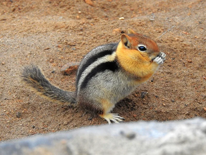
Common Golden-mantled Ground Squirrel Callospermophilus lateralis -
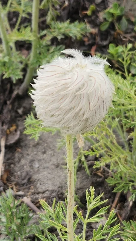
white pasqueflower Pulsatilla occidentalis -
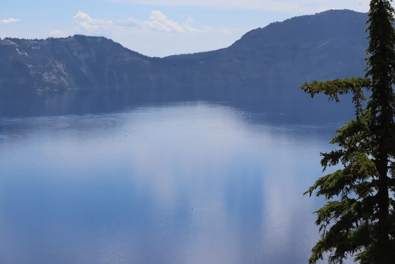
mountain hemlock Tsuga mertensiana -
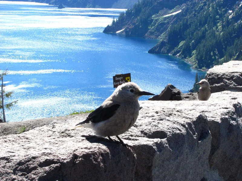
Clark's Nutcracker Nucifraga columbiana -
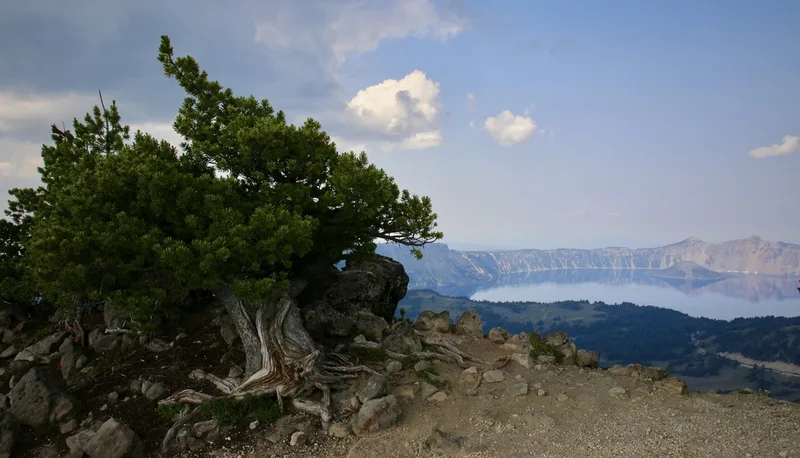
Whitebark Pine Pinus albicaulis -
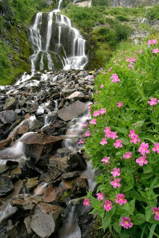
Lewis' monkeyflower Erythranthe lewisii -
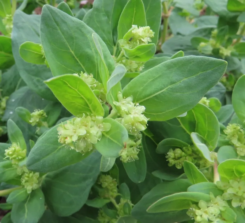
Davis' knotweed Koenigia davisiae -
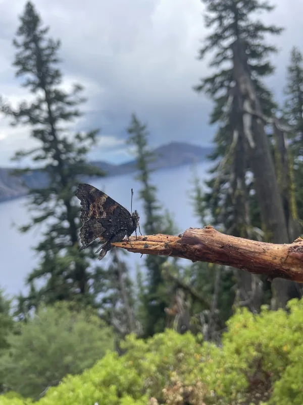
California Tortoiseshell Nymphalis californica -
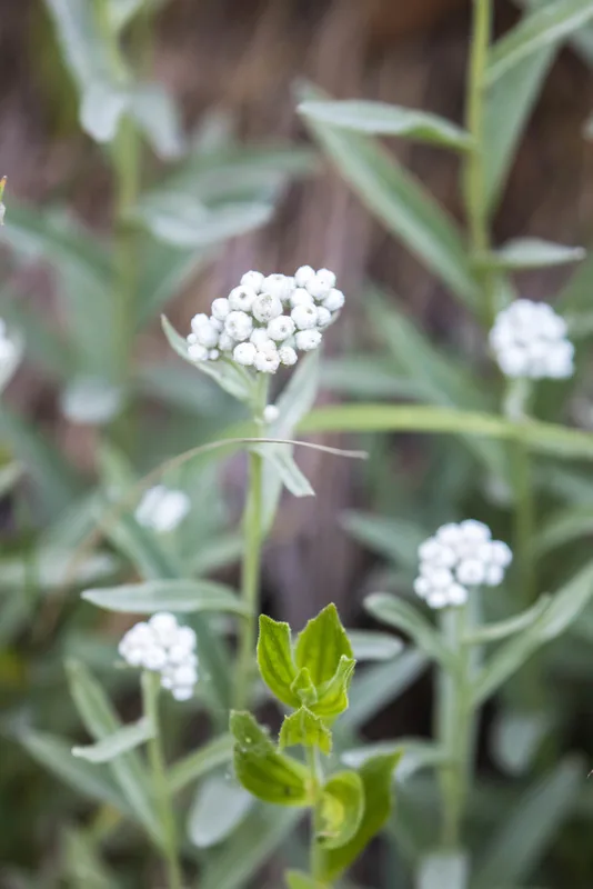
pearly everlasting Anaphalis margaritacea -
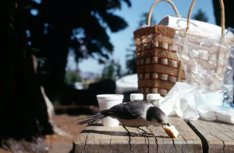
Canada Jay Perisoreus canadensis -
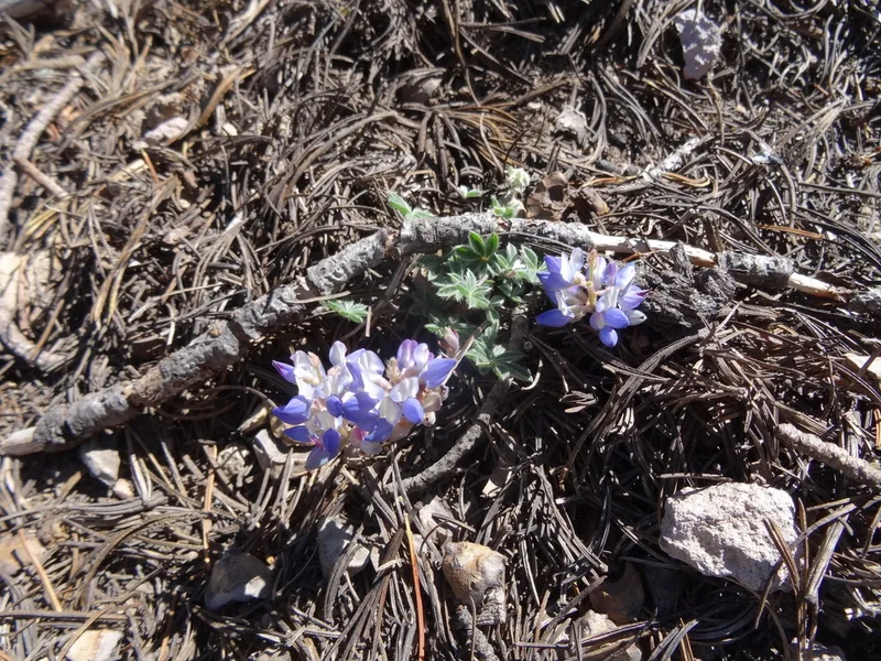
Dwarf Lupine Lupinus lepidus -
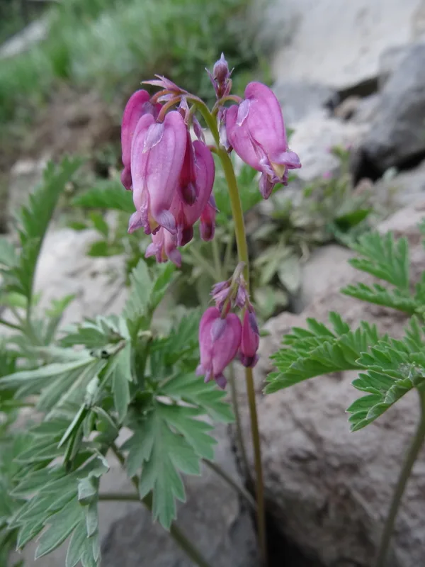
Pacific Bleeding Heart Dicentra formosa
Field Notes · Volcanic lens · Crater Lake National Park · 42.9317, −122.1279