Columbia River Gorge
Columbia River Gorge National Scenic Area · Oregon–Washington, USA
The river is older than the cliffs it runs through.
Also seen through Desert & Deep Time · all at Columbia River Gorge National Scenic Area →.
Why here
The Columbia River did not wait for the mountains to move out of its way. It kept flowing west as lava covered the country, then cut back through the new rock and made a passage across the Cascade Range. The Gorge is the visible record of that argument: cliffs of basalt, slopes softened by weather, and a river still occupying the low line between them. Water wins here by repetition rather than spectacle. A flow arrives, a crack opens, a slope gives way, and the river carries the pieces onward. Look from the ridges, then return to the trailheads and creeks where smaller water is doing the same work. Every stop is another scale of the river’s long persistence.
The story
The payload’s geological column includes the Grande Ronde Basalt and water-bearing deposits. The basalt forms the hard framework of the Gorge; streams and the Columbia exploit its joints, softer layers, and low places.
The living landscape changes with the moisture. Oregon oak and grasswidow occupy open slopes, while wetter ravines hold different plants. The river corridor has also carried roads, towns, and working landscapes, but its oldest structure remains water moving through rock. Read the Gorge as a cross-section rather than a single overlook.
The sites
The river's cut
Goat Point
45.7932, −121.6901
Goat Point gives the Gorge its broadest reading. The river sits below a stack of dark volcanic rock, and the distance lets you see how a single watercourse can occupy a passage through a much larger mountain system. The cliffs are not one wall but layers and breaks, each offering water a different weakness to follow. Stand long enough to see the river’s surface change with light. The point is not a dramatic bend but the relationship between a persistent low line and the country raised around it.
Trace the river from one opening in the cliffs to the next. Look for places where streams descend from the darker layers; those small cuts are the same argument in miniature.
- AccessShort walk
- ExertionEasy
- TimeAn hour
Evans Ridge Trail
45.6756, −121.2953
From Evans Ridge, the Gorge becomes a country of separate slopes rather than a single canyon. Walk with the river below and watch how ridges divide the water that falls on them. Rain and snow do not simply collect in the main channel; they take many shorter routes through cracks, gullies, and ravines before joining the Columbia. The basalt gives the country its strong shoulders, but erosion supplies the detail. This is a place for a slower geological view, one in which the river’s work is distributed across the whole landscape.
Find a small ravine cutting down from the ridge. Follow it visually until it meets a larger drainage. Water reaches the river by many side arguments before the main current carries it west.
- AccessHalf-day hike
- ExertionModerate
- TimeHalf a day
Water in smaller voices
Rock Creek Trailhead
45.7643, −122.3214
Rock Creek makes the Gorge’s main idea audible at a smaller scale. A creek needs no grand canyon to cut into a slope. It follows the path of least resistance, carrying sediment, undercutting banks, and leaving a narrow record of movement through the forest. The trailhead is a useful pause from the big viewpoints because it brings attention to water close to the ground. Listen for changes in pitch where the creek passes over stones. The sound tells you about the channel’s shape before your eyes do.
Find a stretch where the creek moves from a smooth run into riffles. The change in sound marks stones and uneven ground interrupting the current, which is how a small stream begins to sort its bed.
- AccessShort walk
- ExertionEasy
- TimeHalf a day
Life on the basalt
Silver Star Mountain
45.7477, −122.2390
Silver Star Mountain looks across a landscape built from hard volcanic rock but softened by weather and plants. Open slopes give the eye a chance to see the layers, while the mountain’s height exposes the way clouds and rain meet the Gorge. Oregon oak and grassland plants occupy drier ground; gullies and shaded faces hold more moisture. The living pattern is therefore another map of the river’s work. Where water can stay, soil deepens and plants gather. Where the slope sheds it quickly, the basalt remains more visible. The mountain is a place to read those differences together.
Compare an open, sun-facing slope with a shaded gully. The denser growth in the gully is a visible record of water lingering there longer.
- AccessHalf-day hike
- ExertionStrenuous
- TimeA full day
Pilot Knob
45.8007, −121.8854
Pilot Knob offers a compact view of hard rock, moving water, and living cover. The name gives you a point to orient from, but the useful material is the ground around it: exposed volcanic surfaces beside soil-bearing slopes, with the river corridor extending beyond. Look for Oregon oak in the open country and the smaller plants that flower where a thin layer of dust has collected. The Gorge is often described by its scale, yet its character depends on these small transitions. A river can win a long argument one crack at a time.
Look for a plant rooted in a shallow pocket on the exposed rock. The pocket catches dust and water, making a small island of soil where the surrounding basalt stays bare.
- AccessShort walk
- ExertionEasy
- TimeAn hour
When it's best
Spring brings high water and the strongest sense of the Gorge as a river-made passage, while the open slopes can carry early flowers. Summer is drier and clearer, with grassland and oak country easier to explore. Fall brings cooler light and changing leaves in the wetter pockets. Wind can make exposed viewpoints feel much colder than the valley floor, so layer for movement between river and ridge.
Go deeper
The names behind what you saw. The dark cliff rock is Grande Ronde Basalt, part of the Columbia River Basalt Group. Plants in the payload include Oregon oak, Quercus garryana, and grasswidow, Olsynium douglasii.
To read next. - The Columbia River Basalt Group — a starting point for the flood-basalt story behind the Gorge’s cliffs. - The payload’s geological map sources — useful for tracing how individual flows and stream cuts meet along the corridor.
The names behind what you saw
What lives here, and what it's called. Photographs from open collections — an aid to identification, not decoration.
-
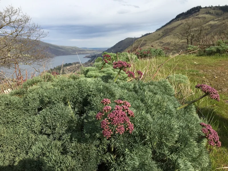
Columbia Desert Parsley Lomatium columbianum -
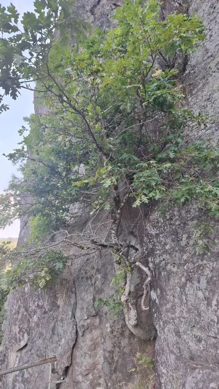
Oregon oak Quercus garryana -
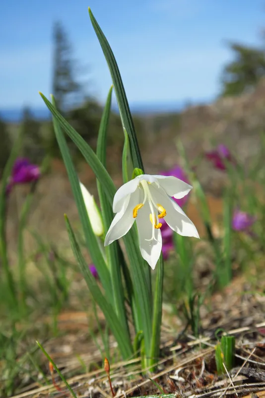
grasswidow Olsynium douglasii -
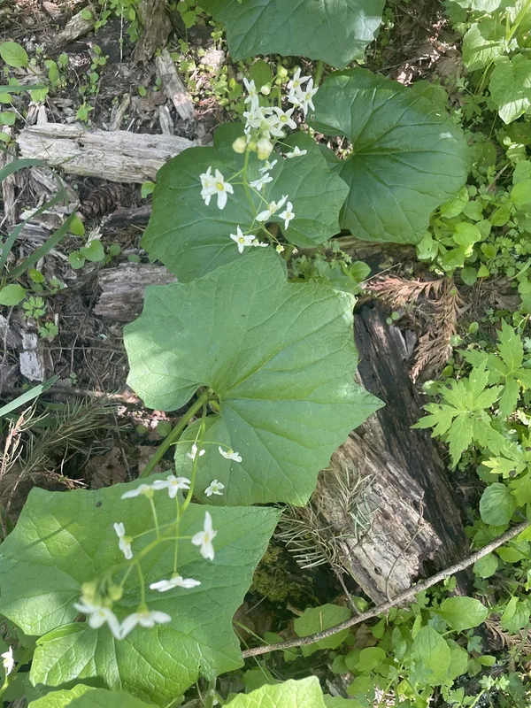
coastal manroot Marah oregana -
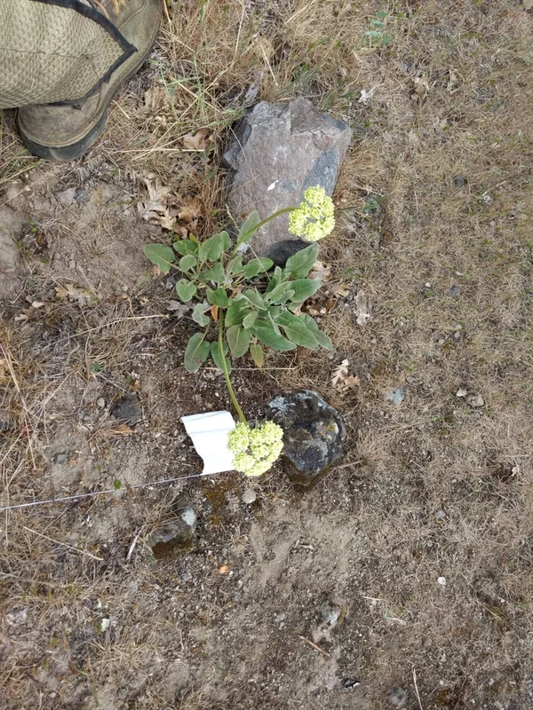
Arrowleaf Buckwheat Eriogonum compositum -
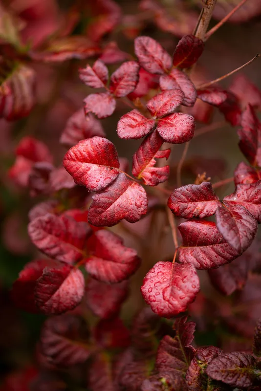
Pacific poison oak Toxicodendron diversilobum -
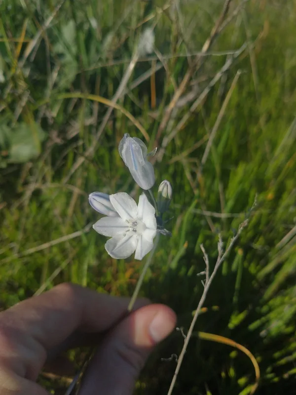
large-flowered triteleia Triteleia grandiflora -
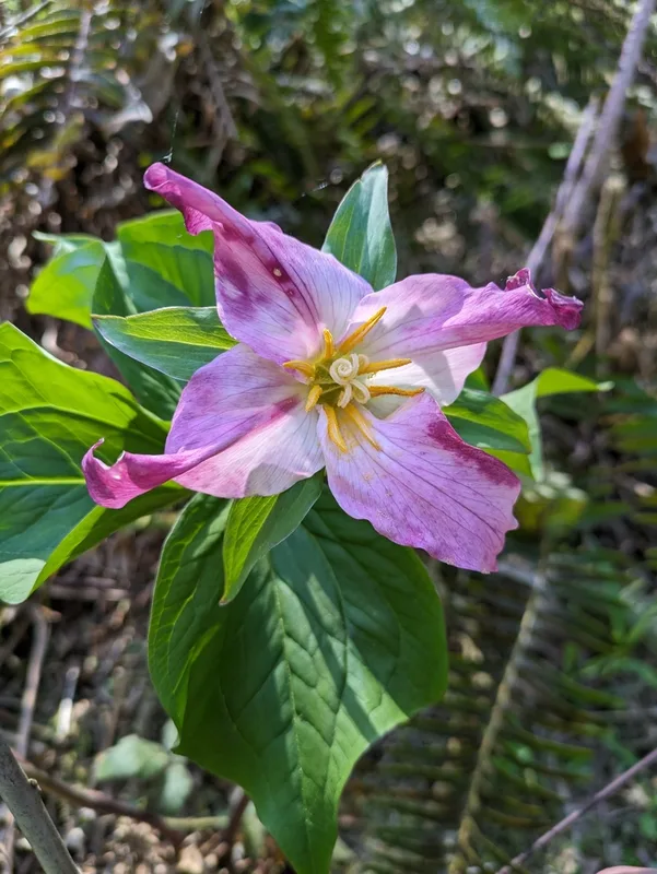
Pacific trillium Trillium ovatum -
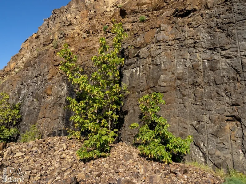
bigleaf maple Acer macrophyllum -
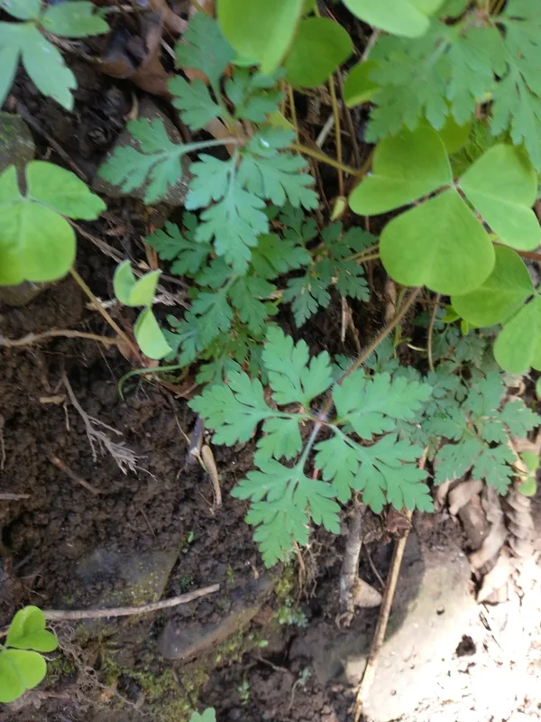
Herb Robert Geranium robertianum -
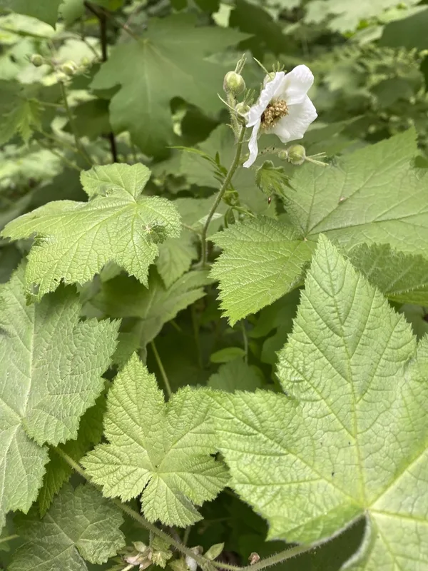
thimbleberry Rubus parviflorus -
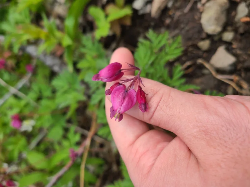
Pacific Bleeding Heart Dicentra formosa
Field Notes · Rivers & Canyons lens · Columbia River Gorge National Scenic Area · 45.6575, −121.0745