Columbia River Gorge
Columbia River Gorge National Scenic Area · Oregon–Washington, USA
Follow the river far enough east and the trees thin, the grass takes over, and the rock stops hiding.
Also seen through Rivers & Canyons · all at Columbia River Gorge National Scenic Area →.
Why here
Drive east through the Gorge and the forest simply runs out. Somewhere past the halfway point, dense conifer gives way to open grass and bare basalt, and the cliffs stop being scenery glimpsed between trees and become the main event. The Cascades wring most of the rain out of the air on their western slopes, so the eastern half of the Gorge lives in a rain shadow — drier, browner, and far less covered than the mossy canyon most visitors picture. What that dryness leaves behind is a rock face you can actually read: layer after layer of old lava, laid bare instead of buried under forest duff. Between the flows, thin bands of sand and gravel mark the quieter stretches when rivers ran across the land instead of lava. Wildflowers that need bare, rocky ground and little competition crowd into the gaps left by all that exposure. This note follows the Gorge’s dry eastern shoulder, where the rock keeps no secrets and the plants that grow on it have made a living out of standing in the open.
The story
The land came first, in layers. Basalt flowed here again and again over millions of years, sheet after sheet burying whatever grew on the surface before it. Between eruptions, rivers had time to lay down sand, gravel, and beds of loose conglomerate before the next flow sealed them under fresh rock — the striped column beneath the Gorge holds tens of millions of years of that rhythm, lava and river taking turns. On the dry east end, that column stays close to the surface instead of vanishing under soil and timber, so it is here that the rhythm is easiest to see.
Life arrived once the rock had a face to grow on. Grasswidow and desert parsley root straight into thin, rocky soil and bloom early, before summer heat and taller grass close the window. Arrowleaf buckwheat holds on through the dry months on ground almost nothing else will take. Scattered Oregon oaks, built for drought, stand alone on slopes too rocky and too dry for a closed forest to form.
People built more quietly on this stretch than on the wetter west end of the Gorge. Columbia Hills State Park, on the Washington side, only took its current shape in 2003, joined together from two older parks around a reservoir on the river. Beyond that, the record for this dry shoulder of the Gorge is thinner than for the canyon’s showier west end — worth exploring, not yet fully told.
The sites
The open column: rock without a green screen
Horsethief Butte
45.6496, −121.0960
Horsethief Butte rises out of open grassland at the eastern, driest reach of the Gorge, a low tower of basalt with almost nothing growing on its flanks. That bareness is not accidental. West of here, the Cascades strip the rain out of the marine air moving up the Columbia; by the time weather reaches this stretch, there is little left to fall, and the plants that would otherwise mask the rock — moss, fern, dense conifer duff — simply cannot get a foothold. What is left standing is basalt, laid down in repeated eruptions during the Miocene, when floods of lava spread across this whole region in sheet after sheet. As each flow cooled, it split into the blocky columns and slabs still visible on the butte’s face, and if you look closely at the exposed rock you can pick out where one flow ended and the next began. Between the biggest lava events, rivers had time to move sand and gravel across the surface before it was buried again — traces of that quieter interval show up as paler, looser bands low on the outcrop. Horsethief Butte is a short climb for what it shows: a cross-section of a rhythm that repeated for millions of years, standing in the open instead of hidden under forest.
Walk the base of the butte and look for a change in the rock’s texture partway up — a band that looks more crumbly or layered than the solid basalt above and below it. That softer band is an old riverbed, sand and gravel that settled here in the pause between two lava flows before the next eruption sealed it under fresh rock.
- AccessShort walk
- ExertionEasy
- TimeAn hour
Stacker Butte
45.7135, −121.1015
Stacker Butte tops out the grassy highlands above Columbia Hills State Park, high enough that on a clear day the view runs both up and down the Gorge — a long, open sightline made possible by the same dryness that keeps the local grass short and the rock exposed. The climb crosses bare basalt grassland for most of its length, with almost no tree cover to block the view of the layered cliffs across the river. That layering is the story: this whole stretch of the Gorge sits on a stack of lava flows put down over millions of years, punctuated by shorter stretches when rivers, not eruptions, controlled the surface and left behind beds of sand and gravel. From this height, the pattern reads less like scenery and more like a diagram — pale sedimentary streaks pinched between broader bands of dark basalt, repeating up the walls of the canyon. Wind here is nearly constant, another product of the same rain-shadow dryness, and it has helped keep the summit grassland open rather than letting brush take hold. Stacker Butte rewards patience more than speed: the higher you climb, the more of the Gorge’s layered history comes into view at once.
From the open summit, trace one continuous dark band of rock as it runs along the far canyon wall across the river. Try to follow it as far as you can in both directions — it is a single lava flow, and where it disappears from view marks roughly how far that one eruption reached.
- AccessHalf-day hike
- ExertionStrenuous
- TimeHalf a day
Signal Hill
45.6235, −121.0928
Signal Hill sits on the drier, southern side of the river, low enough to climb without a full day’s commitment but high enough to put the layered cliffs of the Washington side at eye level rather than overhead. The hill’s own slopes are largely open — bunchgrass and scattered basalt outcrop, with little of the brush and timber that cover the wetter western end of the Gorge. That openness is a direct result of geography: the Cascades to the west catch most of the rain moving in off the Pacific, leaving this stretch of the Gorge to receive only a fraction of it, too little to support the closed forest downstream. What grows here instead roots directly in cracked rock and thin soil. From partway up Signal Hill, the far canyon wall shows the same repeating pattern found across this end of the Gorge: dark basalt in thick bands, each one a separate flood of lava, interrupted here and there by paler streaks where rivers briefly held the ground before the next eruption buried it. The hill is a modest climb, but it puts that pattern in full, unobstructed view — a small rise doing the work of a much longer hike.
Look across the river toward the Washington side and count how many distinct dark bands you can pick out stacked in the cliff face. Each one marks a separate lava flow — the more you can count, the more individual eruptions are stacked in that one section of wall.
- AccessHalf-day hike
- ExertionModerate
- TimeHalf a day
What roots in bare rock
McCall Point
45.6687, −121.3038
McCall Point climbs through open grassland on the Oregon side of the Gorge’s dry eastern reach, ground that supports almost none of the dense forest found closer to Portland. The thin, rocky soil here is exactly what certain wildflowers need. Grasswidow and Columbia desert parsley both push up early, often while the ground is still cool, taking advantage of bare rock and little competition before taller grasses fill in later in the season. Arrowleaf buckwheat holds on through the drier months that follow, rooted straight into cracked basalt where almost nothing else can get purchase. None of these plants would do as well in the shaded, moss-covered soil of the Gorge’s western end — they depend on exactly the openness that the rain shadow creates. The climb itself gains real elevation, with long stretches of exposed slope and little shade, so plan for sun and wind rather than tree cover. Near the top, the grassland gives way to bare rock again, and the view opens across the river to the layered cliffs on the Washington side. McCall Point is as much a lesson in what dry ground supports as it is a viewpoint — the flowers on the way up are the point, not just the scenery at the top.
Early in the season, look for small clusters of pale purple flowers growing almost directly out of bare rock or gravel, low to the ground and leafless at first. That is grasswidow, one of the first wildflowers to bloom here each year, timed to beat the grass that will later crowd it out.
- AccessHalf-day hike
- ExertionModerate
- TimeHalf a day
Wasco Butte
45.6168, −121.3359
Wasco Butte rises from the same dry grassland belt as the wildflower slopes nearby, but it carries less foot traffic and fewer signs of a maintained route, so treat any climb here as a cross-country undertaking rather than a marked trail. The reward is the same open, rocky habitat found across this end of the Gorge, without the company. Thin soil over broken basalt supports scattered stands of Oregon oak, a tree built for drought and poor ground that would lose out to conifers anywhere wetter. Between the oaks, low-growing wildflowers root directly into gravel and cracked rock, doing on Wasco Butte’s slopes what they do across the whole dry shoulder of the Gorge: taking advantage of open ground that denser vegetation can never quite close over. The butte’s higher slopes are mostly bare rock and short grass, offering a clear view down toward the river and across to the layered basalt walls on the far side. Because there is little tree cover to break the wind or the sun, this is not a shoulder-season stroll — go prepared for exposure in both directions. Wasco Butte rewards those willing to navigate rather than follow a sign, with a quieter version of the same open, rock-and-wildflower country found at the more visited stops nearby.
Find one of the scattered, gnarled oaks growing alone on the open slope, away from any cluster of trees. Its twisted, low shape is a response to wind and drought rather than crowding — an oak here has no forest to compete with, only weather to survive.
- AccessHalf-day hike
- ExertionModerate
- TimeHalf a day
Where the dry country widens
Haystack Butte
45.6813, −120.9089
Haystack Butte stands near the eastern edge of the Gorge, where the canyon has widened out and the country starts to feel less like a river corridor and more like open range. The rock here is the same layered basalt found throughout the dry end of the Gorge, but with fewer canyon walls close by to frame it, the scale reads differently — long, low ridgelines instead of towering cliffs. That change says something about deep time as much as geography: the flood basalts that built the whole Gorge did not stop at the canyon’s edges, they spread across a much larger stretch of the interior Northwest, and buttes like this one are outliers of the same rock sheets exposed elsewhere in more dramatic cliff faces. Grass and scattered dry-country shrubs cover the lower slopes, thinning out toward bare rock higher up. There is little shelter from sun or wind at any point on the climb, a reminder of just how far this spot sits from the moist, forested country only a day’s drive to the west. Haystack Butte is less a single dramatic viewpoint than a chance to feel the Gorge’s dry country keep going past where most visitors turn back.
From partway up, look west back along the line of the river corridor and try to spot where the vegetation changes from open grass and bare rock to visibly denser green. That line marks, roughly, where the rain shadow starts losing its grip and the wetter west end of the Gorge begins.
- AccessHalf-day hike
- ExertionModerate
- TimeHalf a day
Gordon Butte
45.5648, −120.8859
Gordon Butte sits at the far eastern edge of the Gorge’s mapped country, past where most established trails give out. No maintained route is guaranteed here, so a visit means route-finding across open range rather than following signs — an undertaking for the well prepared, with a full day set aside and a plan for water and weather, since there is no forest cover anywhere on the approach. What makes the effort worthwhile for this lens is the setting: this is about as dry and open as the Gorge gets, shaped by the same rain-shadow effect that dries out the whole eastern half of the canyon. The basalt underfoot is the same flood-lava rock found throughout the dry end of the Gorge, but here it sits under grass and bare ground with almost no distraction — no waterfall, no dense forest, nothing but rock, sky, and wind. Species that depend on exactly this kind of open, competition-free ground do well on slopes like these. For a visitor who has already spent time on the more accessible buttes closer to the river, Gordon Butte is the place where that same dry, bare-rock story plays out with nobody else around to share it.
Stand still for a minute and take in how open the ground is in every direction — no trees, no shade, nothing to break the wind. That bareness is the same rain-shadow dryness described elsewhere in this note, working here without the forest cover or waterfalls that soften it closer to the river.
- AccessExpedition
- ExertionStrenuous
- TimeA full day
When it's best
The wildflowers that define this dry side of the Gorge are a spring event, usually starting in early spring and finishing before the heat sets in — grasswidow and desert parsley are typically among the first up, blooming on bare rock and thin soil while the grass around them is still short. By summer this whole stretch turns hot, dry, and exposed, with little shade anywhere on the open buttes, so a summer visit rewards an early start and plenty of water over a midday climb. Winter brings the region’s small share of rain and occasional snow to the higher summits, quieting the grassland until the following spring. The rock itself, though, is a year-round draw — the layered basalt that gives this end of the Gorge its readability is exposed in every season, and a clear day at any time of year will show the stacked flows across the canyon walls.
Go deeper
The names behind what you saw. The basalt underfoot is Grande Ronde Basalt, part of the Columbia River Basalt Group — a series of Miocene-age flood-lava eruptions that repeatedly buried this whole region. The interbedded sand, gravel, and conglomerate mark quieter stretches when rivers, not lava, controlled the surface. Grasswidow is Olsynium douglasii; Columbia desert parsley is Lomatium columbianum; arrowleaf buckwheat is Eriogonum compositum; the scattered oaks are Oregon oak, Quercus garryana.
To read next. - The Geological Society of America’s preliminary geologic map of the Columbia River Gorge National Scenic Area lays out, unit by unit, the same layered basalt and sedimentary rock described on these buttes. - The Wikipedia entry on the Columbia River Gorge gives the scale of the canyon as a whole — its length and depth — for readers who want the geography behind the geology. - The entry on Columbia Hills State Park covers the park bordering several of these buttes, useful background for anyone approaching Horsethief Butte or Stacker Butte from the Washington side. - The Wikipedia entry on the Columbia River situates this dry stretch of the Gorge within the much longer river system it belongs to.
The names behind what you saw
What lives here, and what it's called. Photographs from open collections — an aid to identification, not decoration.
-
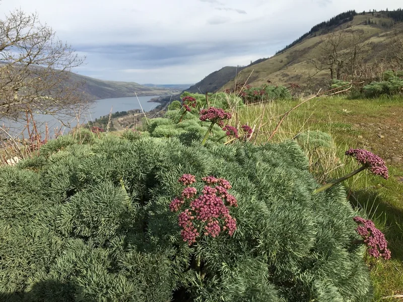
Columbia Desert Parsley Lomatium columbianum -
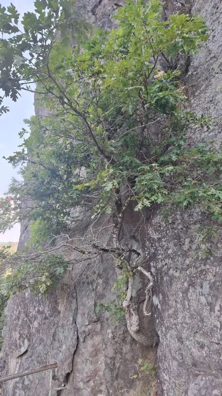
Oregon oak Quercus garryana -
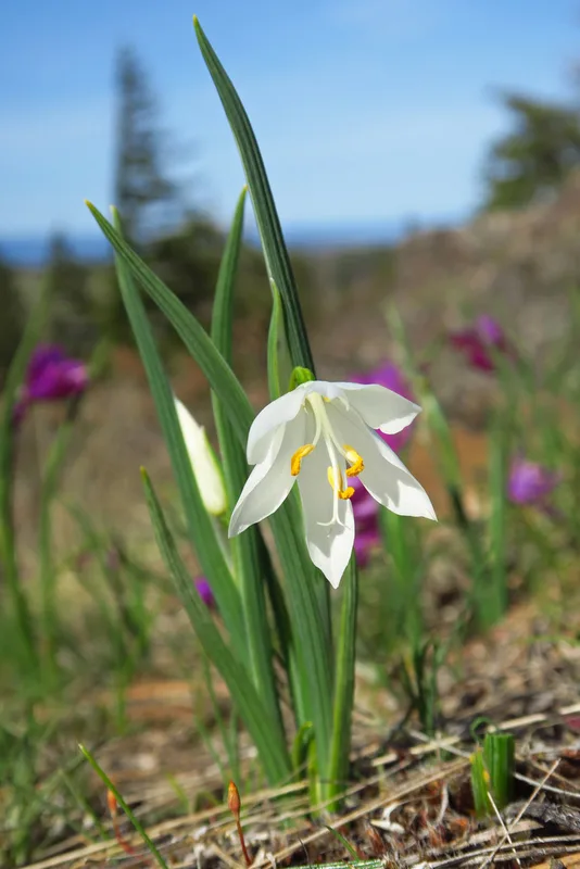
grasswidow Olsynium douglasii -
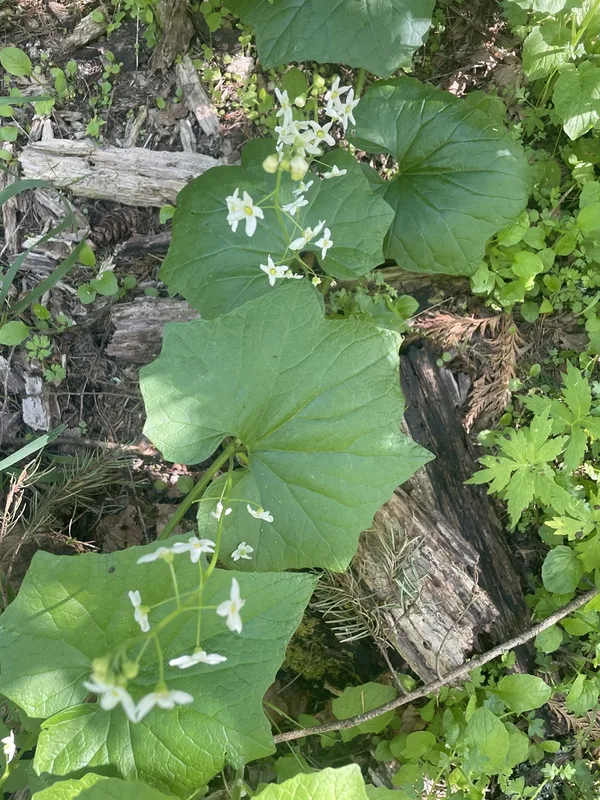
coastal manroot Marah oregana -
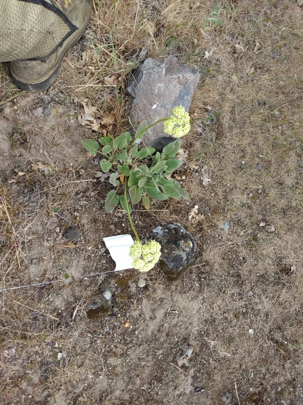
Arrowleaf Buckwheat Eriogonum compositum -
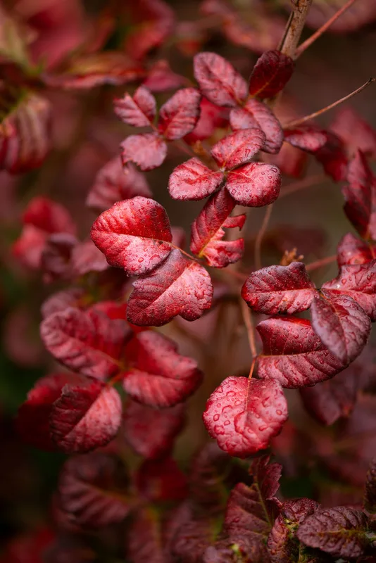
Pacific poison oak Toxicodendron diversilobum -
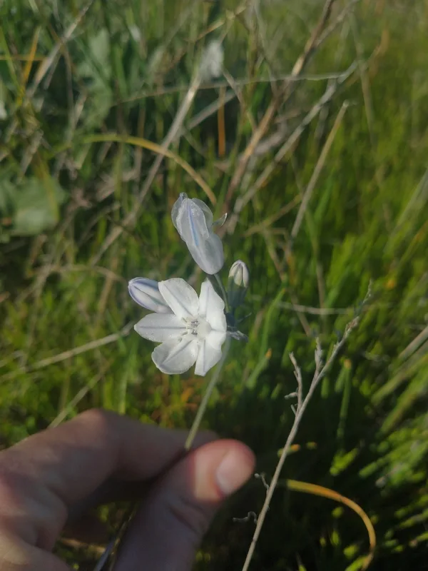
large-flowered triteleia Triteleia grandiflora -
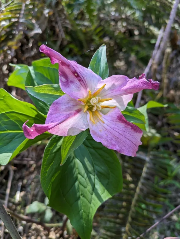
Pacific trillium Trillium ovatum -
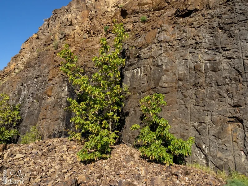
bigleaf maple Acer macrophyllum -
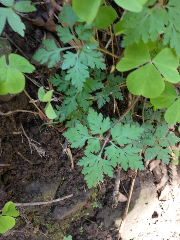
Herb Robert Geranium robertianum -
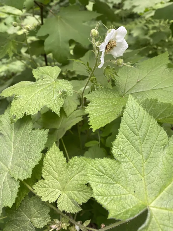
thimbleberry Rubus parviflorus -
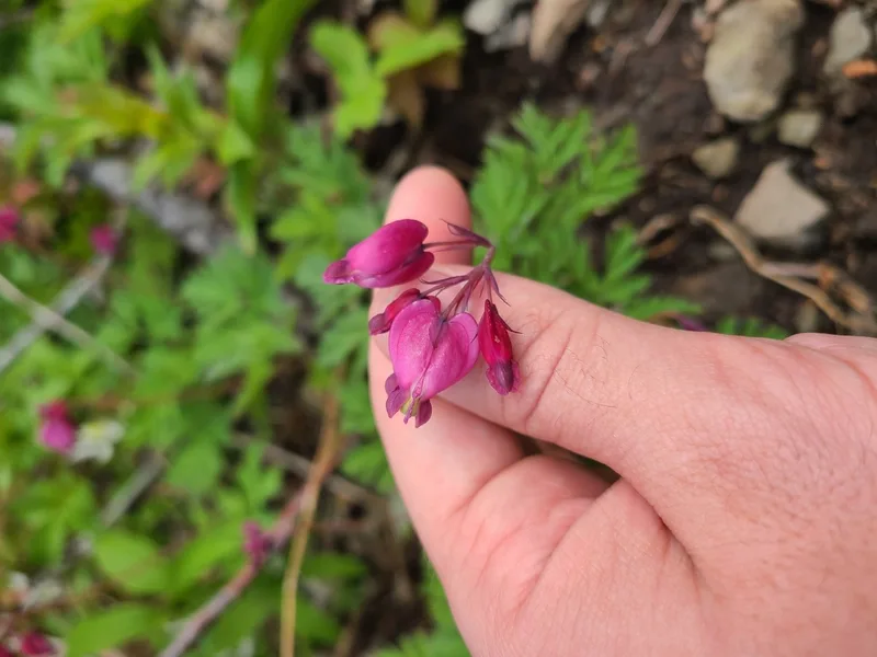
Pacific Bleeding Heart Dicentra formosa
Field Notes · Desert & Deep Time lens · Columbia River Gorge National Scenic Area · 45.6575, −121.0745