Channel Islands
Channel Islands National Park · California, USA
Cold water is the whole story here; the islands are only where you climb out to watch it.
Also seen through Desert & Deep Time · all at Channel Islands National Park →.
Why here
Stand at the edge of any of these islands and the sea below is a different color than the water you left on the mainland — darker, colder, busier. That cold is the reason for everything. Along this coast the ocean does not simply sit: deep water rises to the surface, carrying up the nutrients that sank there, and where cold northern water meets the warmer south the sea turns unusually rich. The islands are only the dry tops of a drowned range, close enough to the mainland to see across yet held apart by that cold channel. What the water grows, everything else eats. Sea lions haul out on the rocks; brown pelicans fold and dive; dolphins run the channel in the hundreds. The islands stayed largely undeveloped and the sea around them became a protected sanctuary, so the old abundance is still here to watch from a cliff edge. Everything in this note comes back to one fact: the sea here is cold, and cold water is full.
The story
The land came first, and it came from the sea floor. The rock of these islands is old marine sediment — sand and mud that settled underwater long ago and was later lifted into daylight — so the islands are, in a sense, the sea turned inside out. They rose close to the mainland but never joined it, and that near-miss is the whole biological story. Animals that managed to reach the islands were stranded, and cut off from their kin, they became their own kind: the mammoths that reached these islands shrank, over generations, into a dwarf elephant no taller than a person.
People arrived astonishingly early. On Santa Rosa, the bones of a man who lived about thirteen thousand years ago are among the oldest known in North America — support for the idea that the first Americans traveled down the coast by boat, living on what the rich water gave. The Chumash held three of these islands — Santa Cruz, Santa Rosa, and San Miguel — for thousands of years, a sea people who crossed the channel between island and mainland.
The water that fed them still does. Under later protection the islands stayed largely undeveloped and the surrounding sea became a sanctuary, so the food web the Chumash knew — the sea lions, the diving birds, the life below the surface — runs much as it did. What you watch from the cliffs is not a restored place but a continuous one: the same cold current, still doing the same work.
The sites
The kelp forest edge
Cavern Point
34.0542, −119.5647
This grassy headland stands above the northeast corner of Santa Cruz Island, where the seafloor drops away fast into cold, clear water. From the edge you look straight down onto a kelp canopy and the open channel beyond — the richest strip of sea in the park, close enough to shore to watch from dry land. It is the best place to grasp the whole note in one glance: cold water below, and the animals it feeds moving through it.
From the point, scan the dark water just off the rocks where the kelp thins into open channel. On a calm morning you may catch brown pelicans diving, sea lions resting at the surface, or the low fins of a dolphin pod crossing — all of them here for the same cold, crowded water. Bring binoculars; a boat is needed to reach the island.
- AccessShort walk
- ExertionEasy
- TimeAn hour
Scorpion Rock Overlook
34.0474, −119.5518
A short climb from the Scorpion anchorage brings you to this overlook above Scorpion Rock, a stack of bare stone standing just offshore. Seabirds crowd rocks like this one because they sit safe from land predators and ringed by feeding water. The rock is a small, plain lesson in why the islands matter to birds: isolation above, abundance below.
Look out to Scorpion Rock and the cliff ledges for cormorants standing wing-out to dry, or a black oystercatcher working the waterline on red legs. The birds nest and rest on the rock precisely because nothing can reach them there. Binoculars help; reaching the overlook means a boat to the island first.
- AccessShort walk
- ExertionEasy
- TimeAn hour
Anacapa: seals, tidepools, and nesting cliffs
Landing Cove
34.0168, −119.3623
Every visitor to Anacapa arrives here, stepping off the boat onto a ladder and climbing the stairs cut into the cliff. Before you climb, the cove itself is the show: sea lions bark and loll on the low rocks, and the water is clear down to a kelp bed that snorkelers and kayakers work close to shore. This is the sea at its most direct — you enter the island through its living edge.
From the landing, watch and listen for California sea lions hauled out on the rocks around the cove; their bark carries before you see them. They rest here between feeding runs into the cold water offshore. To see the kelp bed that feeds them, a snorkel or kayak and a calm day are needed.
- AccessShort walk
- ExertionModerate
- TimeAn hour
Pinniped Point
34.0137, −119.3659
The name is the plainest description in the park: this is a point where pinnipeds haul out. California sea lions rest on the rocks below, climbing out of the cold water to warm and sleep between hunts. They can afford to loaf here because the sea just offshore is thick with the food they need.
From the overlook, find the flat, sea-washed rocks below and the pale shapes of sea lions crowded onto them. They come ashore to rest and warm between feeding runs, then slide back into the cold water to hunt. Binoculars turn a distant smudge into a hundred animals.
- AccessShort walk
- ExertionEasy
- TimeAn hour
Cathedral Cove
34.0156, −119.3680
This cove on Anacapa’s north side is cut into sea caves and arches, with rock benches that the tide uncovers twice a day. When the water pulls back it leaves shallow pools full of the small, tough animals of the intertidal zone — the edge where the rich sea meets the bare island. Gulls nest on the slopes above, feeding on what the same water provides.
At low tide, work slowly along the exposed rock benches below the cove and look into the pools left behind for anemones, crabs, and clinging snails. Each pool is a pocket of the cold sea, stranded for a few hours until the tide returns. Time your visit to a tide table and the lowest water, and turn over no rock you can’t set back exactly.
- AccessShort walk
- ExertionModerate
- TimeHalf a day
Inspiration Point
34.0129, −119.3741
From this point at the west end of Anacapa, the islet chain strings away toward Santa Cruz across open water. It is the best wide view of how these islands sit — small, low tops rising from a cold channel, each ringed by the same feeding water. The channel between them is a highway for birds and dolphins moving from one rich patch to the next.
Look west along the chain of islets and out over the channel for lines of pelicans and cormorants flying low to the water, and, on a calm day, the broken surface of a dolphin pod. They travel the channel because the feeding is good the whole way across. Early, still mornings give the clearest view.
- AccessShort walk
- ExertionEasy
- TimeAn hour
Anacapa Island
34.0154, −119.3635
The island’s orientation sign near the landing lays out what you have come to: the smaller island of Anacapa, a thin, low spine of rock. Its size is the point. Too small for much fresh water, it was never much settled, and its bare cliffs belong mostly to the seabirds and the sea lions. What the island lacks in land, the water around it makes up.
Stand at the sign and look from the map to the cliffs it describes, then down to the water. The island is little more than a nesting rock and a haul-out ledge set in a productive sea — the whole park in miniature. No gear needed; a boat brings you here.
- AccessShort walk
- ExertionEasy
- TimeAn hour
The outer rock
Santa Barbara Island Light
33.4874, −119.0303
Far to the south, alone in open ocean, tiny Santa Barbara Island carries a light on its heights to warn ships off. It is the most isolated stop in the park and the hardest to reach, served by only occasional boats. That isolation is exactly why its cliffs and surrounding water teem: few people, no predators on the rock, and cold, productive sea on every side.
From near the light, scan the cliff ledges and the water below for nesting seabirds — guillemots and cormorants among them — and sea lions on the rocks at the island’s base. Everything living here depends on the rich water that isolation keeps wild. Reaching the island is a long boat crossing; check the schedule well ahead.
- AccessExpedition
- ExertionModerate
- TimeWorth two days
When it's best
The sea sets the calendar here more than the land does. Spring is the season of cold, nutrient-heavy water, when the upwelling is strongest and the food web is at its fullest — the months when sea lions crowd the haul-out rocks and diving birds pack the sea cliffs to nest. Pelicans and cormorants are easiest to see then, working the water close to shore. The best tidepooling comes on the year’s lowest tides, when the water pulls far back off the rocks; check a tide table and time your walk to the water’s edge for the hour around low tide. Common dolphins run the channel year-round, but calm mornings give the best chance of spotting them. The crossing itself is weather, not season: the channel can be flat or rough on any given day, and afternoons usually bring more wind than mornings.
Go deeper
The seals on the rocks are California sea lions, Zalophus californianus; the pods offshore are common dolphins, Delphinus delphis. The diving birds are brown pelican, Pelecanus occidentalis, and western gull, Larus occidentalis; the cormorants standing wing-out on the rocks are Brandt’s cormorant, Urile penicillatus, and pelagic cormorant, Urile pelagicus, alongside the pigeon guillemot, Cepphus columba, and the red-legged black oystercatcher, Haematopus bachmani. The dark ducks riding the swell are surf scoter, Melanitta perspicillata. The dwarf elephant of the island past is the pygmy mammoth, Mammuthus exilis; the sea-laid rock beneath everything is the region’s Miocene marine sandstone and shale.
- Donald W. Weaver, Geology of the Northern Channel Islands (1969) — the classic account of how this sea-laid rock was built and lifted into islands.
- Contributions to the Geology of the Northern Channel Islands, Southern California (1998) — a deeper collection for readers who want the whole rock story.
- Mammuthus exilis from the California Channel Islands (2009) — the dwarf-mammoth study, the clearest single case of what island isolation does to a stranded animal.
The names behind what you saw
What lives here, and what it's called. Photographs from open collections — an aid to identification, not decoration.
-
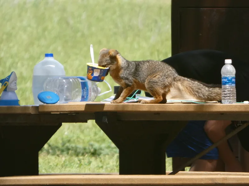
Island Fox Urocyon littoralis -
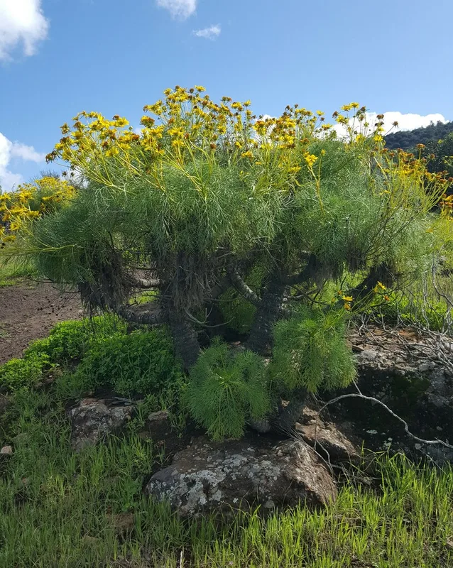
giant coreopsis Leptosyne gigantea -
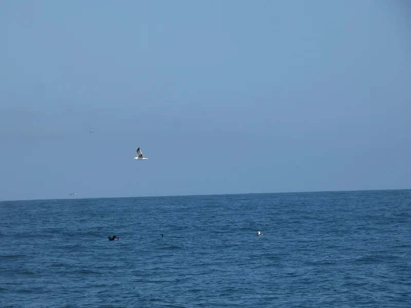
Western Gull Larus occidentalis -
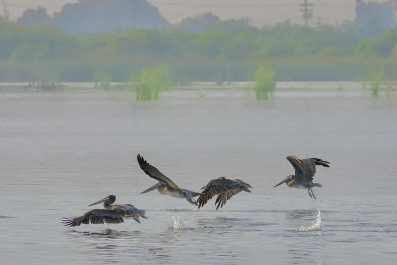
Brown Pelican Pelecanus occidentalis -
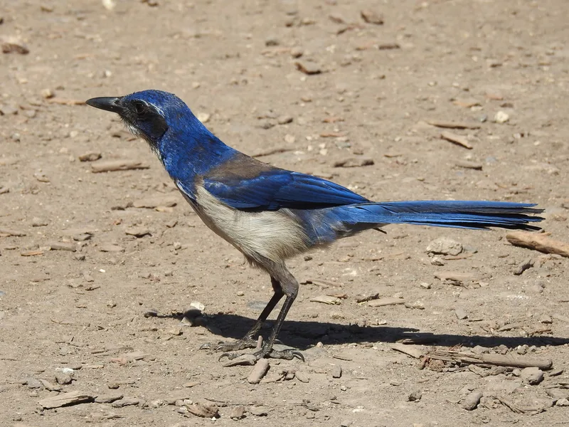
Island Scrub-Jay Aphelocoma insularis -
Common Side-blotched Lizard Uta stansburiana -
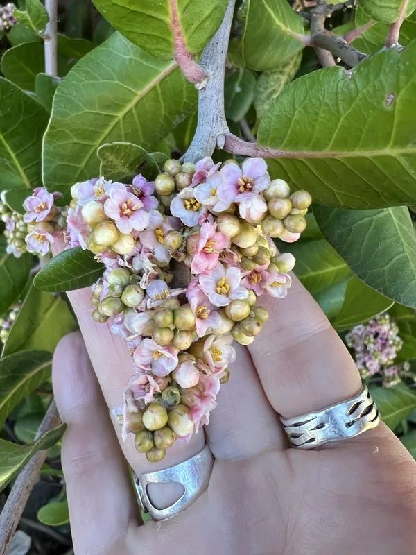
lemonade berry Rhus integrifolia -
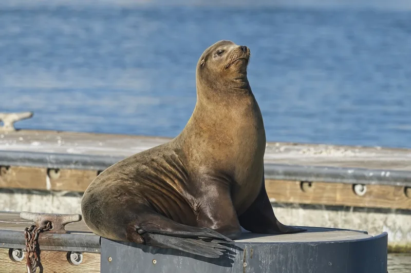
California Sea Lion Zalophus californianus -
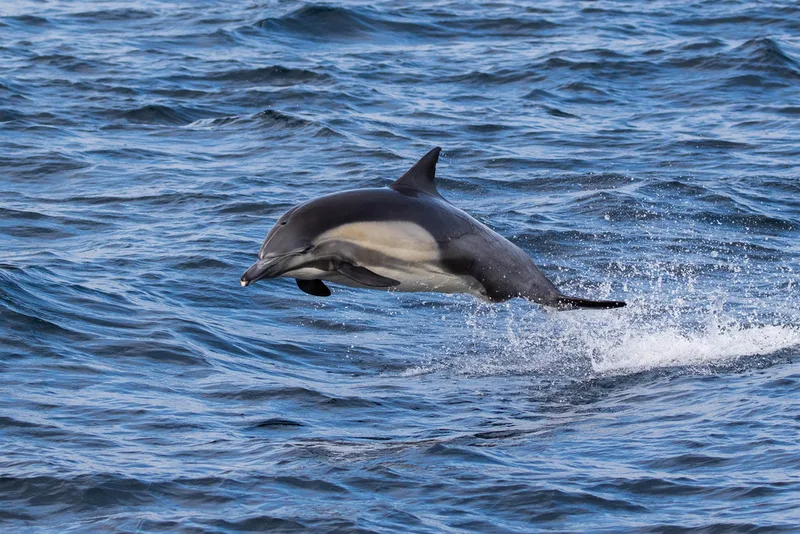
Common Dolphin Delphinus delphis -
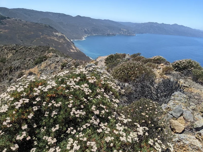
Santa Cruz Island wild buckwheat Eriogonum arborescens -
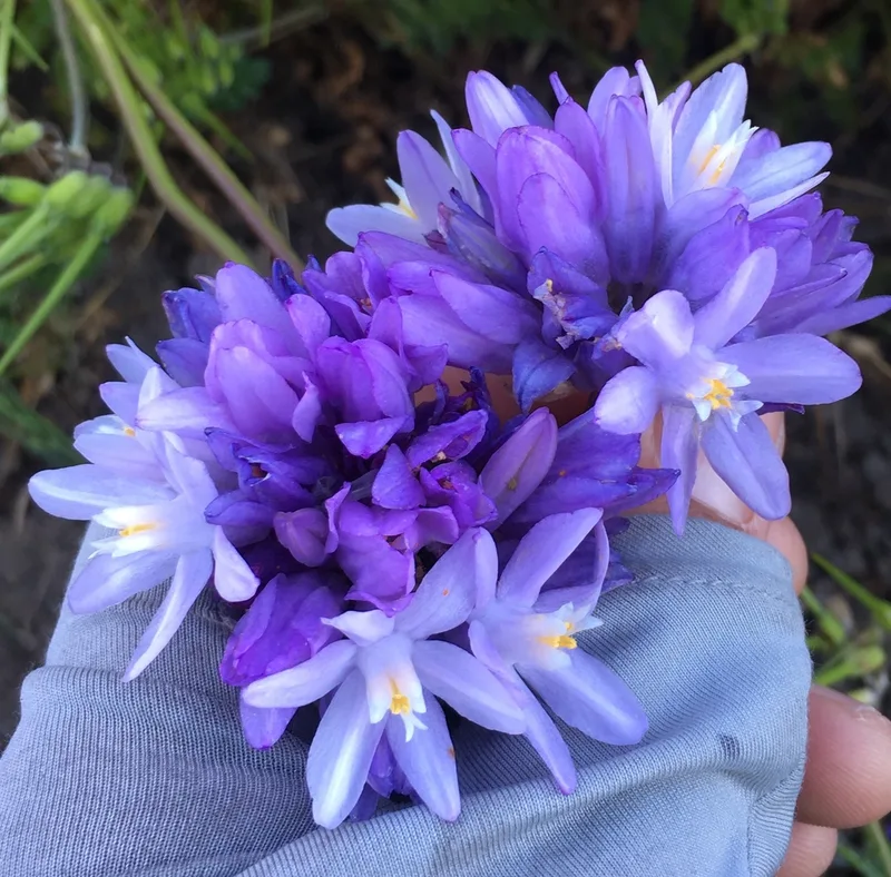
blue dicks Dipterostemon capitatus -
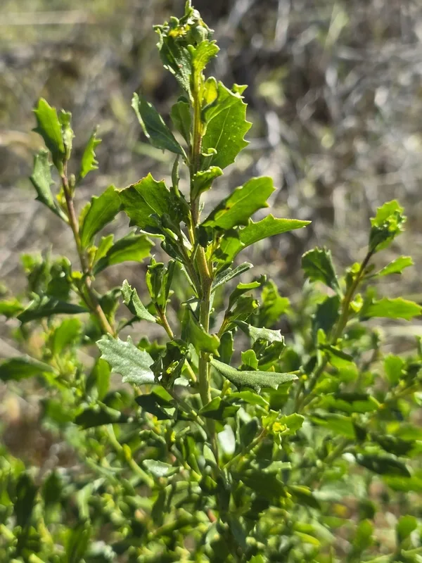
coyote brush Baccharis pilularis
Field Notes · Marine lens · Channel Islands National Park · 33.9664, −120.0954