Channel Islands
Channel Islands National Park · California, USA
The water moved on. The sea floor stayed, and simply rose into the light.
Also seen through Marine · all at Channel Islands National Park →.
Why here
Walk to almost any cliff edge on these islands and look down: the rock is banded, pale layer stacked on pale layer, running along the shoreline as far as you can see. Every band is a trace of the old sea floor — a skim of sand or mud that settled, was buried by the next skim, and waited. Enough ordinary days like that, piled up over a very long stretch of time, built a stack of sea-bottom thick enough to become rock. Then the ground beneath it lifted, the way land slowly rises along much of this coast, until the old sea floor stood up out of the water and became five dry islands. Little forest grows here to hide that story — the cover is mostly low, wind-pruned scrub and grass — so the layered rock stays close to the surface and legible nearly everywhere you look, cliff after cliff, peak after peak. These islands are not simply scenery. They are an old sea floor, propped open, and every place you stand on them is a page of it.
The story
The land came first, built the slow way: sand and mud sank to an old sea floor here, one layer after another, until there was enough of it to become rock. Later the ground lifted — this coast rises in fits and starts — far enough that layers once underwater now cap ridgelines well above it. The rock kept rising and the islands kept drying; today, little of the cover here is forest. It is grass and low, salt-toughened shrub, open enough that the striped rock underneath is rarely far from view.
That openness suits particular lives. Giant coreopsis, a shrub with a crown of yellow daisy flowers each spring, holds a hillside in a way a thirstier plant could not. The island fox, found nowhere else in the world, moves across these open slopes by day with little of the caution a mainland fox would need — there has been nothing here large enough to hunt it. Both are answers to the same bare, dry, exposed country the rock created.
People read that openness too, and early. On Santa Rosa, the bones of a man who lived roughly thirteen thousand years ago are among the oldest known in North America, a discovery that helped make the case that the first Americans could have come down this coast by water rather than only over land. Later, the Chumash held three of these islands, crossing the channel to work a coastline that was more open rock than forest.
The sites
Cliffs cut open
Landing Cove
34.0168, −119.3623
Every visitor to Anacapa arrives here, climbing a stair cut straight up the cliff from the boat landing. Most people are watching the sea lions or the view; the stairway itself is worth a slower look. The steps are cut through the same banded rock that caps the whole island. At the top, the same rock continues out along the island’s low, treeless spine, holding almost nothing back from view. The climb is short but steep, and there is no shade on the way up or at the top, so plan for open sun. Pause partway and you’re standing inside the very stack of old sea floor the rest of this note keeps pointing at — not reading about it from a distance, but inside it.
As you climb the stairway, look at the cut rock face beside the steps rather than out at the view. Find where the color or texture changes from one band to the next — each change marks a fresh skim of sand or mud that settled on the old sea floor, later buried by the next. Count the bands you can pick out between two steps; it’s a fast, rough way to see how many separate layers make up just this one small slice of cliff.
- AccessShort walk
- ExertionModerate
- TimeAn hour
Cathedral Cove
34.0156, −119.3680
Cathedral Cove sits on the seaward side of East Anacapa, where the same layered rock as the landing stairway has been cut and hollowed by the sea into steep walls and a narrow inlet. Waves work at the base of a cliff for a very long time before they open it up like this, following whichever layer is softest and giving way first. The result is a cove with close to vertical rock on both sides, tall enough to feel the scale of the stack from underneath rather than from above. It’s a different way of reading the same rock you saw at the stairway — there, you climbed up through the layers; here, you look up the whole face of them at once, from sea level to the rim. Low shrub often grows right to the cliff edge above, holding what soil there is, but the rock walls themselves stay bare down to the waterline, too steep and too worked by salt spray for anything to take hold. It’s a clear view of how much rock the sea has already taken away, and how much is still standing.
Stand where you can see the full height of the cove’s rock walls, from the waterline to the rim above. Follow the banding up the cliff face and see whether it stays level or tilts — a tilt means this stack of old sea floor was pushed out of position after it formed, not just lifted flat. If the cove is calm, listen for how the waves sound different against exposed rock than against a beach; that is water still doing the work you’re looking at the results of.
- AccessShort walk
- ExertionModerate
- TimeHalf a day
Inspiration Point
34.0129, −119.3741
Inspiration Point sits at the far end of East Anacapa’s short trail, looking west along the low, jagged line of the rest of the island chain. From here the islands read as what they are: a broken line of high points on a single stack of old sea floor, mostly drowned again except where it still clears the water. Nothing about the view is soft. The rock runs pale and treeless out toward the horizon, holding onto only a scatter of shrub and grass, and the drop from the point to the water below is sheer the whole way, with no gentler slope anywhere in sight to break it. From here you can see the shape of the whole idea at once — not one cliff or one cove, but the outline of an entire drowned range, most of it still under the sea, catching daylight only at its highest ridges, this point among them.
From the point, look along the line of low islands and rock stacks running off to the west. Notice how their tops sit at roughly the same height above the water — a rough clue that they’re pieces of one continuous old surface, since separated and partly resubmerged rather than built up individually. On a clear day you can trace that shared skyline for a long stretch before it fades into haze.
- AccessShort walk
- ExertionEasy
- TimeAn hour
Peaks above the old sea floor
Black Mountain
33.9789, −120.0790
Black Mountain is one of the high points of Santa Rosa Island’s interior, well back from any boat landing and reached only by a long day’s walk across open, wind-scoured ground. From up here the layered rock that shows in cross-section down at the coast becomes something else: a whole landscape built from it, rounded and worn rather than sheer. The island’s interior has almost no tree cover to soften the view — grass and low shrub run over most of it — so the shape of the old, uplifted sea floor is visible for miles in every direction, ridge after ridge of the same rock family, weathered by wind and rain into something closer to a rolling plain than a coastline. Reaching the summit means committing to the walk; there’s little water and less shade along the way, and the wind rarely lets up. What you get in return is a long, unbroken read of the same stack of rock the coastal cliffs only show you in cross-section, this time laid out flat and wide instead of standing on edge.
From the summit, look at how the surrounding hills rise and fall in long, smooth curves rather than sharp points. That rounded shape is what happens when the same layered rock seen at the coastal cliffs spends a very long time exposed to wind and rain inland, with nothing but grass to hold it in place. Compare the openness here with a forested mountain you know; the difference is mostly what’s missing from the ground cover.
- AccessHalf-day hike
- ExertionStrenuous
- TimeA full day
Twin Peaks
33.9924, −120.1330
Twin Peaks rise as a matched pair above the western half of Santa Rosa Island, one of several such paired high points on the same lifted stack of old sea floor. Paired or ridged summits like these are common on islands built from stacked marine rock. Standing between the two points, with open grassland running down on every side and almost nothing taller than shrub in view, you can see how thoroughly the interior of this island has been stripped down to its structure. There is no forest here to round off the edges or hide the shape of the uplift; wind and dry ground have kept it looking close to bare. It’s a long walk in from any landing, with real exposure to sun and wind the whole way, but the reward is seeing the folded, paired shape of the rock at true scale rather than as a line on a map.
Stand between the two summits and look at how the ridgeline connecting them dips before rising again to the second peak. A dip like that between two matched high points is often where the rock folded down instead of up when the whole mass was pushed out of the sea. Trace the ridge with your eyes from one peak to the other and see if you can find where the low point sits.
- AccessHalf-day hike
- ExertionStrenuous
- TimeA full day
Soledad Peak
33.9511, −120.1056
Soledad Peak stands near the southern edge of Santa Rosa Island’s high ground, one more summit in the same broken line of old sea floor that runs the length of the island. From up here the geography does most of the talking: ridge after ridge, nearly level-topped, running out toward the coast where the same rock ends abruptly in cliffs. That evenness across so many separate high points is a useful clue on its own — it suggests the whole surface was pushed up and worn down together, as one connected piece, rather than each peak growing on its own schedule. The climb up is long and exposed, crossing open, treeless country the whole way, with the wind picking up the higher you go. There’s a plainness to the ground itself: pale rock breaking through thin, dry soil, grass cropped low by wind and sun, almost nothing to interrupt the view of the rock underneath. Few visitors make it this far inland, which is part of what keeps the summit’s structure so legible — nothing built, nothing planted, just the old sea floor still holding its shape at altitude.
From Soledad Peak, pick two or three other high points along the ridgeline and compare how level their tops sit against the horizon. A shared, even skyline like that across separate peaks is a sign they were once part of one continuous surface, since cut into separate summits by valleys eroding between them. Binoculars help pick out the level line against the sky on a hazy day.
- AccessHalf-day hike
- ExertionStrenuous
- TimeA full day
The outer islands, driest and barest
Green Mountain
34.0410, −120.3885
Green Mountain is the high point of San Miguel Island, the westernmost and most exposed of the park’s islands, set furthest out into open ocean and weather. Despite the name, there is little green about the summit for much of the year; wind here runs hard and near-constant, strong enough to keep trees from ever taking hold and to keep even low shrub cropped and sparse across long stretches of ground. What’s left uncovered is rock and pale, wind-packed soil. San Miguel sits furthest from the mainland and sees the fewest visitors of the group; reaching it takes real commitment, a long crossing followed by a long walk on genuinely open, unsheltered ground. That distance is part of why the island’s structure stays so legible: little has been built on it, and the wind has done more to shape the surface than people have. Reaching the summit means a long day out on exposed ground, but it’s a clear place to see how far bare rock and thin soil can go when nothing softens them.
Once on the ridge, notice how little separates you from bare ground in any direction — no trees anywhere on the skyline, and shrub only in isolated, low patches. Feel how steady and strong the wind is even on what looks like a calm day elsewhere in the park; that wind is doing much of the work of keeping this summit as open as it is.
- AccessExpedition
- ExertionStrenuous
- TimeWorth two days
Signal Peak
33.4720, −119.0412
Signal Peak is the high point of Santa Barbara Island, the smallest and most remote of the park’s islands, little more than a mile across and set well south of the others. Its small size means there’s no interior to speak of — from most points on the island you can see the sea in more than one direction, and the whole surface reads as a single stripped-down unit rather than a landscape with distinct regions. Vegetation is low and sparse across nearly all of it: mostly grass and a scatter of shrub, nothing tall enough to block the view of the pale rock underneath. That bareness makes the island a useful, almost simplified version of what the rest of the park’s geology looks like at a larger scale — an old sea floor lifted clear of the water, worn down, and left with very little to cover it. The crossing to Santa Barbara Island is longer than to the northern islands, so a visit here takes real planning. In return, the whole island can be seen and understood from this single high point.
From Signal Peak, turn in a full circle and count how many directions show open water rather than more land. On an island this small, that view does the work that a hundred separate overlooks would do somewhere larger — you’re seeing nearly the whole rock at once, not a slice of it.
- AccessExpedition
- ExertionModerate
- TimeWorth two days
Santa Barbara Island Light
33.4874, −119.0303
The old light station sits above Santa Barbara Island’s steep northern edge, where the same bare, wind-scoured rock that covers the summit runs straight down to the sea in an unbroken drop. From here you can see how directly the island’s small size and its geology are connected: there is so little of it, and so little softening the surface, that the drop from the highest ground to the water happens in one continuous slope rather than a series of gentler steps. Sites like this were chosen for exactly the reason this one still makes a good stop today — height, and nothing in the way of the view. Standing here and looking back across the island’s low profile toward Signal Peak, you’re looking at essentially the whole of Santa Barbara Island’s exposed rock in a single glance — an old sea floor with almost nothing left covering it.
From the light station, look down the unbroken slope toward the water and try to find any natural break — a ledge, a bench, a change in angle — partway down. On an island this small and this exposed, a smooth, uninterrupted drop like this is common; there has been little time or cover for the rock to weather into anything gentler.
- AccessExpedition
- ExertionModerate
- TimeWorth two days
When it's best
The rock itself doesn’t change with the seasons, so there’s no wrong time to come read it. What shifts is the color around it: for a stretch in spring the open slopes carry a flush of giant coreopsis, its yellow flowers set hard against the pale, bare stone, usually strongest by mid-spring and gone again once the flowers dry. The islands run through the same dry stretch the rest of this coast does each summer, when the grass browns and the rock stands out even more starkly against it; winter rain, when it comes, is the one thing that briefly greens the open ground before the bare country returns.
Go deeper
The pale, banded rock under most of these cliffs is what geologists call the region’s Miocene marine rock — sandstone, shale, and siltstone laid down on an old sea floor roughly 27 to 4 million years ago. The fox that walks these slopes by daylight is the island fox, Urocyon littoralis; the yellow-flowered shrub on the open hillsides is giant coreopsis, Leptosyne gigantea; the blue-black bird calling from the brush is the Island Scrub-Jay, Aphelocoma insularis, found only on Santa Cruz Island. The small lizard sunning on bare rock is the common side-blotched lizard, Uta stansburiana, and the gray-leaved shrub gripping the cliff edges is Santa Cruz Island wild buckwheat, Eriogonum arborescens.
To read next: - Donald W. Weaver, Geology of the Northern Channel Islands (1969) — the original detailed survey of the rock these cliffs are cut from. - Geologic Maps for Geology of the Northern Channel Islands, Southern California Borderland (Weaver, 1969) — the companion maps, useful for tracing one layer across more than one island. - Contributions to the Geology of the Northern Channel Islands, Southern California (1998) — a later collection that expands on Weaver’s original mapping. - Mammuthus exilis from the California Channel Islands: Height, Mass, and Geologic Age (2009) — a study of the islands’ dwarf mammoth that ties an extinct animal directly to the rock layers preserving it.
The names behind what you saw
What lives here, and what it's called. Photographs from open collections — an aid to identification, not decoration.
-

Island Fox Urocyon littoralis -
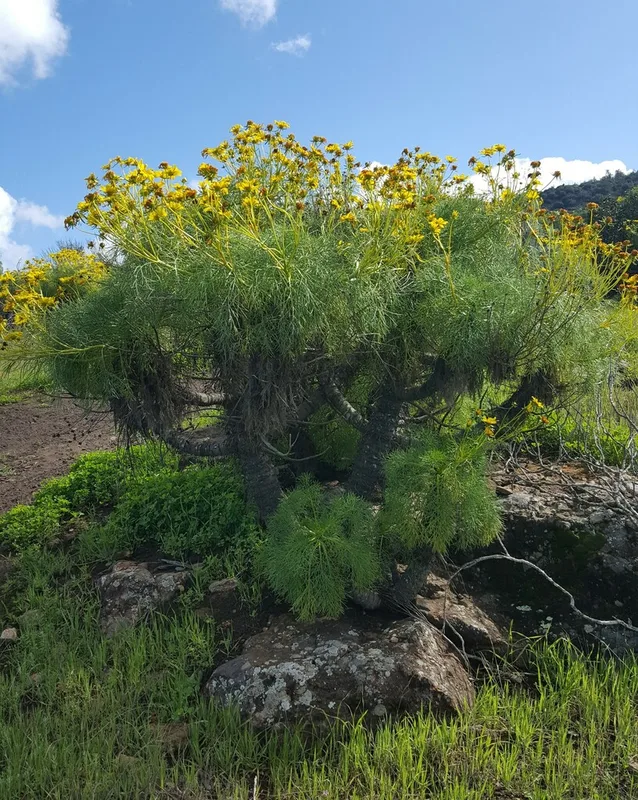
giant coreopsis Leptosyne gigantea -
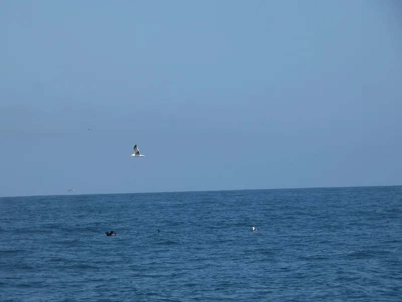
Western Gull Larus occidentalis -
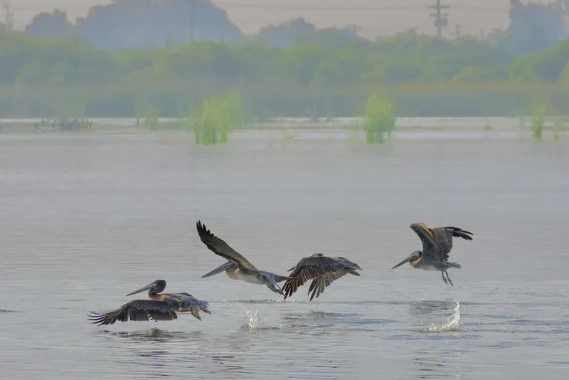
Brown Pelican Pelecanus occidentalis -
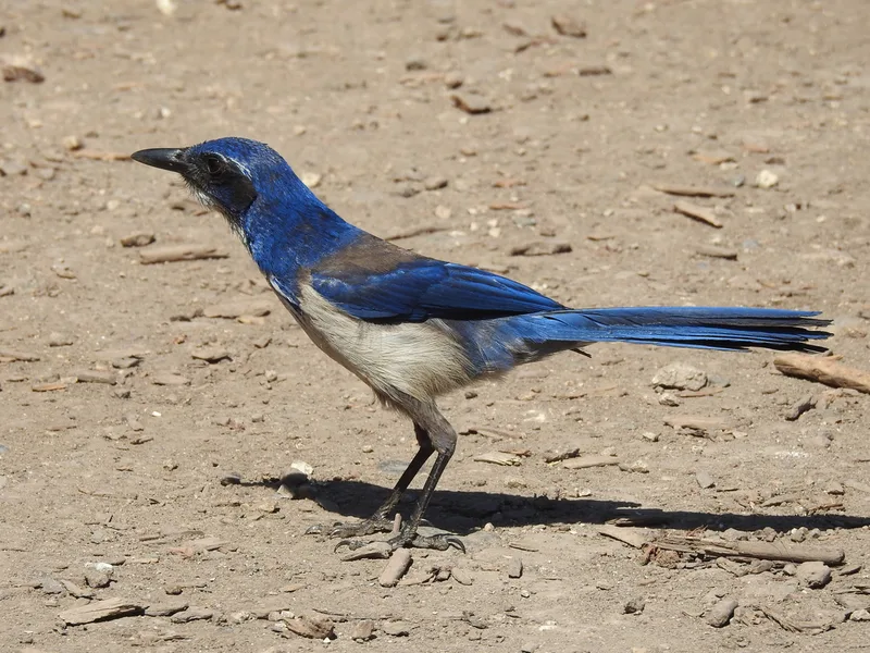
Island Scrub-Jay Aphelocoma insularis -
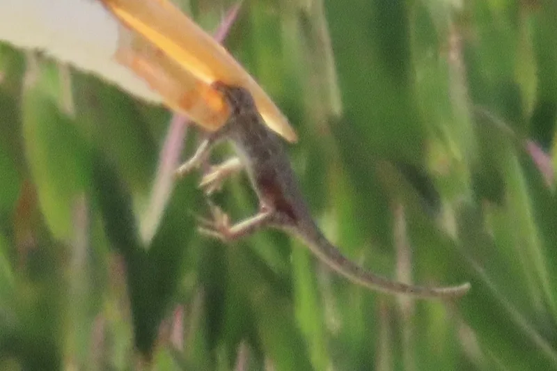
Common Side-blotched Lizard Uta stansburiana -
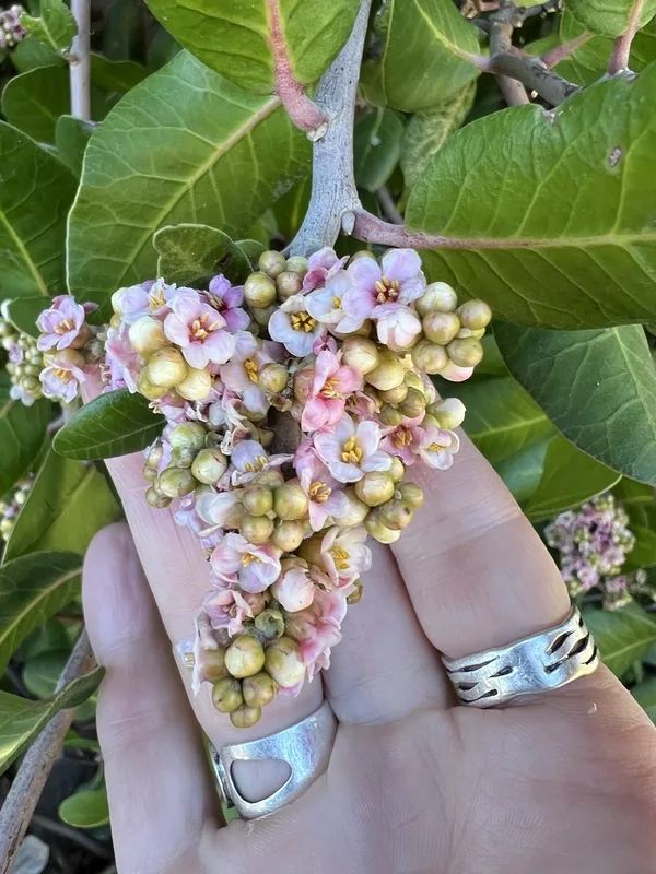
lemonade berry Rhus integrifolia -
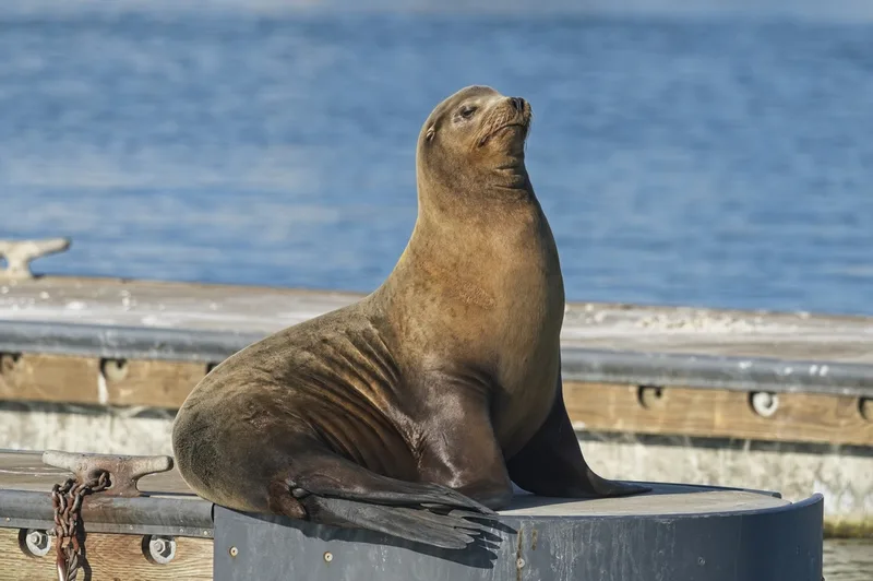
California Sea Lion Zalophus californianus -
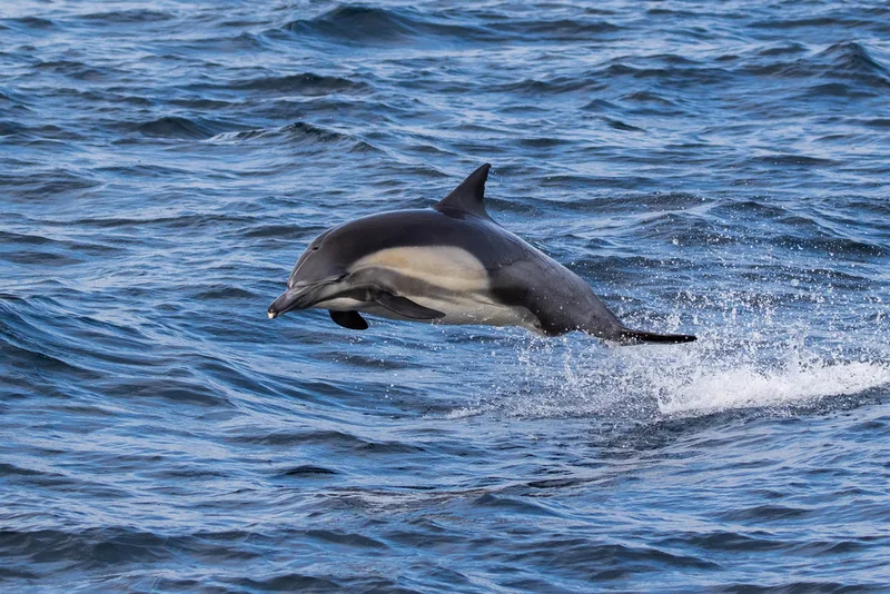
Common Dolphin Delphinus delphis -
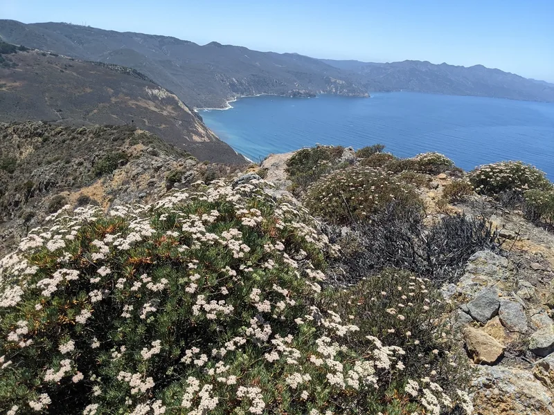
Santa Cruz Island wild buckwheat Eriogonum arborescens -
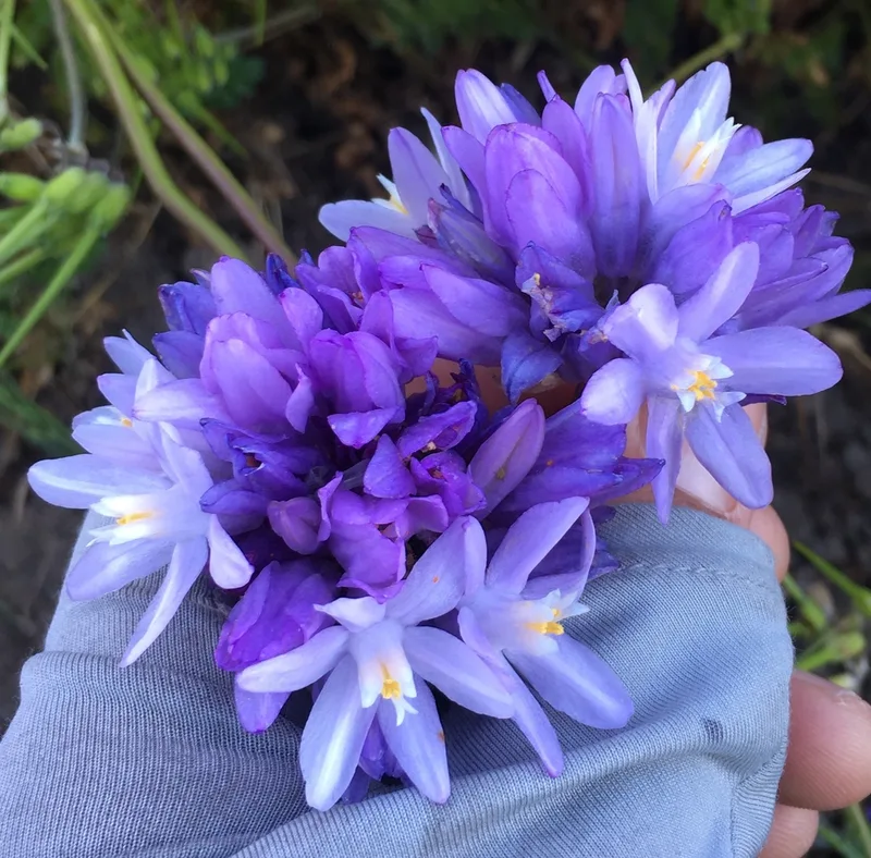
blue dicks Dipterostemon capitatus -
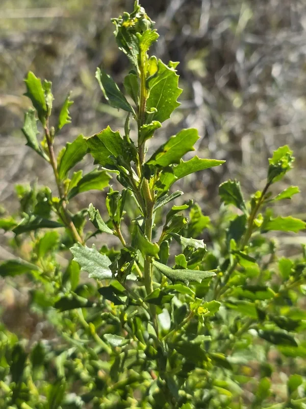
coyote brush Baccharis pilularis
Field Notes · Desert & Deep Time lens · Channel Islands National Park · 33.9664, −120.0954