Capitol Reef
Every layer of this rock is an old river's signature, and the river running through it now is still adding its own.
Also seen through Desert & Deep Time · all at Fruita →.
Why here
The floor of Fruita is not really rock so much as old water, set hard. Long before anything here was a cliff, this ground was a coast — rivers spreading over mudflats, a shallow sea coming and going, red mud and sand piling up between one flood and the next. All of that got buried, squeezed, and turned to stone, layer stacked on layer, until it stood for good. Then a newer river arrived and refused to leave. Instead of finding a way around the rising rock, the Fremont River kept cutting straight down through it, the same slow argument repeated every year, and it is still going — that is the gorge you can look into from the rim above Fruita today. Every site on this list, from the wide gorge to the narrow side-canyon to the one spot where the rock has worn all the way through into a bridge, is that same argument in a different room. Follow the water here and you’re reading one of the few forces patient enough to out-stubborn stone.
The story
The story starts with water that was never trying to make a canyon. Long stretches of this ground began as a coast: rivers threading across mudflats, a shallow sea sliding in and out, red mud and sand settling in thin beds year after year. More sand and gravel piled on top later, burying that older coast under a thicker, drier stack of rock. None of it was built to be a canyon country — it became one only once a river showed up that refused to go around.
Cottonwoods mark where that river still runs, their leaves the one reliably green thing against the red rock for most of the year, and they thin out fast the moment you step away from water. Mule deer move through the same corridor, easiest to find near the river in the cooler hours. A side stream off the main river has cut its own narrow slot on the way down, proof the same pattern repeats at any scale.
People followed the water too. The best-known settlement here grew up exactly where two of these streams meet, and today its old buildings house the park’s own staff rather than the town that once lived there. Who first settled at that confluence, and why, the record here does not say — only that the confluence is still what the place is built around.
The sites
Where the river still cuts
Fremont Gorge Overlook Trailhead
38.2866, −111.2493
This trailhead climbs out of the valley floor and onto the rimrock above Fruita, and the reward at the top is a straight look down into the gorge the Fremont River has cut through the layered rock below. The walls here are stacked color by color — each band a separate stretch of ancient ground, laid down as mud flats, river channels, and a shallow sea that came and went long before there was a canyon here at all. More sand and gravel piled on top of all of that later, adding a thicker, paler cap to the stack. None of it was built to be cut open. It became a gorge only because a river arrived that refused to detour around the rising rock and instead kept sawing straight down through it, a little at a time, for longer than anyone has been watching. The climb up is short but real work in open sun, and the view rewards the effort: a working cross-section of the argument between rock and water, still being decided a little further every year underneath your boots.
From the overlook, pick one wall of the gorge and count the color bands stacked in it from bottom to top. Each band marks a separate stretch of ancient ground — river mud, drifting sand, or the edge of an old sea — laid down before the canyon existed; the river below is simply cutting a cross-section through all of it at once.
- AccessShort walk
- ExertionModerate
- TimeAn hour
Rim Overlook
38.2912, −111.2493
Rim Overlook sits well above the valley floor, high enough to see the gorge not as a single view but as a whole system — the main cut the river has made, and the smaller side-drainages feeding into it from every direction. From here the canyon reads less like a single slot and more like a tree, with the river as the trunk and every dry wash and side canyon as a branch still being carved toward it. That pattern is not decoration; it is how water organizes a whole landscape once it is allowed to keep cutting downward without interruption — every drop of rain that falls anywhere in this country is, eventually, working toward the same river below. The climb to the rim is a genuine hike, gaining real elevation over open rock with little shade, and it is worth doing slowly, in cooler hours, both for comfort and for the light — the layered walls color differently as the sun moves across them through the day. Bring more water than feels necessary; there is none to refill along the way.
From the rim, follow the drainage pattern below with your eye — the main gorge, and every smaller side-canyon feeding into it. Trace one side-canyon from where it starts, high and shallow, to where it joins the main cut; that whole shape is the print of water finding the fastest way down, one storm at a time.
- AccessHalf-day hike
- ExertionStrenuous
- TimeHalf a day
Cohab Canyon Trailhead
38.2826, −111.2462
Cohab Canyon is a side canyon, not the main event — a narrower, tighter cut than the gorge the Fremont River has carved, working its way up into the rock from a different angle. Where the main gorge is wide enough to hold a view, this one closes in around you, the walls close enough on each side that the temperature noticeably drops as you walk between them. It formed the same way every canyon in this country does: water finding the weakest path through the rock and following it down, storm after storm, until a crack became a corridor. The floor stays mostly dry most of the time, which is easy to mistake for calm — a canyon this narrow can fill fast when rain falls anywhere upstream of it, even on a clear day at the trailhead. Look for dry, polished stretches of rock in the canyon floor and smooth-sided drops where water has poured over a ledge; both are evidence of moving water doing the actual carving here, even though the canyon looks bone-dry most days you will walk it.
Where the trail narrows most, run a hand along the canyon wall at chest height. The smooth, almost polished rock there is the mark of moving water and sediment scouring the same spot again and again during flash floods — the driest-looking canyon can still be the most actively carved.
- AccessShort walk
- ExertionModerate
- TimeHalf a day
A bridge only water could make
Hickman Bridge Trailhead
38.2887, −111.2276
The trail from this trailhead leads to a natural bridge — a span of rock with open sky beneath it, standing free of the wall it once belonged to. Bridges like this form the same way every other opening in this rock does: water works along a crack or a thin fin of stone until it wears all the way through, leaving an arch of rock holding nothing up but itself. What makes a bridge different from an arch, by convention, is only that a stream once ran, or still runs, beneath it — proof this particular opening kept moving water, not just occasional rain, doing the cutting. The walk climbs gradually through open, layered country before reaching the bridge itself, and the layered rock along the way is the same old sequence visible from the gorge overlooks nearby, just closer and at eye level. Go slowly on the way up: the exposure is real in summer heat, and the last stretch to the bridge has no shade at all. The bridge itself, when you reach it, is worth a quiet minute of just standing under it before continuing on.
Stand beneath the bridge and look up at its underside. Notice how smooth and rounded the rock is compared with the sharper, more angular rock elsewhere on the trail — that rounding is the signature of water, not wind, doing the shaping.
- AccessShort walk
- ExertionModerate
- TimeAn hour
Hickman Bridge Overlook
38.2915, −111.2325
Not everyone wants the climb to stand under the bridge itself, and this overlook is the honest alternative: a vantage point near the trailhead that takes in the same stretch of carved country — the bridge’s canyon, the layered walls around it — without the elevation gain of the full trail. It is a good stop for understanding the scale of what water has done here before committing to the closer look, or a good substitute on a day when the heat or the crowd on the main trail makes the overlook the better choice. The rock visible from here carries the same story as everywhere else in this canyon system: old, water-laid layers, cut through more recently by water that is still moving. What changes from this distance is perspective — you can see the bridge as part of a larger canyon, rather than as an isolated arch, which is easy to lose once you are standing directly beneath it. Either stop earns its place; this one just asks less of you.
From the overlook, locate the bridge in its canyon and notice how small it looks against the larger cut around it. That scale is the point — the bridge is one hole in a much longer wall the same river has been working on.
- AccessDrive-up
- ExertionEasy
- TimeAn hour
Two waters meet
North Fruita Overlook
38.2871, −111.2373
Fruita is the best-known settlement inside this park, a small cluster of buildings sitting exactly where the Fremont River meets Sulphur Creek — two streams joining into a single canyon. This overlook looks down on that confluence from the north side, close enough to trace the line where the two streams’ canyons come together into one. The town itself is now a ghost town in the ordinary sense — no one lives there in the way a town usually means — though its old buildings still stand and now house people who work for the park. What the written record does not say is who chose that spot first, or why, beyond the plain fact that a confluence is exactly where you would expect people to settle in country this dry: two water sources instead of one, and a wider, gentler stretch of valley where two canyons open out into each other.
From the overlook, find the point where two canyons visibly join into one — that is the confluence Fruita sits on. Notice how the valley widens right at that meeting point; two streams do the work of opening a valley faster than one alone.
- AccessDrive-up
- ExertionEasy
- TimeAn hour
South Fruita Overlook
38.2847, −111.2398
South Fruita Overlook gives the same confluence a different angle — looking north across the valley instead of down into it, taking in the settlement, the meeting of the two streams, and the walls of layered rock rising on every side. Seen from here, Fruita reads less like a town and more like what it has always been: a low, wide spot where two cuts through the rock happen to intersect, wide enough to hold a road and a scatter of buildings and little else. The overlook is an easy stop, more about orientation than exertion — a good place to look at a map of the whole valley with the actual ground in front of you, and to notice how much of what you can see from here, in every direction, traces back to the same two words: moving water. It is a quiet place to sit before or after a longer hike elsewhere on this list.
From here, look for the greenest strip of ground in the valley below — it traces the river and the creek more precisely than any map, because green only grows where the water still reaches.
- AccessDrive-up
- ExertionEasy
- TimeAn hour
When it's best
Come when the days have warmed but the nights still bite, and the river runs a little fuller with runoff from higher ground — cottonwoods along the water are at their greenest then, and mule deer are easiest to find near the water in the cool hours. Wildflowers follow later, once the heat properly arrives, and are worth timing around if you can wait for warmer weather. By late summer, storms upstream can send flash floods down the narrower side-canyons with little warning at the trailhead, so it pays to know the wider weather, not just the sky overhead. The rim overlooks reward a visit in any season.
Go deeper
The names behind what you saw. The old coastal rock underfoot is the Moenkopi Formation, laid down by rivers, tidal flats, and a shallow sea — search the name for the full redbed story. The thicker, sandier rock stacked above it is recorded regionally as Mesozoic sedimentary rock, sandstone and conglomerate. The river-side tree is Frémont Cottonwood, Populus fremontii. The side canyon with its own slot is Sulphur Creek, a named canyoneering route in its own right.
To read next. Only one verified source in this note’s research trail speaks directly to the rock here, so that’s the one to follow: Geologic map of the Fruita quadrangle, Wayne County, Utah (Utah Geological Survey, 2007) is the primary mapping this note simplifies — worth it if you want the full layer-by-layer column rather than the plain-language version.
The names behind what you saw
What lives here, and what it's called. Photographs from open collections — an aid to identification, not decoration.
-
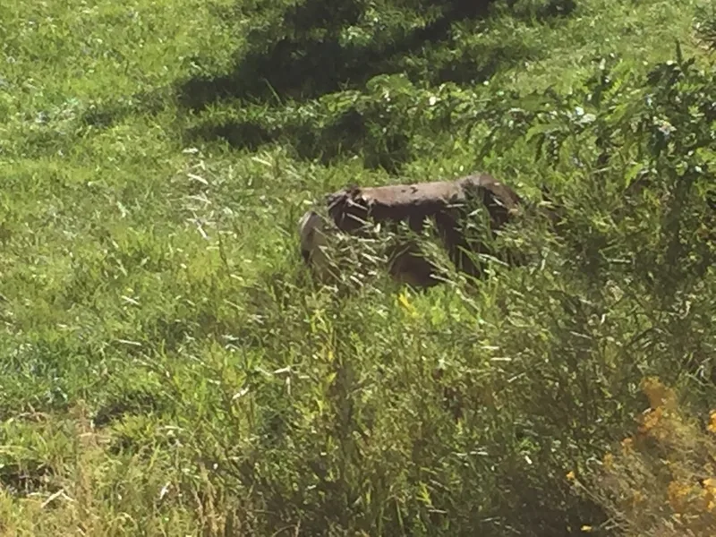
Mule Deer Odocoileus hemionus -
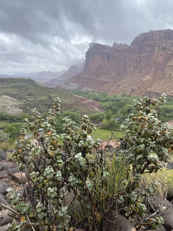
Roundleaf buffaloberry Shepherdia rotundifolia -
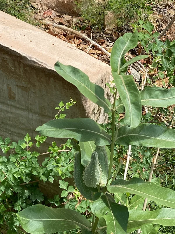
showy milkweed Asclepias speciosa -
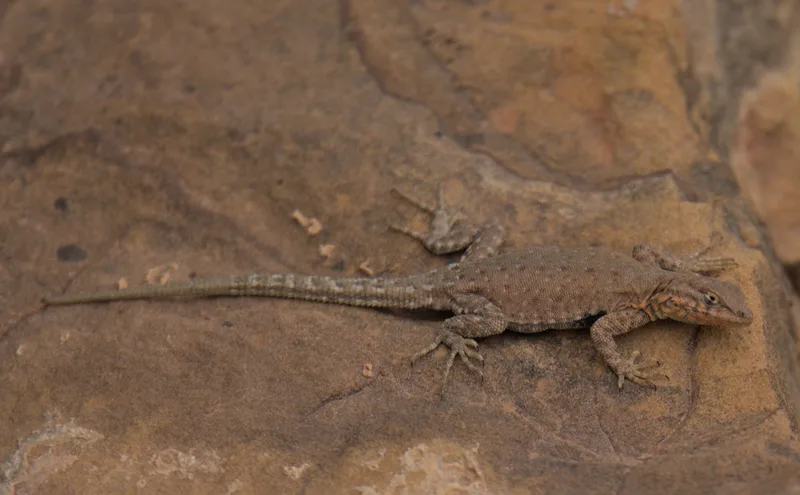
Common Side-blotched Lizard Uta stansburiana -
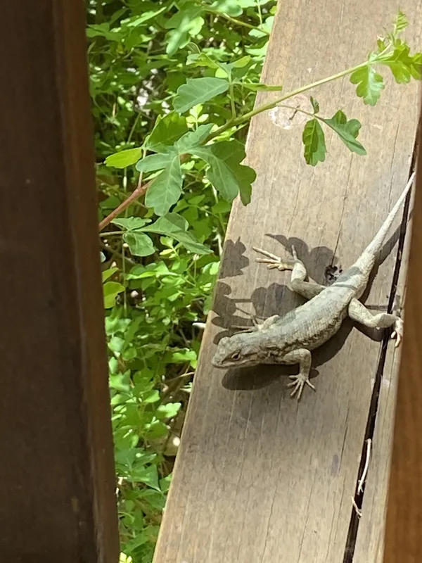
Plateau Fence Lizard Sceloporus tristichus -
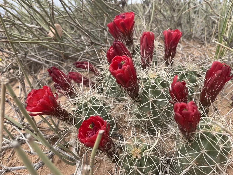
Kingcup Cactus Echinocereus triglochidiatus -
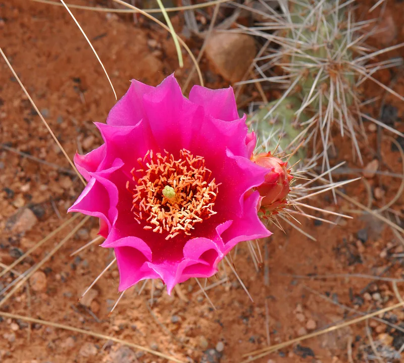
Plains Pricklypear Opuntia polyacantha -
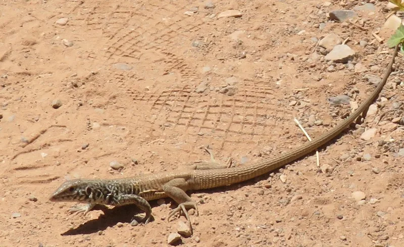
Western Whiptail Aspidoscelis tigris -
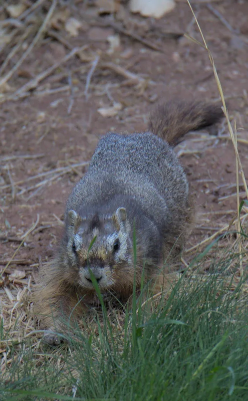
Yellow-bellied Marmot Marmota flaviventris -
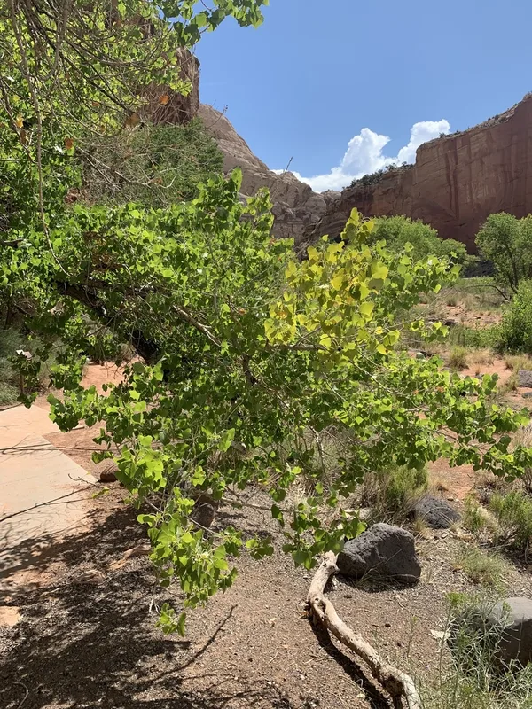
Frémont Cottonwood Populus fremontii -
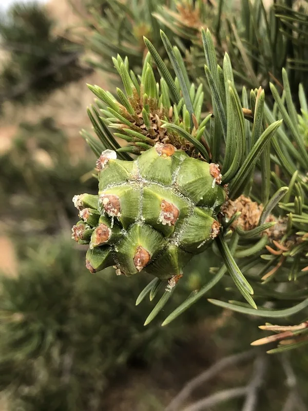
Colorado Pinyon Pinus edulis -
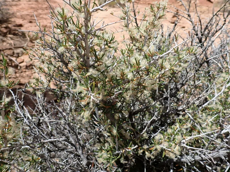
Littleleaf Mountain Mahogany Cercocarpus intricatus
Field Notes · Rivers & Canyons lens · Fruita · 38.2855, −111.2468